
3.22 feet on the Skipper Bridge USGS gage 023177483.

3.22 feet on the Skipper Bridge USGS gage 023177483.
Because SRWMD tells us Blue Sink Launch is closed, our May Suwannee River outing will take out slightly downstream at Swift Creek Lunch, which should be easy to recognize from the river because American Canoe Adventures has put up these nice triangular flags:
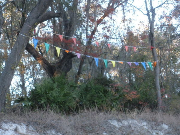
Photo: Jesse Wilkes, November 23, 2016
The put in at White Springs Wayside Park and everything else is the same; see the updated outing announcement for all the details.
We’re bringing bon-bons. See you there in May!
-jsq, John S. Quarterman, Suwannee RIVERKEEPER®
You can join this fun and work by becoming a WWALS member today!
You can’t use traditional models for the karst Floridan Aquifer; new and harsher pesticides are expected this summer; but you can help raise native species; and later this month you can go see many of them in Berrien County, plus WWALS monthly outings, the Withlacoochee and Little River Water Trail, and the Alapaha River Water Trail and some WWALS history.
Yeah, coming this summer, and they’re head-scratchers.
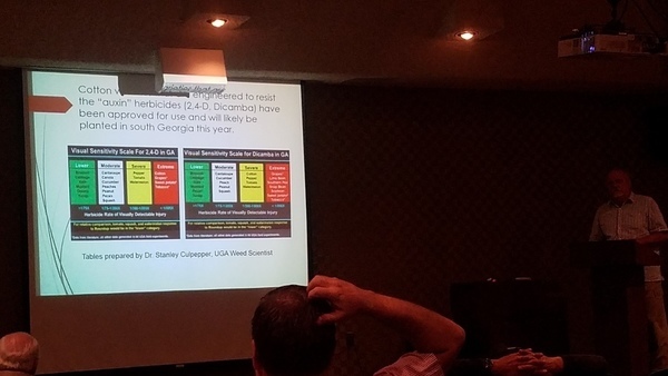
All this was at the quarterly WWALS public meeting, this one on Water, Agriculture, and Forestry at Valdosta State University, March 28, 2017.
Here are links to each WWALS video of each talk, with a few notes and a few extra pictures, followed by a WWALS video playlist. Continue reading
Someone said there’s an actual scientist in the room, so let’s hear from him. So WWALS Science Committee member Geology Professor Can Denizman said a few words about modeling karst limestone aquifers such as the Floridan Aquifer. This was at the March 3, 2017 meeting of the new Environmental Advisory Work Group of the Suwannee River Partnership.
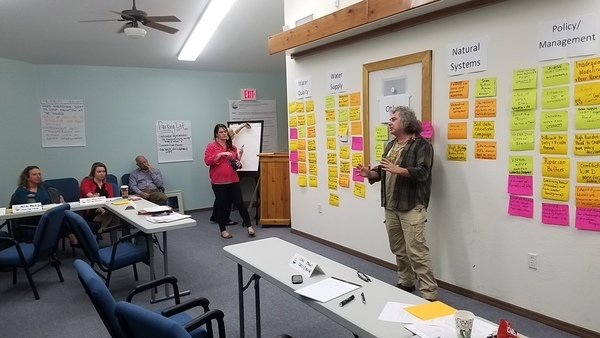
Here’s video followed by a transcript: Continue reading
The south end of Sabal Trail connects its Hunters Creek Pipeline, running through many wetlands and past many subdivisions and malls through Davenport and Kissimmee to connect to Florida Gas Transmission (FGT) just west of Florida’s Turnpike. This is all about six miles south and east of Disney World.

NW past Central Florida Pipeline Corp. to Reunion Compressor Station, 6781 Osceola Polk Line Rd, Davenport, FL 33896, 28.2610489, -81.5572004
Here are aerials taken Continue reading
A medium length summer paddle on the Middle Suwannee River: Fort Macomb Ramp to Ivey Memorial Park June 10, 2017, past springs, shoals, and Branford. This one will probably take about 5 hours paddling, or 6 hours including shuttle. With lunch, swim stops, and bon-bons, of course.
Bring the usual personal flotation device, boat paddles, food, drinking water, warm clothes, and first aid kit.
When: 9AM Saturday 10 June 2017
Put In: Ft. Macomb Ramp, river mile 86.6
From Mayo, travel east on US 27 to CR 410; turn left on CR 410; follow to boat
ramp.
Take Out:
Ivey Memorial Park Ramp, river mile 76.0
Boat ramp is located in Branford on the south side of US 27 at the
Bridge in Ivey Memorial Park.
29.9538379,-82.9303607
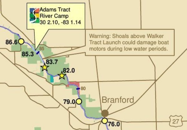
This map detail and all landing directions are from Continue reading
Here is a very interesting paper about increasing nitrogen from crops into the Suwannee River Basin and its springs (promoting algae growth), with actual data on how well best management practices (BMPs) are containing the runoff: Environmental Nitrogen Losses from Commercial Crop Production Systems in the Suwannee River Basin of Florida, by Rishi Prasad, George J. Hochmuth, PLOSOne, Published: December 1, 2016, http://dx.doi.org/10.1371/journal.pone.0167558
Fig 3.
Comparison of A) environmental nitrogen losses (Nenvloss) from three
crops (potato, sweet corn and silage corn) during four growing
seasons (2010 to2013) and B) relationship between seasonal total N
rates and environmental nitrogen losses at the study farm in the
Middle Suwannee River Basin, Florida. Silage corn was not studied
during 2013. Mean values of Nenvloss (represented by individual bars
and their standard errors for the three crops) followed by different
letters indicate significant difference at α = 0.05 level
Abstract Continue reading
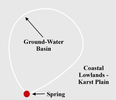
These figures tell the story of springsheds in a coastal lowland karst plain such as much of the Suwannee River Basin. Maybe you already know all this, but if you don’t, these pictures may help make sense of Springsheds and Water Withdrawal Permits in the Suwannee River Basin.
A spring is fed from a ground-water basin.
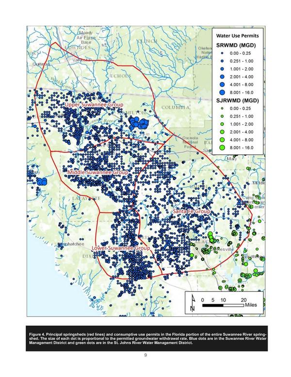
This figure for Florida water withdrawal permits in the Suwannee River springsheds shows by far the largest blue dots for the biggest withdrawal permits in Hamilton County at the location of the PCS Phosphate mine.
Thanks to Continue reading
 Is this what you want Bradford, Union, and other counties in Florida to look like?
I wonder what effect this phosphate mine had on the much lowered water level of White Springs, or the Suwannee River?
Is this what you want Bradford, Union, and other counties in Florida to look like?
I wonder what effect this phosphate mine had on the much lowered water level of White Springs, or the Suwannee River?
The PCS Phosphate mine in Hamilton County near White Springs and Jasper spread under our Southwings plane while surveying the Sabal Trail fracked methane pipeline 22 October 2016. On board were Southwings pilot Roy Zimmer, photographer Dominick Gheesling, Jim Tatum of Our Santa Fe River, and John S. Quarterman of WWALS. Here are pictures by Jim Tatum, a few videos by John S. Quarterman, and a Google map showing the locations. Continue reading