Update 2015-07-27: Pictures and new pipeline information at this link.
 After the
Alapaha River sinks into the Florida Aquifer, some of it comes back up
at the
Alapaha Rise,
which actually flows into the Suwannee River, a bit upstream from the
Alapaha Confluence.
Come with WWALS to the Alapaha Rise, then down the Suwannee River
past the Confluences of both the Alapaha and the Withlacoochee Rivers,
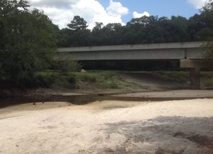
seeing the proposed site of the Sabal Trail Pipeline on the way.
After the
Alapaha River sinks into the Florida Aquifer, some of it comes back up
at the
Alapaha Rise,
which actually flows into the Suwannee River, a bit upstream from the
Alapaha Confluence.
Come with WWALS to the Alapaha Rise, then down the Suwannee River
past the Confluences of both the Alapaha and the Withlacoochee Rivers,
seeing the proposed site of the Sabal Trail Pipeline on the way.
This is a pretty easy outing, but the Suwannee is deep,
so as always bring your personal flotation
device.
If you need a boat, let us know, and we can find you one.
| When: | 8AM Saturday, August 15th, 2015 |
|---|---|
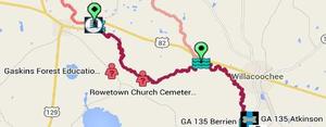
| What: | 8 mile paddle from Gibson Park to Suwannee River State Park, with a side trip upstream first to the Alapaha Rise, then downstream past the Alapaha-Suwannee confluence, the proposed Sabal Trail Pipeline crossing, and ending at the Withlacoochee confluence, taking out at Suwannee River State Park. |
| Duration: | 4 hours, after a 30 minute shuttle. |
| Directions: | Florida Highway 6 in Hamilton County, Florida, west to CR751 South to park just before the river. |
| Responsible party: | Chris Mericle |
This event is FREE! All we ask is that you are a current member of WWALS Watershed Coalition. If not, it’s easy to join online today at /donations/. You do not have to be a member to come on this outing. If you like the experience, we recommend that you join to support the efforts of WWALS. Continue reading