Update 2023-01-12: Suwannee River Chainsaw Cleanup Again 2023-01-28.
This chainsaw cleanup finished well before dark, Suwannee River, Griffis to Fargo 2022-12-29. Thanks, TJ Johnson for leading it, and Shirley Kokidko for getting the wettest.
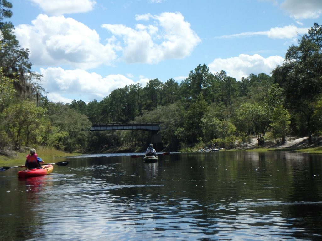
![[Griffis, Deadfall, Gauge, Fargo 2022-12-29]](https://www.wwals.net/pictures/2022-12-29--suwannee-pictures/many.jpg)
Griffis, Deadfall, Gauge, Fargo 2022-12-29
The Fargo gauge was about 2.47 feet (93.07′ NAVD88) and the Above Fargo gauge was about 4.93′ (95.93′ NAVD88).
We found one deadfall already cut and we cut another one.
We found three more: one to duck and float under, one to drag under to the left, and one requiring portage. We shall return.
We saw the mysteriously-placed Suwannee River above Fargo Gauge. The GOPRO360 photographed three creeks: Jones (or Tatum) Creek, Sweetwater Creek, and Alligator Creek, or at least those look like creek mouths more or less where USGS thinks they are.
We saw a new-to-us private landing and got pictures of it and the six others between Griffis Fish Camp and Fargo Ramp.
Also the closed bats-in-the-belfry Suwannee River Visitor Center at Fargo. Continue reading
![[Map: Griffis Fish Camp to Fargo Ramp in WWALS SRWT]](https://www.wwals.net/pictures/2022-12-19--chainsaw-cleanup-suwannee-river/2022-12-24--map-griffis-fargo-srwt.jpg)
![[Start, chainsaws, pizza, sandbars]](https://www.wwals.net/pictures/2022-10-16--chainsaw-cleanup-withlacoochee-pictures/many.jpg)
![[Trashjam, deadfall, chainsaws]](https://www.wwals.net/pictures/2022-09-25--chainsaw-withlacoochee/many.jpg)
![[Banners, Chainsaws, Trash, River]](https://www.wwals.net/pictures/2022-07-30--chainsaw-cleanup-pictures/many.jpg)
![[banners, boats, sandbars, and saws]](https://wwals.net/pictures/2022-06-25--chainsaw-cleanup-pictures/many.jpg)
![[Movie: Electric chainsaw, 30.8630861, -83.3232384 (30M)]](https://www.wwals.net/pictures/2022-06-05--chainsaw-withlacoochee-pictures/20220605_112557.jpg)
![[Banners, Alapahoochee River, Deadfall, Beatty Bridge, Devil Shoal, Turket Creek Waterfall]](https://www.wwals.net/pictures/2021-06-05--alapahoochee-pictures/2021-06-05--many.jpg)
![[Driveway, pavillion, streetlight, logjam, sandbar (rotated)]](https://www.wwals.net/pictures/2020-11-29--langdale-park-upgrade/manyrot.jpg)