FOR IMMEDIATE RELEASE
(See also PDF and previous blog post.)
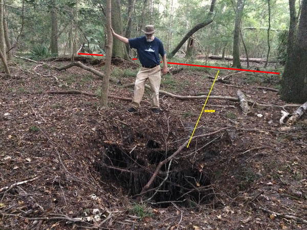
Live Oak, FL, October 5, 2017 — Sabal Trail, operating without a permit, is at risk from a new sinkhole within 60 feet of its 36-inch diameter, high-pressure, fracked methane pipe under Suwannee River State Park (SRSP), between the Suwannee River and the drill site in Hamilton County. Such sinkholes are among the geological risks WWALS warned about that have happened in the fragile karst limestone containing our drinking water in the Floridan Aquifer. We were assured in October 2015 by Sabal Trail and the Florida Department of Environmental Protection (FDEP) that sinkholes and frac-outs would not happen or would be detected and fixed. They keep happening, and Sabal Trail has done nothing about this one. Sabal Trail should not even be continuing operations after the DC Circuit Court vacated its permit six weeks ago.
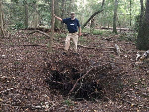
Suwannee
Riverkeeper John S. Quarterman at new sinkhole in Suwannee River
State Park, 2017-10-03.
Photo:
Christopher J. Mericle, Chair, N. Florida Working Group,
Suwannee-St. Johns Group, Sierra Club Florida.
In WWALS vs. Sabal Trail & FDEP (October 2015), FDEP’s one witness, Lisa Prather, said under oath (see https://wwals.net/blog/?p=27799):
“Well, the Suwannee River crossing doesn’t, in fact, have any impacts to an outstanding Florida water, because the directional drill commences in uplands and terminates in uplands. So there are no surface water impacts at that crossing that would affect the outstanding Florida water.”
“Well, any work within, or could have adverse effects on OFW, is considered.In this case, we determine that there would be no impacts to the OFW.”
Suwannee Riverkeeper John S. Quarterman says:
“Email to Ms. Prather’s address now comes back with an error message, while the rest of us are left Continue reading