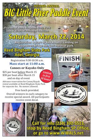
One month from now!
Paddle at your own leisure, or race for prizes
Saturday, March 22nd,
at the
Second Annual
BIG Little River Paddle Event,
at Reed Bingham State Park, Adel, Georgia.
Proceeds to benefit
Friends of Reed Bingham State Park
and WWALS Watershed Coalition.
You can
sign up and pay online or you can do that at the event.
Bret Wagenhorst has prepared a poster suitable for hanging up at your place of fun or business:
PDF.
Comment on this post if you want a paper copy.
Update 15 Feb 2014:
You can also apply to Sponsor (Gold, Silver, or Bronze) on
the event page.
A fundraiser for nonprofits Friends of Reed Bingham State Park and WWALS Watershed Coalition, this is a scenic three mile flatwater paddle on the Little River from Red Roberts landing (at Rountree Bridge, 31 11 32.05 N 83 31 13.25 W) in the north end of the park, to the boat ramp on the Colquitt Co. side of the park lake (park map).
You can do it as a race, or as a scenic leisure paddle. Cost is $25
per boat if you register before March 15, and $30 per boat after that
(registration includes park day pass/admission). You must either provide
your own boat or rent one at the park (separate fee). Participants get
a free shuttle and lunch. Fastest boats in various categories win a
prize. Registration is at Red Roberts landing between 9:30 and 10:30
a.m. (to allow time for a shuttle). Mass start at 11 a.m.
8AM to 1PM this coming Saturday at Reed Bingham State Park,
it’s also the September WWALS outing now:
Rivers Alive Little River Clean Up.
Bring your canoe or kayak or rent one there for half price to volunteers!
We will be removing trash from the Little River and Reed Bingham
Lake. Experienced canoeists and kayakers have the opportunity to
paddle down the little river while picking up garbage. Canoes and
kayaks are available to volunteers for half off. Please register in
advance to ensure your rental spot is available. Non-boaters can
walk around and in the lake and river picking up garbage and debris.
$5 parking. 229-896-3551.
Volunteers will be split into two groups for both river and lake side clean-up. Volunteers are welcome to bring their own kayaks and canoes to join the paddling team down the river for trash collecting. Boats are available at half price rental. The lake crew will be walking the lake perimeter removing trash from the water’s shores.
$4 boat rental. 229-896-3551.
Maybe we need signs like that around here to remind
people that what goes into the ground comes out in our
drinking water.
For example,
San Antonio has its
Edwards Aquifer Protection Program.
Maybe our local governments need to have
Floridan Aquifer Protection Programs.
Georgia state law seems to indicate they should.
(1) Background. Variable levels of recharge area protection can be
based upon the State’s hydrogeology (e.g., areas such as the
Dougherty Plain where a major aquifer crops out would receive a
relatively high degree of protection whereas other areas, such as
the shale hills of northwest Georgia, would receive a lower degree
of protection). Recharge area protection within the significant
recharge areas would be further refined, based upon the local
susceptibility or vulnerability to human induced pollution (e.g.,
high, medium, or low). The significant recharge areas have already
been identified and mapped (about 22-23% of the State). Pollution
susceptibility mapping is ongoing. Existing statutes are adequate
for protecting the remaining recharge areas (about 77-78% of the
State).
[…]
(2)(f)3. In the Coastal Plain, the significant recharge areas are Continue reading →
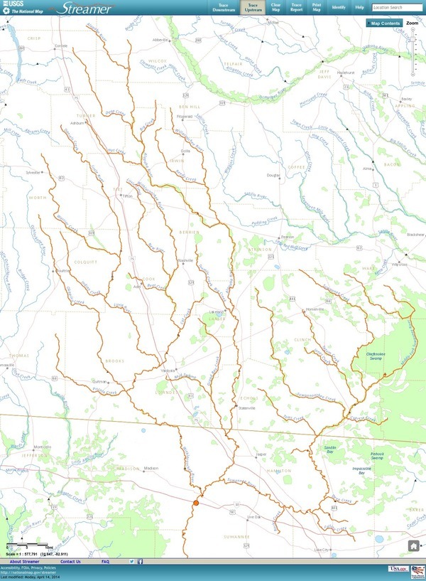
Update 3 March 2016: Suwannee River, ten rivers, and current location of USGS streamer.
The USGS Streamer interactive map
shows all (well, most) tributaries
of our two biggest WWALS rivers.
Visitors sometimes refer to our “four rivers”
since we only originally named four in our
WWALS mission:
Withlacoochee, Willacoochee, Alapaha, and Little.
Yet we added the upper Suwannee, and there always were more than that:
from one to ten rivers, depending on how you count them.
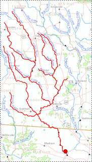
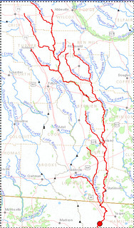
The Withlacoochee River tributary map here shows
the New River south of Tifton joining the Withlacoochee between
Nashville and Adel.
The New River is rather important, since it forms half of the boundary between Cook
and Berrien Counties (the Withlacoochee River forms the other half): Continue reading →
Water issues strongly affect economic development, so I talked about
the new WWALS Watershed Coalition at the
16 April 2013 Board Meeting
of the Valdosta-Lowndes County Industrial Authority.
The VDT declined to speak, so I did.
After apologizing for no okra today,
I commended the Authority for talking about the missing agenda items
and for mentioning due diligence and flood control.
WWALS board meetings are every second Wednesday of the month,
usually at the IHOP in Adel because it’s centrally located.
WWALS is communicating with Valdosta and
various organizations about
flooding and other watershed-wide issues, which in my opinion
have to do with things like too much clearcutting without
consideration for where the water goes, too much development
without consideration for what the impervious surface would do,
(to my surprise, the Executive Director and several board
members nodded along with that)
so it was good to hear them mention flood containment.
Arsenic, Outings, and Flooding: WWALS Watershed Coalition
Regular Meeting, Valdosta-Lowndes County Industrial Authority (VLCIA),
Norman Bennett, Tom Call, Roy Copeland, Chairman, Mary Gooding, Jerry Jennett,
Andrea Schruijer, Executive Director, J. Stephen Gupton, Attorney, Tom Davis, CPA, Allan Ricketts, Project Manager,S. Meghan Duke, Public Relations & Marketing Manager, Lu Williams, Operations Manager,
Video by John S. Quarterman for Lowndes Area Knowledge Exchange (LAKE), Valdosta, Lowndes County, Georgia, 16 April 2013.
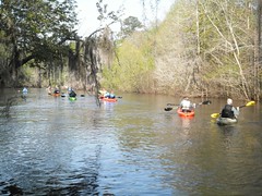
On Saturday, March 30 WWALS held their first joint fundraiser with
the Friends of Reed Bingham State Park: the first annual Big LITTLE
RIVER Paddle Race. We had 18 boats and 27 paddlers participate. The
start was at Rountree Bridge at the north end of Reed Bingham State
Park.
Valdosta City Council Tim Carroll spoke about the need for watershed-wide
planning to reduce flooding and provide water for agriculture with
distributed flood containment reservoirs.
He
referred to
the
materials he sent in advance
as well as to some additional data about water quality measurements
upstream and downstream of selected points.
And he sent an update the next day.

ADEL — Join the Friends of Reed Bingham State Park and WWALS Watershed Coalition on March 22 for the second annual Big Little River Paddle Race.