Tag Archives: Suwannee River

WWALS petition to FL DEP vs. Sabal Trail

This is the petition (PDF) WWALS filed Friday 7 Aug 2015 against FL-DEP’s intent to isue a permit for Sabal Trail to drill under the Suwannee River and otherwise destroy wetlands and add hazards for no benefit.

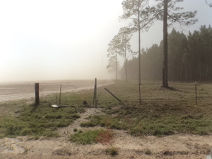
Spectra Energy of Houston, Texas also wants to drill the Sabal Trail pipeline under the Santa Fe River and the Withlacoochee south River (the one that flows from the Green Swamp to the Gulf). Sabal Trail also wants to drill under WWALS’ Withlacoochee River that flows into the Suwannee, but in Georgia, so that is not a topic of this petition.

Remember there are still plenty of things you can do to help stop this pipeline invader from destroying forests, fields, and streams, adding hazards for no benefit.

And you can come see where Sabal Trail proposes to cross the Suwannee this Saturday, August 15th, as we paddle down the river!

-jsq

You can join this fun and work by becoming a WWALS member today!

STATE OF FLORIDA

DEPARTMENT OF ENVIRONMENTAL PROTECTION

Continue reading

Hamilton Co. FL and Lowndes Co. GA asked to oppose Sabal Trail

Two WWALS board members asked their county commissions in two states to oppose Sabal Trail. The Hamilton County, FL Commission answered about the Suwannee River; the Lowndes County, GA Commission sat silently about the Withlacoochee River. Neither did anything, which is why WWALS filed a petition Friday to oppose FL-DEP’s proposed permit for Sabal Trail to drill under the Suwannee River; more on that later. You can help by calling Georgia Gov. Deal and commenting to GA-EDP and FERC. And by becoming a WWALS member today!

On July 21st, Chris Mericle spoke about the Suwannee River. LAKE Video, Hamilton County, FL Commission considers opposing FL-DEP Sabal Trail permit 2015-07-21,

Chris Mericle, Hamilton Co. FL Local resident Chris Mericle asked his county commission to once again oppose the Sabal Trail fracked methane pipeline, this time by opposing a permit Continue reading

Update: Sabal Trail Pipeline, Alapaha, Suwannee, and Withlacoochee Rivers, WWALS Outing 2015-08-15

Update 2015-08-14: Now plus Five Holes caves at Suwannee River State Park!

This flag marks where Sabal Trail plans to drill under the Suwannee River, pictured today by Chris Mericle, who also pictured a number spraypainted on a tree and remarked:

I know it is a small thing but, it is this lack of respect for nature that we will be forced to endure if this pipeline is permitted.

With FL DEP proposing to issue a permit for Sabal Trail, let’s go investigate, and have some fun at the same time.

First we’ll look at the Alapaha Rise, which is where some of the water that disappears from the Alapaha River at its sinks comes back up out of the Floridan Aquifer. To get to the Rise we paddle upstream on the Suwannee River, then Continue reading

Please join the opposition to the Sabal Trail watershed invader –WWALS to SSRWPC

This letter is for today’s Monday 20 July 2015 SSRWPC meeting, at Aniston’s Restaurant, 1404 W. Baker Highway, Douglas, GA. See also the LAKE videos of last month’s SSRWPC meeting. -jsq

PDF

Dear Suwannee-Satilla Regional Water Planning Council,

WWALS Watershed Coalition is the WATERKEEPER® Affiliate representing the watersheds of the Withlacoochee and Little Rivers, which are in the proposed paths of the Sabal Trail natural gas pipeline through Lowndes, Brooks, and Colquitt Counties Georgia.

WWALS has long opposed that pipeline from Alabama to Florida, which is funded by NextEra Energy of Florida and Duke Energy of North Carolina for construction by Spectra Energy of Houston, Texas. WWALS is an intervenor against it with the Federal Energy Regulatory Commission (FERC) on docket CP15-17.

Please ask FERC to deny a permit for Sabal Trail

Continue reading

Agricultural land bought by west coast investors

Investment firms owned by Bill Gates have bought thousands of acress of agricultural land in counties in or near WWALS watersheds in south Georgia and north Florida, all above the Floridan Aquifer, near the Alapaha, Alapahoochee, Withlacoochee, and Suwannee Rivers, as part of a nationwide buying spree of a quarter million acres.

Here’s a summary of what we’ve found thus far. Any more recent posts should be found through this search.

These purchases of hundreds and thousands of contiguous acres are all after Bill Gates announced in 2012 he was going to “fix” agriculture in conjunction with Monsanto and Syngenta.

And it’s not just Bill Gates. Continue reading

Suwannee River Basin watershed organizations and Suwannee-Satilla Regional Water Planning Council

300x243 HUC 031102 Suwannee Basin, in Suwannee Region HUC, by USGS, for WWALS.net, 14 June 2015

Update 2015-06-22: SOS will remain focused on the Lower Suwannee.

Can’t tell the players without a card, and there’s a new player at Monday’s Suwannee-Satilla Regional Water Planning Council 2015-06-15, in between south of Satilla Riverkeeper and WWALS Watershed Coalition: Save Our Suwannee.

Also, WWALS is now WWALS Watershed Coalition, a WATERKEEPER® Affiliate, conserving the Alapaha and Withlacoochee River basins, including the watersheds of all their tributaries.

In Florida, Continue reading

Linkage between ground water and surface water –USGS

Yet more documentation on why gouging a pipeline under the Withlacoochee River, or through this Valdosta Limesink area anywhere, would be a bad idea:

In most watersheds (river basins) in Florida the interactions between ground water and surface water typically result in a single dynamic flow system. This direct hydraulic linkage results from numerous karst features (such as sinkholes, conduit systems in the underlying limestone, and springs) that facilitate the exchange of water between the surface and subsurface (fig. 1). Unique problems can arise in protecting water quality in karst areas because of the direct and rapid transport of recharge through conduits to the subsurface and through resurgence by springs. In some areas, recharge from unknown drainage pathways to areas of discharge may contribute to chemical and biological contamination of water supplies. Such contamination in karst areas has been documented by many studies.

Yes, it says Florida, but the geology doesn’t stop at the state line, as USGS spelled out in a 1999 study of the Withlacoochee River. It works like this in Georgia, too: Continue reading

Alapaha River Rise, Suwannee River, and Sabal Trail Pipeline, WWALS Outing 2015-08-15

Update 2015-07-27: Pictures and new pipeline information at this link.

After the Alapaha River sinks into the Florida Aquifer, some of it comes back up at the Alapaha Rise, which actually flows into the Suwannee River, a bit upstream from the Alapaha Confluence. Come with WWALS to the Alapaha Rise, then down the Suwannee River past the Confluences of both the Alapaha and the Withlacoochee Rivers, seeing the proposed site of the Sabal Trail Pipeline on the way.

This is a pretty easy outing, but the Suwannee is deep, so as always bring your personal flotation device. If you need a boat, let us know, and we can find you one.

When:8AM Saturday, August 15th, 2015
What: 8 mile paddle from Gibson Park to Suwannee River State Park, with a side trip upstream first to the Alapaha Rise, then downstream past the Alapaha-Suwannee confluence, the proposed Sabal Trail Pipeline crossing, and ending at the Withlacoochee confluence, taking out at Suwannee River State Park.
Duration: 4 hours, after a 30 minute shuttle.
Directions: Florida Highway 6 in Hamilton County, Florida, west to CR751 South to park just before the river.
Responsible party: Chris Mericle

This event is FREE! All we ask is that you are a current member of WWALS Watershed Coalition. If not, it’s easy to join online today at /donations/. You do not have to be a member to come on this outing. If you like the experience, we recommend that you join to support the efforts of WWALS. Continue reading

Spring Flood Potential Outlook for Withlacoochee River by NWS

There is potential for “a high impact basin-wide flood event this spring should heavier than normal rainfall occur” in the Withlacoochee Basin.

300x233 Vdsg1 Hg Skipper Bridge, in Withlacoochee River Gauges, by NWS, for WWALS.net, 7 March 2015 National Weather Service Tallahasee, FL 240 PM EST THU MAR 5 2015, Spring Flood Potential Outlook for Southeast Alabama, Southwest and South Central Georgia, and the Florida Panhandle and Big Bend,
Above normal potential for river flooding this Spring,
Existing Conditions.

In the Withlacoochee, Suwannee Basin…

Continue reading

Valdosta spilled into Alapaha as well as Withlacoochee watersheds in February

Spilling sewage into the Withlacoochee River apparently wasn’t enough 300x388 Figure 2.2.5. Sub-basins Areas, in Section 2 Methodology, by City of Valdosta, for WWALS.net, 14 January 2011 for Valdosta: in February it also spilled three times into the Alapaha River watershed. At least once this was due to rains directly on Valdosta, for which the levee proposed by the Army Corps of Engineers on Sugar Creek at the Withlacoochee River wouldn’t help. It’s time for Valdosta to move along with fixing its wastewater problems. More transparency from Valdosta would also help. And I, for one, would like to see that promised Corps flooding study of the entire Suwannee River Basin.

In three different reports in February, Valdosta mentioned sewage overflows into either Knights Creek or Dukes Bay Canal, without mentioning that those flow into Mud Swamp Creek, which joins with Grand Bay Creek to form the Alapahoochee River, which joins the Alapaha River, which flows into the Suwannee River. The Florida Department of Health apparently didn’t know that, since it didn’t mention the Alapaha River in its advisories for counties downstream. But Valdosta should know, according to its own SWMP Update Phase 1 Final Report, Section 2 Methodology, 2011-01-14, that about half of Valdosta is drained by Knights Creek and Dukes Bay Canal: Continue reading