
Categories on the SRWT map
Last update: 2026-02-02
Suggest changes, additions, etc. in pictures or text through this form.
Contents: Airport, Biosolids, Bridge, BridgeHistoric, BridgeSite, CLEAREDFALL, Camping, Cemetery, Church, DEADFALL, Dam, Ferry, Ford, Hiking Trail, Lake, Landfill, Landing, Mine, Obstacle, Outfitter, PMine, Pipeline, Point of Interest, Power Line, Public Land, Railbridge, RailbridgeHistoric, RailbridgeSite, River Gauge, Shoal, Sinkhole, Solar, Spill, Spring, TiMine, Tributary, WTP.
See also Access points and All points.
Descriptions
1 , “”permitted to accept non-hazardous municipal solid waste, including household garbage, commercial waste and special waste.””2 Paddlers are permitted to take food and drink on the Ichetucknee River in non-disposable containers only.
3 Paddlers are permitted to take food and drink on the Ichetucknee River in non-disposable containers only.
4 Paddlers are permitted to take food and drink on the Ichetucknee River in non-disposable containers only.
5 Paddlers are permitted to take food and drink on the Ichetucknee River in non-disposable containers only.
6 https://wwals.net/pictures/2021-07-08–sewage-spills-valdosta-starke
7 https://wwals.net/pictures/2021-07-08–sewage-spills-valdosta-starke
8 https://wwals.net/pictures/2021-07-08–sewage-spills-valdosta-starke
9 https://wwals.net/pictures/2021-07-08–sewage-spills-valdosta-starke
10 https://wwals.net/pictures/2021-07-08–sewage-spills-valdosta-starke
Airport
Keystone Heights Airport 

CATEGORIES: Airport
LAYER: Point of Interest
OWNERSHIP: Private
WATER BODY: Santa Fe River
ADDRESS: 7100 Airport Rd, Starke, FL 32091, Bradford County.
DESCRIPTION: Local airport three miles north of Keystone Heights, Florida.
WEBSITE: http://keystoneairport.com/
PHOTO: https://upload.wikimedia.org/wikipedia/commons/8/85/Keystone_Airpark_FL_5_Feb_1999.jpg
PHOTO SOURCE: USGS via Wikicommons
PHONE NUMBER: (850) 290-2350
Suggestions: https://forms.gle/DipPgU2TP5atc2Rf9
Biosolids
“Cat Creek Class B Biosolids Site, City of Jasper, Florida”


CATEGORIES: Biosolids
LAYER: Point of Interest
OWNERSHIP: Public
WATER BODY: Cat Creek
ADDRESS: SW 53rd Street, Jasper, FL 32052, Hamilton County.
DESCRIPTION: A facility for disposing of solidified human wastes from wastewater treatment plants.
AKA: City of Jasper Biosolids Site or Cat Creek Biosolids Site orFacility ID No. FLA812773
WEBSITE: https://prodenv.dep.state.fl.us/DepNexus/public/electronic-documents/FLA812773/gis-facility!search
PHOTO: https://www.wwals.net/pictures/2024-08-24–hamilton-county-creeks/20240824_144732.jpg
PHOTOSET: https://www.wwals.net/pictures/2024-08-24–hamilton-county-creeks/
PHOTO SOURCE: John S. Quarterman
PHONE NUMBER: (229) 242-0102
Suggestions: https://forms.gle/DipPgU2TP5atc2Rf9
Bridge
Second Gate Suwannee River Sill @ Suwannee River Sill Road 


CATEGORIES: Bridge
LAYER: Bridge
GPS: 30.8164, -82.4136
OWNERSHIP: Public
ACCESS: PARKING: $5 parking pass
WATER BODY: Suwannee River
GAUGE: SCFSP
MILE: 239.42
ADDRESS: From Fargo, travel south on US 441 to GA 177; turn left and travel towards Stephen C. Foster State Park. Go 11.2 miles and turn left on Suwannee River Sill; continue past the first gate a mile on to the second gate. Charlton County.
DESCRIPTION: These large openings that are always open through the Suwannee River Sill comprise the second gate you encounter coming downstream, if you turn right at the Sill and continue a mile.
HISTORIC FACTS: Built by the federal government in 1960, this five-mile-long dirt dam was intended to keep water in the Swamp during droughts, because of wildfires in the 1950s. It didn’t work: it only affected about one percent of the Swamp. In 1998 U.S. FWS concluded that the Sill should be breached and its gates removed. Meanwhile, the structure is popular as an access road to the Suwannee River and the Okefenokee Swamp, and there is resistance to it being completely removed. Meanwhile, its gates (flow outlets) are always open.
WEBSITE: https://www.fws.gov/refuge/Okefenokee/visit/plan_your_visit.html
ADDITIONAL INFO SOURCES: https://www.sciencedirect.com/science/article/abs/pii/002216949290011J
PHOTO: https://www.wwals.net/pictures/2023-12-09–griffis-fish-camp-suwannee-pictures/20231209_114825.jpg
PHOTOSET: https://www.wwals.net/pictures/2023-12-09–griffis-fish-camp-suwannee-pictures/
PHOTO SOURCE: John S. Quarterman
PHONE NUMBER: (229) 242-0102
Suggestions: https://forms.gle/DipPgU2TP5atc2Rf9
Third Gate Suwannee River Sill @ Suwannee River Sill Road
CATEGORIES: Bridge
LAYER: Bridge
GPS: 30.820547, -82.41491
OWNERSHIP: Public
ACCESS: PARKING: $5 parking pass
WATER BODY: North Fork Suwannee River
GAUGE: SCFSP
MILE: 0.06
ADDRESS: From Fargo, travel south on US 441 to GA 177; turn left and travel towards Stephen C. Foster State Park. Go 11.2 miles and turn left on Suwannee River Sill; continue past the first and second gates a bit more than a mile to the third gate. Charlton County.
DESCRIPTION: These large openings that are always open through the Suwannee River Sill comprise the third gate you encounter coming downstream, if you turn right at the Sill and continue a mile to the second gate and then a bit more to the third gate.
HISTORIC FACTS: Built by the federal government in 1960, this five-mile-long dirt dam was intended to keep water in the Swamp during droughts, because of wildfires in the 1950s. It didn’t work: it only affected about one percent of the Swamp. In 1998 U.S. FWS concluded that the Sill should be breached and its gates removed. Meanwhile, the structure is popular as an access road to the Suwannee River and the Okefenokee Swamp, and there is resistance to it being completely removed. Meanwhile, its gates (flow outlets) are always open.
WEBSITE: https://www.fws.gov/refuge/Okefenokee/visit/plan_your_visit.html
ADDITIONAL INFO SOURCES: https://www.sciencedirect.com/science/article/abs/pii/002216949290011J
Suggestions: https://forms.gle/DipPgU2TP5atc2Rf9
First Gate Suwannee River Sill @ Suwannee River Sill Road

CATEGORIES: Bridge
LAYER: Bridge
GPS: 30.803731, -82.41764
OWNERSHIP: Public
ACCESS: PARKING: $5 parking pass
WATER BODY: Suwannee River
GAUGE: SCFSP
MILE: 238.50
ADDRESS: From Fargo, travel south on US 441 to GA 177; turn left and travel towards Stephen C. Foster State Park. Go 11.2 miles and turn left on Suwannee River Sill; continue to the first gate. Charlton County.
DESCRIPTION: These large openings that are always open through the Suwannee River Sill comprise the first gate you encounter coming downstream, if you turn left at the Sill and continue a couple of hundred feet.
HISTORIC FACTS: Built by the federal government in 1960, this five-mile-long dirt dam was intended to keep water in the Swamp during droughts, because of wildfires in the 1950s. It didn’t work: it only affected about one percent of the Swamp. In 1998 U.S. FWS concluded that the Sill should be breached and its gates removed. Meanwhile, the structure is popular as an access road to the Suwannee River and the Okefenokee Swamp, and there is resistance to it being completely removed. Meanwhile, its gates (flow outlets) are always open.
WEBSITE: https://www.fws.gov/refuge/Okefenokee/visit/plan_your_visit.html
ADDITIONAL INFO SOURCES: https://www.sciencedirect.com/science/article/abs/pii/002216949290011J
PHOTO: https://www.wwals.net/pictures/2023-12-09–griffis-fish-camp-suwannee-pictures/20231209_124120.jpg
PHOTOSET: https://www.wwals.net/pictures/2023-12-09–griffis-fish-camp-suwannee-pictures/
PHOTO SOURCE: John S. Quarterman
PHONE NUMBER: (229) 242-0102
Suggestions: https://forms.gle/DipPgU2TP5atc2Rf9
US 441 Bridge @ US 441

CATEGORIES: Bridge
LAYER: Bridge
GPS: 30.68088, -82.55992
OWNERSHIP: Public
WATER BODY: Suwannee River
GAUGE: Fargo
MILE: 220.99
ADDRESS: Half a mile southeast of Fargo on US 441. Clinch County.
DESCRIPTION: The only road bridge over the Suwannee River between the Okefenokee Swamp in Georgia and Florida State Route 6. 417-foot concrete deck on stringers, built in 1952.
WEBSITE: http://bridgereports.com/1092701
PHOTO: https://wwals.net/pictures/2017-03-18–fargo-roline-wwals/20170318_082107.jpg
PHOTOSET: https://wwals.net/pictures/2017-03-18–fargo-roline-wwals
PHOTO SOURCE: John S. Quarterman
PHONE NUMBER: (229) 242-0102
Suggestions: https://forms.gle/DipPgU2TP5atc2Rf9
CR 6 Bridge @ CR 6

CATEGORIES: Bridge
LAYER: Bridge
OWNERSHIP: Public
WATER BODY: Suwannee River
MILE: 195.86
ADDRESS: From White Springs, Travel north on CR 135 to SR 6, turn right; travel east to the bridge. At the foot of the bridge, turn left onto road shoulder and follow the road to the river. Hamilton, Columbia Counties.
DESCRIPTION: Modern highway bridge carrying CR 6 across the Suwannee River.
PHOTO: https://wwals.net/wp-content/themes/pianoblack/img//2017/01/bf078895563375eb7bb4e8246e805768.jpg
PHOTOSET: https://wwals.net/2017/01/01/redoux-suwannee-river-roline-to-cypress-creek/
PHOTO SOURCE: John S. Quarterman
PHONE NUMBER: (229) 242-0102
Suggestions: https://forms.gle/DipPgU2TP5atc2Rf9
US 41 Bridge @ US 41

CATEGORIES: Bridge
LAYER: Bridge
GPS: 30.32582, -82.73851
OWNERSHIP: Public
WATER BODY: Suwannee River
MILE: 171.02
ADDRESS: Downstream of Little Shoals. Southeast of White Springs, Florida. Hamilton, Columbia Counties.
DESCRIPTION: 410.1-foot 6-span girder bridge with concrete cast-in-place bridge across the Suwannee River, built in 1980.
HISTORIC FACTS: Replaces former bridge built in 1925. https://bridgehunter.com/fl/hamilton/white-springs/
AKA: FL-25 Bridge or Ed Scott Bridge
WEBSITE: https://bridgereports.com/1081752
OTHER REFERENCE: https://wwals.net/pictures/2021-05-19–big-shoals-pictures/#US41B
PHOTO: https://wwals.net/pictures/2021-05-19–big-shoals-pictures/20210519_135136.jpg
PHOTOSET: https://wwals.net/pictures/2021-05-19–big-shoals-pictures/
PHOTO SOURCE: John S. Quarterman
PHONE NUMBER: (229) 242-0102
PHOTO2: https://wwals.net/pictures/2016-11-23–gammie-white-springs/384A3781.jpg
Photoset2: https://wwals.net/pictures/2016-11-23–gammie-white-springs/
PHOTO2 SOURCE: Beth Gammie for WWALS on Southwings flight
Suggestions: https://forms.gle/DipPgU2TP5atc2Rf9

FL 136 Bridge
CATEGORIES: Bridge
LAYER: Bridge
OWNERSHIP: Public
WATER BODY: Suwannee River
MILE: 169.05
ADDRESS: From White Springs, take Bridge Street (FL 136) southwest out of town. Hamilton, Columbia Counties.
DESCRIPTION: A modern highway bridge built in 1954.
AKA: J. Graham Black-Joseph W. McAlpin Bridge
Suggestions: https://forms.gle/DipPgU2TP5atc2Rf9
Swift Creek E 78th Place Bridge @ SE 78th Place
CATEGORIES: Bridge
LAYER: Bridge
OWNERSHIP: Public, Hamilton County
WATER BODY: Swift Creek
MILE: 5.59
ADDRESS: Between SE Eagle Lake and SE CR 137. Hamilton County.
DESCRIPTION: Single-lane wooden bridge, weight limit 15 tons.
WEBSITE: https://maps.app.goo.gl/9fxGJ2WFjDETZrgeA
PHOTOSET: https://maps.app.goo.gl/9fxGJ2WFjDETZrgeA
PHOTO SOURCE: Google Streetview
Suggestions: https://forms.gle/DipPgU2TP5atc2Rf9
Swift Creek SW 142nd Blvd Bridge @ E 142nd Boulevard
CATEGORIES: Bridge
LAYER: Bridge
GPS: 30.37667, -82.79911
OWNERSHIP: Public, Hamilton County
WATER BODY: Swift Creek
MILE: 3.23
ADDRESS: 9218 SE 142nd Blvd, White Springs, FL 32096, Hamilton County.
DESCRIPTION: Single-lane wooden bridge, weight limits 10, 15, 20 tons.
WEBSITE: https://maps.app.goo.gl/WEcf7vZ4XJK9ZQqQ8
PHOTOSET: https://maps.app.goo.gl/WEcf7vZ4XJK9ZQqQ8
PHOTO SOURCE: Google Streetview
Suggestions: https://forms.gle/DipPgU2TP5atc2Rf9
Swift Creek US 41 Bridge @ US 41
CATEGORIES: Bridge
LAYER: Bridge
GPS: 30.37061, -82.799898
OWNERSHIP: Public, Hamilton County
WATER BODY: Swift Creek
MILE: 2.78
ADDRESS: 32000 US-41, White Springs, FL 32096, Hamilton County.
DESCRIPTION: Two-lane concrete bridge.
WEBSITE: https://maps.app.goo.gl/3PLpgLfE52A39fWZ8
PHOTOSET: https://maps.app.goo.gl/3PLpgLfE52A39fWZ8
PHOTO SOURCE: Google Streetview
Suggestions: https://forms.gle/DipPgU2TP5atc2Rf9
Swift Creek SE 154th Avenue Bridge @ SE 154th Avenue
CATEGORIES: Bridge
LAYER: Bridge
OWNERSHIP: Public, Hamilton County
WATER BODY: Swift Creek
MILE: 2.22
ADDRESS: 15294 SE 154th Ave., White Springs, FL 32096, Hamilton County.
DESCRIPTION: Tiny one-lane bridge, weight limit 8 tons.
AKA: Swift Creek FL 100 Bridge
WEBSITE: https://maps.app.goo.gl/tXorkqAaBmDdXdz59
PHOTOSET: https://maps.app.goo.gl/3PLpgLfE52A39fWZ8
PHOTO SOURCE: Google Streetview
Suggestions: https://forms.gle/DipPgU2TP5atc2Rf9
Swift Creek CR 25A Bridge @ CR 25A

CATEGORIES: Bridge
LAYER: Bridge
OWNERSHIP: Public, Hamilton County
WATER BODY: Swift Creek
MILE: 0.77
ADDRESS: Between SE 141st Blvd and Swift Creek Tract CR 25A Entrance. Hamilton County.
DESCRIPTION: Concrete two-lane bridge built in 1978.
WEBSITE: https://wwals.net/pictures/2025-06-21–swift-creek-wq
PHOTO: https://www.wwals.net/pictures/2025-06-21–swift-creek-wq/20250621_163604.jpg
PHOTOSET: https://www.wwals.net/pictures/2025-06-21–swift-creek-wq/
PHOTO SOURCE: John S. Quarterman
PHONE NUMBER: (850) 290-2350
Suggestions: https://forms.gle/DipPgU2TP5atc2Rf9
Swift Creek Florida Trail Bridge @ CR 25A

CATEGORIES: Bridge
LAYER: Bridge
OWNERSHIP: Public, SUWANNEE RIVER WATER MANAGEMENT DISTRICT, PARCEL 1846-010
WATER BODY: Swift Creek
MILE: 0.77
ADDRESS: About 150 feet up Swift Creek from the Suwannee River, and 1/2 mile from the access road from Swift Creek CR 25A Entrance. Hamilton County.
DESCRIPTION: Wood span with steel cable railing.
WEBSITE: https://wwals.net/pictures/2025-06-21–swift-creek-wq
PHOTO: https://www.wwals.net/pictures/2025-06-21–swift-creek-wq/IMG_2556.jpg
PHOTOSET: https://www.wwals.net/pictures/2025-06-21–swift-creek-wq/
PHOTO SOURCE: Gee Edwards
PHONE NUMBER: (850) 290-2350
Suggestions: https://forms.gle/DipPgU2TP5atc2Rf9
I-75 Suwannee River Bridge @ I-75
CATEGORIES: Bridge
LAYER: Bridge
GPS: 30.34648, -82.83269
OWNERSHIP: Public
WATER BODY: Suwannee River
GAUGE: White Springs
MILE: 162.14
ADDRESS: Between Blue Sink Launch and Rocky Creek Launch, Suwannee, Hamilton Counties.
DESCRIPTION: Pair of 339.9′ concrete cast-in-place decks on 7-span prestressed-concrete stringer bridges, built 1962, reconstructed 1967.
WEBSITE: https://bridgereports.com/1082164
OTHER REFERENCE: https://bridgereports.com/1082157
ADDITIONAL INFO SOURCES: http://www.suwanneeoutpost.com/waterlevels.html
Suggestions: https://forms.gle/DipPgU2TP5atc2Rf9
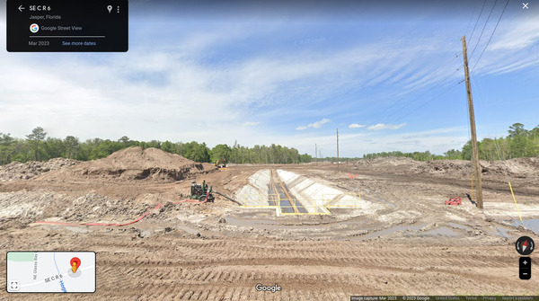
PCS Dragline and Utility Corridor across CR 6

CATEGORIES: Bridge
LAYER: Bridge
OWNERSHIP: Private
WATER BODY: Suwannee River
ADDRESS: 6.5 miles east of Jasper on CR 6 (Hatley Street). Hamilton County.
DESCRIPTION: Large pipes under CR 6 with excavation nearby, as in Army Corps of Engineers permit SAJ-1984-04652 of October 15, 2019.
AKA: Nutrien Dragline and Utilitiy Corridor
OTHER REFERENCE: https://www.saj.usace.army.mil/Missions/Regulatory/Public-Notices/Article/1662437/saj-1984-04652-mod-jpf/
PHOTO: https://www.wwals.net/pictures/2023-06-10–nutrien-phosphate-mine-pictures/KIMG5912.jpg
PHOTOSET: https://www.wwals.net/pictures/2023-06-10–nutrien-phosphate-mine-pictures/
PHOTO SOURCE: Anonymous
PHONE NUMBER: (850) 290-2350
PHOTO2: https://wwals.net/pictures/2019-10-15–pcs-phosphate-usace/p16021coll7_8308-0007.jpg
Photoset2: https://wwals.net/pictures/2019-10-15–pcs-phosphate-usace
PHOTO2 SOURCE: PCS
Suggestions: https://forms.gle/DipPgU2TP5atc2Rf9

Hogans Branch Nutrien Utility Crossing

CATEGORIES: Bridge
LAYER: Bridge
GPS: 30.49535872, -82.76145147
OWNERSHIP: Private
WATER BODY: Suwannee River
ADDRESS: 12.3 miles east of Jasper on CR 6 (Hatley Street), just east of NE Grassy Bay Road and Hogans Branch. Hamilton County.
DESCRIPTION: Large pipes under CR 6 with excavation nearby, as in Special Permit 03-1.
OTHER REFERENCE: https://goo.gl/maps/7chnV3TQue31MSKn7
PHOTOSET: https://www.wwals.net/pictures/2023-06-10–nutrien-phosphate-mine-pictures/#GSV
PHOTO SOURCE: Google Streetview
PHONE NUMBER: (850) 290-2350
PHOTO2: https://www.wwals.net/pictures/2023-03-28–hamco-planning-more/CMMPA-MAPS-20221031-Final-0033.jpg
Photoset2: https://www.wwals.net/pictures/2023-03-28–hamco-planning-more/
PHOTO2 SOURCE: PCS
Suggestions: https://forms.gle/DipPgU2TP5atc2Rf9

Bell Creek SW 107th Avenue Bridge

CATEGORIES: Bridge
LAYER: Bridge
OWNERSHIP: Public
WATER BODY: Bell Creek
ADDRESS: South of Jasper, FL, just beyond the landfill. Hamilton County.
DESCRIPTION: Culverts under SW 107th Avenue carrying a creek that flows west from the Nutrien Phosphate Mine into Basin Swamp. Cat Creek flows up from the south to join Bell Creek.
WEBSITE: https://www.wwals.net/pictures/2024-08-24–hamilton-county-creeks
PHOTO: https://www.wwals.net/pictures/2024-08-24–hamilton-county-creeks/20240824_153747.jpg
PHOTOSET: https://www.wwals.net/pictures/2024-08-24–hamilton-county-creeks/
PHOTO SOURCE: John S. Quarterman
PHONE NUMBER: (229) 242-0102
PHOTO2: https://www.wwals.net/pictures/2024-08-24–hamilton-county-creeks/20240824_153853.jpg
Photoset2: https://www.wwals.net/pictures/2024-08-24–hamilton-county-creeks/
PHOTO2 SOURCE: John S. Quarterman
Photo2 Phone Number: 229-242-0102
Suggestions: https://forms.gle/DipPgU2TP5atc2Rf9
Bell Creek US 41 Bridge

CATEGORIES: Bridge
LAYER: Bridge
OWNERSHIP: Public
WATER BODY: Bell Creek
ADDRESS: SE of Jasper, FL. Hamilton County.
DESCRIPTION: Culverts under US 41 carrying a creek that flows west from the Nutrien Phosphate Mine into Basin Swamp. Cat Creek flows up from the south to join Bell Creek.
WEBSITE: https://www.wwals.net/pictures/2024-08-24–hamilton-county-creeks
PHOTO: https://www.wwals.net/pictures/2024-08-24–hamilton-county-creeks/20240824_150852.jpg
PHOTOSET: https://www.wwals.net/pictures/2024-08-24–hamilton-county-creeks/
PHOTO SOURCE: John S. Quarterman
PHONE NUMBER: (229) 242-0102
PHOTO2: https://www.wwals.net/pictures/2024-08-24–hamilton-county-creeks/20240824_151013.jpg
Photoset2: https://www.wwals.net/pictures/2024-08-24–hamilton-county-creeks/
PHOTO2 SOURCE: John S. Quarterman
Photo2 Phone Number: 229-242-0102
Suggestions: https://forms.gle/DipPgU2TP5atc2Rf9

Biosolids Branch SW 107th Avenue Bridge

CATEGORIES: Bridge
LAYER: Bridge
OWNERSHIP: Public
WATER BODY: Biosolids Branch
ADDRESS: South of SW 53rd Street on SW 107th Avenue. Hamilton County.
DESCRIPTION: A small culvert carrying a tiny creek with little flow that goes north across SW 53rd Street and along the north side of the Jasper Biosolids Site before flowing into Bell Creek.
WEBSITE: https://www.wwals.net/pictures/2024-08-24–hamilton-county-creeks
PHOTO: https://www.wwals.net/pictures/2024-08-24–hamilton-county-creeks/20240824_145245.jpg
PHOTOSET: https://www.wwals.net/pictures/2024-08-24–hamilton-county-creeks/
PHOTO SOURCE: John S. Quarterman
PHONE NUMBER: (229) 242-0102
PHOTO2: https://www.wwals.net/pictures/2024-08-24–hamilton-county-creeks/20240824_154810.jpg
Photoset2: https://www.wwals.net/pictures/2024-08-24–hamilton-county-creeks/
PHOTO2 SOURCE: John S. Quarterman
Photo2 Phone Number: 229-242-0102
Suggestions: https://forms.gle/DipPgU2TP5atc2Rf9

Cat Creek SW 55 Drive Bridge

CATEGORIES: Bridge
LAYER: Bridge
OWNERSHIP: Public
WATER BODY: Cat Creek
ADDRESS: Just west of the south side of Hamilton County High School, south of Jasper, FL. Hamilton County.
DESCRIPTION: Culverts under SW 55 Drive carrying a creek that flows south from the Nutrien Phosphate Mine into Bell Creek.
WEBSITE: https://www.wwals.net/pictures/2024-08-24–hamilton-county-creeks
PHOTO: https://www.wwals.net/pictures/2024-08-24–hamilton-county-creeks/20240824_145743.jpg
PHOTOSET: https://www.wwals.net/pictures/2024-08-24–hamilton-county-creeks/
PHOTO SOURCE: John S. Quarterman
PHONE NUMBER: (229) 242-0102
PHOTO2: https://www.wwals.net/pictures/2024-08-24–hamilton-county-creeks/20240824_150055.jpg
Photoset2: https://www.wwals.net/pictures/2024-08-24–hamilton-county-creeks/
PHOTO2 SOURCE: John S. Quarterman
Photo2 Phone Number: 229-242-0102
Suggestions: https://forms.gle/DipPgU2TP5atc2Rf9

US 129 Suwannee River Bridge

CATEGORIES: Bridge
LAYER: Bridge
OWNERSHIP: Public
WATER BODY: Suwannee River
MILE: 149.81
ADDRESS: From Live Oak, travel north on US 129 to the Suwannee River. Suwannee County.
DESCRIPTION: A two-lane highway bridge built in 1971 between Hamilton and Suwannee Counties over the Suwannee River.
AKA: FL 51 Bridge
PHOTO: https://wwals.net/wp-content/themes/pianoblack/img//2017/05/6ff50a8b1dcd01716ac2a221c237c3b3.jpg
PHOTOSET: https://wwals.net/2017/05/23/pictures-woods-ferry-tract-to-suwannee-springs-2017-05-20/
PHOTO SOURCE: John S. Quarterman
PHONE NUMBER: (229) 242-0102
PHOTO2: https://wwals.net/wp-content/themes/pianoblack/img//2017/05/a9f49a6bd05604ff269f87ef2b7e9f62.jpg
Photoset2: https://wwals.net/2017/05/17/aerials-woods-ferry-tract-to-suwannee-springs-2016-11-23/
PHOTO2 SOURCE: Beth Gammie
Suggestions: https://forms.gle/DipPgU2TP5atc2Rf9
CR 249 Bridge
CATEGORIES: Bridge
LAYER: Bridge
GPS: 30.43694, -83.09167
OWNERSHIP: Public
WATER BODY: Suwannee River
GAUGE: Ellaville
MILE: 135.55
ADDRESS: Just upstream from Gibson Park Ramp, downstream from the Alapaha River Rise. Hamilton, Suwannee Counties.
DESCRIPTION: A 773.0 ft. 2-span steel multi-beam bridge with a concrete cast-in-place deck over the Suwannee River, built in 1984.
AKA: Nobles Ferry Bridge
WEBSITE: https://bridgereports.com/1081892
Suggestions: https://forms.gle/DipPgU2TP5atc2Rf9
Ellaville County Bridge Site

CATEGORIES: Bridge
LAYER: Bridge
OWNERSHIP: Public, TIITF/REC & PARKS & PARKS SUWANNEE RIVER ST PK, PARCEL 24-01S-11E-10898-000000 (90)
WATER BODY: Suwannee River
GAUGE: Ellaville
MILE: 127.49
ADDRESS: Just upstream from the CSX RR Bridge on the left (south) bank is a remaining abutment of the Ellaville County Bridge. Madison, Suwannee Counties.
DESCRIPTION: “”The County Bridge rested upon concrete abutments and lally column supports, but there were also some tall timber pilings on the Madison County (north) side. A few of these very tall timber pilings still remain submerged in the river next to the base of the old County Bridge. Used to be about 8 of these in the mid-1990s. At least 2 remain and can be seen easily at very low water.”” —Ken Sulak
HISTORIC FACTS: Built in 1908 to replace the ferry. Itself replaced by the Hillman Bridge in 1928.
AKA: Ellaville County Bridge
WEBSITE: https://wwals.net/2022/12/01/county-bridge-hillman-bridge-suwannee-river-2022-11-26/
PHOTOSET: https://www.wwals.net/pictures/2022-11-26–county-bridge-hillman-bridge-suwannee-river/#CB
PHOTO SOURCE: Ken Sulak
PHONE NUMBER: (850) 290-2350
Photoset2: https://www.wwals.net/pictures/2022-11-26–county-bridge-hillman-bridge-suwannee-river/#Maps
PHOTO2 SOURCE: Ken Sulak
Suggestions: https://forms.gle/DipPgU2TP5atc2Rf9

US 90 Suwannee River Bridge
CATEGORIES: Bridge
LAYER: Bridge
GPS: 30.3846, -83.17574
OWNERSHIP: Public
WATER BODY: Suwannee River
GAUGE: Ellaville
MILE: 127.24
ADDRESS: A quarter mile downstream from the Withlacoochee River Confluence. Madison, Suwannee Counties.
DESCRIPTION: 761.2 ft. 10-span prestressed concrete stringer bridge built in 1986 over the Suwannee River.
AKA: FL 10 Suwannee River Bridge
WEBSITE: https://bridgereports.com/1082061
PHOTO: https://goo.gl/maps/Jexnmzw2J44yykyu8
PHOTOSET: https://www.google.com/maps/@30.38497, -83.174671, 467m/data=!3m1!1e3
PHOTO SOURCE: Google streetview
PHONE NUMBER: (850) 290-2350
Suggestions: https://forms.gle/DipPgU2TP5atc2Rf9
I-10 Bridge
CATEGORIES: Bridge
LAYER: Bridge
OWNERSHIP: Public
WATER BODY: Suwannee River
GAUGE: Ellaville
MILE: 124.80
ADDRESS: Between Live Oak and Madison, Florida. 2 3/4 miles downstream from the Withlacoochee River Confluence and half a mile upstream fro Anderson Spring Launch. Madison, Suwannee Counties.
DESCRIPTION: A pair of modern interstate highway bridges built in 1971.
Suggestions: https://forms.gle/DipPgU2TP5atc2Rf9
CR 250 Bridge

CATEGORIES: Bridge
LAYER: Bridge
OWNERSHIP: Public
WATER BODY: Suwannee River
MILE: 112.80
ADDRESS: Southwest of Dowling Park, and just downstream from Dowling Park Ramp. Suwanneee, Lafayette Counties.
DESCRIPTION: A modern highway bridge built in 1955 and substantially rebuilt in July 2020.
PHOTOSET: https://wwals.net/2020/08/26/pictures-suwannee-river-dowling-park-river-camp-2020-07-18/
PHOTO SOURCE: John S. Quarterman
PHONE NUMBER: (229) 242-0102
Suggestions: https://forms.gle/DipPgU2TP5atc2Rf9
Hal W. Adams Bridge
CATEGORIES: Bridge
LAYER: Bridge
OWNERSHIP: Public
WATER BODY: Suwannee River
GAUGE: Luraville
MILE: 98.26
ADDRESS: Between Luraville and Mayo. Suwannee, Lafayette Counties.
DESCRIPTION: Highway bridge built in 1947.
AKA: FL 51 Bridge
Suggestions: https://forms.gle/DipPgU2TP5atc2Rf9
Frank R. Norris Bridge
CATEGORIES: Bridge
LAYER: Bridge
GPS: 29.955173, -82.92955
OWNERSHIP: Public
WATER BODY: Suwannee River
MILE: 76.13
ADDRESS: Just west of Branford on US 27. Suwannee, Lafayette Counties.
DESCRIPTION: A modern highway bridge built in 1989.
AKA: US 27 Suwannee River Bridge
Suggestions: https://forms.gle/DipPgU2TP5atc2Rf9
W. O. Cannon Bridge
CATEGORIES: Bridge
LAYER: Bridge
OWNERSHIP: Public
WATER BODY: Suwannee River
MILE: 56.62
ADDRESS: West of Old Town on CR 340, just upstream from Rock Bluff Ramp. Gilchrist, Dixie Counties.
DESCRIPTION: A two-lane highway bridge built in 1965 over the Suwannee River.
AKA: D. W. McCollister Bridge or CR 340 Bridge
Suggestions: https://forms.gle/DipPgU2TP5atc2Rf9
Joe H. Anderson Sr. Bridge
CATEGORIES: Bridge
LAYER: Bridge
OWNERSHIP: Public
WATER BODY: Suwannee River
MILE: 34.34
ADDRESS: Just west of Fanning Springs and about 700 feet upstream from Joe Anderson Jr. Ramp. Dixie, Gilchrist, Levy Counties.
DESCRIPTION: A pair of modern highway bridges built in 1963, carrying US 19, US 98, and Alt. US 27 across the Suwannee River.
Suggestions: https://forms.gle/DipPgU2TP5atc2Rf9
River Styx Culvert

CATEGORIES: Bridge
LAYER: Bridge
OWNERSHIP: Public, LLC TIAA TIMBERLANDS I C/O GREENWOOD RESOURCE INC. PARCEL 0016 001
WATER BODY: River Styx
ADDRESS: GA 94, between Tony Road and Bobby Break. Charlton County.
DESCRIPTION: Joins St. Marys River in the Okefenokee Swamp.
WEBSITE: https://www.wwals.net/pictures/2021-01-10–southwings-oke/#RS
PHOTO: https://www.wwals.net/pictures/2021-01-10–southwings-oke/ONWR-mine-site-35-of-46.jpg
PHOTOSET: https://www.wwals.net/pictures/2021-01-10–southwings-oke/#RS
PHOTO SOURCE: Southwings for WWALS
PHONE NUMBER: (229) 242-0102
Suggestions: https://forms.gle/DipPgU2TP5atc2Rf9
US 27 Bridge

CATEGORIES: Bridge
LAYER: Bridge
GPS: 29.95278, -82.78583
OWNERSHIP: Public
WATER BODY: Ichetucknee River
GAUGE: Ichetucknee
MILE: 1.89
ADDRESS: US 27 (FL 20) near Ichetucknee River State Park. Columbia County.
DESCRIPTION: Nice semi-rapids under the bridge.
AKA: US 20 Bridge
WEBSITE: http://bridgereports.com/1081687
PHOTO: https://wwals.net/pictures/2020-01-20–ichetucknee-santa-fe-pictures/20200120_131737.jpg
PHOTOSET: https://wwals.net/pictures/2020-01-20–ichetucknee-santa-fe-pictures/
PHOTO SOURCE: John S. Quarterman
PHONE NUMBER: (229) 242-0102
Suggestions: https://forms.gle/DipPgU2TP5atc2Rf9
CR 1471 Santa Fe River Bridge
CATEGORIES: Bridge
LAYER: Bridge
OWNERSHIP: Public
WATER BODY: Santa Fe River
GAUGE: Graham
MILE: 75.37
ADDRESS: Just downstream of the Santa Fe Swamp, south of Hampton, FL. Alachua County.
DESCRIPTION: A culvert channelling the Santa Fe River under CR 1471, aka FL 325.
AKA: FL 325 Santa Fe River Bridge
WEBSITE: https://en.wikipedia.org/wiki/Santa_Fe_River_(Florida)
Suggestions: https://forms.gle/DipPgU2TP5atc2Rf9
US 301 Santa Fe River Bridge
CATEGORIES: Bridge
LAYER: Bridge
GPS: 29.83943, -82.163572
OWNERSHIP: Public
WATER BODY: Santa Fe River
MILE: 73.71
ADDRESS: Between Hampton and Waldo. Alachua, Bradford Counties.
DESCRIPTION: A pair of concrete two-lane highway bridges over the Santa Fe River, between Bradford and Alachua Counties, Florida.
WEBSITE: https://en.wikipedia.org/wiki/Santa_Fe_River_(Florida)
Suggestions: https://forms.gle/DipPgU2TP5atc2Rf9
Rayonier Forest Road Santa Fe River Bridge
CATEGORIES: Bridge
LAYER: Bridge
OWNERSHIP: Private, RAYONIER FOREST RESOURCES, LP, PARCEL 01053-0-00000
WATER BODY: Santa Fe River
GAUGE: Graham
MILE: 70.72
ADDRESS: Between Bradford SW CR 18 and Alachua CR 225, SE of Hampton. Alachua, Bradford Counties.
DESCRIPTION: A dirt forest road over the Santa Fe River. Unknown bridge type.
WEBSITE: https://en.wikipedia.org/wiki/Santa_Fe_River_(Florida)
Suggestions: https://forms.gle/DipPgU2TP5atc2Rf9
CR 225 Santa Fe River Bridge
CATEGORIES: Bridge
LAYER: Bridge
OWNERSHIP: Public
WATER BODY: Santa Fe River
GAUGE: Graham
MILE: 69.70
ADDRESS: Northwest of Waldo, west of Hampton. Alachua, Bradford Counties.
DESCRIPTION: A two-lane asphalt-toppped concrete bridge over the Santa Fe River between Bradford and Alachua Counties, Florida, on Alachue NE CR 1475 and Bradford CR 225.
AKA: CR 1475 Santa Fe River Bridge
WEBSITE: https://en.wikipedia.org/wiki/Santa_Fe_River_(Florida)
Suggestions: https://forms.gle/DipPgU2TP5atc2Rf9
SW 136th Avenue Santa Fe River Bridge
CATEGORIES: Bridge
LAYER: Bridge
OWNERSHIP: Public
WATER BODY: Santa Fe River
GAUGE: Graham
MILE: 66.47
ADDRESS: Between Bradford SW CR 18 and Alachua E CR 225, WSW of Graham, FL. Alachua, Bradford Counties.
DESCRIPTION: A dirt county road bridge of unknown type over the Santa Fe River between Bradford and Alachua Counties, Florida.
WEBSITE: https://en.wikipedia.org/wiki/Santa_Fe_River_(Florida)
Suggestions: https://forms.gle/DipPgU2TP5atc2Rf9
FL 235 Santa Fe River Bridge
CATEGORIES: Bridge
LAYER: Bridge
OWNERSHIP: Public
WATER BODY: Santa Fe River
GAUGE: Graham
MILE: 59.81
ADDRESS: South of Brooker, 11100 FL 231, Brooker, FL. Alachua, Bradford Counties.
DESCRIPTION: A two-lane concrete state highway bridge over the Santa Fe River between Bradford and Alachua Counties, Florida.
WEBSITE: https://en.wikipedia.org/wiki/Santa_Fe_River_(Florida)
Suggestions: https://forms.gle/DipPgU2TP5atc2Rf9
CR 1493 Santa Fe River Bridge
CATEGORIES: Bridge
LAYER: Bridge
OWNERSHIP: Public
WATER BODY: Santa Fe River
GAUGE: Graham
MILE: 56.02
ADDRESS: West of Brooker, NNE of LaCrosse, FL. Alachua, Bradford Counties.
DESCRIPTION: A two-lane asphalt-toppped concrete bridge over the Santa Fe River between Bradford and Alachua Counties, Florida, on Alachue NE CR 1493 and Bradford SW CR 237.
AKA: SW CR 237 Santa Fe River Bridge
WEBSITE: https://en.wikipedia.org/wiki/Santa_Fe_River_(Florida)
Suggestions: https://forms.gle/DipPgU2TP5atc2Rf9
CR 125 New River Bridge
CATEGORIES: Bridge
LAYER: Bridge
GPS: 30.103436, -82.16106
OWNERSHIP: Public
WATER BODY: New (FL) River
MILE: 25.96
ADDRESS: Northwest of Lawtey. Union, Bradford Counties.
DESCRIPTION: A narrow two-lane concrete bridge over the New River.
Suggestions: https://forms.gle/DipPgU2TP5atc2Rf9
FL 16 New River Bridge
CATEGORIES: Bridge
LAYER: Bridge
OWNERSHIP: Public
WATER BODY: New (FL) River
MILE: 22.86
ADDRESS: In the middle of Raiford Prison Cemetery. Union, Bradford Counties.
DESCRIPTION: A concrete two-lane bridge over the New River.
Suggestions: https://forms.gle/DipPgU2TP5atc2Rf9
NW 125th Drive New River Bridge
CATEGORIES: Bridge
LAYER: Bridge
OWNERSHIP: Public
WATER BODY: New (FL) River
MILE: 21.06
ADDRESS: Between Raiford and Starke. Union, Bradford Counties.
DESCRIPTION: Googlemaps shows NW 125th Drive crossing the New River, but it’s not clear that it really does.
Suggestions: https://forms.gle/DipPgU2TP5atc2Rf9
CR 229 New River Bridge
CATEGORIES: Bridge
LAYER: Bridge
GPS: 30.037315, -82.2219
OWNERSHIP: Public
WATER BODY: New (FL) River
MILE: 19.48
ADDRESS: Between Raiford and Starke. Union, Bradford Counties.
DESCRIPTION: A concrete two-lane bridge over the New River.
Suggestions: https://forms.gle/DipPgU2TP5atc2Rf9
FL 100 New River Bridge
CATEGORIES: Bridge
LAYER: Bridge
OWNERSHIP: Public
WATER BODY: New (FL) River
MILE: 14.02
ADDRESS: Between Lake Butler and Starke. Union, Bradford Counties.
DESCRIPTION: A concrete two-lane bridge over the New River, on the Florida National Scenic Trail.
AKA: Long Bridge
Suggestions: https://forms.gle/DipPgU2TP5atc2Rf9
FL 231 New River Bridge
CATEGORIES: Bridge
LAYER: Bridge
OWNERSHIP: Public
WATER BODY: New (FL) River
MILE: 6.21
ADDRESS: Between Lake Butler and Brooker. Union, Bradford Counties.
DESCRIPTION: A concrete two-lane bridge over the New River.
AKA: New River Bridge
Suggestions: https://forms.gle/DipPgU2TP5atc2Rf9
FL 18 New River Bridge
CATEGORIES: Bridge
LAYER: Bridge
OWNERSHIP: Public
WATER BODY: New (FL) River
MILE: 0.62
ADDRESS: Two thirds of a mile upstream from the New River Confluence with the Santa Fe River, and half a mile southeast of Worthington Springs, FL. Union, Bradford, Alachua Counties.
DESCRIPTION: A concrete two-lane bridge over the New River.
AKA: CR 18 New River Bridge
Suggestions: https://forms.gle/DipPgU2TP5atc2Rf9
FL 121 Santa Fe River Bridge
CATEGORIES: Bridge
LAYER: Bridge
GPS: 29.921893, -82.42632
OWNERSHIP: Public
WATER BODY: Santa Fe River
MILE: 49.22
ADDRESS: At the south City Limits of Worthington Springs, FL. Union, Alachua Counties.
DESCRIPTION: A two-lane concrete bridge over the Santa Fe River.
Suggestions: https://forms.gle/DipPgU2TP5atc2Rf9
SW CR 241 Santa Fe River Bridge
CATEGORIES: Bridge
LAYER: Bridge
OWNERSHIP: Public
WATER BODY: Santa Fe River
GAUGE: Worthington Springs
MILE: 41.63
ADDRESS: West of Worthington Springs, south of Bradford CR 18 and north of Alachua CR 1491. Union, Alachua Counties.
DESCRIPTION: A two-lane concrete bridge over the Santa Fe River between Union and Alachua Counties, Florida.
WEBSITE: https://en.wikipedia.org/wiki/Santa_Fe_River_(Florida)
Suggestions: https://forms.gle/DipPgU2TP5atc2Rf9
I-75 Santa Fe River Bridge
CATEGORIES: Bridge
LAYER: Bridge
OWNERSHIP: Public
WATER BODY: Santa Fe River
MILE: 36.02
ADDRESS: Between Lake City and Alachua. Columbia, Alachua Counties.
DESCRIPTION: A pair of three-lane concrete interstate highway bridges over the Santa Fe River, between Columbia and Alachua Counties, Florida.
WEBSITE: https://en.wikipedia.org/wiki/Santa_Fe_River_(Florida)
Suggestions: https://forms.gle/DipPgU2TP5atc2Rf9
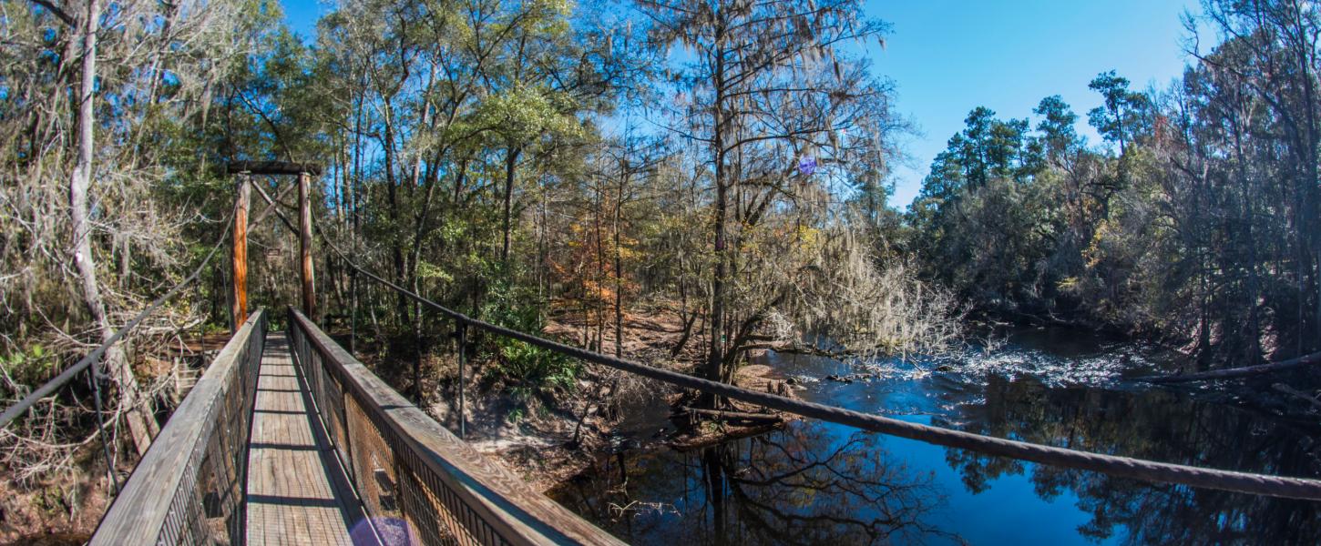
O’Leno SP Suspension Bridge
CATEGORIES: Bridge
LAYER: Bridge
GPS: 29.9144, -82.57946
OWNERSHIP: Public, TIITF/DEP-REC & PARKS, PARCEL 02-7S-17-09867-000
WATER BODY: Santa Fe River
GAUGE: O’Leno
MILE: 33.94
ADDRESS: In O’Leno State Park, 410 SE O’Leno Park Road, High Springs, FL 32643, Columbia, Alachua Counties.
DESCRIPTION: A pedestrian suspension bridge just downstream of the floating swimming dock.
HISTORIC FACTS: “”Effective Aug. 26, 2022: The suspension bridge is closed until further notice.””
WEBSITE: https://www.floridastateparks.org/parks-and-trails/oleno-state-park
PHOTOSET: https://www.floridastateparks.org/parks-and-trails/oleno-state-park
PHOTO SOURCE: Florida State Parks
PHONE NUMBER: (850) 290-2350
Suggestions: https://forms.gle/DipPgU2TP5atc2Rf9
US 441 Santa Fe River Bridge
CATEGORIES: Bridge
LAYER: Bridge
OWNERSHIP: Public
WATER BODY: Santa Fe River
GAUGE: Santa Fe River Rise
MILE: 27.78
ADDRESS: North of High Springs. Columbia, Alachua Counties.
DESCRIPTION: A two-lane concrete U.S. highway bridge carrying US 41 and US 441 over the Santa Fe River between Columbia and Alachua Counties, Florida.
AKA: US 41 Santa Fe River Bridge
WEBSITE: https://en.wikipedia.org/wiki/Santa_Fe_River_(Florida)
Suggestions: https://forms.gle/DipPgU2TP5atc2Rf9
US 27 Santa Fe River Bridge
CATEGORIES: Bridge
LAYER: Bridge
OWNERSHIP: Public
WATER BODY: Santa Fe River
GAUGE: Santa Fe River Rise
MILE: 24.61
ADDRESS: NNW of High Springs, SE of Fort White. Columbia, Alachua Counties.
DESCRIPTION: A two-lane asphalt-topped concrete U.S. highway bridge over the Santa Fe River, between Columbia and Alachua Counties, Florida.
WEBSITE: https://en.wikipedia.org/wiki/Santa_Fe_River_(Florida)
Suggestions: https://forms.gle/DipPgU2TP5atc2Rf9
FL 47 Santa Fe River Bridge
CATEGORIES: Bridge
LAYER: Bridge
OWNERSHIP: Public
WATER BODY: Santa Fe River
GAUGE: Fort White
MILE: 15.80
ADDRESS: South of Fort White. Columbia, Gilchrist Counties.
DESCRIPTION: A two-lane concrete state highway bridge over the Santa Fe River between Columbia and Gilchrist Counties, FL.
WEBSITE: https://en.wikipedia.org/wiki/Santa_Fe_River_(Florida)
Suggestions: https://forms.gle/DipPgU2TP5atc2Rf9
US 129 Santa Fe River Bridge
CATEGORIES: Bridge
LAYER: Bridge
OWNERSHIP: Public
WATER BODY: Santa Fe River
GAUGE: Hildreth
MILE: 2.46
ADDRESS: East of Branford. Suwannee, Gilchrist Counties.
DESCRIPTION: A two-lane concrete U.S. highway bridge over the Santa Fe River between Suwannee and Gilchrist Counties, Florida.
WEBSITE: https://en.wikipedia.org/wiki/Santa_Fe_River_(Florida)
Suggestions: https://forms.gle/DipPgU2TP5atc2Rf9
BridgeHistoric
Historic Suwannee Springs Bridge @ 93rd Drive


CATEGORIES: Bridgehistoric
LAYER: Bridge
OWNERSHIP: Public
WATER BODY: Suwannee River
MILE: 149.95
ADDRESS: From Live Oak, travel north on US 129 to 93 Drive; turn right; park just before the bridge. Suwannee County.
DESCRIPTION: Closed to vehicles since 1971, but open to pedestrian and bicycle traffic, the graffiti and the view of the Suwannee River are the main attractions of this 160-foot Parker through truss bridge.
HISTORIC FACTS: Built in 1931 by the Austin Brothers Bridge Company of Dallas, Texas. Closed to vehicle traffic in 1971 when the present US 129 bridge opened.
AKA: Suwannee Springs Bridge or Grafitti Bridge or Bridge to Nowhere or Hippie Bridge or Suwanee Springs Bridge or Old US 129 Bridge or 93rd Drive Bridge
WEBSITE: https://www.atlasobscura.com/places/hillman-bridge#:~:text=Suwanee%20Springs%20Bridge%20was%20built, 160%20feet%20over%20the%20river.
PHOTO: https://wwals.net/wp-content/themes/pianoblack/img//2017/05/7d699db0ded7f0882c1f58a83abd2284.jpg
PHOTOSET: https://wwals.net/2017/05/23/pictures-woods-ferry-tract-to-suwannee-springs-2017-05-20/
PHOTO SOURCE: John S. Quarterman
PHONE NUMBER: (229) 242-0102
Suggestions: https://forms.gle/DipPgU2TP5atc2Rf9
Historic Hillman Bridge

CATEGORIES: Bridgehistoric
LAYER: Bridge
OWNERSHIP: Public
WATER BODY: Suwannee River
GAUGE: Ellaville
MILE: 127.31
ADDRESS: A fifth of a mile downstream from the Withlacoochee River Confluence, between the CSX RR Bridge and the US 90 Bridge, NE Drew Way, Live Oak, FL 32060, Madison, Suwannee Counties.
DESCRIPTION: Built 1926, abandoned 1983, 916.0-foot 3-span Metal 7 Panel Rivet-Connected Pratt Through Truss bridge over the Suwannee River.
HISTORIC FACTS: “”Hillman Bridge is a through truss bridge located in the small town of Ellaville, once a thriving sawmill and manufacturing center owned by George Franklin Drew, Florida’s governor between 1877 to 1881. Built as a federal aid project in 1925-1926 by the R.H.H. Blackwell Co. of East Aurora, N.Y., it was named “Hillman Bridge” during its construction after W.J. Hillman of Live Oak, a member of the State Road Department who had helped push for the construction of the bridge.”” https://www.abandonedfl.com/hillman-bridge/
AKA: Hillman Bridge or Old US 90 Bridge
WEBSITE: https://www.abandonedfl.com/hillman-bridge/
OTHER REFERENCE: https://historicbridges.org/bridges/browser/?bridgebrowser=florida/ellaville/
PHOTO: https://www.wwals.net/pictures/gretchen/2019-06-01–wwals-withlacoochee/P6011066.jpg
PHOTOSET: https://www.wwals.net/pictures/gretchen/2019-06-01–wwals-withlacoochee/#Suwannee-River
PHOTO SOURCE: Gretchen Quarterman
PHONE NUMBER: (850) 290-2350
Suggestions: https://forms.gle/DipPgU2TP5atc2Rf9
BridgeSite
Boney Bluff Bridge Site

CATEGORIES: Bridgesite
LAYER: Bridge
GPS: 30.62125, -82.6687
OWNERSHIP: Private
WATER BODY: Suwannee River
GAUGE: Fargo
MILE: 209.49
ADDRESS: 12.06 miles downstream from Fargo Ramp, 3.16 miles upstream from GA-FL line. Echols County.
DESCRIPTION: According to Ken Sulak, “”the USACE 1911 survey map shows a ‘Highway Bridge’ at this site.””
AKA: Boney Bluff Bridge
Suggestions: https://forms.gle/DipPgU2TP5atc2Rf9
Turner Bridge Site

CATEGORIES: Bridgesite
LAYER: Bridge
OWNERSHIP: Public
ACCESS: PARKING: Free
WATER BODY: Suwannee River
Lowest boatable: 52
Highest safe: 68
GAUGE: White Springs
MILE: 197.70
ADDRESS: From White Springs, travel north on SE CR 135; cross over SE CR 6 onto NE 180 Boulevard (Woodpecker Route); travel north to NE 38 Trail; turn right and follow road to ramp. Hamilton, Columbia Counties.
DESCRIPTION: Bridge that crossed the Suwannee River from 1900 to 1951. Each bank has a pair of lally columns, which are steel cylinders filled with concrete. The third pair, much shortened, is in the river a bit out from Turner Bridge Ramp.
HISTORIC FACTS: Many, see Turner Bridge mysteries –Ken Sulak 2021-12-16 https://wwals.net/?p=57432
AKA: Turner Bridge
WEBSITE: https://wwals.net/2022/01/05/turner-bridge-mysteries-ken-sulak-2021-12-16/
PHOTO: https://www.wwals.net/pictures/2021-12-16–roline-fl-6-suwannee-pictures/20211216_135206.jpg
PHOTOSET: https://wwals.net/2022/01/05/turner-bridge-mysteries-ken-sulak-2021-12-16/
PHOTO SOURCE: John S. Quarterman
PHONE NUMBER: (229) 242-0102
Suggestions: https://forms.gle/DipPgU2TP5atc2Rf9
Cone Bridge Site @ NW Cone Bridge Road

CATEGORIES: Bridgesite
LAYER: Bridge
OWNERSHIP: Public
WATER BODY: Suwannee River
MILE: 186.50
ADDRESS: From Lake City, travel north on US 441 to NW Cone Bridge Road; turn left and follow road to ramp. Hamilton, Columbia Counties.
DESCRIPTION: Originally a timber wagon bridge built in 1881, “”Cone Bridge was rebuilt on Lally columns (the toppled columns still remain along the end of Cone Bridge Road) as a steel through-strut single-lane, wooden plank decked bridge—probably in 1898 or a bit later. It was built by Andrew Cone Godwin 1865-1942 for William Haddock Cone—who was elderly by then. That bridge was damaged by an overloaded truck in 1970, avoiding the main road checkpoint, and was dismantled thereafter.”” –Ken Sulak https://wwals.net/?p=54537
HISTORIC FACTS: See History of Cone Bridge and the Cone family –Dr. Ken Sulak 2020-12-31 https://wwals.net/?p=54537
AKA: Cone Bridge
WEBSITE: https://wwals.net/?p=54537
PHOTO: https://wwals.net/wp-content/themes/pianoblack/img//2015/11/279a3ad98ba161b5909da5ab703f99db.jpg
PHOTO SOURCE: Gretchen Quarterman
PHONE NUMBER: (850) 290-2350
Suggestions: https://forms.gle/DipPgU2TP5atc2Rf9
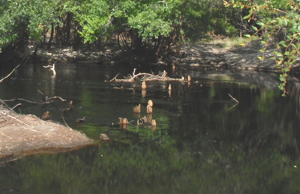
Peoples Bridge Site

CATEGORIES: Bridgesite
LAYER: Bridge
OWNERSHIP: Public, SRWMD, PARCEL 07-1S-17-04497-000 (05)
WATER BODY: Suwannee River
GAUGE: White Springs
MILE: 183.34
ADDRESS: 3.2 miles downstream from Cone Bridge at a small island. Hamilton, Columbia Counties.
DESCRIPTION: A “”wooden foot and wagon bridge possibly built by the congregation of the Oak Grove Church around 1870 so folks on the Hamilton side could attend church on the Columbia side. The double row of old cutoff timber pilings emerges at low water”” as in below 51 feet on the White Springs gauge. —Ken Sulak The left (east) bank in Columbia County is owned by SRWMD; the right (west) bank in Hamilton County is privately owned.
HISTORIC FACTS: Built around 1870.
AKA: Peoples Bridge
WEBSITE: https://wwals.net/2022/12/11/peoples-bridge-suwannee-river-2022-11-27/
OTHER REFERENCE: https://wwals.net/2022/12/13/alligator-church-peoples-bridge-suwannee-river-ken-sulak-1880-07-13/
PHOTO: https://www.wwals.net/pictures/2022-11-27–peoples-bridge-suwannee-river/1669569958222blob.jpg
PHOTOSET: https://www.wwals.net/pictures/2022-11-27–peoples-bridge-suwannee-river/
PHOTO SOURCE: Ken Sulak
PHONE NUMBER: (850) 290-2350
PHOTO2: https://www.wwals.net/pictures/1880-07-13–alligator-peoples-bridge/oak-grove-baptist-church.jpg
Photoset2: https://www.wwals.net/pictures/1880-07-13–alligator-peoples-bridge/
PHOTO2 SOURCE: Ken Sulak
Suggestions: https://forms.gle/DipPgU2TP5atc2Rf9

Old Godwin Bridge Site @ Godwin Bridge Road

CATEGORIES: Bridgesite
LAYER: Bridge
OWNERSHIP: Public
WATER BODY: Suwannee River
MILE: 176.76
ADDRESS: A quarter mile downstream from Big Shoals Tract Launch. Hamilton, Columbia Counties.
DESCRIPTION: Lally columns (steel cylinders filled with concrete) on each side of the Suwannee River are all that remains.
HISTORIC FACTS: Andrew Godwin (165-1942) “”Andrew was a farmer, a contractor who specialized in bridges, and politically active in support of his cousin, Fred P. Cone 1871–1948 (governor of Florida 1937–1941 and known for establishing the Florida State Highway Patrol). The home place was between two of Andrew’s bridges, Cone Bridge and Godwin Bridge, both spanning the Suwannee River in Hamilton County. Neither is still standing, though his pilings are still visible, and they are both popular sites to launch boats in Big Shoals State Park.”” https://www.findagrave.com/memorial/11040023/andrew-godwin
AKA: Old Godwin Bridge
WEBSITE: https://www.findagrave.com/memorial/11040023/andrew-godwin
OTHER REFERENCE: https://wwals.net/pictures/2021-05-19–big-shoals-pictures/#Old-bridge
ADDITIONAL INFO SOURCES: https://www.findagrave.com/memorial/11040023/andrew-godwin
PHOTO: https://www.wwals.net/pictures/2023-05-20–big-shoals-suwannee-river-pictures/20230520_102927.jpg
PHOTOSET: https://www.wwals.net/pictures/2023-05-20–big-shoals-suwannee-river-pictures/#GB
PHOTO SOURCE: John S. Quarterman
PHONE NUMBER: (229) 242-0102
PHOTO2: https://nichterphotographyplus.files.wordpress.com/2021/05/z9x7175.jpg
Photoset2: https://nichterphotographyplus.blog/2021/05/19/remains-of-old-godwin-bridge/
PHOTO2 SOURCE: Kathleen on Nichter Photography PLUS
Suggestions: https://forms.gle/DipPgU2TP5atc2Rf9

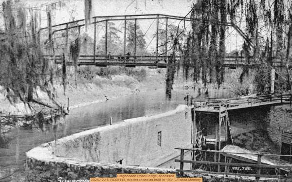
Site of Stagecoach Road Bridge at Suwannee Springs

CATEGORIES: Bridgesite
LAYER: Bridge
OWNERSHIP: Public
WATER BODY: Suwannee River
GAUGE: Suwannee Springs
MILE: 150.00
ADDRESS: 3243 91st Dr., Live Oak, FL 32060. From Live Oak, travel north on US 129 to 93 Drive; turn right; travel north to 32 Street; turn right and follow to park area. Suwannee, Hamilton Counties.
DESCRIPTION: Probably the second oldest steel highway bridge in Florida. Licensed in 1893, but set upon Lally Columns suggesting 1898 or later construction? Completed in 1903 according to Bland & Assoc. Suwannee Springs survey report 2005. 1893 cost $208.89 [HHHC p 104]; marked on USACE 1912 map; Lally columns not patented until 1898, but already used for this and other bridges years before that date. —Ken Sulak 2025-12-13.
HISTORIC FACTS: Licensed by Hamilton County in 1893 to B. F. Boon and Nathan Lewis Bryan 1839-1914 [grandson of Joseph Bryan of Blounts Ferry] but not built until after 1898—probably completed in 1903, in service until 1931.
WEBSITE: https://wwals.net/2025/12/15/old-stagecoach-road-bridge-at-suwannee-springs-2025-12-12/
PHOTO: https://www.wwals.net/pictures/2025-12-12–srwmd-suwannee-springs-bridge/stagecoach-road-bridge.jpg
PHOTOSET: https://www.wwals.net/pictures/2025-12-12–srwmd-suwannee-springs-bridge/
PHOTO SOURCE: Florida Memory
PHONE NUMBER: (850) 290-2350
Suggestions: https://forms.gle/DipPgU2TP5atc2Rf9
Nobles Ferry Bridge Site
CATEGORIES: Bridgesite
LAYER: Bridge
OWNERSHIP: Public
WATER BODY: Suwannee River
MILE: 135.49
ADDRESS: Halfway between Gibson Park Ramp and the Alapaha River Confluence. Hamilton, Suwannee Counties.
DESCRIPTION: “”In 1842, Soloman Zipperer and John Martin Zipperer Jr. got a license to operate a ferry across the Suwannee River at what is now called Nobles Ferry (Gibson Park). Soloman died in 1864, and in 1860 his sister Elizabeth (‘Hester’) Zipperer and William J. J. Duncan obtained a license to build a toll bridge to replace the ferry. Eventually, the toll bridge collapsed and was replaced in 1880 by a new ferry at the same site, operated I think by William P. Nobles, a resident of Live Oak. That ferry ran until 1912 when it was replaced by the old steel truss, single lane Nobles Ferry Bridge. It collapsed under the weight of an illegally-crossing turpentine truck in 1968, and was not replaced by the existing open deck bridge until 1984. The approach road to the ferry landing winds down the south (east) bank and is still evident. Atop the bank is a large oak with a ring scar where the ferry cable was moored. The ferry crossed the Suwannee, landing on either side of the mouth of the Alapaha (east actually landing up into the Alapaha). There were roads down from both sides.”” –Ken Sulak https://wwals.net/?p=57296
HISTORIC FACTS: See History of Alapaha River Bridges, US 41 to Nobles Ferry –Ken Sulak 2021-12-08 https://wwals.net/?p=57296
AKA: Old Nobles Ferry Bridge
Suggestions: https://forms.gle/DipPgU2TP5atc2Rf9
CLEAREDFALL
Sawed log 

CATEGORIES: Clearedfall
LAYER: Point of Interest
OWNERSHIP: Private, CONSERVATION FUND, PARCEL 177 001
WATER BODY: Suwannee River
GAUGE: Fargo
MILE: 233.31
ADDRESS: one and two thirds miles downstream from Griffis Fish Camp. Clinch County.
DESCRIPTION: Sawed off end of a log that no longer obstructs river passage.
WEBSITE: https://www.wwals.net/pictures/2022-12-29–suwannee-pictures/#SawledL
PHOTO: https://www.wwals.net/pictures/2022-12-29–suwannee-pictures/20221229_094952.jpg
PHOTOSET: https://www.wwals.net/pictures/2022-12-29–suwannee-pictures/#SawledL
PHOTO SOURCE: John S. Quarterman
PHONE NUMBER: (229) 242-0102
Suggestions: https://forms.gle/DipPgU2TP5atc2Rf9
Low log

CATEGORIES: Clearedfall
LAYER: Point of Interest
OWNERSHIP: Private, CONSERVATION FUND, PARCEL 156 029
WATER BODY: Suwannee River
GAUGE: Fargo
MILE: 226.08
ADDRESS: Less than 500 feet downstream from Three Steps Landing, Clinch County.
DESCRIPTION: Log at 2.49′ (93.47′ NAVD88). Cut by WWALS 2022-12-29 and removed by WWALS 2023-06-10.
HISTORIC FACTS: Removed on WWALS Chainsaw Outings 2023-06-10. https://www.wwals.net/pictures/2023-06-10–suwannee-chainsaw-pictures/#LLSK
WEBSITE: https://wwals.net/pictures/2022-12-29–suwannee-pictures#L249
OTHER REFERENCE: https://wwals.net/2023/06/15/pictures-suwannee-river-chainsaw-cleanup-three-steps-landing-to-fargo-ga-2023-06-10/
PHOTO: https://www.wwals.net/pictures/2023-06-10–suwannee-chainsaw-pictures/IMG_2209.jpg
PHOTOSET: https://www.wwals.net/pictures/2023-06-10–suwannee-chainsaw-pictures/#LLSK
PHOTO SOURCE: Shirkly Kokidko
PHONE NUMBER: (850) 290-2350
PHOTO2: https://www.wwals.net/pictures/2022-12-29–suwannee-pictures/20221229_145608.jpg
Photoset2: https://www.wwals.net/pictures/2022-12-29–suwannee-pictures/#L249
PHOTO2 SOURCE: John S. Quarterman
Photo2 Phone Number: 229-242-0102
Suggestions: https://forms.gle/DipPgU2TP5atc2Rf9

Duck and float under

CATEGORIES: Clearedfall
LAYER: Point of Interest
OWNERSHIP: Public, CONSERVATION FUND, PARCEL 156 029
WATER BODY: Suwannee River
MILE: 225.95
ADDRESS: About a thousand feet downstream from Three Steps Landing. Clinch County.
DESCRIPTION: Used to have to stay to the left and duck real low and you can float under this log at low water. Removed by WWALS 2023-06-10.
HISTORIC FACTS: Removed on WWALS Chainsaw Outing 2023-06-10. https://www.wwals.net/pictures/2023-06-10–suwannee-chainsaw-pictures/#DFUSK
WEBSITE: https://www.wwals.net/pictures/2022-12-29–suwannee-pictures/#FULeft
OTHER REFERENCE: https://wwals.net/2023/06/15/pictures-suwannee-river-chainsaw-cleanup-three-steps-landing-to-fargo-ga-2023-06-10/
PHOTO: https://www.wwals.net/pictures/2023-06-10–suwannee-chainsaw-pictures/IMG_2225.jpg
PHOTOSET: https://www.wwals.net/pictures/2023-06-10–suwannee-chainsaw-pictures/#DFUSK
PHOTO SOURCE: Shirkly Kokidko
PHONE NUMBER: (850) 290-2350
PHOTO2: https://www.wwals.net/pictures/2022-12-29–suwannee-pictures/floatunderleft.jpg
Photoset2: https://www.wwals.net/pictures/2022-12-29–suwannee-pictures/#FULeft
PHOTO2 SOURCE: John S. Quarterman
Photo2 Phone Number: 229-242-0102
Suggestions: https://forms.gle/DipPgU2TP5atc2Rf9

Drag under left

CATEGORIES: Clearedfall
LAYER: Point of Interest
OWNERSHIP: Public, CONSERVATION FUND, PARCEL 156 029
WATER BODY: Suwannee River
MILE: 225.68
ADDRESS: Less than half a mile downstream from Three Steps Landing. Clinch County.
DESCRIPTION: At low water there was no way to float, but you could drag under to the left. Removed by WWALS 2023-06-10.
HISTORIC FACTS: Removed on WWALS Chainsaw Outing 2023-06-10. https://www.wwals.net/pictures/2023-06-10–suwannee-chainsaw-pictures/#DULSKPR
WEBSITE: https://www.wwals.net/pictures/2022-12-29–suwannee-pictures/#DUL
OTHER REFERENCE: https://www.wwals.net/pictures/2023-06-10–suwannee-chainsaw-pictures/#DULSKPR
PHOTO: https://www.wwals.net/pictures/2023-06-10–suwannee-chainsaw-pictures/IMG_2250.jpg
PHOTOSET: https://www.wwals.net/pictures/2022-12-29–suwannee-pictures/#DUL
PHOTO SOURCE: Shirkly Kokidko
PHONE NUMBER: (850) 290-2350
PHOTO2: https://www.wwals.net/pictures/2022-12-29–suwannee-pictures/IMG_0978.jpg
Photoset2: https://www.wwals.net/pictures/2022-12-29–suwannee-pictures/#DUL
PHOTO2 SOURCE: John S. Quarterman
Photo2 Phone Number: 229-242-0102
Suggestions: https://forms.gle/DipPgU2TP5atc2Rf9

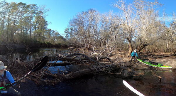
Portage Logjam

CATEGORIES: Clearedfall
LAYER: Point of Interest
OWNERSHIP: Public, CONSERVATION FUND, PARCEL 156 029
WATER BODY: Suwannee River
GAUGE: Fargo
MILE: 225.51
ADDRESS: About 0.65 miles downstream from Three Steps Landing and 1.23 miles upstream from Reeves Landing. Clinch County.
DESCRIPTION: Was a jumble of logs across the river, requiring portaging around using the right bank. Removed by WWALS 2023-06-10.
HISTORIC FACTS: Removed on WWALS Chainsaw Outing 2023-06-10. https://www.wwals.net/pictures/2023-06-10–suwannee-chainsaw-pictures/#PLJ
WEBSITE: https://wwals.net/pictures/2022-12-29–suwannee-pictures#PLJam
OTHER REFERENCE: https://www.wwals.net/pictures/2023-06-10–suwannee-chainsaw-pictures/#PLJ
PHOTO: https://www.wwals.net/pictures/2023-06-10–suwannee-chainsaw-pictures/20230610_142720.jpg
PHOTOSET: https://www.wwals.net/pictures/2023-06-10–suwannee-chainsaw-pictures/#PLJ
PHOTO SOURCE: John S. Quarterman
PHONE NUMBER: (229) 242-0102
PHOTO2: https://www.wwals.net/pictures/2022-12-29–suwannee-pictures/PLJam.jpg
Photoset2: https://wwals.net/pictures/2022-12-29–suwannee-pictures#PLJam
PHOTO2 SOURCE: John S. Quarterman
Photo2 Phone Number: 229-242-0102
Suggestions: https://forms.gle/DipPgU2TP5atc2Rf9

Camping
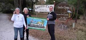
Griffis Fish Camp @ GA 177


CATEGORIES: Camping
LAYER: Brochure
GPS: 30.78246, -82.443594
OWNERSHIP: Private, Edwin Alphin Griffis Estate, et al. PARCEL 177 003
ACCESS: Yes, Launch: riverbank down dirt access road, CAMPING: “RV, Tent, and Primitive, WATER, Flush Toilet, PARKING: $2 boat launch; camping fees, SHELTER, PICNIC AREA
WATER BODY: Suwannee River
GAUGE: Fargo
MILE: 235.17
ADDRESS: 10333 Ga Highway 177 Fargo, Georgia 31631. From Fargo, travel south on US 441 to CR 177; turn left and travel 10 miles northeast; Griffis Fish Camp is on left. Clinch County.
DESCRIPTION: This family-owned fish camp has been there it seems like forever. Fees for river access, campsites, or RV hookups are reasonable, and the pavilions are popular for cookouts. The cold running water at the pavilions and in the bathroom buildings is hard but drinkable. Be sure to ask to see the private museum before putting in at the Suwannee River access to head for Fargo Ramp. Call 229-512-0558 for campsite or pavilion reservations. Call in advance to reserve campsites or pavillions: 229-412-0558
HISTORIC FACTS: Private museum of the owner’s collection.
AKA: 10257 GA 177, Fargo, GA 31631
GRN: Yes
OTHER REFERENCE: https://www.onlyinyourstate.com/georgia/secluded-fish-camp-ga-nature/
PHOTO: https://www.wwals.net/pictures/2019-12-07–kayak-raffle-drawing-griffis-fish-camp/20191207_173759.jpg
PHOTOSET: https://www.wwals.net/pictures/2019-12-07–kayak-raffle-drawing-griffis-fish-camp/
PHOTO SOURCE: John S. Quarterman
PHONE NUMBER: (229) 412-0558
Suggestions: https://forms.gle/DipPgU2TP5atc2Rf9
Suwannee River Eco-Lodge 

CATEGORIES: Camping
LAYER: Brochure
OWNERSHIP: Public, STATE OF GEORGIA, PARCEL 156 028
ACCESS: No, CAMPING, WATER, Flush Toilet, PARKING: ParkPass, SHELTER, PICNIC AREA, HANDICAPPED ACCESSIBLE
WATER BODY: Suwannee River
MILE: 221.66
ADDRESS: 400 Eco Lodge Drive, Fargo, GA 31631, Clinch County.
DESCRIPTION: Actually a motel run by Georgia State Parks, rather than camping. “”The Eco Lodge is made up of 10 rental cottages, an event room, smaller meeting room, BBQ shelter and commercial kitchen. Guests may rent a portion or all of the facility. All vehicles parked at the Eco-Lodge must display a ParkPass and events must end at 10 p.m. The Eco Lodge has Wi-Fi accessibility and is located 18 miles from Stephen C. Foster State Park.””
GRN: Yes
WEBSITE: https://gastateparks.org/SuwanneeRiverEcoLodge
OTHER REFERENCE: https://www.exploregeorgia.org/fargo/places-to-stay/resorts-lodges-plantations/suwannee-river-eco-lodge
ADDITIONAL INFO SOURCES: https://emerginghorizons.com/accessible-georgia-eco-lodge-features-top-notch-access/
PHOTO SOURCE: Explore Georgia
PHONE NUMBER: (912) 637-5274
Suggestions: https://forms.gle/DipPgU2TP5atc2Rf9
Cemetery
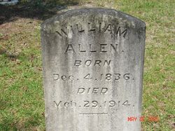
Boney Bluff Cemetery

CATEGORIES: Cemetery
LAYER: Point of Interest
OWNERSHIP: Private, CHURCH—BETHEL PRIVITIVE BAPTIST HISTORICAL PRESERVATION GROUP, PARCEL 095 002A
WATER BODY: Suwannee River
MILE: 209.51
ADDRESS: From Fargo, 0.5 miles west on GA 94, left on Woodpecker Route, 4.4 miles on the left, behind Bethel Primitive Baptist Church. Echols County.
DESCRIPTION: Old cemetery behind long-closed Bethel Primitive Baptist Church. Findagrave Cemetery ID: 2297211.
HISTORIC FACTS: See Bethel Primitive Baptist Church
AKA: Bethel PBC Cemetery or Bethel Primitive Baptist Church Cemetery
WEBSITE: https://www.findagrave.com/cemetery/2297211/boney-bluff-cemetery
OTHER REFERENCE: https://www.fourakerreunion.com/church-bethel-primitive-baptist-echols-county-georgia.html
PHOTOSET: https://www.findagrave.com/memorial/36696994/william-allen
PHOTO SOURCE: Robert Strickland on FindaGrave.com
Suggestions: https://forms.gle/DipPgU2TP5atc2Rf9
Prospect Primitive Baptist Church Cemetery
CATEGORIES: Cemetery
LAYER: Point of Interest
GPS: 30.482685, -82.70514
OWNERSHIP: Private, PROSPECT CHURCH OF THE PRIMITIVE BAPTIST DENOMINATION, PARCEL 1065-010
WATER BODY: Suwannee River
MILE: 192.70
ADDRESS: 18169 SE 54 Dr, Jasper, FL 32052, Hamilton County.
DESCRIPTION: The cemetery is surrounded by a chain link fence, attached to the fence is a sign stating for burial information call (386) 397-2375.
WEBSITE: http://usgenwebsites.org/flgenweb/FLHamilton/cemetery/prospect_prim_bapt_cem-001.html
OTHER REFERENCE: https://raycityhistory.wordpress.com/tag/prospect-primitive-baptist-church/
Suggestions: https://forms.gle/DipPgU2TP5atc2Rf9
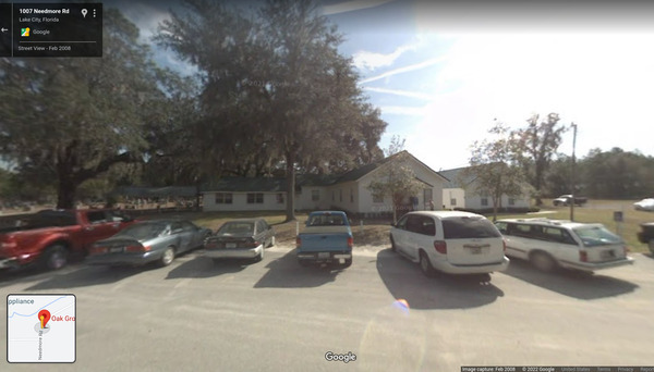
Oak Grove Baptist Church Cemetery
CATEGORIES: Cemetery
LAYER: Point of Interest
GPS: 30.41609, -82.62992
OWNERSHIP: Private
WATER BODY: Suwannee River
MILE: 184.33
ADDRESS: 1007 NE Needmore Road, Deep Creek, Florida, 32096, Columbia County.
DESCRIPTION: See Oak Grove Baptist Church. 598 Memorials, 75% photographed.
WEBSITE: https://www.findagrave.com/cemetery/466503/oak-grove-baptist-church-cemetery
Suggestions: https://forms.gle/DipPgU2TP5atc2Rf9
Townsend Cemetery
CATEGORIES: Cemetery
LAYER: Point of Interest
GPS: 29.82, -82.901
OWNERSHIP: Private, MT NEBO CHURCH CEMETERY, PARCEL 03-08-14-0000-0012-0000
WATER BODY: Suwannee River
MILE: 60.73
ADDRESS: 5669 NW 55th Avenue, Bell, Florida 32619, west side of the road, between NW 55th St. and NW 57th Pl. Gilchrist County.
DESCRIPTION: According to Ken Sulak, the Townsend family owned this cemetery as well as Townsend Ferry and the adjacent land. Many Townsends are buried in Townsend Cemetery.
WEBSITE: https://www.findagrave.com/cemetery/72698/townsend-cemetery
Suggestions: https://forms.gle/DipPgU2TP5atc2Rf9
Church
Oak Grove Baptist Church 

CATEGORIES: Church
LAYER: Point of Interest
OWNERSHIP: Private
WATER BODY: Suwannee River
MILE: 184.33
ADDRESS: 1007 Needmore Road, White Springs, Florida 32096, Columbia County.
DESCRIPTION: A Southern Baptist Church established in the 1870s.
OTHER REFERENCE: https://nfbnetwork.com/churches/oak-grove-baptist-church/
PHOTO: https://www.wwals.net/pictures/1880-07-13–alligator-peoples-bridge/2022-12-13–oak-grove-church.jpg
PHOTOSET: https://goo.gl/maps/DbXR35JrTZBTW56T8
PHOTO SOURCE: Google streetview
PHONE NUMBER: (850) 290-2350
Suggestions: https://forms.gle/DipPgU2TP5atc2Rf9
DEADFALL
Log Across Allen Camp Cutthrough 

CATEGORIES: Deadfall
LAYER: Point of Interest
OWNERSHIP: Public, SUPERIOR PINE PRODUCTS CO, PARCEL 125 001A
WATER BODY: Suwannee River
GAUGE: Fargo
MILE: 232.06
ADDRESS: 3.11 miles downstream from Griffis Fish Camp Landing if you take the cutthrough. Clinch County.
DESCRIPTION: If you do take the cutthrough, this log will be an impediment unless the water is about 5′ (95.98′ NAVD88).
WEBSITE: https://www.wwals.net/pictures/2022-12-29–suwannee-pictures/#LAACCT
PHOTO: https://www.wwals.net/pictures/2022-12-29–suwannee-pictures/logcutthrough.jpg
PHOTOSET: https://www.wwals.net/pictures/2022-12-29–suwannee-pictures/#LAACCT
PHOTO SOURCE: John S. Quarterman
PHONE NUMBER: (229) 242-0102
Suggestions: https://forms.gle/DipPgU2TP5atc2Rf9
Narrow Deadfalls

CATEGORIES: Deadfall
LAYER: Point of Interest
OWNERSHIP: Public, SIRMANS CHERYLANN FRANCIS ET AL, C/O VICKY HARPER, 2447 LOCHWOOD DR, VALDOSTA, GA 31601, PARCEL 156 011
WATER BODY: Suwannee River
GAUGE: Fargo
MILE: 223.80
ADDRESS: About half a mile downstream from Reeves Landing. Clinch County.
DESCRIPTION: Deadfalls from each bank with a narrow passage between their tops.
WEBSITE: https://wwals.net/pictures/2022-12-29–suwannee-pictures#NDfalls
PHOTO: https://www.wwals.net/pictures/2022-12-29–suwannee-pictures/ndfalls.jpg
PHOTOSET: https://wwals.net/pictures/2022-12-29–suwannee-pictures#NDfalls
PHOTO SOURCE: John S. Quarterman
PHONE NUMBER: (229) 242-0102
Suggestions: https://forms.gle/DipPgU2TP5atc2Rf9
Zig-Zag Deadfalls

CATEGORIES: Deadfall
LAYER: Point of Interest
OWNERSHIP: Public, CONSERVATION FUND, PARCEL 156 029
WATER BODY: Suwannee River
GAUGE: Fargo
MILE: 221.98
ADDRESS: About 2.30 miles downstream from Reeves Landing. Clinch County.
DESCRIPTION: Deadfalls requiring zig-zagging back and forth.
WEBSITE: https://wwals.net/pictures/2022-12-29–suwannee-pictures#ZZD
PHOTO: https://www.wwals.net/pictures/2022-12-29–suwannee-pictures/GSBX2377.jpg
PHOTOSET: https://wwals.net/pictures/2022-12-29–suwannee-pictures#ZZD
PHOTO SOURCE: John S. Quarterman
PHONE NUMBER: (229) 242-0102
Suggestions: https://forms.gle/DipPgU2TP5atc2Rf9
Dragging Log

CATEGORIES: Deadfall
LAYER: Point of Interest
OWNERSHIP: Public, CONSERVATION FUND, PARCEL 156 029
WATER BODY: Suwannee River
GAUGE: Fargo
MILE: 221.95
ADDRESS: About 2.33 miles downstream from Reeves Landing. Clinch County.
DESCRIPTION: A log requiring dragging over or portaging around at 2.49′ (93.47′ NAVD88).
WEBSITE: https://wwals.net/pictures/2022-12-29–suwannee-pictures#DLog
PHOTO: https://www.wwals.net/pictures/2022-12-29–suwannee-pictures/GSBX2385.jpg
PHOTOSET: https://wwals.net/pictures/2022-12-29–suwannee-pictures#DLog
PHOTO SOURCE: John S. Quarterman
PHONE NUMBER: (229) 242-0102
Suggestions: https://forms.gle/DipPgU2TP5atc2Rf9
US 441 Deadfalls

CATEGORIES: Deadfall
LAYER: Point of Interest
OWNERSHIP: Public, LANGDALE WOODLANDS LLC, PARCEL 157 022
WATER BODY: Suwannee River
GAUGE: Fargo
MILE: 220.86
ADDRESS: Shortly into the woods below US 441 Bridge. Clinch County.
DESCRIPTION: Mass of deadfalls from right bank. Somebody sawed off deadfalls from left bank to make a narrow passage.
WEBSITE: https://wwals.net/pictures/2022-03-05–fargo-downstream-suwannee-river
OTHER REFERENCE: https://qpublic.schneidercorp.com/Application.aspx?AppID=734&LayerID=11773&PageTypeID=1&KeyValue=157%20%20%20%20022
PHOTO: https://www.wwals.net/pictures/2022-03-05–fargo-downstream-suwannee-river/20220305_100741.jpg
PHOTOSET: https://www.wwals.net/pictures/2022-03-05–fargo-downstream-suwannee-river/
PHOTO SOURCE: John S. Quarterman
PHONE NUMBER: (229) 242-0102
Suggestions: https://forms.gle/DipPgU2TP5atc2Rf9
Dam
Suwannee River Sill @ Suwannee River Sill Road 

CATEGORIES: Dam
LAYER: Point of Interest
OWNERSHIP: Public, USFWS
ACCESS: Yes, Launch: grassy dam riverbank, PARKING: $5 parking pass
WATER BODY: Suwannee River
GAUGE: SCFSP
MILE: 240.28
ADDRESS: From Fargo, travel south on US 441 to GA 177; turn left and travel towards Stephen C. Foster State Park. Go 11.2 miles and turn left on Suwannee River Sill. Ware, Charlton Counties.
DESCRIPTION: A dam on the Suwannee River below the Okefenokee Swamp, with its gates always open. It was intended to keep the water level in the Swamp up, but it failed to do so, and that turned out to be a bad idea for the ecology. For example, cypress trees can only grow from seed when the water is down.
HISTORIC FACTS: Built by the federal government in 1960, this five-mile-long dirt dam was intended to keep water in the Swamp during droughts, because of wildfires in the 1950s. It didn’t work: it only affected about one percent of the Swamp. In 1998 U.S. FWS concluded that the Sill should be breached and its gates removed. Meanwhile, the structure is popular as an access road to the Suwannee River and the Okefenokee Swamp, and there is resistance to it being completely removed. Meanwhile, its gates (flow outlets) are always open.
GRN: Yes
WEBSITE: https://www.fws.gov/refuge/Okefenokee/visit/plan_your_visit.html
OTHER REFERENCE: https://www.exploresouthernhistory.com/suwanneesill.html
ADDITIONAL INFO SOURCES: https://www.sciencedirect.com/science/article/abs/pii/002216949290011J
PHOTOSET: https://wwals.net/pictures/2019-12-08–okefenokee-griffis-fish-camp-suwannee-paddle/
PHOTO SOURCE: John S. Quarterman
PHONE NUMBER: (229) 242-0102
Suggestions: https://forms.gle/DipPgU2TP5atc2Rf9
Ferry
Mixon’s Ferry 
CATEGORIES: Ferry
LAYER: Bridge
OWNERSHIP: Public
WATER BODY: Suwannee River
GAUGE: Fargo
MILE: 235.35
ADDRESS: At the big sandbar upstream from Griffis Fish Camp Landing. Clinch County.
DESCRIPTION: Stagecoaches were loaded on a small barge and poled across the river; the horses would swim.
OTHER REFERENCE: Canoeing and Camping on the Historic Suwannee River, by Rose Knox and Graham Schorb, Second Impression, April 2013, p. 44
Suggestions: https://forms.gle/DipPgU2TP5atc2Rf9
Rawls Camp Ferry
CATEGORIES: Ferry
LAYER: Bridge
GPS: 30.6303, -82.6357
OWNERSHIP: Public
WATER BODY: Suwannee River
GAUGE: Fargo
MILE: 212.59
ADDRESS: 8.96 miles downstream from Fargo Ramp, 5.8 miles upstream from the GA-FL line. From Fargo, 0.5 miles west on GA 94, left on Woodpecker Route for miles, left on Little Pasture Road for 1.1 miles, right on Rawls Camp Road for 0.3 miles to the river. Echols County.
DESCRIPTION: According to Ken Sulak, a 1911 U.S. Army Corps of Engineers map shows an “”Old Ferry”” at this site.
HISTORIC FACTS: According to Ken Sulak, “”The USACE Suwannee River survey was undertaken in Nov 1911 under lead of Capt. Slattery. This took place at the end of a record high water year, the 1911 flood just about a foot less at crest than the all time 1948 flood. The 1911 flood followed the great hurricane of 17 October 1910 that devastated South Florida. Again in 1912 there was high water in the Suwannee. The USACE survey was excellent, resulting in a three page map in folio format. There is a copy in that full large format map in the UF Smathers Library Special Collections. Capt. Slattery’s report to Congress has been lost from National Archives. But map is accurate and detailed. It marks and labels the �Highway Bridge’ and the �Old Ferry’ near present-day Bethel and Rawls landings.””
Suggestions: https://forms.gle/DipPgU2TP5atc2Rf9
Boney Bluff Ferry
CATEGORIES: Ferry
LAYER: Bridge
OWNERSHIP: Private
WATER BODY: Suwannee River
GAUGE: Fargo
MILE: 209.49
ADDRESS: 12.06 miles downstream from Fargo Ramp, 3.16 miles upstream from GA-FL line. Echols County.
DESCRIPTION: Marked on the 1870 Appling County map of the Wiregrass Region Digital History Project.
Suggestions: https://forms.gle/DipPgU2TP5atc2Rf9
Blount’s Ferry
CATEGORIES: Ferry
LAYER: Bridge
OWNERSHIP: Public
WATER BODY: Suwannee River
GAUGE: Fargo
MILE: 204.82
ADDRESS: About a mile downstream from the GA-FL line. Columbia, Hamilton Counties.
DESCRIPTION: Site of a ferry dating from before 1844, probably from at least 1835. “”Blounts Ferry was located in the extreme northwestern part of the county on the Suwannee River near the Georgia state line. Troops camped on this site during the Second Seminole War. Blounts Ferry was thirty miles from Lake City and had about one hundred and sixty people during the mid 1880’s. It had two stores, a saw mill, a grist mill, and a cotton gin. Epanimondas Brown and W. W. King were two of the well-known residents of Blounts Ferry.”” A History of Columbia County Florida (1996) Edward F. Keuchel, page 174.
HISTORIC FACTS: “”County Road 131 was originally known as Blount’s Ferry Road. It was the main connection between Lake City and Blount’s Ferry, a major agricultural town located on the Suwannee River, just south of the Georgia border. In the 1880s, Bount’s Ferry was a settlement of 160 people with two stores, sawmill, cotton gin and grist mill. This road was first paved in 1950, at which time the original steel truss bridge with wooden plank floor, which crossed Falling Creek, was replaced by a concrete bridge. At this time, the road designation was changed to County Road 131. The newly paved road was 133′ east of the original road which meant church property no longer touched the road. Church trustees acquired two small parcels abutting the paved road from the Estate of Mary J. Rivers and from the Columbia County School Board.”” –Nomination of Falling Creek United Methodist Church for National Register of Historic Places, 1996-03-05 https://npgallery.nps.gov/GetAsset/a808a5c1-7cc6-48c5-9439-c02581337736/
WEBSITE: https://wwals.net/2021/01/10/history-of-cone-bridge-and-the-cone-family-dr-ken-sulak-2020-12-31/
OTHER REFERENCE: https://www.lakecityhistory.com/uuid/02905885-C4E0-4A35-9DAE-804ED8349EC9/files/basic-html/page174.html
Suggestions: https://forms.gle/DipPgU2TP5atc2Rf9
Ellaville Suwannee River Ferry
CATEGORIES: Ferry
LAYER: Bridge
OWNERSHIP: Public
WATER BODY: Suwannee River
GAUGE: Ellaville
MILE: 127.49
ADDRESS: Just upstream from the Ellaville Gauge. Madison, Suwannee Counties.
DESCRIPTION: Site of the ferry before the County Bridge and the Hillman Bridge.
HISTORIC FACTS: Before the County Bridge was built in 1908, this ferry was the method to cross the Suwannee River below Ellaville.
WEBSITE: https://wwals.net/2022/12/01/county-bridge-hillman-bridge-suwannee-river-2022-11-26/
PHOTOSET: https://www.wwals.net/pictures/2022-11-26–county-bridge-hillman-bridge-suwannee-river/#Maps
PHOTO SOURCE: Ken Sulak
PHONE NUMBER: (850) 290-2350
Suggestions: https://forms.gle/DipPgU2TP5atc2Rf9
Calloway Landing Townsend Ferry
CATEGORIES: Ferry
LAYER: Bridge
GPS: 29.8213, -82.90798
OWNERSHIP: Public, Gilchrist County, PARCEL 03-08-14-0000-0013-0010
WATER BODY: Suwannee River
GAUGE: Bell
MILE: 60.33
ADDRESS: West end of NW 57th Court, Bell, FL 32619. From Branford, go west on US 27, cross the Suwannee River, turn left on CR 349, left on CR 340, cross the Suwannee River again, left on NW 55th Ave., left on NW 55th St., right on NW 57th Ct., left to stay on NW 57th Ct. to the ramp. Gilchrist County.
DESCRIPTION: According to Ken Sulak, 2025-05-10: This was the landing of the Townsend Ferry from about 1860 to 1990, site of the Townsend—thereafter Barnes Brothers—turpentine still. The toll ferry operated until 1911 when the Rock Bluff free ferry 3 miles downstream put it out of business.
HISTORIC FACTS: Townsend Ferry 1860 to 1990.
Suggestions: https://forms.gle/DipPgU2TP5atc2Rf9
Hurst Landing Townsend Ferry
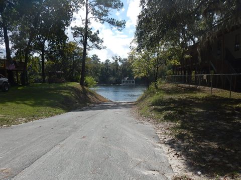
CATEGORIES: Ferry
LAYER: Bridge
OWNERSHIP: Public, Lafayette County
WATER BODY: Suwannee River
GAUGE: Bell
MILE: 59.52
ADDRESS: Ramp Road off of SE Foster Drive, Branford, Florida 32008, Lafayette County.
DESCRIPTION: According to Ken Sulak, the right bank terminus of the Townsend Ferry from Calloway Landing to a narrow concrete landing a bit upstream of the current Hirsh Landing Ramp.
HISTORIC FACTS: Townsend Ferry 1860 to 1990.
WEBSITE: https://boatzia.com/florida/lafayette/hirsh/
PHOTO: https://www.paddleflorida.net/images/north-fl/suwannee/suwannee-L03-hurst-01.JPG
PHOTOSET: https://www.paddleflorida.net/suwannee-river-lower.htm
PHOTO SOURCE: PaddleFlorida
PHONE NUMBER: (850) 290-2350
Suggestions: https://forms.gle/DipPgU2TP5atc2Rf9
Ford
Lodeaver Ford 
CATEGORIES: Ford
LAYER: Bridge
OWNERSHIP: Public
WATER BODY: Suwannee River
GAUGE: Fargo
MILE: 235.35
ADDRESS: At the big sandbar upstream from Griffis Fish Camp Landing. Clinch County.
DESCRIPTION: A pioneer stagecoach crossing of a shallow spot in the river.
OTHER REFERENCE: Canoeing and Camping on the Historic Suwannee River, by Rose Knox and Graham Schorb, Second Impression, April 2013, pp. 43-44
Suggestions: https://forms.gle/DipPgU2TP5atc2Rf9
New River Ford
CATEGORIES: Ford
LAYER: Bridge
OWNERSHIP: Private, BLACKBOTTOM HOLDINGS LLC, PARCEL 18-4S-22-0000-0000-0010
WATER BODY: New (FL) River
MILE: 30.41
ADDRESS: Near the top of the New River. Baker County.
DESCRIPTION: A ford on a private woods road.
Suggestions: https://forms.gle/DipPgU2TP5atc2Rf9
Hiking Trail
Big Shoals portage trail 

CATEGORIES: Hiking Trail
LAYER: Hiking Trail
OWNERSHIP: Public
WATER BODY: Suwannee River
MILE: 175.99
ADDRESS: Downstream from Big Shoals portage takeout. Columbia County.
DESCRIPTION: Woods trail with pine straw downstream from Big Shoals portage takeout. With kayak wheels, beware of large tree roots.
OTHER REFERENCE: https://wwals.net/pictures/2021-05-19–big-shoals-pictures/#Portaging
PHOTO: https://wwals.net/pictures/2021-05-19–big-shoals-pictures/20210519_111137.jpg
PHOTOSET: https://wwals.net/pictures/2021-05-19–big-shoals-pictures/
PHOTO SOURCE: John S. Quarterman
PHONE NUMBER: (229) 242-0102
Suggestions: https://forms.gle/DipPgU2TP5atc2Rf9
Lake
Lake Verne

CATEGORIES: Lake
LAYER: Point of Interest
OWNERSHIP: Private, LAKE VERNE FISHING & HUNTING CLUB GA COR, PARCEL 052 001
WATER BODY: Sweetwater Creek
MILE: 4.32
ADDRESS: 1037 Lake Vern Road, off of Hunting Club Road, off of GA 187 (W Forest Ave.), about halfway between Dupont and Fruitland, 12 miles SSW of Homerville. Clinch County.
DESCRIPTION: A private artificial dammed fishing lake in Clinch County, Georgia.
HISTORIC FACTS: Clayton Tomlinson reported Lake Verne completely dry on 2025-11-12. https://www.facebook.com/reel/4305374873075146
AKA: Lake Vern
WEBSITE: https://www.anyplaceamerica.com/directory/ga/clinch-county-13065/reservoirs/lake-verne-341980/
OTHER REFERENCE: https://www.facebook.com/reel/4305374873075146
Suggestions: https://forms.gle/DipPgU2TP5atc2Rf9
Landfill
Hamilton County Landfill & Recycling 

CATEGORIES: Landfill
LAYER: Point of Interest
OWNERSHIP: Public
WATER BODY: Bell Creek
ADDRESS: On SW 107th Avenue south of Jasper, south of the park and the wastewater treatment plant. Hamilton County.
DESCRIPTION: The landfill for Hamilton County, FL.
WEBSITE: https://www.wwals.net/pictures/2024-08-24–hamilton-county-creeks
PHOTO: https://www.wwals.net/pictures/2024-08-24–hamilton-county-creeks/20240824_143931.jpg
PHOTOSET: https://www.wwals.net/pictures/2024-08-24–hamilton-county-creeks/
PHOTO SOURCE: John S. Quarterman
PHONE NUMBER: (229) 242-0102
Suggestions: https://forms.gle/DipPgU2TP5atc2Rf9
Trail Ridge Landfill *
CATEGORIES: Landfill
LAYER: Point of Interest
GPS: 30.22508, -82.044841
OWNERSHIP: Private, Waste Management
WATER BODY: St. Johns River
ADDRESS: 5110 US Highway 301, Baldwin, FL 32234, Duval County.
DESCRIPTION: Municipal Solid Waste Class I: 0013493-002-SC, * “, “”permitted to accept non-hazardous municipal solid waste, including household garbage, commercial waste and special waste.”
WEBSITE: http://trailridgelandfill.wm.com/index.jsp
PHOTOSET: http://trailridgelandfill.wm.com/images/EntranceSign.jpg
PHOTO SOURCE: Waste Management
Suggestions: https://forms.gle/DipPgU2TP5atc2Rf9
Landing
Kingfisher Landing 
CATEGORIES: Landing
LAYER: Brochure
GPS: 30.95473, -82.137655
OWNERSHIP: Public, USFWS
ACCESS: Yes, Ramp: Concrete, CAMPING, WATER, RESTROOMS, SHELTER, PICNIC AREA
WATER BODY: Middle Fork Suwannee River
MILE: 32.31
ADDRESS: About 13 miles north of Folkston, on US Route 1/GA Hwy 121. Charlton County.
DESCRIPTION: It features a boat ramp, information kiosk, and restroom facilities for day-use and overnight visitors. Access to the Red and Green trails. Visitors must sign in and out of the landing, for their own protection. Entrance fees are required at Kingfisher Landing.
WEBSITE: http://www.n-georgia.com/okefenokee-nwr-entrances.html
DOWNSTREAM: 12 miles from Kingfisher Landing to Maul Hammock Canoe Shelter
PHONE NUMBER: (912) 496-7836
Suggestions: https://forms.gle/DipPgU2TP5atc2Rf9
Maul Hammock Canoe Shelter 
CATEGORIES: Landing
LAYER: Brochure
OWNERSHIP: Public, USFWS
ACCESS: Yes, Launch: overnight platform shelter, CAMPING, RESTROOMS, PARKING: $15/person, SHELTER, PICNIC AREA
WATER BODY: Middle Fork Suwannee River
MILE: 20.31
ADDRESS: This platform is located on the left edge of Maul Hammock Lake, so be sure to look behind you to find your overnight stop. Charlton County.
DESCRIPTION: The lake, and the other lakes along the Red Trail, provide good fishing opportunities, and this site is one of the most remote locations along the overnight camping trails. Enjoy beautiful night sky viewing from this location.
WEBSITE: http://canoeing.com/kingfisher-landing-spirit-suwannee-park/
UPSTREAM: 12 miles from Maul Hammock Canoe Shelter to Kingfisher Landing
DOWNSTREAM: 11 miles from Maul Hammock Canoe Shelter to Big Water Canoe Shelter
Suggestions: https://forms.gle/DipPgU2TP5atc2Rf9
Big Water Canoe Shelter
CATEGORIES: Landing
LAYER: Brochure
OWNERSHIP: Public, USFWS
ACCESS: Yes, Launch: overnight platform shelter, CAMPING, RESTROOMS, PARKING: $15/person, SHELTER, PICNIC AREA
WATER BODY: Middle Fork Suwannee River
MILE: 9.31
ADDRESS: The platform, located on the red trail, is at the north end of Big Water Lake. Charlton County.
DESCRIPTION: The area provides great fishing opportunities (seasonally). Night sky and sunrise/sunset viewing opportunities.
WEBSITE: http://canoeing.com/kingfisher-landing-spirit-suwannee-park/
UPSTREAM: 11 miles from Big Water Canoe Shelter to Maul Hammock Canoe Shelter
DOWNSTREAM: 6.85 miles from Big Water Canoe Shelter to Minnies Lake Canoe Shelter
Suggestions: https://forms.gle/DipPgU2TP5atc2Rf9
Minnies Lake Canoe Shelter

CATEGORIES: Landing
LAYER: Brochure
OWNERSHIP: Public, USFWS
ACCESS: Yes, Launch: day platform shelter, CAMPING, RESTROOMS, SHELTER, PICNIC AREA
WATER BODY: Middle Fork Suwannee River
MILE: 2.46
ADDRESS: Two and a half miles up the Middle Fork of the Suwannee River. Charlton County.
DESCRIPTION: Very nice for a day trip.
WEBSITE: https://www.google.com/maps/place/Minnies+Lake+Canoe+Shelter/@30.8612425, -82.3256656, 672m/data=!3m2!1e3!4b1!4m5!3m4!1s0x88ef8f5d6281bb7d:0x6149813879306dc7!8m2!3d30.8612425!4d-82.3234769
UPSTREAM: 6.85 miles from Minnies Lake Canoe Shelter to Big Water Canoe Shelter
DOWNSTREAM: 3.10 miles from Minnies Lake Canoe Shelter to Billys Island Landing
PHOTO: https://lh5.googleusercontent.com/p/AF1QipMTgQotZH8GmWXwQ4AhqOvhcUxQONZqWErdO8nL=w408-h306-k-no
PHOTOSET: https://www.google.com/maps/place/Minnies+Lake+Canoe+Shelter/@30.8612425, -82.3256656, 672m/data=!3m2!1e3!4b1!4m5!3m4!1s0x88ef8f5d6281bb7d:0x6149813879306dc7!8m2!3d30.8612425!4d-82.3234769
PHOTO SOURCE: Google maps
PHONE NUMBER: (850) 290-2350
Suggestions: https://forms.gle/DipPgU2TP5atc2Rf9
Bluff Lake Canoe Shelter
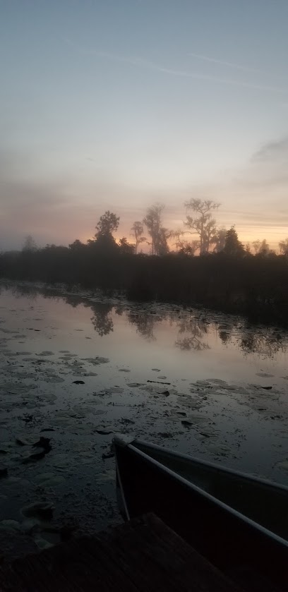
CATEGORIES: Landing
LAYER: Brochure
OWNERSHIP: Public, USFWS
ACCESS: Yes, Launch: overnight platform shelter, CAMPING, RESTROOMS, PARKING: $15/person, SHELTER, PICNIC AREA
WATER BODY: Green Trail Okefenokee Swamp
MILE: 12.00
ADDRESS: This site is located on the Green Trail (accessible from Kingfisher Landing). Paddle across Bluff Lake to get to the overnight shelter. Charlton County.
DESCRIPTION: Stars are beautiful on a dark night.
WEBSITE: https://www.recreation.gov/camping/campsites/583321
DOWNSTREAM: 8.00 miles from Bluff Lake Canoe Shelter to Floyds Island Cabin
PHOTO: https://lh5.googleusercontent.com/p/AF1QipOPtALFHEbhk09-pRwhRP_Ptr0z_1TjdugXNRUq=w408-h839-k-no
PHOTOSET: https://www.google.com/maps/place/Bluff+Lake+Canoe+Shelter/@30.8782046, -82.152764, 17z/data=!3m1!4b1!4m5!3m4!1s0x88e5630d26bac585:0x5f3f8c6fcdbc569f!8m2!3d30.8782046!4d-82.1505753
PHOTO SOURCE: Google maps
PHONE NUMBER: (850) 290-2350
Suggestions: https://forms.gle/DipPgU2TP5atc2Rf9
Floyds Island Cabin

CATEGORIES: Landing
LAYER: Brochure
GPS: 30.8566, -82.2653916
OWNERSHIP: Public, USFWS
ACCESS: Yes, Launch: island bank, CAMPING, RESTROOMS, PARKING: $15/person, SHELTER, PICNIC AREA
WATER BODY: Green Trail Okefenokee Swamp
MILE: 4.00
ADDRESS: This island is located on the Green Trail. If you are camping on Floyds Island as a through trip, you must portage across the island. The portage is approximately 1/4 mile. Charlton County.
DESCRIPTION: The Floyds Island cabin is deep in the heart of the Okefenokee National Wildlife Refuge. This historic cabin was built by the Hebard Cypress Company and is now on the National Register of Historic Places. **Currently, the historic Floyds Cabin is off-limits to visitors due to severe damage from a fallen tree early in 2019. The campsite is located immediately in front of the cabin.
UPSTREAM: 8.00 miles from Floyds Island Cabin to Bluff Lake Canoe Shelter
PHOTO SOURCE: Okefenokee NWR
PHONE NUMBER: (850) 290-2350
Suggestions: https://forms.gle/DipPgU2TP5atc2Rf9
Monkey Lake Canoe Shelter
CATEGORIES: Landing
LAYER: Brochure
OWNERSHIP: Public, USFWS
ACCESS: Yes, Launch: overnight platform shelter, CAMPING, RESTROOMS, PARKING: $15/person, SHELTER, PICNIC AREA
WATER BODY: Pink Trail Okefenokee Swamp
MILE: 24.00
ADDRESS: Located in Grand Prairie on the Pink Trail on the edge of Monkey Lake, Ware County.
DESCRIPTION: with the back of the platform surrounded by scrub/shrub habitat. Be sure to take the time to paddle past the overnight stop to Buzzards Roost—this wide open lake provides great wildlife viewing and fishing opportunities.
WEBSITE: https://www.recreation.gov/camping/campsites/583272
Suggestions: https://forms.gle/DipPgU2TP5atc2Rf9
Suwannee Canal Boat Ramp 
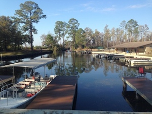
CATEGORIES: Landing
LAYER: Brochure
GPS: 30.73848915, -82.14082336
OWNERSHIP: Public, USFWS
ACCESS: Yes, Ramp: Concrete, CANOE, CAMPING, WATER, RESTROOMS, SHELTER, PICNIC AREA
WATER BODY: Suwannee Canal
MILE: 18.40
ADDRESS: 4159 Suwannee Canal Road, Folkston, GA 31537. From Folkston, travel south on GA Hwy. 121/23 and follow the signs 8 miles to the entrance. Charlton County.
DESCRIPTION: “”Okefenokee Adventures (concession operation) offers guided boat tours, canoe/kayak rentals, boat rentals, and a gift shop are all available to visitors. Okefenokee Adventures also provides food service on-site and is a great place to stop in and pick up any last minute items for your trip in the swamp and to check out what the most recent wildlife sightings have been. For information about the refuge, call the Visitor Center at 912-496-7836. For information about guided boat tours and boat rentals, contact Okefenokee Adventures at 912-496-7156.””
WEBSITE: https://sherpaguides.com/georgia/wildlife_viewing/colonial_coast/76.html
OTHER REFERENCE: https://www.fws.gov/refuge/Okefenokee/visit/plan_your_visit.html
DOWNSTREAM: 1.40 miles from Suwannee Canal Boat Ramp to Cedar Hammock Canoe Shelter
PHOTO: https://wwals.net/wp-content/themes/pianoblack/img//2016/11/b806818906dc60d13f33e2a138dbd0a9.jpg
PHOTOSET: https://wwals.net/2016/11/22/pictures-pioneer-day-okefenokee-nwr-2016-11-19/
PHOTO SOURCE: John S. Quarterman
PHONE NUMBER: (912) 496-7836
Suggestions: https://forms.gle/DipPgU2TP5atc2Rf9
Cedar Hammock Canoe Shelter
CATEGORIES: Landing
LAYER: Brochure
OWNERSHIP: Public, USFWS
ACCESS: Yes, Launch: platform shelter, CAMPING, RESTROOMS, PARKING: $15/person, SHELTER, PICNIC AREA
WATER BODY: Suwannee Canal
MILE: 17.00
ADDRESS: This floating platform is located in Mizell Prairie on the yellow trail. Only three miles from the boat ramp at the Suwannee Canal Recreation Area (SCRA),, Ware County.
DESCRIPTION: this location is great for less experienced paddlers and/or families with children!
WEBSITE: https://www.recreation.gov/camping/campsites/583273
UPSTREAM: 1.40 miles from Cedar Hammock Canoe Shelter to Suwannee Canal Boat Ramp
DOWNSTREAM: 8.60 miles from Cedar Hammock Canoe Shelter to Coffee Bay Day Use Shelter
Suggestions: https://forms.gle/DipPgU2TP5atc2Rf9
Coffee Bay Day Use Shelter
CATEGORIES: Landing
LAYER: Brochure
GPS: 30.7616351, -82.227
OWNERSHIP: Public, USFWS
ACCESS: Yes, Launch: day platform shelter, CAMPING, RESTROOMS, SHELTER, PICNIC AREA
WATER BODY: Suwannee Canal
MILE: 8.40
ADDRESS: Only a few miles down Suwannee Canal. Ware County.
DESCRIPTION: “”It was just a high strip of ground between the swamp and the canal, but had a covered picnic area and a composting toilet.””
UPSTREAM: 8.60 miles from Coffee Bay Day Use Shelter to Cedar Hammock Canoe Shelter
DOWNSTREAM: 4.00 miles from Coffee Bay Day Use Shelter to Round Top Canoe Shelter
Suggestions: https://forms.gle/DipPgU2TP5atc2Rf9
Round Top Canoe Shelter
CATEGORIES: Landing
LAYER: Brochure
OWNERSHIP: Public, USFWS
ACCESS: Yes, Launch: overnight platform shelter, CAMPING, RESTROOMS, PARKING: $15/person, SHELTER, PICNIC AREA
WATER BODY: Suwannee Canal
MILE: 4.40
ADDRESS: Located on the Purple Trail in Chase Prairie, Charlton County.
DESCRIPTION: this site has a 360 degree view that doesn’t disappoint. This site provides some of the most beautiful sunrises and sunsets.
WEBSITE: https://www.recreation.gov/camping/campsites/583270
UPSTREAM: 4.00 miles from Round Top Canoe Shelter to Coffee Bay Day Use Shelter
DOWNSTREAM: 3.10 miles from Round Top Canoe Shelter to Canal Run Campsite
PHOTO: https://lh5.googleusercontent.com/p/AF1QipPTbtM7MjkfPG3_Qx1L90k-yDfoOejZCOfs2WTT=w493-h240-k-no
PHOTOSET: https://www.google.com/maps/place/Round+Top+Canoe+Shelter/@30.8019079, -82.2312566, 13.5z/data=!4m5!3m4!1s0x88ef8781635d58e1:0x16ed01c6dc9751c7!8m2!3d30.8036186!4d-82.2199942
PHOTO SOURCE: Google maps
PHONE NUMBER: (850) 290-2350
Suggestions: https://forms.gle/DipPgU2TP5atc2Rf9
Canal Run Campsite

CATEGORIES: Landing
LAYER: Brochure
OWNERSHIP: Public, USFWS
ACCESS: Yes, Launch: overnight platform shelter, CAMPING, RESTROOMS, PARKING: $15/person, SHELTER, PICNIC AREA
WATER BODY: Suwannee Canal
MILE: 1.30
ADDRESS: On the edge of the historic Suwannee Canal on the Orange Trail. Charlton County.
DESCRIPTION: Surrounded by pines, cypress, and loblolly bays dripping with spanish moss. Campfires, in the provided fire ring, are permitted here.
WEBSITE: https://www.recreation.gov/camping/campsites/583271
UPSTREAM: 3.10 miles from Canal Run Campsite to Round Top Canoe Shelter
PHOTO: https://lh5.googleusercontent.com/p/AF1QipPJP1lBbS8DV-yJYIbBc6vyRGlZeIymmBnpZMBD=w408-h839-k-no
PHOTOSET: https://www.google.com/maps/place/Canal+run+campsite/@30.815353, -82.2551582, 17z/data=!3m1!4b1!4m5!3m4!1s0x88ef864c2bd87877:0xe6d400936c4b1b2e!8m2!3d30.815353!4d-82.2529695
PHOTO SOURCE: Google maps
PHONE NUMBER: (850) 290-2350
Suggestions: https://forms.gle/DipPgU2TP5atc2Rf9
Billys Island Landing

CATEGORIES: Landing
LAYER: Brochure
OWNERSHIP: Public, USFWS
ACCESS: Yes, Launch: steps to wooden dock, DOCK
WATER BODY: Suwannee River
MILE: 244.78
ADDRESS: Only two miles up the Suwannee River from Stephen C. Foster State Park. Charlton County.
DESCRIPTION: About 2/3 of a mile up the East Fork Suwannee River from where the Middle Fork turns off, put in at some wood steps to see remnants of a logging operation and a cemetery.
HISTORIC FACTS: Native Americans long lived in the Land of the Trembling Earth. During the Seminole Wars in the early nineteenth century, Billy Bowlegs was the leader of a party of Indians, escaped slaves, and AWOL soldiers who used Billys Island as a base. By 1838, the U.S. Army had taken over the island. In the 1850s the Lee family moved to the island, farming, fishing, hunting, and foraging. The Georgia land sale of the entire swamp in 1889 to the Suwannee Canal Company did not disturb the Lees. Once that failed, the Hebard family bought he Swamp in 1901 and started logging all the cypress in the swamp and pine trees on the islands they could get. The island briefly boombed with movies, a church, and whisky stills. The Lees sued, lost, and left. The loggers left in 1926 and the Lees returned. The U.S. purchased the Swamp in 1937. Persuaded by scientific research since 1912 and especially naturalist Francis Lee, President Franklin D. Roosevelt created the Okefenokee Wildlife Refuge by executive order in 1937.
WEBSITE: https://wwals.net/2017/02/05/wwals-okefenokee-billys-island-outing-2016-12-10/
ADDITIONAL INFO SOURCES: https://traveltips.usatoday.com/history-billys-island-okefenokee-swamp-georgia-55056.html
DOWNSTREAM: 1.73 miles from Billys Island Landing to Stephen C. Foster State Park Ramp
PHOTO: https://wwals.net/wp-content/themes/pianoblack/img//2017/02/afa2f3ca3fdb686465e3c08f032d7acd.jpg
PHOTOSET: https://wwals.net/2017/02/05/wwals-okefenokee-billys-island-outing-2016-12-10/
PHOTO SOURCE: John S. Quarterman
PHONE NUMBER: (229) 242-0102
Suggestions: https://forms.gle/DipPgU2TP5atc2Rf9
Stephen C. Foster State Park Ramp @ GA 177 

CATEGORIES: Landing
LAYER: Brochure
OWNERSHIP: Public, USFWS
ACCESS: Yes, Ramp: Concrete on paved access road, plus grassy canal side, DOCK, CANOE, CAMPING: “RV, Tent, and Primitive, FOOD: Store, WATER, Flush Toilet, PARKING: State park fees, SHELTER, PICNIC AREA, FISH BAIT, HANDICAPPED ACCESSIBLE
WATER BODY: Suwannee River
GAUGE: SCFSP
MILE: 243.05
ADDRESS: 17515 GA-177, Fargo, GA 31631. From Fargo, travel south on US 441 to CR 177; turn left and travel to Stephen C. Foster State Park. Charlton County.
DESCRIPTION: Paddlers usually put in down the access road from the ramp, at the west entrance to the one-of-a-kind Okefenokee Swamp. “”This remote park is a primary entrance to the legendary Okefenokee Swamp—one of Georgia’s seven natural wonders. Spanish moss-laced trees reflect off the black swamp waters, while cypress knees rise upward from the glass-like surface. Here, paddlers and photographers will enjoy breathtaking scenery and abundant wildlife. Alligators, turtles, raccoons, black bears, deer, ibis, herons, wood storks, red-cockaded woodpeckers and numerous other creatures make their homes in the 402, 000 acre refuge. Stargazers will appreciate the particularly dark sky.””
WEBSITE: https://www.fws.gov/refuge/Okefenokee/visit/plan_your_visit.html
UPSTREAM: 1.73 miles from Stephen C. Foster State Park Ramp to Billys Island Landing
DOWNSTREAM: 1.32 miles from Stephen C. Foster State Park Ramp to Mixon’s Hammock Canoe Shelter
PHOTO: https://wwals.net/wp-content/themes/pianoblack/img//2017/12/0abc6626c5eda845369f5e6c00d635c2.jpg
PHOTOSET: https://wwals.net/2017/12/11/one-alligator-some-turtles-many-birds-cold-and-clear-okefenokee-outing/
PHOTO SOURCE: John S. Quarterman
PHONE NUMBER: (912) 637-5274
Suggestions: https://forms.gle/DipPgU2TP5atc2Rf9
Mixon’s Hammock Canoe Shelter
CATEGORIES: Landing
LAYER: Brochure
OWNERSHIP: Public, USFWS
ACCESS: Yes, Launch: overnight platform shelter, CAMPING, RESTROOMS, PARKING: $15/person, SHELTER, PICNIC AREA
WATER BODY: Suwannee River
GAUGE: SCFSP
MILE: 241.73
ADDRESS: Located at the west end of Billys Lake before the River Narrows on the Brown Trail. Charlton County.
DESCRIPTION: The only canoe shelter on the Suwannee River proper. “”You can spend the afternoon hiking around the island rich with history and cooking hotdogs over a campfire (fire ring provided on the island).”” “”This island is a great opportunity for less experienced paddlers and families with children to do an overnight in the swamp—only two miles from Stephen C. Foster State Park boat launch.””
GRN: Yes
WEBSITE: https://www.recreation.gov/camping/campsites/583221
UPSTREAM: 1.32 miles from Mixon’s Hammock Canoe Shelter to Stephen C. Foster State Park Ramp
DOWNSTREAM: 2.46 miles from Mixon’s Hammock Canoe Shelter to North Fork Suwannee River Landing
PHOTO: https://lh5.googleusercontent.com/p/AF1QipNDxBRg2JBwNi3P2Q70O8_XR5LJSHzSHGAqbidx=w408-h306-k-no
PHOTOSET: https://www.google.com/maps/place/Mixon’s+Hammock+Canoe+Shelter/@30.8243092, -82.3838401, 672m/data=!3m2!1e3!4b1!4m5!3m4!1s0x88ef85310cf47705:0x7012c453bc9908e7!8m2!3d30.8243092!4d-82.3816514
PHOTO SOURCE: Google maps
PHONE NUMBER: (850) 290-2350
Suggestions: https://forms.gle/DipPgU2TP5atc2Rf9
Craven’s Hammock Canoe Shelter @ Suwannee River Sill Road
CATEGORIES: Landing
LAYER: Brochure
OWNERSHIP: Public
ACCESS: Yes, Launch: overnight platform shelter, CAMPING, RESTROOMS, PARKING: $5 parking pass, SHELTER, PICNIC AREA
WATER BODY: North Fork Suwannee River
GAUGE: SCFSP
MILE: 5.14
ADDRESS: Five miles up from the Confluence of the North Fork Suwannee River at the Sill, which is a mile up the Sill from where the Suwannee River comes down to meet the Sill, or a little more than a mile past the first gate. Charlton County.
DESCRIPTION: One of the least-visited Okefenokee Swamp platforms.
WEBSITE: https://www.google.com/maps/place/Craven’s+Hammock+Canoe+Shelter/@30.8866211, -82.4196258, 672m/data=!3m2!1e3!4b1!4m5!3m4!1s0x88ef90446e1bf019:0x788f61b94039aca0!8m2!3d30.8866211!4d-82.4174371
Suggestions: https://forms.gle/DipPgU2TP5atc2Rf9
North Fork Suwannee River Landing @ Suwannee River Sill Road
CATEGORIES: Landing
LAYER: Brochure
GPS: 30.81875, -82.41392
OWNERSHIP: Public
ACCESS: Yes, Launch: riverbank, PARKING: $5 parking pass
WATER BODY: Suwannee River
GAUGE: SCFSP
MILE: 239.27
ADDRESS: From Fargo, travel south on US 441 to CR 177; turn left and travel towards Stephen C. Foster State Park. Go 11.2 miles and turn left on Suwannee River Sill. Charlton County.
DESCRIPTION: Walk up the sill and put in where the North Fork of the Suwannee River meets the main branch of the Suwannee River.
AKA: North Fork Suwannee River Confluence or North Fork Suwannee River at the Sill
UPSTREAM: 2.46 miles from North Fork Suwannee River Landing to Mixon’s Hammock Canoe Shelter
DOWNSTREAM: 0.62 mile from North Fork Suwannee River Landing to Suwannee River Sill Landing
Suggestions: https://forms.gle/DipPgU2TP5atc2Rf9
Suwannee River Sill Landing @ Suwannee River Sill Road

CATEGORIES: Landing
LAYER: Brochure
OWNERSHIP: Public
ACCESS: Yes, Launch: grassy dam riverbank, PARKING: $5 parking pass
WATER BODY: Suwannee River
GAUGE: SCFSP
MILE: 238.65
ADDRESS: Slightly northeast of the first gate in the Suwannee River Sill. Charlton County.
DESCRIPTION: Where you first reach the Sill coming downstream on the Suwannee River. You can turn left and go 3/4 of a mile through the first gate (or over the Sill) to the Suwannee River Sill Ramp. (Miles upstream from Suwannee River Sill Landing are counted this way.) Or you can turn right and go a mile up the Sill, through the second gate, and 1.4 miles down to the Suwannee River Sill Ramp. Or turn right, go a mile up the Sill, and continue 5.14 miles up the North Fork of the Suwannee River to Cravens Hammock.
HISTORIC FACTS: Built by the federal government in 1960, this five-mile-long dirt dam was intended to keep water in the Swamp during droughts, because of wildfires in the 1950s. It didn’t work: it only affected about one percent of the Swamp. In 1998 U.S. FWS concluded that the Sill should be breached and its gates removed. Meanwhile, the structure is popular as an access road to the Suwannee River and the Okefenokee Swamp, and there is resistance to it being completely removed. Meanwhile, its gates (flow outlets) are always open.
GRN: Yes
WEBSITE: https://www.fws.gov/refuge/Okefenokee/visit/plan_your_visit.html
OTHER REFERENCE: https://www.exploresouthernhistory.com/suwanneesill.html
ADDITIONAL INFO SOURCES: https://www.sciencedirect.com/science/article/abs/pii/002216949290011J
UPSTREAM: 0.62 mile from Suwannee River Sill Landing to North Fork Suwannee River Landing
DOWNSTREAM: 0.78 mile from Suwannee River Sill Landing to Suwannee River Sill Ramp
PHOTO: https://www.wwals.net/pictures/2023-12-09–griffis-fish-camp-suwannee-pictures/20231209_112520.jpg
PHOTOSET: https://www.wwals.net/pictures/2023-12-09–griffis-fish-camp-suwannee-pictures/
PHOTO SOURCE: John S. Quarterman
PHONE NUMBER: (229) 242-0102
Suggestions: https://forms.gle/DipPgU2TP5atc2Rf9
Suwannee River Sill Ramp @ Suwannee River Sill Road

CATEGORIES: Landing
LAYER: Brochure
OWNERSHIP: Public
ACCESS: Yes, Launch: concrete ramp on paved road below the sill; riverbank on the dam above. PARKING: $5 parking pass, HANDICAPPED ACCESSIBLE
WATER BODY: Suwannee River
GAUGE: Fargo
MILE: 237.87
ADDRESS: From Fargo, travel south on US 441 to GA 177; turn left and travel towards Stephen C. Foster State Park. Go 11.2 miles and turn left on Suwannee River Sill. Charlton County.
DESCRIPTION: Parking is below the Sill gates. You can put in below the gates on the concrete ramp, or on the dam side above. It’s an unusual location, on a five-mile-long dirt dam that seemed like a good idea at the time, but whose gates are now always left open; it that may soon be demolished. See Suwannee River Sill.
HISTORIC FACTS: See Suwannee River Sill.
AKA: Suwannee River Sill Landing
WEBSITE: https://www.fws.gov/refuge/Okefenokee/visit/plan_your_visit.html
OTHER REFERENCE: https://www.exploresouthernhistory.com/suwanneesill.html
UPSTREAM: 0.78 mile from Suwannee River Sill Ramp to Suwannee River Sill Landing
DOWNSTREAM: 2.70 miles from Suwannee River Sill Ramp to Griffis Fish Camp Landing
PHOTOSET: https://wwals.net/pictures/2019-12-08–okefenokee-griffis-fish-camp-suwannee-paddle/
PHOTO SOURCE: John S. Quarterman
PHONE NUMBER: (912) 637-5274
Suggestions: https://forms.gle/DipPgU2TP5atc2Rf9
Griffis Fish Camp Landing @ GA 177

CATEGORIES: Landing Private
LAYER: Brochure
GPS: 30.7845, -82.446333
OWNERSHIP: Private, Edwin Alphin Griffis Estate, et al. PARCEL 177 003
ACCESS: Yes, Launch: riverbank down dirt access road, CAMPING: “RV, Tent, and Primitive, WATER, Flush Toilet, PARKING: $2 boat launch; camping fees, SHELTER, PICNIC AREA
WATER BODY: Suwannee River
GAUGE: Fargo
MILE: 235.17
ADDRESS: 10333 Ga Highway 177 Fargo, Georgia 31631. From Fargo, travel south on US 441 to CR 177; turn left and travel 10 miles northeast; Griffis Fish Camp is on left. Clinch County.
DESCRIPTION: The river can be quite high up the dirt access road, but it’s still easily accessible on this very gentle slope, at this family-owned fish camp. Put in here for nineteen idyllic river miles with little human in evidence beyond timber company signs on the right bank and an even more private fish camp on the left bank, before Fargo Ramp. There is a small charge for river access. Call 229-512-0558 for campsite or pavilion reservations. Call in advance to reserve campsites or pavillions: 229-412-0558
AKA: 10257 GA 177, Fargo, GA 31631
GRN: Yes
UPSTREAM: 2.70 miles from Griffis Fish Camp Landing to Suwannee River Sill Ramp
DOWNSTREAM: 14.17 miles from Griffis Fish Camp Landing to Fargo Ramp
PHOTOSET: https://wwals.net/pictures/2019-12-08–okefenokee-griffis-fish-camp-suwannee-paddle/
PHOTO SOURCE: John S. Quarterman
PHONE NUMBER: (229) 242-0102
PHOTO2: https://www.wwals.net/pictures/2020-11-07–okefenokee-floyds-island/20201106_151924.jpg
Photoset2: https://www.wwals.net/pictures/2020-11-07–okefenokee-floyds-island/
PHOTO2 SOURCE: John S. Quarterman
Photo2 Phone Number: 229-242-0102
Suggestions: https://forms.gle/DipPgU2TP5atc2Rf9

Allen Camp Landing


CATEGORIES: Landing Private
LAYER: Point of Interest
OWNERSHIP: Private, CONSERVATION FUND, PARCEL 177 001
ACCESS: Launch: riverbank down dirt access road
WATER BODY: Suwannee River
GAUGE: Fargo
MILE: 232.34
ADDRESS: Left bank, 2.83 miles downstream from Griffis Fish Camp, 11.51 miles upstream from Fargo Ramp. See Long Straight Road. Clinch County.
DESCRIPTION: Dirt Road to sandy riverbank. Private: do not use without permission.
AKA: Long Straight Road Landing
WEBSITE: https://www.wwals.net/pictures/2022-12-29–suwannee-pictures/#ACL
OTHER REFERENCE: https://arcgis.earthviews.com/public/suwannee-river-0121#398
PHOTO: https://www.wwals.net/pictures/2022-12-29–suwannee-pictures/acl.jpg
PHOTOSET: https://www.wwals.net/pictures/2022-12-29–suwannee-pictures/#ACL
PHOTO SOURCE: John S. Quarterman
PHONE NUMBER: (229) 242-0102
Suggestions: https://forms.gle/DipPgU2TP5atc2Rf9
Sport Camp Landing

CATEGORIES: Landing Private
LAYER: Point of Interest
OWNERSHIP: Private, CONSERVATION FUND, PARCEL 178 002
ACCESS: Launch: riverbank down dirt access road
WATER BODY: Suwannee River
GAUGE: Fargo
MILE: 230.95
ADDRESS: Left bank, 4.22 miles downstream from Griffis Fish Camp, 10.13 miles upstream from Fargo Ramp. See Sport Camp Road. Clinch County.
DESCRIPTION: Dirt Road to sandy riverbank. Private: do not use without permission.
AKA: Sport Camp Road Landing
WEBSITE: https://www.wwals.net/pictures/2022-12-29–suwannee-pictures/#SCL
OTHER REFERENCE: https://arcgis.earthviews.com/public/suwannee-river-0121#586
PHOTO: https://www.wwals.net/pictures/2022-12-29–suwannee-pictures/20221229_104351.jpg
PHOTOSET: https://www.wwals.net/pictures/2022-12-29–suwannee-pictures/#SCL
PHOTO SOURCE: John S. Quarterman
PHONE NUMBER: (229) 242-0102
PHOTO2: https://www.wwals.net/pictures/2022-08-25–suwannee-upstream-landings/sport-camp-road-landing.jpg
Photoset2: https://www.wwals.net/pictures/2022-08-25–suwannee-upstream-landings/
PHOTO2 SOURCE: GRN
Suggestions: https://forms.gle/DipPgU2TP5atc2Rf9

Long Camp Landing

CATEGORIES: Landing Private
LAYER: Point of Interest
OWNERSHIP: Private, CONSERVATION FUND, PARCEL 156 029
ACCESS: Launch: riverbank down dirt access road
WATER BODY: Suwannee River
GAUGE: Fargo
MILE: 230.27
ADDRESS: Left bank, 4.91 miles downstream from Griffis Fish Camp, 9.44 miles upstream from Fargo Ramp. See Long Camp Road. Clinch County.
DESCRIPTION: Dirt Road to sandy riverbank. Private: do not use without permission.
AKA: Long Camp Road Landing
WEBSITE: https://www.wwals.net/pictures/2022-12-29–suwannee-pictures/#LCL
OTHER REFERENCE: https://arcgis.earthviews.com/public/suwannee-river-0121#712
PHOTO: https://www.wwals.net/pictures/2022-12-29–suwannee-pictures/20221229_111213.jpg
PHOTOSET: https://www.wwals.net/pictures/2022-12-29–suwannee-pictures/#LCL
PHOTO SOURCE: John S. Quarterman
PHONE NUMBER: (229) 242-0102
Suggestions: https://forms.gle/DipPgU2TP5atc2Rf9
Drawdy Mill Landing

CATEGORIES: Landing Private
LAYER: Point of Interest
OWNERSHIP: Private, CONSERVATION FUND, PARCEL 156 029
ACCESS: Launch: riverbank down dirt access road
WATER BODY: Suwannee River
GAUGE: Fargo
MILE: 228.79
ADDRESS: Left bank, 6.38 miles downstream from Griffis Fish Camp, 7.97 miles upstream from Fargo Ramp. See Drawdy Mill Road. Clinch County.
DESCRIPTION: Dirt Road to sandy riverbank. Private: do not use without permission.
AKA: Short Straight Road Landing or Drawdy Mill Road Landing
WEBSITE: https://www.wwals.net/pictures/2022-12-29–suwannee-pictures/#DMRL
OTHER REFERENCE: https://arcgis.earthviews.com/public/suwannee-river-0121#972
PHOTO: https://www.wwals.net/pictures/2022-12-29–suwannee-pictures/20221229_113725.jpg
PHOTOSET: https://www.wwals.net/pictures/2022-12-29–suwannee-pictures/#DMRL
PHOTO SOURCE: John S. Quarterman
PHONE NUMBER: (229) 242-0102
Suggestions: https://forms.gle/DipPgU2TP5atc2Rf9
Possible Palmetto Landing

CATEGORIES: Landing Private
LAYER: Point of Interest
OWNERSHIP: Private, CONSERVATION FUND, PARCEL 156 029
ACCESS: Launch: riverbank down dirt access road
WATER BODY: Suwannee River
GAUGE: Fargo
MILE: 227.90
ADDRESS: Left bank, between Drawdy Mill Landing and Three Steps Landing. Clinch County.
DESCRIPTION: Dirt Road to sandy riverbank. Private: do not use without permission. Not clear how road access works.
WEBSITE: https://www.wwals.net/pictures/2022-12-29–suwannee-pictures/#PLLB
PHOTO: https://www.wwals.net/pictures/2022-12-29–suwannee-pictures/20221229_115416.jpg
PHOTOSET: https://www.wwals.net/pictures/2022-12-29–suwannee-pictures/#PLLB
PHOTO SOURCE: John S. Quarterman
PHONE NUMBER: (229) 242-0102
Suggestions: https://forms.gle/DipPgU2TP5atc2Rf9
Three Steps Landing
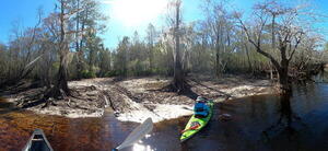
CATEGORIES: Landing Private
LAYER: Point of Interest
OWNERSHIP: Private, CONSERVATION FUND, PARCEL 156 029
ACCESS: Launch: riverbank down dirt access road
WATER BODY: Suwannee River
GAUGE: Fargo
MILE: 226.15
ADDRESS: Left bank, 9.02 miles downstream from Griffis Fish Camp, 5.33 miles upstream from Fargo Ramp. See Three Steps Road. Clinch County.
DESCRIPTION: Dirt Road to sandy riverbank. Private: do not use without permission.
WEBSITE: https://wwals.net/pictures/2022-12-29–suwannee-pictures/#TSL
OTHER REFERENCE: https://www.wwals.net/pictures/2023-06-10–suwannee-chainsaw-pictures/#TSL
ADDITIONAL INFO SOURCES: https://arcgis.earthviews.com/public/suwannee-river-griffis#1117
PHOTO: https://www.wwals.net/pictures/2022-12-29–suwannee-pictures/tsl.jpg
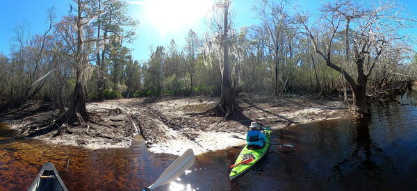
PHOTOSET: https://www.wwals.net/pictures/2022-12-29–suwannee-pictures/#TSL
PHOTO SOURCE: John S. Quarterman
PHONE NUMBER: (229) 242-0102
PHOTO2: https://www.wwals.net/pictures/2022-12-29–suwannee-pictures/20221229_125742.jpg
Photoset2: https://www.wwals.net/pictures/2022-12-29–suwannee-pictures/#TSL
PHOTO2 SOURCE: John S. Quarterman
Photo2 Phone Number: 229-242-0102
Suggestions: https://forms.gle/DipPgU2TP5atc2Rf9

Reeves Landing

CATEGORIES: Landing Private
LAYER: Point of Interest
OWNERSHIP: Private, SIRMANS CHERYLANN FRANCIS ET AL, C/O VICKY HARPER, 2447 LOCHWOOD DR, VALDOSTA, GA 31601, PARCEL 156 011
ACCESS: Launch: riverbank down dirt access road.
WATER BODY: Suwannee River
GAUGE: Fargo
MILE: 224.28
ADDRESS: Left bank, 10.90 miles downstream from Griffis Fish Camp, 3.45 miles upstream from Fargo Ramp. See Reeves Landing Road. Clinch County.
DESCRIPTION: Dirt Road to sandy riverbank. Private: do not use without permission.
WEBSITE: https://www.wwals.net/pictures/2022-12-29–suwannee-pictures/#RL
OTHER REFERENCE: https://www.wwals.net/pictures/2023-06-10–suwannee-chainsaw-pictures/#ARL
ADDITIONAL INFO SOURCES: https://arcgis.earthviews.com/public/suwannee-river-griffis#1374
PHOTO: https://www.wwals.net/pictures/2022-12-29–suwannee-pictures/20221229_154458.jpg
PHOTOSET: https://www.wwals.net/pictures/2022-12-29–suwannee-pictures/#RL
PHOTO SOURCE: John S. Quarterman
PHONE NUMBER: (229) 242-0102
PHOTO2: https://www.wwals.net/pictures/2023-06-10–suwannee-chainsaw-pictures/20230610_151258.jpg
Photoset2: https://www.wwals.net/pictures/2023-06-10–suwannee-chainsaw-pictures/#ARL
PHOTO2 SOURCE: John S. Quarterman
Photo2 Phone Number: 229-242-0102
Suggestions: https://forms.gle/DipPgU2TP5atc2Rf9

Sexton Landing

CATEGORIES: Landing Private
LAYER: Point of Interest
OWNERSHIP: Private, SEXTON MARLIN B JR ET AL, PARCEL 156 017
ACCESS: Launch: riverbank down dirt access road.
WATER BODY: Suwannee River
GAUGE: Fargo
MILE: 224.10
ADDRESS: Left bank about 900 feet downstream from Reeves Landing. Clinch County.
DESCRIPTION: Dirt Road to sandy riverbank. Private: do not use without permission.
WEBSITE: https://www.wwals.net/pictures/2022-12-29–suwannee-pictures/#SL
OTHER REFERENCE: https://www.wwals.net/pictures/2023-06-10–suwannee-chainsaw-pictures/#PSL
PHOTO: https://www.wwals.net/pictures/2023-06-10–suwannee-chainsaw-pictures/20230610_152054.jpg
PHOTOSET: https://www.wwals.net/pictures/2023-06-10–suwannee-chainsaw-pictures/#PSL
PHOTO SOURCE: John S. Quarterman
PHONE NUMBER: (229) 242-0102
PHOTO2: https://www.wwals.net/pictures/2022-12-29–suwannee-pictures/20221229_154825.jpg
Photoset2: https://www.wwals.net/pictures/2022-12-29–suwannee-pictures/#SL
PHOTO2 SOURCE: John S. Quarterman
Photo2 Phone Number: 229-242-0102
Suggestions: https://forms.gle/DipPgU2TP5atc2Rf9

Fargo Ramp @ US 441

CATEGORIES: Landing
LAYER: Brochure
OWNERSHIP: Public, SUPERIOR PINE PRODUCTS CO, PARCEL F03 001
ACCESS: Yes, Ramp: Concrete, HANDICAPPED ACCESSIBLE
WATER BODY: Suwannee River
Lowest boatable: 92.5
Highest safe: 100
GAUGE: Fargo
MILE: 221.00
ADDRESS: Half a mile southeast of Fargo on US 441, the boat ramp is on the northeast side of US 441 and on the west (right bank) of the Suwannee River. Clinch County.
DESCRIPTION: Nice concrete ramp, good access road, plenty of parking. Downstream there are plenty of turtles, cypress, oaks, pines, some creeks, many white sand beaches, maybe a small shoal if the water is low enough, and no roads for 26 river miles in Georgia and Florida.
AKA: Fargo Boat Ramp
ADDITIONAL INFO SOURCES: http://www.suwanneeoutpost.com/waterlevels.html
UPSTREAM: 14.17 miles from Fargo Ramp to Griffis Fish Camp Landing
DOWNSTREAM: 19 miles from Fargo Ramp to Roline Boat Ramp
PHOTO: https://wwals.net/pictures/2017-03-18–fargo-roline-wwals/20170318_073044.jpg
PHOTOSET: https://wwals.net/pictures/2017-03-18–fargo-roline-wwals/
PHOTO SOURCE: John S. Quarterman
PHONE NUMBER: (229) 242-0102
Suggestions: https://forms.gle/DipPgU2TP5atc2Rf9
Maple Set Campground
CATEGORIES: Landing
LAYER: Other
OWNERSHIP: Public, TIITF / AG FORESTRY, PARCEL 05-1N-21-0000-0000-0020
ACCESS: Yes, Launch: riverbank down dirt access road, CAMPING, PARKING: Free
WATER BODY: North Prong Saint Marys River
GAUGE: Moniac
MILE: 135.57
ADDRESS: 11656 FL-2, Sanderson, FL 32087, right bank of St. Marys River, upstream from Baxter, FL and FL 2. Baker County.
DESCRIPTION: “”The Maple Set Campground is located within the Maple Set Recreation Area, in the John M. Bethea State Forest (Baker County), about 30 minutes north of Sanderson, FL. This campground is located next to the St. Mary’s River and has the following facilities: campsites with no electricity or water, a communal pitcher pump (non-potable water), swimming area, a boardwalk and hiking trail. Recreational activities featured here are: fishing, hiking, hunting, swimming, canoeing, picnicking, bird watching, wildlife viewing and photography.””
WEBSITE: https://www.reserveamerica.com/explore/maple-set-campground/FLFS/1120133/overview
OTHER REFERENCE: https://floridastateforests.reserveamerica.com/camping/maple-set-campground/r/facilityDetails.do?contractCode=FLFS&parkId=1120133
PHOTO SOURCE: ReserveAmerica
PHONE NUMBER: (904) 259-4688
Suggestions: https://forms.gle/DipPgU2TP5atc2Rf9
Superior Pine Products Private Landing

CATEGORIES: Landing Private
LAYER: Point of Interest
OWNERSHIP: Private, SUPERIOR PINE PRODUCTS CO, PARCEL F03 001
ACCESS: Launch: riverbank down dirt access road.
WATER BODY: Suwannee River
GAUGE: Fargo
MILE: 220.78
ADDRESS: Right (northwest) bank, 0.28 miles downstream from Fargo Ramp. Clinch County.
DESCRIPTION: Dirt Road to sandy riverbank. Private: do not use without permission. Land entrance is apparently from a side street off of Riverside Drive 30.682367, -82.565458. See Superior Pine Products, 119 Riverside Drive, Fargo, GA 31631.
WEBSITE: https://wwals.net/pictures/2022-03-05–fargo-downstream-suwannee-river
OTHER REFERENCE: https://qpublic.schneidercorp.com/Application.aspx?AppID=734&LayerID=11773&PageTypeID=1&KeyValue=F03%20%20%20%20001
PHOTO: https://www.wwals.net/pictures/2022-03-05–fargo-downstream-suwannee-river/20220305_100959.jpg
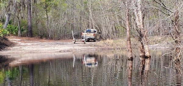
PHOTOSET: https://www.wwals.net/pictures/2022-03-05–fargo-downstream-suwannee-river/
PHOTO SOURCE: John S. Quarterman
PHONE NUMBER: (229) 242-0102
Suggestions: https://forms.gle/DipPgU2TP5atc2Rf9
Langdale Clinch Landing

CATEGORIES: Landing Private
LAYER: Point of Interest
OWNERSHIP: Private, LANGDALE WOODLANDS LLC, PARCEL 157 022
ACCESS: Launch: riverbank down dirt access road.
WATER BODY: Suwannee River
GAUGE: Fargo
MILE: 218.83
ADDRESS: Left (west) bank, 2.13 miles downstream from Fargo Ramp. Clinch County.
DESCRIPTION: Dirt Road to sandy riverbank. Private: do not use without permission. Land entrance is off of US 441 about 1.4 miles south of GA 94.
WEBSITE: https://wwals.net/pictures/2022-03-05–fargo-downstream-suwannee-river
OTHER REFERENCE: https://qpublic.schneidercorp.com/Application.aspx?AppID=734&LayerID=11773&PageTypeID=1&KeyValue=157%20%20%20%20022
PHOTOSET: https://www.wwals.net/pictures/2022-03-05–fargo-downstream-suwannee-river/
PHOTO SOURCE: John S. Quarterman
PHONE NUMBER: (229) 242-0102
Suggestions: https://forms.gle/DipPgU2TP5atc2Rf9
Sarah Touchton Road Landing

CATEGORIES: Landing Private
LAYER: Point of Interest
OWNERSHIP: Private, LEVITON BLAKE E & BETH H, PARCEL 099 004
ACCESS: Launch: riverbank down dirt access road.
WATER BODY: Suwannee River
GAUGE: Fargo
MILE: 216.80
ADDRESS: Right (north) bank, 4.26 miles downstream from Fargo Ramp, 10.5 miles upstream from the GA-FL line. 937 Sarah Touchton Road, off of Woodpecker Route, south of GA 94, west of Fargo, GA. Echols County.
DESCRIPTION: Dirt Road to sandy riverbank. Private: do not use without permission.
OTHER REFERENCE: https://wwals.net/pictures/2022-08-25–suwannee-upstream-landings
PHOTO: https://www.wwals.net/pictures/2022-08-25–suwannee-upstream-landings/sarah-touchton-road-landing.jpg
PHOTOSET: https://www.wwals.net/pictures/2022-08-25–suwannee-upstream-landings/
PHOTO SOURCE: John S. Quarterman
PHONE NUMBER: (229) 242-0102
Suggestions: https://forms.gle/DipPgU2TP5atc2Rf9
Log Landing

CATEGORIES: Landing Private
LAYER: Point of Interest
OWNERSHIP: Private, LEVITON CAROLYN (LIFE ESTATE), PARCEL 100 002
ACCESS: Launch: riverbank down dirt access road.
WATER BODY: Suwannee River
GAUGE: Fargo
MILE: 213.43
ADDRESS: Right (north) bank, 8.12 miles downstream from Fargo Ramp, 6.64 miles upstream from the GA-FL line. From Fargo, 0.5 miles west on GA 94, left on Woodpecker Route for miles, left on Little Pasture Road for 1.9 miles (pass Rawls Camp Road), right on unnamed road for 0.3 miles to the river. Echols County.
DESCRIPTION: Dirt Road to sandy riverbank. Private: do not use without permission.
AKA: Little Pasture Road Landing
WEBSITE: https://wwals.net/pictures/2022-08-25–suwannee-upstream-landings
OTHER REFERENCE: https://qpublic.schneidercorp.com/Application.aspx?AppID=765&LayerID=11801&PageTypeID=4&PageID=5603&KeyValue=100%20%20%20%20002
PHOTO: https://www.wwals.net/pictures/2022-08-25–suwannee-upstream-landings/little-pasture-road-landing.jpg
PHOTOSET: https://www.wwals.net/pictures/2022-08-25–suwannee-upstream-landings/
PHOTO SOURCE: John S. Quarterman
PHONE NUMBER: (229) 242-0102
Suggestions: https://forms.gle/DipPgU2TP5atc2Rf9
Rawls Camp Landing

CATEGORIES: Landing Private
LAYER: Point of Interest
GPS: 30.6304, -82.6358978
OWNERSHIP: Private, HART ROBERT KEVIN, PARCEL 095 006
ACCESS: Launch: riverbank down dirt access road.
WATER BODY: Suwannee River
GAUGE: Fargo
MILE: 212.59
ADDRESS: Right (north) bank, 8.96 miles downstream from Fargo Ramp, 5.8 miles upstream from the GA-FL line. From Fargo, 0.5 miles west on GA 94, left on Woodpecker Route for miles, left on Little Pasture Road for 1.1 miles, right on Rawls Camp Road for 0.3 miles to the river. Echols County.
DESCRIPTION: Dirt Road to sandy riverbank. Private: do not use without permission.
WEBSITE: https://wwals.net/pictures/2022-08-25–suwannee-upstream-landings
OTHER REFERENCE: https://qpublic.schneidercorp.com/Application.aspx?AppID=765&LayerID=11801&PageTypeID=1&KeyValue=095%20%20%20%20006
PHOTO: https://www.wwals.net/pictures/2022-08-25–suwannee-upstream-landings/rawls-camp-landing.jpg
PHOTOSET: https://www.wwals.net/pictures/2022-08-25–suwannee-upstream-landings/
PHOTO SOURCE: John S. Quarterman
PHONE NUMBER: (229) 242-0102
Suggestions: https://forms.gle/DipPgU2TP5atc2Rf9
Handley Landing

CATEGORIES: Landing Private
LAYER: Point of Interest
OWNERSHIP: Private, HANDLEY EMILY KATHARINE, PARCEL 086 004
ACCESS: Launch: riverbank down dirt access road.
WATER BODY: Suwannee River
GAUGE: Fargo
MILE: 210.48
ADDRESS: Right (north) bank, 11.07 miles downstream from Fargo Ramp, 3.69 miles upstream from the GA-FL line, Woodpecker Route, 3.9 miles south of GA 94, west of Fargo, GA. Echols County.
DESCRIPTION: Dirt Road to sandy riverbank. Private: do not use without permission.
WEBSITE: https://wwals.net/pictures/2022-08-25–suwannee-upstream-landings
OTHER REFERENCE: https://qpublic.schneidercorp.com/Application.aspx?AppID=765&LayerID=11801&PageTypeID=1&KeyValue=086%20%20%20%20004
PHOTO: https://www.wwals.net/pictures/2022-08-25–suwannee-upstream-landings/20220305_145318.jpg
PHOTOSET: https://www.wwals.net/pictures/2022-08-25–suwannee-upstream-landings/
PHOTO SOURCE: John S. Quarterman
PHONE NUMBER: (229) 242-0102
Suggestions: https://forms.gle/DipPgU2TP5atc2Rf9
Bethel Landing

CATEGORIES: Landing Private
LAYER: Point of Interest
GPS: 30.62152, -82.6693
OWNERSHIP: Private, LANGDALE COMPANY THE, PARCEL 095 002
ACCESS: Launch: riverbank down dirt access road.
WATER BODY: Suwannee River
GAUGE: Fargo
MILE: 209.48
ADDRESS: Right bank, 12.06 miles downstream from Fargo Ramp, 3.16 miles upstream from GA-FL line. Echols County.
DESCRIPTION: Dirt Road to sandy riverbank. Private: do not use without permission.
AKA: The Fish House Boat Ramp
WEBSITE: https://wwals.net/pictures/2022-08-25–suwannee-upstream-landings
PHOTO: https://www.wwals.net/pictures/2022-08-25–suwannee-upstream-landings/20220305_151137.jpg
PHOTOSET: https://www.wwals.net/pictures/2022-08-25–suwannee-upstream-landings/
PHOTO SOURCE: John S. Quarterman
PHONE NUMBER: (229) 242-0102
Suggestions: https://forms.gle/DipPgU2TP5atc2Rf9
Wetherington Landing

CATEGORIES: Landing Private
LAYER: Point of Interest
OWNERSHIP: Private, WETHERINGTON ROBERT CHARLES, PARCEL 090 002A1
ACCESS: Launch: riverbank down dirt access road.
WATER BODY: Suwannee River
GAUGE: Fargo
MILE: 207.60
ADDRESS: Right bank, 13.95 miles downstream from Fargo Ramp, 0.81 miles upstream from GA-FL line. Echols County.
DESCRIPTION: Dirt Road to sandy riverbank. Private: do not use without permission.
WEBSITE: https://wwals.net/pictures/2022-08-25–suwannee-upstream-landings
PHOTO: https://www.wwals.net/pictures/2022-08-25–suwannee-upstream-landings/20220305_154341.jpg
PHOTOSET: https://www.wwals.net/pictures/2022-08-25–suwannee-upstream-landings/
PHOTO SOURCE: John S. Quarterman
PHONE NUMBER: (229) 242-0102
Suggestions: https://forms.gle/DipPgU2TP5atc2Rf9
Roline Boat Ramp @ NE 25 Way

CATEGORIES: Landing
LAYER: Brochure
OWNERSHIP: Public, SUWANNEE RIVER WATER MANAGEMENT DISTRICT, PARCEL 1130-010
ACCESS: Yes, Ramp: narrow, smooth, and sandy down a dirt access road
WATER BODY: Suwannee River
Lowest boatable: 52
Highest safe: 68
GAUGE: White Springs
MILE: 202.00
ADDRESS: From White Springs, travel north on SE CR 135; cross over SE CR 6 onto NE 180 Boulevard (Woodpecker Route); travel north to NE 25 Way; turn right and follow road to ramp. Hamilton County.
DESCRIPTION: On the right (west) bank, this is the first take-out in Florida, for small boats only. The ramp and the land around it is owned by the Suwannee River Water Management District, in its Roline tract, part of the Cypress Creek Conservation Area. East across the river is private property, but the beach below the mean high water mark is public property in Florida.
AKA: Roline Launch or Roline Ramp
GRN: Yes
WEBSITE: https://www.mysuwanneeriver.com/225/Turner-Bridge-Roline-Cypress-Creek-South
OTHER REFERENCE: http://www.suwanneeoutpost.com/waterlevels.html
ADDITIONAL INFO SOURCES: http://suwanneeoutpost.com/reportfargotoconebridgefeb08.html
UPSTREAM: 19 miles from Roline Boat Ramp to Fargo Ramp
DOWNSTREAM: 4.30 miles from Roline Boat Ramp to Turner Bridge Ramp
PHOTO: https://www.wwals.net/pictures/2017-03-18–fargo-roline-wwals/20170318_164846.jpg
PHOTOSET: https://www.wwals.net/pictures/2017-03-18–fargo-roline-wwals/
PHOTO SOURCE: John S. Quarterman
PHONE NUMBER: (229) 242-0102
PHOTO2: https://www.wwals.net/pictures/2022-03-06–roline-turner-bridge-suwannee-river/img0619.jpg
Photoset2: https://www.wwals.net/pictures/2022-03-06–roline-turner-bridge-suwannee-river/
PHOTO2 SOURCE: John S. Quarterman
Photo2 Phone Number: 229-242-0102
Suggestions: https://forms.gle/DipPgU2TP5atc2Rf9

Turner Bridge Ramp @ NE 38 Trail

CATEGORIES: Landing
LAYER: Brochure
OWNERSHIP: Public, SUWANNEE RIVER WATER MANAGEMENT DISTRICT, PARCEL 1008-000
ACCESS: Yes, Ramp: Concrete
WATER BODY: Suwannee River
Lowest boatable: 52
Highest safe: 68
GAUGE: White Springs
MILE: 197.70
ADDRESS: From White Springs, travel north on SE CR 135; cross over SE CR 6 onto NE 180 Boulevard (Woodpecker Route); travel north to NE 38 Trail; turn right and follow road to ramp. Hamilton County.
DESCRIPTION: On the right (west) bank, this is a good concrete ramp on a dirt road with ample parking.
HISTORIC FACTS: See Turner Bridge.
AKA: Turner Bridge Boat Ramp
WEBSITE: https://www.mysuwanneeriver.com/225/Turner-Bridge-Roline-Cypress-Creek-South
ADDITIONAL INFO SOURCES: http://www.suwanneeoutpost.com/waterlevels.html
UPSTREAM: 4.30 miles from Turner Bridge Ramp to Roline Boat Ramp
DOWNSTREAM: 1.84 miles from Turner Bridge Ramp to Cypress Creek South Launch
PHOTO: https://www.wwals.net/pictures/2022-03-06–roline-turner-bridge-suwannee-river/20220306_130122.jpg
PHOTOSET: https://www.wwals.net/pictures/2022-03-06–roline-turner-bridge-suwannee-river/
PHOTO SOURCE: John S. Quarterman
PHONE NUMBER: (229) 242-0102
Suggestions: https://forms.gle/DipPgU2TP5atc2Rf9
Cypress Creek South Launch @ FL 6

CATEGORIES: Landing
LAYER: Brochure
GPS: 30.50737, -82.71711
OWNERSHIP: Public
ACCESS: Yes, Launch: riverbank
WATER BODY: Suwannee River
Lowest boatable: 52
Highest safe: 68
GAUGE: White Springs
MILE: 195.86
ADDRESS: From White Springs, Travel north on CR 135 to SR 6, turn right; travel east to the bridge. At the foot of the bridge, turn left onto road shoulder and follow the road to the river. Hamilton County.
DESCRIPTION: Rustic launch next to busy county road in 21-acre SRWMD tract.
WEBSITE: https://www.mysuwanneeriver.com/225/Turner-Bridge-Roline-Cypress-Creek-South
ADDITIONAL INFO SOURCES: http://www.suwanneeoutpost.com/waterlevels.html
UPSTREAM: 1.84 miles from Cypress Creek South Launch to Turner Bridge Ramp
DOWNSTREAM: 9.36 miles from Cypress Creek South Launch to Cone Bridge Road Ramp
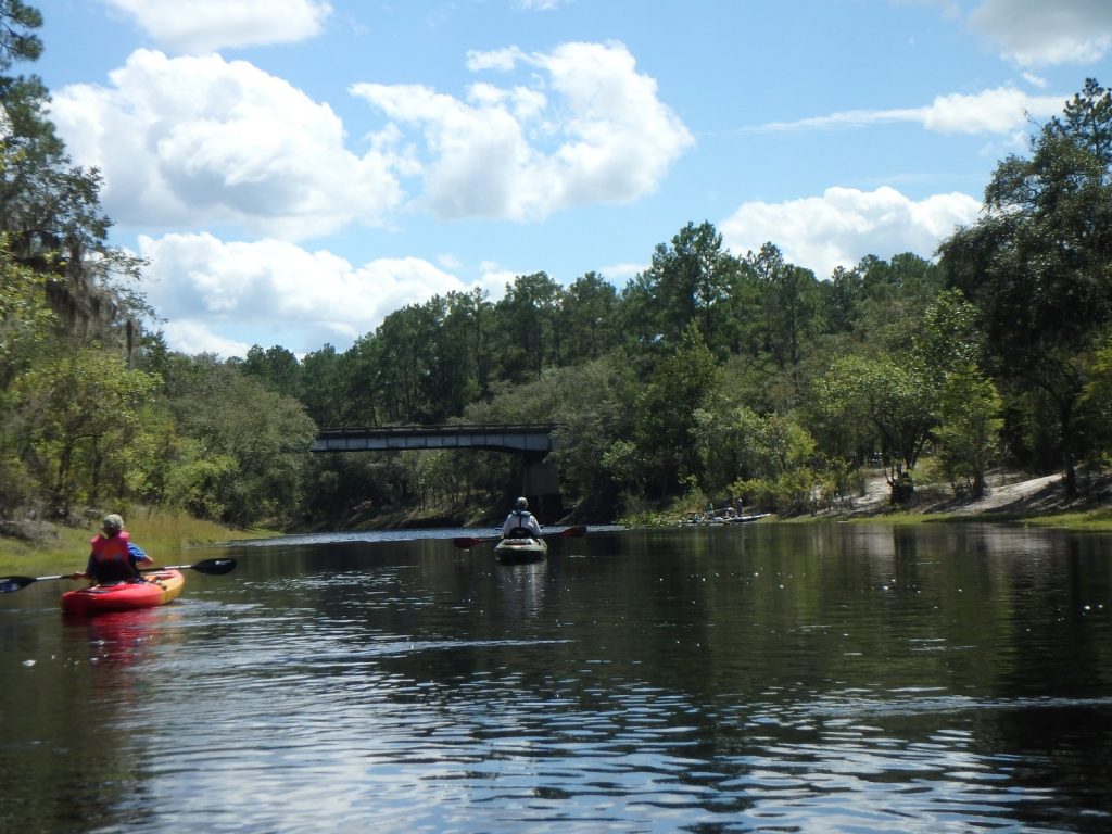
PHOTOSET: https://wwals.net/2017/01/01/redoux-suwannee-river-roline-to-cypress-creek/
PHOTO SOURCE: John S. Quarterman
PHONE NUMBER: (229) 242-0102
PHOTO2: https://wwals.net/wp-content/themes/pianoblack/img//2015/11/44a86df8d28bbbbb0e9bcc7df58d220c.jpg
Photoset2: https://wwals.net/2015/11/23/pictures-fl-6-to-cone-bridge-suwannee-river-gretchen-quarterman/
PHOTO2 SOURCE: Gretchen Quarterman
Suggestions: https://forms.gle/DipPgU2TP5atc2Rf9

Hunter Creek Launch @ CR 135

CATEGORIES: Landing
LAYER: Other
OWNERSHIP: Public, SUWANNEE RIVER WATER MANAGEMENT DISTRICT, PARCEL 1028-000
ACCESS: Launch: riverbank down dirt woods road. PARKING: Free
WATER BODY: Suwannee River
GAUGE: White Springs
MILE: 192.71
ADDRESS: Right bank, 3.15 miles downstream from Cypress Creek South Launch (FL 6). From White Springs, go east on US 41 S, turn left onto Suwanee Street aka Third Street, continue onto CR 135, after 12.5 miles (pass SE 54th Drive) turn right, go 0.4 miles to the Suwannee River. Hamilton County.
DESCRIPTION: Parking at a riverside launch down a half mile of dirt road. But SRWMD prefers people not use this access.
WEBSITE: https://map.mysuwanneeriver.com/tracts/hunter-creek-95/
PHOTO: https://www.wwals.net/pictures/2022-09-17–roline-hunter-creek-suwannee/srwmd-hunter-creek-tract.jpg
PHOTOSET: https://www.wwals.net/pictures/2022-09-17–roline-hunter-creek-suwannee/
PHOTO SOURCE: SRWMD
PHONE NUMBER: (850) 290-2350
Suggestions: https://forms.gle/DipPgU2TP5atc2Rf9
Hunter Creek Launch River GPS

CATEGORIES: Landing
LAYER: Other
OWNERSHIP: Public
ACCESS: Launch: riverbank down dirt woods road. PARKING: Free
WATER BODY: Suwannee River
MILE: 192.71
ADDRESS: Right bank, 3.15 miles downstream from Cypress Creek South Launch (FL 6). From White Springs, go east on US 41 S, turn left onto Suwanee Street aka Third Street, continue onto CR 135, after 12.5 miles (pass SE 54th Drive) turn right, go 0.4 miles to the Suwannee River.
DESCRIPTION: Parking at a riverside launch down a half mile of dirt road. But SRWMD prefers people not use this access.
AKA: Hunters Creek Landing or Hunter Creek Landing
WEBSITE: https://map.mysuwanneeriver.com/tracts/hunter-creek-95/
PHOTO: https://www.wwals.net/pictures/2022-09-17–roline-hunter-creek-suwannee/hunters-creek-landing.jpg
PHOTOSET: https://www.wwals.net/pictures/2022-09-17–roline-hunter-creek-suwannee/
PHOTO SOURCE: Dennis Price
PHONE NUMBER: (850) 290-2350
Suggestions: https://forms.gle/DipPgU2TP5atc2Rf9
Cone Bridge Road Ramp @ NW Cone Bridge Road

CATEGORIES: Landing
LAYER: Brochure
OWNERSHIP: Public
ACCESS: Yes, Ramp: Concrete
WATER BODY: Suwannee River
Lowest boatable: 51
Highest safe: 68
GAUGE: White Springs
MILE: 186.50
ADDRESS: From Lake City, travel north on US 441 to NW Cone Bridge Road; turn left and follow road to ramp. Columbia County.
DESCRIPTION: A wide concrete ramp with ample parking.
HISTORIC FACTS: See History of Cone Bridge and the Cone family –Dr. Ken Sulak 2020-12-31 https://wwals.net/?p=54537
AKA: Cone Bridge Road Boat Ramp
ADDITIONAL INFO SOURCES: http://www.suwanneeoutpost.com/waterlevels.html
UPSTREAM: 9.36 miles from Cone Bridge Road Ramp to Cypress Creek South Launch
DOWNSTREAM: 9.40 miles from Cone Bridge Road Ramp to Big Shoals Tract Launch
PHOTO: https://wwals.net/wp-content/themes/pianoblack/img//2015/11/028c77fe95bd125ea2c428a9629d1a1c.jpg
PHOTOSET: https://wwals.net/2015/11/23/pictures-fl-6-to-cone-bridge-suwannee-river-gretchen-quarterman/
PHOTO SOURCE: Gretchen Quarterman
PHONE NUMBER: (850) 290-2350
Suggestions: https://forms.gle/DipPgU2TP5atc2Rf9
Big Shoals Tract Launch @ Godwin Bridge Road

CATEGORIES: Landing
LAYER: Brochure
OWNERSHIP: Public
ACCESS: Yes, Launch: dock and steps down long walk from parking area. HANDICAPPED ACCESSIBLE
WATER BODY: Suwannee River
Lowest boatable: 51
Highest safe: 65
GAUGE: White Springs
MILE: 177.10
ADDRESS: Right bank. From White Springs, travel north on CR 135 to SE 94 Street (Godwin Bridge Road); turn right and follow road to Big Shoals. Hamilton County.
DESCRIPTION: Dock, steps, and ramp after long walk from parking.
HISTORIC FACTS: Built in 2017 by George & Associates Consulting Engineers. https://gaceng.net/portfolio/big-shoals-state-park-kayak-canoe-launch/
AKA: Big Shoals canoe launch
WEBSITE: https://map.mysuwanneeriver.com/tracts/big-shoals-25/
OTHER REFERENCE: https://wwals.net/pictures/2021-05-19–big-shoals-pictures/#Land
ADDITIONAL INFO SOURCES: http://www.suwanneeoutpost.com/waterlevels.html
UPSTREAM: 9.40 miles from Big Shoals Tract Launch to Cone Bridge Road Ramp
DOWNSTREAM: 6.10 miles from Big Shoals Tract Launch to Suwannee River Wayside Park Ramp
PHOTO: https://wwals.net/pictures/2021-05-19–big-shoals-pictures/20210519_102158.jpg
PHOTOSET: https://wwals.net/pictures/2021-05-19–big-shoals-pictures/
PHOTO SOURCE: John S. Quarterman
PHONE NUMBER: (229) 242-0102
PHOTO2: https://wwals.net/pictures/2021-05-19–big-shoals-pictures/20210519_102335.jpg
Photoset2: https://wwals.net/pictures/2021-05-19–big-shoals-pictures/
PHOTO2 SOURCE: John S. Quarterman
Photo2 Phone Number: 229-242-0102
Suggestions: https://forms.gle/DipPgU2TP5atc2Rf9

Big Shoals Tract Launch River GPS @ Godwin Bridge Road

CATEGORIES: Landing
LAYER: Other
GPS: 30.3539634, -82.6869
OWNERSHIP: Public
ACCESS: Yes, Launch: dock and steps down long walk from parking area. HANDICAPPED ACCESSIBLE
WATER BODY: Suwannee River
Lowest boatable: 51
Highest safe: 65
GAUGE: White Springs
MILE: 177.16
ADDRESS: Right bank. From White Springs, travel north on CR 135 to SE 94 Street (Godwin Bridge Road); turn right and follow road to Big Shoals. Hamilton County.
DESCRIPTION: Dock, steps, and ramp after long walk from parking.
HISTORIC FACTS: Built in 2017 by George & Associates Consulting Engineers. https://gaceng.net/portfolio/big-shoals-state-park-kayak-canoe-launch/
AKA: Big Shoals canoe launch
WEBSITE: https://map.mysuwanneeriver.com/tracts/big-shoals-25/
OTHER REFERENCE: https://wwals.net/pictures/2021-05-19–big-shoals-pictures/#Land
ADDITIONAL INFO SOURCES: http://www.suwanneeoutpost.com/waterlevels.html
PHOTO: https://wwals.net/pictures/2021-05-19–big-shoals-pictures/20210519_102419.jpg
PHOTOSET: https://wwals.net/pictures/2021-05-19–big-shoals-pictures/
PHOTO SOURCE: John S. Quarterman
PHONE NUMBER: (229) 242-0102
Photoset2: https://www.wwals.net/pictures/2023-05-20–big-shoals-suwannee-river-pictures/#BBFR
PHOTO2 SOURCE: Gee Edwards
Photo2 Phone Number: 229-242-0102
Suggestions: https://forms.gle/DipPgU2TP5atc2Rf9

Big Shoals portage

CATEGORIES: Landing
LAYER: Other
OWNERSHIP: Public
ACCESS: Yes, Launch: sandy riverbank up to portage trail around Big Shoals.
WATER BODY: Suwannee River
Lowest boatable: 55
Highest safe: 65
GAUGE: White Springs
MILE: 176.09
ADDRESS: Left bank, 1 mile downstream from Big Shoals Tract Launch. Columbia County.
DESCRIPTION: Dirt riverbank landing just above sign on tree: “”WARNING FOR YOUR SAFETY PORTAGE NOW HAZARDOUS RAPIDS AHEAD””.
WEBSITE: https://wwals.net/pictures/2021-05-19–big-shoals-pictures/#Portage-takeout
PHOTO: https://wwals.net/pictures/2021-05-19–big-shoals-pictures/big/20210519_110024.jpg
PHOTOSET: https://wwals.net/pictures/2021-05-19–big-shoals-pictures/
PHOTO SOURCE: John S. Quarterman
PHONE NUMBER: (229) 242-0102
Suggestions: https://forms.gle/DipPgU2TP5atc2Rf9
Big Shoals portage rough put in

CATEGORIES: Landing
LAYER: Other
OWNERSHIP: Public
ACCESS: Yes, Launch: rocky riverbank down from portage path.
WATER BODY: Suwannee River
MILE: 175.94
ADDRESS: Left bank below the main part of Big Shoals, Columbia County.
DESCRIPTION: It’s steep and rocky, but a group can help each other down into the water.
WEBSITE: https://www.wwals.net/pictures/2023-05-20–big-shoals-suwannee-river-pictures/#PBIBS
PHOTO: https://www.wwals.net/pictures/2023-05-20–big-shoals-suwannee-river-pictures/20230520_111120.jpg
PHOTOSET: https://www.wwals.net/pictures/2023-05-20–big-shoals-suwannee-river-pictures/#PBIBS
PHOTO SOURCE: John S. Quarterman
PHONE NUMBER: (229) 242-0102
Suggestions: https://forms.gle/DipPgU2TP5atc2Rf9
Big Shoals portage put in

CATEGORIES: Landing
LAYER: Other
OWNERSHIP: Public
ACCESS: Yes, Launch: rocky riverbank down from portage path.
WATER BODY: Suwannee River
Lowest boatable: 55
Highest safe: 65
GAUGE: White Springs
MILE: 175.85
ADDRESS: Left bank below most of Big Shoals. Columbia County.
DESCRIPTION: You can put in earlier, but best to portage all the way down here to this rocky riverbank to avoid Big Shoals.
OTHER REFERENCE: https://wwals.net/pictures/2021-05-19–big-shoals-pictures/#Portage-Put-In
PHOTO: https://wwals.net/pictures/2021-05-19–big-shoals-pictures/20210519_115319.jpg
PHOTOSET: https://wwals.net/pictures/2021-05-19–big-shoals-pictures/
PHOTO SOURCE: John S. Quarterman
PHONE NUMBER: (229) 242-0102
Suggestions: https://forms.gle/DipPgU2TP5atc2Rf9
Suwannee River Wayside Park Ramp @ US 41

CATEGORIES: Landing
LAYER: Brochure
GPS: 30.3255, -82.739167
OWNERSHIP: Public, Town of White Springs, FL, PARCEL 8758-000
ACCESS: Yes, Ramp: Concrete
WATER BODY: Suwannee River
Lowest boatable: 51
Highest safe: 68
GAUGE: White Springs
MILE: 171.00
ADDRESS: Right bank, just downstream of US 41 Bridge. From White Springs, travel south on US 41 to the river; the ramp is on the south side in the town park. Hamilton County.
DESCRIPTION: Public park and boat ramp on the Suwannee River. Take out downstream of Big Shoals and Little Shoals.
AKA: White Springs Boat Ramp
OTHER REFERENCE: https://wwals.net/pictures/2021-05-19–big-shoals-pictures/#Take-Out
ADDITIONAL INFO SOURCES: http://www.suwanneeoutpost.com/waterlevels.html
UPSTREAM: 6.10 miles from Suwannee River Wayside Park Ramp to Big Shoals Tract Launch
DOWNSTREAM: 2.70 miles from Suwannee River Wayside Park Ramp to Stephen Foster Folk Culture Center State Park Launch
PHOTO: https://wwals.net/pictures/2021-05-19–big-shoals-pictures/20210519_135229.jpg
PHOTOSET: https://wwals.net/pictures/2021-05-19–big-shoals-pictures/
PHOTO SOURCE: John S. Quarterman
PHONE NUMBER: (229) 242-0102
Suggestions: https://forms.gle/DipPgU2TP5atc2Rf9
Stephen Foster Folk Culture Center State Park Launch @ Lillian Sanders Drive

CATEGORIES: Landing
LAYER: Brochure
OWNERSHIP: Public
ACCESS: Yes, Launch: riverbank
WATER BODY: Suwannee River
Lowest boatable: 51
Highest safe: 68
GAUGE: White Springs
MILE: 168.30
ADDRESS: Canoe launch is in Stephen Foster Folk Culture Center State Park in White Springs. Hamilton County.
ADDITIONAL INFO SOURCES: http://www.suwanneeoutpost.com/waterlevels.html
UPSTREAM: 2.70 miles from Stephen Foster Folk Culture Center State Park Launch to Suwannee River Wayside Park Ramp
DOWNSTREAM: 4.81 miles from Stephen Foster Folk Culture Center State Park Launch to Swift Creek Launch
PHOTO: https://wwals.net/pictures/2016-11-23–gammie-white-springs/384A3776.jpg
PHOTOSET: https://wwals.net/pictures/2016-11-23–gammie-white-springs/
PHOTO SOURCE: Beth Gammie for WWALS on Southwings flight
PHONE NUMBER: (850) 290-2350
Suggestions: https://forms.gle/DipPgU2TP5atc2Rf9
Swift Creek Launch @ CR 25A
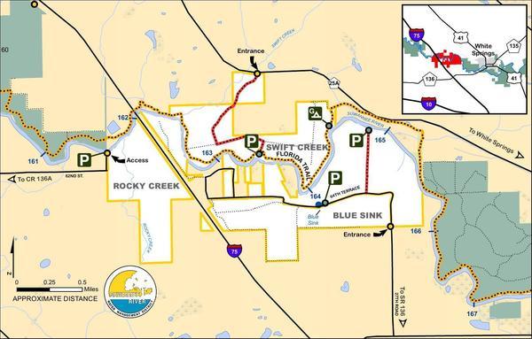
CATEGORIES: Landing
LAYER: Brochure
GPS: 30.34129, -82.81692
OWNERSHIP: Public
ACCESS: Yes, Launch: riverbank
WATER BODY: Suwannee River
Lowest boatable: 51
Highest safe: 68
GAUGE: White Springs
MILE: 163.49
ADDRESS: Swift Creek tract from White Springs: Take CR 25A west; the entrance to the Swift Creek tract is on the left. Hamilton County.
DESCRIPTION: Swift Creek Landing is here: 30.34129, -82.81692, but google maps will route that to the wrong side of the river. So use 30.34278, -82.8221 to route to Swift Creek Tract, and then it’s left, right to the launch.
WEBSITE: https://www.mysuwanneeriver.com/274/Blue-Sink-Rocky-Creek-Swift-Creek
ADDITIONAL INFO SOURCES: http://www.suwanneeoutpost.com/waterlevels.html
UPSTREAM: 4.81 miles from Swift Creek Launch to Stephen Foster Folk Culture Center State Park Launch
DOWNSTREAM: 0.17 mile from Swift Creek Launch to Blue Sink Launch
PHOTO: http://www.l-a-k-e.org/blog/wp-content/uploads/2017/04/42e4036bc1a8e3c89dc06532da05aad1.jpg
PHOTOSET: https://www.mysuwanneeriver.com/274/Blue-Sink-Rocky-Creek-Swift-Creek
PHOTO SOURCE: SRWMD
PHONE NUMBER: (850) 290-2350
Suggestions: https://forms.gle/DipPgU2TP5atc2Rf9
Blue Sink Launch @ 64th Terrace

CATEGORIES: Landing
LAYER: Brochure
OWNERSHIP: Public
ACCESS: Yes, Launch: riverbank
WATER BODY: Suwannee River
Lowest boatable: 51
Highest safe: 68
GAUGE: White Springs
MILE: 163.32
ADDRESS: 3565 64th Terrace, White Springs, FL 32096, Suwannee County.
DESCRIPTION: Blue Sink tract from Live Oak: Travel northeast on SR 136 crossing I-75; travel approximately 1 mile past the interstate, turn left on 27th Road and the Blue Sink tract begins approximately .75 mile on both sides of the road. From White Springs: Travel southwest on SR 136, turn right on 27th Road.
WEBSITE: https://www.mysuwanneeriver.com/274/Blue-Sink-Rocky-Creek-Swift-Creek
ADDITIONAL INFO SOURCES: http://www.suwanneeoutpost.com/waterlevels.html
UPSTREAM: 0.17 mile from Blue Sink Launch to Swift Creek Launch
DOWNSTREAM: 1.60 miles from Blue Sink Launch to Rocky Creek Launch
PHOTO: https://wwals.net/pictures/2016-11-23–gammie-white-springs/384A3760.jpg
PHOTOSET: https://wwals.net/pictures/2016-11-23–gammie-white-springs/384A3760.jpg
PHOTO SOURCE: Beth Gammie for WWALS on Southwings flight
PHONE NUMBER: (850) 290-2350
Suggestions: https://forms.gle/DipPgU2TP5atc2Rf9
Rocky Creek Launch @ 62nd Street
CATEGORIES: Landing
LAYER: Brochure
OWNERSHIP: Public
ACCESS: Yes, Launch: riverbank
WATER BODY: Suwannee River
GAUGE: White Springs
MILE: 161.72
ADDRESS: Rocky Creek tract from Live Oak: Travel north on US 129, turn right on CR 136A, go east 6 miles, turn left on 53rd Road, follow 53rd Road to 62nd Street, turn right; the street dead ends at the Rocky Creek tract. Suwannee County.
WEBSITE: https://www.mysuwanneeriver.com/274/Blue-Sink-Rocky-Creek-Swift-Creek
UPSTREAM: 1.60 miles from Rocky Creek Launch to Blue Sink Launch
DOWNSTREAM: 2.51 miles from Rocky Creek Launch to Woods Ferry River Camp
PHOTO: http://www.l-a-k-e.org/blog/wp-content/uploads/2017/04/42e4036bc1a8e3c89dc06532da05aad1.jpg
PHOTOSET: https://www.mysuwanneeriver.com/274/Blue-Sink-Rocky-Creek-Swift-Creek
PHOTO SOURCE: SRWMD
PHONE NUMBER: (850) 290-2350
Suggestions: https://forms.gle/DipPgU2TP5atc2Rf9
Woods Ferry River Camp 

CATEGORIES: Landing
LAYER: Brochure
OWNERSHIP: Public
ACCESS: Yes, Stairs: quite steep, CAMPING, WATER, RESTROOMS, SHELTER, PICNIC AREA
WATER BODY: Suwannee River
GAUGE: White Springs
MILE: 159.21
ADDRESS: The Woods Ferry River Camp is located 10 miles from White Springs. The river camps are accessible by river only. No vehicles or overnight parking is permitted. Call 800-868-9914 for more information. Suwannee County.
DESCRIPTION: The camp sits on a high bluff above the river, and an elaborate system of boardwalks will guide you in to the camp.
HISTORIC FACTS: Effective July 18, 2023: Please use caution when using the steps at Woods Ferry River Camp.
WEBSITE: https://www.floridastateparks.org/parks-and-trails/suwannee-river-wilderness-state-trail/river-camps
OTHER REFERENCE: https://map.mysuwanneeriver.com/tracts/woods-ferry-243/
UPSTREAM: 2.51 miles from Woods Ferry River Camp to Rocky Creek Launch
DOWNSTREAM: 1.21 miles from Woods Ferry River Camp to Woods Ferry Tract Launch
PHOTO: https://www.floridastateparks.org/sites/default/files/media/image/WoodsFerry.jpg
PHOTOSET: https://www.floridastateparks.org/parks-and-trails/suwannee-river-wilderness-state-trail/river-camps
PHOTO SOURCE: Florida State Parks
PHONE NUMBER: (800) 868-9914
Suggestions: https://forms.gle/DipPgU2TP5atc2Rf9
Woods Ferry Tract Launch @ Woods Ferry Path

CATEGORIES: Landing
LAYER: Brochure
GPS: 30.362, -82.868333
OWNERSHIP: Public
ACCESS: Yes, Launch: riverbank
WATER BODY: Suwannee River
GAUGE: Suwannee Springs
MILE: 158.00
ADDRESS: From Live Oak, travel north on US 129 to CR 136A; turn right; travel east to 57 Drive; turn left and continue north to Woods Ferry Path; follow Woods Ferry Path to canoe launch. Suwannee County.
DESCRIPTION: A sandy beach at the end of a woods road.
WEBSITE: https://map.mysuwanneeriver.com/tracts/woods-ferry-243/
UPSTREAM: 1.21 miles from Woods Ferry Tract Launch to Woods Ferry River Camp
DOWNSTREAM: 8.00 miles from Woods Ferry Tract Launch to Suwannee Springs Launch
PHOTO: https://wwals.net/wp-content/themes/pianoblack/img//2017/05/5b223e569b7bcbd91f5cef23e681eb04.jpg
PHOTOSET: https://wwals.net/2017/05/23/pictures-woods-ferry-tract-to-suwannee-springs-2017-05-20/
PHOTO SOURCE: John S. Quarterman
PHONE NUMBER: (229) 242-0102
PHOTO2: https://wwals.net/pictures/2016-11-23–gammie-white-springs/woods-ferry-tract-launch.jpg
Photoset2: https://wwals.net/pictures/2016-11-23–gammie-white-springs/
PHOTO2 SOURCE: Beth Gammie for WWALS on Southwings flight
Suggestions: https://forms.gle/DipPgU2TP5atc2Rf9

Suwannee Springs Launch @ 32 Street

CATEGORIES: Landing
LAYER: Brochure
OWNERSHIP: Public
ACCESS: Yes, Stairs: Wooden Steps
WATER BODY: Suwannee River
GAUGE: Suwannee Springs
MILE: 150.00
ADDRESS: 3243 91st Dr., Live Oak, FL 32060. From Live Oak, travel north on US 129 to 93 Drive; turn right; travel north to 32 Street; turn right and follow to park area. Suwannee County.
DESCRIPTION: A sand beach and stairs next to a sulfur spring with a stone spring wall.
HISTORIC FACTS: “”Suwannee Springs was one of Florida’s original tourist destinations. The spring pool was enclosed in the late 1800s to create a bathing area for a resort hotel, which used to be located nearby. People came from all around the east coast to partake of the “healing sulfur waters” which were rumored to cure everything from gout to marital problems. From the civil war to the 1920s the site had a succession of four wooden hotels, a bathhouse, and many private cottages. A special spur railroad line was established just to take the tourists to the springs. The last hotel burned in 1925 and with the decline of the railroads the resort faded away. Today the springhouse and some private cabins on adjacent property are all that is left of the site.”” https://visitsuwannee.com/live-oak/suwannee-springs
WEBSITE: https://visitsuwannee.com/live-oak/suwannee-springs
OTHER REFERENCE: https://www.mysuwanneeriver.com/168/Sugar-Creek-Suwannee-Springs-Linville
UPSTREAM: 8.00 miles from Suwannee Springs Launch to Woods Ferry Tract Launch
DOWNSTREAM: 1.50 miles from Suwannee Springs Launch to Spirit of Suwannee Music Park Ramp
PHOTO: https://www.wwals.net/pictures/2020-10-16–suwannee-fl-6-sl/20201016_142847.jpg
PHOTOSET: https://www.wwals.net/pictures/2020-10-16–suwannee-fl-6-sl
PHOTO SOURCE: John S. Quarterman
PHONE NUMBER: (229) 242-0102
Suggestions: https://forms.gle/DipPgU2TP5atc2Rf9
Spirit of Suwannee Music Park Ramp @ 95th Drive
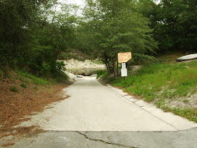
CATEGORIES: Landing Public?
LAYER: Brochure
OWNERSHIP: Public? Spirit of Suwannee Music Park
ACCESS: Yes, Ramp: Concrete, CANOE, CAMPING: “RV, Tent, WATER, RESTROOMS, PARKING: Free, SHELTER, PICNIC AREA
WATER BODY: Suwannee River
GAUGE: Suwannee Springs
MILE: 148.50
ADDRESS: 2461 95th Dr, Live Oak, FL 32060, From Live Oak, travel north on US 129 to Spirit of Suwannee Music Park; turn left on 95 Drive and follow road to boat ramp. Suwannee County.
DESCRIPTION: Left bank. Somewhat sandy at times, but always clear up to Suwannee Canoe Outpost. Inside Spirit of Suwannee Music Park.
UPSTREAM: 1.50 miles from Spirit of Suwannee Music Park Ramp to Suwannee Springs Launch
DOWNSTREAM: 1.20 miles from Spirit of Suwannee Music Park Ramp to Deese-Howard Ramp
PHOTO: http://www.otariinae.net/Stanley/Suwannee/soc.jpg
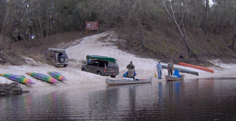
PHOTOSET: http://www.otariinae.net/Stanley/Suwannee/index.htm
PHOTO SOURCE: SRWMD
PHONE NUMBER: (386) 364-4991
Suggestions: https://forms.gle/DipPgU2TP5atc2Rf9
Deese-Howard Ramp @ 107th Road
CATEGORIES: Landing
LAYER: Brochure
OWNERSHIP: Public
ACCESS: Yes, Ramp: Concrete, PARKING: Free
WATER BODY: Suwannee River
GAUGE: Suwannee Springs
MILE: 147.30
ADDRESS: 107th Road, Live Oak, FL 32060, Suwannee County.
DESCRIPTION: From Live Oak, travel north on CR 795 to 24 Street; turn right on 24 Street; travel east to 107 Road; turn left and follow road to boat ramp.
UPSTREAM: 1.20 miles from Deese-Howard Ramp to Spirit of Suwannee Music Park Ramp
DOWNSTREAM: 6.22 miles from Deese-Howard Ramp to Holton Creek River Camp
PHOTO: http://suwanneeparks.com/wp-content/uploads/2013/09/kyakslide-940×300.jpg
PHOTOSET: http://suwanneeparks.com/deesehoward-boat-ramp/
PHOTO SOURCE: Suwannee Parks & Recreation
PHONE NUMBER: (850) 290-2350
Suggestions: https://forms.gle/DipPgU2TP5atc2Rf9
Holton Creek River Camp
CATEGORIES: Landing
LAYER: Brochure
GPS: 30.42928553, -83.03571939
OWNERSHIP: Public
ACCESS: Yes, Stairs: steep, CAMPING, WATER, RESTROOMS, SHELTER, PICNIC AREA
WATER BODY: Suwannee River
GAUGE: Ellaville
MILE: 141.08
ADDRESS: Located between Spirit of the Suwannee Music Park and Suwannee River State Park. The river camps are accessible by river only. No vehicles or overnight parking is permitted. Call 800-868-9914 for more information. Hamilton County.
DESCRIPTION: The Holton Creek River Camp is the second river camp between White Springs and Branford and provides 5 screened shelters, a picnic pavilion, restrooms with hot showers, and a tent-camping area. For more information on the Suwannee River Wilderness Trail, call or visit: 800.868.9914 https://www.floridastateparks.org/parks-and-trails/suwannee-river-wilderness-state-trail
HISTORIC FACTS: Effective Sept. 12, 2023: Holton Creek River Camp remains closed after Hurricane Idalia.
WEBSITE: https://www.floridastateparks.org/parks-and-trails/suwannee-river-wilderness-state-trail/river-camps
OTHER REFERENCE: http://www.suwanneeadventures.com/river-camps.html
UPSTREAM: 6.22 miles from Holton Creek River Camp to Deese-Howard Ramp
DOWNSTREAM: 5.68 miles from Holton Creek River Camp to Gibson Park Ramp
PHOTO: https://www.floridastateparks.org/sites/default/files/media/image/Holton.jpg
PHOTOSET: https://www.floridastateparks.org/parks-and-trails/suwannee-river-wilderness-state-trail/river-camps
PHOTO SOURCE: Florida State Parks
PHONE NUMBER: (800) 868-9914
Suggestions: https://forms.gle/DipPgU2TP5atc2Rf9
Gibson Park Ramp @ SW CR 751

CATEGORIES: Landing
LAYER: Brochure
OWNERSHIP: Public, Hamilton County, PARCEL 3620-000
ACCESS: Yes, Ramp: Concrete, PARKING: Free, PICNIC AREA, HANDICAPPED ACCESSIBLE
WATER BODY: Suwannee River
GAUGE: Ellaville
MILE: 135.40
ADDRESS: 6844 SW CR 751, Jasper, FL 32052. Right bank, west side of the river. From Jasper, Hamilton County, FL, travel southwest on Right bank. SW CR 249 to SW CR 751; turn left and boat ramp is on the right in Gibson Park. Hamilton County.
DESCRIPTION: The last stop on the Alapaha River Water Trail is on the Suwannee River: Gibson Park Ramp, in a county park of Hamilton County, Florida. Much of the year those last 17.95 river miles are dry down from Jennings Bluff Launch. But in the rainy season (winter) sometimes the Alapaha is high and fast and it’s a quick paddle to the Suwannee and a very short upstream to Gibson Park Ramp.
AKA: Hutch Gibson Park Public Boat Ramp or Nobles Ferry.
WEBSITE: https://hamiltoncountyfl.com/parks-recreation/
UPSTREAM: 5.68 miles from Gibson Park Ramp to Holton Creek River Camp
DOWNSTREAM: 5.00 miles from Gibson Park Ramp to Suwannee River Campsites Ramp
PHOTOSET: https://www.wwals.net/pictures/2021-05-11–nondiscrimination-policy/
PHOTO SOURCE: Bobby McKenzie
PHONE NUMBER: (850) 290-2350
Suggestions: https://forms.gle/DipPgU2TP5atc2Rf9
Suwannee River Campsites Ramp @ SW 46th Ave.

CATEGORIES: Landing
LAYER: Brochure
GPS: 30.414, -83.159167
OWNERSHIP: Public, SRWMD? PARCEL 5555-555
ACCESS: Yes, Ramp: Concrete, PARKING: Free
WATER BODY: Suwannee River
GAUGE: Ellaville
MILE: 130.40
ADDRESS: Right bank. 10650 SW 46th Ave., Jasper, FL 32052, Hamilton County.
DESCRIPTION: From US 90, turn right onto NE Myrrh Street; cross the Withlacoochee River (road becomes CR 141); turn right on SW 74 Street; turn right on SW 44 Lane; travel south to SW 77 Street; turn left and follow to boat ramp. Government Owned for General Public Use.
HISTORIC FACTS: River put-in for many protests in 2015, 2016, and 2017 against the Sabal Trail fracked methane pipeline crossing slightly downstream. https://wwals.net/?p=28959
AKA: CR 141 Ramp (SRWMD) or Suwannee Campsites Ramp or Florida Trail Suwannee River Boat Launch Trailhead or Big Oak Boat Ramp.
UPSTREAM: 5.00 miles from Suwannee River Campsites Ramp to Gibson Park Ramp
DOWNSTREAM: 2.70 miles from Suwannee River Campsites Ramp to Suwannee River State Park Ramp
PHOTO: https://wwals.net/wp-content/themes/pianoblack/img//2021/12/20170423_125547-1.jpg
PHOTOSET: https://wwals.net/2017/04/23/suwannee-river-campsites/
PHOTO SOURCE: John S. Quarterman
PHONE NUMBER: (229) 242-0102
Suggestions: https://forms.gle/DipPgU2TP5atc2Rf9
Suwannee River State Park Ramp @ 201st Path
CATEGORIES: Landing
LAYER: Brochure
GPS: 30.3877, -83.1688
OWNERSHIP: Public, SRWMD
ACCESS: Yes, Launch: Concrete, CAMPING, WATER, RESTROOMS, PARKING: $5.00/vehicle, SHELTER, PICNIC AREA
WATER BODY: Suwannee River
GAUGE: Ellaville
MILE: 127.70
ADDRESS: Left bank, 3631 201st Path, Live Oak, FL 32060, Suwannee County.
DESCRIPTION: Slightly upstream from the Withlacoochee River Confluence with the Suwannee River.
WEBSITE: https://www.floridastateparks.org/park/Suwannee-River
UPSTREAM: 2.70 miles from Suwannee River State Park Ramp to Suwannee River Campsites Ramp
DOWNSTREAM: 3.30 miles from Suwannee River State Park Ramp to Anderson Spring Launch
PHOTO: https://wwals.net/wp-content/themes/pianoblack/img//2015/08/69d2ffd7fa67b505d9a5ee0658c5e8f31.jpg
PHOTO SOURCE: John S. Quarterman
PHONE NUMBER: (229) 242-0102
Suggestions: https://forms.gle/DipPgU2TP5atc2Rf9
Anderson Spring Launch @ River Road
CATEGORIES: Landing
LAYER: Brochure
GPS: 30.352967, -83.18937
OWNERSHIP: Public
ACCESS: Yes, Launch: riverbank
WATER BODY: Suwannee River
GAUGE: Ellaville
MILE: 124.40
ADDRESS: From Live Oak, go west on US 90; turn left onto River Road; entrance to Anderson Springs will be on your right. Suwannee County.
UPSTREAM: 3.30 miles from Anderson Spring Launch to Suwannee River State Park Ramp
DOWNSTREAM: 8.80 miles from Anderson Spring Launch to Boundary Bend Ramp
Suggestions: https://forms.gle/DipPgU2TP5atc2Rf9
Boundary Bend Ramp @ SE Boundary Bend Trail
CATEGORIES: Landing
LAYER: Brochure
OWNERSHIP: Public
ACCESS: Yes, Ramp: Concrete
WATER BODY: Suwannee River
GAUGE: Dowling Park
MILE: 115.60
ADDRESS: From Dowling Park, travel west on CR 250; turn right on NW CR 101; travel north on NW CR 101 (road becomes SE Waccamaw Avenue); turn right on SE Boundary Bend Trail and follow to ramp. Madison County.
UPSTREAM: 8.80 miles from Boundary Bend Ramp to Anderson Spring Launch
DOWNSTREAM: 2.37 miles from Boundary Bend Ramp to Dowling Park River Camp
Suggestions: https://forms.gle/DipPgU2TP5atc2Rf9
Dowling Park River Camp

CATEGORIES: Landing
LAYER: Brochure
OWNERSHIP: Public
ACCESS: Yes, Stairs: steep, CAMPING, WATER, RESTROOMS, SHELTER, PICNIC AREA
WATER BODY: Suwannee River
GAUGE: Dowling Park
MILE: 113.23
ADDRESS: Located right across the river from the Advent Christian Village in the town of Dowling Park. The river camps are accessible by river only. No vehicles or overnight parking is permitted. Call 800-868-9914 for more information. Lafayette County.
DESCRIPTION: Steep steps up from the river to a boat rack, across a dining pavilion, to two air-conditioned bathrooms with hot and cold running water, with nearby five elevated and screened sleeping pavilions with electricity.
HISTORIC FACTS: Effective Sept. 12, 2023: Dowling Park River Camp remains closed after Hurricane Idalia.
WEBSITE: https://www.floridastateparks.org/parks-and-trails/suwannee-river-wilderness-state-trail/river-camps
OTHER REFERENCE: https://map.mysuwanneeriver.com/tracts/dowling-park-river-camp-55/
UPSTREAM: 2.37 miles from Dowling Park River Camp to Boundary Bend Ramp
DOWNSTREAM: 0.23 mile from Dowling Park River Camp to Dowling Park Ramp
PHOTOSET: https://wwals.net/2020/08/26/pictures-suwannee-river-dowling-park-river-camp-2020-07-18/
PHOTO SOURCE: John S. Quarterman
PHONE NUMBER: (229) 242-0102
PHOTO2: https://www.floridastateparks.org/sites/default/files/media/image/Dowling.jpg
Photoset2: https://www.floridastateparks.org/sites/default/files/media/image/Dowling.jpg
PHOTO2 SOURCE: Florida State Parks
Photo2 Phone Number: 800-868-9914
Suggestions: https://forms.gle/DipPgU2TP5atc2Rf9
Dowling Park Ramp @ CR 250

CATEGORIES: Landing
LAYER: Brochure
GPS: 30.244833, -83.249
OWNERSHIP: Public
ACCESS: Yes, Ramp: Concrete
WATER BODY: Suwannee River
GAUGE: Dowling Park
MILE: 113.00
ADDRESS: The boat ramp is on the north side of CR 250 at the Suwannee River. Suwannee County.
DESCRIPTION: Wide and easily accessible, slightly downstream from Dowling Park River Camp.
UPSTREAM: 0.23 mile from Dowling Park Ramp to Dowling Park River Camp
DOWNSTREAM: 1.80 miles from Dowling Park Ramp to Sims Landing Ramp (North Lafayette County)
PHOTOSET: https://wwals.net/2020/08/26/pictures-suwannee-river-dowling-park-river-camp-2020-07-18/
PHOTO SOURCE: John S. Quarterman
PHONE NUMBER: (229) 242-0102
Suggestions: https://forms.gle/DipPgU2TP5atc2Rf9
Sims Landing Ramp (North Lafayette County) @ NW Sims Landing Road
CATEGORIES: Landing
LAYER: Brochure
GPS: 30.2275, -83.240667
OWNERSHIP: Public
ACCESS: Yes, Ramp: Concrete
WATER BODY: Suwannee River
GAUGE: Dowling Park
MILE: 111.20
ADDRESS: From Dowling Park, travel west on CR 250; turn left on NW CR 251; travel south on NW CR 251; turn left on NW Sims Landing Road and follow to boat ramp. Lafayette County.
UPSTREAM: 1.80 miles from Sims Landing Ramp (North Lafayette County) to Dowling Park Ramp
DOWNSTREAM: 1.00 mile from Sims Landing Ramp (North Lafayette County) to Christian Tract Launch
Suggestions: https://forms.gle/DipPgU2TP5atc2Rf9
Christian Tract Launch @ Shirley Springs Trail
CATEGORIES: Landing
LAYER: Brochure
GPS: 30.215, -83.243167
OWNERSHIP: Public
ACCESS: Yes, Launch: riverbank
WATER BODY: Suwannee River
GAUGE: Dowling Park
MILE: 110.20
ADDRESS: From Live Oak, travel southwest on CR 250 to 225 Road; turn left; travel south to 136 Street; turn right and travel west; crossover 233 Road onto Christian Path; follow road and turn right on Shirley Springs Trail; follow road to canoe launch. Suwannee County.
UPSTREAM: 1.00 mile from Christian Tract Launch to Sims Landing Ramp (North Lafayette County)
DOWNSTREAM: 3.70 miles from Christian Tract Launch to Charles Spring Ramp
Suggestions: https://forms.gle/DipPgU2TP5atc2Rf9
Charles Spring Ramp @ 237 Drive
CATEGORIES: Landing
LAYER: Brochure
GPS: 30.166833, -83.231
OWNERSHIP: Public
ACCESS: Yes, Ramp: Concrete
WATER BODY: Suwannee River
GAUGE: Luraville
MILE: 106.50
ADDRESS: From Live Oak, travel south on SR 51 to 152 Street; turn right on 152 Street; travel west crossing 237 Drive and boat ramp is in the county park. Suwannee County.
UPSTREAM: 3.70 miles from Charles Spring Ramp to Christian Tract Launch
DOWNSTREAM: 0.10 mile from Charles Spring Ramp to Ezell Landing Ramp
Suggestions: https://forms.gle/DipPgU2TP5atc2Rf9
Ezell Landing Ramp @ Ezell Landing Road
CATEGORIES: Landing
LAYER: Brochure
OWNERSHIP: Public, BOARD OF COUNTY COMMISSIONERS, Lafayette County, FL, PARCEL 05-04-11-0000-0000-00701
ACCESS: Yes, Ramp: Concrete
WATER BODY: Suwannee River
GAUGE: Luraville
MILE: 106.40
ADDRESS: 1384 NW Ezell Landing Rd, Mayo, FL 32066. From Mayo, travel north on US 27 to CR 292; turn right on CR 292; travel north to ninety degree turn; continue straight on Ezell Landing Road and follow to boat ramp. Lafayette County.
UPSTREAM: 0.10 mile from Ezell Landing Ramp to Charles Spring Ramp
DOWNSTREAM: 3.10 miles from Ezell Landing Ramp to Lafayette Blue Springs State Park Ramp
Suggestions: https://forms.gle/DipPgU2TP5atc2Rf9
Allen Mill Creek Landing @ NW County Rd 292
CATEGORIES: Landing
LAYER: Other
OWNERSHIP: Public, SUWANNEE RIVER WATER MANAGEMENT DISTRICT, PARCEL 08-04-11-0000-0000-00100
ACCESS: Launch: sandy creek bank
WATER BODY: Suwannee River
GAUGE: Luraville
MILE: 105.46
ADDRESS: North Entrance, Lafayette Blue Springs State Park, 4298 NW County Rd 292, Mayo, FL 32066, Lafayette County.
DESCRIPTION: Sandy access with parking on Allen Mill Pond Springs Run, just upstream from the Suwannee River, in Allen Mill Pond Tract of Lafayette Blue Springs State Park.
HISTORIC FACTS: Ken Sulak says, “”site of the Moseley Ferry, general store, riverboat landing, and the great Allen Mill. This is where General Breckenridge, with assistance from the Moseleys, crossed the river on his escape run at the end of the Civil War.””
WEBSITE: https://map.mysuwanneeriver.com/tracts/allen-mill-pond-lafayette-blue-spring-state-park-13/
Suggestions: https://forms.gle/DipPgU2TP5atc2Rf9
Lafayette Blue Springs State Park Ramp @ NW Blue Springs Road
CATEGORIES: Landing
LAYER: Brochure
GPS: 30.127167, -83.2255
OWNERSHIP: Public, TIITF/BLUE SPRINGS PARK, PARCEL 21-04-11-0000-0000-00100
ACCESS: Yes, Ramp: Concrete
WATER BODY: Suwannee River
GAUGE: Luraville
MILE: 103.30
ADDRESS: South Entrance, Lafayette Blue Springs State Park, 808 Blue Springs Rd, Mayo, FL 32066. From Mayo, travel west on US 27 to CR 292; turn right and go north to NW Blue Springs Road; turn right and follow road to Lafayette Blue Springs State Park. Lafayette County.
UPSTREAM: 3.10 miles from Lafayette Blue Springs State Park Ramp to Ezell Landing Ramp
DOWNSTREAM: 5.10 miles from Lafayette Blue Springs State Park Ramp to Hal W. Adams Bridge Ramp
Suggestions: https://forms.gle/DipPgU2TP5atc2Rf9
Hal W. Adams Bridge Ramp @ FL 51
CATEGORIES: Landing
LAYER: Brochure
GPS: 30.098833, -83.171
OWNERSHIP: Public
ACCESS: Yes, Ramp: Concrete
WATER BODY: Suwannee River
GAUGE: Luraville
MILE: 98.20
ADDRESS: From Mayo, travel north on SR 51 to the river and the ramp is on the right. Lafayette County.
UPSTREAM: 5.10 miles from Hal W. Adams Bridge Ramp to Lafayette Blue Springs State Park Ramp
DOWNSTREAM: 0.80 mile from Hal W. Adams Bridge Ramp to Telford Springs Ramp
Suggestions: https://forms.gle/DipPgU2TP5atc2Rf9
Telford Springs Ramp
CATEGORIES: Landing
LAYER: Brochure
OWNERSHIP: Public
ACCESS: Yes, Ramp: Concrete
WATER BODY: Suwannee River
GAUGE: Luraville
MILE: 97.40
ADDRESS: From Live Oak, travel south on SR 51 to 180 Street; turn left; travel east to 203 Road; turn right and follow to boat ramp. Suwannee County.
UPSTREAM: 0.80 mile from Telford Springs Ramp to Hal W. Adams Bridge Ramp
DOWNSTREAM: 1.72 miles from Telford Springs Ramp to Peacock Slough River Camp
Suggestions: https://forms.gle/DipPgU2TP5atc2Rf9
Peacock Slough River Camp
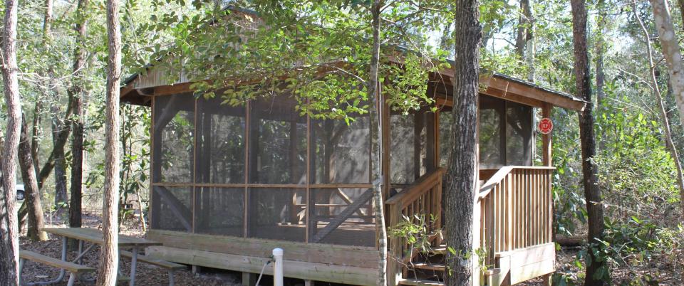
CATEGORIES: Landing
LAYER: Brochure
OWNERSHIP: Public
ACCESS: Yes, Launch: riverbank, CAMPING, WATER, RESTROOMS, SHELTER, PICNIC AREA
WATER BODY: Suwannee River
GAUGE: Luraville
MILE: 95.68
ADDRESS: Located on the river just south of Peacock Springs State Park. The river camps are accessible by river only. No vehicles or overnight parking is permitted. Call 800-868-9914 for more information. Lafayette County.
DESCRIPTION: The outpouring of water from the spring system to the river is often visible at the river camp entrance.
AKA: Peacock Slough Landing
WEBSITE: https://www.floridastateparks.org/parks-and-trails/suwannee-river-wilderness-state-trail/river-camps
OTHER REFERENCE: https://thedyrt.com/camping/florida/peacock-slough
UPSTREAM: 1.72 miles from Peacock Slough River Camp to Telford Springs Ramp
DOWNSTREAM: 2.78 miles from Peacock Slough River Camp to Hardenbergh Ramp
PHOTO: https://www.floridastateparks.org/sites/default/files/media/image/Peacock.jpg
PHOTOSET: https://www.floridastateparks.org/parks-and-trails/suwannee-river-wilderness-state-trail/river-camps
PHOTO SOURCE: Florida State Parks
PHONE NUMBER: (800) 868-9914
Suggestions: https://forms.gle/DipPgU2TP5atc2Rf9
Hardenbergh Ramp
CATEGORIES: Landing
LAYER: Brochure
OWNERSHIP: Public
ACCESS: Yes, Ramp: Concrete
WATER BODY: Suwannee River
GAUGE: Luraville
MILE: 92.90
ADDRESS: From Mayo, travel east on US 27 to NE CR 361; turn left; travel north to NE CR 354; cross over to NE Pecan Avenue; turn right on NE River Road and follow to boat ramp. Lafayette County.
UPSTREAM: 2.78 miles from Hardenbergh Ramp to Peacock Slough River Camp
DOWNSTREAM: 1.00 mile from Hardenbergh Ramp to Suwannee River Rendezvous Ramp
Suggestions: https://forms.gle/DipPgU2TP5atc2Rf9
Suwannee River Rendezvous Ramp
CATEGORIES: Landing
LAYER: Brochure
GPS: 30.086833, -83.0945
OWNERSHIP: Public
ACCESS: Yes, Launch: riverbank
WATER BODY: Suwannee River
GAUGE: Luraville
MILE: 91.90
ADDRESS: From Mayo, travel US 27 east 4.5 miles to NE CR 354; turn left and travel north to NE Primrose Road; turn right at the curve; the ramp is at Suwannee River Rendezvous. Lafayette County.
UPSTREAM: 1.00 mile from Suwannee River Rendezvous Ramp to Hardenbergh Ramp
DOWNSTREAM: 1.50 miles from Suwannee River Rendezvous Ramp to Royal Springs Ramp
Suggestions: https://forms.gle/DipPgU2TP5atc2Rf9
Royal Springs Ramp
CATEGORIES: Landing
LAYER: Brochure
GPS: 30.083333, -83.074
OWNERSHIP: Public
ACCESS: Yes, Ramp: Concrete
WATER BODY: Suwannee River
GAUGE: Luraville
MILE: 90.40
ADDRESS: From Live Oak, take SR 51 south to CR 349; turn left on CR 349; travel south to 198 Terrace; turn right and travel west to 157 Lane; turn left and follow road to 198 Trail; turn left and travel east to 157 Drive; turn right into park. Suwannee County.
DESCRIPTION: In Hugh Byron Hollingsworth Sr. County Park.
AKA: Hugh Byron Hollingsworth Sr. Ramp
UPSTREAM: 1.50 miles from Royal Springs Ramp to Suwannee River Rendezvous Ramp
DOWNSTREAM: 3.80 miles from Royal Springs Ramp to Ft. Macomb Ramp
Suggestions: https://forms.gle/DipPgU2TP5atc2Rf9
Ft. Macomb Ramp
CATEGORIES: Landing
LAYER: Brochure
OWNERSHIP: Public
ACCESS: Yes, Ramp: Concrete
WATER BODY: Suwannee River
GAUGE: Luraville
MILE: 86.60
ADDRESS: From Mayo, travel east on US 27 to CR 410; turn left on CR 410; follow to boat ramp. Lafayette County.
UPSTREAM: 3.80 miles from Ft. Macomb Ramp to Royal Springs Ramp
DOWNSTREAM: 1.34 miles from Ft. Macomb Ramp to Adams Tract River Camp
Suggestions: https://forms.gle/DipPgU2TP5atc2Rf9
Adams Tract River Camp
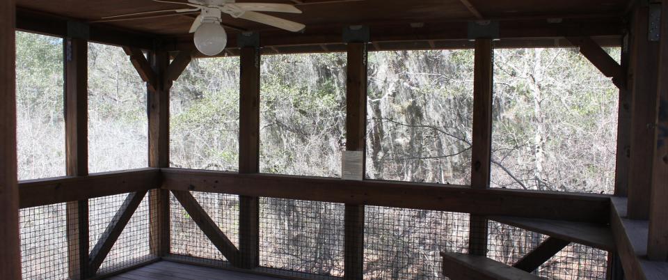
CATEGORIES: Landing
LAYER: Brochure
GPS: 30.035, -83.019
OWNERSHIP: Public
ACCESS: Yes, Launch: riverbank, CAMPING, WATER, RESTROOMS, SHELTER, PICNIC AREA
WATER BODY: Suwannee River
GAUGE: Branford
MILE: 85.26
ADDRESS: Located just a few miles upriver of Troy Springs State Park, just north of Branford. The river camps are accessible by river only. No vehicles or overnight parking is permitted. Call 800-868-9914 for more information. Lafayette County.
DESCRIPTION: There are some open, treeless areas of the camp that are ideal for stargazing with the nearest city lights miles away. It is located within a Suwannee River Water Management District Tract and provides ample hiking trails to explore throughout a longleaf pine community. Please be aware that scheduled hunting is permitted on this property certain times of the year. For information on hunting season dates, call 386-758-0525 or visit Florida Fish and Wildlife Commission.
WEBSITE: https://www.floridastateparks.org/parks-and-trails/suwannee-river-wilderness-state-trail/river-camps
OTHER REFERENCE: https://map.mysuwanneeriver.com/tracts/adams-4/
UPSTREAM: 1.34 miles from Adams Tract River Camp to Ft. Macomb Ramp
DOWNSTREAM: 1.56 miles from Adams Tract River Camp to Walker Tract Launch
PHOTO: https://www.floridastateparks.org/sites/default/files/media/image/Adams.jpg
PHOTOSET: https://www.floridastateparks.org/parks-and-trails/suwannee-river-wilderness-state-trail/river-camps
PHOTO SOURCE: Florida State Parks
PHONE NUMBER: (800) 868-9914
Suggestions: https://forms.gle/DipPgU2TP5atc2Rf9
Walker Tract Launch
CATEGORIES: Landing
LAYER: Brochure
GPS: 30.016833, -83.006
OWNERSHIP: Public
ACCESS: Yes, Launch: riverbank
WATER BODY: Suwannee River
GAUGE: Branford
MILE: 83.70
ADDRESS: From Branford, travel west on US 27 to NE CR 425; turn right and travel north; at the end of the pavement the road becomes NE Jeff Walker Road; turn right on the first dirt road to the right and follow to canoe launch. Lafayette County.
UPSTREAM: 1.56 miles from Walker Tract Launch to Adams Tract River Camp
DOWNSTREAM: 1.70 miles from Walker Tract Launch to Ruth Springs Launch
Suggestions: https://forms.gle/DipPgU2TP5atc2Rf9
Ruth Springs Launch
CATEGORIES: Landing
LAYER: Brochure
OWNERSHIP: Public
ACCESS: Yes, Launch: riverbank
WATER BODY: Suwannee River
GAUGE: Branford
MILE: 82.00
ADDRESS: From Branford, travel west on US 27 to NE CR 425; turn right and travel north to NE Ruth Springs Road, turn right and take the first dirt road to the left and follow to canoe launch. Lafayette County.
UPSTREAM: 1.70 miles from Ruth Springs Launch to Walker Tract Launch
DOWNSTREAM: 3.00 miles from Ruth Springs Launch to Patrician Oaks Ramp
Suggestions: https://forms.gle/DipPgU2TP5atc2Rf9
Patrician Oaks Ramp
CATEGORIES: Landing
LAYER: Brochure
OWNERSHIP: Public
ACCESS: Yes, Ramp: Concrete
WATER BODY: Suwannee River
GAUGE: Branford
MILE: 79.00
ADDRESS: From Branford, travel west on US 27 to NE Lantana Road; turn right and follow road to boat ramp. Lafayette County.
UPSTREAM: 3.00 miles from Patrician Oaks Ramp to Ruth Springs Launch
DOWNSTREAM: 3.00 miles from Patrician Oaks Ramp to Ivey Memorial Park Ramp
Suggestions: https://forms.gle/DipPgU2TP5atc2Rf9
Ivey Memorial Park Ramp
CATEGORIES: Landing
LAYER: Brochure
OWNERSHIP: Public
ACCESS: Yes, Ramp: Concrete
WATER BODY: Suwannee River
GAUGE: Branford
MILE: 76.00
ADDRESS: Boat ramp is located in Branford on the south side of US 27 at the Bridge in Ivey Memorial Park. Suwannee County.
UPSTREAM: 3.00 miles from Ivey Memorial Park Ramp to Patrician Oaks Ramp
DOWNSTREAM: 9.30 miles from Ivey Memorial Park Ramp to Dorothy Land Ramp
Suggestions: https://forms.gle/DipPgU2TP5atc2Rf9
Dorothy Land Ramp
CATEGORIES: Landing
LAYER: Brochure
OWNERSHIP: Public
ACCESS: Yes, Ramp: Concrete
WATER BODY: Suwannee River
GAUGE: Branford
MILE: 66.70
ADDRESS: From Branford, travel US 27 west to CR 349; turn left and travel south to SE CR 480; turn left and travel east to SE CR 500; turn left and travel north to SE CR 490; turn right and follow to boat ramp. Lafayette County.
UPSTREAM: 9.30 miles from Dorothy Land Ramp to Ivey Memorial Park Ramp
DOWNSTREAM: 3.50 miles from Dorothy Land Ramp to Sims Landing Ramp
Suggestions: https://forms.gle/DipPgU2TP5atc2Rf9
Sims Landing Ramp
CATEGORIES: Landing
LAYER: Brochure
GPS: 29.854, -82.887333
OWNERSHIP: Public
ACCESS: Yes, Ramp: Concrete
WATER BODY: Suwannee River
GAUGE: Bell
MILE: 63.20
ADDRESS: From Branford, travel US 27 west to CR 349; turn left and travel south to SE CR 500; turn left and travel to SE S. N. Hill Road; turn right and travel to SE R. M. Mears Road; turn right and follow to ramp. Lafayette County.
UPSTREAM: 3.50 miles from Sims Landing Ramp to Dorothy Land Ramp
DOWNSTREAM: 2.87 miles from Sims Landing Ramp to Calloway Boat Ramp
Suggestions: https://forms.gle/DipPgU2TP5atc2Rf9
Calloway Boat Ramp
CATEGORIES: Landing
LAYER: Brochure
GPS: 29.821, -82.9077
OWNERSHIP: Public, Gilchrist County, PARCEL 03-08-14-0000-0013-0010
ACCESS: Yes, Ramp: Sand covering concrete, PARKING: Free
WATER BODY: Suwannee River
GAUGE: Bell
MILE: 60.33
ADDRESS: West end of NW 57th Court, Bell, FL 32619. From Branford, go west on US 27, cross the Suwannee River, turn left on CR 349, left on CR 340, cross the Suwannee River again, left on NW 55th Ave., left on NW 55th St., right on NW 57th Ct., left to stay on NW 57th Ct. to the ramp. Gilchrist County.
DESCRIPTION: According to Ken Sulak, a sand-covered concrete boat ramp. It is owned by Gilchrist County.
OTHER REFERENCE: https://mapcarta.com/N3670735860
ADDITIONAL INFO SOURCES: https://naturalatlas.com/boat-launches/calloway-boat-landing-2090279
UPSTREAM: 2.87 miles from Calloway Boat Ramp to Sims Landing Ramp
DOWNSTREAM: 0.73 mile from Calloway Boat Ramp to Hirsh Landing Ramp
Suggestions: https://forms.gle/DipPgU2TP5atc2Rf9
Hirsh Landing Ramp
CATEGORIES: Landing
LAYER: Brochure
GPS: 29.82525, -82.919833
OWNERSHIP: Public, Lafayette County
ACCESS: Yes, Ramp: Concrete, PARKING: Free
WATER BODY: Suwannee River
GAUGE: Bell
MILE: 59.60
ADDRESS: From Branford, travel US 27 west to CR 349; turn left and travel south to SE CR 500; turn left and travel to SE Leopard Road; turn right and travel to SE Foster Drive; turn right; ramp is on the left. Lafayette County.
UPSTREAM: 0.73 mile from Hirsh Landing Ramp to Calloway Boat Ramp
DOWNSTREAM: 2.50 miles from Hirsh Landing Ramp to NW 967 Street Ramp
Suggestions: https://forms.gle/DipPgU2TP5atc2Rf9
NW 967 Street Ramp
CATEGORIES: Landing
LAYER: Brochure
GPS: 29.7995, -82.9275
OWNERSHIP: Public
ACCESS: Yes, Ramp: Concrete
WATER BODY: Suwannee River
GAUGE: Bell
MILE: 57.10
ADDRESS: From Old Town, travel north on CR 349 to CR 340; turn left and travel east 2.5 miles to NW 967 Street; turn left; ramp is at the end of the road. Dixie County.
UPSTREAM: 2.50 miles from NW 967 Street Ramp to Hirsh Landing Ramp
DOWNSTREAM: 0.50 mile from NW 967 Street Ramp to Rock Bluff Ramp
Suggestions: https://forms.gle/DipPgU2TP5atc2Rf9
Rock Bluff Ramp
CATEGORIES: Landing
LAYER: Brochure
OWNERSHIP: Public, Gilchrist County, PARCEL 16-08-14-0161-0001-0010
ACCESS: Yes, Ramp: Concrete
WATER BODY: Suwannee River
GAUGE: Bell
MILE: 56.60
ADDRESS: 192 NE 967 Street Old Town, FL 32680, Gilchrist County.
DESCRIPTION: From Bell, travel north on US 129; turn left on CR 340; travel west to county park on the left at the river. The 1.94 acre Rock Bluff Ferry Landing Park combines with CR 340 road frontage for access to the Rock Bluff Ramp.
WEBSITE: https://visitdixie.org/boat-ramps/
UPSTREAM: 0.50 mile from Rock Bluff Ramp to NW 967 Street Ramp
DOWNSTREAM: 1.60 miles from Rock Bluff Ramp to Gornto Spring Ramp
Suggestions: https://forms.gle/DipPgU2TP5atc2Rf9
Gornto Spring Ramp
CATEGORIES: Landing
LAYER: Brochure
OWNERSHIP: Public
ACCESS: Yes, Ramp: Concrete
WATER BODY: Suwannee River
GAUGE: Bell
MILE: 55.00
ADDRESS: 2463 NE 816th Ave, Old Town, FL 32680, Dixie County.
DESCRIPTION: From Branford, travel south on CR 349 to NE 816 Avenue; turn left and follow road to boat ramp.
WEBSITE: https://visitdixie.org/boat-ramps/
UPSTREAM: 1.60 miles from Gornto Spring Ramp to Rock Bluff Ramp
DOWNSTREAM: 3.00 miles from Gornto Spring Ramp to Log Landing Ramp
PHOTO SOURCE: Daniel Gray
PHONE NUMBER: (352) 440-1203
Suggestions: https://forms.gle/DipPgU2TP5atc2Rf9
Log Landing Ramp
CATEGORIES: Landing
LAYER: Brochure
OWNERSHIP: Public
ACCESS: Yes, Ramp: Concrete
WATER BODY: Suwannee River
GAUGE: Bell
MILE: 52.00
ADDRESS: From Trenton, travel north on US 129 to CR 232; turn left and travel west to SW 70 Avenue; turn right; travel north to NW 7 Place; travel west to NW 6 Street; turn left and follow road to boat ramp. Gilchrist County.
UPSTREAM: 3.00 miles from Log Landing Ramp to Gornto Spring Ramp
DOWNSTREAM: 2.10 miles from Log Landing Ramp to Wannee Ramp
Suggestions: https://forms.gle/DipPgU2TP5atc2Rf9
Wannee Ramp
CATEGORIES: Landing
LAYER: Brochure
OWNERSHIP: Public
ACCESS: Yes, Ramp: Concrete
WATER BODY: Suwannee River
GAUGE: Bell
MILE: 49.90
ADDRESS: From Trenton, travel north on US 129 to CR 232; turn left and travel west to SW 70 Avenue; turn right; travel north to SW 10 Street; turn left; travel west to SW 80 Avenue; turn right and follow road to boat ramp. Gilchrist County.
UPSTREAM: 2.10 miles from Wannee Ramp to Log Landing Ramp
DOWNSTREAM: 3.90 miles from Wannee Ramp to Eula Landing Ramp
Suggestions: https://forms.gle/DipPgU2TP5atc2Rf9
Eula Landing Ramp
CATEGORIES: Landing
LAYER: Brochure
GPS: 29.700667, -82.9385
OWNERSHIP: Public
ACCESS: Yes, Ramp: Concrete
WATER BODY: Suwannee River
GAUGE: Bell
MILE: 46.00
ADDRESS: From Trenton, travel north on US 129 to CR 232; turn left and travel west to SW 70 Avenue; turn right; travel north to SW 25 Street; turn left; travel west to SW 25 Place; turn right and follow road to boat ramp. Gilchrist County.
UPSTREAM: 3.90 miles from Eula Landing Ramp to Wannee Ramp
DOWNSTREAM: 2.00 miles from Eula Landing Ramp to Turner Point Landing Ramp
Suggestions: https://forms.gle/DipPgU2TP5atc2Rf9
Turner Point Landing Ramp
CATEGORIES: Landing
LAYER: Brochure
GPS: 29.693, -82.957833
OWNERSHIP: Public
ACCESS: Yes, Ramp: Concrete
WATER BODY: Suwannee River
GAUGE: Wilcox
MILE: 44.00
ADDRESS: 886 NE 453rd Ave, Old Town, FL 32680, Dixie County.
DESCRIPTION: From Old Town, travel north on CR 349 to NE 410 Avenue; turn right; follow to sharp left curve; road becomes NE 835 Street; continue north to NE 453 Avenue; turn right into park; the boat ramp is at the end of the road.
WEBSITE: https://visitdixie.org/boat-ramps/
UPSTREAM: 2.00 miles from Turner Point Landing Ramp to Eula Landing Ramp
DOWNSTREAM: 0.90 mile from Turner Point Landing Ramp to Hart Springs Ramp
PHOTO SOURCE: David Grissett
PHONE NUMBER: (352) 210-7545
Suggestions: https://forms.gle/DipPgU2TP5atc2Rf9
Hart Springs Ramp
CATEGORIES: Landing
LAYER: Brochure
OWNERSHIP: Public
ACCESS: Yes, Ramp: Concrete
WATER BODY: Suwannee River
GAUGE: Wilcox
MILE: 43.10
ADDRESS: From Trenton, travel north on US 129 to CR 344; turn left and travel west to CR 232; turn right; travel north to CR 344; turn left and travel west to SW 90 Avenue; turn right and follow road to ramp. Gilchrist County.
UPSTREAM: 0.90 mile from Hart Springs Ramp to Turner Point Landing Ramp
DOWNSTREAM: 2.10 miles from Hart Springs Ramp to Purvis Landing Ramp
Suggestions: https://forms.gle/DipPgU2TP5atc2Rf9
Purvis Landing Ramp
CATEGORIES: Landing
LAYER: Brochure
OWNERSHIP: Public
ACCESS: Yes, Ramp: Concrete
WATER BODY: Suwannee River
GAUGE: Wilcox
MILE: 41.00
ADDRESS: 294 NE 832nd St, Old Town, FL 32680, Dixie County.
DESCRIPTION: From Old Town, travel north on CR 349 to NE 272 Avenue, turn right and follow road to boat ramp.
WEBSITE: https://visitdixie.org/boat-ramps/
UPSTREAM: 2.10 miles from Purvis Landing Ramp to Hart Springs Ramp
DOWNSTREAM: 1.00 mile from Purvis Landing Ramp to Shingle Landing Ramp
PHOTO SOURCE: Chantell Miller
PHONE NUMBER: (352) 949-5752
Suggestions: https://forms.gle/DipPgU2TP5atc2Rf9
Shingle Landing Ramp
CATEGORIES: Landing
LAYER: Brochure
OWNERSHIP: Public
ACCESS: Yes, Ramp: Concrete
WATER BODY: Suwannee River
GAUGE: Wilcox
MILE: 40.00
ADDRESS: From Fanning Springs, travel northeast on SR 26 to CR 232; turn left; travel north to SW 70 Street; turn left and follow road to boat ramp. Gilchrist County.
UPSTREAM: 1.00 mile from Shingle Landing Ramp to Purvis Landing Ramp
DOWNSTREAM: 4.20 miles from Shingle Landing Ramp to Suwannee Gables Ramp
Suggestions: https://forms.gle/DipPgU2TP5atc2Rf9
Suwannee Gables Ramp
CATEGORIES: Landing
LAYER: Brochure
GPS: 29.586667, -82.9575
OWNERSHIP: Public
ACCESS: Yes, Ramp: Concrete
WATER BODY: Suwannee River
GAUGE: Wilcox
MILE: 35.80
ADDRESS: From Fanning Springs, cross the river on US 19; travel west and Suwannee Gables Motel is on the right. Dixie County.
UPSTREAM: 4.20 miles from Suwannee Gables Ramp to Shingle Landing Ramp
DOWNSTREAM: 1.60 miles from Suwannee Gables Ramp to Joe Anderson Jr. Ramp
Suggestions: https://forms.gle/DipPgU2TP5atc2Rf9
Joe Anderson Jr. Ramp
CATEGORIES: Landing
LAYER: Brochure
OWNERSHIP: Public
ACCESS: Yes, Ramp: Concrete
WATER BODY: Suwannee River
GAUGE: Wilcox
MILE: 34.20
ADDRESS: 113 SE 155th Ave, Old Town, FL 32680, Dixie County.
DESCRIPTION: From Fanning Springs, cross the river on US 19; turn left on SE 989 Street; travel south to SE 155 Avenue; turn left and the ramp is at the end of the street.
WEBSITE: https://visitdixie.org/boat-ramps/
UPSTREAM: 1.60 miles from Joe Anderson Jr. Ramp to Suwannee Gables Ramp
DOWNSTREAM: 2.20 miles from Joe Anderson Jr. Ramp to Hinton Landing Ramp
PHOTO SOURCE: Barry Russel
PHONE NUMBER: (614) 563-1461
Suggestions: https://forms.gle/DipPgU2TP5atc2Rf9
Hinton Landing Ramp
CATEGORIES: Landing
LAYER: Brochure
GPS: 29.557833, -82.95
OWNERSHIP: Public
ACCESS: Yes, Ramp: Concrete
WATER BODY: Suwannee River
GAUGE: Wilcox
MILE: 32.00
ADDRESS: 119 SE 230th Ave, Old Town, FL 32680, Dixie County.
DESCRIPTION: From Old Town, travel south on CR 349 to SE CR 346; turn left; travel east to SE CR 317; turn right and follow road to boat ramp.
WEBSITE: https://visitdixie.org/boat-ramps/
UPSTREAM: 2.20 miles from Hinton Landing Ramp to Joe Anderson Jr. Ramp
DOWNSTREAM: 1.80 miles from Hinton Landing Ramp to Old Pine Landing Ramp
Suggestions: https://forms.gle/DipPgU2TP5atc2Rf9
Old Pine Landing Ramp
CATEGORIES: Landing
LAYER: Brochure
OWNERSHIP: Public
ACCESS: Yes, Ramp: Concrete
WATER BODY: Suwannee River
GAUGE: Manatee Springs
MILE: 30.20
ADDRESS: 239 SE 837th St, Old Town, FL 32680, Dixie County.
DESCRIPTION: From Old Town, travel south on CR 349 to SE 295 Avenue; turn left; travel east to SE 837 Street; turn right and follow road to boat ramp.
WEBSITE: https://visitdixie.org/boat-ramps/
UPSTREAM: 1.80 miles from Old Pine Landing Ramp to Hinton Landing Ramp
DOWNSTREAM: 1.50 miles from Old Pine Landing Ramp to New Pine Landing Ramp
Suggestions: https://forms.gle/DipPgU2TP5atc2Rf9
New Pine Landing Ramp
CATEGORIES: Landing
LAYER: Brochure
GPS: 29.529333, -82.9775
OWNERSHIP: Public
ACCESS: Yes, Ramp: Concrete
WATER BODY: Suwannee River
GAUGE: Manatee Springs
MILE: 28.70
ADDRESS: 22 SE 849th St, Old Town, FL 32680, Dixie County.
DESCRIPTION: From Old Town, travel south on CR 349 to SE 311 Avenue; turn left; travel east to SE 849 Street; turn left and boat ramp is on the right.
WEBSITE: https://visitdixie.org/boat-ramps/
UPSTREAM: 1.50 miles from New Pine Landing Ramp to Old Pine Landing Ramp
DOWNSTREAM: 0.60 mile from New Pine Landing Ramp to New Clay Landing Ramp
Suggestions: https://forms.gle/DipPgU2TP5atc2Rf9
New Clay Landing Ramp
CATEGORIES: Landing
LAYER: Brochure
OWNERSHIP: Public
ACCESS: Yes, Ramp: Concrete
WATER BODY: Suwannee River
GAUGE: Manatee Springs
MILE: 28.10
ADDRESS: From Chiefland, travel west on NW 115 Street to NW 110 Avenue; turn right and travel north to NW 129 Place; turn left and travel west to NW 130 Street; turn left and follow road to ramp. Levy County.
UPSTREAM: 0.60 mile from New Clay Landing Ramp to New Pine Landing Ramp
DOWNSTREAM: 3.00 miles from New Clay Landing Ramp to Manatee Springs State Park Launch
Suggestions: https://forms.gle/DipPgU2TP5atc2Rf9
Manatee Springs State Park Launch
CATEGORIES: Landing
LAYER: Brochure
GPS: 29.489, -82.977833
OWNERSHIP: Public
ACCESS: Yes, Ramp: Concrete
WATER BODY: Suwannee River
GAUGE: Manatee Springs
MILE: 25.10
ADDRESS: From Chiefland, travel west on NW 115 Street to Manatee Springs State Park. Levy County.
UPSTREAM: 3.00 miles from Manatee Springs State Park Launch to New Clay Landing Ramp
DOWNSTREAM: 0.50 mile from Manatee Springs State Park Launch to Usher Landing Ramp
Suggestions: https://forms.gle/DipPgU2TP5atc2Rf9
Usher Landing Ramp
CATEGORIES: Landing
LAYER: Brochure
OWNERSHIP: Public
ACCESS: Yes, Ramp: Concrete
WATER BODY: Suwannee River
GAUGE: Manatee Springs
MILE: 24.60
ADDRESS: From Chiefland, travel west on NW 115 Street to NW 107 Terrace; turn left and travel south to Usher boat ramp sign; turn right and follow road to boat ramp. Levy County.
UPSTREAM: 0.50 mile from Usher Landing Ramp to Manatee Springs State Park Launch
DOWNSTREAM: 1.40 miles from Usher Landing Ramp to Camp Azalea Ramp
Suggestions: https://forms.gle/DipPgU2TP5atc2Rf9
Camp Azalea Ramp
CATEGORIES: Landing
LAYER: Brochure
GPS: 29.4635, -82.986667
OWNERSHIP: Public
ACCESS: Yes, Ramp: Concrete
WATER BODY: Suwannee River
GAUGE: Manatee Springs
MILE: 23.20
ADDRESS: From Chiefland, travel west on NW 115 Street to NW 107 Terrace; turn left and travel south to Camp Azalea; turn right on NW 128 Court and follow road to boat ramp. Levy County.
UPSTREAM: 1.40 miles from Camp Azalea Ramp to Usher Landing Ramp
DOWNSTREAM: 0.50 mile from Camp Azalea Ramp to Yellow Jacket Ramp
Suggestions: https://forms.gle/DipPgU2TP5atc2Rf9
Yellow Jacket Ramp
CATEGORIES: Landing
LAYER: Brochure
OWNERSHIP: Public
ACCESS: Yes, Ramp: Concrete
WATER BODY: Suwannee River
GAUGE: Fowlers Bluff
MILE: 22.70
ADDRESS: 374 SE 752 Street, Old Town, FL 32680, Dixie County.
DESCRIPTION: From Old Town, travel south on CR 349 to SE 477 Avenue; turn left; travel east to SE 752 Street; turn right and follow road to boat ramp.
WEBSITE: https://visitdixie.org/boat-ramps/
UPSTREAM: 0.50 mile from Yellow Jacket Ramp to Camp Azalea Ramp
DOWNSTREAM: 5.90 miles from Yellow Jacket Ramp to Fowlers Bluff Ramp
Suggestions: https://forms.gle/DipPgU2TP5atc2Rf9
Fowlers Bluff Ramp
CATEGORIES: Landing
LAYER: Brochure
GPS: 29.3965, -83.026
OWNERSHIP: Public
ACCESS: Yes, Ramp: Concrete
WATER BODY: Suwannee River
GAUGE: Fowlers Bluff
MILE: 16.80
ADDRESS: From Chiefland, travel on SW 4 Avenue (CR 345) 6 miles; turn right on CR 347; travel 9 miles; turn right on NW 46 Lane and follow to boat ramp. Levy County.
UPSTREAM: 5.90 miles from Fowlers Bluff Ramp to Yellow Jacket Ramp
DOWNSTREAM: 0.80 mile from Fowlers Bluff Ramp to Weeks Landing Launch
Suggestions: https://forms.gle/DipPgU2TP5atc2Rf9
Weeks Landing Launch
CATEGORIES: Landing
LAYER: Brochure
GPS: 29.397, -83.035667
OWNERSHIP: Public
ACCESS: Yes, Launch: riverbank, PARKING: Free
WATER BODY: Suwannee River
GAUGE: Fowlers Bluff
MILE: 16.00
ADDRESS: From Old Town, travel south 17 miles on CR 349 to unmarked Lower Suwannee National Wildlife Refuge Road; turn left and follow road to canoe launch. Dixie County.
DESCRIPTION: In the Lower Suwannee River Wildlife Refuge. Shirley Kokidko reported 2025-05-25 that the Dixie County side is open during the different hunting seasons. Now the gate is locked but you can walk around it for foot/bike traffic. The canoe launch icon is on their map but lacking the information that you have to walk your kayak 1.5 miles to get from the gate to the river. We have used Weeks Landing in the past so maybe this is a new or temporary change. For anyone planning an itinerary to paddle the lower region, the phone number for LSRWR is 352-493-0238.
WEBSITE: https://www.friendsofrefuges.org
OTHER REFERENCE: https://www.fws.gov/refuge/lower-suwannee
UPSTREAM: 0.80 mile from Weeks Landing Launch to Fowlers Bluff Ramp
DOWNSTREAM: 8.40 miles from Weeks Landing Launch to Munden Creek Primitive Ramp
Suggestions: https://forms.gle/DipPgU2TP5atc2Rf9
Munden Creek Primitive Ramp
CATEGORIES: Landing
LAYER: Brochure
OWNERSHIP: Public, Dixie County, PARCEL 21-13-12-0000-3471-0000
ACCESS: Yes, Ramp: Concrete
WATER BODY: Suwannee River
GAUGE: Fowlers Bluff
MILE: 7.60
ADDRESS: From Suwannee, travel north on CR 349 to SE 371 Street; turn right and travel east to SE 374 Street and follow road to boat ramp. Dixie County.
UPSTREAM: 8.40 miles from Munden Creek Primitive Ramp to Weeks Landing Launch
DOWNSTREAM: 3.55 miles from Munden Creek Primitive Ramp to Suwannee Marina Ramp
Suggestions: https://forms.gle/DipPgU2TP5atc2Rf9
Suwannee Marina Ramp

CATEGORIES: Landing Private
LAYER: Brochure
GPS: 29.3279, -83.14007
OWNERSHIP: Private, Suwannee Marina Services LLC, PARCEL 19-13-12-2994-0003-5250
ACCESS: Yes, Ramp: Concrete, FOOD: Restaurant, WATER, RESTROOMS, PARKING: Free, SHELTER
WATER BODY: Suwannee River
GAUGE: Suwannee River above Gopher River
MILE: 4.05
ADDRESS: 49 SE 903 Avenue, Suwannee, FL 32692, Dixie County.
DESCRIPTION: Commercially Owned for General Public Use
AKA: Starling’s Suwannee Marina Inc. https://marinas.com/view/marina/55cq7e_Starlings_Suwannee_Marina_Inc_Suwannee_FL_United_States
WEBSITE: https://www.waterwayguide.com/marina/suwannee-marina-inc
UPSTREAM: 3.55 miles from Suwannee Marina Ramp to Munden Creek Primitive Ramp
DOWNSTREAM: 0.15 mile from Suwannee Marina Ramp to Anderson Landing Ramp
PHOTOSET: https://www.facebook.com/thesuwanneemarina/
PHOTO SOURCE: Suwannee Marina Inc.
PHONE NUMBER: (352) 542-9159
Suggestions: https://forms.gle/DipPgU2TP5atc2Rf9
Anderson Landing Ramp
CATEGORIES: Landing Private
LAYER: Brochure
GPS: 29.3305, -83.143333
OWNERSHIP: Private, Dixie County
ACCESS: Yes, Ramp: Concrete, DOCK, CAMPING, WATER, RESTROOMS, PARKING: Free
WATER BODY: Suwannee River
GAUGE: Suwannee River above Gopher River
MILE: 3.90
ADDRESS: 2299 SE CR 349, Suwannee, FL 32692, mile 396 on the Florida Circumnavigational Saltwater Paddling Trail. Dixie County.
DESCRIPTION: Parking across CR 349. New floating dock to tie up to while parking. “”Restaurants and Bills Fish Camp and Motel nearby. Motel Reservations: (352) 542-7086″”
AKA: Demory Creek Public Boat Ramp.
WEBSITE: https://floridadep.gov/sites/default/files/Segment%206%20Maps%2012_13_23.pdf
OTHER REFERENCE: https://www.floridapaddlingtrails.com/complete-fpta-ct-map-set
UPSTREAM: 0.15 mile from Anderson Landing Ramp to Suwannee Marina Ramp
DOWNSTREAM: 0.12 mile from Anderson Landing Ramp to Miller’s Marina of Suwannee Ramp
PHOTOSET: https://paddling.com/paddle/locations/anderson-landing-river-camp
PHOTO SOURCE: Paddling.com
PHONE NUMBER: (850) 290-2350
Suggestions: https://forms.gle/DipPgU2TP5atc2Rf9
Miller’s Marina of Suwannee Ramp

CATEGORIES: Landing Private
LAYER: Brochure
GPS: 29.32613, -83.14512
OWNERSHIP: Private, 95 Van Dam Corp A New York Corporation, PARCEL 30-13-12-3500-000A-0012
ACCESS: Yes, Ramp: Concrete, DOCK, WATER, PARKING: Free
WATER BODY: Suwannee River
GAUGE: Suwannee River above Gopher River
MILE: 3.78
ADDRESS: 90 SE 910th Ave., Suwannee, FL 32692, Dixie County.
DESCRIPTION: Commercially Owned for General Public Use
AKA: Gateway Marina.
WEBSITE: http://www.gatewaymarina.us/img/docking02.jpg
UPSTREAM: 0.12 mile from Miller’s Marina of Suwannee Ramp to Anderson Landing Ramp
PHOTOSET: https://www.facebook.com/pages/Millers-Marina-of-Suwannee-Inc/143206805725819
PHOTO SOURCE: Miller’s Marina of Suwannee
PHONE NUMBER: (352) 542-7349
Suggestions: https://forms.gle/DipPgU2TP5atc2Rf9
McKinney Landing
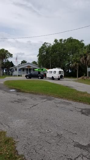
CATEGORIES: Landing
LAYER: Brochure
GPS: 29.32726, -83.1506
OWNERSHIP: Public, DIXIE DISTRICT SCHOOLS COMMUNITY & YOUTH CENTERS, PARCEL 19-13-12-0000-3384-0000
ACCESS: Yes, Ramp: Easy-launch, DOCK, WATER, RESTROOMS, PARKING: Free, SHELTER
WATER BODY: Tributary of Demory Creek
GAUGE: Suwannee River above Gopher River
MILE: 3.78
ADDRESS: 23461 SE 349 Hwy, Suwannee, FL 32692, Dixie County.
DESCRIPTION: Pretty new, with easy launch. At the Community Center in the Town of Suwannee.
WEBSITE: https://paddling.com/paddle/locations/suwannee-community-center
PHOTOSET: https://paddling.com/paddle/locations/suwannee-community-center
PHOTO SOURCE: Paddling.com
Suggestions: https://forms.gle/DipPgU2TP5atc2Rf9
Suwannee Boat Ramp
CATEGORIES: Landing
LAYER: Brochure
GPS: 29.32371, -83.14433
OWNERSHIP: Public, Dixie County, PARCEL 30-13-12-3500-000D-0000
ACCESS: Yes, Ramp: Concrete
WATER BODY: Suwannee River
GAUGE: Suwannee River above Gopher River
MILE: 3.78
ADDRESS: 447 SE 205 Street, Suwannee, FL 32692, Dixie County.
DESCRIPTION: Government Owned for General Public Use
UPSTREAM: 0.12 mile from Suwannee Boat Ramp to Anderson Landing Ramp
Suggestions: https://forms.gle/DipPgU2TP5atc2Rf9
Horseshoe Beach Park and Boat Ramp
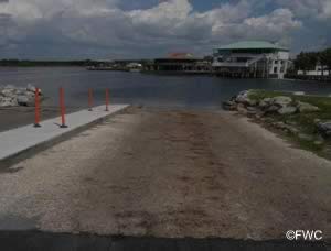
CATEGORIES: Landing
LAYER: Brochure
GPS: 29.44006, -83.29279
OWNERSHIP: Public, Dixie County
ACCESS: Yes, Ramp: Concrete, DOCK, CAMPING: RV, WATER, RESTROOMS, PARKING: Free, PICNIC AREA
WATER BODY: Florida Circumnavigational Saltwater Paddling Trail
MILE: 381.40
ADDRESS: 244 8th Avenue West, Horseshoe Beach, FL 32648, Dixie County.
DESCRIPTION: This is “”a county park in the town of Horseshoe Beach. You can replenish water supplies—enough for two days–and walk a short distance to a convenience store and a restaurant.”” https://floridadep.gov/sites/default/files/Seg_6_text_CT%20July%202023.pdf
AKA: Butler Douglas Memorial Horseshoe Beach Boat Ramp.
WEBSITE: https://boatzia.com/florida/dixie/horseshoe-beach-park-and-boat-ramp/
OTHER REFERENCE: https://floridadep.gov/sites/default/files/Seg_6_text_CT%20July%202023.pdf
UPSTREAM: 0.60 mile from Horseshoe Beach Park and Boat Ramp to El Sea’s Fish Camp
PHOTOSET: https://www.saltchef.com/catch_fish/FL/Dixie/boat_ramps.html
PHOTO SOURCE: FWC
PHONE NUMBER: Ms. Debbie (352) 210-5767
Suggestions: https://forms.gle/DipPgU2TP5atc2Rf9
El Sea’s Fish Camp
CATEGORIES: Landing Private
LAYER: Brochure
GPS: 29.4395, -83.2885
OWNERSHIP: Private
ACCESS: Yes, Launch: canalside, DOCK, CAMPING, WATER, RESTROOMS, PARKING: Free, SHELTER, PICNIC AREA
WATER BODY: Florida Circumnavigational Saltwater Paddling Trail
MILE: 382.00
ADDRESS: 260 3rd Ave E, Horseshoe Beach, FL 32648, Dixie County.
DESCRIPTION: “”We are located on the main channel to the Gulf of Mexico with Dock space available on the property. You can tie off your boat, clean your fish, build a campfire and cook your meal all in one place. As well as rooms, kitchenettes and dry boat storage we also have RV spots available up to 50 amp service.”” Reservations (352) 440-2601, marinadmiller@yahoo.com https://www.tripadvisor.ca/Hotel_Review-g34302-d4893448-Reviews-El_Sea_s_Fish_Camp-Horseshoe_Beach_Florida.html
WEBSITE: https://www.facebook.com/elseasfishcamp/
OTHER REFERENCE: https://floridadep.gov/sites/default/files/Segment%206%20Maps%2012_13_23.pdf
UPSTREAM: 1.40 miles from El Sea’s Fish Camp to Butler Island Campsite
DOWNSTREAM: 0.60 mile from El Sea’s Fish Camp to Horseshoe Beach Park and Boat Ramp
Suggestions: https://forms.gle/DipPgU2TP5atc2Rf9
Fish Bone Creek Primitive Boat Launch
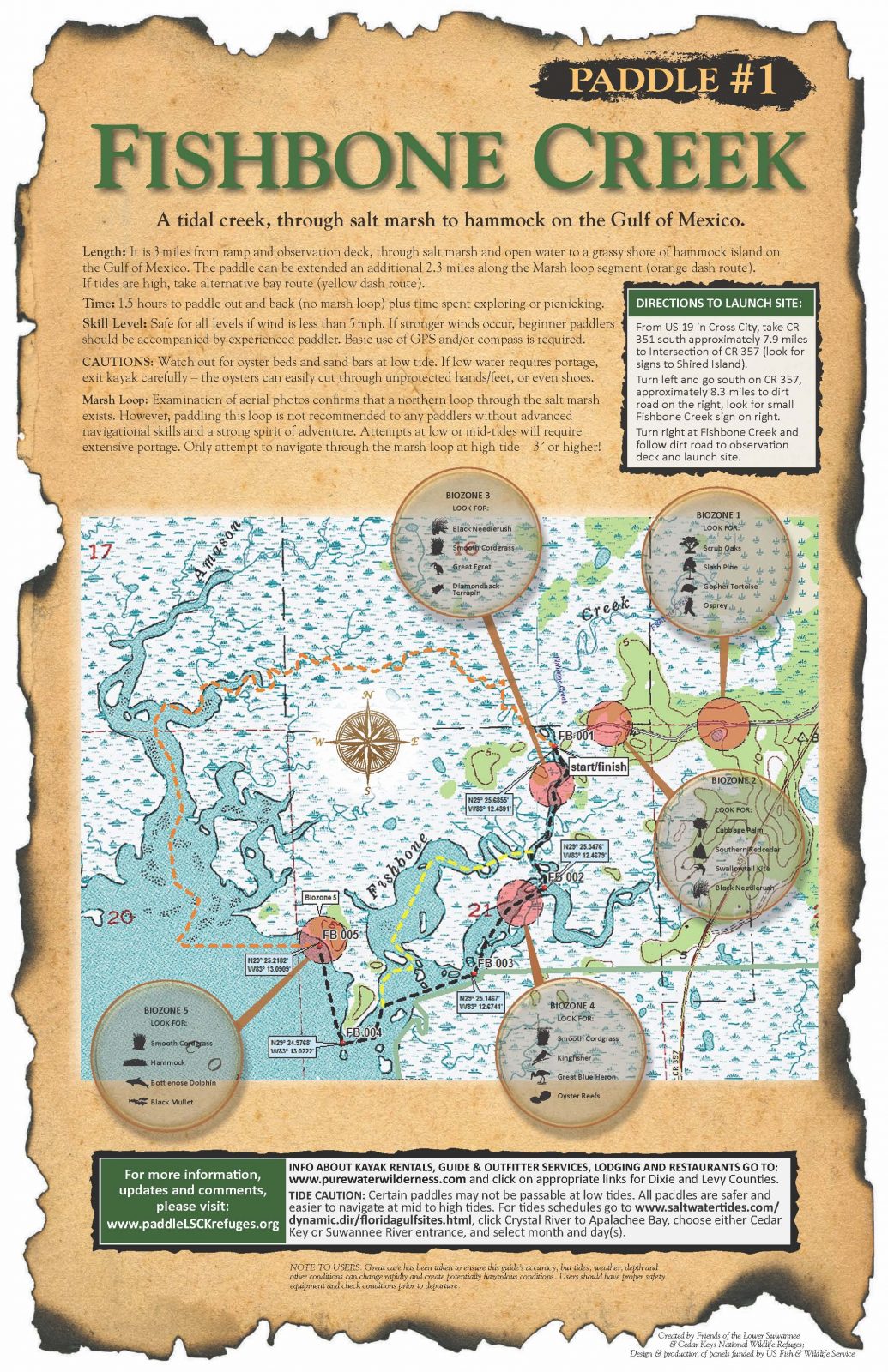
CATEGORIES: Landing
LAYER: Brochure
GPS: 29.42822, -83.20722
OWNERSHIP: Public, U.S. Fish and Wildlife Service
ACCESS: Yes, Launch: Mud and sand, PARKING: Free
WATER BODY: Fishbone Creek
ADDRESS: CR 357, Cross City, FL 32628, Dixie County.
DESCRIPTION: Small boats only, open daylight hours only. “”Fishbone Creek has an observation tower about 1.5 miles from the mouth. “”
WEBSITE: https://www.naturalnorthflorida.com/things-to-do/fishbone-creek/
OTHER REFERENCE: https://floridadep.gov/sites/default/files/Seg_6_text_CT%20July%202023.pdf
PHOTO: https://www.naturalnorthflorida.com/blog/wp-content/uploads/2018/09/1_fishbone_creekr_Page_1.jpg
PHOTOSET: https://www.naturalnorthflorida.com/things-to-do/fishbone-creek/
PHOTO SOURCE: Visit Natural North Florida
PHONE NUMBER: (850) 290-2350
Suggestions: https://forms.gle/DipPgU2TP5atc2Rf9
Butler Island Campsite
CATEGORIES: Landing
LAYER: Brochure
GPS: 29.4312, -83.2697
OWNERSHIP: Public
ACCESS: Yes, Launch: sand, CAMPING
WATER BODY: Florida Circumnavigational Saltwater Paddling Trail
MILE: 383.40
ADDRESS: Island in the Gulf east-southeast of Horsehoe Beach, Dixie County.
DESCRIPTION: “”Beware of poison ivy. Horseshoe Beach Free FWC permit required.”” “”The Butler Island Campsite is 1.7 miles from Horseshoe Point, on the south side of the island. Camping is beneath a canopy of live oaks, palms, and a rare stand of mature cedars, but beware of poison ivy. As with other sites, the low-lying coontie palm grows here, a protected species. The starchy tubers—poisonous if not prepared properly—were once an important food source for Native Americans and early settlers.””
WEBSITE: https://floridadep.gov/sites/default/files/Segment%206%20Maps%2012_13_23.pdf
OTHER REFERENCE: https://floridadep.gov/sites/default/files/Seg_6_text_CT%20July%202023.pdf
UPSTREAM: 5.00 miles from Butler Island Campsite to Shired Island Public Boat Ramp
DOWNSTREAM: 1.40 miles from Butler Island Campsite to El Sea’s Fish Camp
Suggestions: https://forms.gle/DipPgU2TP5atc2Rf9
Shired Island Public Boat Ramp
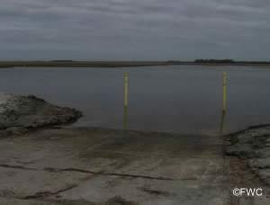
CATEGORIES: Landing
LAYER: Brochure
GPS: 29.39885, -83.20479
OWNERSHIP: Public, Dixie County
ACCESS: Yes, Ramp: Concrete, DOCK, RESTROOMS, PARKING: Free
WATER BODY: Florida Circumnavigational Saltwater Paddling Trail
MILE: 388.40
ADDRESS: 11072 SE Hwy 357, Horseshoe, FL 32648, Dixie County.
DESCRIPTION: “the county campground at Shired Island (pronounced Sheered), about 5 miles from Butler Island (fee required). The water is not potable and has a strong sulfur smell. Nearby, a large Indian shell midden about 12 feet high, with sides exposed due to erosion, is worth viewing.””, In Lower Suwannee NWR
WEBSITE: https://floridadep.gov/sites/default/files/Seg_6_text_CT%20July%202023.pdf
OTHER REFERENCE: https://floridadep.gov/sites/default/files/Segment%206%20Maps%2012_13_23.pdf
UPSTREAM: 5.10 miles from Shired Island Public Boat Ramp to Cat Island rest stop
DOWNSTREAM: 5.00 miles from Shired Island Public Boat Ramp to Butler Island Campsite
PHOTOSET: https://www.saltchef.com/catch_fish/FL/Dixie/boat_ramps.html
PHOTO SOURCE: FWC
PHONE NUMBER: (352) 498-0009
Suggestions: https://forms.gle/DipPgU2TP5atc2Rf9
Cat Island rest stop
CATEGORIES: Landing
LAYER: Brochure
GPS: 29.3283, -83.1769
OWNERSHIP: Public
ACCESS: Yes, Launch: sandy island bank
WATER BODY: Florida Circumnavigational Saltwater Paddling Trail
MILE: 393.50
ADDRESS: West of the town of Suwannee and north of the Suwannee River Mouth, Dixie County.
DESCRIPTION: Privately owned, with no facilities.
OTHER REFERENCE: https://www.floridapaddlingtrails.com/complete-fpta-ct-map-set
UPSTREAM: 2.50 miles from Cat Island rest stop to FLCT Anderson Landing Ramp
DOWNSTREAM: 5.10 miles from Cat Island rest stop to Shired Island Public Boat Ramp
Suggestions: https://forms.gle/DipPgU2TP5atc2Rf9
FLCT Anderson Landing Ramp
CATEGORIES: Landing Private
LAYER: Brochure
GPS: 29.33043, -83.1433
OWNERSHIP: Private, Dixie County
ACCESS: Yes, Ramp: Concrete, DOCK, CAMPING, WATER, RESTROOMS, PARKING: Free
WATER BODY: Florida Circumnavigational Saltwater Paddling Trail
GAUGE: Suwannee River above Gopher River
MILE: 396.00
ADDRESS: 2299 SE CR 349, Suwannee, FL 32692, Dixie County.
DESCRIPTION: Parking across CR 349. New floating dock to tie up to while parking. “”Restaurants and Bills Fish Camp and Motel nearby. Motel Reservations: (352) 542-7086″”
AKA: Demory Creek Public Boat Ramp.
WEBSITE: https://floridadep.gov/sites/default/files/Segment%206%20Maps%2012_13_23.pdf
OTHER REFERENCE: https://www.floridapaddlingtrails.com/complete-fpta-ct-map-set
UPSTREAM: 12.3 miles from FLCT Anderson Landing Ramp to Shell Mound Park and Public Boat Ramp
DOWNSTREAM: 2.50 miles from FLCT Anderson Landing Ramp to Cat Island rest stop
PHOTOSET: https://paddling.com/paddle/locations/anderson-landing-river-camp
PHOTO SOURCE: Paddling.com
PHONE NUMBER: (850) 290-2350
Suggestions: https://forms.gle/DipPgU2TP5atc2Rf9
McCormick Creek Launch
CATEGORIES: Landing
LAYER: Brochure
GPS: 29.29054, -83.06266
OWNERSHIP: Public, U.S. Fish and Wildlife Service
ACCESS: Yes, Launch: limerock, PARKING: Free
WATER BODY: McCormick Creek
ADDRESS: Off of South Entrance Road, Chiefland, FL 32626, in Lower Suwannee NWR. Levy County.
DESCRIPTION: Canoes and kayaks only. Daylight hours only.
WEBSITE: https://boatzia.com/florida/levy/mccormick-creek-canoe-kayak-launch/
Suggestions: https://forms.gle/DipPgU2TP5atc2Rf9
Shell Mound Primitive Boat Launch
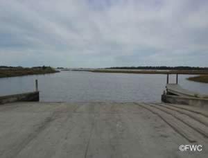
CATEGORIES: Landing
LAYER: Brochure
GPS: 29.2068, -83.0691
OWNERSHIP: Public, U.S. Fish and Wildlife Service
ACCESS: Yes, Launch: gravel on mud beach, PARKING: Free
WATER BODY: Suwannee Sound
ADDRESS: End of County Road 326, Cedar Key, FL 32625, Levy County.
DESCRIPTION: A two-lane concrete ramp, with airboat skids on one lane.
WEBSITE: https://boatzia.com/florida/levy/shell-mound-park-and-public-boat-ramp/
OTHER REFERENCE: https://www.floridapaddlingtrails.com/complete-fpta-ct-map-set
PHOTOSET: https://www.saltchef.com/catch_fish/FL/Levy/boat_ramps.html
PHOTO SOURCE: FWC
PHONE NUMBER: (352) 221-4466
Suggestions: https://forms.gle/DipPgU2TP5atc2Rf9
Shell Mound Park and Public Boat Ramp

CATEGORIES: Landing
LAYER: Brochure
GPS: 29.21007, -83.06331
OWNERSHIP: Public, Levy County
ACCESS: Yes, Ramp: Concrete, CAMPING: RV, RESTROOMS, PARKING: “RV $15, Tents $10, Tents no electric $5, PICNIC AREA
WATER BODY: Florida Circumnavigational Saltwater Paddling Trail
MILE: 408.30
ADDRESS: 17650 SW 78th Place, Cedar Key, FL 32625, Levy County.
DESCRIPTION: There are 20 campsites with water and power hookups, 10 primitive camping sites, restroom and shower facilities, boat ramp, a fish cleaning area, volleyball, basketball, and an RV dumping station. “”The historic Shell Mound is an interesting destination and a chance to stretch your legs. This five-acre, 28-foot-tall Timucuan Indian mound offers a panoramic view of a Gulf Coast Wilderness. It was primarily built from discarded oyster and scallop shells, possibly during winter solstice celebrations throughout generations that may have spanned 3500 years.””
HISTORIC FACTS: Archeological mound is approximately ½ mile west of campsites on County Road 32. Rebuilt Shell Mound Pier is now open, 2024-05-31. https://cedarkeynews.com/index.php/conservation/8483-shell-mound-pier-now-open
WEBSITE: https://visitnaturecoast.com/boat-ramps/
OTHER REFERENCE: https://floridadep.gov/sites/default/files/Seg_6_text_CT%20July%202023.pdf
ADDITIONAL INFO SOURCES: https://www.fws.gov/refuge/lower-suwannee
UPSTREAM: 5.00 miles from Shell Mound Park and Public Boat Ramp to Cedar Key Number 4 Bridge Boat Ramp
DOWNSTREAM: 12.3 miles from Shell Mound Park and Public Boat Ramp to FLCT Anderson Landing Ramp
PHOTO: https://cedarkeynews.com/images/PIX_2024/CONSERVATION/REFUGES/JUNE/100_0423.JPG
PHOTOSET: https://cedarkeynews.com/index.php/conservation/8483-shell-mound-pier-now-open
PHOTO SOURCE: Lower Suwannee National Wildlife Refuge via Cedar Key News
PHONE NUMBER: (703) 622-3896
Suggestions: https://forms.gle/DipPgU2TP5atc2Rf9
Cedar Key Number 4 Bridge Boat Ramp
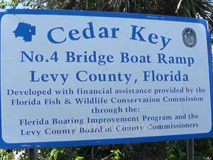
CATEGORIES: Landing
LAYER: Brochure
GPS: 29.16433, -83.02698
OWNERSHIP: Public, Levy County
ACCESS: Yes, Ramp: Concrete, DOCK, RESTROOMS, PARKING: Free
WATER BODY: Florida Circumnavigational Saltwater Paddling Trail
MILE: 413.30
ADDRESS: 11311 SW 153rd Court, Cedar Key, FL 32625, Levy County.
DESCRIPTION: This boat ramp and pier are located on State Road 24 in Cedar Key.
AKA: #4 Bridge Boat Ramp and Fishing Pier.
WEBSITE: https://www.visitnaturecoast.com/boat-ramps.php
OTHER REFERENCE: https://www.floridapaddlingtrails.com/complete-fpta-ct-map-set
DOWNSTREAM: 5.00 miles from Cedar Key Number 4 Bridge Boat Ramp to Shell Mound Park and Public Boat Ramp
PHOTOSET: https://www.saltchef.com/catch_fish/FL/Levy/boat_ramps.html
PHOTO SOURCE: FWC
Suggestions: https://forms.gle/DipPgU2TP5atc2Rf9
Cedar Key Museum State Park Kayak Launch
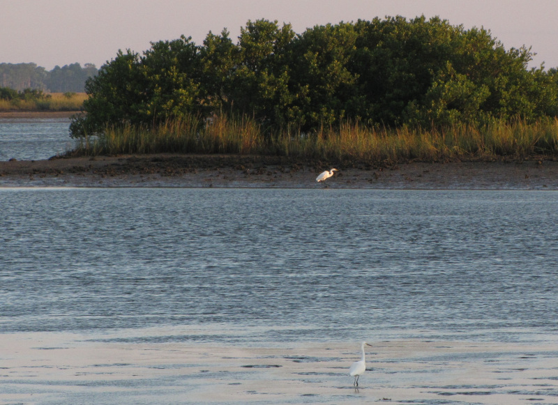
CATEGORIES: Landing
LAYER: Brochure
GPS: 29.15193, -83.04917
OWNERSHIP: Public, FDEP
ACCESS: Yes, Launch: dirt, RESTROOMS, PARKING: Free
WATER BODY: Gulf of Mexico
ADDRESS: 12231 SW 166 Court, Cedar Key, FL 32625, Levy County.
DESCRIPTION: Long portage required. 8 AM to sundown.
PHOTOSET: https://www.floridastateparks.org/learn/paddle-gulf-marshes-cedar-key
PHOTO SOURCE: Florida State Parks
Suggestions: https://forms.gle/DipPgU2TP5atc2Rf9
Cedar Key Marina Basin Side Boat Ramp
CATEGORIES: Landing
LAYER: Brochure
GPS: 29.136, -83.03
OWNERSHIP: Public, City of Cedar Key
ACCESS: Yes, Ramp: Concrete, DOCK, RESTROOMS, PARKING: Launching fees are payable at the automated kiosks.
WATER BODY: Gulf of Mexico
ADDRESS: A St., south of First Street, Cedar Key, FL 32625, Levy County.
DESCRIPTION: 1 very wide launching lane & courtesy docks. The bridge clearance at the far end of basin limits boats depending on tidal conditions.
AKA: Inside Boat Ramp.
WEBSITE: https://www.saltchef.com/catch_fish/FL/Levy/boat_ramps.html
PHOTOSET: https://www.saltchef.com/catch_fish/FL/Levy/boat_ramps.html
PHOTO SOURCE: FWC
Suggestions: https://forms.gle/DipPgU2TP5atc2Rf9
Cedar Key Marina Gulf Side Boat Ramp
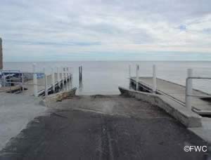
CATEGORIES: Landing
LAYER: Brochure
GPS: 29.13593, -83.02934
OWNERSHIP: Public, City of Cedar Key
ACCESS: Yes, Ramp: Concrete, DOCK, RESTROOMS, PARKING: Launching fees are payable at the automated kiosks.
WATER BODY: Gulf of Mexico
ADDRESS: A St., south of First Street, Cedar Key, FL 32625, Levy County.
DESCRIPTION: 2 launching lanes & courtesy docks.
WEBSITE: https://www.saltchef.com/catch_fish/FL/Levy/boat_ramps.html
PHOTOSET: https://www.saltchef.com/catch_fish/FL/Levy/boat_ramps.html
PHOTO SOURCE: FWC
Suggestions: https://forms.gle/DipPgU2TP5atc2Rf9
Cedar Key City Beach Park
CATEGORIES: Landing
LAYER: Brochure
GPS: 29.1369, -83.0296
OWNERSHIP: Public, City of Cedar Key
ACCESS: Yes, Launch: beach, CANOE, FOOD, WATER, RESTROOMS, PARKING
WATER BODY: Gulf of Mexico
ADDRESS: Lil Shark Park, 192 2nd St, Cedar Key, FL 32625, Levy County.
DESCRIPTION: “”The landing at Cedar Key City Beach Park is at the left end of the beach, by the kayak rental area. The historic town of Cedar Key is well worth a day or two of exploration. At charming Cedar Key, you can buy groceries, eat in a variety of restaurants, visit a museum, and peruse numerous shops.””
WEBSITE: https://floridadep.gov/sites/default/files/Seg_6_text_CT%20July%202023.pdf
OTHER REFERENCE: https://floridadep.gov/sites/default/files/Seg_6_text_CT%20July%202023.pdf
Suggestions: https://forms.gle/DipPgU2TP5atc2Rf9
North Launch Ichetucknee S.S.P. *

CATEGORIES: Landing
LAYER: Brochure
GPS: 29.98292, -82.76053
OWNERSHIP: Public, TIITF/DEP-REC & PARKS, PARCEL 07-6S-16-03790-000 (OTHER)
ACCESS: Yes, Stairs: wooden steps, CANOE, FOOD: Yes: Concession and Restaurant, WATER, RESTROOMS, PARKING: $6, SHELTER, PICNIC AREA, FISH BAIT
WATER BODY: Ichetucknee River
GAUGE: Ichetucknee
MILE: 5.20
ADDRESS: Ichetucknee S.P. North Entrance, 8294 SW Elim Church Rd, Fort White, FL 32038, Columbia County.
DESCRIPTION: Popular summer weekend tubing put-in and winter canoe and kayak put-in. * Paddlers are permitted to take food and drink on the Ichetucknee River in non-disposable containers only. Canoes and kayaks use during weekdays during summer season due to high volume of tubing traffic. Canoes and kaysks must yield right of way to tubers.
DOWNSTREAM: 2.04 miles from North Launch Ichetucknee S.S.P. to Dampier’s Landing
PHOTO: https://wwals.net/pictures/2020-01-20–ichetucknee-santa-fe-pictures/20200120_104549.jpg
PHOTOSET: https://wwals.net/pictures/2020-01-20–ichetucknee-santa-fe-pictures/
PHOTO SOURCE: John S. Quarterman
PHONE NUMBER: (229) 242-0102
Suggestions: https://forms.gle/DipPgU2TP5atc2Rf9
Midpoint Launch

CATEGORIES: Landing
LAYER: Point of Interest
GPS: 29.9641, -82.7637
OWNERSHIP: Public
ACCESS: Yes, Stairs: Dock, DOCK, PARKING: $6
WATER BODY: Ichetucknee River
GAUGE: Ichetucknee
MILE: 3.69
ADDRESS: Ichetucknee S.P. North Entrance, 8294 SW Elim Church Rd, Fort White, FL 32038, then right down to the river. Columbia County.
DESCRIPTION: Tubing put-in only.
PHOTO: https://wwals.net/pictures/2020-01-20–ichetucknee-santa-fe-pictures/20200120_113437.jpg
PHOTOSET: https://wwals.net/pictures/2020-01-20–ichetucknee-santa-fe-pictures/
PHOTO SOURCE: John S. Quarterman
PHONE NUMBER: (229) 242-0102
Suggestions: https://forms.gle/DipPgU2TP5atc2Rf9
Dampier’s Landing *

CATEGORIES: Landing
LAYER: Brochure
OWNERSHIP: Public, TIITF/DEP-REC & PARKS, PARCEL 13-6S-15-00506-000 (OTHER)
ACCESS: Yes, Stairs: Dock, DOCK, CANOE, PARKING: $6, SHELTER, PICNIC AREA
WATER BODY: Ichetucknee River
GAUGE: Ichetucknee
MILE: 3.16
ADDRESS: About a 10 minute walk from parking lot at South Entrance, 11627 SW Us Highway 27, Fort White, Florida 32071, Columbia County.
DESCRIPTION: 2/3 of the way between North and South Ichetucknee S.P. river entrances. * Paddlers are permitted to take food and drink on the Ichetucknee River in non-disposable containers only.
WEBSITE: https://floridadep.gov/sites/default/files/IchetuckneeGUIDE_0.pdf
UPSTREAM: 2.04 miles from Dampier’s Landing to North Launch Ichetucknee S.S.P.
DOWNSTREAM: 1.05 miles from Dampier’s Landing to South Launch Ichetucknee S.S.P.
PHOTO: https://wwals.net/pictures/2020-01-20–ichetucknee-santa-fe-pictures/20200120_114722.jpg
PHOTOSET: https://wwals.net/pictures/2020-01-20–ichetucknee-santa-fe-pictures/
PHOTO SOURCE: John S. Quarterman
PHONE NUMBER: (229) 242-0102
Suggestions: https://forms.gle/DipPgU2TP5atc2Rf9
South Launch Ichetucknee S.S.P. *
CATEGORIES: Landing
LAYER: Brochure
OWNERSHIP: Public, TIITF/DEP-REC & PARKS, PARCEL 23-6S-15-00508-000 (OTHER)
ACCESS: Yes, Stairs: wooden steps, CANOE, FOOD: Yes: Concession and Restaurant, WATER, RESTROOMS, PARKING: $6, SHELTER, PICNIC AREA
WATER BODY: Ichetucknee River
GAUGE: Ichetucknee
MILE: 2.11
ADDRESS: Ichetucknee S.P. South Entrance, 11627 SW Us Highway 27, Fort White, Florida 32071, Columbia County.
DESCRIPTION: Popular summer weekend tubing put-in and winter canoe and kayak put-in. * Paddlers are permitted to take food and drink on the Ichetucknee River in non-disposable containers only. Paddle craft only in winter months after Labor Day and before Memorial Day. Closed to paddle craft in summer due to tubers.
UPSTREAM: 1.05 miles from South Launch Ichetucknee S.S.P. to Dampier’s Landing
DOWNSTREAM: 3.99 miles from South Launch Ichetucknee S.S.P. to North Launch Ichetucknee S.S.P.
PHOTOSET: https://www.naturalnorthflorida.com/things-to-do/ichetucknee-springs-state-park/
PHOTO SOURCE: Visit Natural North Florida
PHONE NUMBER: (850) 290-2350
Suggestions: https://forms.gle/DipPgU2TP5atc2Rf9
South Launch Ichetucknee S.S.P. GPS *

CATEGORIES: Landing
LAYER: Point of Interest
GPS: 29.9547, -82.7846
OWNERSHIP: Public, TIITF/DEP-REC & PARKS, PARCEL 23-6S-15-00508-000 (OTHER)
ACCESS: Yes, Stairs: wooden steps, CANOE, FOOD: Yes: Concession and Restaurant, WATER, RESTROOMS, PARKING: $6, SHELTER, PICNIC AREA
WATER BODY: Ichetucknee River
GAUGE: Ichetucknee
MILE: 2.11
ADDRESS: Ichetucknee S.P. South Entrance, 11627 SW Us Highway 27, Fort White, Florida 32071, Columbia County.
DESCRIPTION: Popular summer weekend tubing put-in and winter canoe and kayak put-in. * Paddlers are permitted to take food and drink on the Ichetucknee River in non-disposable containers only. Paddle craft only in winter months after Labor Day and before Memorial Day. Closed to paddle craft in summer due to tubers.
PHOTO: https://wwals.net/pictures/2020-01-20–ichetucknee-santa-fe-pictures/20200120_130140.jpg
PHOTOSET: https://wwals.net/pictures/2020-01-20–ichetucknee-santa-fe-pictures/
PHOTO SOURCE: John S. Quarterman
PHONE NUMBER: (229) 242-0102
Suggestions: https://forms.gle/DipPgU2TP5atc2Rf9
Three Rivers Park

CATEGORIES: Landing Private
LAYER: Point of Interest
GPS: 29.94976, -82.78829
OWNERSHIP: Private, Three Rivers Estates Property Owners, INC
ACCESS: Launch: Riverbank
WATER BODY: Ichetucknee River
GAUGE: Ichetucknee
MILE: 1.62
ADDRESS: Private Park, 404 SW Riverside Ave., Fort White, FL 32038, Columbia County.
DESCRIPTION: Private TREPO park. (386) 497-3320, info@trepo.net
WEBSITE: https://trepo.net/parks/
PHOTO: https://wwals.net/pictures/2020-01-20–ichetucknee-santa-fe-pictures/20200120_132722.jpg
PHOTOSET: https://wwals.net/pictures/2020-01-20–ichetucknee-santa-fe-pictures/
PHOTO SOURCE: John S. Quarterman
PHONE NUMBER: (229) 242-0102
Suggestions: https://forms.gle/DipPgU2TP5atc2Rf9
Hodor Park

CATEGORIES: Landing Private
LAYER: Point of Interest
OWNERSHIP: Private, Three Rivers Estates Property Owners, INC
ACCESS: Launch: Riverbank
WATER BODY: Ichetucknee River
GAUGE: Ichetucknee
MILE: 1.60
ADDRESS: Private Park, 404 SW Riverside Ave., Fort White, FL 32038, Columbia County.
DESCRIPTION: Private TREPO park. (386) 497-3320, info@trepo.net
WEBSITE: https://trepo.net/parks/hodor/
PHOTO: https://trepo.net/wp-content/uploads/2021/01/32559.jpg?quality=100.3022022316132
PHOTOSET: https://trepo.net/parks/hodor/
PHOTO SOURCE: TREPO
PHONE NUMBER: (386) 497-3320
Suggestions: https://forms.gle/DipPgU2TP5atc2Rf9
Point Park

CATEGORIES: Landing Private
LAYER: Point of Interest
OWNERSHIP: Private, Three Rivers Estates Property Owners, INC
ACCESS: Launch: Riverbank
WATER BODY: Ichetucknee River
GAUGE: Ichetucknee
MILE: 0.23
ADDRESS: Private Park, 2810 SW Santa Fe Dr, Fort White, FL 32038, Columbia County.
DESCRIPTION: Private TREPO park. (386) 497-3320, info@trepo.net
WEBSITE: https://trepo.net/parks/
OTHER REFERENCE: https://nicelocal.com/florida/entertainment/point_park_a_trepo_park/
PHOTO: https://wwals.net/pictures/2020-01-20–ichetucknee-santa-fe-pictures/20200120_140115.jpg
PHOTOSET: https://wwals.net/pictures/2020-01-20–ichetucknee-santa-fe-pictures/
PHOTO SOURCE: John S. Quarterman
PHONE NUMBER: (229) 242-0102
Suggestions: https://forms.gle/DipPgU2TP5atc2Rf9
Sampson and Rowell Lake Boat Ramp
CATEGORIES: Landing
LAYER: Brochure
OWNERSHIP: Public
ACCESS: Yes, Ramp: Concrete, RESTROOMS, PARKING: Free
WATER BODY: Rowell to Sampson Run 03110206000236
GAUGE: Lake Sampson near Starke
ADDRESS: 14300 Southwest 75th Avenue, Starke, FL 32091, at the end of the road, west (downstream) of the railroad bridge, on the right (north) bank of the waterway. Bradford County.
DESCRIPTION: Just upstream from Lake Sampson on the waterway from Lake Rowell.
WEBSITE: https://www.bradfordcountyfl.gov/parks
OTHER REFERENCE: https://www.google.com/maps/place/29%C2%B055’19.7%22N+82%C2%B010’20.1%22W/@29.9219695, -82.1723544, 209m/data=!3m1!1e3!4m4!3m3!8m2!3d29.9221389!4d-82.17225?entry=ttu
PHOTO: https://maps.app.goo.gl/1b1B8EgZk8foxVUA8
PHOTOSET: https://www.google.com/maps/place/29%C2%B055’19.7%22N+82%C2%B010’20.1%22W/@29.9228945, -82.1719992, 676m/data=!3m1!1e3!4m4!3m3!8m2!3d29.9221389!4d-82.17225?entry=ttu
PHOTO SOURCE: Google Streetview
PHONE NUMBER: (850) 290-2350
Suggestions: https://forms.gle/DipPgU2TP5atc2Rf9
Hampton Lake Boat Ramp
CATEGORIES: Landing
LAYER: Brochure
OWNERSHIP: Public
ACCESS: Yes, Ramp: Concrete, PARKING: Free
WATER BODY: Hampton Lake
ADDRESS: West End of Southwest 101st Street, Hampton, FL 32044, Bradford County.
DESCRIPTION: On a narrow paved road with parking on each side for trucks and boat trailers.
WEBSITE: https://www.bradfordcountyfl.gov/parks
OTHER REFERENCE: https://www.google.com/maps/place/29%C2%B051’50.9%22N+82%C2%B009’42.4%22W/@29.8641442, -82.1616408, 1352m/data=!3m1!1e3!4m4!3m3!8m2!3d29.8641389!4d-82.1617778?entry=ttu
PHOTO: https://maps.app.goo.gl/Si7B2Yni9iizRHk3A
PHOTOSET: https://www.google.com/maps/place/29%C2%B051’50.9%22N+82%C2%B009’42.4%22W/@29.8641442, -82.1616408, 1352m/data=!3m1!1e3!4m4!3m3!8m2!3d29.8641389!4d-82.1617778?entry=ttu
PHOTO SOURCE: Google Streetview
PHONE NUMBER: (850) 290-2350
Suggestions: https://forms.gle/DipPgU2TP5atc2Rf9
Santa Fe Lake Boat Ramp
CATEGORIES: Landing
LAYER: Brochure
OWNERSHIP: Public
ACCESS: Yes, Ramp: Concrete, PARKING: Free
WATER BODY: Lake Santa Fe
GAUGE: Earleton
MILE: 82.00
ADDRESS: 42500 Northeast State Road 26, Melrose, FL 32666, Alachua County.
DESCRIPTION: On a wide paved entrance and parking road, on the southeast side of the lake.
AKA: Lake Santa Fe Boat Ramp
WEBSITE: https://www.bradfordcountyfl.gov/parks
PHOTO: https://maps.app.goo.gl/SEaFiimatCJcmifh6
PHOTOSET: https://www.google.com/maps/place/29%C2%B042’48.2%22N+82%C2%B003’48.1%22W/@29.7133028, -82.0633432, 5417m/data=!3m1!1e3!4m4!3m3!8m2!3d29.7133889!4d-82.0633611?entry=ttu
PHOTO SOURCE: Google Streetview
PHONE NUMBER: (850) 290-2350
Suggestions: https://forms.gle/DipPgU2TP5atc2Rf9
Little Lake Santa Fe Boat Ramp
CATEGORIES: Landing
LAYER: Brochure
OWNERSHIP: Public
ACCESS: Yes, Ramp: Concrete, RESTROOMS, PARKING: Free
WATER BODY: Little Lake Santa Fe
GAUGE: Earleton
MILE: 80.00
ADDRESS: 3858 Southeast 20th Avenue, Keystone Heights, FL 32656, west of the road, east of the lake. Bradford County.
DESCRIPTION: On a gravelled entrance and parking area.
AKA: Little Santa Fe Lake Boat Ramp
WEBSITE: https://www.bradfordcountyfl.gov/parks
OTHER REFERENCE: https://www.google.com/maps/place/Little+Santa+Fe+Lake+Boat+Ramp/@29.7730588, -82.0782891, 169m/data=!3m1!1e3!4m6!3m5!1s0x88e605049a100321:0x677e971d2f1be1ba!8m2!3d29.7737617!4d-82.078247!16s%2Fg%2F11c19qm086?entry=ttu
PHOTO: https://maps.app.goo.gl/RxyEWLA5YNWVNuet7
PHOTOSET: https://www.google.com/maps/place/Little+Santa+Fe+Lake+Boat+Ramp/@29.7730588, -82.0782891, 169m/data=!3m1!1e3!4m6!3m5!1s0x88e605049a100321:0x677e971d2f1be1ba!8m2!3d29.7737617!4d-82.078247!16s%2Fg%2F11c19qm086?entry=ttu
PHOTO SOURCE: Google Streetview
PHONE NUMBER: (850) 290-2350
Suggestions: https://forms.gle/DipPgU2TP5atc2Rf9
Worthington Springs Ramp @ FL 121
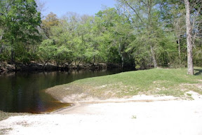
CATEGORIES: Landing
LAYER: Brochure
OWNERSHIP: Public
ACCESS: Yes, Ramp: Concrete
WATER BODY: Santa Fe River
GAUGE: Worthington Springs
MILE: 49.10
ADDRESS: The boat ramp is on the northwest side of SR 121 and the Santa Fe River. Union County.
DESCRIPTION: But “”a difficult place to navigate; shallow and swampy.”” —Joanne Tremblay
WEBSITE: http://www.mysuwanneeriver.com/64/Boating-Canoeing
DOWNSTREAM: 12 miles from Worthington Springs Ramp to Bible Camp Road Ramp
PHOTO SOURCE: SRWMD
Suggestions: https://forms.gle/DipPgU2TP5atc2Rf9
Palestine Lake Boat Ramp
CATEGORIES: Landing
LAYER: Other
GPS: 30.11711484, -82.39739653
OWNERSHIP: Public
ACCESS: Yes, Ramp: Gravel on a dirt access road, PARKING: Free
WATER BODY: Palestine Lake
ADDRESS: At the end of 66th Street SW, on the east side of the lake. Union County.
DESCRIPTION: Gravel ramp on a dirt access road. “”Although the lake is large the ramp is best suited for small boats. The unpaved access can be rough. The lake can be choppy if the wind picks up.”” —FWC
AKA: Palestine Lake Public Boat Ramp (Small Boats)
WEBSITE: https://boatzia.com/florida/union/palestine-lake-boat-ramp-ne-66th-street/
PHOTOSET: https://www.google.com/maps/place/Palestine+Lake/@30.1170641, -82.3983803, 366m/data=!3m1!1e3!4m6!3m5!1s0x88ef4ff4c1acc921:0xd361c59828e0f4ee!8m2!3d30.1154511!4d-82.4075526!16s%2Fg%2F1hhjddx50?entry=ttu
PHOTO SOURCE: Googlemaps
Suggestions: https://forms.gle/DipPgU2TP5atc2Rf9
Swift Creek Pond Canoe Launch
CATEGORIES: Landing
LAYER: Other
OWNERSHIP: Public
ACCESS: Yes, Launch: Pond bank on a dirt access road, PARKING: Free
WATER BODY: Swift Creek
ADDRESS: CR 238 at NE 197th Loop, Lake Butler Florida 32054. on the east side of the pond. Union County.
DESCRIPTION: Pond bank on a dirt access and parking road. “”This undeveloped access site is on private property. Please respect the land and the lake so the owners do not have to fence off the access. If posted do not trespass.”” —FWC
AKA: Swift Creek Pond Canoe Access
WEBSITE: https://gis.myfwc.com/BoatRampFinder/
PHOTO: https://maps.app.goo.gl/rhDH8htReKysAckWA
PHOTOSET: https://www.google.com/maps/search/Swift+Creek+Pond+Primitive+Boat+Ramp+-+County+Road+238+at+NW+167th+Terrace/@30.1211734, -82.2903041, 169m/data=!3m1!1e3?entry=ttu
PHOTO SOURCE: Google Streetview
PHONE NUMBER: (850) 290-2350
Suggestions: https://forms.gle/DipPgU2TP5atc2Rf9
Swift Creek Pond Primitive Boat Ramp
CATEGORIES: Landing
LAYER: Other
OWNERSHIP: Public
ACCESS: Yes, Ramp: Gravel on a dirt access road, PARKING: Free
WATER BODY: Swift Creek
ADDRESS: CR 238 at NW 167th Terrace, Swift Creek Pond, Lake Butler Florida 32054. on the southeast side of the pond. Union County.
DESCRIPTION: A gravel ramp on a dirt access and parking road. “”This undeveloped access site is on private property. Please respect the land and the lake so the owners do not have to fence off the access. If posted do not trespass. For small trailer boats, 4×4 might help. Best for canoes.”” —FWC
AKA: Swift Creek Pond Small Boat Access
OTHER REFERENCE: https://gis.myfwc.com/BoatRampFinder/
PHOTO: https://maps.app.goo.gl/SFdTCQATdDnPG2Tm8
PHOTOSET: https://www.google.com/maps/search/Swift+Creek+Pond+Primitive+Boat+Ramp+-+County+Road+238+at+NW+167th+Terrace/@30.1177293, -82.2928575, 674m/data=!3m1!1e3?entry=ttu
PHOTO SOURCE: Google Streetview
PHONE NUMBER: (850) 290-2350
Suggestions: https://forms.gle/DipPgU2TP5atc2Rf9
Lakeside Park Public Boat Ramp
CATEGORIES: Landing
LAYER: Brochure
GPS: 30.02661825, -82.33983039
OWNERSHIP: Public, LAKE BUTLER CITY OF, PARCEL 30-05-20-00-000-0100-0 (1106) 04
ACCESS: Yes, Ramp: Concrete on a paved access road, RESTROOMS, SHELTER, PICNIC AREA
WATER BODY: Butler Lake
ADDRESS: NW 2nd Ave., on the south side of the lake, next to the community center at 155 NW 3rd St, Lake Butler, FL 32054. Union County.
DESCRIPTION: A concrete map on a paved access road and parking area, with flush toilet. Government Owned for General Public Use.
AKA: Lake Butler Boat Ramp
WEBSITE: https://gis.myfwc.com/BoatRampFinder/
OTHER REFERENCE: https://boatzia.com/florida/union/lakeside-park-public-boat-ramp/
PHOTO: https://maps.app.goo.gl/SdZyft3QHShwyQYt5
PHOTOSET: https://www.google.com/maps/place/30%C2%B001’35.8%22N+82%C2%B020’23.4%22W/@30.0265447, -82.3397393, 1350m/data=!3m1!1e3!4m4!3m3!8m2!3d30.0266182!4d-82.3398304?entry=ttu
PHOTO SOURCE: Google Streetview
PHONE NUMBER: (850) 290-2350
Suggestions: https://forms.gle/DipPgU2TP5atc2Rf9
Bible Camp Road Ramp @ US 41

CATEGORIES: Landing
LAYER: Brochure
OWNERSHIP: Public, TIITF/DEP-REC & PARKS, PARCEL 36-6S-17-09862-000
ACCESS: Yes, Ramp: Concrete on dirt access road. PARKING: Free
WATER BODY: Santa Fe River
GAUGE: O’Leno
MILE: 37.10
ADDRESS: From High Springs, travel north on US 41 to SE Sprite Loop; turn right; travel north to SE Bible Camp Street and follow road to boat ramp on the right bank, just downstream from the I-75 bridge. Columbia County.
DESCRIPTION: Run by Columbia County on land owned by the State of Florida.
WEBSITE: http://www.mysuwanneeriver.com/64/Boating-Canoeing
OTHER REFERENCE: https://www.youtube.com/watch?v=u-SB7D7P8a4
UPSTREAM: 12 miles from Bible Camp Road Ramp to Worthington Springs Ramp
DOWNSTREAM: 3.12 miles from Bible Camp Road Ramp to O’Leno Canoe Launch
PHOTO SOURCE: SRWMD
PHOTO2: https://www.floridapaddlenotes.com/wp-content/uploads/2020/02/The-Take-Out-1536×1017.jpg
Photoset2: Florida Paddle Notes
Suggestions: https://forms.gle/DipPgU2TP5atc2Rf9
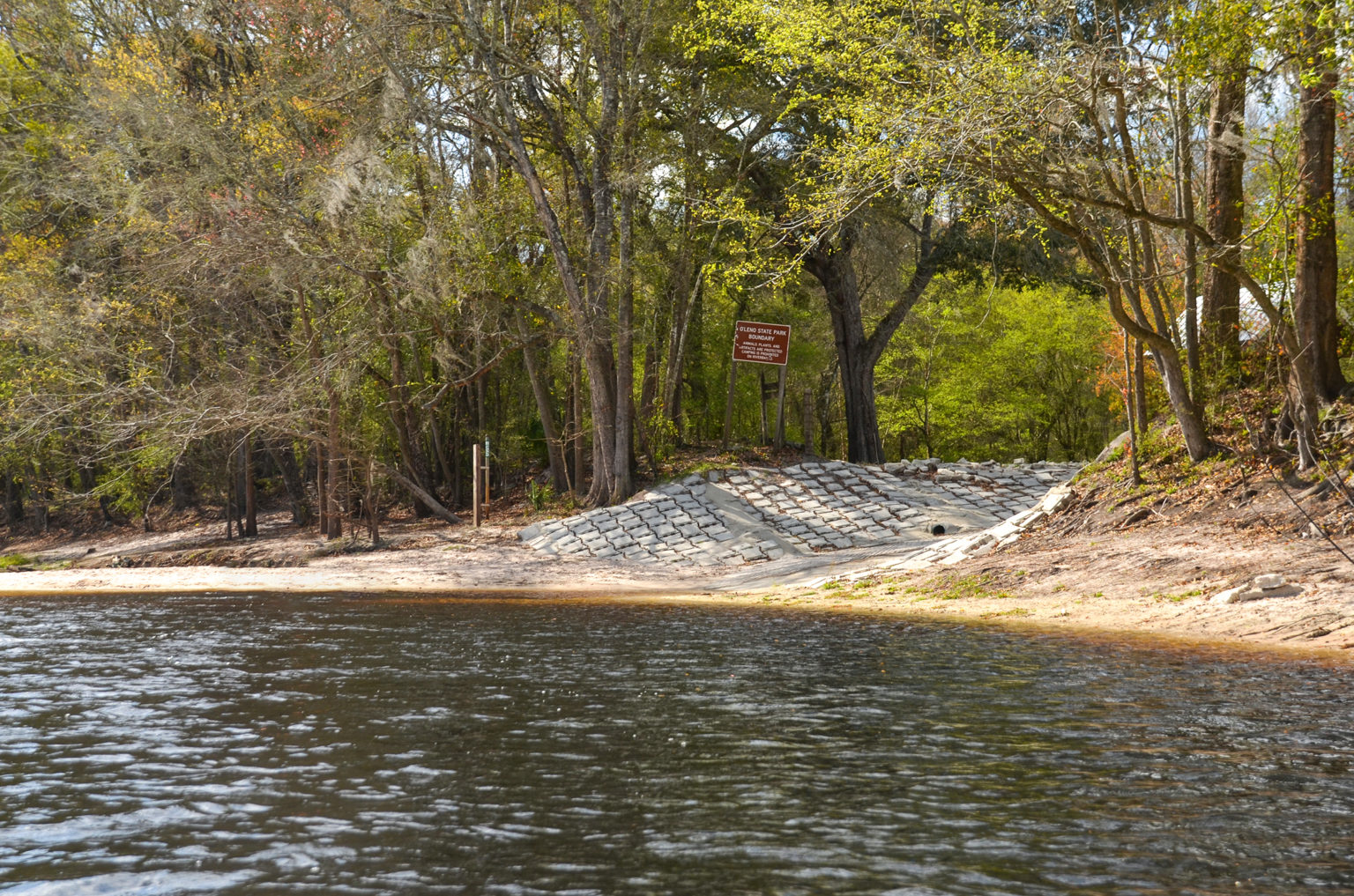
O’Leno Canoe Launch
CATEGORIES: Landing
LAYER: Brochure
GPS: 29.915, -82.5795
OWNERSHIP: Public, TIITF/DEP-REC & PARKS, PARCEL 02-7S-17-09867-000
ACCESS: Yes, Launch: dirt riverside, CAMPING: “Yes: RV, Tent, and Primitive, WATER, RESTROOMS, PARKING: $5, SHELTER, PICNIC AREA, HANDICAPPED ACCESSIBLE
WATER BODY: Santa Fe River
GAUGE: O’Leno
MILE: 33.98
ADDRESS: Right bank, just upstream from the floating swimming dock, in O’Leno State Park, 410 SE O’Leno Park Road, High Springs, FL 32643, Columbia County.
DESCRIPTION: Paddlers must go up river and return, as canoeing down river is prohibited due to the location of the swimming area and the environmental sensitivity of the river sink. Launches are subject to closure based on water levels and will be closed when the river is flooded or when water levels are extremely low. Please contact the ranger station at 386-454-1853 for more information and to inquire about the availability of the launches prior to your visit.
WEBSITE: https://www.floridastateparks.org/parks-and-trails/oleno-state-park
UPSTREAM: 3.12 miles from O’Leno Canoe Launch to Bible Camp Road Ramp
DOWNSTREAM: 6.38 miles from O’Leno Canoe Launch to High Springs Ramp
Suggestions: https://forms.gle/DipPgU2TP5atc2Rf9
High Springs Ramp @ NW 210 Lane
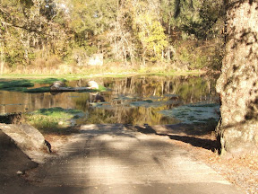
CATEGORIES: Landing
LAYER: Brochure
OWNERSHIP: Public
ACCESS: Yes, Ramp: Concrete
WATER BODY: Santa Fe River
GAUGE: Santa Fe River Rise
MILE: 27.60
ADDRESS: From High Springs, travel north on US 41 to NW 210 Lane; turn left and follow road to boat ramp. Alachua County.
DESCRIPTION: A concrete canoe and kayak ramp on a paved access road.
WEBSITE: http://www.mysuwanneeriver.com/64/Boating-Canoeing
UPSTREAM: 6.38 miles from High Springs Ramp to O’Leno Canoe Launch
DOWNSTREAM: 3.00 miles from High Springs Ramp to US 27 Ramp
PHOTO SOURCE: SRWMD
Suggestions: https://forms.gle/DipPgU2TP5atc2Rf9
US 27 Ramp @ US 27

CATEGORIES: Landing
LAYER: Brochure
GPS: 29.844121, -82.6309
OWNERSHIP: Public
ACCESS: Yes, Ramp: Concrete
WATER BODY: Santa Fe River
GAUGE: Santa Fe River Rise
MILE: 24.60
ADDRESS: From High Springs, travel north on US 27 crossing the Santa Fe River and the boat ramp is on the right. Columbia County.
DESCRIPTION: The ramp is in poor shape, can be an axle breaker.
AKA: River Rise Ramp
WEBSITE: http://www.mysuwanneeriver.com/64/Boating-Canoeing
UPSTREAM: 3.00 miles from US 27 Ramp to High Springs Ramp
DOWNSTREAM: 2.10 miles from US 27 Ramp to Poe Springs Ramp
PHOTO: https://www.wwals.net/pictures/2024-01-04–wq/2024-01-04–SF27–1.5.24-7.jpg
PHOTOSET: https://www.wwals.net/pictures/2024-01-04–wq/
PHOTO SOURCE: Joanne Tremblay
PHONE NUMBER: (850) 290-2350
PHOTO2 SOURCE: SRWMD
Suggestions: https://forms.gle/DipPgU2TP5atc2Rf9
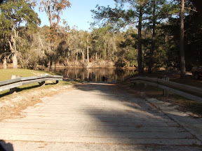
Poe Springs Ramp @ CR 340
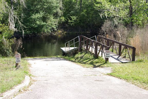
CATEGORIES: Landing
LAYER: Brochure
OWNERSHIP: Public
ACCESS: Yes, Ramp: Concrete
WATER BODY: Santa Fe River
GAUGE: Poe Springs
MILE: 22.50
ADDRESS: From High Springs, travel south on CR 236 to CR 340; turn right and travel 3 miles west; the entrance to Poe Springs is on the right. Alachua County.
DESCRIPTION: County park, admission may be required when staffed.
WEBSITE: http://www.mysuwanneeriver.com/64/Boating-Canoeing
UPSTREAM: 2.10 miles from Poe Springs Ramp to US 27 Ramp
DOWNSTREAM: 1.57 miles from Poe Springs Ramp to Rum Island Ramp
PHOTO SOURCE: SRWMD
Suggestions: https://forms.gle/DipPgU2TP5atc2Rf9
Rum 138 Launch @ Riverland Court
CATEGORIES: Landing Private
LAYER: Other
OWNERSHIP: Private, JIPSON DOUGLAS K & JIPSON MERRILLEE M, PARCEL 36-7S-16-04352-000 (23178)
ACCESS: Yes, Launch: Unknown
WATER BODY: Santa Fe River
GAUGE: Poe Springs
MILE: 21.30
ADDRESS: 460 SW Riverland Ct, Ft White, FL 32038, Columbia County.
DESCRIPTION: Private Santa Fe River access a bit upstream from Rum Island, by outfitter Rum 138.
WEBSITE: https://rum138.com/
OTHER REFERENCE: https://oursantaferiver.org/kayaktivism-sat-may-29-11am-2pm-on-the-river-by-ginnie-springs-campground/
PHONE NUMBER: (386) 454-4247
Suggestions: https://forms.gle/DipPgU2TP5atc2Rf9
Rum Island Ramp @ CR 138
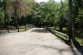
CATEGORIES: Landing
LAYER: Brochure
OWNERSHIP: Public
ACCESS: Yes, Ramp: Concrete
WATER BODY: Santa Fe River
GAUGE: Poe Springs
MILE: 20.93
ADDRESS: From Ft. White, travel south on SR 47 to CR 138; turn left; travel east to SW Rum Island Terrace; turn right and follow road to ramp. Columbia County.
DESCRIPTION: County park, must pay admission to get in: $5 per vehicle. https://www.columbiacountyfla.com/ParksandRecreation.asp
WEBSITE: http://www.mysuwanneeriver.com/64/Boating-Canoeing
OTHER REFERENCE: https://www.columbiacountyfla.com/ParksandRecreation.asp
UPSTREAM: 1.57 miles from Rum Island Ramp to Poe Springs Ramp
DOWNSTREAM: 1.68 miles from Rum Island Ramp to Ginnie Springs Ramp
PHOTO SOURCE: SRWMD
Suggestions: https://forms.gle/DipPgU2TP5atc2Rf9
Ginnie Springs Ramp @ NE 60th Ave.
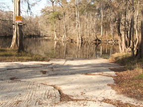
CATEGORIES: Landing
LAYER: Brochure
OWNERSHIP: Public, WRAY SPRING LAND TRUST, LLC, PARCEL 34-07-16-0000-0001-0000
ACCESS: Yes, Ramp: Concrete
WATER BODY: Santa Fe River
GAUGE: Fort White
MILE: 19.25
ADDRESS: From Ft. White, travel south to CR 340; turn left; travel east to NE 60th Avenue; turn left and follow road to park. Gilchrist County.
DESCRIPTION: Inside the Private Ginnie Springs Park; entry payment required. https://ginniespringsoutdoors.com/admission-pricing/
WEBSITE: http://www.mysuwanneeriver.com/64/Boating-Canoeing
OTHER REFERENCE: https://ginniespringsoutdoors.com/admission-pricing/
UPSTREAM: 1.68 miles from Ginnie Springs Ramp to Rum Island Ramp
DOWNSTREAM: 0.51 mile from Ginnie Springs Ramp to Eddins Boat Ramp
PHOTO SOURCE: SRWMD
Suggestions: https://forms.gle/DipPgU2TP5atc2Rf9
Eddins Boat Ramp

CATEGORIES: Landing
LAYER: Brochure
OWNERSHIP: Public, Gilchrist County, PARCEL 27-07-16-0000-0004-0000
ACCESS: Yes, Ramp: Unknown, PARKING: Free but limited space
WATER BODY: Santa Fe River
GAUGE: Fort White
MILE: 18.74
ADDRESS: I-75 Exit 423, south on US 47 through Fort White, cross the Santa Fe River, left on NE 65th St., left on NE 55th Ave., right on NE 70th St. to its end; left bank of the river. Gilchrist County.
DESCRIPTION: “”¼ acre park just past Ginnie Springs, on the South side of the river.”” “”This is a beautiful little pocket park bordering Ginnie Springs Recreational Complex. Its a great place to put in if you want to avoid the insanity of people partying at Ginnie. There is a tight turn around area, and a rough muddy landing. There is no trash recepticals. There were a couple of bonfire spots.”” —Joanne Tremblay
UPSTREAM: 0.51 mile from Eddins Boat Ramp to Ginnie Springs Ramp
DOWNSTREAM: 2.94 miles from Eddins Boat Ramp to FL 47 Ramp
PHOTO: https://www.wwals.net/pictures/2024-01-04–wq/2024-01-04–eddins–1.5.24-2.jpg
PHOTOSET: https://www.wwals.net/pictures/2024-01-04–wq/
PHOTO SOURCE: Joanne Tremblay
PHONE NUMBER: (850) 290-2350
Suggestions: https://forms.gle/DipPgU2TP5atc2Rf9
FL 47 Ramp @ FL 47
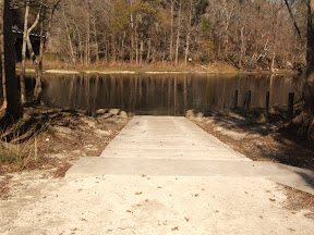
CATEGORIES: Landing
LAYER: Brochure
OWNERSHIP: Public
ACCESS: Yes, Ramp: Concrete
WATER BODY: Santa Fe River
GAUGE: Fort White
MILE: 15.80
ADDRESS: From Ft. White, travel south on SR 47; cross the Santa Fe River and the boat ramp is on the left in the county park. Gilchrist County.
DESCRIPTION: County park admission fee required Friday through Sunday.
AKA: Santa Fe River County Park Ramp, Santa Fe River Gilchrist County Park Ramp
WEBSITE: http://www.mysuwanneeriver.com/64/Boating-Canoeing
UPSTREAM: 2.94 miles from FL 47 Ramp to Eddins Boat Ramp
DOWNSTREAM: 0.50 mile from FL 47 Ramp to Hollingsworth Bluff Ramp
PHOTO SOURCE: SRWMD
Suggestions: https://forms.gle/DipPgU2TP5atc2Rf9
Hollingsworth Bluff Ramp

CATEGORIES: Landing
LAYER: Brochure
OWNERSHIP: Public
ACCESS: Yes, Ramp: Concrete
WATER BODY: Santa Fe River
GAUGE: Fort White
MILE: 15.30
ADDRESS: From Ft. White, travel south on SR 47 to CR 138; turn right; travel west to NE 2nd Way; turn right and follow road to boat ramp on the right. Columbia County.
WEBSITE: http://www.mysuwanneeriver.com/64/Boating-Canoeing
UPSTREAM: 0.50 mile from Hollingsworth Bluff Ramp to FL 47 Ramp
DOWNSTREAM: 2.70 miles from Hollingsworth Bluff Ramp to BW Turner Boat Ramp
PHOTO SOURCE: SRWMD
Suggestions: https://forms.gle/DipPgU2TP5atc2Rf9
BW Turner Boat Ramp

CATEGORIES: Landing
LAYER: Brochure
GPS: 29.89669, -82.763392
OWNERSHIP: Public, Gilchrist County, PARCEL 12-07-15-0000-0012-0000
ACCESS: Yes, Ramp: Concrete
WATER BODY: Santa Fe River
GAUGE: Fort White
MILE: 12.60
ADDRESS: From Ft. White, travel south on SR 47 to CR 138; turn right; travel west to NE 100 Street; turn right and follow road to NE 25 Avenue; turn left; turn right on NE 108th Place; follow that to the end. Gilchrist County.
DESCRIPTION: It’s in a 1.43 acre Gilchrist County park, and so may require an admission fee.
AKA: Santa Fe River Ramp
WEBSITE: http://www.mysuwanneeriver.com/64/Boating-Canoeing
OTHER REFERENCE: https://qpublic.schneidercorp.com/Application.aspx?AppID=820&LayerID=15174&PageTypeID=4&PageID=6883&KeyValue=12-07-15-0000-0012-0000
UPSTREAM: 2.70 miles from BW Turner Boat Ramp to Hollingsworth Bluff Ramp
DOWNSTREAM: 1.90 miles from BW Turner Boat Ramp to Ira Bea Oasis Ramp
PHOTO SOURCE: SRWMD
Suggestions: https://forms.gle/DipPgU2TP5atc2Rf9
Ira Bea Oasis Ramp @ NE 2nd Way

CATEGORIES: Landing
LAYER: Brochure
OWNERSHIP: Public, Gilchrist County, PARCEL 01-07-15-0000-0001-0000
ACCESS: Yes, Ramp: Concrete on gravel access road with parking, PARKING: Free
WATER BODY: Santa Fe River
GAUGE: Fort White
MILE: 10.70
ADDRESS: From Ft. White, travel south on SR 47 to CR 138; turn right; travel west to NE 2nd Way; turn right and follow road to boat ramp on the right. Gilchrist County.
DESCRIPTION: It’s in a 1.5 acre Gilchrist County park, and so may require an admission fee.
HISTORIC FACTS: Apparently Tudeen Ramp was completely rebuilt 2022-12-22 to the tune of $167, 974.00 in federal funds disbursed by the Florida Fish and Wildlife Conservation Commission. https://facts.fldfs.com/Search/ContractDetail.aspx?AgencyId=770000&ContractId=19027
AKA: Tudeen Boat Ramp
WEBSITE: http://www.mysuwanneeriver.com/64/Boating-Canoeing
OTHER REFERENCE: https://publictest.myfwc.com/LE/boatramp/public/Ramp.aspx?FacilityID=GI10008QS&Name=Tudeen+Boat+Ramp
UPSTREAM: 1.90 miles from Ira Bea Oasis Ramp to BW Turner Boat Ramp
DOWNSTREAM: 8.30 miles from Ira Bea Oasis Ramp to US 129 Ramp
PHOTO SOURCE: SRWMD
Suggestions: https://forms.gle/DipPgU2TP5atc2Rf9
TREPO Columbia County Boat Ramp 
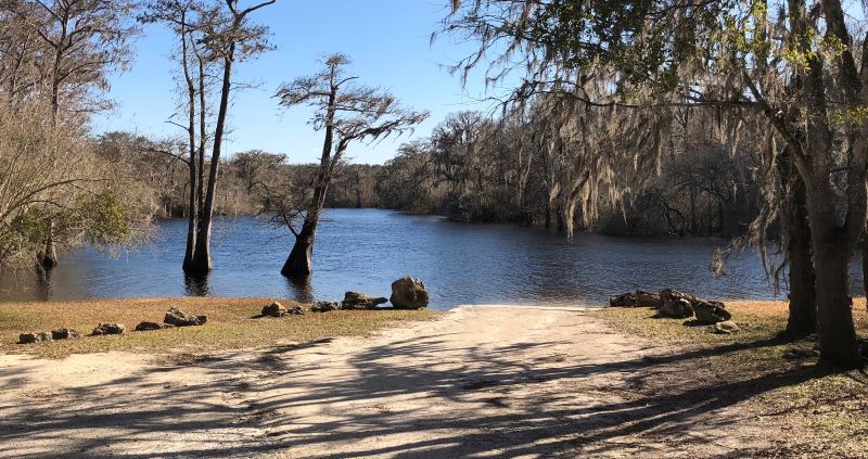
CATEGORIES: Landing Private
LAYER: Point of Interest
OWNERSHIP: Private
ACCESS: Ramp: Concrete
WATER BODY: Santa Fe River
GAUGE: Three Rivers Estates
MILE: 7.74
ADDRESS: Private park, 2322 SW Santa Fe Dr. Fort White, FL. 32038, Columbia County.
DESCRIPTION: Private TREPO park. (386) 497-3320, info@trepo.net “”Gated boat ramp for launching your boat on the Santa Fe River. Sun-up to Sundown. Rules: No extended mooring of watercraft. Mooring and docking are permitted only to launch and retrieve watercraft. No fishing, swimming, cooking, picnicking or sunbathing. Dogs must be kept on a leash, you must clean up after your pets.””
WEBSITE: https://trepo.net/parks/boat-ramp-cc/
PHOTO: https://trepo.net/wp-content/uploads/2021/01/pic9-1.jpeg
PHOTOSET: https://trepo.net/parks/boat-ramp-cc/
PHOTO SOURCE: TREPO
PHONE NUMBER: (386) 497-3320
Suggestions: https://forms.gle/DipPgU2TP5atc2Rf9
TREPO Suwannee County Boat Ramp
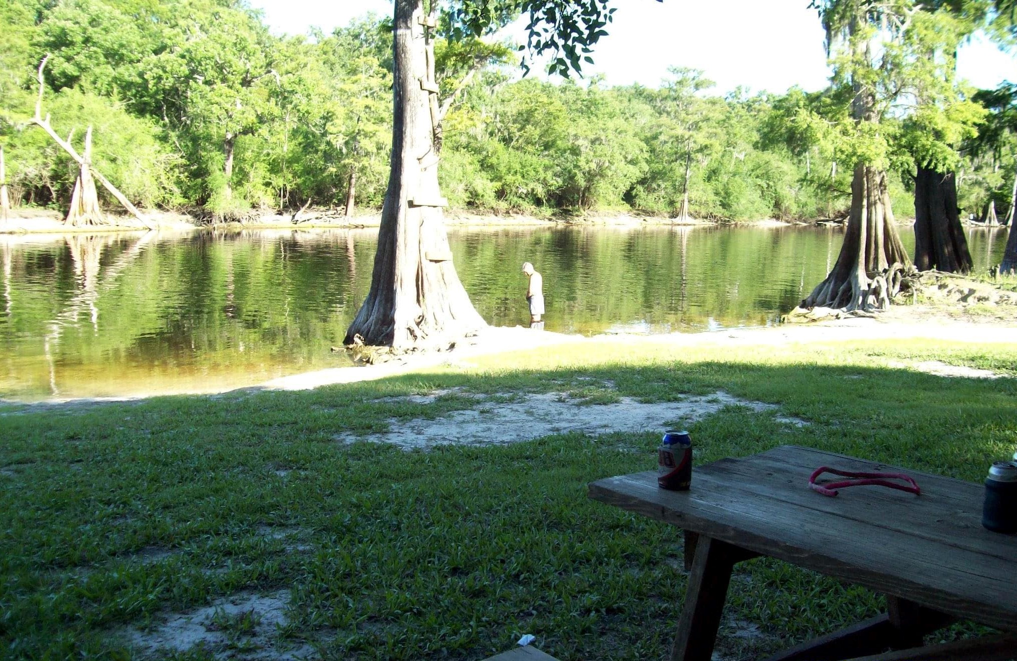
CATEGORIES: Landing Private
LAYER: Point of Interest
GPS: 29.922141, -82.82563
OWNERSHIP: Private, Three Rivers Estates Property Owners, INC
ACCESS: Ramp: Concrete
WATER BODY: Santa Fe River
GAUGE: Three Rivers Estates
MILE: 5.11
ADDRESS: 29046 River Run Rd, Branford, FL 32008, Suwannee County.
DESCRIPTION: Private park. “”No key, no entrance. Parks and facilities are reserved for members and their guests. Members are responsible for their guests.””
WEBSITE: https://trepo.net/parks/boat-ramp-sc/
PHOTO: https://trepo.net/wp-content/uploads/2021/01/boatramp5.jpg
PHOTOSET: https://trepo.net/parks/boat-ramp-sc/
PHOTO SOURCE: TREPO
PHONE NUMBER: (386) 497-3320
Suggestions: https://forms.gle/DipPgU2TP5atc2Rf9
US 129 Ramp @ 296th St.

CATEGORIES: Landing
LAYER: Brochure
OWNERSHIP: Public, SUWANNEE COUNTY, PARCEL 01-07S-14E-04490-000000
ACCESS: Yes, Ramp: Concrete
WATER BODY: Santa Fe River
GAUGE: Hildreth
MILE: 2.40
ADDRESS: From Branford, travel east on US 27; turn right on US 129; travel south to 296th Street; turn right and William Guy Lemons Memorial Park is on the left. Suwannee County.
DESCRIPTION: In a 1.85 acre Suwannee County Park.
AKA: William Guy Lemmon Memorial Park Ramp (Suwannee County), William Guy Lemmons Memorial Park Ramp (SRWMD), Hwy 129 Boat Ramp
WEBSITE: https://boatzia.com/florida/suwannee/william-guy-lemon-park/
OTHER REFERENCE: https://boatzia.com/florida/suwannee/william-guy-lemon-park/
UPSTREAM: 8.30 miles from US 129 Ramp to Ira Bea Oasis Ramp
DOWNSTREAM: 0.30 mile from US 129 Ramp to Sandy Point Campground Ramp
PHOTO: https://www.wwals.net/pictures/2024-03-06–wq/2024-03-06–SF129-other-IMG_4559.jpg
PHOTOSET: https://www.wwals.net/pictures/2024-03-06–wq/#Lemmons
PHOTO SOURCE: Joanne Tremblay
PHONE NUMBER: (850) 290-2350
Suggestions: https://forms.gle/DipPgU2TP5atc2Rf9
Sandy Point Campground Ramp @ 296th St.

CATEGORIES: Landing
LAYER: Brochure
OWNERSHIP: Public, FANNING DEBORAH ELAINE, PARCEL 01-07S-14E-04481-000000
ACCESS: Yes, Ramp: Concrete
WATER BODY: Santa Fe River
GAUGE: Hildreth
MILE: 2.10
ADDRESS: 29685 59th Dr, Branford, FL. From Branford, travel east on US 27; turn right on US 129; travel south to 296th Street; turn right; travel west on 296th Street; Sandy Point Campground is on the left. Suwannee County.
DESCRIPTION: Privately owned. Call for information 386-961-1390 or see facebook page. https://www.facebook.com/profile.php?id=100047676923284
WEBSITE: http://www.mysuwanneeriver.com/64/Boating-Canoeing
OTHER REFERENCE: https://www.facebook.com/profile.php?id=100047676923284
UPSTREAM: 0.30 mile from Sandy Point Campground Ramp to US 129 Ramp
DOWNSTREAM: 0.80 mile from Sandy Point Campground Ramp to Ellie Ray’s River Landing Ramp
PHOTO SOURCE: SRWMD
Suggestions: https://forms.gle/DipPgU2TP5atc2Rf9
Ellie Ray’s River Landing Ramp @ 110th St.
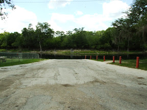
CATEGORIES: Landing
LAYER: Brochure
OWNERSHIP: Public
ACCESS: Yes, Ramp: Concrete
WATER BODY: Santa Fe River
GAUGE: Hildreth
MILE: 1.30
ADDRESS: From Branford, travel east on US 27; turn right on US 129; travel south; cross the Santa Fe River; travel to NW 110th Street; turn right and follow road to boat ramp. Gilchrist County.
DESCRIPTION: A private business that charges for access and has limited boat slips: “”Sitting on the spring fed, Santa Fe River, in North Central Florida, you can Kayak, fish, get a good tan, whatever your flavor, its here because you are on DAY-CATION when you are at Ellie Ray’s!””
WEBSITE: https://www.ellieraysrvresort.com/
UPSTREAM: 0.80 mile from Ellie Ray’s River Landing Ramp to Sandy Point Campground Ramp
DOWNSTREAM: 1.20 miles from Ellie Ray’s River Landing Ramp to Wanamake Ramp
PHOTO SOURCE: SRWMD
Suggestions: https://forms.gle/DipPgU2TP5atc2Rf9
Wanamake Ramp @ NW 38th Court

CATEGORIES: Landing
LAYER: Brochure
OWNERSHIP: Public, Gilchrist County, PARCEL 12-07-14-0000-0008-0000
ACCESS: Yes, Ramp: Concrete
WATER BODY: Santa Fe River
GAUGE: Hildreth
MILE: 0.10
ADDRESS: From Branford, travel east on US 27; turn right on US 129; travel south; cross the Santa Fe River; travel to NW 102nd Place; turn right; travel west to NW 38th Court; turn right and follow road to boat ramp. Gilchrist County.
DESCRIPTION: A Gilchrist County boat ramp on 0.19 acres that apparently charges no fee. Boatzia says it is an unpaved sand ramp and very shallow, so unloading boats from a trailer may be difficult.
AKA: GC Butler Boat Landing or GC Butler Boat Ramp or Butler Ramp
WEBSITE: http://www.mysuwanneeriver.com/64/Boating-Canoeing
UPSTREAM: 1.20 miles from Wanamake Ramp to Ellie Ray’s River Landing Ramp
DOWNSTREAM: 1.02 miles from Wanamake Ramp to Dorothy Land Ramp
PHOTO SOURCE: SRWMD
Suggestions: https://forms.gle/DipPgU2TP5atc2Rf9
Mine
Denali Mine 
CATEGORIES: Mine
LAYER: Brochure
OWNERSHIP: Private, BOURNE REACHER LLC, PARCEL 32-05S-14E-03723-001000
WATER BODY: Suwannee River
MILE: 80.10
ADDRESS: 24401 93rd Dr, O Brien, FL 32071, Suwannee County.
DESCRIPTION: “”Surface Metal Mine specialising in Crushed, Broken Limestone NEC, operated by Denali Mining Inc.””
HISTORIC FACTS: Application FLA187232-005 for an Industrial Wastewater Permit filed with FDEP October 6, 2022.
WEBSITE: https://minesdatabase.com/mines/view/801273
Suggestions: https://forms.gle/DipPgU2TP5atc2Rf9
Obstacle
Annoying Branches 

CATEGORIES: Obstacle
LAYER: Point of Interest
OWNERSHIP: Public, CONSERVATION FUND, PARCEL 177 001
WATER BODY: Suwannee River
GAUGE: Fargo
MILE: 231.78
ADDRESS: A bit more than half a mile downstream from Allen Camp Landing. Clinch County.
DESCRIPTION: They will make you duck, and could tip you over.
WEBSITE: https://www.wwals.net/pictures/2022-12-29–suwannee-pictures/#ABranches
PHOTO: https://www.wwals.net/pictures/2022-12-29–suwannee-pictures/annoyingbranches.jpg
PHOTOSET: https://www.wwals.net/pictures/2022-12-29–suwannee-pictures/#ABranches
PHOTO SOURCE: John S. Quarterman
PHONE NUMBER: (229) 242-0102
Suggestions: https://forms.gle/DipPgU2TP5atc2Rf9
Tight Spot

CATEGORIES: Obstacle
LAYER: Point of Interest
OWNERSHIP: Public, CONSERVATION FUND, PARCEL 156 029
WATER BODY: Suwannee River
GAUGE: Fargo
MILE: 229.85
ADDRESS: About half a mile down from Long Camp Landing. Clinch County.
DESCRIPTION: A narrow spot in the river.
WEBSITE: https://www.wwals.net/pictures/2022-12-29–suwannee-pictures/#TS
PHOTO: https://www.wwals.net/pictures/2022-12-29–suwannee-pictures/20221229_111926.jpg
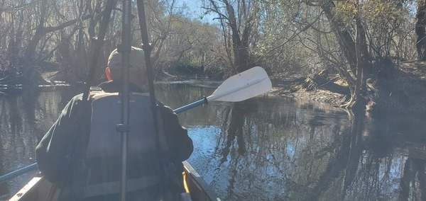
PHOTOSET: https://www.wwals.net/pictures/2022-12-29–suwannee-pictures/#TS
PHOTO SOURCE: John S. Quarterman
PHONE NUMBER: (229) 242-0102
Suggestions: https://forms.gle/DipPgU2TP5atc2Rf9
Overhanging Branches

CATEGORIES: Obstacle
LAYER: Point of Interest
OWNERSHIP: Public, CONSERVATION FUND, PARCEL 156 029
WATER BODY: Suwannee River
GAUGE: Fargo
MILE: 222.09
ADDRESS: About 2.18 miles downstream from Reeves Landing. Clinch County.
DESCRIPTION: Overhanging branches that are at least annoying.
WEBSITE: https://wwals.net/pictures/2022-12-29–suwannee-pictures#OHBranches
PHOTO: https://www.wwals.net/pictures/2022-12-29–suwannee-pictures/GSBX2362.jpg
PHOTOSET: https://wwals.net/pictures/2022-12-29–suwannee-pictures#OHBranches
PHOTO SOURCE: John S. Quarterman
PHONE NUMBER: (229) 242-0102
Suggestions: https://forms.gle/DipPgU2TP5atc2Rf9
Outfitter
Suwannee River Outfitters & Lodge


CATEGORIES: Outfitter
LAYER: Brochure
GPS: 30.6864, -82.5617
OWNERSHIP: Private, Todd Enfinger, PARCEL F02 029, F02 030
ACCESS: Yes, PARKING: Free, SHELTER
WATER BODY: Suwannee River
GAUGE: Fargo
MILE: 221.00
ADDRESS: 729 US-441, Fargo, GA 31631, Clinch County.
DESCRIPTION: Under new ownership, in the center of Fargo near the Suwannee River. toddenfinger@gmail.com
HISTORIC FACTS: Reopened in 2021 under new ownership of Todd Enfinger. As of August 24, 2021, he has finished most construction and is finishing opening everything.
AKA: Suwannee River Outfitters
GRN: No
OTHER REFERENCE: https://m.facebook.com/pages/category/Hotel/Suwannee-River-Outfitters-and-Lodge-101175871664840/
PHOTO: http://media-cdn.tripadvisor.com/media/photo-s/07/5b/29/55/suwannee-river-outfitters.jpg
PHOTO SOURCE: TripAdvisor
PHONE NUMBER: (727) 565-7433
Suggestions: https://forms.gle/DipPgU2TP5atc2Rf9
American Canoe Adventures @ Bridge Street
CATEGORIES: Outfitter
LAYER: Brochure
OWNERSHIP: Private
ACCESS: Yes
WATER BODY: Suwannee River
GAUGE: White Springs
MILE: 169.02
ADDRESS: 10610 Bridge St. White Springs, FL 32096, Hamilton County.
DESCRIPTION: “”You will be transported to your trip from our shop. On the way you will be provided with a river map, an explanation of your trip, and current river conditions. Approximated paddling times will vary with your paddling proficiency, weather conditions, and water level, but average 2 to 3 miles an hour.””
GRN: Yes
WEBSITE: https://aca1.com/
ADDITIONAL INFO SOURCES: http://www.suwanneeoutpost.com/waterlevels.html
PHOTO: https://img1.wsimg.com/isteam/ip/07862e21-56db-4b42-9004-85367c386fae/bdf2871e47ee28d0dbab0cf8cf414bde.jpeg/:/cr=t:19.88%25, l:4.82%25, w:90.36%25, h:60.24%25/rs=w:600, h:300, cg:true, m
PHOTOSET: https://aca1.com/
PHOTO SOURCE: American Canoe Adventures
PHONE NUMBER: (386) 397-1309
Suggestions: https://forms.gle/DipPgU2TP5atc2Rf9
Suwannee Canoe Outpost @ 95th Drive
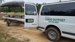
CATEGORIES: Outfitter
LAYER: Brochure
GPS: 30.4058, -82.948765
OWNERSHIP: Private
ACCESS: Yes, Ramp: Concrete, CANOE, CAMPING: “Yes, Outposts, Outpost toilet, PARKING: Free, SHELTER, PICNIC AREA, HANDICAPPED ACCESSIBLE
WATER BODY: Suwannee River
GAUGE: Suwannee Springs
MILE: 148.50
ADDRESS: 2461 95th Dr, Live Oak, FL 32060, Suwannee County.
DESCRIPTION: On the left bank: “”The Suwannee Canoe Outpost is the original premier canoe outfitter on the Suwannee River! We have been at our current location in the Spirit of the Suwannee Music Park since 1993. We are fortunate to be located at a boat ramp, so we can maximize customer satisfaction while minimizing shuttle times! We offer canoe rental and shuttle service on three of the most exciting and remote rivers in Florida, the Suwannee, North Withlacoochee, and Alapaha Rivers!
HISTORIC FACTS: The oldest outfitter in the Suwannee River Basin.
GRN: Yes
WEBSITE: http://shop.suwanneeoutpost.com/
PHOTO: https://wwals.net/pictures/2018-02-18–ga-37-withlacoochee/20180218_084006.jpg
PHOTOSET: https://wwals.net/pictures/2018-02-18–ga-37-withlacoochee/
PHOTO SOURCE: John S. Quarterman
PHONE NUMBER: (386) 364-4991
PHOTO2: https://www.wwals.net/pictures/2020-10-16–suwannee-fl-6-sl/20201016_151342.jpg
Photoset2: https://www.wwals.net/pictures/2020-10-16–suwannee-fl-6-sl/
PHOTO2 SOURCE: John S. Quarterman
Photo2 Phone Number: 229-242-0102
Suggestions: https://forms.gle/DipPgU2TP5atc2Rf9

Suwannee River Canoe Rental
CATEGORIES: Outfitter
LAYER: Brochure
OWNERSHIP: Private
WATER BODY: Suwannee River
GAUGE: Ellaville
MILE: 127.60
ADDRESS: 4404 193rd Dr, Live Oak, FL 32060, Suwannee County.
DESCRIPTION: Est. 1986.
GRN: No
WEBSITE: http://www.suwanneerivercanoerental.com/
PHOTOSET: http://www.suwanneerivercanoerental.com/About-Us.html
PHOTO SOURCE: Suwannee River Canoe Rental
PHONE NUMBER: (386) 364-4185
Suggestions: https://forms.gle/DipPgU2TP5atc2Rf9
Suwannee River Rendezvous
CATEGORIES: Outfitter
LAYER: Brochure
GPS: 30.08683, -83.09455
OWNERSHIP: Private
WATER BODY: Suwannee River
GAUGE: Luraville
MILE: 91.90
ADDRESS: 828 NE Primrose Rd, Mayo, FL 32066, Lafayette County.
DESCRIPTION: Campground & RV Resort in Mayo, Florida
GRN: No
WEBSITE: https://www.suwanneeriverrendezvous.com/
Suggestions: https://forms.gle/DipPgU2TP5atc2Rf9
Cave Dive Camp
CATEGORIES: Outfitter
LAYER: Other
GPS: 30.063209, -83.05606
OWNERSHIP: Private, Sean McCarthy
ACCESS: Yes
WATER BODY: Suwannee River
GAUGE: Luraville
MILE: 88.31
ADDRESS: 14942 Riverside Dr, O’Brien, FL 32071, Suwannee County.
DESCRIPTION: Private Camping and Aquatic Adventures on the Suwannee River
GRN: No
WEBSITE: http://www.cavedivecamp.com/
PHOTOSET: http://www.cavedivecamp.com/
PHOTO SOURCE: Cave Dive Camp
PHONE NUMBER: (407) 797-2633
Suggestions: https://forms.gle/DipPgU2TP5atc2Rf9
Rum 138

CATEGORIES: Outfitter
LAYER: Brochure
OWNERSHIP: Private
WATER BODY: Santa Fe River
MILE: 21.14
ADDRESS: 2070 SW County Road 138, Fort White, FL 32038, Columbia County.
DESCRIPTION: Outfitter, kayak sales, and art gallery near Rum Island on the Santa Fe River.
WEBSITE: https://rum138.com/
PHOTO: https://www.wwals.net/pictures/2024-02-08–wkfl-santa-fe-river/20240208_103843.jpg
PHOTOSET: https://www.wwals.net/pictures/2024-02-08–wkfl-santa-fe-river/
PHOTO SOURCE: John S. Quarterman
PHONE NUMBER: (386) 454 4247
Suggestions: https://forms.gle/DipPgU2TP5atc2Rf9
PMine
Nutrien Phosphate Mine


CATEGORIES: Pmine
LAYER: Brochure
OWNERSHIP: Private, PCS Phosphate (Nutrien)
WATER BODY: Suwannee River
ADDRESS: From I-75 North, exit at State Road 129; travel north to Jasper (SR 129 will merge into SR 41); turn right onto County Road 6 and travel east approximately six miles to the project sites north and south of CR 6. Hamilton County.
DESCRIPTION: Decades-old phosphate mine that keeps expanding. Now owned by Nutrien of Canada.
AKA: PCS Phosphate Mine
PHOTO: https://www.wwals.net/pictures/2023-05-12–nutrien-phosphate-mine-pictures/IMG_8494.jpg
PHOTOSET: https://www.wwals.net/pictures/2023-05-12–nutrien-phosphate-mine-pictures/
PHOTO SOURCE: Anonymous
PHONE NUMBER: (850) 290-2350
PHOTO2: https://wwals.net/pictures/2019-10-15–pcs-phosphate-usace/p16021coll7_8308-0006.jpg
Photoset2: https://wwals.net/pictures/2019-10-15–pcs-phosphate-usace
PHOTO2 SOURCE: PCS
Suggestions: https://forms.gle/DipPgU2TP5atc2Rf9

HPS II Phosphate Mine

CATEGORIES: Pmine
LAYER: Brochure
GPS: 29.92191, -82.34453
OWNERSHIP: Private, HPS II
WATER BODY: Santa Fe River
ADDRESS: West of CR 231 in Bradford County, FL, Bradford County.
DESCRIPTION: Proposed phosphate mine in Bradford County, FL. Also proposed in Union County, FL, but that part is much less likely to happen.
WEBSITE: https://wwals.net/issues/phosphate-mining/#hpsii
PHOTO: https://wwals.net/wp-content/themes/pianoblack/img//2017/08/f109952edabddba956822126e13c01e6.jpg
PHOTOSET: https://wwals.net/issues/phosphate-mining/#hpsii
PHOTO SOURCE: WWALS
PHONE NUMBER: (850) 290-2350
Suggestions: https://forms.gle/DipPgU2TP5atc2Rf9
Pipeline
FGT Perry Gas Pipeline 

CATEGORIES: Pipeline
LAYER: Point of Interest
OWNERSHIP: Private
WATER BODY: Suwannee River
GAUGE: Ellaville
MILE: 125.38
ADDRESS: 4037 River Road, Live Oak, FL 32060, Madison, Suwannee Counties.
DESCRIPTION: According to the sign on the banks of the Suwannee River.
WEBSITE: https://www.wwals.net/pictures/2025-12-20–pilgrims-pride-outfall-suwannee-river/
PHOTO: https://www.wwals.net/pictures/2025-12-20–pilgrims-pride-outfall-suwannee-river/20251220_115119.jpg
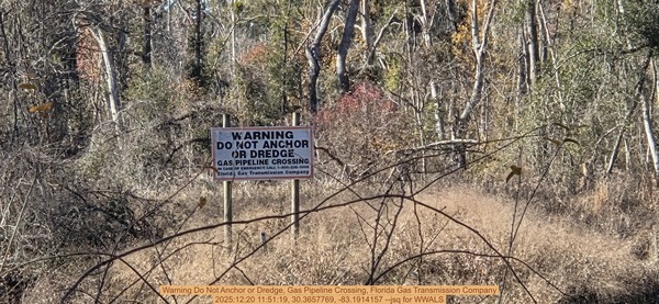
PHOTOSET: https://www.wwals.net/pictures/2025-12-20–pilgrims-pride-outfall-suwannee-river/
PHOTO SOURCE: John S. Quarterman
PHONE NUMBER: (850) 290-2350
Suggestions: https://forms.gle/DipPgU2TP5atc2Rf9
Point of Interest
Waycross turnoff 
CATEGORIES: Point Of Interest
LAYER: Point of Interest
OWNERSHIP: Public, USFWS
WATER BODY: Middle Fork Suwannee River
MILE: 16.69
ADDRESS: West of the trail to Maul Hammock, connects north through a little-maintained trail to Okefenokee Swamp Park, Ware County.
DESCRIPTION: No known markings.
Suggestions: https://forms.gle/DipPgU2TP5atc2Rf9
Big Water or Floyds Island Sign

CATEGORIES: Point Of Interest
LAYER: Point of Interest
OWNERSHIP: Public, USFWS
WATER BODY: Middle Fork Suwannee River
MILE: 4.76
ADDRESS: Between Minnies Lake Canoe Shelter and Big Water. Charlton County.
DESCRIPTION: Straight up the Middle Fork Suwannee River to Big Water, or turn right to Floyds Island.
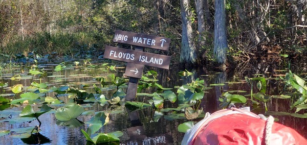
PHOTOSET: https://www.wwals.net/pictures/2023-11-04–floyds-island-camping-okefenokee-pictures/
PHOTO SOURCE: John S. Quarterman
PHONE NUMBER: (229) 242-0102
Suggestions: https://forms.gle/DipPgU2TP5atc2Rf9
Sill or Big Water
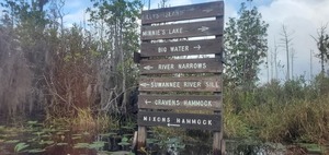
CATEGORIES: Point Of Interest
LAYER: Brochure
OWNERSHIP: Public, USFWS
WATER BODY: Suwannee River
GAUGE: SCFSP
MILE: 243.04
ADDRESS: On the Suwannee River across from the end of the access canal for Stephen C. Foster State Park Ramp. Charlton County.
DESCRIPTION: Points right or upstream to Billys Island, MInnie’s Lake, and Big Water, and left or downstream to River Narrows, Suwannee River Sill, Cravens Hammock, and Mixons Hammock.
GRN: Yes
PHOTO: https://www.wwals.net/pictures/2020-11-07–okefenokee-floyds-island/20201107_103607.jpg
PHOTOSET: https://www.wwals.net/pictures/2020-11-07–okefenokee-floyds-island/
PHOTO SOURCE: John S. Quarterman
PHONE NUMBER: (229) 242-0102
Suggestions: https://forms.gle/DipPgU2TP5atc2Rf9
Suwannee River Narrows
CATEGORIES: Point Of Interest
LAYER: Point of Interest
OWNERSHIP: Public
WATER BODY: Suwannee River
GAUGE: SCFSP
MILE: 242.33
ADDRESS: Between Billys Lake and Mixons Hammock. Charlton County.
DESCRIPTION: A narrow stretch of the Suwannee River, difficult at low water.
Suggestions: https://forms.gle/DipPgU2TP5atc2Rf9
Charlton-Ware County Line
CATEGORIES: Point Of Interest
LAYER: Point of Interest
OWNERSHIP: Public
WATER BODY: Suwannee River
GAUGE: Fargo
MILE: 237.64
ADDRESS: Below the Suwannee River Sill Ramp, downstream from where the Suwannee River meets the outfall of the First Gate of the Suwannee River Sill. Charlton, Ware Counties.
DESCRIPTION: Somebody in an office drew a straight line on a map, through the Okefenokee Swamp and the Suwannee River.
Suggestions: https://forms.gle/DipPgU2TP5atc2Rf9
“West River Entrance, Okefenokee National Wildlife Refuge”

CATEGORIES: Point Of Interest
LAYER: Brochure
GPS: 30.7944, -82.4357
OWNERSHIP: Public
WATER BODY: Suwannee River
GAUGE: Fargo
MILE: 236.48
ADDRESS: Little more than a mile upstream from Griffis Fish Camp. Ware, Clinch Counties.
DESCRIPTION: A large, tall, sign says: “”NATIONAL WILDLIFE REFUGE, NO FIREARMS, NO HUNTING, NO MOTORS LARGER THAN 10 H.P., NO CAMPING, NO FIRES, FISHING BY POLES&REELS ONLY, ALL VISITORS MUST LEAVE BY SUNSET””. This is also the county line between Ware (upstream) and Clinch (downstream) Counties, Georgia.
WEBSITE: https://www.fws.gov/refuge/Okefenokee/visit/plan_your_visit.html
OTHER REFERENCE: https://wwals.net/2021/02/15/nominating-okefenokee-nwr-for-unesco-world-heritage-list-2021-01-26/
PHOTOSET: https://wwals.net/pictures/2019-12-08–okefenokee-griffis-fish-camp-suwannee-paddle/
PHOTO SOURCE: John S. Quarterman
PHONE NUMBER: (229) 242-0102
Photoset2: https://wwals.net/pictures/2019-12-08–okefenokee-griffis-fish-camp-suwannee-paddle/
PHOTO2 SOURCE: John S. Quarterman
Photo2 Phone Number: 229-242-0102
Suggestions: https://forms.gle/DipPgU2TP5atc2Rf9

“West Road Entrance, Okefenokee National Wildlife Refuge”
CATEGORIES: Point Of Interest
LAYER: Brochure
OWNERSHIP: Public
WATER BODY: Suwannee River
GAUGE: Fargo
MILE: 236.17
ADDRESS: 10855 GA-177, Fargo, GA 31631, Clinch County.
DESCRIPTION: See Stephen C. Foster State Park.
WEBSITE: https://www.fws.gov/refuge/Okefenokee/visit/plan_your_visit.html
OTHER REFERENCE: https://wwals.net/2021/02/15/nominating-okefenokee-nwr-for-unesco-world-heritage-list-2021-01-26/
Suggestions: https://forms.gle/DipPgU2TP5atc2Rf9
Survey Flags

CATEGORIES: Point Of Interest
LAYER: Point of Interest
OWNERSHIP: Private, CONSERVATION FUND, PARCEL 177 007
WATER BODY: Suwannee River
GAUGE: Fargo
MILE: 233.49
ADDRESS: Left bank, one and a half miles downstream from Griffis Fish Camp Landing. Clinch County.
DESCRIPTION: Survey flags hanging from tree branches, probably between Clinch County parcels 177 007 and 177 001, both Conservation Fund.
WEBSITE: https://www.wwals.net/pictures/2022-12-29–suwannee-pictures/#Survey-flags
PHOTO: https://www.wwals.net/pictures/2022-12-29–suwannee-pictures/20221229_094528.jpg
PHOTOSET: https://www.wwals.net/pictures/2022-12-29–suwannee-pictures/#Survey-flags
PHOTO SOURCE: John S. Quarterman
PHONE NUMBER: (229) 242-0102
Suggestions: https://forms.gle/DipPgU2TP5atc2Rf9
Allen Camp Cutthrough

CATEGORIES: Point Of Interest
LAYER: Point of Interest
OWNERSHIP: Public, CONSERVATION FUND, PARCEL 177 001
WATER BODY: Suwannee River
GAUGE: Fargo
MILE: 232.45
ADDRESS: To the right, 2.72 miles downstream from Griffis Fish Camp, and 0.12 miles upstream from Allen Camp Landing. Clinch County.
DESCRIPTION: Stay to the left to get to Allen Camp Landing; do not take the cutthrough.
WEBSITE: https://www.wwals.net/pictures/2022-12-29–suwannee-pictures/small/accutthrough.jpg
PHOTO: https://www.wwals.net/pictures/2022-12-29–suwannee-pictures/accutthrough.jpg
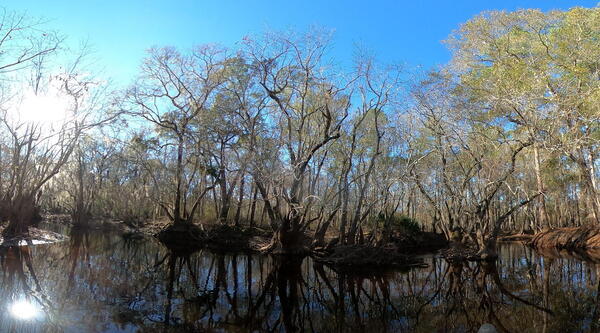
PHOTOSET: https://www.wwals.net/pictures/2022-12-29–suwannee-pictures/#ACCT
PHOTO SOURCE: John S. Quarterman
PHONE NUMBER: (229) 242-0102
Suggestions: https://forms.gle/DipPgU2TP5atc2Rf9
Allen Camp Road

CATEGORIES: Point Of Interest
LAYER: Point of Interest
OWNERSHIP: Private, CONSERVATION FUND, PARCEL 177 007
WATER BODY: Suwannee River
GAUGE: Fargo
MILE: 232.34
ADDRESS: From Fargo, GA, go 8.5 miles up GA 177 N, turn left just before Green Top Road, go 0.6 miles to riverbank for Allen Camp Landing. Clinch County.
DESCRIPTION: Dirt Road to sandy riverbank. Private: do not use without permission.
AKA: Long Straight Road
OTHER REFERENCE: https://goo.gl/maps/XbHqhKk919pQpfos7
PHOTO: https://www.wwals.net/pictures/2022-08-25–suwannee-upstream-landings/long-straight-road.jpg
PHOTOSET: https://www.wwals.net/pictures/2022-08-25–suwannee-upstream-landings/
PHOTO SOURCE: Google Streetview
PHONE NUMBER: (850) 290-2350
Suggestions: https://forms.gle/DipPgU2TP5atc2Rf9
Sport Camp Road

CATEGORIES: Point Of Interest
LAYER: Point of Interest
OWNERSHIP: Private, CONSERVATION FUND, PARCEL 178 002
WATER BODY: Suwannee River
GAUGE: Fargo
MILE: 230.95
ADDRESS: From Fargo, GA, at the 8 mile marker on GA 177N, turn left on Sport Camp Road, go 0.4 miles and turn right, go another 0.4 miles to riverbank for Sport Camp Landing, Clinch County.
DESCRIPTION: Dirt Road to sandy riverbank. Private: do not use without permission.
OTHER REFERENCE: https://goo.gl/maps/bKU4KF1qC1NRTV8d9
PHOTO: https://www.wwals.net/pictures/2022-08-25–suwannee-upstream-landings/sport-camp-road.jpg
PHOTOSET: https://www.wwals.net/pictures/2022-08-25–suwannee-upstream-landings/
PHOTO SOURCE: Google Streetview
PHONE NUMBER: (850) 290-2350
Suggestions: https://forms.gle/DipPgU2TP5atc2Rf9
Long Camp Road

CATEGORIES: Point Of Interest
LAYER: Point of Interest
OWNERSHIP: Private, CONSERVATION FUND, PARCEL 156 029
WATER BODY: Suwannee River
GAUGE: Fargo
MILE: 230.27
ADDRESS: From Fargo, GA, go 6.51 miles up GA 177 N, turn left on Long Camp Road, then first left to riverbank, about 1.1 miles from highway for Long Camp Landing. Clinch County.
DESCRIPTION: Dirt Road to sandy riverbank. Private: do not use without permission.
OTHER REFERENCE: https://goo.gl/maps/PawbbjGP7v7U4P1H9
PHOTO: https://www.wwals.net/pictures/2022-08-25–suwannee-upstream-landings/long-camp-road.jpg
PHOTOSET: https://www.wwals.net/pictures/2022-08-25–suwannee-upstream-landings/
PHOTO SOURCE: Google Streetview
PHONE NUMBER: (850) 290-2350
Suggestions: https://forms.gle/DipPgU2TP5atc2Rf9
Drawdy Mill Road

CATEGORIES: Point Of Interest
LAYER: Point of Interest
OWNERSHIP: Private, CONSERVATION FUND, PARCEL 156 029
WATER BODY: Suwannee River
GAUGE: Fargo
MILE: 228.79
ADDRESS: From Fargo, GA, go 6.5 miles up GA 177 N, turn left on unmarked road, go straight about 0.5 miles to riverbank for Drawdy Mill Landing. Clinch County.
DESCRIPTION: Dirt Road to sandy riverbank. Private: do not use without permission.
AKA: Short Straight Road
OTHER REFERENCE: https://goo.gl/maps/2RcbxMDj1kJQakcR9
PHOTO: https://www.wwals.net/pictures/2022-08-25–suwannee-upstream-landings/short-straight-road.jpg
PHOTOSET: https://www.wwals.net/pictures/2022-08-25–suwannee-upstream-landings/
PHOTO SOURCE: Google Streetview
PHONE NUMBER: (850) 290-2350
Suggestions: https://forms.gle/DipPgU2TP5atc2Rf9
Three Steps Road

CATEGORIES: Point Of Interest
LAYER: Point of Interest
OWNERSHIP: Private, CONSERVATION FUND, PARCEL 156 029
WATER BODY: Suwannee River
GAUGE: Fargo
MILE: 226.15
ADDRESS: From Fargo, GA, go 3.5 miles up GA 177 N, turn left on unmarked road, go 1.5 miles and turn right, go about 100 feet to riverbank for Three Steps Middle Landing. Clinch County.
DESCRIPTION: Dirt Road to sandy riverbank. Private: do not use without permission.
OTHER REFERENCE: https://goo.gl/maps/wvVdz6UwbPGWCPsG9
PHOTOSET: https://www.wwals.net/pictures/2022-08-25–suwannee-upstream-landings/
PHOTO SOURCE: Google Streetview
PHONE NUMBER: (850) 290-2350
Suggestions: https://forms.gle/DipPgU2TP5atc2Rf9
Reeves Landing Road

CATEGORIES: Point Of Interest
LAYER: Point of Interest
OWNERSHIP: Private, SIRMANS CHERYLANN FRANCIS ET AL, C/O VICKY HARPER, 2447 LOCHWOOD DR, VALDOSTA, GA 31601, PARCEL 156 011
WATER BODY: Suwannee River
GAUGE: Fargo
MILE: 224.28
ADDRESS: From Fargo, GA, go 2.5 miles up GA 177 N, turn left on Reeves Landing Road (CR 176), go straight about 0.4 miles to riverbank for Reeves Landing, Clinch County.
DESCRIPTION: Dirt Road to sandy riverbank. Private: do not use without permission.
OTHER REFERENCE: https://goo.gl/maps/hJpbLvAxcXskaJrw9
PHOTO: https://www.wwals.net/pictures/2022-08-25–suwannee-upstream-landings/reeves-landing-road.jpg
PHOTOSET: https://www.wwals.net/pictures/2022-08-25–suwannee-upstream-landings/
PHOTO SOURCE: Google Streetview
PHONE NUMBER: (850) 290-2350
Suggestions: https://forms.gle/DipPgU2TP5atc2Rf9
Suwannee River Visitor Center

CATEGORIES: Point Of Interest
LAYER: Other
OWNERSHIP: Public, STATE OF GEORGIA, PARCEL 156 028
WATER BODY: Suwannee River
GAUGE: Fargo
MILE: 221.04
ADDRESS: Next to Fargo Ramp, in the southeast edge of Fargo, at US 441 and the Suwannee River (right bank). Clinch County.
DESCRIPTION: A $2 million visitor center, opened in 2004, closed since some time after 2011. It used to have exhibits on tannic acid, numerous animal displays, an introductory fiver film, and exhibits on the timber industry and local history.
HISTORIC FACTS: It was statewide news when it opened in 2004. https://wwals.net/?p=60538 Closed due to budget and bats after about 2011, before February 2015. https://wwals.net/?p=60567
WEBSITE: https://wwals.net/2022/12/31/suwannee-river-visitor-center-2022-12-29/
OTHER REFERENCE: https://www.ohranger.com/ga/stephen-c-foster/poi/suwannee-river-visitor-center-fargo
PHOTO: https://www.wwals.net/pictures/2022-12-29–suwannee-river-welcome-center/20221229_082240.jpg
PHOTOSET: https://wwals.net/2022/12/31/suwannee-river-visitor-center-2022-12-29/
PHOTO SOURCE: John S. Quarterman
PHONE NUMBER: (229) 242-0102
PHOTO2: https://www.wwals.net/pictures/2022-12-29–suwannee-river-welcome-center/GSBY2503.jpg
Photoset2: https://wwals.net/2022/12/31/suwannee-river-visitor-center-2022-12-29/
PHOTO2 SOURCE: John S. Quarterman
Photo2 Phone Number: 229-242-0102
Suggestions: https://forms.gle/DipPgU2TP5atc2Rf9

Cypress Creek Island

CATEGORIES: Point Of Interest
LAYER: Point of Interest
OWNERSHIP: Public
WATER BODY: Suwannee River
GAUGE: Fargo
MILE: 218.45
ADDRESS: Island near mouth of Cypress Creek, 2.52 miles downstream from Fargo Ramp. Clinch County.
DESCRIPTION: Small island near the mouth of Cypress Creek, which drains the southwest corner of the Okefenokee Swamp.
WEBSITE: https://wwals.net/pictures/2022-03-05–fargo-downstream-suwannee-river
OTHER REFERENCE: https://wwals.net/2021/04/04/okefenokee-swamp-south-drains-west-to-suwannee-river/
PHOTO: https://www.wwals.net/pictures/2022-03-05–fargo-downstream-suwannee-river/cypress-creek-island.jpg
PHOTOSET: https://www.wwals.net/pictures/2022-03-05–fargo-downstream-suwannee-river/
PHOTO SOURCE: John S. Quarterman
PHONE NUMBER: (229) 242-0102
Suggestions: https://forms.gle/DipPgU2TP5atc2Rf9
Lunch Point Beach

CATEGORIES: Point Of Interest
LAYER: Point of Interest
OWNERSHIP: Public, LEVITON BLAKE E & BETH H, PARCEL 099 004
WATER BODY: Suwannee River
GAUGE: Fargo
MILE: 216.79
ADDRESS: Left (south) bank, 4.27 miles downstream from Fargo Ramp. Echols County.
DESCRIPTION: Good lunch and swimming beach on a point.
WEBSITE: https://wwals.net/pictures/2022-08-25–suwannee-upstream-landings
OTHER REFERENCE: https://qpublic.schneidercorp.com/Application.aspx?AppID=765&LayerID=11801&PageTypeID=1&KeyValue=099%20%20%20%20004
PHOTO: https://www.wwals.net/pictures/2022-08-25–suwannee-upstream-landings/lunch-beach.jpg
PHOTOSET: https://www.wwals.net/pictures/2022-08-25–suwannee-upstream-landings/
PHOTO SOURCE: John S. Quarterman
PHONE NUMBER: (229) 242-0102
Suggestions: https://forms.gle/DipPgU2TP5atc2Rf9
Swimming Island Beach

CATEGORIES: Point Of Interest
LAYER: Point of Interest
OWNERSHIP: Public
WATER BODY: Suwannee River
GAUGE: Fargo
MILE: 212.44
ADDRESS: Right (west) bank, 9.02 miles downstream from Fargo Ramp, 5.65 miles upstream from GA-FL line. Echols County.
DESCRIPTION: Nice sandy beach on an eyot.
WEBSITE: https://wwals.net/pictures/2022-03-05–fargo-downstream-suwannee-river
PHOTO: https://www.wwals.net/pictures/2022-03-05–fargo-downstream-suwannee-river/20220305_132552.jpg
PHOTOSET: https://www.wwals.net/pictures/2022-03-05–fargo-downstream-suwannee-river/
PHOTO SOURCE: John S. Quarterman
PHONE NUMBER: (229) 242-0102
Suggestions: https://forms.gle/DipPgU2TP5atc2Rf9
Unintentional Swimming

CATEGORIES: Point Of Interest
LAYER: Point of Interest
OWNERSHIP: Public
WATER BODY: Suwannee River
GAUGE: Fargo
MILE: 212.31
ADDRESS: 9.15 miles downstream from Fargo Ramp, 5.52 miles upstream from GA-FL line. Echols County.
DESCRIPTION: If you want to capsize, this is not a bad spot, fairly easy to get out of the water, and just downstream from a nice beach to dry off on.
WEBSITE: https://wwals.net/pictures/2022-03-05–fargo-downstream-suwannee-river
PHOTO: https://www.wwals.net/pictures/2022-03-05–fargo-downstream-suwannee-river/20220305_135645.jpg
PHOTOSET: https://www.wwals.net/pictures/2022-03-05–fargo-downstream-suwannee-river/
PHOTO SOURCE: John S. Quarterman
PHONE NUMBER: (229) 242-0102
Suggestions: https://forms.gle/DipPgU2TP5atc2Rf9
Swimming Beach

CATEGORIES: Point Of Interest
LAYER: Point of Interest
OWNERSHIP: Public, HANDLEY EMILY KATHARINE, PARCEL 086 004
WATER BODY: Suwannee River
GAUGE: Fargo
MILE: 209.95
ADDRESS: Right bank, 11.6 miles downstream from Fargo Ramp, 3.16 miles upstream from the GA-FL line. Echols County.
DESCRIPTION: One of many good beaches for lunch and swimming.
PHOTO SOURCE: Shirley Kokidko
PHONE NUMBER: (850) 290-2350
Suggestions: https://forms.gle/DipPgU2TP5atc2Rf9
Bethel Primitive Baptist Church

CATEGORIES: Point Of Interest
LAYER: Point of Interest
OWNERSHIP: Private, CHURCH—BETHEL PRIVITIVE BAPTIST HISTORICAL PRESERVATION GROUP, PARCEL 095 002A
WATER BODY: Suwannee River
MILE: 209.51
ADDRESS: From Fargo, 0.5 miles west on GA 94, left on Woodpecker Route, 4.4 miles on the left. Echols County.
DESCRIPTION: A church built in about 1843, currently closed.
HISTORIC FACTS: The Bethel Primitive Baptist Church was originally constituted in 1843 and services were held continually until January 1992. The church was reconstituted April 18, 1993 and services were held until several years ago (source). The original church is believed to have been built during or about 1843. On September 23, 1930, the land on which it was built was bought from D.H. Register for the sum of $100.00. … To preserve the family heritage, The Bethel Primitive Baptist Preservation and Historical Committee has obtained this church. –Fouraker Reunion https://www.fourakerreunion.com/church-bethel-primitive-baptist-echols-county-georgia.html
OTHER REFERENCE: https://www.fourakerreunion.com/church-bethel-primitive-baptist-echols-county-georgia.html
PHOTO: https://www.wwals.net/pictures/2022-08-25–suwannee-upstream-landings/bethel-pbc-qpublic.jpg
PHOTOSET: https://www.wwals.net/pictures/2022-08-25–suwannee-upstream-landings/
PHOTO SOURCE: Echols County Tax Assessors
PHONE NUMBER: (850) 290-2350
Suggestions: https://forms.gle/DipPgU2TP5atc2Rf9
Wetherington Point

CATEGORIES: Point Of Interest
LAYER: Point of Interest
OWNERSHIP: Private, WETHERINGTON ROBERT CHARLES, PARCEL 090 002A1
WATER BODY: Suwannee River
GAUGE: Fargo
MILE: 207.29
ADDRESS: Right bank, 14.26 miles downstream from Fargo Ramp, 0.50 miles upstream from GA-FL line. Echols County.
DESCRIPTION: A wooded sandy point on the right bank. Private: do not go inland without permission.
WEBSITE: https://wwals.net/pictures/2022-08-25–suwannee-upstream-landings
OTHER REFERENCE: https://www.wwals.net/pictures/2022-08-25–suwannee-upstream-landings/
PHOTO: https://www.wwals.net/pictures/2022-08-25–suwannee-upstream-landings/20220305_163101.jpg
PHOTOSET: https://www.wwals.net/pictures/2022-08-25–suwannee-upstream-landings/
PHOTO SOURCE: John S. Quarterman
PHONE NUMBER: (229) 242-0102
Suggestions: https://forms.gle/DipPgU2TP5atc2Rf9
GA-FL Line Suwannee River

CATEGORIES: Point Of Interest
LAYER: Other
OWNERSHIP: Public
WATER BODY: Suwannee River
GAUGE: Fargo
MILE: 206.79
ADDRESS: 14.76 miles downstream from Fargo and 4.79 miles upstream from Roline Launch. Echols, Hamilton, Columbia Counties.
DESCRIPTION: The Suwannee River goes due south with a white beach on the left at the state line, then there’s a bend to the right and a beach on the right. Echols County, Georgia is on both sides of the river. In Florida, Columbia County is east on the left bank and Hamilton County is west on the right bank. Immediately in Florida, Suwannee River Water Management District (SRWMD) land starts and continues for many miles down past Roline.
PHOTO: https://www.wwals.net/pictures/2022-03-06–roline-turner-bridge-suwannee-river/20220306_092514.jpg
PHOTOSET: https://www.wwals.net/pictures/2022-03-06–roline-turner-bridge-suwannee-river/
PHOTO SOURCE: John S. Quarterman
PHONE NUMBER: (229) 242-0102
PHOTO2: https://wwals.net/pictures/2017-03-18–fargo-roline-wwals/20170318_143947.jpg
Photoset2: https://wwals.net/pictures/2017-03-18–fargo-roline-wwals/
PHOTO2 SOURCE: John S. Quarterman
Photo2 Phone Number: 229-242-0102
Suggestions: https://forms.gle/DipPgU2TP5atc2Rf9

Big Shoals portage warning

CATEGORIES: Point Of Interest
LAYER: Point of Interest
OWNERSHIP: Public
WATER BODY: Suwannee River
MILE: 176.70
ADDRESS: Right bank, 500 feet upstream of portage. Hamilton County.
DESCRIPTION: Sign on a tree on the right bank: “”WARNING HAZARDOUS RAPIDS AHEAD RECOMMEND USING PORTAGE TO THE LEFT 500 FT AHEAD
WEBSITE: https://wwals.net/pictures/2021-05-19–big-shoals-pictures/#Portage-warning-right-bank
PHOTO: https://wwals.net/pictures/2021-05-19–big-shoals-pictures/20210519_104540.jpg
PHOTOSET: https://wwals.net/pictures/2021-05-19–big-shoals-pictures/big/
PHOTO SOURCE: John S. Quarterman
PHONE NUMBER: (229) 242-0102
Suggestions: https://forms.gle/DipPgU2TP5atc2Rf9
Big Shoals fire pit

CATEGORIES: Point Of Interest
LAYER: Point of Interest
OWNERSHIP: Public
WATER BODY: Suwannee River
MILE: 175.94
ADDRESS: Inland from left bank, downstream from portage takeout, Columbia County.
DESCRIPTION: Fire pit in woods opening.
OTHER REFERENCE: https://wwals.net/pictures/2021-05-19–big-shoals-pictures/#Fire-pit
PHOTO: https://wwals.net/pictures/2021-05-19–big-shoals-pictures/20210519_111340.jpg
PHOTOSET: https://wwals.net/pictures/2021-05-19–big-shoals-pictures/
PHOTO SOURCE: John S. Quarterman
PHONE NUMBER: (229) 242-0102
Suggestions: https://forms.gle/DipPgU2TP5atc2Rf9
Big Shoals overlook

CATEGORIES: Point Of Interest
LAYER: Point of Interest
OWNERSHIP: Public
WATER BODY: Suwannee River
MILE: 175.94
ADDRESS: Left bank right by the biggest shoals in Big Shoals. Columbia County.
DESCRIPTION: A good place to walk along the riverbank and look at Big Shoals roaring.
OTHER REFERENCE: https://wwals.net/pictures/2021-05-19–big-shoals-pictures/#BS1
PHOTO: https://wwals.net/pictures/2021-05-19–big-shoals-pictures/20210519_111405.jpg
PHOTOSET: https://wwals.net/pictures/2021-05-19–big-shoals-pictures/
PHOTO SOURCE: John S. Quarterman
PHONE NUMBER: (229) 242-0102
Suggestions: https://forms.gle/DipPgU2TP5atc2Rf9
Big Shoals lunch beach

CATEGORIES: Point Of Interest
LAYER: Point of Interest
GPS: 30.33795, -82.68437
OWNERSHIP: Public
WATER BODY: Suwannee River
MILE: 175.80
ADDRESS: Right bank just below Big Shoals, Hamilton County.
DESCRIPTION: A nice sandy beach perfect for lunch.
PHOTO: https://www.wwals.net/pictures/2023-05-20–big-shoals-suwannee-river-pictures/20230520_114309.jpg
PHOTOSET: https://www.wwals.net/pictures/2023-05-20–big-shoals-suwannee-river-pictures/#BBS
PHOTO SOURCE: John S. Quarterman
PHONE NUMBER: (229) 242-0102
Suggestions: https://forms.gle/DipPgU2TP5atc2Rf9
Big Shoals Public Lands Boundary

CATEGORIES: Point Of Interest
LAYER: Point of Interest
OWNERSHIP: Public
WATER BODY: Suwannee River
MILE: 171.40
ADDRESS: About 4.5 miles downstream from Big Shoals, and 0.4 miles upstream from Suwannee River Wayside Park Ramp. Hamilton County.
DESCRIPTION: Marked by a sign on the right bank.
PHOTO: https://www.wwals.net/pictures/2023-05-20–big-shoals-suwannee-river-pictures/20230520_142616.jpg
PHOTOSET: https://www.wwals.net/pictures/2023-05-20–big-shoals-suwannee-river-pictures/#BSPLB
PHOTO SOURCE: John S. Quarterman
PHONE NUMBER: (229) 242-0102
Suggestions: https://forms.gle/DipPgU2TP5atc2Rf9
Columbia and Suwannee County Line
CATEGORIES: Point Of Interest
LAYER: Point of Interest
OWNERSHIP: Public
WATER BODY: Suwannee River
MILE: 165.73
ADDRESS: Beyond the end of NW McClung Court, on the left bank, 2.68 miles downstream from Stephen Foster Folk Culture Center State Park Launch and 2.24 miles upstream from Swift Creek Launch. Suwannee, Columbia Counties.
DESCRIPTION: Unmarked.
Suggestions: https://forms.gle/DipPgU2TP5atc2Rf9
NE end Ellaville log boom
CATEGORIES: Point Of Interest
LAYER: Point of Interest
OWNERSHIP: Public
WATER BODY: Suwannee River
GAUGE: Ellaville
MILE: 127.54
ADDRESS: On the left (east) bank of the mouth of the Withlacoochee River. Hamilton County.
DESCRIPTION: Site of one end of the log boom that caught pine trees floated down the Withlacoochee River.
HISTORIC FACTS: The log boom fed the timber mill that was the prosperity of Ellaville.
WEBSITE: https://wwals.net/2022/12/01/county-bridge-hillman-bridge-suwannee-river-2022-11-26/
PHOTOSET: https://www.wwals.net/pictures/2022-11-26–county-bridge-hillman-bridge-suwannee-river/#Maps
PHOTO SOURCE: Ken Sulak
PHONE NUMBER: (850) 290-2350
Suggestions: https://forms.gle/DipPgU2TP5atc2Rf9
NW end Ellaville log boom
CATEGORIES: Point Of Interest
LAYER: Point of Interest
OWNERSHIP: Public
WATER BODY: Suwannee River
GAUGE: Ellaville
MILE: 127.50
ADDRESS: On the right (west) bank of the mouth of the Withlacoochee River. Madison County.
DESCRIPTION: Site of one end of the log boom that caught pine trees floated down the Withlacoochee River.
HISTORIC FACTS: The log boom fed the timber mill that was the prosperity of Ellaville.
WEBSITE: https://wwals.net/2022/12/01/county-bridge-hillman-bridge-suwannee-river-2022-11-26/
PHOTOSET: https://www.wwals.net/pictures/2022-11-26–county-bridge-hillman-bridge-suwannee-river/#Maps
PHOTO SOURCE: Ken Sulak
PHONE NUMBER: (850) 290-2350
Suggestions: https://forms.gle/DipPgU2TP5atc2Rf9
Pilgrims Pride Processing Plant
CATEGORIES: Point Of Interest
LAYER: Other
OWNERSHIP: Private
WATER BODY: Suwannee River
GAUGE: Ellaville
MILE: 127.60
ADDRESS: 19740 US Highway 90, Live Oak, FL 32060, Suwannee County.
DESCRIPTION: Chicken processing plant with an outflow pipe into the Suwannee River. NPDES Permit No. FL0001465.
HISTORIC FACTS: Environment Florida sued Pilgrims Pride 2017-03-09 about excess effluent from the company’s treated effluent outfall into the Suwannee River. https://wwals.net/2017/03/27/legal-filing-about-pilgrims-pride-effluent-into-suwannee-river/ On 2017-11-14, according to PR by the plaintiff, If approved by U.S. District Judge Timothy J. Corrigan, the settlement would require Pilgrim’s Pride to make equipment upgrades, investigate the possibility of eliminating or significantly reducing all discharges to the Suwannee River, and pay what is believed to be the largest Clean Water Act penalty in a citizen enforcement suit in Florida history. https://wwals.net/2017/11/16/pilgrims-pride-to-pay-1-43-million-suwannee-river-pollution-to-settle-lawsuit-by-environment-florida-and-sierra-club-2017-11-14/
WEBSITE: https://www.pilgrims.com
PHOTO: https://www.wwals.net/pictures/2025-12-20–pilgrims-pride-outfall-suwannee-river/20251220_131844.jpg
PHOTOSET: https://www.wwals.net/pictures/2025-12-20–pilgrims-pride-outfall-suwannee-river/20251220_115221.jpg
PHOTO SOURCE: John S. Quarterman
PHONE NUMBER: (850) 290-2350
Suggestions: https://forms.gle/DipPgU2TP5atc2Rf9
Suwannee Plant
CATEGORIES: Point Of Interest
LAYER: Other
OWNERSHIP: Private, Duke Energy
WATER BODY: Suwannee River
GAUGE: Ellaville
MILE: 126.74
ADDRESS: 3880 River Rd, Live Oak, FL 32060, Suwannee County.
DESCRIPTION: The Duke Energy Suwannee River Natural gas power plant has 3 generators that generated 17.2 GWh during the 3-month period between September 2024 to December 2024.
HISTORIC FACTS: “”Peaking plant; all 3 gas turbines were retired in December 2016, reducing MW tot capacity to 155.”” https://www.industrynet.com/listing/3810806/duke-energy-florida-inc-suwannee-river-plant
WEBSITE: https://www.industrynet.com/listing/3810806/duke-energy-florida-inc-suwannee-river-plant
OTHER REFERENCE: https://www.gridinfo.com/plant/suwannee-river/638
Suggestions: https://forms.gle/DipPgU2TP5atc2Rf9
Trails AirPark

CATEGORIES: Point Of Interest
LAYER: Point of Interest
GPS: 30.097, -83.1816
OWNERSHIP: Private, THE TRAILS, PARCEL 26-04S-11E-12071-000000 (27478) 34
WATER BODY: Suwannee River
GAUGE: Luraville
MILE: 98.93
ADDRESS: From Live Oak, head south on FL 51. After 16 miles, turn right onto 180th Street, left onto 211th Road, right onto Piper Pllace, left onto 211th Drive, left onto Boeing Drive, continue onto 209th Drive, and it’s on the right. Suwannee County.
DESCRIPTION: Suwannee riverside property of Trails AirPark, which inland includes an airplane landing strip.
WEBSITE: https://thetrailsairpark.weebly.com/index.html
PHOTO: https://thetrailsairpark.weebly.com/uploads/1/0/9/9/109943483/20170809-104736_orig.jpg
PHOTOSET: https://thetrailsairpark.weebly.com/
PHOTO SOURCE: Trails AirPark
PHONE NUMBER: (850) 290-2350
Suggestions: https://forms.gle/DipPgU2TP5atc2Rf9
Cedar Key Fishing Pier
CATEGORIES: Point Of Interest
LAYER: Point of Interest
OWNERSHIP: Public
ACCESS: RESTROOMS
WATER BODY: Gulf of Mexico
ADDRESS: 550 Dock Street, Cedar Key, FL 32625, Levy County.
DESCRIPTION: This big dock is located on Dock Street in Cedar Key and is an observation and fishing pier. The dock was damaged in 2004 during the hurricanes, and FEMA agreed to pay to replace the dock. It has been rebuilt and reopened in 2008. It offers fishing access and bathroom facilities.
AKA: Cedar Key Dock.
WEBSITE: https://www.visitnaturecoast.com/boat-ramps.php
Suggestions: https://forms.gle/DipPgU2TP5atc2Rf9
St. George Chip Mill
CATEGORIES: Point Of Interest
LAYER: Point of Interest
OWNERSHIP: Private, SHARON BELL & PADGETT, ELI L. & SIDNEY E & RODNEY BELL, PARCEL 0084 003002
WATER BODY: Mims Creek
ADDRESS: 8906 GA 94, St. George, GA 31562, Charlton County.
DESCRIPTION: Aka Fulghum Fibres. Contracted to Twin Pines Minerals for processing ore from TPM titanium mine.
WEBSITE: https://www.wwals.net/pictures/2021-01-10–southwings-oke/#CM
PHOTO: https://www.wwals.net/pictures/2021-01-10–southwings-oke/ONWR-mine-site-21-of-46.jpg
PHOTOSET: https://www.wwals.net/pictures/2021-01-10–southwings-oke/#CM
PHOTO SOURCE: Southwings for WWALS
PHONE NUMBER: (229) 242-0102
Suggestions: https://forms.gle/DipPgU2TP5atc2Rf9
Cherokee of Georgia Tribal Grounds

CATEGORIES: Point Of Interest
LAYER: Point of Interest
OWNERSHIP: Private, CHEROKEES OF GEORGIA, INTERTRIBAL COUNCIL, INC, PARCEL 0107 043
WATER BODY: Mims Creek
ADDRESS: 110 Cherokee Way, St George, GA 31562, Charlton County.
DESCRIPTION: Holds annual pow-wow.
WEBSITE: https://www.wwals.net/pictures/2021-01-10–southwings-oke/#CGTG
PHOTO: https://www.wwals.net/pictures/2021-01-10–southwings-oke/ONWR-mine-site-29-of-46.jpg
PHOTOSET: https://www.wwals.net/pictures/2021-01-10–southwings-oke/#CGTG
PHOTO SOURCE: Southwings for WWALS
PHONE NUMBER: (229) 242-0102
Suggestions: https://forms.gle/DipPgU2TP5atc2Rf9
O’Leno Floating Dock
CATEGORIES: Point Of Interest
LAYER: Point of Interest
OWNERSHIP: Public, TIITF/DEP-REC & PARKS, PARCEL 02-7S-17-09867-000
WATER BODY: Santa Fe River
GAUGE: O’Leno
MILE: 33.96
ADDRESS: Right bank, in O’Leno State Park, 410 SE O’Leno Park Road, High Springs, FL 32643, Columbia County.
DESCRIPTION: For swimming, with barriers above and below. No lifeguard on duty. May be closed due to water levels. Please contact the ranger station at 386-454-1853 prior to your arrival to inquire about the status of the swimming area.
WEBSITE: https://www.floridastateparks.org/parks-and-trails/oleno-state-park
Suggestions: https://forms.gle/DipPgU2TP5atc2Rf9
Mills Dock
CATEGORIES: Point Of Interest
LAYER: Point of Interest
GPS: 29.8267, -82.6445
OWNERSHIP: Private
WATER BODY: Santa Fe River
MILE: 23.08
ADDRESS: 18633 NW 282nd Drive, High Springs, FL 32643, Alachua County.
DESCRIPTION: A private boat dock.
Suggestions: https://forms.gle/DipPgU2TP5atc2Rf9
Power Line
Duke Energy Perry Power Line 
CATEGORIES: Power Line
LAYER: Point of Interest
OWNERSHIP: Private
WATER BODY: Suwannee River
GAUGE: Ellaville
MILE: 125.38
ADDRESS: 4037 River Road, Live Oak, FL 32060, Madison, Suwannee Counties.
DESCRIPTION: From the Duke Energy Suwannee River Power Plant to Perry, Florida.
WEBSITE: https://www.gridinfo.com/plant/suwannee-river/638
Suggestions: https://forms.gle/DipPgU2TP5atc2Rf9
Worthington Springs to Palatka Power Line
CATEGORIES: Power Line
LAYER: Point of Interest
GPS: 29.932265, -82.37973
OWNERSHIP: Private
WATER BODY: New (FL) River
MILE: 3.00
ADDRESS: ESE of the south end of SW 144th Road. Union, Bradford Counties.
DESCRIPTION: A power line.
Suggestions: https://forms.gle/DipPgU2TP5atc2Rf9
Public Land
Okefenokee Swamp Park 

CATEGORIES: Public Land
LAYER: Brochure
OWNERSHIP: Public, .Okefenokee Association Inc. PARCEL 118 001
ACCESS: WATER, RESTROOMS, SHELTER, PICNIC AREA
WATER BODY: Okefenokee Swamp
MILE: 20.50
ADDRESS: 5700 Okefenokee Swamp Park Road Waycross, GA 31503, Ware County.
DESCRIPTION: “”Located in the Okefenokee National Wildlife Refuge, the Okefenokee Swamp Park is a convenient point of entry and a magnificent show-window for the “Land of the Trembling Earth.”””
WEBSITE: https://okeswamp.com/
Suggestions: https://forms.gle/DipPgU2TP5atc2Rf9
“Main Entrance, Okefenokee National Wildlife Refuge”
CATEGORIES: Public Land
LAYER: Brochure
GPS: 30.739, -82.14
OWNERSHIP: Public, USFWS
ACCESS: Yes, Ramp: Concrete, CANOE, CAMPING, WATER, RESTROOMS, SHELTER, PICNIC AREA
WATER BODY: Suwannee Canal
MILE: 18.40
ADDRESS: 4159 Suwannee Canal Road, Folkston, GA 31537. From Folkston, travel south on GA Hwy. 121/23 and follow the signs 8 miles to the entrance. Charlton County.
DESCRIPTION: “”Suwannee Canal Recreation Area is a federal facility located deep in the Okefenokee National Wildlife Refuge. Known as the eastern access to the 396, 000-acre wildlife refuge, it is the site of the visitors center. This site provides the best road access to the open water prairies of the Okefenokee. Other habitats surrounding the Area include shrub-scrub forest and cypress domes.””
WEBSITE: https://www.fws.gov/refuge/Okefenokee/visit/plan_your_visit.html
OTHER REFERENCE: https://sherpaguides.com/georgia/wildlife_viewing/colonial_coast/76.html
PHOTO: https://wwals.net/wp-content/themes/pianoblack/img//2016/11/16f05c5250e01303b6f2863278153eef.jpg
PHOTOSET: https://wwals.net/2016/11/22/pictures-pioneer-day-okefenokee-nwr-2016-11-19/
PHOTO SOURCE: John S. Quarterman
PHONE NUMBER: (912) 496-7836
Suggestions: https://forms.gle/DipPgU2TP5atc2Rf9
Stephen C. Foster State Park @ GA 177

CATEGORIES: Public Land
LAYER: Brochure
OWNERSHIP: Public, USFWS
ACCESS: Yes, Ramp: Concrete on paved access road, plus grassy canal side, DOCK, CANOE, CAMPING: “RV, Tent, and Primitive, FOOD: Store, WATER, Flush Toilet, PARKING: State park fees, SHELTER, PICNIC AREA, FISH BAIT, HANDICAPPED ACCESSIBLE
WATER BODY: Suwannee River
GAUGE: SCFSP
MILE: 242.95
ADDRESS: 17515 GA-177, Fargo, GA 31631. From Fargo, travel south on US 441 to CR 177; turn left and travel to Stephen C. Foster State Park. Charlton County.
DESCRIPTION: “”This remote park is a primary entrance to the legendary Okefenokee Swamp—one of Georgia’s seven natural wonders. Spanish moss-laced trees reflect off the black swamp waters, while cypress knees rise upward from the glass-like surface. Here, paddlers and photographers will enjoy breathtaking scenery and abundant wildlife. Alligators, turtles, raccoons, black bears, deer, ibis, herons, wood storks, red-cockaded woodpeckers and numerous other creatures make their homes in the 402, 000 acre refuge. Stargazers will appreciate the particularly dark sky.””
GRN: Yes
WEBSITE: https://gastateparks.org/StephenCFoster
PHOTOSET: https://www.wwals.net/pictures/2020-11-17–gwc-dd/
PHOTO SOURCE: John S. Quarterman
PHONE NUMBER: (912) 637-5274
Suggestions: https://forms.gle/DipPgU2TP5atc2Rf9
Stephen Foster Folk Culture Center State Park

CATEGORIES: Public Land
LAYER: Other
OWNERSHIP: Public
WATER BODY: Suwannee River
MILE: 168.59
ADDRESS: 11016 Lillian Saunders Drive, White Springs, FL 32096, Hamilton County.
DESCRIPTION: “”Situated on the banks of the legendary Suwannee River, this center honors the memory of American composer Stephen Foster, who wrote “”Old Folks at Home, “” the song that made the river famous. The museum features exhibits about Foster’s most famous songs, and his music can be heard emanating from the park’s 97-bell carillon throughout the day. Hiking, bicycling, canoeing and wildlife viewing are popular activities. Miles of trails wind through some of the most scenic areas of North Florida. Overnight visitors can stay in the full-facility campground or in a cabin.””
HISTORIC FACTS: Every Memorial Day weekend (last weekend in May), the park hosts the Florida Folk Festival. https://www.floridastateparks.org/FloridaFolkFestival Other special events include concerts, weekend retreats, a regional quilt show, a holiday light display and an antique tractor show.
WEBSITE: https://www.floridastateparks.org/parks-and-trails/stephen-foster-folk-culture-center-state-park
PHOTO: https://www.wwals.net/pictures/2023-05-26–fl-folk-festival/SF_ColinHackney_FFF_Tower.jpg
PHOTOSET: https://www.wwals.net/pictures/2023-05-26–fl-folk-festival/
PHOTO SOURCE: Florida State Parks
PHONE NUMBER: (850) 245-2157
Suggestions: https://forms.gle/DipPgU2TP5atc2Rf9
Jasper Hamilton County Park

CATEGORIES: Public Land
LAYER: Point of Interest
OWNERSHIP: Public
WATER BODY: Bell Creek
ADDRESS: On SW 107th Avenue south of Jasper, before the landfill. Hamilton County.
DESCRIPTION: A sizeable park operated by Hamilton County Parks & Recreation.
WEBSITE: https://www.wwals.net/pictures/2024-08-24–hamilton-county-creeks
PHOTO: https://www.wwals.net/pictures/2024-08-24–hamilton-county-creeks/20240824_143812.jpg
PHOTOSET: https://www.wwals.net/pictures/2024-08-24–hamilton-county-creeks/
PHOTO SOURCE: John S. Quarterman
PHONE NUMBER: (229) 242-0102
PHOTO2: https://www.wwals.net/pictures/2024-08-24–hamilton-county-creeks/20240824_152701.jpg
Photoset2: https://www.wwals.net/pictures/2024-08-24–hamilton-county-creeks/
PHOTO2 SOURCE: John S. Quarterman
Photo2 Phone Number: 229-242-0102
Suggestions: https://forms.gle/DipPgU2TP5atc2Rf9

Woods Ferry Tract

CATEGORIES: Public Land
LAYER: Hiking Trail
OWNERSHIP: Public
ACCESS: CAMPING, PARKING: Free, SHELTER, PICNIC AREA
WATER BODY: Suwannee River
GAUGE: Suwannee Springs
MILE: 158.33
ADDRESS: From Live Oak: Travel north on US 129, turn right on CR 136A, travel 4 miles east on CR 136A, turn left on 57th Drive; travel 1 mile north on 57th Drive. The entrance is straight ahead at the 90° right turn — enter the property on Woods Ferry Path. Suwannee County.
DESCRIPTION: The Woods Ferry tract features a canoe launch. Visitors may enjoy biking, fishing, hiking, horseback riding, and wildlife viewing on administrative roads.
WEBSITE: https://map.mysuwanneeriver.com/activity/canoe-launch/
PHOTO: https://wwals.net/pictures/2016-11-23–gammie-white-springs/384A3747.jpg
PHOTOSET: https://wwals.net/pictures/2016-11-23–gammie-white-springs/
PHOTO SOURCE: Beth Gammie for WWALS on Southwings flight
PHONE NUMBER: (850) 290-2350
Suggestions: https://forms.gle/DipPgU2TP5atc2Rf9
J.H. Anderson Jr. Memorial Park

CATEGORIES: Public Land
LAYER: Brochure
GPS: 29.799769, -82.91802
OWNERSHIP: Public, SRWMD, PARCEL 09-08-14-0000-0005-0000
ACCESS: RESTROOMS, PARKING: $5, PICNIC AREA
WATER BODY: Suwannee River
GAUGE: Bell
MILE: 56.74
ADDRESS: 6560 Co Rd 340, Bell, FL 32619, Gilchrist County.
DESCRIPTION: This park encompasses 175-acres, protects the Rock Bluff Springs, and sits directly on the banks of the Suwannee River.
WEBSITE: https://www.mysuwanneeriver.com/ArchiveCenter/ViewFile/Item/1243
PHOTO: https://wwals.net/pictures/2019-05-30–rock-bluff-spring-park/rock-bluff-springs-edwin-mccook.jpg
PHOTO SOURCE: WWALS
PHONE NUMBER: (850) 290-2350
Suggestions: https://forms.gle/DipPgU2TP5atc2Rf9
Rock Bluff Ferry Landing Park
CATEGORIES: Public Land
LAYER: Brochure
GPS: 29.79536, -82.91867
OWNERSHIP: Public, Gilchrist County, PARCEL 16-08-14-0161-0001-0010
ACCESS: Yes, Ramp: Concrete, CAMPING
WATER BODY: Suwannee River
GAUGE: Bell
MILE: 56.60
ADDRESS: Highway 340 at NW 67th Terrace, Gilchrist County.
DESCRIPTION: A 1.94 acre public park, containing Rock Bluff Ramp.
Suggestions: https://forms.gle/DipPgU2TP5atc2Rf9
Anderson’s Landing River Camp
CATEGORIES: Public Land
LAYER: Hiking Trail
GPS: 29.33009, -83.14398
OWNERSHIP: Public, BOARD OF TRUSTEES OF THE INTERNAL TRUST FUND OF THE STATE OF FLORIDA, PARCEL 19-13-12-0000-3424-0000
ACCESS: CAMPING, WATER, RESTROOMS, PARKING: Free, SHELTER, PICNIC AREA
WATER BODY: Demory Creek
GAUGE: Suwannee River above Gopher River
MILE: 3.90
ADDRESS: 23103 SE 349 Hwy, Suwannee, FL 32692, Dixie County.
DESCRIPTION: Corner of SE 225th St.
WEBSITE: http://www.suwanneeadventures.com/river-camps.html
Suggestions: https://forms.gle/DipPgU2TP5atc2Rf9
Lower Suwannee National Wildlife Refuge
CATEGORIES: Public Land
LAYER: Other
OWNERSHIP: Public, U.S. Fish and Wildlife Service
WATER BODY: Suwannee River
ADDRESS: 16450 NW 31St Place, Chiefland, FL 32626-4874 Along the lower Suwannee River and in the Estuary west past Fish Bone Creek to Horseshoe Cove and east to Shell Mound. Public access includes Fish Bone Creek Primitive Boat Launch, Shell Mound, and many locations along the Suwannee River. Dixie, Levy Counties.
DESCRIPTION: Established to protect the high water quality of the historic Suwannee River. The flow of the Suwannee feeds the estuarine waters of the Gulf of Mexico, habitat for the Gulf sturgeon and feeding grounds for resident and migratory shorebirds, wading birds and waterfowl.
WEBSITE: https://www.fws.gov/refuge/lower-suwannee
PHOTOSET: https://www.fws.gov/apps/story/why-i-took-these-shots-5
PHOTO SOURCE: Lower Suwannee National Wildlife Refuge via Cedar Key News
PHONE NUMBER: (352) 493-0238
Suggestions: https://forms.gle/DipPgU2TP5atc2Rf9
Cedar Keys National Wildlife Refuge

CATEGORIES: Public Land
LAYER: Other
GPS: 29.12287, -83.030439
OWNERSHIP: Public
WATER BODY: Gulf of Mexico
ADDRESS: C/O Lower Suwannee National Wildlife Refuge, 16450 NW 31St Place, Chiefland, FL 32626-4874 There is public water access at Cedar Key. Levy County.
DESCRIPTION: Cedar Keys National Wildlife Refuge provides a safe haven for wildlife and terrific recreation opportunities for people in the Gulf of Mexico. The 13 islands of the Cedar Keys National Wildlife Refuge began many thousands of years ago as fish camps of First Peoples on the peninsula of Florida.
WEBSITE: https://www.fws.gov/refuge/cedar-keys
PHOTOSET: https://www.fws.gov/refuge/cedar-keys/news
PHOTO SOURCE: Cedar Keys National Wildlife Refuge via Cedar Key News
PHONE NUMBER: (352) 493-0238
Suggestions: https://forms.gle/DipPgU2TP5atc2Rf9
O’Leno State Park
CATEGORIES: Public Land
LAYER: Brochure
GPS: 29.920258, -82.60005
OWNERSHIP: Public, TIITF/DEP-REC & PARKS, PARCEL 02-7S-17-09867-000
ACCESS: Yes, CAMPING: “Yes: RV, Tent, and Primitive, WATER, RESTROOMS, PARKING: $5, SHELTER, PICNIC AREA, HANDICAPPED ACCESSIBLE
WATER BODY: Santa Fe River
GAUGE: O’Leno
MILE: 33.96
ADDRESS: 410 SE O’Leno Park Road, High Springs, FL 32643, Columbia, Alachua Counties.
DESCRIPTION: One of the original nine Florida State Parks, with boating, fishing, and swimming on the Santa Fe River upstream from O’Leno Sink.
HISTORIC FACTS: The original town, founded in the mid-1800s, was named Keno for gambling, and changed its name to Leno in 1876 to get a Post Office. Later it was known as Old Leno, then O’Leno. “”In 1894, the SF&W Railroad was diverted to pass through Fort White instead of Leno. This led to the eventual demise of the town, and by 1896, everyone had moved away.”” In 1935 the state purchased the site for a Florida Forest Service camp. “”In July 1935, the Civilian Conservation Corps installed workers from Company 418. Camp P-67, to assist Works Progress Administration (WPA) workers at O’Leno…. Camp O’Leno opened in 1938 as a Florida Forest Service training camp…. Opened as a state park in 1940, O’Leno State Park became one of the original nine state parks in the Florida Park Service.”” https://www.floridastateparks.org/parks-and-trails/oleno-state-park/history
WEBSITE: https://www.floridastateparks.org/parks-and-trails/oleno-state-park
Suggestions: https://forms.gle/DipPgU2TP5atc2Rf9
Railbridge
Norfolk Southern RR Bridge 

CATEGORIES: Railbridge
LAYER: Bridge
GPS: 30.683977, -82.55951
OWNERSHIP: Private, Norfolk Southern Railroad
WATER BODY: Suwannee River
GAUGE: Fargo
MILE: 221.17
ADDRESS: A quarter mile southeast of Fargo, due east of Riverside Drive. Clinch County.
DESCRIPTION: The only railroad bridge over the Suwannee River between the Okefenokee Swamp in Georgia and White Springs, Florida. Norfolk Southern is the railroad.
PHOTO: https://www.wwals.net/pictures/2022-12-29–suwannee-pictures/20221229_164037.jpg
PHOTOSET: https://www.wwals.net/pictures/2022-12-29–suwannee-pictures/#NSRR
PHOTO SOURCE: John S. Quarterman
PHONE NUMBER: (229) 242-0102
Suggestions: https://forms.gle/DipPgU2TP5atc2Rf9
NS RR Bridge

CATEGORIES: Railbridge
LAYER: Bridge
GPS: 30.326129, -82.7383
OWNERSHIP: Private, Norfolk Southern
WATER BODY: Suwannee River
MILE: 171.07
ADDRESS: Downstream of Little Shoals. Southeast of White Springs, Florida. Hamilton, Columbia Counties.
DESCRIPTION: Deck plate girder railroad bridge over the Suwannee River by Norfolk Southern Railroad.
AKA: Norfolk Southern Railroad Suwannee River Bridge
WEBSITE: https://bridgehunter.com/fl/hamilton/bh95108/
OTHER REFERENCE: http://www.nscorp.com/content/nscorp/en/shipping-tools/system-maps-directories-schedules.html
PHOTO: https://wwals.net/pictures/2021-05-19–big-shoals-pictures/20210519_135121.jpg
PHOTOSET: https://wwals.net/pictures/2021-05-19–big-shoals-pictures/
PHOTO SOURCE: John S. Quarterman
PHONE NUMBER: (229) 242-0102
PHOTO2: https://www.wwals.net/pictures/2023-05-20–big-shoals-suwannee-river-pictures/20230520_143334.jpg
Photoset2: https://www.wwals.net/pictures/2023-05-20–big-shoals-suwannee-river-pictures/#TO
PHOTO2 SOURCE: John S. Quarterman
Photo2 Phone Number: 229-242-0102
Suggestions: https://forms.gle/DipPgU2TP5atc2Rf9

Swift Creek RR Spur Bridge
CATEGORIES: Railbridge
LAYER: Bridge
OWNERSHIP: Private, Norfolk Southern RailRoad
WATER BODY: Norfolk Southern RailRoad
MILE: 5.67
ADDRESS: 430 feet upstream from Swift Creek E 78th Place Bridge. Hamilton County.
DESCRIPTION: Railroad trestle bridge.
WEBSITE: https://maps.app.goo.gl/wv5mVUQWT1bhuvFn6
PHOTOSET: https://maps.app.goo.gl/wv5mVUQWT1bhuvFn6
PHOTO SOURCE: Google Streetview
Suggestions: https://forms.gle/DipPgU2TP5atc2Rf9
Swift Creek NSRR Bridge @ Norfolk Southern RailRoad
CATEGORIES: Railbridge
LAYER: Bridge
OWNERSHIP: Private, Norfolk Southern RailRoad
WATER BODY: Norfolk Southern RailRoad
MILE: 2.80
ADDRESS: 50 feet upstream from the US 41 bridge. Hamilton County.
DESCRIPTION: Railroad trestle bridge.
WEBSITE: https://maps.app.goo.gl/o9jXm4CfgjxiQd7G6
PHOTOSET: https://maps.app.goo.gl/o9jXm4CfgjxiQd7G6
PHOTO SOURCE: Google Streetview
Suggestions: https://forms.gle/DipPgU2TP5atc2Rf9
CSX RR Bridge

CATEGORIES: Railbridge
LAYER: Bridge
OWNERSHIP: Public
WATER BODY: Suwannee River
GAUGE: Ellaville
MILE: 127.44
ADDRESS: 370 feet downstream from the Withlacoochee River Confluence. Madison, Suwannee Counties.
DESCRIPTION: Bridge actively used by CSX Railroad. Formerly the Pensacola and Georgia Railroad.
WEBSITE: https://www.wwals.net/pictures/gretchen/2019-06-01–wwals-withlacoochee/#Suwannee-River
PHOTO: https://www.wwals.net/pictures/gretchen/2019-06-01–wwals-withlacoochee/P6011062.jpg
PHOTOSET: https://www.wwals.net/pictures/gretchen/2019-06-01–wwals-withlacoochee/#Suwannee-River
PHOTO SOURCE: Gretchen Quarterman
PHONE NUMBER: (850) 290-2350
PHOTO2: https://www.wwals.net/pictures/gretchen/2019-06-01–wwals-withlacoochee/P6011064.jpg
Photoset2: https://www.wwals.net/pictures/gretchen/2019-06-01–wwals-withlacoochee/#Suwannee-River
PHOTO2 SOURCE: Gretchen Quarterman
Suggestions: https://forms.gle/DipPgU2TP5atc2Rf9

Wildwood Subdivision Railroad
CATEGORIES: Railbridge
LAYER: Bridge
OWNERSHIP: Private
WATER BODY: Santa Fe River
MILE: 73.71
ADDRESS: Between CR 1471 and US 301, and between Hampton and Waldo. Alachua County.
DESCRIPTION: A railroad bridge over the Santa Fe River, on the Wildwood Subdivision Railroad, owned by CSX. Is this bridge still standing?
WEBSITE: https://en.wikipedia.org/wiki/Santa_Fe_River_(Florida)
OTHER REFERENCE: https://en.wikipedia.org/wiki/Wildwood_Subdivision
Suggestions: https://forms.gle/DipPgU2TP5atc2Rf9
RailbridgeHistoric
Historic LOPG RR Bridge

CATEGORIES: Railbridgehistoric
LAYER: Bridge
GPS: 30.24327, -83.250864
OWNERSHIP: Public
WATER BODY: Suwannee River
MILE: 112.77
ADDRESS: About 150 feet downstream of the CR 250 Bridge. Suwanneee, Lafayette Counties.
DESCRIPTION: Former Live Oak, Perry and Gulf Railroad line, built in 1957, closed in 1977.
AKA: LOPG RR Bridge
Suggestions: https://forms.gle/DipPgU2TP5atc2Rf9
Historic Drew Bridge
CATEGORIES: Railbridgehistoric
LAYER: Bridge
GPS: 30.10103, -83.114136
OWNERSHIP: Public
WATER BODY: Suwannee River
MILE: 93.68
ADDRESS: Three quarters of a mile upstream from Hardenbergh Ramp, and 4 1/2 miles downstream from Hal W. Adams Bridge Ramp. 154 Trestle Dr NE, Mayo, FL 32066. Suwannee, Lafayette Counties.
DESCRIPTION: A railroad hand-turned swing bridge of the former Suwannee & San Pedro Railroad line, now perpetually askew in the middle of the Suwannee River. “”This railroad bridge was reportedly moved here from Brazil and put into service at this location around 1901, and abandoned in 1920.”” –Historic Bridges https://historicbridges.org/bridges/browser/?bridgebrowser=florida/drewbridge/
HISTORIC FACTS: “”The bridge and the railroad it served has connections to Florida’s governor (from 1877-1881) George Franklin Drew and his sons George L. Drew and Franklin Drew. George Franklin Drew also created a logging company called the Drew Lumber Company, which was operated along with his son George L. Drew. In 1899, the lumber company found need for a railroad to haul their materials, and they ended up buying the Suwannee and San Pedro Railroad, and extended it so that it would cross the Suwannee River. They took over the railroad’s charter in July 1, 1899 and only 20 days later amended it to extend the link to places like Mayo, FL. This new, extended route needed a Suwannee River bridge. George L. Drew died in September 27, 1900, and Franklin Drew and George L. Drew took the lead in the railroad endeavor as a result. They had purchased a bridge for $15, 500, which reportedly came from Brazil, which was barged into this location to serve their new section of railroad line. Reportedly, the eastern approach grading work was completed by May 8, 1901. It is thus assumed the bridge was installed around this time. The Suwannee and San Pedro Railroad was merged with some other railroad companies into the Florida Railway in 1905. The railway did not last, partially due to completion from other railroads, and from 1918-1921 the railroad was dismantled. The bridge however was not scrapped out, and instead in 1920, Suwannee and Lafayette Counties purchased the bridge for potential use as a highway bridge. This apparently never panned out, and the bridge has remained standing abandoned in the open position to this day.”” https://historicbridges.org/bridges/browser/?bridgebrowser=florida/drewbridge/
AKA: Drew Bridge
WEBSITE: https://historicbridges.org/bridges/browser/?bridgebrowser=florida/drewbridge/
Suggestions: https://forms.gle/DipPgU2TP5atc2Rf9
Nature Coast State Trail Bridge
CATEGORIES: Railbridgehistoric
LAYER: Bridge
OWNERSHIP: Private
MILE: 37.50
ADDRESS: Between Old Town and Wilcox, 1.7 miles upstream fromm Suwannee Gables Ramp and 2.41 miles downstream from Shingle Landing Ramp. Dixie, Gilchrist Counties.
DESCRIPTION: Former CSX Transportation railroad bridge, now used as a hiking trail.
Suggestions: https://forms.gle/DipPgU2TP5atc2Rf9
RailbridgeSite
SFWRR Bridge Site

CATEGORIES: Railbridgesite
LAYER: Bridge
OWNERSHIP: Public
WATER BODY: Suwannee River
MILE: 148.25
ADDRESS: A quarter mile downstream from Spirit of Suwannee Music Park Ramp. Hamilton, Suwannee Counties.
DESCRIPTION: Site of a rail bridge of the former Savannah, Florida & Western Railway line. Built in the 1860s, retired in 1988.
AKA: SFWRR Bridge or ACLRailbridge or SBD Railbridge or CSXT Railbridge
Suggestions: https://forms.gle/DipPgU2TP5atc2Rf9
River Gauge
Stephen C. Foster State Park Gauge

CATEGORIES: River Gauge
LAYER: River Gauge
OWNERSHIP: Public, USFWS
WATER BODY: Suwannee River
Lowest boatable: 113.5
Highest safe: 115
GAUGE: SCFSP
MILE: 242.95
ADDRESS: 17515 GA-177, Fargo, GA 31631. From Fargo, travel south on US 441 to CR 177; turn left and travel to Stephen C. Foster State Park. Charlton County.
DESCRIPTION: Call Stephen C. Foster State Park and ask: 912-637-5274. Their recommended minimum is 113.5, maximum 115. Right now it’s above 116. Downstream from the Sill, use the Fargo gauge.
AKA: SCFSP Gauge
GRN: Yes
WEBSITE: https://gastateparks.org/StephenCFoster
PHONE NUMBER: (912) 637-5274
Suggestions: https://forms.gle/DipPgU2TP5atc2Rf9
Suwannee River above Fargo Gauge

CATEGORIES: River Gauge
LAYER: River Gauge
GPS: 30.7075, -82.5391667
OWNERSHIP: Public, unlisted, PARCEL unlisted
WATER BODY: Suwannee River
GAUGE: Above Fargo
MILE: 223.53
ADDRESS: Right (north) bank, about 3/4 of a mile downstream from Reeves Landing and about 2.71 miles upstream from Fargo Ramp. Clinch County.
DESCRIPTION: USGS 02314495 SUWANNEE RIVER ABOVE FARGO, GA
WEBSITE: https://waterdata.usgs.gov/monitoring-location/02314495/#parameterCode=00065&period=P7D
PHOTO: https://www.wwals.net/pictures/2022-12-29–suwannee-pictures/abg.jpg
PHOTOSET: https://www.wwals.net/pictures/2022-12-29–suwannee-pictures/#AFG
PHOTO SOURCE: John S. Quarterman
PHONE NUMBER: (229) 242-0102
PHOTO2: https://www.wwals.net/pictures/2022-12-29–suwannee-pictures/20221229_155742.jpg
Photoset2: https://www.wwals.net/pictures/2022-12-29–suwannee-pictures/#AFG
PHOTO2 SOURCE: John S. Quarterman
Photo2 Phone Number: 229-242-0102
Suggestions: https://forms.gle/DipPgU2TP5atc2Rf9

Fargo Gauge @ US 441
CATEGORIES: River Gauge
LAYER: River Gauge
OWNERSHIP: Public
WATER BODY: Suwannee River
GAUGE: Fargo
MILE: 221.00
ADDRESS: On US 441 bridge, half a mile southeast of Fargo, GA, Clinch County.
DESCRIPTION: USGS 02314500 SUWANNEE RIVER AT US 441, AT FARGO, GA
WEBSITE: https://water.weather.gov/ahps2/hydrograph.php?wfo=jax&gage=fgog1&prob_type=stage&source=hydrograph
Suggestions: https://forms.gle/DipPgU2TP5atc2Rf9
Benton Gauge @ FL 6
CATEGORIES: River Gauge
LAYER: River Gauge
OWNERSHIP: Public
WATER BODY: Suwannee River
GAUGE: Benton
MILE: 195.84
ADDRESS: From White Springs, Travel north on CR 135 to SR 6 and onwards to the Suwannee River. Hamilton, Columbia Counties.
DESCRIPTION: USGS 02315000 SUWANNEE R NR BENTON FLA
WEBSITE: https://water.weather.gov/ahps2/hydrograph.php?wfo=jax&gage=sbnf1&prob_type=stage&source=hydrograph
ADDITIONAL INFO SOURCES: http://www.suwanneeoutpost.com/waterlevels.html
Suggestions: https://forms.gle/DipPgU2TP5atc2Rf9
White Springs Gauge
CATEGORIES: River Gauge
LAYER: River Gauge
OWNERSHIP: Public
WATER BODY: Suwannee River
GAUGE: White Springs
MILE: 172.02
ADDRESS: US 41 bridge over Suwannee River at White Springs, FL, Hamilton, Columbia Counties.
DESCRIPTION: USGS 02315500 SUWANNEE RIVER AT WHITE SPRINGS, FLA.
WEBSITE: https://water.weather.gov/ahps2/hydrograph.php?wfo=jax&gage=wspf1&prob_type=stage&source=hydrograph
ADDITIONAL INFO SOURCES: http://www.suwanneeoutpost.com/waterlevels.html
Suggestions: https://forms.gle/DipPgU2TP5atc2Rf9
Suwannee Springs Gauge
CATEGORIES: River Gauge
LAYER: River Gauge
OWNERSHIP: Public
WATER BODY: Suwannee River
GAUGE: Suwannee Springs
MILE: 150.23
ADDRESS: From Live Oak, travel north on US 129 to 93 Drive; turn right; travel north to 32 Street; turn right and follow to park area. Suwannee County.
DESCRIPTION: USGS 02315550 SUWANNEE RIVER AT SUWANNEE SPRINGS FLA
WEBSITE: https://water.weather.gov/ahps2/hydrograph.php?wfo=jax&gage=likf1&prob_type=stage&source=hydrograph
Suggestions: https://forms.gle/DipPgU2TP5atc2Rf9
Alapaha Rise Gauge
CATEGORIES: River Gauge
LAYER: River Gauge
OWNERSHIP: Private
ACCESS: No
WATER BODY: Suwannee River
GAUGE: Alapaha River Rise
MILE: 135.73
ADDRESS: 15 ft north of southwest 68th Street, 1, 000 ft north of the Suwannee River and 10 mi southwest of Jasper. Hamilton County.
DESCRIPTION: USGS 02315626 historic
WEBSITE: https://wwals.net/2014/11/03/alapaha-river-water-levels/#Rise
PHOTO: https://wwals.net/wp-content/themes/pianoblack/img//2014/11/e14b339c024df3469f215831872cced1.jpg
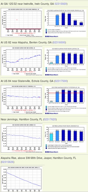
PHOTOSET: https://wwals.net/2014/11/03/alapaha-river-water-levels/
PHOTO SOURCE: John S. Quarterman
PHONE NUMBER: (229) 242-0102
Suggestions: https://forms.gle/DipPgU2TP5atc2Rf9
Ellaville Gauge

CATEGORIES: River Gauge
LAYER: River Gauge
OWNERSHIP: Public, TIITF/REC & PARKS & PARKS SUWANNEE RIVER ST PK, PARCEL 24-01S-11E-10898-000000 (90)
WATER BODY: Suwannee River
GAUGE: Ellaville
MILE: 127.49
ADDRESS: Left bank, just upstream from CSX RR bridge, upstream from Hillman Bridge and US 90. Suwannee County.
DESCRIPTION: USGS 02319500 SUWANNEE RIVER AT ELLAVILLE, FLA
HISTORIC FACTS: “”The fact that the gauge station is right next to the old bridge site tells me that the gauge station was put in place also in 1908. It was left there but rebuilt in 1925 when the Hillman Bridge was built further downstream.”” —Ken Sulak
WEBSITE: https://water.weather.gov/ahps2/hydrograph.php?wfo=tae&gage=ellf1
PHOTO: https://water.weather.gov/resources/hydrographs/ellf1_hg.png
PHOTOSET: https://water.weather.gov/ahps2/hydrograph.php?gage=ellf1&wfo=tae
PHOTO SOURCE: National Weather Service
PHONE NUMBER: (850) 290-2350
Suggestions: https://forms.gle/DipPgU2TP5atc2Rf9
Dowling Park Gauge @ CR 250
CATEGORIES: River Gauge
LAYER: River Gauge
OWNERSHIP: Public
WATER BODY: Suwannee River
GAUGE: Dowling Park
MILE: 112.83
ADDRESS: Suwannee River at CR 250, Suwanneee, Lafayette Counties.
DESCRIPTION: USGS 02319800 SUWANNEE RIVER AT DOWLING PARK, FLORIDA
WEBSITE: https://water.weather.gov/ahps2/hydrograph.php?wfo=tae&gage=douf1
Suggestions: https://forms.gle/DipPgU2TP5atc2Rf9
Luraville Gauge
CATEGORIES: River Gauge
LAYER: River Gauge
OWNERSHIP: Public
WATER BODY: Suwannee River
GAUGE: Luraville
MILE: 98.26
ADDRESS: On SR 51 Hal W. Adams Bridge between Luraville and Mayo. Suwannee, Lafayette Counties.
DESCRIPTION: USGS 02320000 SUWANNEE RIVER AT LURAVILLE, FLA.
WEBSITE: https://water.weather.gov/ahps2/hydrograph.php?wfo=tae&gage=lurf1&prob_type=stage&source=hydrograph
Suggestions: https://forms.gle/DipPgU2TP5atc2Rf9
Branford Gauge
CATEGORIES: River Gauge
LAYER: River Gauge
OWNERSHIP: Public
WATER BODY: Suwannee River
GAUGE: Branford
MILE: 76.13
ADDRESS: On US 27 bridge west from Branford. Suwannee County.
DESCRIPTION: USGS 02320500 SUWANNEE RIVER AT BRANFORD, FLA.
WEBSITE: https://water.weather.gov/ahps2/hydrograph.php?wfo=tae&gage=bfdf1&prob_type=stage&source=hydrograph
Suggestions: https://forms.gle/DipPgU2TP5atc2Rf9
Bell Gauge
CATEGORIES: River Gauge
LAYER: River Gauge
OWNERSHIP: Public
WATER BODY: Suwannee River
GAUGE: Bell
MILE: 56.24
ADDRESS: From Bell, travel north on US 129; turn left on CR 340; travel west to county park on the left at the river. Gilchrist County.
DESCRIPTION: USGS 02323000 SUWANNEE RIVER NEAR BELL, FLORIDA
WEBSITE: https://water.weather.gov/ahps2/hydrograph.php?wfo=tae&gage=rckf1&prob_type=stage&source=hydrograph
Suggestions: https://forms.gle/DipPgU2TP5atc2Rf9
Wilcox Gauge
CATEGORIES: River Gauge
LAYER: River Gauge
OWNERSHIP: Public
WATER BODY: Suwannee River
GAUGE: Wilcox
MILE: 34.22
ADDRESS: West of Fanning Springs on US 19 bridge. Levy County.
DESCRIPTION: USGS 02323500 SUWANNEE RIVER NEAR WILCOX, FLA.
WEBSITE: https://water.weather.gov/ahps2/hydrograph.php?wfo=tae&gage=wcxf1&prob_type=stage&source=hydrograph
Suggestions: https://forms.gle/DipPgU2TP5atc2Rf9
Manatee Springs Gauge
CATEGORIES: River Gauge
LAYER: River Gauge
OWNERSHIP: Public
WATER BODY: Suwannee River
GAUGE: Manatee Springs
MILE: 25.10
ADDRESS: From Chiefland, travel west on NW 115 Street to Manatee Springs State Park. Levy County.
DESCRIPTION: USGS 02323566 MANATEE SPRING NR CHIEFLAND FLA
WEBSITE: https://water.weather.gov/ahps2/hydrograph.php?wfo=tae&gage=mtsf1&prob_type=stage&source=hydrograph
Suggestions: https://forms.gle/DipPgU2TP5atc2Rf9
Fowlers Bluff Gauge
CATEGORIES: River Gauge
LAYER: River Gauge
OWNERSHIP: Private
WATER BODY: Suwannee River
GAUGE: Fowlers Bluff
MILE: 17.03
ADDRESS: From Fowlers Bluff, east on CR 347, left on NW 149 Ave., continue to end; is on private property. Levy County.
DESCRIPTION: USGS 02323590 SUWANNEE RIVER AT FOWLERS BLUFF
WEBSITE: https://water.weather.gov/ahps2/hydrograph.php?wfo=tae&gage=fwbf1&prob_type=stage&source=hydrograph
Suggestions: https://forms.gle/DipPgU2TP5atc2Rf9
Ichetucknee River Gauge
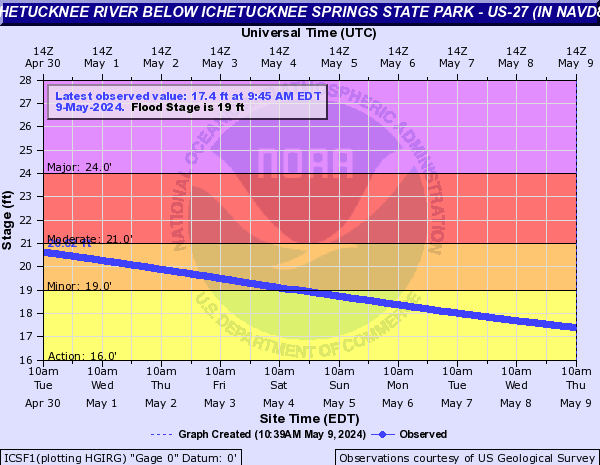
CATEGORIES: River Gauge
LAYER: River Gauge
OWNERSHIP: Public
WATER BODY: Ichetucknee River
GAUGE: Ichetucknee
MILE: 1.87
ADDRESS: South of U.S. 27 at the Ichetucknee River, apparently on the Suwannee River Greenway. Columbia County.
DESCRIPTION: USGS 02322700 ICHETUCKNEE R @ HWY27 NR HILDRETH, FL
WEBSITE: https://water.weather.gov/ahps2/hydrograph.php?gage=icsf1&wfo=jax
PHOTO: https://water.weather.gov/resources/hydrographs/icsf1_hg.png
PHOTOSET: https://water.weather.gov/ahps2/hydrograph.php?gage=icsf1&wfo=jax
PHOTO SOURCE: National Weather Service
PHONE NUMBER: (850) 290-2350
Suggestions: https://forms.gle/DipPgU2TP5atc2Rf9
Alligator Creek at Starke Gauge
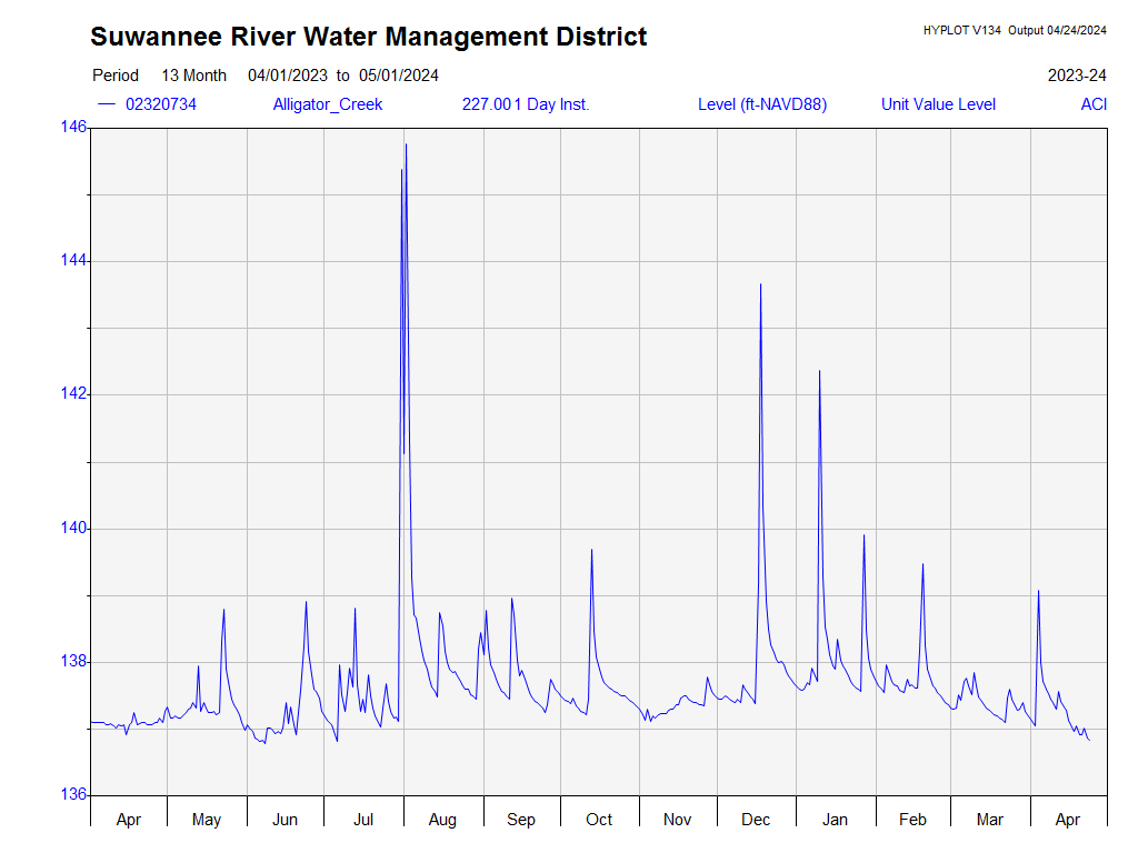
CATEGORIES: River Gauge
LAYER: River Gauge
GPS: 29.936847, -82.11563
OWNERSHIP: Public
WATER BODY: Alligator Creek 00277787
GAUGE: Alligator Creek at Starke
MILE: 2.90
ADDRESS: 603 Edwards Rd, Starke, FL 32091, behind the Starke WTP. Bradford County.
DESCRIPTION: Apparently it is possible to paddle Alligator Creek.
WEBSITE: https://water.weather.gov/ahps2/hydrograph.php?wfo=jax&gage=acsf1
OTHER REFERENCE: http://www.mysuwanneeriver.org/realtime/river-30-day.php?id=02320734
PHOTO: http://www.mysuwanneeriver.org/data/02320734/02320734_12MONTH.png
PHOTOSET: http://www.mysuwanneeriver.org/realtime/river-30-day.php?id=02320734
PHOTO SOURCE: SRWMD
PHONE NUMBER: (850) 290-2350
Photoset2: https://www.floridapaddlenotes.com/alligator-creek/
PHOTO2 SOURCE: James Steele, Florida Paddle Notes, March 2, 2019
Suggestions: https://forms.gle/DipPgU2TP5atc2Rf9
Lake Sampson near Starke Gauge
CATEGORIES: River Gauge
LAYER: River Gauge
OWNERSHIP: Public
WATER BODY: Lake Sampson
GAUGE: Lake Sampson near Starke
ADDRESS: 14664 SW 75th Ave, Starke, FL 32091, Bradford County.
DESCRIPTION: On the east (upstream) shore of Lake Sampson, a bit north of the outflow from Lake Rowell.
WEBSITE: https://water.weather.gov/ahps2/hydrograph.php?wfo=jax&gage=lssf1&prob_type=stage&source=hydrograph
Suggestions: https://forms.gle/DipPgU2TP5atc2Rf9
Sampson River at Sampson City Gauge
CATEGORIES: River Gauge
LAYER: River Gauge
OWNERSHIP: Public
WATER BODY: Sampson River
GAUGE: Sampson River at Sampson City
ADDRESS: 10243 SW CR 225, Starke, FL 32091, Bradford County.
DESCRIPTION: On a pier on the upstream (NE) side of the CR 225 bridge.
AKA: Sampson River at CR 225 Gauge
WEBSITE: https://water.weather.gov/ahps2/hydrograph.php?wfo=jax&gage=sssf1&prob_type=stage&source=hydrograph
PHOTO: https://maps.app.goo.gl/yfg5DY9whJ7x4tHg8
PHOTOSET: https://www.google.com/maps/place/SW+138th+St, +Florida+32091/@29.9189952, -82.210762, 84m/data=!3m1!1e3!4m6!3m5!1s0x88e8aaa7fcf4e817:0x258518e91becaccd!8m2!3d29.9182236!4d-82.2148371!16s%2Fg%2F1thbxhdw?entry=ttu
PHOTO SOURCE: Google Streetview
PHONE NUMBER: (850) 290-2350
PHOTO2: http://www.mysuwanneeriver.org/data/02320800/02320800_12MONTH.png
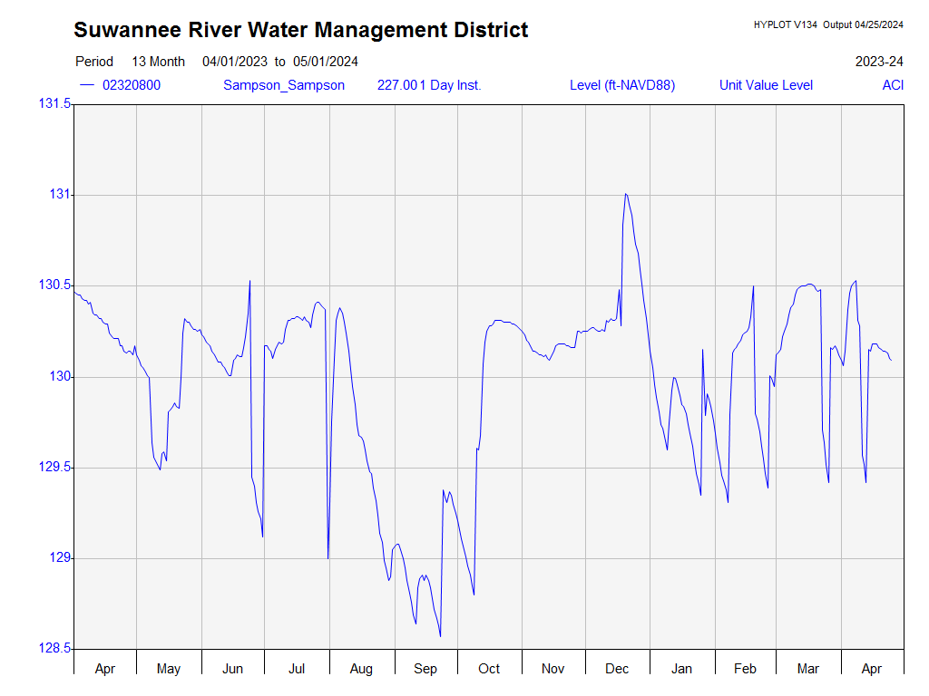
Photoset2: http://www.mysuwanneeriver.org/realtime/river-30-day.php?id=02320800
PHOTO2 SOURCE: SRWMD
Suggestions: https://forms.gle/DipPgU2TP5atc2Rf9

Earleton Gauge
CATEGORIES: River Gauge
LAYER: River Gauge
GPS: 29.745, -82.098611
OWNERSHIP: Private
WATER BODY: Santa Fe Lake
GAUGE: Earleton
MILE: 80.74
ADDRESS: On Santa Fe Lake, Bradford County.
DESCRIPTION: USGS 02320600 SANTA FE LAKE NR KEYSTONE HTS, FLA.
WEBSITE: https://water.weather.gov/ahps2/hydrograph.php?wfo=jax&gage=erlf1&prob_type=stage&source=hydrograph
Suggestions: https://forms.gle/DipPgU2TP5atc2Rf9
Graham Gauge
CATEGORIES: River Gauge
LAYER: River Gauge
OWNERSHIP: Public
WATER BODY: Santa Fe River
GAUGE: Graham
MILE: 69.69
ADDRESS: On N CR 225 bridge south of Graham. Bradford County.
DESCRIPTION: USGS 02320700 SANTA FE RIVER NEAR GRAHAM, FLA.
WEBSITE: https://water.weather.gov/ahps2/hydrograph.php?wfo=jax&gage=grmf1&prob_type=stage
Suggestions: https://forms.gle/DipPgU2TP5atc2Rf9
Lake Butler Gauge
CATEGORIES: River Gauge
LAYER: River Gauge
OWNERSHIP: Public
WATER BODY: New (FL) River
GAUGE: Lake Butler
MILE: 13.98
ADDRESS: On SR 100 bridge between Lake Butler and Starke. Union County.
DESCRIPTION: USGS 02321000 NEW RIVER NR LAKE BUTLER FLA
WEBSITE: https://water.weather.gov/ahps2/hydrograph.php?wfo=jax&gage=nrbf1&prob_type=stage
Suggestions: https://forms.gle/DipPgU2TP5atc2Rf9
Worthington Springs Gauge
CATEGORIES: River Gauge
LAYER: River Gauge
OWNERSHIP: Public
WATER BODY: Santa Fe River
GAUGE: Worthington Springs
MILE: 49.23
ADDRESS: On the FL 121 bridge south of Worthington Springs. Alachua County.
DESCRIPTION: USGS 02321500 SANTA FE RIVER AT WORTHINGTON SPRINGS, FLA.
AKA: Worthington Spring Gauge
WEBSITE: https://water.weather.gov/ahps2/hydrograph.php?wfo=jax&gage=worf1&prob_type=stage&source=hydrograph
Suggestions: https://forms.gle/DipPgU2TP5atc2Rf9
O’Leno Gauge
CATEGORIES: River Gauge
LAYER: River Gauge
OWNERSHIP: Public
WATER BODY: Santa Fe River
GAUGE: O’Leno
MILE: 36.02
ADDRESS: In O’Leno State Park just downstream from I-75. Columbia County.
DESCRIPTION: USGS 02321898 SANTA FE RIVER AT O’LENO STATE PARK FLA
WEBSITE: https://water.weather.gov/ahps2/hydrograph.php?wfo=jax&gage=olpf1&prob_type=stage&source=hydrograph
Suggestions: https://forms.gle/DipPgU2TP5atc2Rf9
Santa Fe River Rise Gauge
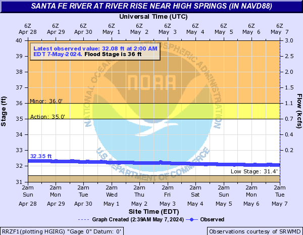
CATEGORIES: River Gauge
LAYER: River Gauge
OWNERSHIP: Public
WATER BODY: Santa Fe River
GAUGE: Santa Fe River Rise
MILE: 30.27
ADDRESS: 373 S.W. U.S. Highway 27, Fort White FL 32643, in River Rise Preserve State Park. Columbia County.
DESCRIPTION: USGS 02321958 SANTA FE RIVER AT RIVER RISE NR HIGH SPRINGS, FL
WEBSITE: https://water.weather.gov/ahps2/hydrograph.php?wfo=jax&gage=rrzf1&prob_type=stage&source=hydrograph
OTHER REFERENCE: https://www.floridastateparks.org/RiverRise
PHOTO: https://water.weather.gov/resources/hydrographs/rrzf1_hg.png
PHOTOSET: https://water.weather.gov/ahps2/hydrograph.php?wfo=jax&gage=rrzf1&prob_type=stage&source=hydrograph
PHOTO SOURCE: National Weather Service
PHONE NUMBER: (850) 290-2350
Suggestions: https://forms.gle/DipPgU2TP5atc2Rf9
Poe Springs Gauge
CATEGORIES: River Gauge
LAYER: River Gauge
OWNERSHIP: Public
WATER BODY: Santa Fe River
GAUGE: Poe Springs
MILE: 22.79
ADDRESS: From High Springs, travel south on CR 236 to CR 340; turn right and travel 3 miles west; the entrance to Poe Springs is on the right. Alachua County.
DESCRIPTION: USGS 02322140 POE SPRINGS NEAR HIGH SPRINGS, FL
WEBSITE: https://water.weather.gov/ahps2/hydrograph.php?wfo=jax&gage=poef1&prob_type=stage&source=hydrograph
Suggestions: https://forms.gle/DipPgU2TP5atc2Rf9
Fort White Gauge
CATEGORIES: River Gauge
LAYER: River Gauge
OWNERSHIP: Public
WATER BODY: Santa Fe River
GAUGE: Fort White
MILE: 17.93
ADDRESS: Off of NE 55th Ave. Gilchrist County.
DESCRIPTION: USGS 02322500 SANTA FE RIVER NEAR FORT WHITE, FLA.
WEBSITE: https://water.weather.gov/ahps2/hydrograph.php?wfo=jax&gage=fwhf1&prob_type=stage&source=hydrograph
Suggestions: https://forms.gle/DipPgU2TP5atc2Rf9
Three Rivers Estates Gauge
CATEGORIES: River Gauge
LAYER: River Gauge
GPS: 29.9325, -82.799167
OWNERSHIP: Public
WATER BODY: Santa Fe River
GAUGE: Three Rivers Estates
MILE: 7.03
ADDRESS: On Santa Fe River about 200 feet upstream of Ichetucknee River Confluence, Gilchrist County.
DESCRIPTION: USGS 02322703 Three Rivers Estates, Santa Fe River
WEBSITE: https://water.weather.gov/ahps2/hydrograph.php?wfo=jax&gage=tref1&prob_type=stage&source=hydrograph
Suggestions: https://forms.gle/DipPgU2TP5atc2Rf9
Hildreth Gauge
CATEGORIES: River Gauge
LAYER: River Gauge
OWNERSHIP: Public
WATER BODY: Santa Fe River
GAUGE: Hildreth
MILE: 2.42
ADDRESS: From Branford, travel east on US 27; turn right on US 129; travel south to 296th Street; turn right and William Guy Lemons Memorial Park is on the left. Suwannee County.
DESCRIPTION: USGS 02322800 SANTA FE RIVER NR HILDRETH FLA
WEBSITE: https://water.weather.gov/ahps2/hydrograph.php?wfo=jax&gage=ftwf1&prob_type=stage
Suggestions: https://forms.gle/DipPgU2TP5atc2Rf9
Shoal
Big Shoals 

CATEGORIES: Shoal
LAYER: Brochure
OWNERSHIP: Public
WHITEWATER CLASS: Class III
WATER BODY: Suwannee River
Lowest boatable: 55
Highest safe: 65
GAUGE: White Springs
MILE: 175.97
ADDRESS: Little more than a mile downstream from Big Shoals Tract Launch. Hamilton, Columbia Counties.
DESCRIPTION: Class III rapids, the biggest in Florida. Not for the faint of heart, and even experienced paddlers be prepared and do not go alone. Portaging is usually wiser. Portage on the left bank. https://www.americanwhitewater.org/content/River/view/river-detail/3181/main Or you can take out at the overlook on the right bank shortly below Big Shoals, and walk back to Big Shoals Tract Launch. https://www.liveabout.com/kayaking-big-shoals-on-the-suwannee-river-2555489
WEBSITE: https://map.mysuwanneeriver.com/tracts/big-shoals-25/
PHOTO: https://wwals.net/pictures/2021-05-19–big-shoals-pictures/20210519_112033.jpg
PHOTOSET: https://wwals.net/pictures/2021-05-19–big-shoals-pictures
PHOTO SOURCE: John S. Quarterman
PHONE NUMBER: (229) 242-0102
PHOTO2: https://www.wwals.net/pictures/2021-05-19–big-shoals-outing/20210221_194740-tp-shoals.jpg
Photoset2: https://wwals.net/pictures/2021-05-19–big-shoals-outing
PHOTO2 SOURCE: Tom Potter
Suggestions: https://forms.gle/DipPgU2TP5atc2Rf9

Little Shoals

CATEGORIES: Shoal
LAYER: Brochure
OWNERSHIP: Public
WHITEWATER CLASS: Class II
WATER BODY: Suwannee River
Lowest boatable: 55
Highest safe: 68
GAUGE: White Springs
MILE: 172.28
ADDRESS: About three and a half miles downstream from Big Shoals and 4.7 miles down from Big Shoals Tract Launch. Hamilton, Columbia Counties.
DESCRIPTION: Substantial rapids. Be prepared.
WEBSITE: https://map.mysuwanneeriver.com/tracts/little-shoals-121/
OTHER REFERENCE: https://wwals.net/pictures/2021-05-19–big-shoals-pictures/#LS
ADDITIONAL INFO SOURCES: http://www.suwanneeoutpost.com/waterlevels.html
PHOTO: https://wwals.net/pictures/2021-05-19–big-shoals-pictures/20210519_132424.jpg
PHOTOSET: https://wwals.net/pictures/2021-05-19–big-shoals-pictures/
PHOTO SOURCE: John S. Quarterman
PHONE NUMBER: (229) 242-0102
PHOTO2: https://www.wwals.net/pictures/2021-05-19–big-shoals-outing/20190119_135542.jpg
Photoset2: https://wwals.net/pictures/2021-05-19–big-shoals-outing
PHOTO2 SOURCE: John S. Quarterman
Photo2 Phone Number: 229-242-0102
Suggestions: https://forms.gle/DipPgU2TP5atc2Rf9

US 41 Shoals

CATEGORIES: Shoal
LAYER: Brochure
GPS: 30.3281, -82.73679
OWNERSHIP: Public
WHITEWATER CLASS: Class I
WATER BODY: Suwannee River
Lowest boatable: 55
Highest safe: 68
GAUGE: White Springs
MILE: 171.23
ADDRESS: Within sight of the Norfolk Southern Railroad and US 41 bridges. Hamilton, Columbia Counties.
DESCRIPTION: Small rapids that can catch you off guard.
WEBSITE: https://map.mysuwanneeriver.com/tracts/little-shoals-121/
OTHER REFERENCE: https://wwals.net/pictures/2021-05-19–big-shoals-pictures/#US41S
ADDITIONAL INFO SOURCES: http://www.suwanneeoutpost.com/waterlevels.html
PHOTO: https://wwals.net/pictures/2021-05-19–big-shoals-pictures/20210519_135006.jpg
PHOTOSET: https://wwals.net/pictures/2021-05-19–big-shoals-pictures/
PHOTO SOURCE: John S. Quarterman
PHONE NUMBER: (229) 242-0102
PHOTO2: https://www.wwals.net/pictures/2021-05-19–big-shoals-outing/20190119_135542.jpg
Photoset2: https://wwals.net/pictures/2021-05-19–big-shoals-outing
PHOTO2 SOURCE: John S. Quarterman
Photo2 Phone Number: 229-242-0102
Suggestions: https://forms.gle/DipPgU2TP5atc2Rf9
Sinkhole
Live Oak Sinkhole 
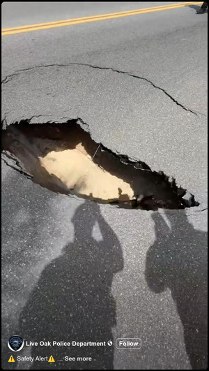
CATEGORIES: Sinkhole
LAYER: Other
OWNERSHIP: Public
WATER BODY: Suwannee River
ADDRESS: Eastbound lane of US 90 (E Howard Street) between Dowling Ave. and Union Ave. Suwannee County.
DESCRIPTION: A sinkhole opened in US 90 in the middle of Live Oak, FL, on Monday, August 25, 2025. It was reported fixed the next day.
WEBSITE: https://www.facebook.com/reel/1262305625163421/
PHOTOSET: https://www.facebook.com/reel/1262305625163421/
PHOTO SOURCE: Live Oak Police Department
PHONE NUMBER: (850) 290-2350
Suggestions: https://forms.gle/DipPgU2TP5atc2Rf9
O’Leno Sink

CATEGORIES: Sinkhole
LAYER: Brochure
OWNERSHIP: Public
WATER BODY: Santa Fe River
GAUGE: O’Leno
MILE: 33.52
ADDRESS: In O’Leno State Park, 410 SE O’Leno Park Road, High Springs, FL 32643, Alachua County.
DESCRIPTION: Where the Santa Fe River goes underground. Accessible only by land; you cannot paddle downstream from the floating swimming dock.
WEBSITE: https://www.floridastateparks.org/parks-and-trails/oleno-state-park
PHOTO: https://www.wwals.net/pictures/2024-02-01–wq/2024-02-01–oleno-swirl-IMG_4371.jpg
PHOTOSET: https://www.wwals.net/pictures/2024-02-01–wq/
PHOTO SOURCE: Joanne Tremblay
PHONE NUMBER: (850) 290-2350
Suggestions: https://forms.gle/DipPgU2TP5atc2Rf9
Mill Creek Sink
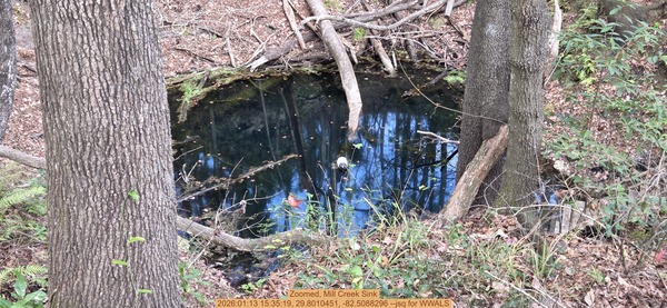
CATEGORIES: Sinkhole
LAYER: Brochure
OWNERSHIP: Private, NATIONAL SPELEOLOGICAL SOCIETY INC, PARCEL 03066-002-001
WATER BODY: Mill Creek
ADDRESS: Off I-75 Exit 399, in the woods behind (east) of Sonny’s BBQ, 15935 NW US Hwy 441, Alachua, FL 32615, Alachua County.
DESCRIPTION: According to its owner, the National Speleological Society (NSS): Mill Creek Sink is a water filled sinkhole connected to a water filled cave located near I-75 in the city of Alachua, Florida. Mill Creek Sink is the only known window to the underground Mill Creek Stream System. The sinkhole slopes steeply nearly 50 feet down to the water’s edge. Most of the year the sinkhole is filled with very dark, tannic-stained water as well as fallen trees and debris. Clear water is normally not encountered for a considerable distance into the system. The main cave system has tunnel both upstream and downstream with depths to 227 feet.
HISTORIC FACTS: Renamed from Alachua Sink in 2003. https://cavedivingaccident.com/beneath-the-surface-the-tragic-dive-of-lance-crawford-and-the-perils-of-alachua-sink/ NSS says: Dye tracing studies3 done by the NSS-CDS in February of 1976 and 2006 revealed that Mill Creek Sink is connected to Hornsby Springs, a straight line distance of six miles. Hornsby Springs is a tributary water source for the Santa Fe River. The Santa Fe River is designated as an “”Outstanding Florida Waterway”” which is the most prominent designation for a river in the State of Florida. The uniqueness of this hydrological relationship provides an upstream karst window to a sensitive water source, which is part of a major conduit feeding the Florida Aquifer. https://legacy.caves.org/preserves/ascp/mcsp-mp.shtml
AKA: Alachua Sink
WEBSITE: https://legacy.caves.org/preserves/ascp/mcsp-mp.shtml
PHOTO: https://www.wwals.net/pictures/2025-01-13–mill-creek-sink/20260113_153519.jpg
PHOTOSET: https://www.wwals.net/pictures/2025-01-13–mill-creek-sink/20260113_153519.jpg
PHOTO SOURCE: John S. Quarterman
PHONE NUMBER: (229) 242-0102
PHOTO2: https://www.wwals.net/pictures/2025-01-13–mill-creek-sink/20260113_155025.jpg
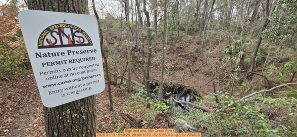
Photoset2: https://www.wwals.net/pictures/2025-01-13–mill-creek-sink/
PHOTO2 SOURCE: John S. Quarterman
Photo2 Phone Number: 229-242-0102
Suggestions: https://forms.gle/DipPgU2TP5atc2Rf9

Solar
Echo River Solar Energy Center 
CATEGORIES: Solar
LAYER: Other
GPS: 30.29621, -82.85798
OWNERSHIP: Private
WATER BODY: Rocky Creek
GAUGE: White Springs
ADDRESS: 8442 Hogan Rd, Live Oak, FL 32060, Suwannee County.
DESCRIPTION: 74.5 MW solar power farm by FPL.
WEBSITE: https://wwals.net/2018/08/03/fpl-echo-river-solar-energy-facility-suwannee-county-fl/
PHOTO: https://wwals.net/wp-content/themes/pianoblack/img//2018/08/3f610af16256cea38976e4f6786f9408.jpg
PHOTOSET: https://wwals.net/2018/08/03/fpl-echo-river-solar-energy-facility-suwannee-county-fl/
PHOTO SOURCE: FPL
PHONE NUMBER: (850) 290-2350
Suggestions: https://forms.gle/DipPgU2TP5atc2Rf9
Suwannee Solar Plant

CATEGORIES: Solar
LAYER: Other
OWNERSHIP: Private, Duke Energy, PARCEL 25-01S-11E-1090700.0000
WATER BODY: Suwannee River
GAUGE: Ellaville
MILE: 127.36
ADDRESS: River Road, Live Oak, FL 32060, east across from Duke Suwannee River Power Plant. Suwannee County.
DESCRIPTION: 8.8 megawatt solar plant on 62 acres.
WEBSITE: https://wwals.net/2017/04/24/suwannee-bocc-approves-duke-solar-plant-2017-04-18/
PHOTO: http://wwals.com/wp-content/themes/pianoblack/img//2017/04/a6c027f5faee8c0ad55dbbabfa9592f5.jpg
PHOTOSET: https://wwals.net/2017/04/24/suwannee-bocc-approves-duke-solar-plant-2017-04-18/
PHOTO SOURCE: Suwannee County Property Appraiser
PHONE NUMBER: (850) 290-2350
PHOTO2: https://www.wwals.net/pictures/2025-12-20–pilgrims-pride-outfall-suwannee-river/20251220_113725.jpg
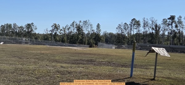
Photoset2: https://www.wwals.net/pictures/2025-12-20–pilgrims-pride-outfall-suwannee-river/
PHOTO2 SOURCE: John S. Quarterman
Suggestions: https://forms.gle/DipPgU2TP5atc2Rf9
SR26 Solar Farm
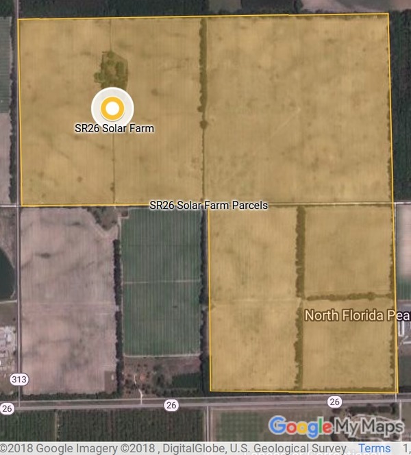
CATEGORIES: Solar
LAYER: Other
GPS: 29.6247, -82.87764
OWNERSHIP: Private, PARCEL 11-10-14-0000-0003-0000; 12-10-14-0000-0003-0000; and 13-10-14-0000-0002-0000.
WATER BODY: Suwannee River
GAUGE: Wilcox
ADDRESS: 4370 SW 80th St, Trenton, FL 32693, Gilchrist County.
DESCRIPTION: 74.9 Megawatts AC of solar power going in at 4370 SW 80 Street, Trenton, Florida, assuming the Gilchrist BOCC approved it as staff recommended.
WEBSITE: https://wwals.net/2018/06/11/sr26-solar-farm-trenton-gilchrist-county-florida/
PHOTO: https://wwals.net/wp-content/themes/pianoblack/img//2018/06/0f5a5361ffa3997c5365580691ecfa2e.jpg
PHOTOSET: https://wwals.net/2018/06/11/sr26-solar-farm-trenton-gilchrist-county-florida/
PHOTO SOURCE: John S. Quarterman
PHONE NUMBER: (229) 242-0102
Suggestions: https://forms.gle/DipPgU2TP5atc2Rf9
Spill
Homerville Gallows Branch Lift Station Spill 
CATEGORIES: Spill
LAYER: Point of Interest
ADDRESS: The manhole inside the fence at the main lift station at the WWTP, 245 E. Forest Ave. — Main LS Manhole by Dickerson St. Clinch County.
DESCRIPTION: Spilled 5, 000 gallons of raw sewage due to “”Hydraulic Overload”” into Gallows Branch, which runs into Surveyors Creek into the Okefenokee Swamp.
Suggestions: https://forms.gle/DipPgU2TP5atc2Rf9
Spill from Trail Ridge South Chemours Mine
CATEGORIES: Spill
LAYER: Point of Interest
GPS: 29.90647903, -82.05765152
OWNERSHIP: Private, North Florida Land Trust, PARCEL 04612-0-00100 (12797) 10
WATER BODY: Lake Rowell
ADDRESS: A wetland west of SE 5th Lane and east of SE 13th Ave. and Boat Drain Road, north of SE 127th Street. Bradford County.
DESCRIPTION: The spill could drain through the wetland either down a branch of the Alligator Creek that runs through Starke, or down Prevatt Creek more directly into Lake Rowell. The wetland is owned by North Florida Land Trust, “”North Florida Land Trust is a non-profit organization committed to protecting and preserving our region’s irreplaceable natural beauty.””
HISTORIC FACTS: January 30-31, 2024, Chemours had a stormwater or process water spill from its Trail Ridge South titanium dioxide mine. “”Water from reclamation cell was not contained and turbid water left the permitted facility and entered adjacent wetland. This water does not contain any hazardous materials. upon discovery, dozers reinforced the berm to contain water.””
PHOTOSET: wwals.net/pictures/2024-01-30—spill-trail-ridge-south-chemours
PHOTO SOURCE: WWALS
PHONE NUMBER: (850) 290-2350
Suggestions: https://forms.gle/DipPgU2TP5atc2Rf9
Tailings Spill from Trail Ridge South Chemours
CATEGORIES: Spill
LAYER: Point of Interest
GPS: 29.89094873, -82.04341783
OWNERSHIP: Private, Armory Board State of Florida c/o Dept of Military Affairs/State, PARCEL 000731-017-00
WATER BODY: Santa Fe River
ADDRESS: North of Camp Road, west of Treat Road, actually in Clay County, on land owned by the State of Florida, draining into Bradford County. Clay County.
DESCRIPTION: The spill is at the top of Double Run Branch 03110206003356, on land in Clay County owned by Armory Board State of Florida. That drains west into Bradford County, through land owned by SRWMD and Rayonier Forest Resources, LP, into Double Run Creek, which goes through land owned by Schoeffel Enterprises LLC and Harry W. and Mary Ann Kyle, before it drains through more Rayonier and SRWMD land into the Santa Fe Swamp Conservation Area into the Santa Fe River.
HISTORIC FACTS: “”On Saturday September 14, 2024 at approximately 11:00 am, an operator noticed accumulated stormwater in a tailings pit overtopping a berm with some water going into the adjacent wetland. Operator immediately stopped the flow. There was a miscommunication between the operator and the shift supervisor, and notification to the Area Manager and Environmental was not communicated until the following day (September 15, 2024 afternoon). We are continuing to finalize the volume: however, It is estimated that approximately 1200 gallons of water was released.”” https://floridadep.gov/pollutionnotice
WEBSITE: wwals.net/pictures/2024-09-14—spill-trailridge-mine-chemours
PHOTOSET: https://www.wwals.net/pictures/2024-09-14–spill-trailridge-mine-chemours/
PHOTO SOURCE: WWALS
PHONE NUMBER: (850) 290-2350
Suggestions: https://forms.gle/DipPgU2TP5atc2Rf9
Water St @ FL 16 Spill *
CATEGORIES: Spill
LAYER: Point of Interest
OWNERSHIP: Bradford, PARCEL FL
ACCESS: Alligator Creek 00277787, TYPE OF LAUNCH, DOCK: “Raw sewage spill, some part of 30, 000 gallons, “”N. Water Street and SR 16″” 2021-07-07 during Tropical Storm Elsa. CANOE: Public
MILE: 4.13
ADDRESS: “”N. Water Street and SR 16”
DESCRIPTION: FL 32091, * https://wwals.net/pictures/2021-07-08–sewage-spills-valdosta-starke
WEBSITE: Starke
OTHER REFERENCE: Near Dolly’s Bar-B-Q, near Alligator Creek 00277787, into Lake Rowell, Lake Sampson, Sampson River, Santa Fe River.
Suggestions: https://forms.gle/DipPgU2TP5atc2Rf9
Clark St @ FL 16 Spill *
CATEGORIES: Spill
LAYER: Point of Interest
OWNERSHIP: Bradford, PARCEL FL
ACCESS: Alligator Creek 00277787, TYPE OF LAUNCH, DOCK: “Raw sewage spill, some part of 30, 000 gallons, “”SR 16 and Clark St”” 2021-07-07 during Tropical Storm Elsa. CANOE: Public
MILE: 4.12
ADDRESS: “”SR 16 and Clark St”
DESCRIPTION: FL 32091, * https://wwals.net/pictures/2021-07-08–sewage-spills-valdosta-starke
WEBSITE: Starke
OTHER REFERENCE: Near Sam’s Discount Liquor, near Alligator Creek 00277787, into Lake Rowell, Lake Sampson, Sampson River, Santa Fe River.
Suggestions: https://forms.gle/DipPgU2TP5atc2Rf9
FL 100 @ Alligator Creek Spill *
CATEGORIES: Spill
LAYER: Point of Interest
OWNERSHIP: Bradford, PARCEL FL
ACCESS: Alligator Creek 00277787, TYPE OF LAUNCH, DOCK: “Raw sewage spill, some part of 30, 000 gallons, “”SR 100 and Alligator Creek”” 2021-07-07 during Tropical Storm Elsa. CANOE: Public
MILE: 3.55
ADDRESS: “”SR 100 and Alligator Creek”
DESCRIPTION: FL 32091, * https://wwals.net/pictures/2021-07-08–sewage-spills-valdosta-starke
WEBSITE: Starke
OTHER REFERENCE: State Highway crossing Alligator Creek 00277787, into Lake Rowell, Lake Sampson, Sampson River, Santa Fe River.
Suggestions: https://forms.gle/DipPgU2TP5atc2Rf9
Orange Street @ Legion Terrace Spill *
CATEGORIES: Spill
LAYER: Point of Interest
GPS: 29.941851, -82.11472
OWNERSHIP: Bradford, PARCEL FL
ACCESS: Alligator Creek 00277787, TYPE OF LAUNCH, DOCK: “Raw sewage spill, some part of 30, 000 gallons, “”Orange street Legion Terrance”” 2021-07-07 during Tropical Storm Elsa. CANOE: Public
MILE: 2.98
ADDRESS: “”Orange street Legion Terrance”
DESCRIPTION: FL 32091, * https://wwals.net/pictures/2021-07-08–sewage-spills-valdosta-starke
WEBSITE: Starke
OTHER REFERENCE: Residential neighborhood, near Alligator Creek 00277787, into Lake Rowell, Lake Sampson, Sampson River, Santa Fe River.
Suggestions: https://forms.gle/DipPgU2TP5atc2Rf9
Melton Terrace Spill *
CATEGORIES: Spill
LAYER: Point of Interest
OWNERSHIP: Bradford, PARCEL FL
ACCESS: Alligator Creek 00277787, TYPE OF LAUNCH, DOCK: “Raw sewage spill, some part of 30, 000 gallons, “”Milton Terrance Sidewalk”” 2021-07-07 during Tropical Storm Elsa. CANOE: Public
MILE: 2.90
ADDRESS: “”Milton Terrance Sidewalk”
DESCRIPTION: FL 32091, * https://wwals.net/pictures/2021-07-08–sewage-spills-valdosta-starke
WEBSITE: Starke
OTHER REFERENCE: Residential neighborhood, near Alligator Creek 00277787, into Lake Rowell, Lake Sampson, Sampson River, Santa Fe River.
Suggestions: https://forms.gle/DipPgU2TP5atc2Rf9
High Springs Railroad Ave Spill
CATEGORIES: Spill
LAYER: Point of Interest
GPS: 29.82482649, -82.59387311
OWNERSHIP: Public
WATER BODY: Santa Fe River
MILE: 27.94
ADDRESS: 23301 NW 186th Ave, High Springs, FL 32643, Alachua County.
DESCRIPTION: A 1, 500-gallon sewage spill, from midnight to 7AM, April 24, 2024. “”Bypass ball valve in discharge pipe vault union separated and pumped out from there. Residents in area mentioned smelling something around midnight the previous night but never reported it till maintenance showed up at 0700 and called us to report it. We were able to shut the pumps off and close a valve after the vault to isolate the station.””
WEBSITE: https://wwals.net/2024/04/26/high-springs-fl-1500-gallon-sewage-spill-ne-railroad-ave-2024-04-24/
Suggestions: https://forms.gle/DipPgU2TP5atc2Rf9
High Springs Railroad Ave SE Douglas St Spill
CATEGORIES: Spill
LAYER: Point of Interest
GPS: 29.82195886, -82.58891037
OWNERSHIP: Public
WATER BODY: Santa Fe River
MILE: 27.94
ADDRESS: 23007 NW Railroad Ave., High Springs, FL 32643, east of SE Douglas Street. Alachua County.
DESCRIPTION: A 4, 500-gallon sewage spill, from 6:30 to 11:00 AM, February 2, 2026, of which 4, 000 gallons were vacuumed up: Break in 6-inch Ductile Iron Pipe, believe caused by the freeze that occurred overnight. Leak has been repaired, dig site is backfilled, has lime and signs posted. End quote. This was far from any creeks or the Santa Fe River, so it probably had no effect on waterways.
Suggestions: https://forms.gle/DipPgU2TP5atc2Rf9
High Springs Plaza Spill

CATEGORIES: Spill
LAYER: Point of Interest
GPS: 29.80965399, -82.60677044
OWNERSHIP: Public
WATER BODY: Santa Fe River
MILE: 23.75
ADDRESS: 16782 FL-45, High Springs, FL 32643, Alachua County.
DESCRIPTION: Sewage spill site, mostly vacuumed up, unlikely to have gotten into the Santa Fe River.
HISTORIC FACTS: “”Notified of leak early morning, was able to turn off lift stations and stop most of flow from air relieve valve temporarily till a VacTruck was able to arrive to pump down and wash work area. Rags had gotten caught in valve and caused the ball to not close completely, causing the discharge, removed rags to properly close, again. Applied lime to affected area and posted signage and caution tape to quarantine the area.”” 1200 gallons spilled, 800 vacuumed up. https://floridadep.gov/pollutionnotice
WEBSITE: https://floridadep.gov/pollutionnotice
OTHER REFERENCE: https://wwals.net/2023/05/04/high-springs-small-sewage-spill-santa-fe-river-2023-05-04/
PHOTO: https://www.wwals.net/pictures/2023-05-04–high-springs-sewage-spill/many.jpg
PHOTOSET: https://www.wwals.net/pictures/2023-05-04–high-springs-sewage-spill/
PHOTO SOURCE: John S. Quarterman
PHONE NUMBER: (850) 290-2350
Suggestions: https://forms.gle/DipPgU2TP5atc2Rf9
Spring
Alapaha River Rise 

CATEGORIES: Spring
LAYER: Brochure
OWNERSHIP: Private, Edmund G. Herder Jr, PARCEL 3619-070
ACCESS: No
WATER BODY: Suwannee River
GAUGE: Ellaville
MILE: 135.69
ADDRESS: Right bank. Upstream on the Suwannee River from Gibson Park Ramp past CR 249. Hamilton County.
DESCRIPTION: The Alapaha River comes out of this spring next to the Suwannee River, after traveling 19 miles underground from the Dead River Sink during much of the dry season.
HISTORIC FACTS: SRWMD and FDEP dye test of 2016-06-22 found dye coming back up about six days later in Alapaha River Rise and Holton Creek Rise on the Suwannee River. https://wwals.net/?p=20807
WEBSITE: https://wwals.net/maps/alapaha-water-trail/map-alapaha-river-trail/underground/#Rise
PHOTO: https://wwals.net/wp-content/themes/pianoblack/img//2015/08/9465ab1041b3f75e2b2d275ca8dc58f91.jpg
PHOTO SOURCE: John S. Quarterman
PHONE NUMBER: (229) 242-0102
Suggestions: https://forms.gle/DipPgU2TP5atc2Rf9
Five Holes Beach Access

CATEGORIES: Spring
LAYER: Other
OWNERSHIP: Public
WATER BODY: Suwannee River
GAUGE: Ellaville
MILE: 130.77
ADDRESS: Downstream from Gibson Park, right bank, last bend before Suwannee River Campsites Ramp. Hamilton County.
DESCRIPTION: Beach access for climb up to five linked swallets leading to the Suwannee River.
PHOTO: https://wwals.net/wp-content/themes/pianoblack/img//2015/08/42cefa181cdec8937b9dbb738c7346411.jpg
PHOTO SOURCE: John S. Quarterman
PHONE NUMBER: (229) 242-0102
Suggestions: https://forms.gle/DipPgU2TP5atc2Rf9
Five Holes Outflow

CATEGORIES: Spring
LAYER: Point of Interest
OWNERSHIP: Public
WATER BODY: Suwannee River
GAUGE: Ellaville
MILE: 130.75
ADDRESS: Downstream from Gibson Park, right bank, last bend before Suwannee River Campsites Ramp, just past the beach. Hamilton County.
DESCRIPTION: The outflow, also known as Seven Sisters Springs, of Five Holes, a chain of linked swallets.
PHOTO: https://wwals.net/wp-content/themes/pianoblack/img//2015/08/f94c2e66d0ac005bab615414ce51a0f31.jpg
PHOTO SOURCE: John S. Quarterman
PHONE NUMBER: (229) 242-0102
Suggestions: https://forms.gle/DipPgU2TP5atc2Rf9
Seven Sisters Springs

CATEGORIES: Spring
LAYER: Other
GPS: 30.4175, -83.155331
OWNERSHIP: Public
WATER BODY: Suwannee River
GAUGE: Ellaville
MILE: 130.74
ADDRESS: Downstream from Gibson Park, just before Suwannee River Campsites Ramp. Hamilton County.
DESCRIPTION: 4th Magnitude spring, which is the outflow of Five Holes, a chain of linked sinks and springs. “”Seven Sisters Cave has two springs inside. The “”sisters”” refer to skylight entrances. The cave ends in a deep upstream sump.”” —Alan Cressler, 2008-08-14
PHOTO: https://wwals.net/wp-content/themes/pianoblack/img//2015/08/20588d762ab6c0bad2a0d9eb642a95121.jpg
PHOTO SOURCE: John S. Quarterman
PHONE NUMBER: (229) 242-0102
PHOTO2: https://live.staticflickr.com/3041/2776217253_481912bb33_3k.jpg
Photoset2: https://www.flickr.com/photos/alan_cressler/2776217253
PHOTO2 SOURCE: Alan Cressler
Suggestions: https://forms.gle/DipPgU2TP5atc2Rf9

Five Holes Land Access

CATEGORIES: Spring
LAYER: Point of Interest
OWNERSHIP: Public
WATER BODY: Suwannee River
GAUGE: Ellaville
MILE: 130.72
ADDRESS: Walk north from Suwannee River Campsites to the gate just east of SW 46th Ave. Hamilton County.
DESCRIPTION: A woods trail to a chain of five swallets above the Suwannee River.
WEBSITE: https://www.wwals.net/pictures/2018-02-10–five-holes/#Sign
PHOTO: https://www.wwals.net/pictures/2018-02-10–five-holes/20180210_154545.jpg
PHOTOSET: https://www.wwals.net/pictures/2018-02-10–five-holes/#Sign
PHOTO SOURCE: John S. Quarterman
PHONE NUMBER: (229) 242-0102
Suggestions: https://forms.gle/DipPgU2TP5atc2Rf9
Edwards Spring

CATEGORIES: Spring
LAYER: Point of Interest
OWNERSHIP: Private, MARTIN DENNIS C & EDITH B CO-TRUSTEES, PARCEL 24-01S-11E-10897-010250 (24645)
WATER BODY: Suwannee River
GAUGE: Ellaville
MILE: 127.43
ADDRESS: River Road, betweeen Historic Hillman Bridge and the CSX RR Bridge over the Suwannee River, on private property. Suwannee County.
DESCRIPTION: A 6-foot diameter spring pool below steep cave walls, with underground conduits that connect under the Suwannee River to Suwannacoochee Spring on the Withlacoochee RIver. Naturally, a favorite with cave divers. Ask permission of the property owner.
HISTORIC FACTS: On January 29, 2025, TJ Johnson was building steps into the spring.
AKA: Ellaville Spring
WEBSITE: https://cavedivingaccident.com/caves/edwards-spring-usa/
OTHER REFERENCE: http://thespringsfever.com/spr/Ellaville.html
PHOTO: https://www.wwals.net/pictures/2025-04-22–edwards-spring/20250422_104028.jpg
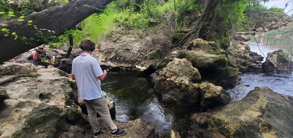
PHOTOSET: https://www.wwals.net/pictures/2025-04-22–edwards-spring/
PHOTO SOURCE: John S. Quarterman
PHONE NUMBER: (850) 290-2350
Suggestions: https://forms.gle/DipPgU2TP5atc2Rf9
TiMine
Chemours Jesup Mine 

CATEGORIES: Timine
LAYER: Brochure
OWNERSHIP: Private, HOPKINS W C & SONS, P O BOX 488, FOLKSTON GA 31537, PARCEL 72-59
WATER BODY: Dobson Mill Branch
ADDRESS: 892 Power Line Rd, Jesup, GA 31545, Wayne County.
DESCRIPTION: “”The mine will maintain an average depth of 15 feet and be on land currently used for growing and harvesting timber, located west of the city of Jesup, near Highway 84 and Holmesville and Empire roads.””
HISTORIC FACTS: DuPont previously tried mining this site.
WEBSITE: https://www.chemours.com/en/about-chemours/global-reach/wayne-county
OTHER REFERENCE: https://gov.georgia.gov/press-releases/2020-09-22/kemp-welcomes-chemours-wayne-county-86-million-investment-creates-78-new
ADDITIONAL INFO SOURCES: https://wwals.net/2021/05/04/chemours-new-florida-mine-what-about-next-to-the-okefenokee-swamp-in-georgia-2021-04-23/
PHOTO: https://www.wwals.net/pictures/2019-09-08–chemours-jesup/20190908_081125.jpg
PHOTOSET: https://www.wwals.net/pictures/2019-09-08–chemours-jesup/
PHOTO SOURCE: WWALS
PHONE NUMBER: (850) 290-2350
PHOTO2: https://www.wwals.net/pictures/2019-09-08–chemours-jesup/qpublic-wayne.jpg
Photoset2: https://www.wwals.net/pictures/2019-09-08–chemours-jesup/
PHOTO2 SOURCE: WWALS
Photo2 Phone Number: 850-290-2350
Suggestions: https://forms.gle/DipPgU2TP5atc2Rf9

Mission Mine North Chemours

CATEGORIES: Timine
LAYER: Brochure
OWNERSHIP: Private, Chemours (Southern Ionics)
WATER BODY: Satilla River
ADDRESS: On Tyler Field Road north of Winokur Rock Road, west of Riverside Road. Brantley County.
DESCRIPTION: Site of future Titanium mine by about 2025. Currently has offices and storage yards. Is also the office location for Mission Mine South. Just across the county line in Brantley County.
PHOTO: https://wwals.net/pictures/2020-04-27–mission-mine/Mission-Mine-North-Map.jpg
PHOTO SOURCE: WWALS SRWT Map
PHONE NUMBER: (229) 242-0102
Suggestions: https://forms.gle/DipPgU2TP5atc2Rf9
Mission MIne South Chemours

CATEGORIES: Timine
LAYER: Brochure
GPS: 31.0198, -81.9727
OWNERSHIP: Private, Chemours (Southern Ionics)
WATER BODY: Satilla River
ADDRESS: Georgia Highway 301, west of River Road, and south of Winokur Road, near the City of Folkston, Charlton County, Georgia, Charlton County.
DESCRIPTION: Titanium and zirconium mine. Offices are currently at Mission Mine North Chemours.
PHOTO: https://i.ytimg.com/vi/mxC_BIGnU1A/hqdefault.jpg
PHOTOSET: https://wwals.net/2019/11/23/okefenokee-flyaround-wayne-morgan-2019-10-05/
PHOTO SOURCE: Wayne Morgan for WWALS
PHONE NUMBER: (229) 242-0102
Suggestions: https://forms.gle/DipPgU2TP5atc2Rf9
NW Corner Twin Pines Mine land

CATEGORIES: Timine
LAYER: Other
GPS: 30.58738, -82.13832
OWNERSHIP: Private, Trail Ridge Land LLC, PARCEL 0036 001001
WATER BODY: Okefenokee Swamp
ADDRESS: Swamp Perimeter Road, north of Coyote Loop, Charlton County.
DESCRIPTION: A few hundred feet from the edge of the Okefenokee Swamp, and less than 3, 000 feet from the Okefenokee National Wildlife Refuge
WEBSITE: https://www.wwals.net/pictures/2021-01-10–southwings-oke/#NW-Corner-TPM-Land
PHOTO: https://www.wwals.net/pictures/2021-01-10–southwings-oke/ONWR-mine-site-13-of-46.jpg
PHOTOSET: https://www.wwals.net/pictures/2021-01-10–southwings-oke/#NW-Corner-TPM-Land
PHOTO SOURCE: Southwings for WWALS
PHONE NUMBER: (229) 242-0102
Suggestions: https://forms.gle/DipPgU2TP5atc2Rf9
Twin Pines Minerals Mine

CATEGORIES: Timine
LAYER: Brochure
GPS: 30.52081, -82.1261
OWNERSHIP: Private, Trail Ridge Land LLC, PARCEL 0059 001002
WATER BODY: St. Marys River
ADDRESS: Heavy equipment on T-Model Road north of GA 94 about 5.7 miles west of St. George and about 6.6 miles east of Moniac. “”The 2, 414 acre site is located North of Georgia Highway 94, West of Georgia Highway 23, and East of the Okefenokee National Wildlife Refuge, Saint George, Charlton County, Georgia.””, Charlton County.
DESCRIPTION: Heavy mineral sand mine, especially for titanium.
WEBSITE: https://wwals.net/pictures/2019-07-12–tpm-usace/
PHOTO: https://wwals.net/pictures/2019-10-05–equipment-tpm/equipment-crop.jpg
PHOTOSET: https://wwals.net/pictures/2019-10-05–equipment-tpm/
PHOTO SOURCE: WWALS
PHONE NUMBER: (229) 242-0102
PHOTO2: https://wwals.net/pictures/2019-07-12–tpm-usace/landings-starke.jpg
Photoset2: https://wwals.net/pictures/2019-07-12–tpm-usace/landings-starke.jpg
PHOTO2 SOURCE: WWALS
Suggestions: https://forms.gle/DipPgU2TP5atc2Rf9

North Maxville Mine Chemours

CATEGORIES: Timine
LAYER: Brochure
OWNERSHIP: Private, Chemours
WATER BODY: St. Marys River
ADDRESS: 7775 South County Road 228, Macclenny, Florida 32063, Clay County.
DESCRIPTION: Heavy minerals mine by The Chemours Company FC, LLC
WEBSITE: https://wwals.net/pictures/2019-02-07–lfco-chemours
PHOTO: https://wwals.net/pictures/2019-07-30–chemours-dredge/IMG_2032.jpg
PHOTOSET: https://wwals.net/pictures/2019-07-30–chemours-dredge
PHOTO SOURCE: Carol Burton
PHONE NUMBER: (850) 290-2350
Suggestions: https://forms.gle/DipPgU2TP5atc2Rf9
Maxville Mine Chemours
CATEGORIES: Timine
LAYER: Brochure
OWNERSHIP: Private, Chemours
WATER BODY: St. Johns River
ADDRESS: 780 Highway 301 Maxville, Florida 32234, Clay County.
DESCRIPTION: Heavy minerals mine by The Chemours Company FC, LLC
WEBSITE: https://wwals.net/pictures/2019-02-07–lfco-chemours
Suggestions: https://forms.gle/DipPgU2TP5atc2Rf9
Highland Mine Chemours
CATEGORIES: Timine
LAYER: Brochure
GPS: 30.05590244, -82.04947911
OWNERSHIP: Private, Chemours
WATER BODY: New (FL) River
ADDRESS: 274 NE County Road 125, Lawtey, Florida 32058-3258, Clay County.
DESCRIPTION: Heavy minerals mine by The Chemours Company FC, LLC
WEBSITE: https://wwals.net/pictures/2019-02-07–lfco-chemours
Suggestions: https://forms.gle/DipPgU2TP5atc2Rf9
Trailridge Mine Chemours
CATEGORIES: Timine
LAYER: Brochure
OWNERSHIP: Private, Chemours
WATER BODY: Santa Fe River
ADDRESS: 5222 Treat Road Starke, Florida 32091, Bradford County.
DESCRIPTION: Heavy minerals mine by The Chemours Company FC, LLC
WEBSITE: https://wwals.net/pictures/2019-02-07–lfco-chemours
Suggestions: https://forms.gle/DipPgU2TP5atc2Rf9
Trail Ridge South Mine Chemours

CATEGORIES: Timine
LAYER: Brochure
OWNERSHIP: Private, Chemours
WATER BODY: Santa Fe River
ADDRESS: Just north of Keystone Heights Airport. Bradford County.
DESCRIPTION: Heavy minerals mine by The Chemours Company FC, LLC
WEBSITE: https://wwals.net/2019/10/18/chemours-titanium-mine-expansion-bradford-bocc-2019-10-17/
PHOTO: https://wwals.net/pictures/2019-10-17–chemours-bradford-county-fl/20191017_190419.jpg
PHOTOSET: https://wwals.net/2019/10/18/chemours-titanium-mine-expansion-bradford-bocc-2019-10-17/
PHOTO SOURCE: WWALS
PHONE NUMBER: (229) 242-0102
Suggestions: https://forms.gle/DipPgU2TP5atc2Rf9
Tributary
Middle Fork Suwannee River Confluence 

CATEGORIES: Tributary
LAYER: Brochure
GPS: 30.8349, -82.34313
OWNERSHIP: Public, USFWS
WATER BODY: Suwannee River
MILE: 244.14
ADDRESS: Little more than a mile up the Suwannee River from Stephen C. Foster State Park Ramp, the Middle Fork comes in from the north. Charlton County.
DESCRIPTION: At the central crossroads of the Okefenokee Swamp, paddle north up the Middle Fork to Minnies Lake, Floyd’s Island, Big Water, and Maul Hammock.
PHOTO: https://wwals.net/wp-content/themes/pianoblack/img//2017/02/dad578fd267908d691f391bc507ec1ae.jpg
PHOTOSET: https://wwals.net/2017/02/05/wwals-okefenokee-billys-island-outing-2016-12-10/
PHOTO SOURCE: John S. Quarterman
PHONE NUMBER: (229) 242-0102
Suggestions: https://forms.gle/DipPgU2TP5atc2Rf9
Suwannee Canal Confluence
CATEGORIES: Tributary
LAYER: Brochure
OWNERSHIP: Public, USFWS
WATER BODY: East Fork Suwannee River
MILE: 4.70
ADDRESS: Between Billys Island and Canal Run Campsite, Charlton County.
DESCRIPTION: This failed attempt to drain the Swamp east now channels water west into the Suwannee River.
HISTORIC FACTS: In 1889, the Georgia General Assembly offered to sell the Okefenokee Swamp. In 1890 the Suwannee Canal Company paid $26.5 cents per acre for 238, 120 acres, and i 1891 started building the Suwannee Canal in an attempt to drain the Swamp east into the St. Marys River. Stream shovels, convict labor, and even gold miners failed to get through Trail Ridge.
WEBSITE: https://en.wikipedia.org/wiki/Suwannee_Canal
Suggestions: https://forms.gle/DipPgU2TP5atc2Rf9
East Fork Suwannee River Confluence
CATEGORIES: Tributary
LAYER: Brochure
GPS: 30.83475, -82.3431
OWNERSHIP: Public, USFWS
WATER BODY: Suwannee River
MILE: 244.14
ADDRESS: Little more than a mile up the Suwannee River from Stephen C. Foster State Park Ramp. Charlton County.
DESCRIPTION: At the central crossroads of the Okefenokee Swamp, paddle east on the East Fork to Billys Island, and on up the Suwannee Canal for more stops on the way to the Refuge Main Entrance.
PHOTO: https://wwals.net/wp-content/themes/pianoblack/img//2017/02/dad578fd267908d691f391bc507ec1ae.jpg
PHOTOSET: https://wwals.net/2017/02/05/wwals-okefenokee-billys-island-outing-2016-12-10/
PHOTO SOURCE: John S. Quarterman
PHONE NUMBER: (229) 242-0102
Suggestions: https://forms.gle/DipPgU2TP5atc2Rf9
Alligator Creek

CATEGORIES: Tributary
LAYER: Other
OWNERSHIP: Public, SUPERIOR PINE PRODUCTS CO, PARCEL 125 001A
WATER BODY: Suwannee River
GAUGE: Fargo
MILE: 230.32
ADDRESS: Right bank, just above Long Camp Landing. Clinch County.
DESCRIPTION: It wanders in from the woods after coming down from the west edge of the Okefenokee National Wildlife Refuge.
WEBSITE: https://www.wwals.net/pictures/2022-12-29–suwannee-pictures/#ACreek
PHOTO: https://www.wwals.net/pictures/2022-12-29–suwannee-pictures/alligatorcreek.jpg
PHOTOSET: https://www.wwals.net/pictures/2022-12-29–suwannee-pictures/#ACreek
PHOTO SOURCE: John S. Quarterman
PHONE NUMBER: (229) 242-0102
Suggestions: https://forms.gle/DipPgU2TP5atc2Rf9
Sweetwater Creek

CATEGORIES: Tributary
LAYER: Other
OWNERSHIP: Public, CONSERVATION FUND, PARCEL 156 029
WATER BODY: Suwannee River
GAUGE: Fargo
MILE: 226.88
ADDRESS: Left bank, about 3/4 of the way from Drawdy Mill Landing to Three Steps Landing. Clinch County.
DESCRIPTION: Comes in slantwise from the left after descending from the Okefenokee Swamp and crossing GA 177.
WEBSITE: https://www.wwals.net/pictures/2022-12-29–suwannee-pictures/#SWC
PHOTO: https://www.wwals.net/pictures/2022-12-29–suwannee-pictures/sweetwatercreek.jpg
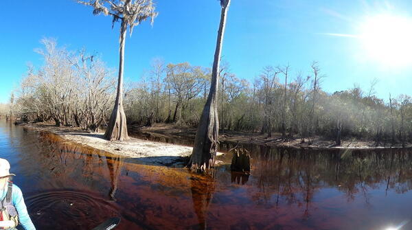
PHOTOSET: https://www.wwals.net/pictures/2022-12-29–suwannee-pictures/#SWC
PHOTO SOURCE: John S. Quarterman
PHONE NUMBER: (229) 242-0102
Suggestions: https://forms.gle/DipPgU2TP5atc2Rf9
Jones Creek

CATEGORIES: Tributary
LAYER: Other
OWNERSHIP: Public, CONSERVATION FUND, PARCEL 156 029
WATER BODY: Suwannee River
GAUGE: Fargo
MILE: 225.10
ADDRESS: Right bank, about a mile downstream from Three Steps Landing, and less than a mile upstream from Reeves Landing. Clinch County.
DESCRIPTION: The waters of this creek contrast with the red-yellow tannic acid Suwannee River color, after the creek comes down all the way from Homerville.
AKA: Tatum Creek
WEBSITE: https://wwals.net/pictures/2022-12-29–suwannee-pictures#JCreek
OTHER REFERENCE: https://www.wwals.net/pictures/2023-06-10–suwannee-chainsaw-pictures/#TatumCreek
PHOTO: https://www.wwals.net/pictures/2023-06-10–suwannee-chainsaw-pictures/20230610_144830.jpg
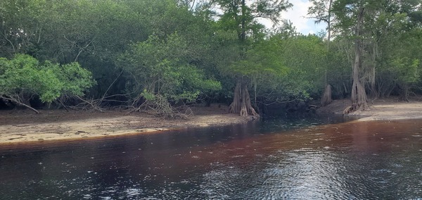
PHOTOSET: https://www.wwals.net/pictures/2023-06-10–suwannee-chainsaw-pictures/#TatumCreek
PHOTO SOURCE: John S. Quarterman
PHONE NUMBER: (229) 242-0102
PHOTO2: https://www.wwals.net/pictures/2022-12-29–suwannee-pictures/JCreek.jpg
Photoset2: https://wwals.net/pictures/2022-12-29–suwannee-pictures#JCreek
PHOTO2 SOURCE: John S. Quarterman
Photo2 Phone Number: 229-242-0102
Suggestions: https://forms.gle/DipPgU2TP5atc2Rf9

Suwannoochee Creek

CATEGORIES: Tributary
LAYER: Point of Interest
OWNERSHIP: Public
WATER BODY: Suwannee River
GAUGE: Fargo
MILE: 217.97
ADDRESS: Right bank, 2.99 miles downstream from Fargo Ramp. Clinch, Echols Counties.
DESCRIPTION: Probable mouth of Suwanoochee Creek, the border between Clinch and Echols Counties, Georgia.
WEBSITE: https://wwals.net/pictures/2022-03-05–fargo-downstream-suwannee-river
PHOTO: https://www.wwals.net/pictures/2022-03-05–fargo-downstream-suwannee-river/suwannoochee-creek.jpg
PHOTOSET: https://www.wwals.net/pictures/2022-03-05–fargo-downstream-suwannee-river/
PHOTO SOURCE: John S. Quarterman
PHONE NUMBER: (229) 242-0102
Suggestions: https://forms.gle/DipPgU2TP5atc2Rf9
Little Swannee Creek

CATEGORIES: Tributary
LAYER: Point of Interest
OWNERSHIP: Public, LEVITON FAMILY PROPERTIES LP, PARCEL 100 002A
WATER BODY: Suwannee River
GAUGE: Fargo
MILE: 213.88
ADDRESS: Left (south) bank, 7.58 miles downstream from Fargo Ramp. Echols County.
DESCRIPTION: Mouth of a creek that drains much of the south side of the Okefenokee Swamp.
AKA: Little Suwannee Creek
WEBSITE: https://wwals.net/pictures/2022-03-05–fargo-downstream-suwannee-river
OTHER REFERENCE: https://wwals.net/2021/04/04/okefenokee-swamp-south-drains-west-to-suwannee-river/
PHOTO: https://www.wwals.net/pictures/2022-03-05–fargo-downstream-suwannee-river/little-swannee-creek.jpg
PHOTOSET: https://www.wwals.net/pictures/2022-03-05–fargo-downstream-suwannee-river/
PHOTO SOURCE: John S. Quarterman
PHONE NUMBER: (229) 242-0102
Suggestions: https://forms.gle/DipPgU2TP5atc2Rf9
Toms Creek

CATEGORIES: Tributary
LAYER: Other
OWNERSHIP: Public, SUWANNEE RIVER WATER MANAGEMENT DISTRICT, PARCEL 1113-010
WATER BODY: Suwannee River
GAUGE: Fargo
MILE: 206.16
ADDRESS: Right bank, 15.39 miles downstream from Fargo and 5.16 miles upstream from Roline Boat Ramp. Hamilton County.
DESCRIPTION: A narrow opening between bluffs for a creek that crosses Echols County, Georgia, and GA 94 to reach the Suwannee River in Hamilton County, Florida.
WEBSITE: https://www.wwals.net/pictures/2022-03-06–roline-turner-bridge-suwannee-river/
PHOTO: https://www.wwals.net/pictures/2022-03-06–roline-turner-bridge-suwannee-river/toms-creek.jpg
PHOTOSET: https://www.wwals.net/pictures/2022-03-06–roline-turner-bridge-suwannee-river/
PHOTO SOURCE: John S. Quarterman
PHONE NUMBER: (229) 242-0102
Suggestions: https://forms.gle/DipPgU2TP5atc2Rf9
Robinson Creek

CATEGORIES: Tributary
LAYER: Other
OWNERSHIP: Public
WATER BODY: Suwannee River
MILE: 175.68
ADDRESS: Left bank, a quarter mile below Big Shoals, 1.3 miles below Big Shoals Tract Launch. Columbia County.
DESCRIPTION: Forms eddies in the river.
OTHER REFERENCE: https://wwals.net/pictures/2021-05-19–big-shoals-pictures/#RC
PHOTO: https://www.wwals.net/pictures/2023-05-20–big-shoals-suwannee-river-pictures/20230520_120325.jpg
PHOTOSET: https://www.wwals.net/pictures/2023-05-20–big-shoals-suwannee-river-pictures/#RC
PHOTO SOURCE: John S. Quarterman
PHONE NUMBER: (229) 242-0102
PHOTO2: https://wwals.net/pictures/2021-05-19–big-shoals-pictures/20210519_120228.jpg
Photoset2: https://wwals.net/pictures/2021-05-19–big-shoals-pictures
PHOTO2 SOURCE: John S. Quarterman
Photo2 Phone Number: 229-242-0102
Suggestions: https://forms.gle/DipPgU2TP5atc2Rf9

Bell Springs Run

CATEGORIES: Tributary
LAYER: Other
OWNERSHIP: Public
WATER BODY: Suwannee River
MILE: 175.32
ADDRESS: Left bank, 1/3 mile below Robinson Creek, 2/3 miles below Big Shoals, 1 2/3 miles down from Big Shoals Tract Launch. Columbia County.
DESCRIPTION: Spring water coming out of a sharp cleft in the riverbank bluff.
OTHER REFERENCE: https://wwals.net/pictures/2021-05-19–big-shoals-pictures/#BSR
PHOTO: https://www.wwals.net/pictures/2023-05-20–big-shoals-suwannee-river-pictures/20230520_121004.jpg
PHOTOSET: https://www.wwals.net/pictures/2023-05-20–big-shoals-suwannee-river-pictures/#BSR
PHOTO SOURCE: John S. Quarterman
PHONE NUMBER: (229) 242-0102
PHOTO2: https://wwals.net/pictures/2021-05-19–big-shoals-pictures/20210519_121203.jpg
Photoset2: https://wwals.net/pictures/2021-05-19–big-shoals-pictures/
PHOTO2 SOURCE: John S. Quarterman
Photo2 Phone Number: 229-242-0102
Suggestions: https://forms.gle/DipPgU2TP5atc2Rf9

Right Bank Dry Runoff

CATEGORIES: Tributary
LAYER: Other
OWNERSHIP: Public
WATER BODY: Suwannee River
MILE: 174.87
ADDRESS: Right bank, half a mile below Bell Springs Run, 1.1 miles below Big Shoals, 2.11 miles below Big Shoals Tract Launch. Hamilton County.
DESCRIPTION: USGS does not know of a creek here, but it sure looks like one.
OTHER REFERENCE: https://wwals.net/pictures/2021-05-19–big-shoals-pictures/#RBDR
PHOTO: https://www.wwals.net/pictures/2023-05-20–big-shoals-suwannee-river-pictures/20230520_122032.jpg
PHOTOSET: https://www.wwals.net/pictures/2023-05-20–big-shoals-suwannee-river-pictures/#RBDR
PHOTO SOURCE: John S. Quarterman
PHONE NUMBER: (229) 242-0102
PHOTO2: https://wwals.net/pictures/2021-05-19–big-shoals-pictures/20210519_122606.jpg
Photoset2: https://wwals.net/pictures/2021-05-19–big-shoals-pictures/
PHOTO2 SOURCE: John S. Quarterman
Photo2 Phone Number: 229-242-0102
Suggestions: https://forms.gle/DipPgU2TP5atc2Rf9

Big Shoals Main Creek

CATEGORIES: Tributary
LAYER: Other
OWNERSHIP: Public
WATER BODY: Suwannee River
MILE: 174.09
ADDRESS: Right bank, 1 1/4 miles below Bell Springs Run, 1.88 miles below Big Shoals, 2.89 miles below Big Shoals Tract Launch. Hamilton County.
DESCRIPTION: A noticeable creek mouth. According to USGS it drains most of the park, as well as parts of the Nutrien phosphate mine. What is its real name?
OTHER REFERENCE: https://wwals.net/pictures/2021-05-19–big-shoals-pictures/#BSMC
PHOTO: https://www.wwals.net/pictures/2023-05-20–big-shoals-suwannee-river-pictures/20230520_124133.jpg
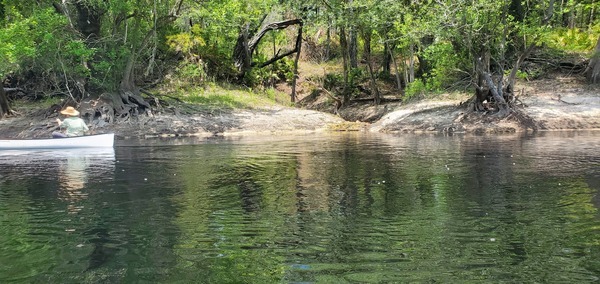
PHOTOSET: https://www.wwals.net/pictures/2023-05-20–big-shoals-suwannee-river-pictures/20230520_124133.html
PHOTO SOURCE: John S. Quarterman
PHONE NUMBER: (229) 242-0102
Suggestions: https://forms.gle/DipPgU2TP5atc2Rf9
Falling Creek

CATEGORIES: Tributary
LAYER: Other
OWNERSHIP: Public
WATER BODY: Suwannee River
MILE: 173.31
ADDRESS: Left bank, 2 2/3 miles below Big Shoals and 3 2/3 miles below Big Shoals Tract Launch. Columbia County.
DESCRIPTION: A sizeable flowing creek with a bridge across it for the Cross Seminole Trail. It comes north almost 12 miles from the other side of I-10.
WEBSITE: https://www.wwals.net/pictures/2023-05-20–big-shoals-suwannee-river-pictures/#FC
OTHER REFERENCE: https://www.wwals.net/pictures/2023-05-20–big-shoals-suwannee-river-pictures/#FC
PHOTOSET: https://www.wwals.net/pictures/2023-05-20–big-shoals-suwannee-river-pictures/#FC
PHOTO SOURCE: John S. Quarterman
PHONE NUMBER: (229) 242-0102
Suggestions: https://forms.gle/DipPgU2TP5atc2Rf9
Hall Barnett Creek

CATEGORIES: Tributary
LAYER: Other
GPS: 30.3264667, -82.7384
OWNERSHIP: Public
WATER BODY: Suwannee River
MILE: 171.08
ADDRESS: Right bank, a hundred feet upstream from the Norfolk Southern Railroad Bridge. Hamilton County.
DESCRIPTION: A creek that comes down the east side of White Springs.
PHOTO: https://www.wwals.net/pictures/2023-05-20–big-shoals-suwannee-river-pictures/20230520_143402.jpg
PHOTOSET: https://www.wwals.net/pictures/2023-05-20–big-shoals-suwannee-river-pictures/#HBC
PHOTO SOURCE: John S. Quarterman
PHONE NUMBER: (229) 242-0102
Suggestions: https://forms.gle/DipPgU2TP5atc2Rf9
Swift Creek Confluence @ CR 25A

CATEGORIES: Tributary
LAYER: Brochure
GPS: 30.34575, -82.8271
OWNERSHIP: Public, SUWANNEE RIVER WATER MANAGEMENT DISTRICT, PARCEL 1846-010
WATER BODY: Swift Creek
MILE: 162.48
ADDRESS: Right bank of Suwannee River, on Florida Trail, 1/2 mile upstream (north) from road in Swift Creek Tract CR 25A Entrance, Hamilton County.
DESCRIPTION: Green Swift Creek comes down fronm the Nutrien phosphate mine, through steep karst limestone banks, into the Suwannee River.
WEBSITE: https://wwals.net/pictures/2025-06-21–swift-creek-wq
PHOTO: https://www.wwals.net/pictures/2025-06-21–swift-creek-wq/IMG_2559.jpg
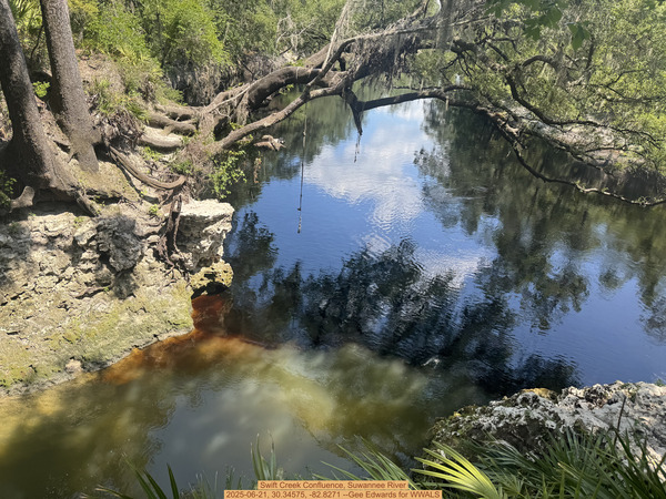
PHOTOSET: https://www.wwals.net/pictures/2025-06-21–swift-creek-wq/
PHOTO SOURCE: Gee Edwards
PHONE NUMBER: (850) 290-2350
Suggestions: https://forms.gle/DipPgU2TP5atc2Rf9
Alapaha River Confluence

CATEGORIES: Tributary
LAYER: Brochure
GPS: 30.43672, -83.09655
OWNERSHIP: Public
ACCESS: No
WATER BODY: Suwannee River
GAUGE: Ellaville
MILE: 135.37
ADDRESS: Put in at Gibson Park and float downstream on the Suwannee River, Hamilton County.
DESCRIPTION: Confluence of the Alapaha River with the Suwannee River. There is water here year-round, but upstream not far may be dry much of the year. End of the Alapaha River.
WEBSITE: http://www.hamiltoncountyflorida.com/cd_parksrec.aspx
PHOTO: https://wwals.net/wp-content/themes/pianoblack/img//2015/08/e06605733a8679809c29c7945c923d6f1.jpg
PHOTO SOURCE: John S. Quarterman
PHONE NUMBER: (229) 242-0102
Suggestions: https://forms.gle/DipPgU2TP5atc2Rf9
Withlacoochee River Confluence
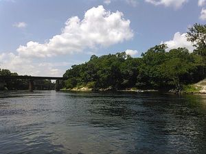
CATEGORIES: Tributary
LAYER: Brochure
OWNERSHIP: Public
WATER BODY: Suwannee River
GAUGE: Ellaville
MILE: 127.50
ADDRESS: About a quarter mile past the ranger station, a high bluff overlooks the spot where the Withlacoochee River comes in river right to join the Suwannee River about a thousand feet downstream from SRSP Boat Ramp, on its way to the Gulf of Mexico. Hamilton, Madison, Suwannee Counties.
DESCRIPTION: The tea-colored tannic acid water of the Withlacoochee River quickly gets lost in the deeper blackwater Suwannee River.
WEBSITE: https://www.floridastateparks.org/park/Suwannee-River
PHOTO: https://wwals.net/wp-content/themes/pianoblack/img//2015/08/998b9be46550e514053d60b9cf7c438c1.jpg
PHOTO SOURCE: John S. Quarterman
PHONE NUMBER: (229) 242-0102
Suggestions: https://forms.gle/DipPgU2TP5atc2Rf9
Suwannee Plant Intake
CATEGORIES: Tributary
LAYER: Point of Interest
OWNERSHIP: Private, Duke Energy
WATER BODY: Suwannee River
GAUGE: Ellaville
MILE: 126.78
ADDRESS: 3880 River Rd, Live Oak, FL 32060, Suwannee County.
DESCRIPTION: Cooling water intake for natural gas power plant
WEBSITE: https://www.industrynet.com/listing/3810806/duke-energy-florida-inc-suwannee-river-plant
Suggestions: https://forms.gle/DipPgU2TP5atc2Rf9
Suwannee Plant Outflow
CATEGORIES: Tributary
LAYER: Point of Interest
OWNERSHIP: Private, Duke Energy
WATER BODY: Suwannee River
GAUGE: Ellaville
MILE: 126.45
ADDRESS: 3880 River Rd, Live Oak, FL 32060, Suwannee County.
DESCRIPTION: Cooling water outflow from natural gas power plant
WEBSITE: https://www.industrynet.com/listing/3810806/duke-energy-florida-inc-suwannee-river-plant
Suggestions: https://forms.gle/DipPgU2TP5atc2Rf9
Suwannee River Mouth
CATEGORIES: Tributary
LAYER: Brochure
OWNERSHIP: Public
WATER BODY: Gulf of Mexico
GAUGE: Suwannee River above Gopher River
MILE: 1.30
ADDRESS: Downstream of the Town of Suwannee, Dixie, Levy Counties.
Suggestions: https://forms.gle/DipPgU2TP5atc2Rf9
East side canal entrance
CATEGORIES: Tributary
LAYER: Point of Interest
GPS: 29.3255, -83.1528
OWNERSHIP: Public
WATER BODY: Florida Circumnavigational Saltwater Paddling Trail
MILE: 395.00
ADDRESS: Comes in from the Gulf along the east and south side of the town of Suwannee, FL, Dixie County.
DESCRIPTION: Follow canal along east side of town to campground.
OTHER REFERENCE: https://www.floridapaddlingtrails.com/complete-fpta-ct-map-set
Suggestions: https://forms.gle/DipPgU2TP5atc2Rf9
FLCT Mouth of Suwannee River
CATEGORIES: Tributary
LAYER: Brochure
GPS: 29.2868, -83.167
OWNERSHIP: Public
WATER BODY: Florida Circumnavigational Saltwater Paddling Trail
MILE: 399.80
ADDRESS: Out into the Gulf southeast of Alligator Pass, Dixie, Levy Counties.
DESCRIPTION: Almost as far out as mile zero for the Suwannee River Wilderness Trail. This is a landmark (watermark?) on the Florida Circumnavigational Saltwater Paddling Trail.
OTHER REFERENCE: https://www.floridapaddlingtrails.com/complete-fpta-ct-map-set
Suggestions: https://forms.gle/DipPgU2TP5atc2Rf9
New (FL) River Confluence
CATEGORIES: Tributary
LAYER: Point of Interest
OWNERSHIP: Public
WATER BODY: Santa Fe River
MILE: 49.84
ADDRESS: Two thirds of a mile upstream from the FL 121 Santa Fe River Bridge and Worthington Springs Ramp. A few hundred feet southeast of Worthington Springs. Union, Bradford, Alachua Counties.
DESCRIPTION: Confluence of the New River with the Santa Fe River, in the middle of wooded wetlands.
Suggestions: https://forms.gle/DipPgU2TP5atc2Rf9
Ichetucknee River Confluence

CATEGORIES: Tributary
LAYER: Brochure
OWNERSHIP: Public
WATER BODY: Ichetucknee River
GAUGE: Ichetucknee
MILE: 7.08
ADDRESS: Near 295th Loop, Brandord, FL, in Suwannee County, near Santa Fe Rd, Fort White, FL, in Columbia County, farther from 130th Pl, Branford, FL, Gilchrist County. Gilchrist County.
DESCRIPTION: The six-mile Ichetucknee River joins the Santa Fe River, a few miles upstream of the Suwannee River.
WEBSITE: https://wwals.net/pictures/2016-11-23–ichetucknee-santa-fe/
PHOTO: https://wwals.net/pictures/2016-11-23–ichetucknee-santa-fe/384A3916.jpg
PHOTOSET: https://wwals.net/pictures/2016-11-23–ichetucknee-santa-fe/
PHOTO SOURCE: John S. Quarterman
PHONE NUMBER: (229) 242-0102
PHOTO2: https://wwals.net/pictures/2020-01-20–ichetucknee-santa-fe-pictures/20200120_140618.jpg
Photoset2: https://wwals.net/pictures/2020-01-20–ichetucknee-santa-fe-pictures/
PHOTO2 SOURCE: John S. Quarterman
Photo2 Phone Number: 229-242-0102
Suggestions: https://forms.gle/DipPgU2TP5atc2Rf9

Santa Fe River Confluence
CATEGORIES: Tributary
LAYER: Brochure
OWNERSHIP: Public
WATER BODY: Suwannee River
GAUGE: Hildreth
MILE: 65.78
ADDRESS: A quarter mile downstream from Wanamake Ramp on the Santa Fe River. Downstream from Dorothy Land Ramp on the Suwannee River and upstream from Sims Landing Ramp. Suwannee, Gilchrist, Lafayette Counties.
DESCRIPTION: Tri-point of Suwannee, Gilchrist, and Lafayette Counties, Florida.
WEBSITE: https://en.wikipedia.org/wiki/Santa_Fe_River_(Florida)
Suggestions: https://forms.gle/DipPgU2TP5atc2Rf9
WTP
Outfall 2 for SCFSP 
CATEGORIES: Wtp
LAYER: Brochure
OWNERSHIP: Public, USFWS
WATER BODY: Suwannee River
MILE: 243.05
ADDRESS: East across GA 177 from SCFSP Boat Ramp. Charlton County.
DESCRIPTION: Second of two outfalls for “”treated domestic wastewater”” from the park’s NPDES Wastewater Permit No. GAG550009.
GRN: Yes
Suggestions: https://forms.gle/DipPgU2TP5atc2Rf9
Outfall 1 for SCFSP
CATEGORIES: Wtp
LAYER: Brochure
OWNERSHIP: Public, USFWS
WATER BODY: Suwannee River
MILE: 242.23
ADDRESS: West of GA 177, across from Residents Road. Charlton County.
DESCRIPTION: First of two outfalls for “”treated domestic wastewater”” from the park’s NPDES Wastewater Permit No. GAG550009.
GRN: Yes
Suggestions: https://forms.gle/DipPgU2TP5atc2Rf9
Homerville WTP
CATEGORIES: Wtp
LAYER: Brochure
ADDRESS: 245 E. Forest Ave. Clinch County.
DESCRIPTION: On Gallows Branch, which runs into Surveyors Creek into the Okefenokee Swamp.
HISTORIC FACTS: Correct operational and maintenance deficiencies; submit plan for refurbishment and/or replacement of East Forest Avenue plant; submit plan for renovation of Reddick St. plant –Enforcement Order EPD-WQ-3599 https://enfo.gaepd.org/Details/2878
OTHER REFERENCE: https://waterdata.usgs.gov/monitoring-location/310211082442601/#period=P1Y&showMedian=true
Suggestions: https://forms.gle/DipPgU2TP5atc2Rf9
Jasper Wastewater Treatment Plant

CATEGORIES: Wtp
LAYER: Brochure
OWNERSHIP: Public
WATER BODY: Bell Creek
ADDRESS: On SW 107th Avenue south of Jasper, south of the park, north of the landfill. Hamilton County.
DESCRIPTION: The wastewater treatment plant for Jasper, FL.
AKA: NPDES Permit No. FL0027880
WEBSITE: https://www.wwals.net/pictures/2024-08-24–hamilton-county-creeks
PHOTO: https://www.wwals.net/pictures/2024-08-24–hamilton-county-creeks/20240824_153335.jpg
PHOTOSET: https://www.wwals.net/pictures/2024-08-24–hamilton-county-creeks/
PHOTO SOURCE: John S. Quarterman
PHONE NUMBER: (229) 242-0102
PHOTO2: https://www.wwals.net/pictures/2024-08-24–hamilton-county-creeks/20240824_153335.jpg
Photoset2: https://www.wwals.net/pictures/2024-08-24–hamilton-county-creeks/
PHOTO2 SOURCE: John S. Quarterman
Photo2 Phone Number: 229-242-0102
Suggestions: https://forms.gle/DipPgU2TP5atc2Rf9
Live Oak WTP
CATEGORIES: Wtp
LAYER: Brochure
OWNERSHIP: Public
WATER BODY: Suwannee River
MILE: 149.81
ADDRESS: 701 Lime Ave NW, Live Oak, FL 32064, Suwannee County.
DESCRIPTION: A 2.5 MBD wastewater plant rebuilt in 2022. Rebuilt in 2022 with a $3, 240, 000 grant via FDEP and SRWMD. https://protectingfloridatogether.gov/sites/default/files/documents/FY2021-22_WastewaterGrantsSelected_1.pdf 10, 000 gallon sewage spill, “”confined to wastewater plant site lawn and garden lime is being applied to the affected areas.”” 2023-12-01 https://wwals.net/2023/12/02/sewage-spills-ashburn-ga-live-oak-fl-2023-12-01/
AKA: Yes
WEBSITE: https://www.liveoaktx.net/departments/public-works/water-waste-water#water-waste-water
OTHER REFERENCE: https://www.haskell.com/projects/live-oak-wastewater-treatment-plant/
PHOTO: https://www.haskell.com/wp-content/uploads/2020/08/projects-live-oak-wastewater-plant-hero.jpg
PHOTOSET: https://www.haskell.com/projects/live-oak-wastewater-treatment-plant/
PHOTO SOURCE: Haskell
PHONE NUMBER: (904) 791-4500
Suggestions: https://forms.gle/DipPgU2TP5atc2Rf9
Pilgrims Pride Outflow

CATEGORIES: Wtp
LAYER: Brochure
OWNERSHIP: Private
WATER BODY: Suwannee River
GAUGE: Ellaville
MILE: 125.38
ADDRESS: US 90, turn south on River Road, turn right on Cedar Lane, go to the river. Suwannee County.
DESCRIPTION: Outflow into the Suwannee River from the Pilgrims Pride chicken processing plant on US 90. NPDES Permit No. FL0001465. According to the 2020 reissue of the permit, this is Surface Water Discharge D-001: An existing 1.50 MGD Monthly Average Daily Flow (MADF) permitted discharge to Suwannee River, (Class III Fresh Waters, WBID# 3422B), from Outfall D-001, which is an 18” diameter steel pipe approximately 20-feet from shore discharging at an elevation of approximately 39 feet (MSL).
HISTORIC FACTS: Environment Florida sued Pilgrims Pride 2017-03-09 about excess effluent from the company’s treated effluent outfall into the Suwannee River. https://wwals.net/2017/03/27/legal-filing-about-pilgrims-pride-effluent-into-suwannee-river/ On 2017-11-14, according to PR by the plaintiff, If approved by U.S. District Judge Timothy J. Corrigan, the settlement would require Pilgrim’s Pride to make equipment upgrades, investigate the possibility of eliminating or significantly reducing all discharges to the Suwannee River, and pay what is believed to be the largest Clean Water Act penalty in a citizen enforcement suit in Florida history. https://wwals.net/2017/11/16/pilgrims-pride-to-pay-1-43-million-suwannee-river-pollution-to-settle-lawsuit-by-environment-florida-and-sierra-club-2017-11-14/
WEBSITE: https://wwals.net/2017/03/27/legal-filing-about-pilgrims-pride-effluent-into-suwannee-river/
PHOTO: https://www.wwals.net/pictures/2025-12-20–pilgrims-pride-outfall-suwannee-river/20251220_115221.jpg
PHOTOSET: https://www.wwals.net/pictures/2025-12-20–pilgrims-pride-outfall-suwannee-river/
PHOTO SOURCE: John S. Quarterman
PHONE NUMBER: (850) 290-2350
Suggestions: https://forms.gle/DipPgU2TP5atc2Rf9
Starke WTP
CATEGORIES: Wtp
LAYER: Brochure
GPS: 29.938, -82.115
OWNERSHIP: Public
WATER BODY: Alligator Creek 00277787
MILE: 2.98
ADDRESS: 602 Edwards Rd, Starke, FL 32091, Bradford County.
DESCRIPTION: Municipal wastewater treatment plant handling up to 1.65 million gallons, on Alligator Creek 00277787, into Lake Rowell, Lake Sampson, Sampson River, Santa Fe River.
HISTORIC FACTS: 15, 000 gallons of raw sewage on July 7, 2021, and before: “”On June 26, 2021 we started receiving heavy rain. At around 2:48 p.m. the influent well at the Starke WWTF reached it’s high level alarm and on call operator responded to SCADA call out alarm. Upon arrival Operator observed the influent wet well was a max compacity and back up generator was on and running. We also had power failures and other alarms of equipment. On of the three influent pumps was tripped out. The operator reset the VFD for the influent pump and it started up. The operator also checked the effluent out fall to Alligator Creek and the creek had rose to above the effluent outfall cause a backup in the plant effluent treatment system. The effluent pump was not enough to keep up with the flow coming thru the plant with the excessive rain. The operator took all necessary actions to prevent this spill for occurring with equipment the city has. We calculated a spill volume of 45, 000 gallons and 20, 000 of that went into Alligator Creek. We received 2.38″” of rain and a total of 7.71″” of rain fall for the week of June 21 thru June 26, 2021.””
AKA: Starke WWTF.
OTHER REFERENCE: https://floridadep.gov/pollutionnotice
ADDITIONAL INFO SOURCES: https://wwals.net/pictures/2021-07-08–sewage-spills-valdosta-starke
Suggestions: https://forms.gle/DipPgU2TP5atc2Rf9
Florida State Prison WWTF
CATEGORIES: Wtp
LAYER: Brochure
OWNERSHIP: Public
WATER BODY: New (FL) River
MILE: 14.05
ADDRESS: 7819 NW 228th St, Raiford, FL 32083, Union County.
DESCRIPTION: Next to the New River of the Santa Fe River: “”The Florida State Prison facility (FLA113450) has a 1.78 mgd permitted flow with a 20-million-gallon storage pond, a 40-milliongallon high-density polyethelene (HDPE)-lined effluent storage pond, and a 766-acre sprayfield divided into 15 center pivot irrigation zones.””
HISTORIC FACTS: “”Lightning struck the control panel of our main influent lift station. in the time it took to get an emergency pump going the wet well overflowed onto the ground based on flows from our flow meter it appears to be around 20, 000-30, 000 gallons. it should be noted that the ground water infiltration here is extremely bad and we believe a lot of influent was diluted with rain water. it rained heavy during the entire event approximately 3″” +-“”
WEBSITE: https://floridadep.gov/sites/default/files/newrivercoliformdotmdl.pdf
OTHER REFERENCE: https://floridadep.gov/pollutionnotice
Suggestions: https://forms.gle/DipPgU2TP5atc2Rf9
High Springs Waste Water Plant

CATEGORIES: Wtp
LAYER: Brochure
OWNERSHIP: Public
WATER BODY: Santa Fe River
MILE: 23.26
ADDRESS: 25555 NW 158 Ave, High Springs, FL 32643, Alachua County.
DESCRIPTION: Spray field being upgraded to wetland for treatment of municipal wastewater from High Springs, Florida.
HISTORIC FACTS: Received FDEP grant in December 2021 of almost $7 million to upgrade from spray field to wetland. https://www.wcjb.com/2021/12/20/high-springs-wastewater-treatment-facility-receives-fdep-grant/ Had 500 gallong sewage spill July 7, 2022. https://wwals.net/?p=59035
WEBSITE: https://www.highsprings.us/publicworks
PHOTO: https://www.wwals.net/pictures/2022-07-07–high-springs-spill/sewer_plant_aerial.jpg
PHOTOSET: https://www.wwals.net/pictures/2022-07-07–high-springs-spill/
PHOTO SOURCE: High Springs Public Works
PHONE NUMBER: (386) 454-2134
Suggestions: https://forms.gle/DipPgU2TP5atc2Rf9