In one of its first actions at its first official board meeting,
![]() FLORIDA voted to sign the
Resolution Against Phosphate Mines in Florida, December 19, 2018.
FLORIDA voted to sign the
Resolution Against Phosphate Mines in Florida, December 19, 2018.
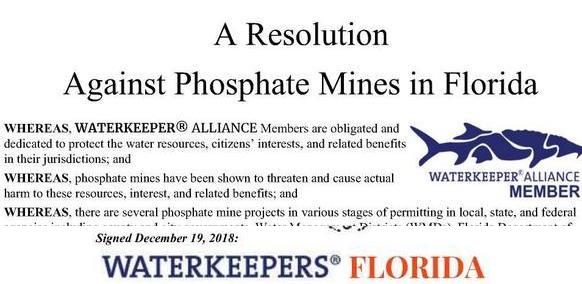
This opposition throughout Florida to phosphate mines anywhere in the state
is especially timely, with
public hearings and a vote coming up in January soon
in Bradford County on the HPS II phosphate mine application.
A dozen of its thirteen members had already signed for their individual organizations. According to its bylaws, all members of WATERKEEPERS Florida are now signed on with the organization. Besides, the thirteenth member, Continue reading