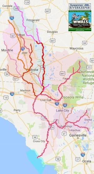
Frequently there’s no flow in the Little Alapaha River at US 41, but Saturday there was.
In the Alapaha River where it is often completely dry under US 41, there was plenty of water, a bit west of Jasper, Florida, in Hamilton County.
![[Rivers at US 41, Hamilton County, FL, 2024-08-24, Alapaha River, Little Alapaha River]](https://www.wwals.net/pictures/2024-08-24--alapaha-little-alapaha-rivers-hamilton-county-fl/fbmany.jpg)
Rivers at US 41, Hamilton County, FL, 2024-08-24, Alapaha River, Little Alapaha River
The Alapaha River Jennings Gauge was about 66.06 feet NAVD88 at 2:15 PM, Saturday, August 24, 2024. That’s well within the WWALS recommended water levels of low 65, high 76 at US 4 1 on the Alapaha River Water Trail (ARWT).
Here’s a bit of video:
https://youtu.be/FWFsUfMSOP0 Continue reading
![[Little Alapaha River, @ US 41 2024-05-25, Alapaha River in Action Stage @ US 41, 78.22 NAVD88 Jennings Gauge]](https://www.wwals.net/pictures/2024-05-25--little-alapaha-river/igmany.jpg)
![[Composite US 41 Little Alapaha River Bridge]](https://www.wwals.net/pictures/2022-02-07--little-alapaha-river/many41.jpg)
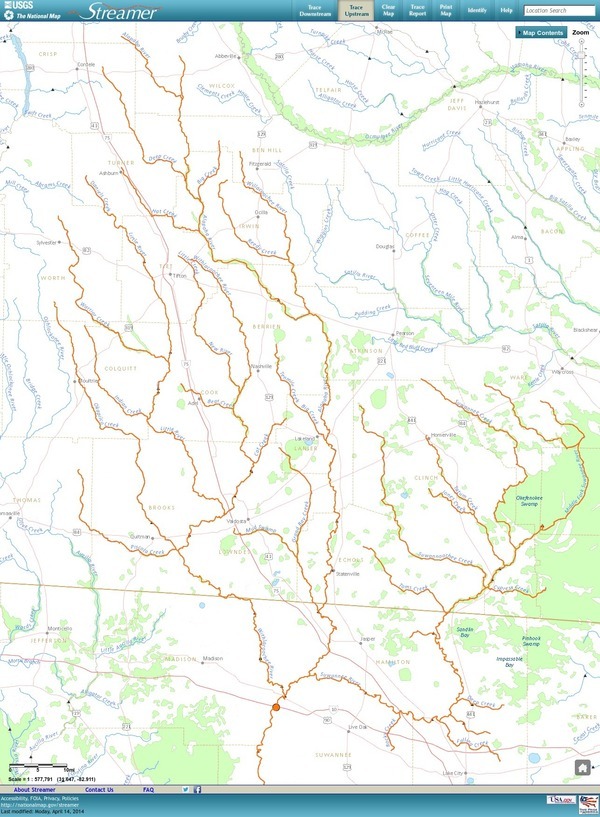
![[Source, Bridge, Swallet, Confluence: Little Alapaha River]](https://www.wwals.net/pictures/2022-02-07--little-alapaha-river/many.jpg)
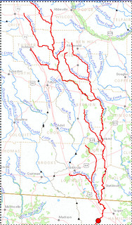
![[US 41 Bridge, Little Alapaha River, Suwannee River, Alapaha River Rise]](https://www.wwals.net/pictures/2022-02-05--last-stretch-alapaha-pictures/many.jpg)