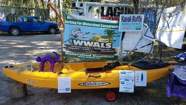
FOR IMMEDIATE RELEASE
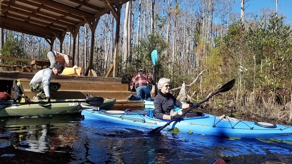
Hahira, Georgia, December 13, 2017 — People got kayak raffle tickets for three months at festivals from Alapaha, Georgia to Live Oak, Florida, and online, until the drawing at a Suwannee Riverkeeper outing Sunday at the top of the Suwannee River in the Okefenokee Swamp. The lucky winner of a kayak donated by Malibu Kayaks is Chris Newton from the Atlantic coast of Florida. “No way!” he said.
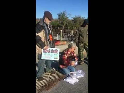
At Stephen C. Foster State Park, Fargo, Georgia, Gretchen Quarterman, Acting Executive Director for WWALS Watershed Coalition, said:
“These are all the tickets that we sold. And these are the ones that Shirley [Kokidko, WWALS board member] sold. These are the ones that came from Phil [Hubbard, WWALS board member of Valdosta, Lowndes County, Georgia]. These are the ones that came from Hulaween [Live Oak, Suwannee County, Florida]. These are the ones that came from Skillet Fest [Quitman, Brooks County, Georgia, suggested by WWALS member John Horton of Quitman and Suwannee, Dixie County, Florida] ….”
WWALS board member Shirley Kokidko of Pearson, Atkinson County, Georgia, had the video camera at Continue reading