Tag Archives: Osceola National Forest

Reject or EIS: Twin Pines Minerals mine near Okefenokee –U.S. Rep. Al Lawson 2020-02-13

U.S. Rep. Al Lawson Jr, Twitter, 2PM, 14 February 2020, @RepAlLawsonJr,

I sent a letter to the Army Corps of Engineers to express my concerns about Twin Pines Minerals, LLC’s plan to mine for titanium near the Okefenokee National Wildlife Refuge. These actions could have detrimental effects on the area’s biodiversity and natural resources.

[U.S. Rep. Al Lawson to USACE]
U.S. Rep. Al Lawson to USACE


AL LAWSON
5TH DISTRICT, FLORIDA
ASSISTANT MAJORITY WHIP
COMMITTEE ON
FINANCIAL SERVICES
COMMITTEE ON
AGRICULTURE

Congress of the United States
 
House of Representatives
 
Washington, DC 20515-0905

February 13, 2020

Col. Daniel Hibner
U.S. Army Corps of Engineers
Savannah District
100 W. Oglethorpe Avenue
Savannah, Georgia 31401

Dear Hearing Officer:

I am writing to express my concerns about Twin Pines Minerals, LLC’s application for a clean water (CWA) permit to mine for titanium near the Okefenokee National Wildlife Refuge, Osceola National Forest, and Osceola Wildlife Management Area. I urge the U.S. Army Corps of Engineers (Corps) to carefully consider the significant environmental, social, and economic costs that could occur if the permit is granted. It is crucial that the Corps require an environmental impact statement under the National Environmental Policy Act (NEPA). Furthermore, the Corps should reject the permit application if it appears the mine will harm the environment.

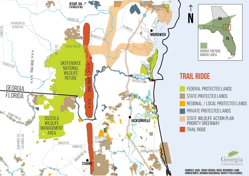
Trail Ridge and Okefenokee NWR

If approved, the project would destroy portions of Trail Ridge, which acts as Continue reading

Nutrien (PCS) mining phosphate and water in Hamilton County and soon in Columbia County? 2018-07-11

Update 2023-05-08: Fixed some images.

Five Years Later: Hamilton County Planning Commission wants conditions on Nutrien phosphate mine permit renewal 2023-03-28.

See also: PCS Phosphate Mine dragline access permit application SAJ-1984-04652 2019-10-15.

Thanks to Jim Tatum of OSFR for spotting this op-ed in the Lake City Reporter yesterday by WWALS member and Practicing Geologist Dennis J. Price of Hamilton County, Florida about Nutrien (PCS) mining phosphate and water in Hamilton County and likely planning to expand to Columbia County.

[Dennis Price explains, 13:50:12, 30.57871, -83.05231]
Photo by John S. Quarterman of Dennis J. Price at the Dead River of the Alapaha River, 2018-01-27.

To the Editor:

Much has been written in the last year about Sam Oosterhoudt’s mitigation bank. I was involved in permitting the bank through the Army Corps (ACOE) and The Florida Department of Environmental Regulation. It took about 5 years to get all the permits. Now, 9 years after work began on the project, the phosphate company (then PCS now Nutrien) petitioned the state to shut down the mitigation bank.

I do not know for sure, but, Nutrien may tell you that during the recent sale of PCS and the review of mineral interests owned, they discovered that the mitigation bank had snuck in there and set up shop over their minerals. This probably has some truth to it but I think there is a much more involved reason.

In Hamilton County, Nurtrien/PCS is planning to run out of phosphate to mine in about 10 years, give or take a few years either way. I do not believe they are planning on shutting the doors and leaving. Occidental Chemical Company started mining in Hamilton County Continue reading

West Mims Fire in Upper Suwannee River watershed in Okefenokee Swamp 2017-04-15

Now is not a good time to stay overnight in the Okefenokee Swamp, or to travel at night between Fargo and Moniac, because of smoke.

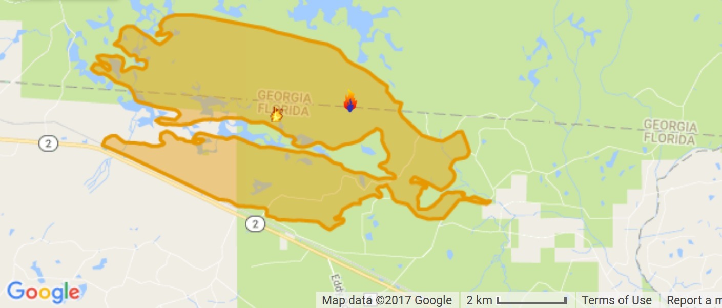
Lightning started the West Mims fire Thursday, apparently west of Moniac, Georgia in Baker County, Florida. That was in the St Marys River watershed, but the fire has since expanded west and north into the upper Suwannee River watershed and Ware County, Georgia. According to today’s update from InciWeb, the Incident Information System, the fire now involves 13,000 acres and is only 3% contained. Even with 110 firefighters and a variety of equipment, the estimated containment date is two months from now: “Thursday June 15th, 2017 approx. 12:00 AM”. It is a southern fire forest, after all.

Incident Map
Map from InciWeb 2017-04-15. Approximate Location 30.574 latitude, -82.323 longitude.

It’s probably best not to go there at night, since InciWeb says: Continue reading