Tag Archives: SGRC

Workshop, Greater Brooks 2030 Comprehensive Plan, 2017-02-07

First on the list of Areas Requiring Special Attention in Brooks County, Georgia:

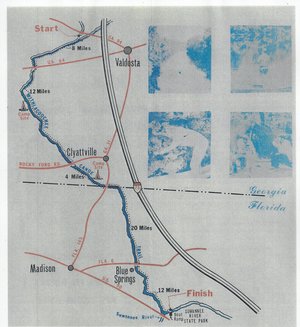
  • Areas of significant natural or cultural resources, particularly where they are likely to be intruded upon or otherwise impacted by development; such as wetlands, groundwater recharge areas and river corridors.

/pictures/2007-01-01--brooks-compplan/[Map D-4 Water Resource Protection Districts]
Map D-4 Water Resource Protection Districts

According to Ariel Godwin of the Southern Georgia Regional Commission,

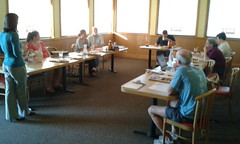
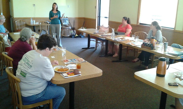
The next workshop for the Brooks County Comprehensive Plan will be:

Thursday, February 7th, 2017
9:30 a.m
Brooks County Commission Offices
610 South Highland Street, Quitman

In this workshop we will work on the Land Use Maps and Character Areas.

We are inviting you to participate to ensure Continue reading

Canoeing Guide to the Withlacoochee River c. 1979

300x327 Map, in Canoe Guide to the Withlacoochee River Trail, by John S. Quarterman, for WWALS.net, 0  1979 Including both Florida and Georgia, a second river got map and guide attention back in the 1970s. To be updated in the Withlacoochee River Water Trail.

This Withlacoochee River guide is courtesy of John Leonard, Executive Director of the Southern Georgia Regional Commission (SGRC).


I would speculate that it is the most recent of the three guides posted thus far, because the Continue reading

Canoeing Guide to the Alapaha River c. 1979

300x601 Cover: Georgias Cleanest River, in Canoeing Guide to the Alapaha River, by John S. Quarterman, for WWALS.net, 0  1979 Here’s a different guide to the Alapaha River from the one WWALS previously received; this one is courtesy of John Leonard, Executive Director of the Southern Georgia Regional Commission (SGRC). The Alapaha River Water Trail WWALS is currently developing is merely a continuation of this more than three decade old Alapaha Canoe Trail.

John Leonard said that when he started at the predecessor of the SGRC in 1980, calls came in frequently asking about water levels on the Alapaha River. It took him a while to realize why: the Alapaha River Trail had been written up in Southern Living! He did not have Continue reading

Alapahoochee Watershed Area Map by SGRC

The South Georgia Regional Commission (SGRC) produced this interesting map of the Alapahoochee River Watershed 300x225 Title, in Alapahoochee Watershed Area, by John S. Quarterman, for WWALS.net, 15 July 2014 I saw on the counter while visiting the USDA FSA office in Valdosta about something unrelated. Curiously, it doesn’t show the actual river nor its tributaries Mud Creek and Grand Bay Creek. But it does show that this watershed includes much of Valdosta, half of Dasher, and all of Lake Park. Continue reading

Adopt-A-Stream bacterial and chemical monitoring workshops in Waycross

Bacterial Monitoring on Friday and Chemical Monitoring on Saturday in Waycross, by Georgia Adopt-A-Stream (AAS), Satilla Riverkeeper, and other. This is not a WWALS event, but everyone is invited. -jsq Continue reading

Emily Davenport, Storm Water Utilities Director, City of Valdosta, at WWALS 27 June 2013 2012

The first speaker at a WWALS board meeting after incorporation was Emily Davenport, the Storm Water Utilities Director for the City of Valdosta.

Emily Davenport, Brittney Hull, Angela Bray of SGRC, Dave Hetzel Emily Davenport, Brittney Hull (Treasurer), Angela Bray of SGRC, Dave Hetzel (President), Nathan Wilkins (Secretary), visitor, Gretchen Quarterman, Bret Wagenhorst, John S. Quarterman (VP, photographing)
Emily Davenport, Brittney Hull (Treasurer), Angela Bray of SGRC, Dave Hetzel (President), Nathan Wilkins (Secretary), visitor, Gretchen Quarterman, Bret Wagenhorst, John S. Quarterman (VP, photographing)

Bret Wagenhorst, Gretchen Quarterman, visitor, Emily Davenport, Brittney Hull, Angela Bray of SGRC

-jsq