Update 2023-04-19: Videos: US 84 to Mayday, Alapaha River 2016-05-07
Waterfalls on the Alapaha River?
![[Movie: Waterfall (786K), 30.87078, -83.02267]](https://www.wwals.net/pictures/2016-05-07--us84-to-mayday-alapaha-river/KVID4839.jpg)
Movie: Waterfall (786K), 30.8707800, -83.0226700
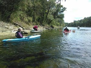
Two weeks after the WWALS outing from US 84 to Mayday, some of us who didn’t make that one paddled the same stretch. The earlier crew had smooth sailing. We had rapids and waterfalls, because the Alapaha River was feet lower on the Statenville USGS Gauge. Continue reading


![[Under the cypress]](/pictures/2017-04-29--blrpr-hubbard/PWHX8661.jpg)
![[McIntyre Spring and State Line Shoals 2016-07-09]](https://www.wwals.net/pictures/2016-07-09--nankin-ga-fl-line/igmany.jpg)