
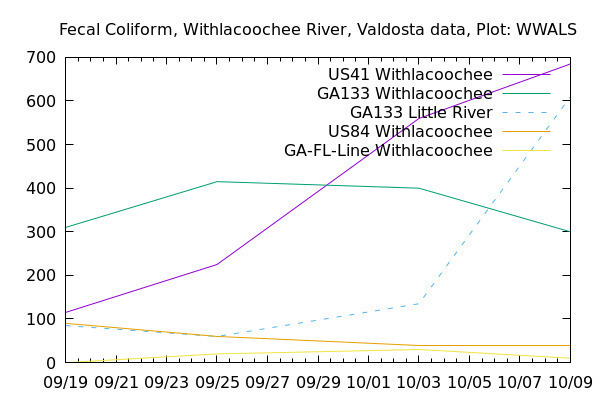
Gainesville Sun, 12:01 AM, Monday, March 16, 2020, John S. Quarterman: More testing needed to track river pollution (see also PDF),
Fecal bacterial contamination from Georgia probably reached the Gulf of Mexico about March 3, 2020, according to the Suwannee River Water Management District (SRWMD).
![[Tifton to the Gulf]](https://www.wwals.net/pictures/2020-03-03--cleaner-wq/map-suwannee-gulf.jpg)
Tifton to the Gulf
In the WWALS map of all public landings in the Suwannee River Basin.
The good news: we know about that, because of much more water quality monitoring being done since I wrote a column about the issue last year for The Sun.
This recent testing was provoked by a spill of 7.5 million gallons of raw sewage into Sugar Creek near Valdosta, Ga., in December. With no rain, the sewage sat there for a week, and then moved down the Withlacoochee River in about three weekly globs, at least once reaching the Suwannee.
This Valentine’s Day, Valdosta exceeded our request, testing not one but Continue reading
![[2019-10-31--center-of-wlrwt]](https://www.wwals.net/pictures/2019-10-31--wwals-gosp-troupville-river-camp/2019-10-31--center-of-wlrwt.jpg)
![[Air]](https://www.wwals.net/pictures/2019-01-06--wwals-troupville-testing/20190106_152646.jpg)
![[Continue titrating with Sodium Thiosulfate ONE DROP AT A TIME, swirling thoroughly after each drop,]](https://www.wwals.net/pictures/2019-01-06--wwals-troupville-testing/20190106_155851.jpg)
![[Brown Dog out, 09:31:38, 30.8484784, -83.3482902]](https://www.wwals.net/pictures/2018-10-13--troupville-cleanup-pictures/20181013_093138.jpg)
![[Red, yellow, white, blue, 10:09:03, 30.8454610, -83.3467969]](https://www.wwals.net/pictures/2018-10-13--troupville-cleanup-pictures/20181013_100903.jpg)
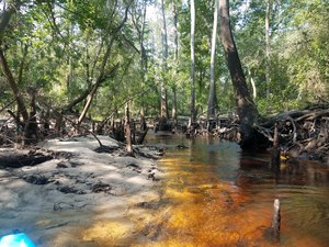
![[Log in tree, 2018:07:14 10:02:25, 30.8495694, -83.3402911]](https://www.wwals.net/pictures/2018-07-21--withlacoochee-troupville/20180714_100225.jpg)
![[Withlacoochee River at GA 133 in the WWALS map of the Withlacoochee and Little River Water Trail (WLRWT)]](https://www.wwals.net/pictures/2018-07-21--withlacoochee-troupville/google-map.jpg)
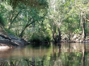
![[Beavers?, 2018:07:14 10:02:45, 30.8491566, -83.3404211]](https://www.wwals.net/pictures/2018-07-21--withlacoochee-troupville/20180714_100245.jpg)


![[Deer stand, 2018:07:14 10:11:39, 30.8472271, -83.3428214]](https://www.wwals.net/pictures/2018-07-21--withlacoochee-troupville/20180714_101139.jpg)
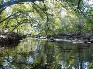
![[Side deadfall, 2018:07:14 10:17:13, 30.8461670, -83.3430003]](https://www.wwals.net/pictures/2018-07-21--withlacoochee-troupville/20180714_101713.jpg)
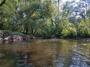
![[End of cutoff, 2018:07:14 10:18:11, 30.8467601, -83.3425382]](https://www.wwals.net/pictures/2018-07-21--withlacoochee-troupville/20180714_101811.jpg)
![[Trees, 2018:07:14 10:41:51, 30.8479584, -83.3408428]](https://www.wwals.net/pictures/2018-07-21--withlacoochee-troupville/20180714_104151-0.jpg)
![[Power line, 2018:07:14 10:52:08, 30.8499246, -83.3400640]](https://www.wwals.net/pictures/2018-07-21--withlacoochee-troupville/20180714_105208.jpg)
![[Submerged deadfall, 2018:07:14 11:14:34, 30.8519610, -83.3391584]](https://www.wwals.net/pictures/2018-07-21--withlacoochee-troupville/20180714_111435.jpg)