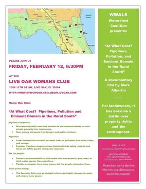
If you missed it in Live Oak last night, or in one of the previous premieres along the Georgia coast,
you can see the movie online:
 At What Cost? Pipelines, Pollution and Eminent Domain in the Rural South,
by Mark Albertin.
And yes, he’s happy for it to be shown elsewhere; just ask.
At What Cost? Pipelines, Pollution and Eminent Domain in the Rural South,
by Mark Albertin.
And yes, he’s happy for it to be shown elsewhere; just ask.
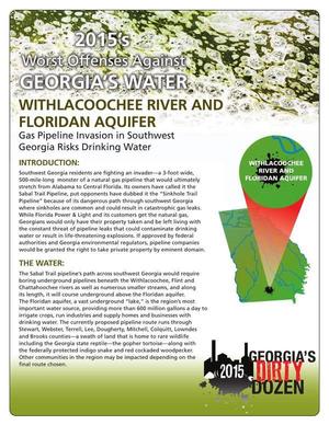
Thanks to Push Back the Pipeline for getting this movie made about Kinder Morgan’s proposed petroleum products pipeline from South Carolina across the Georgia coast to Jacksonville, Florida. Special thanks to Eileen, Lori, and Debra and the Woman’s Club of Live Oak for the movie showing last night, and to SpectraBusters, Our Santa Fe River, and Gulf Restoration Network for helping promote it. Don’t forget the hike to the Suwannee River Sabal Trail crossing 8:15 AM Thursday 28 February 2016 with Suwannee and Hamilton County Commissioners.
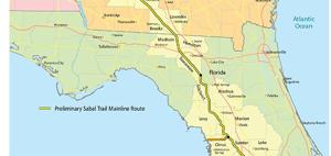
Most of the issues are the same for the invading Sabal Trail fracked methane pipeline which Continue reading