Update 2017-09-01: Add
#StopETP Day of Action one day early to the same event in Live Oak.
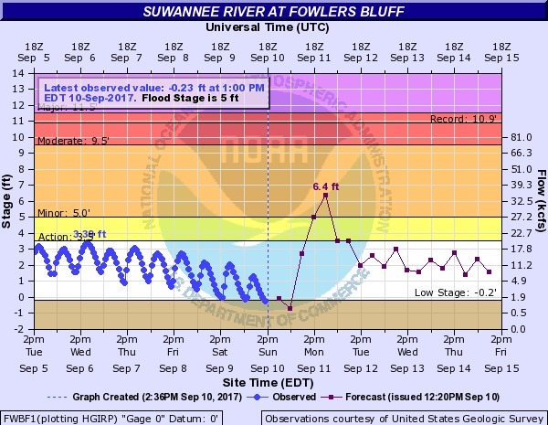
Suwannee Riverkeeper John S. Quarterman will
show four years of Sabal Fail, and the Three Stooges plumbing in Dunellon.
WWALS member Cecile Scofield will
talk about LNG export all over Florida.
Flint Riverkeeper Gordon Rogers will explain
what the fossil fuel industry calls the Great Major Victory by Sierra Club, Flint Riverkeeper, and Chattahoochee Riverkeeper, and what it means (so far as anyone knows).
WWALS E.D. Gretchen Quarterman will lay out what you can do to help
stop Sabal Trail and reform FERC.
Plus videos.
When:
6:30 PM, Thursday, September 7, 2017
Where:
Live Oak Woman’s Club, 1308 11th St SW, Live Oak, FL 32064
Free:
There is no admission fee and you do not have to be a member of WWALS to attend. Naturally, we do encourage you to join WWALS today. https://wwals.net/blog/donations/
Event:
facebook,
meetup
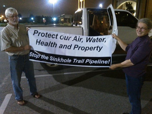
Gordon Rogers, Flint Riverkeeper and Gretchen Quarterman, WWALS Executive Director
Videos: Continue reading →