Tag Archives: White Springs

PCS Phosphate Mine Special and Renewal Permits, Jasper, FL 2018-01-23

See also: Pictures: PCS Phosphate mine permit Public Hearings, Jasper, FL 2018-01-23.

While residents of Union and Bradford Counties, Florida try to fight off the proposed HPS II phosphate mine on the New and Santa Fe Rivers, Hamilton County faces renewal and modification of permits for the PCS Phosphate mine, near White Springs and the Suwannee River.

When: 6PM, Tuesday, January 23, 2018

Where: County Commission Meeting Room, County Courthouse,
207 Northeast First Street, Jasper, Florida

What: North Florida Public Notices, search for PCS Phosphate finds notices for two public hearings the same evening:

Closeup, PCS Plant,
Photo: John S. Quarterman for WWALS on Southwings flight 2016-10-22.

1. 1/11/2018

NOTICE OF PUBLIC HEARING CONCERNING APPLICATION FOR MODIFICATION TO MASTER MINING PLAN AND SPECIAL PERMIT BY THE PLANNING AND ZONING BOARD OF HAMILTON COUNTY, FLORIDA, NOTICE IS HEREBY GIVEN that, Continue reading

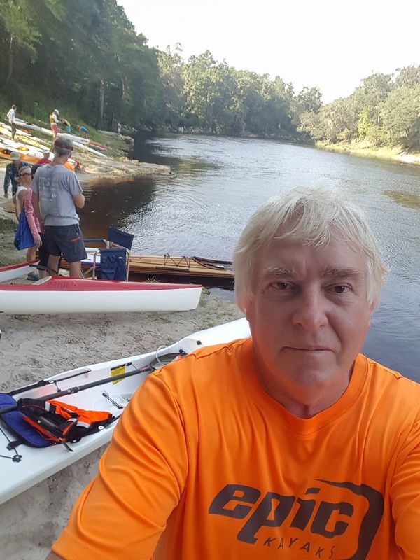
Three Suwannee River paddle races starting 2017-10-14

On October 14, 2017 we recommend you join WWALS on the Withlacoochee River from Nankin Boat Ramp to Madison Highway, stopping at McIntyre Spring and Arnold Springs, with many shoals.

But if you have a mind to race that day instead, here are three opportunities for you:

  1. Fargo to White Springs,
  2. the entire length of the Suwannee River
  3. from Suwannee River State Park to Manatee Springs State Park

Phil Hubbard getting ready
Phil Hubbard getting ready July 29, 2017 for Mere Mortals Paddling Race 2017 on the Withlacoochee and Suwannee Rivers

None of these races are by WWALS; we are merely listing them for your information. Continue reading

PotashCorp Field Trip Summary –David Wilson 2017-04-13

The moonscape that seems to go on forever while flying over Hamilton County, Florida in a small plane is the PCS phosphate mine, as seen in some WWALS aerials in these slides that David Wilson presented at a Santa Fe River Springs Protection Forum April 13, 2017 at Otter Springs, Florida. Dave is Treasurer of the Board of Florida Springs Institute, and a WWALS member. His slides are published on the WWALS website with his permission.


Slide 14

According to the slides, perhaps JEA is responsible for the low water levels at White Sulfur Springs, formerly a famous resort, now bone dry: Continue reading

Water low but passable, White Springs to Swift Creek, Suwannee River 2017-05-20

Update 2017-05-17: OK, the water’s gotten too low at the original location, so we’re moving downstream to Woods Ferry Tract Launch to Suwannee Springs.

Hands Across the Sand on the Suwannee Saturday! The river is quite low (48.78 feet NAVD on the White Springs gage), but it looks doable from the put-in and take-out. A ranger at Stephen Foster State Park told me paddling from White Springs to Swift Creek would be doable, perhaps with a few dry spots. I’ll also call a local outfitter or two for their opinions.

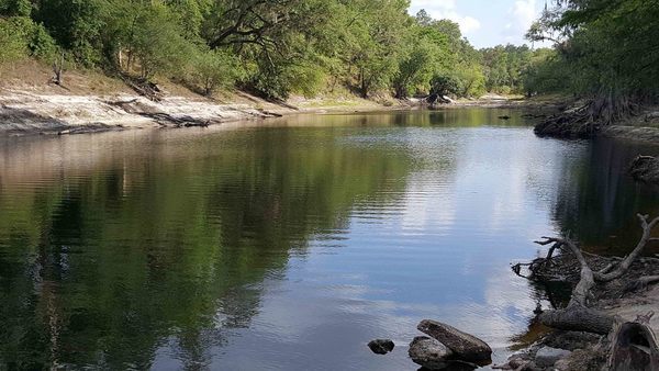
White Springs down from ramp

White Springs down from ramp

Meanwhile, bring bug spray (gnats) and a rope (to pull your boat over sand bars), and we’re still on for 9AM Saturday 20 May 2017. See the outing announcement for more details.

Plus: that’s the day of Hands Across the Sand, “Say NO to dirty fuels and YES to clean energy”. WWALS has been saying that for years, so somewhere on the Suwannee we will stop and do Hands Across the Sand against the Sabal Trail fracked methane pipeline and for solar power.

White Springs low spot

Continue reading

White Springs to Swift Creek, Suwannee River, 2017-05-20

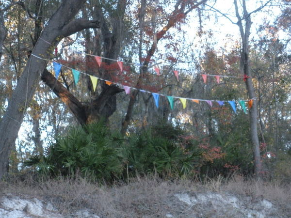
Because SRWMD tells us Blue Sink Launch is closed, our May Suwannee River outing will take out slightly downstream at Swift Creek Lunch, which should be easy to recognize from the river because American Canoe Adventures has put up these nice triangular flags:

Flags by ACA
Photo: Jesse Wilkes, November 23, 2016

The put in at White Springs Wayside Park and everything else is the same; see the updated outing announcement for all the details.

We’re bringing bon-bons. See you there in May!

 -jsq, John S. Quarterman, Suwannee RIVERKEEPER®

You can join this fun and work by becoming a WWALS member today!

PCS Phosphate Mine 2016-10-22

W across PCS Phosphate Mine, 30.4429360, -82.7851800 Is this what you want Bradford, Union, and other counties in Florida to look like? I wonder what effect this phosphate mine had on the much lowered water level of White Springs, or the Suwannee River?

The PCS Phosphate mine in Hamilton County near White Springs and Jasper spread under our Southwings plane while surveying the Sabal Trail fracked methane pipeline 22 October 2016. On board were Southwings pilot Roy Zimmer, photographer Dominick Gheesling, Jim Tatum of Our Santa Fe River, and John S. Quarterman of WWALS. Here are pictures by Jim Tatum, a few videos by John S. Quarterman, and a Google map showing the locations. Continue reading

White Springs to Blue SInk Swift Creek Launch, Suwannee River, 2017-05-20

Update 2017-05-17: OK, the water’s gotten too low at the original location, so we’re moving downstream to Woods Ferry Tract Launch to Suwannee Springs.

Update 2017-05-15: The water’s low, but so far it’s a go, plus it’s Hands across the Sands on the Suwannee against the Sabal Trail fracked methane pipeline and for solar power.

Update 2017-04-06: SRWMD tells us Blue Sink Launch is closed, so we’ll be taking out nearby at Swift Creek Launch.

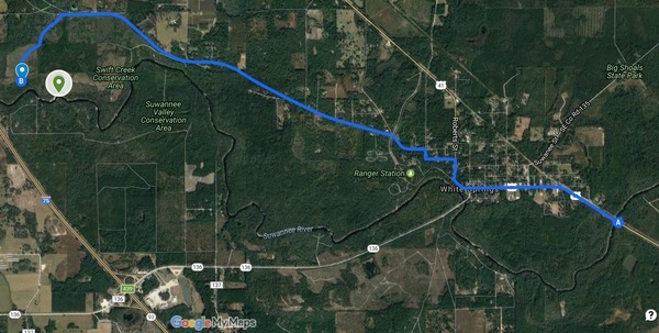
Join WWALS for a brief paddle 8 miles on the Suwannee River through White Springs down to Blue Sink Swift Creek Launch. This shouldn’t take more than 4 hours paddling or 5 hours including shuttle. With lunch, swim stops, and bon-bons, of course.

Bring the usual personal flotation device, boat paddles, food, drinking water, warm clothes, and first aid kit. If you don’t have a boat, there are many outfitters, or let us know and many of us have spare boats.

When: 9AM Saturday 20 May 2017

Put In: Suwannee River Wayside Park Ramp, river mile 171.0
From White Springs, travel south on US 41 to the river; the ramp is on the south side in the town park.

GPS: 30.3255398,-82.7413685

Shuttle
This map drawn using landing directions from the Suwannee River Wilderness Trail map of Boat Ramps & Canoe Launches and SRWMD’s Blue Sink, Rocky Creek, Swift Creek.

Duration: 5 hours

Events: facebook, meetup.

Free: This outing is Free! And we recommend you support the work of WWALS by becoming a WWALS member today!

Shuttle Distance: Continue reading

Delay Roline Redoux as Suwannee River rises after Hurricane Hermine 2016-09-05

Update 2016-09-04: “We’re on for Monday morning! River excellent condition,” says expedition leader Phil Hubbard.

With water still coming downstream from Hurricane Hermine and storms following, USGS WSPF1 at White Springs expedition leader Phil Hubbard says:

I’m thinking looking at the weather forecast, the only safe call we can make today is to delay till Monday pend river level. The rain probability is actually higher on Sunday but looks good for Monday.

So we’re rescheduling Redoux Roline for 10 AM Monday morning September 5th 2016, still at Roline.

At lest now now we know the Suwannee River won’t be too low!

Hoping to see you there. Details are still in the first blog post.

-jsq

You can join this fun and work by becoming a WWALS member today!

Continue reading

We have a right to expect waterways and groundwater to be clean –Dennis J. Price

Another letter against Sabal Trail and for the rivers and the aquifer in the paper Suwannee Democrat, May 5th 2016.

In response to Jason Bashaw’s, Chairman of the Suwannee County Commission, article in the Suwannee Valley Times, I have this to say. Why is it that if people are concerned about the environment they live in, they are automatically placed into this environmental left category? Like many, many people in our surrounding counties, I hunt, fish, hike and paddle our local rivers. I use the environment as do we all.

I use the environment as do we all. So, for working and paying taxes all my life — as a Vietnam Veteran, as a person who chose to live in this rural part of Florida and raise his kid, as a person who is not now nor ever will be wealthy — I count our public lands, our woods and rivers as a reward for doing the right thing. I do not mind my tax dollars going towards public lands. Mr. Bashaw uses the environmental left in a derogatory manner as a means of denigrating them, and he is including me in it and I resent it. I resent it for my friend’s in WWALS and others who show concern for the pipeline route. I have not met an environmental lefty among them.

WWALS is, Continue reading