A leisurely five mile paddle in about two and a half hours through a surprisingly wild section of the Withlacoochee River, much of it actually inside Valdosta, the biggest city in the Suwannee River Basin, on the Withlacoochee and Little River Water Trail (WLRWT).
When: 9 AM, Saturday, March 3, 2018
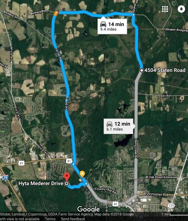
Put In: Staten Road Landing, 4556 Staten Road, Valdosta, GA 31605, Lowndes County, GA. 7.1 miles north of downtown Valdosta. Beware: it’s a long rough dirt road access, then a scramble down the riverbank.
GPS: 30.9328, -83.28227
Take Out: Langdale Park Boat Ramp, 3781 N. Valdosta Rd., Valdosta, GA 31602, Lowndes County, GA.
Free: This outing is Free! And we recommend you support the work of WWALS by becoming a WWALS member today!

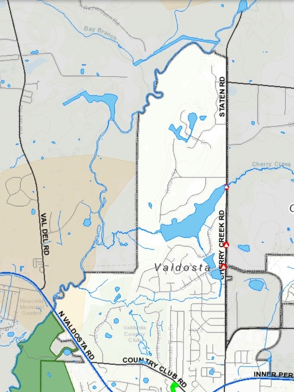
Map: VALORGIS.
White is Valdosta inside grey city limits, yellow is recharge zones for the Floridan Aquifer, green is Langdale Park.
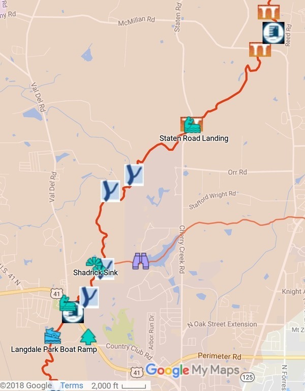
We start in Lowndes County, cross over the county’s expanded sewer and water lines at Bay Branch (those lines head for Stafford-Wright Road). Then the City of Valdosta is on our left briefly before back to county both sides, and Sermons Branch (is that its real name?). Into a Floridan Aquifer recharge zone, passing on our right the Shadrick Sink, notorious for making Valdosta double the depth of its water wells to get under river water in groundwater. Then Cherry Creek comes in from the left, with a sinkhole right at the confluence, followed by a Withlacoochee River slough. Then we see Valdosta on the left again, Stillhouse Branch comes out of Valdosta Country Club (maybe with less trash than we found in October 2015). We cross under US 41 North, out of the city but into Langdale Park of the Valdosta-Lowndes County Parks and Recreation Authority, where we get out.
Duration: 5 hours
Bring: the usual personal flotation device, boat paddles, food, drinking water, warm clothes, and first aid kit. Also trash pickers and trash bags: every WWALS outing is also a cleanup.

Map: Withlacoochee and Little River Water Trail Map.
Shuttle distance: 6.1 miles
Shuttle duration: 45 minutes
Paddle distance: 5.1 mi
Paddle duration: 4.5 hours
Gauge: Skipper Bridge, 023177483
Highest safe 10.7 feet, 131 NAVD. Lowest boatable 2.3 feet, 122.6 NAVD.
When we last paddled this stretch, March 20, 2016, water levels actually rose from 5.25 to 5.5 feet (125.55 to 125.80 NAVD88) at the Skipper Bridge Gauge. Today, Monday January 1, 2018, the Skipper Bridge gauge reads 123.97, which isn’t bad, and we should be in the rainy season by March.
Gauge: Valdosta (US 41), 02317755
Highest safe 12.7 feet, 123 NAVD. Lowest boatable 3.5 feet, 113.8 NAVD.
On March 20, 2016, water levels rose from 8.0 to 8 feet (118.3 to 118.4 NAVD88) at the Valdosta Gauge. Today, Monday January 1, 2018, the Valdosta gauge reads 115.43. and we should be in the rainy season by March.
Host: Phil Hubbard
Contact: Phil Hubbard
Backup: in case of high or low water is: Ray’s Mill Pond, 875 Rays Millpond Rd, Ray City, GA 31645, Berrien County, GA.
More: For more outings and events as they are posted, see the WWALS calendar.
-jsq, John S. Quarterman, Suwannee RIVERKEEPER®
You can join this fun and work by becoming a WWALS member today!
Short Link:


