Tag Archives: Alapaha River

Paid permitting of paddle boats and boards Tuesday? 2017-11-28

One group wouldn’t do it, so its parent may: require paid permits for paddle boats and boards in Florida.

When: 9AM, Tuesday, November 28, 2017

Where: Mission Inn, 10400 County Road 48, Howey-in-the-Hills, 34737
That’s a golf club resort halfway between The Villages and Orlando, rooms $179 to $246 for Monday night.

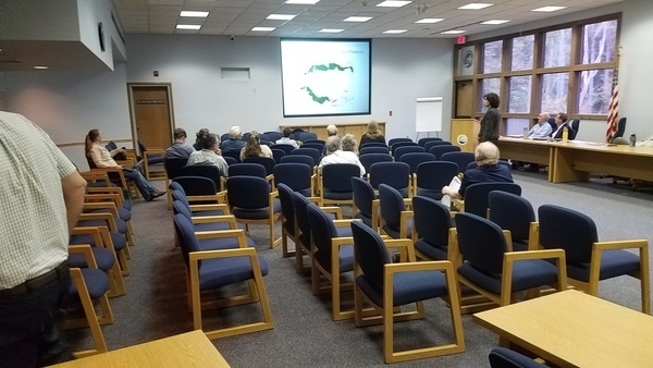
Who: Boating Advisory Council (BAC) of the Florida Fish and Wildlife Conservation Commission (FWC)

Event: On the agenda under “Unfinished Business / Updates”:
“Non-Motorized Boat Working Group Recommendations Review — William Griswold”

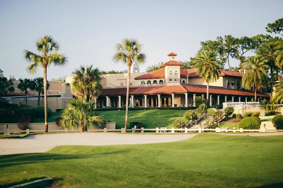
TripAdvisor, Mission Inn Resort & Club, 10400 County Road 48, Howey in the Hills, FL 34737-3000

How to Comment: Continue reading

Capt. Henry Will Jones Bridge, Alapaha River, Lakeland, Lanier County, GA

Nobody seems to know the bridge just east of Lakeland has a name: Captain Henry Will Jones Bridge. Just below it is Lakeland Boat Ramp on the Alapaha River Water Trail (ARWT). We’ll be going by there in a few months on the Alapaha Quest.

Scott Thompson, Pieces of Our Past, November 30, 2015, CAPTAIN HENRY WILL JONES,

Captain Henry Will Jones

Henry Will Jones was born about 1917 in what became Lanier County just as our country was entering World War I. After Continue reading

Suwannee River Basin Maps

Update 2019-02-13: And a version with Landings. See also Water Trails, with more detailed maps and access points.

Nobody seems to have done this, so we did: a map of the Suwannee River Basin, with the major watersheds and the Estuary shaded, and all the major rivers, plus many of the creeks. Bonus: springs! Narrow, Suwannee River Basin Click on this link for an interactive google map of the Suwannee River Basin.

The river traces come from USGS and Chris Graham. The watershed boundaries are from USGS. The springs are from the Florida Springs Institute, plus four Georgia springs collected by WWALS.

The eight-digit hydrologic unit codes (HUC8) for the Suwannee River Basin are: Continue reading

WWALS at Alapaha Station Celebration 2017-11-11

Update 2018-11-09: Pictures.

We will have the WWALS festival booth at the Alapaha Station Celebration on Saturday November 11, for the fourth year running. Join us for a fun day of outreach to members of our community.

When: 9AM – 5PM, Saturday, November 11, 2017

Where: Alapaha Station, 245 NE Railroad St, Alapaha, Georgia

Event: facebook, meetup

Miss Alapaha Station Mini Supreme, The winners
Miss Alapaha Station Mini Supreme at the WWALS booth last year.

The station is only a few miles from Continue reading

Pictures: WWALS at Alapaha Station Celebration 2016-11-12

Last year at Alapaha Station Celebration we met a lot of people ad had a good time. We’ll be back there this Saturday.

Sign up here, WWALS booth

Continue reading

Sheboggy to GA 135, Alapaha Quest 2017-01-0627

Update 2018-01-19: Rescheduled again, due to low water, to become a hike to the Dead River Sink, still on January 27, 2018.

Update 2018-01-01: Rescheduled to January 27, 2018! Follow this link for the revised outing details.

A long paddle to start the Alapaha Quest! Along the way we will pass Rowetown Church and the Willacoochee River Confluence as we paddle down the wild and exotic Alapaha River in the south Georgia winter.

When: 7AM Saturday, January 6, 2018

Put In: Sheboggy Landing at US 82, east of Alapaha, Berrien County, Georgia.

GPS: 31.386278, -83.191611

Take Out: GA 135 Atkinson near Willacoochee, GA in Atkinson County.

Price: This outing is $10.00 for nonmembers, and free to WWALS members. We recommend you support the work of WWALS by becoming a WWALS member today!

Event: facebook meetup

18.26 miles or 10 hours paddling, ARWT

Bring: Continue reading

WWALS Alapaha Quest starts Saturday, January 6th27th, 2018

Update 2018-01-19: First leg rescheduled again, due to low water, to become a hike to the Dead River Sink, still on January 27, 2018.

Update 2018-01-01: The first leg of the Alapaha Quest is rescheduled to January 27, 2018! Follow this link for the revised details of that outing.

Join us to explore the entire Alapaha River Water Trail on the 2018 Alapaha Quest!

The Alapaha River is described as unspoiled, wild, and scenic. Add these remoteness features, some the dark reddish-brown waters with occasional shoals and it becomes a gem to paddle.

Landings, ARWT

What is the Alapaha Quest?

Continue reading

Sasser Landing to Jennings Bluff & Dead River Sink 2015-06-14

See three sinks, a waterfall, and a distributary in these videos from the WWALS Outing to Turket Creek Waterfall, the Alapahoochee River, the Alapaha River Sink, and the Dead River Sink, June 14, 2015. A WWALS video playlist follows the links to each video below. Continue reading

Irma sewage spills from Lowndes County 2017-09-12

Received 28 September 2017 from Lowndes County Utilities Director Steve Stalvey:

Google Map by WWALS.net,
See interactive google map.

John,

This is the information I sent to the State concerning the spills related to Irma on Tuesday 9-12-17. Continue reading

SWIM Plan Meeting, Live Oak 2017-10-03

Nitrates, agriculture, and silviculture were already in, and sewage, phosphate mines, and the Floridan Aquifer got added yesterday afternoon in Live Oak in public comments on updates to SRWMD’s SWIM Plans, plus new SRWMD E.D. Hugh Thomas spoke.

Audience with back of Hugh Thomas, Coastal Rivers Basin Presentation

Thanks to presenter Tom Singleton, the slides presented are on the WWALS website. Here are a few notes and pictures.

Floridan Aquifer

Merrillee Malwitz-Jipson of Sierra Club Florida noted Continue reading