Tag Archives: creeks

Sabal Trail slips its in-service request to June; FERC classifies WWALS shutdown request as motion 2017-05-26

They finally admit to FERC the Sabal Trail boondoggle is a month late! And FERC reclassifies the WWALS filing as a motion for all three SMPP pipelines.

Susan Salisbury, Palm Beach Post, 26 May 2017, Sabal Trail seeks new pipeline start date; group wants shutdown,

Sabal Trail Transmission on Friday asked federal regulators for an early June in-service date for its portion of the Alabama-to-Florida natural gas pipeline, a later date than it had requested earlier this month.

With segmented KMI FGT JEP to Jacksonville to Eagle LNG export:

On May 17 Houston-based Sabal Trail had asked the Federal Energy Regulatory Commission for permission to start sending gas through the pipeline by today — May 26.

Also Friday, the Georgia-based WWALS Watershed Coalition asked FERC to deny all requests to place the pipeline into service, and said FERC should revoke the permit and shut it down.

The Sierra Club recently asked FERC to delay the pipeline’s operation until after pending litigation is resolved.

FERC has yet to act on either of Sabal Trail’s start-up date requests or on The Sierra Club’s request.

Maybe FERC staff have noticed Continue reading

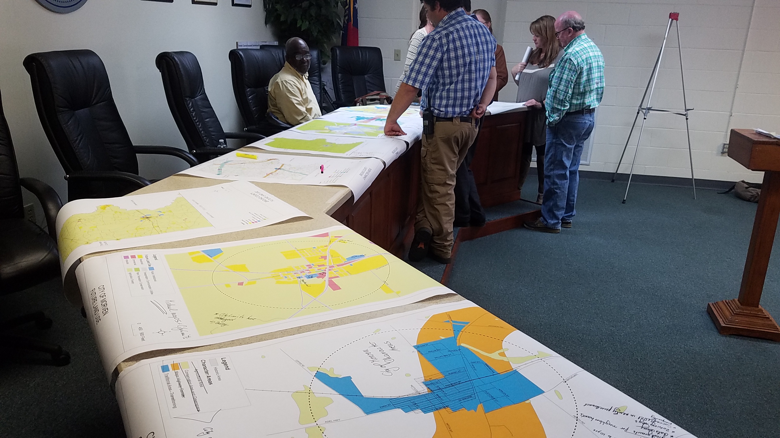
Brooks County Comprehensive Plan Workshop

More about that in a previous post.

 -jsq, John S. Quarterman, Suwannee RIVERKEEPER®

You can join this fun and work by becoming a WWALS member today!

Workshop, Greater Brooks 2030 Comprehensive Plan, 2017-02-07

First on the list of Areas Requiring Special Attention in Brooks County, Georgia:

  • Areas of significant natural or cultural resources, particularly where they are likely to be intruded upon or otherwise impacted by development; such as wetlands, groundwater recharge areas and river corridors.

/pictures/2007-01-01--brooks-compplan/[Map D-4 Water Resource Protection Districts]
Map D-4 Water Resource Protection Districts

According to Ariel Godwin of the Southern Georgia Regional Commission,

The next workshop for the Brooks County Comprehensive Plan will be:

Thursday, February 7th, 2017
9:30 a.m
Brooks County Commission Offices
610 South Highland Street, Quitman

In this workshop we will work on the Land Use Maps and Character Areas.

We are inviting you to participate to ensure Continue reading

Sabal Trail in Lowndes County, GA 2016-12-12

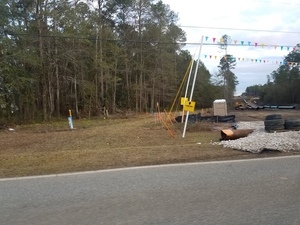
Sabal Trail’s 100-foot gouge makes the old pipeline right of way look like nothing, across Lowndes County, Georgia; pictures by John S. Quarterman for WWALS on 12 December 2016, with videos and a google map.

Troy Access signs start on Nankin Road shortly after you come up from Florida.

Rocky Ford Road is the most obvious pipeline crossing. You can see all the way to it from Barrett Coody Road. Continue reading

Bevel Creek, not Beaty Creek, on Williams Road off Loch Laurel, Lowndes County, Georgia

Mystery finally solved of where is the road over what creek does Lowndes County Georgia want to replace a bridge?

Loch Laurel Road to Williams Road --Google Maps Item 6.b. Replacement of Beatty Creek Bridge on Williams Road, for yesterday morning’s Lowndes County Commission Work Session: where is this for the $634,800 low bid from Southern Concrete Construction of Albany, GA? There are two Williams Roads in Lowndes County and no Beaty Creek. In the north end of the county Cat Creek has a tributary Beatty Mill Creek, with a Williams Road running near it between Upper New Bethel Road and Beatty Mill Creek Road. But according to all the maps I can find, Williams Road does not cross Beatty Mill Creek.

So what exactly is it that the county wants to pay the low bidder $634,800 for? In the 8:30 AM Tuesday 25 April 2016 Work Session, Commissioner Mark Wisenbaker asked, “Where exactly is this?” Continue reading

Sabal Trail Contractor Fair, Moultrie, GA 2016-04-15

Not just for compressor station counties, also apparently also for where Sabal Trail has promised side taps, including Moultrie, Georgia, as seen today in the Tifton Gazette and the Valdosta Daily Times.

Southern Regional Technical College, Seminar Center, 361 Industrial Drive, Moultrie, GA 31788 When: 11AM – 2PM Friday, April 15th 2016

Where: Southern Regional Technical College, Seminar Center, 361 Industrial Drive, Moultrie, GA 31788

This Moultrie job fair is scheduled one month after Colquitt County sent FERC exorbitant claims of benefits in property tax revenue, wildly high and out-of-context construction jobs claims, and discounted safety and environmental concerns, with no mention whatever of agriculture, nevermind Colquitt County’s letter to FERC two years before about agricultural concerns.

The Colquitt letter to FERC made no mention of lowered property values reducing tax revenue, cited no source, just “It is estimated that”. However, in the same paragraph: Continue reading

Ray’s Mill Pond, 2016-04-02

See you 9AM tomorrow morning April 3rd for the WWALS Outing at the 3,500 acre Ray’s Mill Pond, View from boatramp which is open for boating 24/7; just put a dollar in the box. In the evenings Monday thru Thursday, don’t park your boat on the pavement because the restaurant is open then, and it’s very popular, but no worries on a Sunday morning.

You can join this fun and work by becoming a WWALS member today!

-jsq

You can join this fun and work by becoming a WWALS member today!

View from boatramp
View from boatramp

Deposit .00 Launch Fee Here

Launch Fee .00
Launch Fee .00

No Boat Trailers on Paved Lot Thursday Thru Saturday 4PM til 10PM

Busy restaurant parking lot

Cat Creek flooding
Cat Creek flooding

Rays Mill Pond spillway

View from walkway
View from walkway

Three more Valdosta wastewater overflows 2016-03-28

Who thought it was a good idea for stormwater to go into Valdosta’s sanitary sewer system? 700 Cypress Street, Valdosta, GA Whoever it was, the current Valdosta Utilities, Engineering, and especially Stormwater Director have to deal with it, frequently. Maybe some of the upwards of $300 million Valdosta is spending on force main, new Withlacoochee Wastewater Treatment Plant, etc., will help with this problem. But none of that will stop rain from falling on Valdosta, and little of it is directed at the Alapaha River watershed in Valdosta, where one of this week’s three spills went.

Come see for yourself where Sugar Creek flows into the Withlacoochee River, this Sunday morning, April 3rd, on the extra WWALS Outing from Langdale Park to the Little River Boat Ramp. And come paddle with us on the Alapaha River Saturday morning April 23rd, from Hotchkiss Road in Lanier County to Mayday in Echols County, upstream from where Knights Creek flows into Mud Swamp Creek, which joins Grand Bay Creek to form the Alapahoochee River, which joins the Alapaha River in Florida. And of course both the Withlacoochee and the Alapaha join the Suwannee River. Valdosta says there’s no significant vestige of its wastewater that far downstream. It would be good to have some independent water quality monitoring to be sure.

I notice Section 5 Mud Swamp Creek Basin of Valdosta’s Master Stormwater Management Plan says: Continue reading

EPA Clean Water Rule finalized

I still see EPA’s new Clean Water Rule as a good thing, since it protects drinking water, paddling, and fishing, while opponents remain quite vague about what might be wrong with it.

After last year’s comment period, U.S. EPA has posted a prepublication version of its final Clean Water Rule.

Katie Shepherd, L.A. Times, 27 May 2015, Under new EPA rule, Clean Water Act protections will cover all active tributaries, Continue reading

Alapaha River @ US 84: endpoint of Sunday’s WWALS Outing 24 August 2014

Chris Graham took this picture a week ago of the Alapaha River at US 84, where tomorrow’s WWALS Outing will end up. Come join us on this gem of a blackwater rural river! We’re boating the central area of the in-progress Alapaha River Trail, tomorrow afternoon, Sunday, August 24st 2014.

Meet up at 1:30 at Hotchkiss Crossing on the Lanier County side.

We will drop the boats off, drive the end point at US 84, on a public right of way, where the road is gravel.

Get on water at 2:00.

We will pass by the location for the new Lowndes County boat ramp and public access point. This is a relatively short paddle, about 1.27 miles, but it could take as long as 2 hours if the water level stays low.

This event is FREE! All we ask is that Continue reading