Tag Archives: Land Between the Rivers

River and Creek Cleanup 2021-10-09

River and Creek Cleanup, WWALS, Lowndes County, Valdosta 2021-10-09 (PDF)

Hahira, GA, September 16, 2020 — WWALS has found some of the sources of the infamous trashjam on Sugar Creek, and at least one upstream property owner has made progress in stopping litter before it escapes. But there are other sources, and trash still collects back of the Salty Snapper.

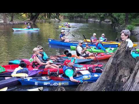
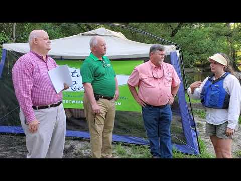
Downstream on the Withlacoochee River, flood waters spread that trash all over the Land Between the Rivers at the Little River Confluence, where one day there will be a River Camp and a River Park. You are invited to join us at Troupville Boat Ramp to walk downstream and help clean up that property, too. Valdosta and Lowndes County also have cleanup locations that same day.

“If you are looking to help make a difference, these locations need the most help, 9AM, Saturday, October 9, 2021!” said WWALS member Bobby McKenzie, who has been on this trash case for a year now.

[Flyer]
Flyer

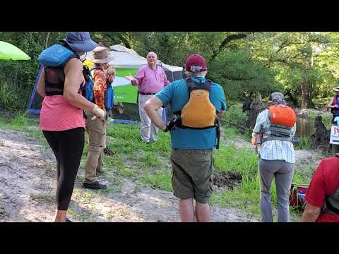
No boats necessary, although if you want to bring a boat, there are water cleanup opportunities. Please bring sturdy mud boots or shoes, long pants and clothes that can get wet or dirty, insect repellant, a refillable water bottle, and an emergency phone number. Trash bags and trash pickers will be provided, as well as drinking water and snacks, but bring your own if you can. Please maintain a physical distance of at least six feet from people not in your household. Please wear a mask when near people not in your household. We will have extra masks.

This event is part of the Georgia Rivers Alive cleanup program.

Also participating will be Current Problems from Gainesville, Florida.

Update 2021-09-17: facebook event.

Update 2021-09-20: meetup.

The WWALS locations are:

  • Salty Snapper (Sugar Creek)
    Address: Parking lot, Salty Snapper, 1405 Gornto Rd, Valdosta, GA 31602.
    GPS: 30.861809, -83.318841
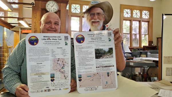
  • Land Between the Rivers (Little and Withlacoochee Rivers) @ Troupville Boat Ramp
    Address: 19664 Valdosta Hwy, Valdosta, GA 31602, west of I-75 exit 18.
    GPS: 30.851842, -83.346536
    It will be hunting season. Please wear hunting orange. Do not cross the river. WWALS will have sign-in sheets that are also event waivers so our insurance will cover you.

The Valdosta Locations are:

Continue reading

River and Creek Cleanup, Lowndes County, Valdosta, and WWALS 2020-10-10

FOR IMMEDIATE RELEASE (See also PDF)

River and Creek Cleanup, Lowndes County, Valdosta, and WWALS 2020-10-10

Hahira, GA, September 8, 2020 — Lowndes County has three rivers, all great for fishing, boating, and swimming, and Valdosta has many creeks. Everyone enjoys our waterways better when they are clean. Here’s a fun opportunity to get outside and clean them up.

[Flyer: Cleanup on three rivers, many creeks]
Flyer: Cleanup on three rivers, many creeks

Lowndes County, the City of Valdosta, and WWALS Watershed Coalition, Inc. (WWALS) are jointly organizing a three-river cleanup in the county, at Troupville Boat Ramp on the Little River, at Sugar Creek on the Withlacoochee River, and at Naylor Boat Ramp on the Alapaha River, plus cleanups in Valdosta on Onemile Branch, Twomile Branch, and Sugar Creek.

Please join us, from 9 AM to 11 AM, on Saturday, October 10, 2020. No boat required, although if you want to bring a boat, there are water cleanup opportunities at each river location and some of the creeks.

Please bring sturdy mud boots or shoes, long pants and clothes that can get wet or dirty, insect repellant, a refillable water bottle, and an emergency phone number. Trash bags and trash pickers will be provided, as well as drinking water and snacks, but bring your own if you can.

Please maintain a physical distance of at least six feet from people not in your household. Please wear a mask when near people not in your household. We will have extra masks.

Events: Facebook, meetup.

The Valdosta Locations are:

Continue reading

Pictures: Troupville River Camp site –Gretchen Quarterman 2020-08-27

Yesterday the Detail Group convened at Troupville Boat Ramp to see the site of the proposed Troupville River Park.

[Photo: Gretchen Quarterman, of Chad McLeod (Lowndes County), George Page (VLPRA), Mac McCall (Architect), Jason Scarpate (ASA Engineering), John S. Quarterman (Suwannee Riverkeeper), Tom H. Johnson Jr. (WWALS President), Tom Baird (Archaeologist) at Troupville Boat Ramp]
Photo: Gretchen Quarterman, of Chad McLeod (Lowndes County), George Page (VLPRA), Mac McCall (Architect), Jason Scarpate (ASA Engineering), John S. Quarterman (Suwannee Riverkeeper), Tom H. Johnson Jr. (WWALS President), Tom Baird (Archaeologist) at Troupville Boat Ramp

A larger Steering Group is meeting weekly to update and resubmit last year’s application for a grant to the Georgia Outdoor Stewardship Program (GOSP) for a Troupville River Camp. This year we have strong buy in from Lowndes County, the City of Valdosta, three local Authorities (Parks & Rec., Tourism, and Development), the Chamber of Commerce, McCall Architects, ASA Engineering, Valdosta Disc Golf, and others. Suwannee River Water Management District has already been participating. The local Georgia statehouse delegation was on last week’s call, as was the Georgia Department of Natural Resources (GA-DNR). Key to all of this is 74 acres for sale by Helen Tapp of Land Between the Rivers (LBTR), below Troupville Boat Ramp down to the Little River Confluence, to be combined with the existing 49-acre VLPRA park, to create a 123-acre Troupville River Park. If you or your organization are interested in helping with this nature preserve and multi-use park, please let us know.

[Concept Plan by ASA Engineering (rotated and trimmed)]
Concept Plan by ASA Engineering (rotated and trimmed)

Yesterday we looked to see where hiking, biking, and horse trails might go, to see fishing spots along the Little River, to look at the Little River Confluence, where a Viewscape Pavilion can go.

[Withlacoochee River comes in from left, continues ahead]
Withlacoochee River comes in from left, continues ahead

We considered stairs or ramp for boaters to take out of the Withlacoochee River, to look at invasive plants and native palmettos, big oaks, and pines upstream, along with deadfalls and switchbacks. Then we went inland to see where to put bathrooms, dining pavillion, and sleeping platforms for Troupville River Camp.

[Chad McLeod (Lowndes County), Mark Gaither (Disc Golf), John S. Quarterman (Suwannee Riverkeeper), Tom Baird (Archaeologist), Jason Scarpate (ASA Engineering, Mac McCall (Architect), Tom H. Johnson Jr. (WWALS President), George Page (VLPRA)]
Chad McLeod (Lowndes County), Mark Gaither (Disc Golf), John S. Quarterman (Suwannee Riverkeeper), Tom Baird (Archaeologist), Jason Scarpate (ASA Engineering, Mac McCall (Architect), Tom H. Johnson Jr. (WWALS President), George Page (VLPRA)

We walked up the big discovery by ASA Engineering last November of old Broad Street, the main north-south street and highway of historic Troupville, the Lowndes County seat until 1860, before Valdosta.

To see where the Championship Disc Golf Course could go, we walked down the Power line right of way and the Old Valdosta sewer line near the Withlacoochee River, below the Georgia 133 bridge over the Withlacoochee River.

Later, I went back and established that the apparent East-west road does indeed go through from the Little River to the Crossroads with Broad Street. I didn’t have much luck finding a road through east to the Withlacoochee River, but I did find a Nice hunting spot on the river, more than one Gopher hole, and got pictures of more of the old Valdosta sewer line easement where a Disc Golf fairway can go.

Many of these pictures are by Continue reading

Water Trail signs to Lowndes County Museum 2019-07-30

Don Davis of the Lowndes County Museum had asked for copies of some water trail signs, so today I delivered to him duplicates of the ones for Troupville Boat Ramp:

WLRWT Signs, Lowndes County Museum

One of them is about the entire Withlacoochee and Little River Water Trail (WLRWT). As befits a museum, this one is actually a prototype, with Continue reading

Videos: Valdosta and Florida Counties about sewage 2019-07-10

Congenial yet sometimes testy, the Florida counties meeting Valdosta about sewage again last night.

The Valdosta catch basin many Floridians thought would be finished by now? Probably by December.

That report the Utilities Manager last time said explained why 8 or 10 million gallons was big enough for a catch basin? No, it doesn’t explain that. Fortunately, Georgia EPD wants to know how many gallons will be needed for how much rain, and apparently won’t issue a permit for the catch basin until there are answers, so maybe we’ll finally find out.

GA-EPD also wanted to know what if the catch basin fills up? Valdosta’s answer: tanker trucks to ship the sewage from the Withlacoochee Wastewater Treatment Plant to the Mud Creek Wastewater Treatment Plant. Or the other direction, if needed. That sounds like a fine idea. Although it doesn’t address the question of what if the heavy rains fall directly on Valdosta and both WTPs fill up.

Meanwhile, the catch basin is just one of a combination of fixes, mostly intended to alleviate infiltration of stormwater into the sewer system, and about 25% of those are done, says Valdosta City Manager Mark Barber.

Will all these projects be finished this year? No.

Floridians offer to get national elected officials to help.

Floridians also emphasized Ecotourism, and asked me to talk about the 350 people who just came through on Paddle Georgia (#PaddleGA2019), the WWALS Boomerang paddle race from Florida to Georgia and back, and the proposed River Camp at the Little River Confluence west of Valdosta, like the ones on the Suwannee River Wilderness Trail. Valdosta Mayor John Gayle wrote down the date of the WWALS Boomerang (October 26th), and afterwards both Hamilton and Madison Counties promised to help.

Tom Mirti of SRWMD described Florida water quality testing, but didn’t mention that FDEP’s monthly testing isn’t made public until four months later. He did mention that FDEP is now testing for sucralose. Merrillee Malwwitz-Jipson, who requested that, was sitting right there. Thanks to her and Jim Tatum for coming from Florida to this meeting.

Valdosta City Manager Mark Barber said Valdosta was still testing at the state line, which caused me to ask why I didn’t get any results for those locations this year in response to open records requests, then? Valdosta Utilities Director Darryl Muse said that was because they haven’t actually tested at the state line this year. He also complained that he had staff working 100 hours a week. Which makes me wonder whether the city of Valdosta is really giving him what he needs, or whether he hasn’t asked for everything he needs.

Anyway, people were rightly impressed with how much Valdosta has done and with their current plans. However, there is still room for improvement.

Below are Continue reading

2009 Withlacoochee River flooding of caterer location for Paddle Georgia Final Feast 2009-04-09

The Withlacoochee River hasn’t risen like this since The Salty Snapper moved in, which is good, since they’re catering the Final Feast tonight on the Suwannee River in Suwannee County, Florida for the last day of #PaddleGA2019, after we paddle in at the Hal W. Adams Bridge Boat Ramp in Lafayette County.

[Canoe to the door]
Canoe to the door

Donald O. Davis of the Lowndes County Historical Society writes:

The caterer’s building and the 2009 Withlacoochee flood. The original long-running restaurant in the location was JP Muldoons. The Salty Snapper opened in 2015.

[WLRWT]
Map: WWALS google map of the Withlacoochee and Little River Water Trail (WLRWT).
The Salty Snapper is just east of Continue reading

At Trail’s End: Congratulations to you from the Old Folks at Home 2019-06-21

Donald O. Davis of the Lowndes County Historical Society, and a descendant of one of the early settler families at Journey’s End, writes for the last day of #PaddleGA2019:

In 1866 John H. Polk and his bride, Mary Frances Lewis Polk homesteaded on this bend of the Suwannee just below the now Hal Adams Bridge Boat Ramp. They were both from Withlacoochee Counties, he Lowndes, Ga. and she Hamilton, Fla.

[Polk ca 1918 Mayo FL Suwannee River 001 400 dpi restored HE 2]
Polk ca 1918 Mayo FL Suwannee River 001 400 dpi restored HE 2

He was severely injured in Continue reading

River Camp between the Little and Withlacoochee Rivers? 2019-06-17

The private land between Troupville Boat Ramp and the Little River Confluence would be perfect to roll into the park containing the boat ramp, just west of Valdosta, Georgia. It would be a perfect place for a River Camp like those on the Suwannee River in Florida.

[Helen Tapp]
Helen Tapp

Local conservationist looking to transform 70 acres for the public, Emma Wheeler, WCTV, 17 June 2019,

LOWNDES COUNTY, Ga. (WCTV) — One South Georgia property owner is looking to put more than 70 acres to good use.

The land sits at the confluence of the Little River and the Withlacoochee River. It has been privately owned since the 1800’s, but it could become a new asset to the community.

Thick forest and white sand winds all along the river extending from the Troupville Boat Ramp. Property owner Helen Tapp calls it the “Land Between the Rivers.” It has been in her family for generations, but now she wants to see it used for something bigger.

“This place wants to be part of the community,” Tapp said. “It’s a Continue reading

Valdosta and Lowndes County greet Paddle Georgia at Land Between the Rivers 2019-06-15

Lowndes County Chairman Bill Slaughter and Valdosta City Council Tim Carroll, representing the Mayor, greeted Paddle Georgia, #PaddleGA2019, and Gwyneth Moody at Land Between the Rivers, with Helen Tapp representing the landowners, at the Withlacoochee River Confluence. Donald O. Davis of the Lowndes County Historical Society provided background.

Here’s a LAKE video playlist:


Valdosta and Lowndes County greet Paddle Georgia at Land Between the Rivers 2019-06-15
Video by John S. Quarterman for WWALS Watershed Coalition (WWALS),

Golf cart shuttle courtesy of The Battery Source, driven by WWALS members Conn and Trudy Cole and Gretchen Quarterman.

 -jsq, John S. Quarterman, Suwannee RIVERKEEPER®

You can join this fun and work by becoming a WWALS member today!

When the water was really high at Spook Bridge 1928-08-19

The Withlacoochee River is higher this morning than yesterday, so conditions are fine for #PaddleGA2019!

Those people on Spook Bridge during the 1928 flood were crazy:

[During flood of-1928 with Blue Springs sign]
During flood of-1928 with Blue Springs sign

Don Davis of the Lowndes County Historical Society, who sent these old pictures, wrote:

Constructed in 1921? the bridge in the 1928 flood photo is the old US84 (GA38) bridge that the group will paddle under as “Spook Bridge.”

According to the USGS Quitman (US 84) gauge, that flood crested on August 19, 1928, which actually wasn’t quite as high as in 2013, 1948, or 2009.

Historic Crests
(1) 118.17 ft on 04/05/2009
(2) 115.20 ft on 04/04/1948
(3) 114.98 ft on 03/01/2013
(4) 114.80 ft on 08/19/1928
(5) 114.29 ft on 02/13/1986

Gauges

Right now the USGS Quitman (US 84) gauge reads 86.15 feet NAVD 88, which is well above the 85.9 feet Joe Cook wanted for Paddle Georgia. And it has been rising since yesterday morning. The fellow who left his kayak at the bottom of Troupville Boat Ramp may be in for a surprise….

[Quitman]
Quitman

Upstream, the gauges are even higher, and that water is coming downstream.

Hahira at Continue reading