Tag Archives: Alapaha River

WWALS at VSU Learning in Retirement 2017-08-31

Come ask Gretchen questions this Thursday morning, 10-11AM, at VSU’s Continuing Education building in midtown Valdosta.

When: 10AM to 11AM, Thursday, August 31, 2017

Where: VSU Continuing Education
903 N Patterson St, Valdosta, Georgia 31698

Event: facebook

Gretchen Quarterman, Executive Director, WWALS Watershed Coalition
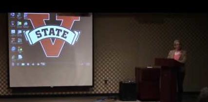
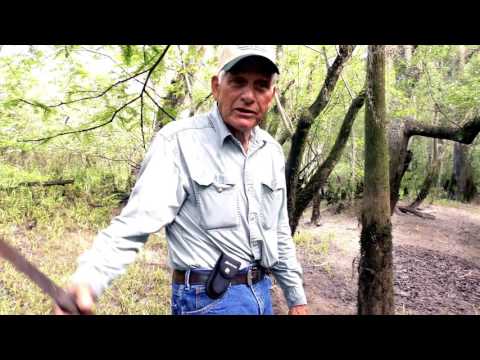
Gretchen Quarterman speaking at a WWALS public meeting at VSU last spring

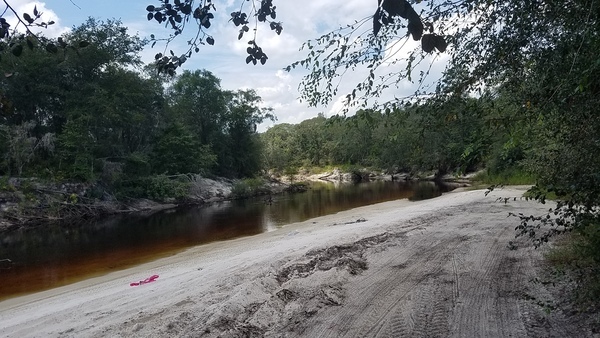
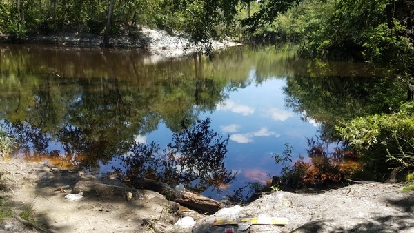
WWALS will be offering an interactive lecture at Valdosta State Learning in Retirement Fall Session. We will talk about the watershed of the Suwannee Basin, the Floridan Aquifer, current challenges, and how together we can make sure our water is swimmable, fishable, and drinkable.

Continue reading

Pafford’s Landing, Alapaha River

Plenty of trash to pick up on the site of the WWALS Rivers Alive Cleanup and Paddle Outing, Alapaha River 2017-09-10.

Beach with purple trash

Such a nice river. Come help clean it up!

See also one reason we always give a safety lecture before boating.

 -jsq, John S. Quarterman, Suwannee RIVERKEEPER®

Continue reading

Burnt Church access to Alapaha River 2017-08-18

Historic church, steep downhill access to the Alapaha River, and lots of trash.

And trash

Why would anybody trash a nice river like that? Continue reading

Old Coffee Road across Alapaha River

Many of you know Julian Fields, retired forester, very knowledgable about many things around south Georgia. In this video, he’s showing people where Old Coffee Road forded the Alapaha River. I haven’t been able to find a map of any age that shows that ford. However, given that Old Coffee Road in Berrien County goes as far as Rowetown Church Road, I’d guess either Rowetown Church Road is where Old Coffee Road crossed the river, at Rowetown Church Cemetery, or it was somewhat upstream. Does anybody know?

Julian Fields

Or I suppose I could just ask Julian. Here’s the video: Continue reading

Lola Tract: WMA in Lanier and Lowndes Counties

Update 2019-05-09: fixed URLs and added map.

It has a name and it is listed: Lola Tract; WMA Stockton:

Offus84
Google Streetview, Lanier County CR 123 off of US 84 aka GA 38.

Lola Tract WMA is a 391 acre property near Stockton. Hunting opportunities include deer, bear, turkey and small game.

This property is only open during hunt dates.

Directions:

From Stockton Take Hwy. 84 west for 1.4 miles. WMA kiosk is on the right. WMA is on both sides of the river.

Voluntary Public Access Area

Continue reading

WMA in Lanier and Lowndes Counties

Yes, it’s a WMA on both sides of the Alapaha River, and it will open for hunting this year. It’s also one of seven or eight, all also Dr. Acree’s land. They will each have names, which are currently unknown, but will pop up in the next few days on the DNR website.

Floating downstream
Photo: John S. Quarterman, 2 April 2017, in Alapaha River, Hotchkiss Road to US 84 2017-04-02

This WMA information is from someone who’s been on site and knows the details, Continue reading

Alapaha River, Hotchkiss Road to US 84 2017-04-02

This was a tiny outing for a couple of visitors from Oregon through what has since become a new Wildlife Management Area on the Alapaha River, between Hotchkiss Road (which had some magnificent potholes) in Lanier County to the site of the pending new park and boat ramp off of US 84 in Lowndes County, Georgia, all on the Alapaha River Water Trail.

Suwannee Riverkeeper banner on the Alapaha River

The visitors were Continue reading

Naylor Boat Ramp and Sheboggy Landing, Alapaha River

The Lowndes County parcel in the new Wildlife Management Area off of US 84 does not go as far north as the Lanier County one, and does not go all the way to the Alapaha River at US 84:

Lowndes County between US 84 almost to Old State Road
Lowndes County parcel 0259 030A from US 84 almost to Old State Road

This is because some years ago Continue reading

WMA signs in Lanier County, Alapaha River

Christopher Graham reports: “These signs are everywhere on Hotchkiss Road on the Lanier side of the Alapaha River.”

Boundary Wildlife Management Area
Boundary Wildlife Management Area; Photo: Christopher Graham, 29 July 2017

Please note this is not the Alapaha River Wildlife Management Area off of US 319 between Tifton and Ocilla. That Alapaha River WMA is way upstream of the top of the Alapaha River Water Trail (ARWT), although it is on the ARWT map.

These new WMA signs are in the middle of the ARWT on this 266 acres in Lanier County parcel Continue reading

Three Suwannee River paddle races starting 2017-10-14

On October 14, 2017 we recommend you join WWALS on the Withlacoochee River from Nankin Boat Ramp to Madison Highway, stopping at McIntyre Spring and Arnold Springs, with many shoals.

But if you have a mind to race that day instead, here are three opportunities for you:

  1. Fargo to White Springs,
  2. the entire length of the Suwannee River
  3. from Suwannee River State Park to Manatee Springs State Park

Phil Hubbard getting ready
Phil Hubbard getting ready July 29, 2017 for Mere Mortals Paddling Race 2017 on the Withlacoochee and Suwannee Rivers

None of these races are by WWALS; we are merely listing them for your information. Continue reading