The
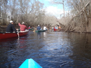
Expert paddle on the Alapaha River from US 82,
 found the water level just right and encountered no obstacles
it couldn’t float over in
the 17 January 2015 WWALS Outing.
Paddlers were
Heather Brasell, Jack Hartley, Chris and Deanna Mericle, John
S. Quarterman, and Bret Wagenhorst.
For more information, see the
report by outing organizer Bret Wagenhorst.
Here are some pictures and videos taken by John S. Quarterman.
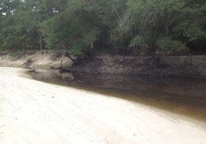
found the water level just right and encountered no obstacles
it couldn’t float over in
the 17 January 2015 WWALS Outing.
Paddlers were
Heather Brasell, Jack Hartley, Chris and Deanna Mericle, John
S. Quarterman, and Bret Wagenhorst.
For more information, see the
report by outing organizer Bret Wagenhorst.
Here are some pictures and videos taken by John S. Quarterman.
Here’s a video playlist, followed by some still pictures: Continue reading