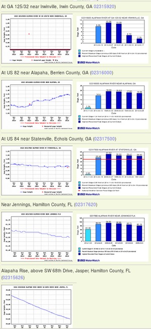
The Alapaha River goes underground because the underlying karst limestone rises in what’s called the Cody Scarp, which runs across north Florida. Other rivers that go underground there include the Little Alapaha River and the Santa Fe River. The Withlacoochee River does not go underground, but it does sprout Madison Blue Spring.

Source: Bulletin of the Geological Society of America, vol. 123, no. 3-4, p. 457.
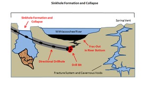
Here’s a cutaway diagram of how all that works underground: Continue reading