
 The Alapaha River is the first illustration in the
Soil Survey of Lowndes County of August 1979.
This A+ gem of a blackwater river remains “unspoiled, wild, and scenic”
and still “provides water sports and fishing for hundreds of people”.
More people will know about it soon, due to the
Alapaha River Water Trail.
Come see an unuusal feature farther downstream:
the Alapaha Sink, where the river goes underground.
Come with WWALS to the Sink October 26th. Continue reading
The Alapaha River is the first illustration in the
Soil Survey of Lowndes County of August 1979.
This A+ gem of a blackwater river remains “unspoiled, wild, and scenic”
and still “provides water sports and fishing for hundreds of people”.
More people will know about it soon, due to the
Alapaha River Water Trail.
Come see an unuusal feature farther downstream:
the Alapaha Sink, where the river goes underground.
Come with WWALS to the Sink October 26th. Continue reading
Tag Archives: Alapaha River
Alapaha Sink: WWALS Outing 2PM 26 Oct 2014
 Update 24 October 2014: Map, directions, and how to join WWALS.
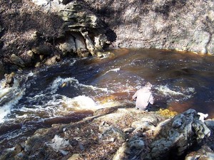
Come see where the Alapaha River goes underground, near Jennings, in Hamilton County, Florida, 2PM, Sunday, October 26th, 2014. This is a walking outing; no boats required.
Directions to the parking area:
Take I-75 south to State Road 6 in Florida. Go east (left) to US 41.
Go north (left) about one mile. Turn right on NW 76th Terrace and go
a mile. Turn right on NW 25th Lane and go about a mile.
 Turn left at
the Jennings Bluff Tract sign and go .9 mile. It dead ends at the
parking area. That road is gravel and dirt and kinda bumpy. The
parking area can probably hold ten vehicles at least.
Turn left at
the Jennings Bluff Tract sign and go .9 mile. It dead ends at the
parking area. That road is gravel and dirt and kinda bumpy. The
parking area can probably hold ten vehicles at least.
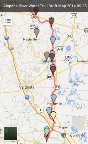
The location for the Sink on the draft Alapaha River Water Trail map apparently Continue reading
Alapaha River access at Hwy 82 at very low water
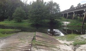 Pictures of the location of the
Alapaha River Cleanup at US 82, 27 September 2014,
taken east of the town of Alapaha at US 82 on the Alapaha River by Bret Wagenhorst.
Pictures of the location of the
Alapaha River Cleanup at US 82, 27 September 2014,
taken east of the town of Alapaha at US 82 on the Alapaha River by Bret Wagenhorst.
And this access point is on the Alapaha River Water Trail WWALS is developing.
Continue readingAlapaha River Cleanup at US 82, 27 September 2014
 Second WWALS outing this month, this time on land;
facebook event.
Second WWALS outing this month, this time on land;
facebook event.
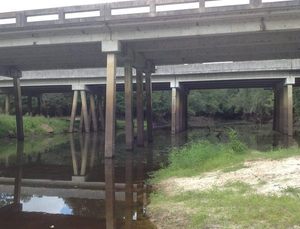
If you enjoy paddling the Alapaha River, I hope you will consider coming out this Saturday to give back and help clean up along the river’s banks as part of a
GA Rivers Alive cleanup. Starts at 0900 at the boat ramp at the Hwy 82 bridge just east of the town of Alapaha. I anticipate the cleanup will last about an hour. Bring work gloves and good cheer.
It is much easier to pick up trash along the banks Continue reading
Alapaha Dead River Sink
Update 2014-11-13: This is actually the Dead River Sink. See also the Alapaha River Sink. -jsq
Received 16 September 2044:
I just saw the photos on WWALS web site of Bret’s trip to find the sink, Very nice.
Here are some photos of the sink you may want to add.
-Chris Mericle
Plus this Sunday, 10AM 21 September 2014, Chris and Deanna Mericle will be our local hosts at the WWALS outing on the Withlacoochee and Suwannee Rivers in Florida.
-jsq
Continue readingWWALS and Satilla Riverkeeper in Perry, GA
Us south Georgia watershed groups have to stick together!
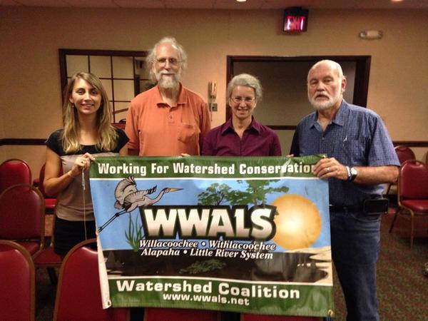
Pictured are Satilla Riverkeeper Ashby Nix, WWALS Watershed Coalition: President John S. Quarterman, Treasurer Gretchen Quarterman, Ambassador Dave Hetzel, in Perry, Georgia, 21 August 2014.
Thanks to workshop presenter Loren Moore Continue reading
Counties and Cities in WWALS Watersheds
Update 2019-10-03: More like 35 counties. See instead recently updated WWALS Counties and Cities.
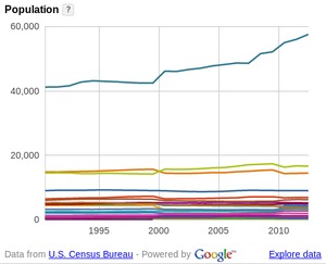
Can you remember all 23 counties in the WWALS watersheds, and the thirty or more cities and towns? I can’t, so I made a new WWALS web page on WWALS Counties and Cities, with population comparisons and maps. Some of it may surprise you.
 The Alapaha River starts way up in Turner County,
and runs right through Nashville in Berrien County,
Lakeland in Lanier County, Statenville in Echols County,
and near Jasper in Hamilton County, Florida.
These counties and cities are the core of the
Alapaha River Water Trail.
Come see the middle of that Trail this afternoon:
Alapaha River @ US 84: endpoint of Sunday’s WWALS Outing 24 August 2014. Continue reading
The Alapaha River starts way up in Turner County,
and runs right through Nashville in Berrien County,
Lakeland in Lanier County, Statenville in Echols County,
and near Jasper in Hamilton County, Florida.
These counties and cities are the core of the
Alapaha River Water Trail.
Come see the middle of that Trail this afternoon:
Alapaha River @ US 84: endpoint of Sunday’s WWALS Outing 24 August 2014. Continue reading
EPA hearings Tuesday and Wednesday in Atlanta and Climate Rally by Sierra Club
Mercury in the Alapaha River probably comes from coal Plant Scherer near Macon. EPA is holding public hearings on its proposed Clean Power Plan next week, 29-30 July 2014, in Atlanta. You can also comment online until 16 October 2014 on Docket ID EPA-HQ-OAR-2013-0602. And you can express your opinion outside with Georgia Sierra Club at the Atlanta Climate Rally Tuesday at high noon. Maybe you want to mention shifting from coal to “natural” gas (fracked methane) actually may make matters worse here, so EPA needs to go further.

While that proposed carbon rule may help clean up coal plants like Scherer, it says nothing about methane, which EPA says is Continue reading
Coal plant mercury in Alapaha River
Update 2015-04-28: See EPA 2002 report that spells out Plant Scherer as the largest mercury point source in the Alapaha Airshed.
Background to the EPA hearings on its proposed Clean Power Plan: EPA previously said nonpoint source pollution is the biggest water quality problem, and EPA and GA EPD say our Alapaha River is contaminated with mercury. That mercury comes from Plant Scherer, the country’s dirtiest coal plant.

The problem, effects, and cause are spelled out in these Comments on CAMR Draft, Language Options by Jill Johnson, Georgia Public Interest Research Group, April 6, 2006: Continue reading
WWALS gets grant from river network –VDT
Statewide organization recognizes WWALS Watershed Coalition, plus local direct and indirect economic benefits of an Alapaha Water Trail, wrote the reporter who called me yesterday about the WWALS PR. -jsq
Matthew Woody wrote for the Valdosta Daily Times yesterday, WWALS gets grant from river network,
The Willacoochee, Withlacoochee, Alapaha, and Little River Systems Watershed Coalition, Inc. (WWALS) received a $500 Alapaha Water Trail Grant from the Georgia River Network. John Quarterman, president of WWALS, said that making a water trail on the Alapaha River involves mapping out the river and putting out guide posts. The maps will show where boat ramps are along the river.
This grant goes beyond maps and guide posts; it signifies that a statewide organization recognizes South Georgia rivers.
“The grant for the Alapaha Water Trail is Continue reading