Tag Archives: Suwannee River

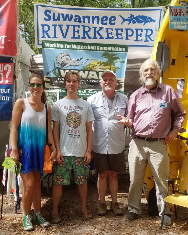
Morgan Murray, Collier County Waterkeeper Harrison Langley, WWALS Science Committee Chair Tom Potter, Suwannee Riverkeeper John S. Quarterman

Update 2017-10-04: Pictures from all four days of Wanee.

At Wanee
Morgan Murray, Collier County Waterkeeper Harrison Langley, WWALS Science Committee Chair Tom Potter, Suwannee Riverkeeper John S. Quarterman

We’ll be at Wanee through Saturday.

 -jsq, John S. Quarterman, Suwannee RIVERKEEPER®

You can join this fun and work by becoming a WWALS member today!

WWALS at Wanee Wednesday through Saturday 2017-04-19-22

Wanee snuck in an extra afternoon this starting 2:30 PM Wednesday April 19th for Remembering Butch Trucks, and yes, WWALS will be there tomorrow through Saturday, so look for the WWALS and Suwannee Riverkeeper banners.

For more about the music festival that started them all, see the previous post.

If you want to help at the WWALS table, send email to wwalswatershed@gmail.com or call 229-242-0102 or come by the Suwannee Riverkeeper table.

 -jsq, John S. Quarterman, Suwannee RIVERKEEPER®

You can join this fun and work by becoming a WWALS member today!

Videos: More people, equipment, and smoke: West Mims Fire Okefenokee update 2017-04-16

Naturally a party of people we know were paddling across the Okefenokee Swamp over the weekend, but far north of the fire, so they had no problems, getting out just before the overnight stops in the Okefenokee NWR close today. Apparently they could see skyglow of the West Mims Fire on the southern horizon at night. Meanwhile, smoke has been seen as far north as North Carolina and I can smell it in Lowndes County, 60 miles west of the fire.
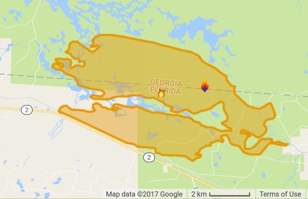
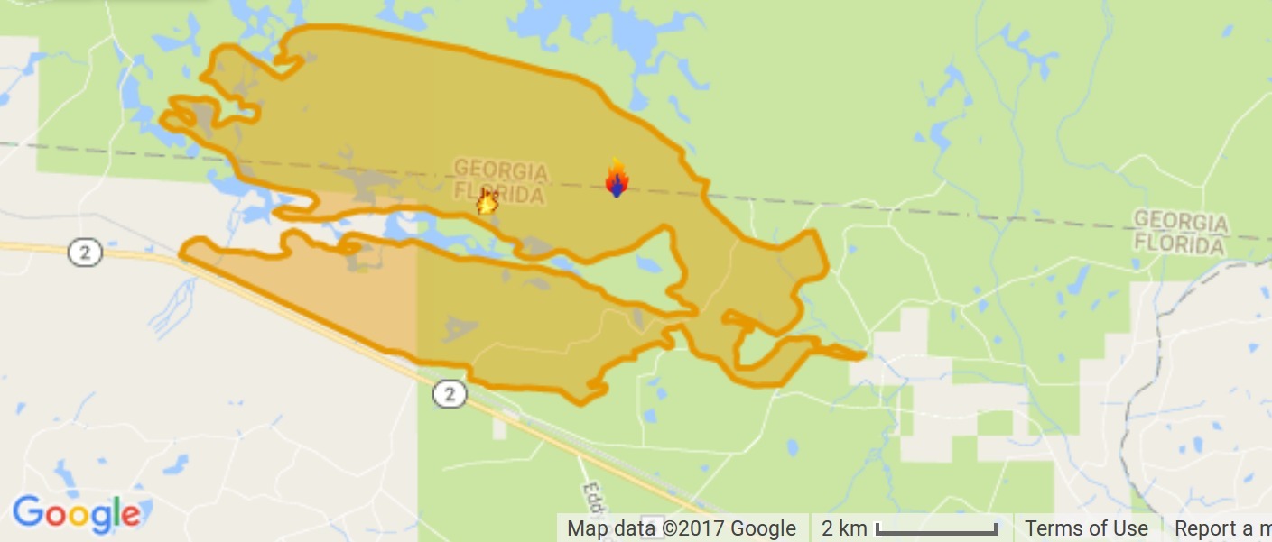
InciWeb map
Map by InciWeb, 16 April 2017.

Hannah Patrick, WWAYTV3, Wilmington, NC, 16 April 2017, Strong winds drive smoke from Georgia Wildfire into NC,

Multiple media outlets report that the National Weather Service in Raleigh said southwest winds pushed the smoke up Sunday from the southeast Georgia fire.

The Division of Environmental Quality air quality index number for the Triangle area of Raleigh, Durham and Chapel Hill hit the orange alert level Sunday. That means people who are sensitive to air quality should stay inside.

Officials believe the smoke is coming from the Georgia fire and not one in McDowell County, North Carolina, that the U.S. Forest Service said was about 85 percent contained as of Sunday.

InciWeb says the number of personnel has increased to 184, the number of engines to 17, and the number of tractor plows to 27; still 5 dozers and one hot shot crew. However, the acreage burned has increased to 18,551, with still only 3% contained, and the same estimated containment date two months out of Thursday June 15th, 2017 approx. 12:00 AM.

The fire still seems to be staying within the mile-wide buffer zone around the NWR established by the Okefenokee-Osceola Local Implementation Team.

Before we and our ancestors massively modified the environment of the U.S. southeastern coastal plains, back when there was a longleaf pine forest from southern Virginia to eastern Texas, lightning-lit fires would burn for many miles and many days.

 -jsq, John S. Quarterman, Suwannee RIVERKEEPER®

You can join this fun and work by becoming a WWALS member today!
West Mims Fire in Upper Suwannee River watershed in Okefenokee Swamp 2017-04-15

Now is not a good time to stay overnight in the Okefenokee Swamp, or to travel at night between Fargo and Moniac, because of smoke.

Lightning started the West Mims fire Thursday, apparently west of Moniac, Georgia in Baker County, Florida. That was in the St Marys River watershed, but the fire has since expanded west and north into the upper Suwannee River watershed and Ware County, Georgia. According to today’s update from InciWeb, the Incident Information System, the fire now involves 13,000 acres and is only 3% contained. Even with 110 firefighters and a variety of equipment, the estimated containment date is two months from now: “Thursday June 15th, 2017 approx. 12:00 AM”. It is a southern fire forest, after all.

Incident Map
Map from InciWeb 2017-04-15. Approximate Location 30.574 latitude, -82.323 longitude.

It’s probably best not to go there at night, since InciWeb says: Continue reading

Lower and Middle Suwannee River Basin Management Action Plan (BMAP) Meeting 2017-04-13

Today in Live Oak: what FDEP is doing about water quality and quantity in the Suwannee Basin below the Withlacoochee Confluence. Agenda

See the PDF or the transcription below.

Lower and Middle Suwannee River Basin Management Action Plan (BMAP) Meeting

DATE: Thursday, April 13, 2017
TIME: 6:00 PM
PLACE: Suwannee River Water Management District
Board Room
9225 CR 49
Live Oak, FL 32060

THIS MEETING IS OPEN TO THE PUBLIC

AGENDA Continue reading

Agenda, Santa Fe River Springs Protection Forum 2017-04-13

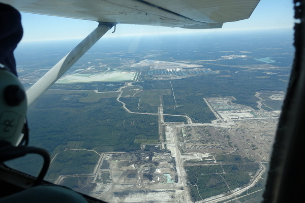
The agenda says it’s for a Santa Fe River Springs Protection Forum, but the venue at Otter Springs is on the Suwannee River downstream of the Santa Fe River, and Potash Corp Field Trip Summary is about the phosphate mine in Hamilton County well upstream on the Suwannee River, using pictures from the WWALS Southwings flight of 22 October 2016. Many people and organizations are concerned about an attempt to start another phosphate mine in Union and Bradford Counties, which are upstream of the Santa Fe River.

Follow the link for the agenda PDF, and there’s an image below.

When: 9:30 am – 3:00 pm, Thursday, April 13, 2017

Where: Otter Springs Campground
6470 SW 80th Avenue, Trenton FL, 32693

What: Santa Fe River Springs Protection Forum

Bee Haven Bay, now PCS Phosphate mine, 30.5089370, -82.8682070

Bee Haven Bay, now PCS Phosphate mine,
Picture by WWALS member Jim Tatum of Our Santa Fe River on WWALS Southwings flight 2017-10-22 piloted by Roy Zimmer, with Continue reading

Sabal Trail a month late and still sending the press disinformation

No, Ms. Grover, your pipeline is not a job generator for Florida, Georgia, or Alabama, and yes, you’ve slipped your schedule.

“Florida is swarming with protests, like an antbed stirred up by a 600-mile pipeline stick,” John S. Quarterman, president, WWALS Watershed Coalition

You know what would bring economic benefits to the Sunshine State? Solar power, which already employs more people than coal, oil, and natural gas combined, which produced 1 in 20 new jobs last year, and last year solar power produced more new electricity than any other source.

Ms. Grover is paid to picture that fossil-fuel cash-out in the best possible light. Yet once you know the actual facts, it looks more like the Picture of Dorian Gray.


“How sad it is! I shall grow old, and horrible, and dreadful. But this picture will remain always young. It will never be older than this particular day of June…. If it were only the other way! If it were I who was to be always young, and the picture that was to grow old! For that—for that—I would give everything! Yes, there is nothing in the whole world I would not give! I would give my soul for that!” —Dorian Gray, in The Picture of Dorian Gray, by Oscar Wilde

Joseph A. Mann Jr., FloridaBulldog.org, 23 March 2017, With help from investor-Gov. Scott, Sabal Trail natural gas pipeline looks to open in June, Continue reading

White Springs to Swift Creek, Suwannee River, 2017-05-20

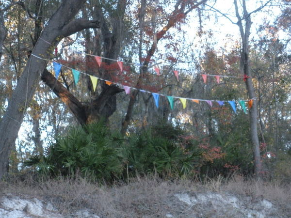
Because SRWMD tells us Blue Sink Launch is closed, our May Suwannee River outing will take out slightly downstream at Swift Creek Lunch, which should be easy to recognize from the river because American Canoe Adventures has put up these nice triangular flags:

Flags by ACA
Photo: Jesse Wilkes, November 23, 2016

The put in at White Springs Wayside Park and everything else is the same; see the updated outing announcement for all the details.

We’re bringing bon-bons. See you there in May!

 -jsq, John S. Quarterman, Suwannee RIVERKEEPER®

You can join this fun and work by becoming a WWALS member today!

Ft Macomb to Ivey Memorial Park, Suwannee River, 2017-06-10

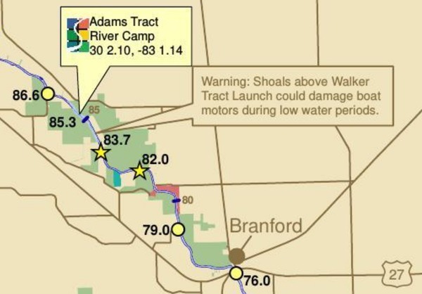
A medium length summer paddle on the Middle Suwannee River: Fort Macomb Ramp to Ivey Memorial Park June 10, 2017, past springs, shoals, and Branford. This one will probably take about 5 hours paddling, or 6 hours including shuttle. With lunch, swim stops, and bon-bons, of course.

Bring the usual personal flotation device, boat paddles, food, drinking water, warm clothes, and first aid kit.

When: 9AM Saturday 10 June 2017

Put In: Ft. Macomb Ramp, river mile 86.6
From Mayo, travel east on US 27 to CR 410; turn left on CR 410; follow to boat ramp.

GPS: 30.0097911,-83.0168023

Take Out: Ivey Memorial Park Ramp, river mile 76.0
Boat ramp is located in Branford on the south side of US 27 at the Bridge in Ivey Memorial Park.
29.9538379,-82.9303607

Event: facebook, meetup

River mile 86.6 to 76.0
This map detail and all landing directions are from Continue reading

Crop nitrogen losses into Suwannee Basin

Here is a very interesting paper about increasing nitrogen from crops into the Suwannee River Basin and its springs (promoting algae growth), with actual data on how well best management practices (BMPs) are containing the runoff: Environmental Nitrogen Losses from Commercial Crop Production Systems in the Suwannee River Basin of Florida, by Rishi Prasad, George J. Hochmuth, PLOSOne, Published: December 1, 2016, http://dx.doi.org/10.1371/journal.pone.0167558


Fig 3. Comparison of A) environmental nitrogen losses (Nenvloss) from three crops (potato, sweet corn and silage corn) during four growing seasons (2010 to2013) and B) relationship between seasonal total N rates and environmental nitrogen losses at the study farm in the Middle Suwannee River Basin, Florida. Silage corn was not studied during 2013. Mean values of Nenvloss (represented by individual bars and their standard errors for the three crops) followed by different letters indicate significant difference at α = 0.05 level

Abstract Continue reading