Category Archives: creeks

Sabal Trail alleged plan for soil mixing 2018-03-09

Yesterday Sabal Trail filed with FERC a sketchy plan to investigate the subsoil and topsoil mixing it caused on four farmers’ lands in two Georgia counties. The tail wagging the dog, Sabal Trail demanded FERC rubberstamp this plan within one week.
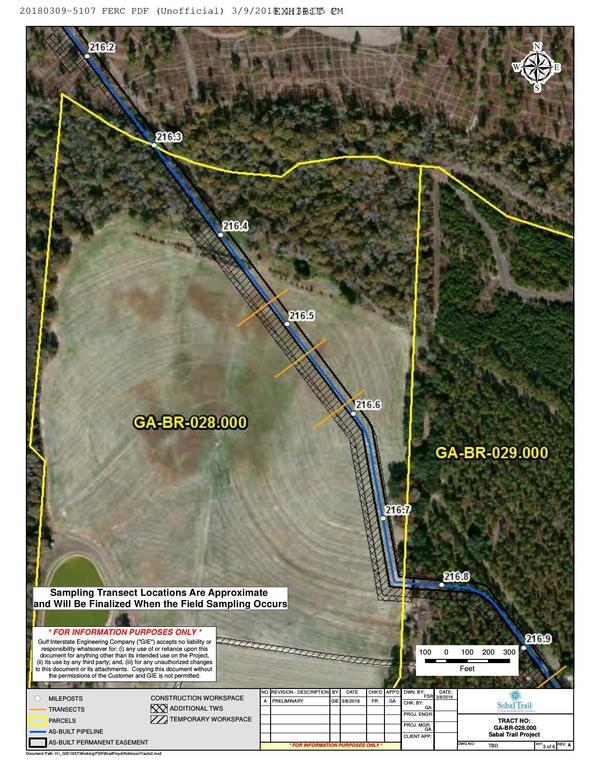
GA-BR-028.000 Dowdy north field, Little Creek, MP 216.4, 1657-PL-DG-70197-218
GA-BR-028.000 Dowdy north field, Little Creek, MP 216.4, 1657-PL-DG-70197-218, 30.9503000, -83.6217700

Needless to say FERC didn’t supply the GPS coordinates, nor the county parcel numbers, nor the related Sabal Trail alignment maps: WWALS did that, to figure out things are in what Sabal Trail filed.

The details are on the WWALS website, also including maps by WWALS.

 -jsq, John S. Quarterman, Suwannee RIVERKEEPER®

You can join this fun and work by becoming a WWALS member today!

Hagan Bridge, Franklinville, Withlacoochee River 2018-02-11

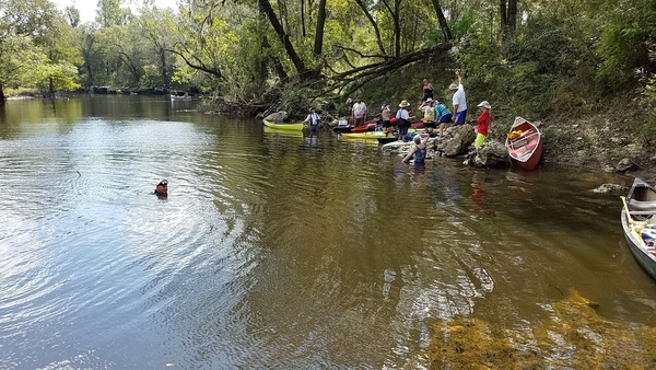
Two new fallers, an unscheduled creek upstream and confluences of several more downstream, the Withlacoochee River Roundabout, (some around it twice), a nice drizzle, and a fine time was had by 19 paddlers from 2 years old to 70-plus on the balmy winter Withlacoochee River, Sunday, February 11, 2018.

paddlers and banners

I am worried, though, since Continue reading

Earl Wetherington Foot Bridge

Maybe this bridge was named for Earl Wetherington Foot, since it has vehicular traffic. Since I can’t find any mention of such a person, maybe it was named for Earl Wetherington (1925-2013) and once upon a time was a foot bridge. Anyway, it’s on Gornto Road in Valdosta, Lowndes County, Georgia, over Sugar Creek, slightly upstream from the Withlacoochee River.

Bridge, Over Sugar Creek

Bridge, Over Sugar Creek

It was closed in the “700-year” flood of 2013, which followed the “700-year” flood of 2009 (I think it was closed then, too). Continue reading

Staten Road to Langdale Park, Withlacoochee River, 2018-03-03

A leisurely five mile paddle in about two and a half hours through a surprisingly wild section of the Withlacoochee River, much of it actually inside Valdosta, the biggest city in the Suwannee River Basin, on the Withlacoochee and Little River Water Trail (WLRWT).

When: 9 AM, Saturday, March 3, 2018

Put In: Staten Road Landing, 4556 Staten Road, Valdosta, GA 31605, Lowndes County, GA. 7.1 miles north of downtown Valdosta. Beware: it’s a long rough dirt road access, then a scramble down the riverbank.

GPS: 30.9328, -83.28227

Take Out: Langdale Park Boat Ramp, 3781 N. Valdosta Rd., Valdosta, GA 31602, Lowndes County, GA.

Free: This outing is Free! And we recommend you support the work of WWALS by becoming a WWALS member today!
Event: facebook, meetup

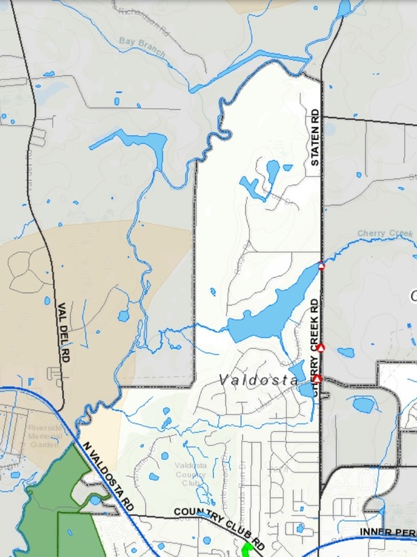
VALORGIS, Route
Map: VALORGIS. White is Valdosta inside grey city limits, yellow is recharge zones for the Floridan Aquifer, green is Langdale Park.

We start in Lowndes County, cross over the county’s expanded sewer and water lines at Bay Branch (those lines head for Stafford-Wright Road). Then the City of Valdosta is on our left briefly before back to county both sides, and Sermons Branch (is that its real name?). Into a Floridan Aquifer recharge zone, passing on our right the Shadrick Sink, notorious for Continue reading

Cleanup and outing, Nankin, Mcintyre and Arnold Springs, Mozell Spells, Withlacoochee River 2017-10-14

Tires and trash cleaned up at Nankin Boat Ramp, swimming and diver tales at McIntyre Spring, a creek, karst, shoals, and rapids, into Florida and back to Georgia all downstream, Valdosta Railway Trestle, Madison County Four Freedoms Trail, and exotic invasive Japanese Climbing Fern, all on a fall day on the Withlacoochee River with WWALS Watershed Coalition, Suwannee Riverkeeper. Thanks to all who came to paddle from as far as two hours from Gainesville, Florida and four hours from Pine Mountain, Georgia.

A free diver, 12:47:33,, McIntyre Spring

The Quitman (US 84) Gauge was at about 2.6′ (86′ NAVD88).

Here are some pictures.

This post is just the first part; more pictures will follow are posted with diving and landowners at Arnold Springs, Old Clyattville Road Bridge Horn Bridge, and Mozell Spells (State Line Ramp). and a Google Map, and a few videos are still to come.

These are some of our many favorite spots on the Withlacoochee and Little River Water Trail.

Watch wwals.net for more outings are they are announced, or see the WWALS calendar or the WWALS outings and events web page. We have outings at least once a month.

Banner and fourteen picker-uppers, 09:55:21,, Georgia Adopt-A-Stream Cleanup 30.6749200, -83.3939200

Continue reading

SELC against proposed suspension of Clean Water Rule 2017-12-13

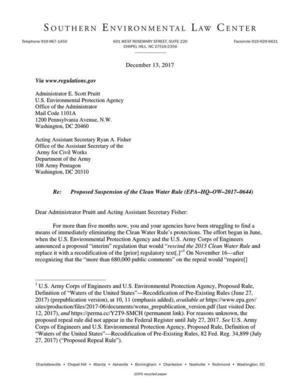
Yesterday, the Southern Environmental Law Center (SELC) submitted a sixteen-page letter against the EPA’s proposed suspension of the Clean Water Rule, on behalf fifty-six organizations including WWALS.10

Struggling to eliminate, Letter Much of that letter could as easily apply to today’s foregone vote to eliminate the FCC’s net neutrality rule. FCC Chairman Ajit Pai’s “‘unalterably closed’” views should have been enough for him to recuse himself. The three FCC Commissioners for the elimination of net neutrality made it clear they were not paying attention to the millions of public comments, despite requirements of the Administrative Procedure Act to do so. Chairman Pai with perhaps unintentional irony even argued that there was no need to hold public hearings since far more people commented online, which of course is only possible through an open Internet. Nevermind that the FCC appears to be ignoring those comments.

Similarly, the EPA does not seem to be paying attention to the “more than 680,000 public comments” on the Clean Water Rule repeal beyond taking only six days to come up with a two year delay in implementation of that rule.

The SELC letter to the EPA even cites two cases against the FCC when it says: Continue reading

Irma sewage spills from Lowndes County 2017-09-12

Received 28 September 2017 from Lowndes County Utilities Director Steve Stalvey:

Google Map by WWALS.net,
See interactive google map.

John,

This is the information I sent to the State concerning the spills related to Irma on Tuesday 9-12-17. Continue reading

Quitman, GA, WPCP spill 2017-09-11

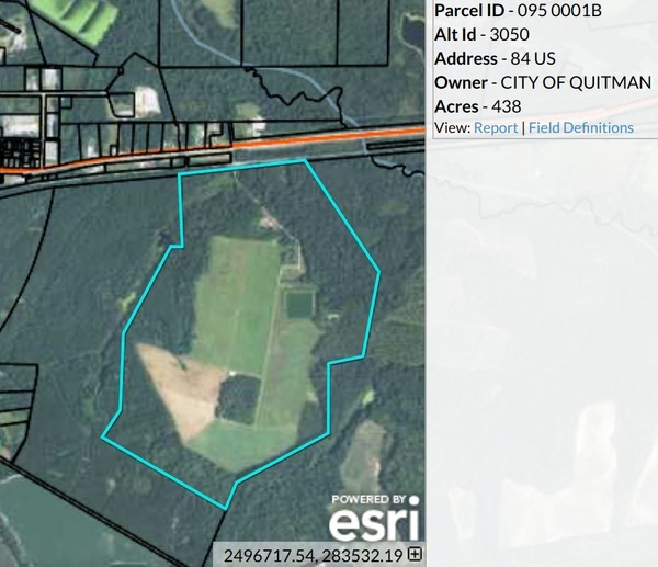
Quitman, Georgia also spilled sewage during Tropical Storm Irma, next to Okapilco Creek, which runs into the Withlacoochee River, then the Suwannee River.

Quitman WPCP, South of US 84

According to John Thursby with Quitman Utilities, the lift station at Quitman’s main wastewater treatment plant lost power, and Continue reading

GA DNR responds about Sabal Trail at Okapilco Creek 2017-09-21

Not the answer I was looking for, but GA-EPD is still by far the most responsive agency regarding Sabal Trail.

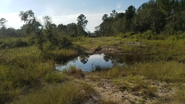
West to sinkhole, Coffee Road, near Okapilco Creek

Lisa Myler of GA-DNR called back Friday about 7PM saying Tom Fowler had been to the Okapilco Creek Sabal Trail sinkhole site I reported.

I called her back Monday, and after DNR’s web server came back up she forwarded Tom Fowler’s report today: Continue reading

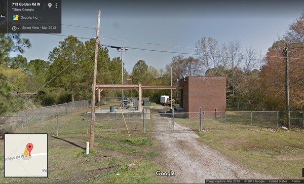
Cow House Branch Lift Station Spill in Tifton, GA 2019 2017-09-11

Tifton spilled 277 times more sewage than Valdosta. Tifton Gazette, 20 September 2017, Power outage cause 250,000 gallon wastewater spill,

Street View, Golden Road Lift Station

TIFTON — There were 250,000 gallons of wastewater spillage due to the power outage cause by Hurricane Irma, according to Thomas Coker, water and wastewater superintendent.

The spillage occurred at Continue reading