
Points on the ARWT map
Last update: 2026-07-15
Suggest changes, additions, etc. in pictures or text through this form.
See also Categories and Access points.
Descriptions
Source 

CATEGORIES: Spring
LAYER: Brochure
GPS: 32.05733, -83.64005
OWNERSHIP: Private, HOPKINS & COMPANY LLC, PARCEL 100 5
ACCESS: No
WATER BODY: Alapaha River
MILE: 201.43
ADDRESS: 9465 HWY 215, Vienna, GA, Dooly County.
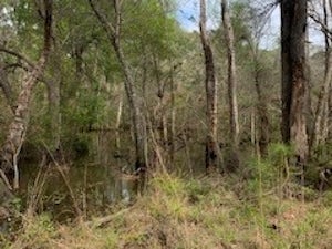
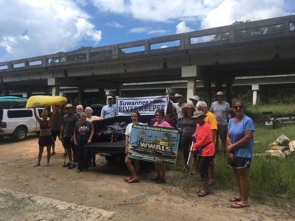
DESCRIPTION: Source of the Alapaha River, in private land, with a mound exactly at the USGS coordinates, where two small creeks converge. These pictures were taken with permission of the landowner; please do not trespass.
GRN: Yes
WEBSITE: https://wwals.net/2020/03/02/source-of-the-alapaha-river-2020-02-27/
DOWNSTREAM: 73.83 miles from Source to Sheboggy Boat Ramp
PHOTO: https://wwals.net/pictures/2020-02-27–alapaha-river-source/20200227_132859.jpg
PHOTOSET: https://wwals.net/pictures/2020-02-27–alapaha-river-source/
PHOTO SOURCE: John S. Quarterman
PHONE NUMBER: (229) 242-0102
Suggestions: https://forms.gle/DipPgU2TP5atc2Rf9
Rochelle Northwest WPCP 
CATEGORIES: Wtp
LAYER: Brochure
OWNERSHIP: Public
WATER BODY: Reynolds Creek
ADDRESS: 10348 Amaco Rd. (CR 254), Rochelle, GA 31079, Wilcox County.
DESCRIPTION: “Up to 0.336 MGD of treated wastewater is being discharged to Unnamed Tributary of Reynolds Creek in the Suwanee River Basin.””, NPDES Permit No. GA0024244. The permit says it’s on Cemetery Road, which google maps calls Amaco Road.
WEBSITE: http://ofmpub.epa.gov/enviro/fii_query_detail.disp_program_facility?p_registry_id=110009139681
OTHER REFERENCE: https://wwals.net/pictures/2018-08-30–permits/rochelle/northwest
Suggestions: https://forms.gle/DipPgU2TP5atc2Rf9
Gin House lift station
CATEGORIES: Wtp
LAYER: Brochure
OWNERSHIP: Public
WATER BODY: Northern Ditch of Reynolds Creek
ADDRESS: Corner of Sook Road and Gin House Road, Rochelle, GA 31079, Wilcox County.
DESCRIPTION: Location is approximate, according to citizens’ legal complaint of 2013.
WEBSITE: https://earthjustice.org/sites/default/files/Rochelle-NOI.pdf
Suggestions: https://forms.gle/DipPgU2TP5atc2Rf9
Lime Town lift station
CATEGORIES: Wtp
LAYER: Brochure
OWNERSHIP: Public
WATER BODY: Northern Ditch of Reynolds Creek
ADDRESS: End of Jackson Road, Rochelle, GA 31079, Wilcox County.
DESCRIPTION: Location is guesswork, from 2013 citizens’ legal complaint.
WEBSITE: https://earthjustice.org/sites/default/files/Rochelle-NOI.pdf
Suggestions: https://forms.gle/DipPgU2TP5atc2Rf9
Rochelle Southeast WPCP
CATEGORIES: Wtp
LAYER: Brochure
OWNERSHIP: Public
WATER BODY: Mill Creek
ADDRESS: 378 7th Ave., Rochelle, GA 31079, Wilcox County.
DESCRIPTION: “Up to 0.04 MGD of treated wastewater is being discharged to Mill Creek in the Suwanee River Basin.”””” Behind the softball fields, next to Mill Creek. NPDES Permit No. GA0024236.
WEBSITE: http://ofmpub.epa.gov/enviro/fii_query_detail.disp_program_facility?p_registry_id=110010041329
OTHER REFERENCE: https://wwals.net/pictures/2018-08-30–permits/rochelle/southeast
Suggestions: https://forms.gle/DipPgU2TP5atc2Rf9
Mill Creek 
CATEGORIES: Tributary
LAYER: Other
OWNERSHIP: Private
WATER BODY: Alapaha River
MILE: 181.61
ADDRESS: South of Palm Rd, Ocilla, GA 31774, Dooly County.
DOWNSTREAM: 54.01 miles from Mill Creek to Sheboggy Boat Ramp
Suggestions: https://forms.gle/DipPgU2TP5atc2Rf9
Jay Calhoun Road Bridge 
CATEGORIES: Bridge
LAYER: Bridge
GPS: 31.8587, -83.4797
OWNERSHIP: Public
WATER BODY: Alapaha River
MILE: 179.60
ADDRESS: On Jay Calhoun Road between GA 112 and CR 61, south of Rochelle. Wilcox County.
DESCRIPTION: A local road bridge and the first bridge over the Alapaha River downstream from Mill Creek out of Rochelle.
WEBSITE: https://www.google.com/maps/place/31%C2%B051’31.3%22N+83%C2%B028’46.9%22W/@31.8587, -83.4818887, 532m/data=!3m1!1e3!4m5!3m4!1s0x0:0x0!8m2!3d31.8587!4d-83.4797
DOWNSTREAM: 52 miles from Jay Calhoun Road Bridge to Sheboggy Boat Ramp
PHOTOSET: https://www.google.com/maps/place/31%C2%B051’31.3%22N+83%C2%B028’46.9%22W/@31.8587, -83.4818887, 532m/data=!3m1!1e3!4m5!3m4!1s0x0:0x0!8m2!3d31.8587!4d-83.4797
PHOTO SOURCE: Google maps
Suggestions: https://forms.gle/DipPgU2TP5atc2Rf9
US 90 bridge
CATEGORIES: Bridge
LAYER: Bridge
OWNERSHIP: Public
WATER BODY: Alapaha River
MILE: 176.17
ADDRESS: Ashley St E., Rebecca, GA 31783, Ben Hill, Turner Counties.
DESCRIPTION: Federal highway bridge.
WEBSITE: https://www.google.com/maps/place/31%C2%B048’56.7%22N+83%C2%B028’28.1%22W/@31.8157625, -83.4766697, 532m/data=!3m2!1e3!4b1!4m5!3m4!1s0x0:0x0!8m2!3d31.815758!4d-83.474481
DOWNSTREAM: 48.57 miles from US 90 bridge to Sheboggy Boat Ramp
PHOTO: https://www.google.com/maps/@31.8154736, -83.4749717, 3a, 40.7y, 98.73h, 82.36t/data=!3m6!1e1!3m4!1saW–l77ZkNT2qNdcJ5z9ug!2e0!7i3328!8i1664
PHOTOSET: https://www.google.com/maps/place/31%C2%B048’56.7%22N+83%C2%B028’28.1%22W/@31.8157625, -83.4766697, 532m/data=!3m2!1e3!4b1!4m5!3m4!1s0x0:0x0!8m2!3d31.815758!4d-83.474481
PHOTO SOURCE: Google maps
PHONE NUMBER: (850) 290-2350
Suggestions: https://forms.gle/DipPgU2TP5atc2Rf9
Hawkinsville & Florida Southern Railway Site


CATEGORIES: Railbridgesite
LAYER: Bridge
GPS: 31.7714, -83.4547
OWNERSHIP: Public
WATER BODY: Alapaha River
MILE: 172.52
ADDRESS: East of Co Rd 59, Rebecca, GA 31783, Ben Hill, Turner Counties.
DESCRIPTION: Incorporated 1889, abandoned 1923.
HISTORIC FACTS: “”The Hawkinsville and Florida Southern Railway (H&FS) was founded in 1896 and by 1901 was operating 43 miles (69 km) of track from Hawkinsville to Worth, Georgia, USA, where it connected with the Georgia Southern and Florida Railroad.[1] It also operated a 15-mile (24 km) line between Davisville and Fitzgerald, Georgia. In 1907, a portion of the H&FS was leased to the Gulf Line Railway However, in 1913, the H&FS took over operations and fully absorbed the Gulf Line resulting in a line from Hawkinsville to Camilla, Georgia. In 1922, the H&FS went bankrupt. The section from Camilla to Ashburn, Georgia, was purchased by the Georgia, Ashburn, Sylvester and Camilla Railway but no buyers could be found for the remainder of the system and it was abandoned by 1923.””
AKA: Hawkinsville & Florida Southern Railway Site
WEBSITE: https://railga.com/hawfs.html
OTHER REFERENCE: https://en.wikipedia.org/wiki/Hawkinsville_and_Florida_Southern_Railway
DOWNSTREAM: 44.92 miles from Hawkinsville & Florida Southern Railway Site to Sheboggy Boat Ramp
PHOTO: https://railga.com/hawfs95map2.jpg
PHOTOSET: https://railga.com/hawfs.html
PHOTO SOURCE: RailGa.com. Georgia’s Railroad History & Heritage. Â Steve Storey
PHONE NUMBER: (850) 290-2350
Suggestions: https://forms.gle/DipPgU2TP5atc2Rf9
Ashburn MLK Lift Station 
CATEGORIES: Liftstation
LAYER: Point of Interest
OWNERSHIP: Public, City of Ashburn, PARCEL A02 012
WATER BODY: Fudge Branch of Ashburn Branch
ADDRESS: Martin Luther King Jr. Drive between Fudge Street and Coley St., Ashburn, GA 31714, Turner County.
DESCRIPTION: It spills sewage too often.
WEBSITE: https://cityofashburn.net/departments/wastewater-management/
Suggestions: https://forms.gle/DipPgU2TP5atc2Rf9
Ashburn Rockhouse Rd Sylvia Spill 
CATEGORIES: Spill
LAYER: Point of Interest
OWNERSHIP: Public
WATER BODY: Hat Creek
MILE: 20.60
ADDRESS: Rockhouse Road and Sylvia Drive, Ashburn, GA 31714, Turner County.
DESCRIPTION: Spilled 150, 000 gallons of raw sewage due to “”Wet weather”” 2024-03-23, into Hat Creek, which runs into the Alapaha River.
Suggestions: https://forms.gle/DipPgU2TP5atc2Rf9
Ashburn Airport WPCP
CATEGORIES: Wtp
LAYER: Brochure
OWNERSHIP: Public, City of Ashburn, PARCEL 027 055
ACCESS: No
WATER BODY: Hat Creek
MILE: 20.28
ADDRESS: 410 Rockhouse Rd, Ashburn, GA 31714, Turner County.
DESCRIPTION: “Up to 1.16 MGD of treated wastewater is being discharged to the Hat Creek in the Suwanee River Basin.”” Hat Creek runs into the Alapaha River upstream of US 319. NPDES Permit No. GA0025852.
WEBSITE: https://cityofashburn.net/departments/wastewater-management/
OTHER REFERENCE: https://wwals.net/pictures/2018-08-30–permits/ashburn
ADDITIONAL INFO SOURCES: https://greencompanydb.com/facilities/view/318245
PHOTO: https://wwals.net/wp-content/themes/pianoblack/img//2019/02/95953dcadea2d811899e2bfbb7d6fa34.jpg
PHOTOSET: https://wwals.net/2019/02/05/ashburn-ga-spilled-at-top-of-little-river-basin-2019-01-22/
PHOTO SOURCE: John S. Quarterman
PHONE NUMBER: (229) 242-0101
Suggestions: https://forms.gle/DipPgU2TP5atc2Rf9
Sycamore Academy Ave. Spill

CATEGORIES: Spill
LAYER: Point of Interest
OWNERSHIP: Public
WATER BODY: Hat Creek
MILE: 19.02
ADDRESS: Apparently across from 301 Academy Ave., Sycamore, GA 31790, Turner County.
DESCRIPTION: 350 gallons of raw sewage during Hurricane Helene, into Hat Creek, which goes into the Alapaha River.
WEBSITE: https://wwals.net/pictures/2024-09-27–spills
PHOTO: https://www.wwals.net/pictures/2024-09-27–spills/big/2024-09-27–sycamore-spill-ga-epd-2024-10-03.jpg
PHOTOSET: https://www.wwals.net/pictures/2024-09-27–spills/
PHOTO SOURCE: WWALS
PHONE NUMBER: (850) 290-2350
Suggestions: https://forms.gle/DipPgU2TP5atc2Rf9
VLS Fitzgerald WTP
CATEGORIES: Wtp
LAYER: Brochure
OWNERSHIP: Private
WATER BODY: Satilla Creek
ADDRESS: 188 Rip Wiley Rd, Fitzgerald, GA 31750, Ben Hill County.
DESCRIPTION: A private wastewater processing facility in the Satilla River Basin that feeds to Fitzgerald WTP in the Suwannee River basin. NPDES Permit No. GAP050369
Suggestions: https://forms.gle/DipPgU2TP5atc2Rf9
Fitzgerald LAS
CATEGORIES: Wtp
LAYER: Brochure
OWNERSHIP: Public
WATER BODY: Otter Creek
ADDRESS: 544 Camp Brooklyn Rd Fitzgerald, GA 31750, Ben Hill County.
DESCRIPTION: Land Application System (LAS) in the Ocmuilgee River Basin for the Fitzgerald, Ben Hill County, WTP in the Suwannee River Basin. NPDES Permit No. GA0047236
ADDITIONAL INFO SOURCES: https://greencompanydb.com/facilities/view/789675
PHONE NUMBER: (229) 426-5431
Suggestions: https://forms.gle/DipPgU2TP5atc2Rf9
Ben Hill WTP
CATEGORIES: Wtp
LAYER: Brochure
GPS: 31.679488, -83.24645
OWNERSHIP: Public
ACCESS: No
WATER BODY: Turkey Creek
ADDRESS: 201 Ed Ward Rd Fitzgerald, GA 31750, Ben Hill County.
DESCRIPTION: Ben Hill County Waste Water Treatment Plant, on Turkey Creek, upstream from Lake Beatrice, which goes to the Alapaha River. See also Fitzgerald LAS and VLS Fitzgerald WTP, NPDES Permit No. GA0047236
AKA: Fitzgerald Water, Light & Bond Commission (C.A. Newcomer)
WEBSITE: https://developfitzgeraldbenhill.com/infrastructure/
ADDITIONAL INFO SOURCES: https://greencompanydb.com/facilities/view/719102
PHONE NUMBER: (229) 424-0256
Suggestions: https://forms.gle/DipPgU2TP5atc2Rf9
Turkey Creek
CATEGORIES: Tributary
LAYER: Other
OWNERSHIP: Private
ACCESS: No
WATER BODY: Willacoochee Creek
ADDRESS: West of US 129 at Thrasher Road, Ben Hill County.
DESCRIPTION: Confluence with Willacoochee Creek
Suggestions: https://forms.gle/DipPgU2TP5atc2Rf9
Brushy Creek
CATEGORIES: Tributary
LAYER: Other
OWNERSHIP: Private
ACCESS: No
WATER BODY: Willacoochee River
ADDRESS: North of GA 32 west of Evergreen Road, Irwin County.
DESCRIPTION: Joins with Willacoochee Creek to form the Willacoochee River
Suggestions: https://forms.gle/DipPgU2TP5atc2Rf9
Willacoochee Creek
CATEGORIES: Tributary
LAYER: Other
OWNERSHIP: Private
ACCESS: No
WATER BODY: Willacoochee River
ADDRESS: North of GA 32 west of Evergreen Road, Irwin County.
DESCRIPTION: Joins with Brushy Creek to form the Willacoochee River
Suggestions: https://forms.gle/DipPgU2TP5atc2Rf9
GA 107 Bridge
CATEGORIES: Bridge
LAYER: Bridge
GPS: 31.72106, -83.456233
OWNERSHIP: Public
WATER BODY: Alapaha River
MILE: 168.12
ADDRESS: Sylvester Rd, Rebecca, GA 31783, Turner, Irwin Counties.
DOWNSTREAM: 40.52 miles from GA 107 Bridge to Sheboggy Boat Ramp
Suggestions: https://forms.gle/DipPgU2TP5atc2Rf9
Ross Lake 
CATEGORIES: Lake
LAYER: Other
OWNERSHIP: Private, RIDDLE TOM E & ROSS LAKE LLLP, PARCEL 068 008
WATER BODY: Deep Creek
ADDRESS: Rebecca-Waterloo Road, Turner County.
DESCRIPTION: Private lake on Deep Creek
Suggestions: https://forms.gle/DipPgU2TP5atc2Rf9
Deep Creek
CATEGORIES: Tributary
LAYER: Other
OWNERSHIP: Private
WATER BODY: Alapaha River
MILE: 165.77
ADDRESS: North of Crystal Lake Road, east of Rebecca-Waterloo Road, Irwin County.
DOWNSTREAM: 38.17 miles from Deep Creek to Sheboggy Boat Ramp
Suggestions: https://forms.gle/DipPgU2TP5atc2Rf9
Walker Ford 
CATEGORIES: Ford
LAYER: Other
GPS: 31.6899, -83.4615
OWNERSHIP: Public
WATER BODY: Alapaha River
MILE: 165.63
ADDRESS: At end of Bussey Road, downstream from Deep Creek, Irwin County.
DESCRIPTION: Historical ford.
DOWNSTREAM: 38.03 miles from Walker Ford to Sheboggy Boat Ramp
Suggestions: https://forms.gle/DipPgU2TP5atc2Rf9
Flat Ford
CATEGORIES: Ford
LAYER: Other
GPS: 31.6814, -83.4621
OWNERSHIP: Public
WATER BODY: Alapaha River
MILE: 164.96
ADDRESS: North (upstream) from Crystal Lake Road. Irwin County.
DESCRIPTION: Historical ford.
WEBSITE: https://en.wikipedia.org/wiki/Alapaha_River
DOWNSTREAM: 37.36 miles from Flat Ford to Sheboggy Boat Ramp
Suggestions: https://forms.gle/DipPgU2TP5atc2Rf9
Crystal Lake Road Bridge
CATEGORIES: Bridge
LAYER: Bridge
OWNERSHIP: Public
WATER BODY: Alapaha River
MILE: 164.55
ADDRESS: Crystal Lake Road, Chula, GA 31733, Irwin County.
DESCRIPTION: Two-lane concrete bridge built in 1972.
WEBSITE: https://maps.app.goo.gl/WycA9XcHtBSo9rEs7
DOWNSTREAM: 36.95 miles from Crystal Lake Road Bridge to Sheboggy Boat Ramp
Suggestions: https://forms.gle/DipPgU2TP5atc2Rf9
Big Creek
CATEGORIES: Tributary
LAYER: Other
OWNERSHIP: Private
WATER BODY: Alapaha River
MILE: 159.92
ADDRESS: Upstream of GA 125/32 Bridge, Irwin County.
DOWNSTREAM: 32.32 miles from Big Creek to Sheboggy Boat Ramp
Suggestions: https://forms.gle/DipPgU2TP5atc2Rf9
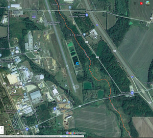
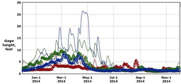
Irwinville Gauge 

CATEGORIES: River Gauge
LAYER: River Gauge
OWNERSHIP: Public
ACCESS: No
WATER BODY: Alapaha River
Lowest boatable: 263.9
Highest safe: 268
GAUGE: Irwinville
MILE: 159.77
ADDRESS: At GA 125/32 near Irwinville, GA, Irwin County.
DESCRIPTION: USGS 02315920
WEBSITE: https://wwals.net/2014/11/03/alapaha-river-water-levels/#Irwinville
DOWNSTREAM: 32.17 miles from Irwinville Gauge to Sheboggy Boat Ramp
PHOTOSET: https://wwals.net/2014/12/01/alapaha-river-rainy-season/
PHOTO SOURCE: John S. Quarterman
PHONE NUMBER: (229) 242-0102
Suggestions: https://forms.gle/DipPgU2TP5atc2Rf9
GA 125/32 Bridge
CATEGORIES: Bridge
LAYER: Bridge
OWNERSHIP: Public
ACCESS: No
WATER BODY: Alapaha River
MILE: 159.77
ADDRESS: At GA 125/32 near Irwinville, GA, just downstream of Big Creek and upstream from Factory Creek. Irwin County.
DESCRIPTION: Two-lane concrete-deck bridge with side walkways built in 1992.
WEBSITE: https://maps.app.goo.gl/KfiFak45kNd5V2VE9
DOWNSTREAM: 32.17 miles from GA 125/32 Bridge to Sheboggy Boat Ramp
PHOTO: https://wwals.net/wp-content/themes/pianoblack/img//2014/12/2de537020e73ab86b2687803ae198750.jpg
PHOTOSET: https://wwals.net/2014/12/01/alapaha-river-rainy-season/
PHOTO SOURCE: John S. Quarterman
PHONE NUMBER: (229) 242-0102
Suggestions: https://forms.gle/DipPgU2TP5atc2Rf9
Factory Creek
CATEGORIES: Tributary
LAYER: Other
OWNERSHIP: Private
WATER BODY: Alapaha River
MILE: 159.56
ADDRESS: Downstream of GA 125/32 Bridge, Irwin County.
DOWNSTREAM: 31.96 miles from Factory Creek to Sheboggy Boat Ramp
Suggestions: https://forms.gle/DipPgU2TP5atc2Rf9
Sand Creek Bridge
CATEGORIES: Bridge
LAYER: Bridge
OWNERSHIP: Public
WATER BODY: Sand Creek
ADDRESS: White Water Road, Chula, GA, over Sand Creek, about a mile upstream from the Alapaha River. Irwin County.
DESCRIPTION: Narrow two-lane concrete deck bridge with with steel railings.
AKA: Joe T. Fletcher Bridge
WEBSITE: https://maps.app.goo.gl/TKEsjRT4yHvnKd6WA
Suggestions: https://forms.gle/DipPgU2TP5atc2Rf9
Sand Creek
CATEGORIES: Tributary
LAYER: Other
OWNERSHIP: Private
WATER BODY: Alapaha River
MILE: 159.17
ADDRESS: East of White Water Road, Chula, GA, Irwin County.
DOWNSTREAM: 31.57 miles from Sand Creek to Sheboggy Boat Ramp
Suggestions: https://forms.gle/DipPgU2TP5atc2Rf9
Hat Creek
CATEGORIES: Tributary
LAYER: Other
OWNERSHIP: Private
WATER BODY: Alapaha River
MILE: 153.65
ADDRESS: About 2 miles upstream from US 319, Irwin County.
DESCRIPTION: Rises at Ashburn, GA
DOWNSTREAM: 26.05 miles from Hat Creek to Sheboggy Boat Ramp
Suggestions: https://forms.gle/DipPgU2TP5atc2Rf9
Tifton & Northeastern RR Bridge
CATEGORIES: Railbridgesite
LAYER: Bridge
GPS: 31.5497, -83.4151
OWNERSHIP: Private
WATER BODY: Alapaha River
MILE: 152.93
ADDRESS: Upstream from US 319, Tift, Irwin Counties.
DESCRIPTION: Chartered 1891, built 1892, abandoned 1960s.
HISTORIC FACTS: “”The Tifton and Northeastern Railroad was chartered on October 15, 1891 and built a 25-mile line from Tifton, Georgia, United States to Fitzgerald, Georgia in 1896. The T&N was consolidated with the Atlantic and Birmingham Railroad and the Tifton, Thomasville and Gulf Railway on December 3, 1903 to form the Atlantic and Birmingham Railway. It then became part of the Atlanta, Birmingham and Atlantic Railroad when it took over the A&B on April 12, 1906.””
WEBSITE: https://en.wikipedia.org/wiki/Tifton_and_Northeastern_Railroad
DOWNSTREAM: 25.33 miles from Tifton & Northeastern RR Bridge to Sheboggy Boat Ramp
Suggestions: https://forms.gle/DipPgU2TP5atc2Rf9
SONAT Willacoochee Creek 
CATEGORIES: Pipeline
LAYER: Point of Interest
GPS: 31.65685, -83.254318
OWNERSHIP: Private
WATER BODY: Willacoochee Creek
ADDRESS: East of Wiregrass GA Technical College, 667 Perry House Rd, Fitzgerald, GA 31750, Ben Hill County.
DESCRIPTION: Southern Natural Gas Pipeline
Suggestions: https://forms.gle/DipPgU2TP5atc2Rf9
SONAT Stump Creek
CATEGORIES: Pipeline
LAYER: Point of Interest
OWNERSHIP: Private
WATER BODY: Stump Creek
ADDRESS: 506-400 Clark- Howell Rd, Ocilla, GA 31774, Irwin County.
DESCRIPTION: Southern Natural Gas Pipeline
Suggestions: https://forms.gle/DipPgU2TP5atc2Rf9
SONAT Little Creek
CATEGORIES: Pipeline
LAYER: Point of Interest
OWNERSHIP: Private
WATER BODY: Little Creek
ADDRESS: Co Rd 5, Ocilla, GA 31774, Irwin County.
DESCRIPTION: Southern Natural Gas Pipeline
Suggestions: https://forms.gle/DipPgU2TP5atc2Rf9
SONAT Reedy Creek
CATEGORIES: Pipeline
LAYER: Point of Interest
OWNERSHIP: Private
WATER BODY: Reedy Creek
ADDRESS: 839-487 Bugle Lane Rd, Ocilla, GA 31774, Irwin County.
DESCRIPTION: Southern Natural Gas Pipeline
Suggestions: https://forms.gle/DipPgU2TP5atc2Rf9
SONAT Jack Creek
CATEGORIES: Pipeline
LAYER: Point of Interest
OWNERSHIP: Private
WATER BODY: Jack Creek
ADDRESS: 144-126 Co Rd 264, Ocilla, GA 31774, Irwin County.
DESCRIPTION: Southern Natural Gas Pipeline
PHOTO: https://www.google.com/maps/@31.5614141, -83.3679407, 3a, 39.7y, 83.27h, 78.45t/data=!3m7!1e1!3m5!1s1IsyNLlUqCWkNJP7nGQzKQ!2e0!6s%2F%2Fgeo0.ggpht.com%2Fcbk%3Fpanoid%3D1IsyNLlUqCWkNJP7nGQzKQ%26output%3Dthumbnail%26cb_client%3Dmaps_sv.tactile.gps%26thumb%3D2%26w%3D203%26h%3D100%26yaw%3D82.93995%26pitch%3D0%26thumbfov%3D100!7i13312!8i6656
PHOTOSET: https://www.google.com/maps/@31.5614141, -83.3679407, 3a, 39.7y, 83.27h, 78.45t/data=!3m7!1e1!3m5!1s1IsyNLlUqCWkNJP7nGQzKQ!2e0!6s%2F%2Fgeo0.ggpht.com%2Fcbk%3Fpanoid%3D1IsyNLlUqCWkNJP7nGQzKQ%26output%3Dthumbnail%26cb_client%3Dmaps_sv.tactile.gps%26thumb%3D2%26w%3D203%26h%3D100%26yaw%3D82.93995%26pitch%3D0%26thumbfov%3D100!7i13312!8i6656
PHOTO SOURCE: Google maps
PHONE NUMBER: (850) 290-2350
Suggestions: https://forms.gle/DipPgU2TP5atc2Rf9
SONAT Pipeline
CATEGORIES: Pipeline
LAYER: Point of Interest
OWNERSHIP: Private
WATER BODY: Alapaha River
MILE: 152.47
ADDRESS: 1495 Chula Brookfield Rd Tifton, GA 31794, Tift, Irwin Counties.
DESCRIPTION: Southern Natural Gas Pipeline
DOWNSTREAM: 24.87 miles from SONAT Pipeline to Sheboggy Boat Ramp
PHOTO: https://www.google.com/maps/@31.5408608, -83.4188202, 3a, 75y, 55.94h, 90t/data=!3m7!1e1!3m5!1sXwNAzARVOR-Yy9JMZ8iSDw!2e0!6s%2F%2Fgeo0.ggpht.com%2Fcbk%3Fpanoid%3DXwNAzARVOR-Yy9JMZ8iSDw%26output%3Dthumbnail%26cb_client%3Dmaps_sv.tactile.gps%26thumb%3D2%26w%3D203%26h%3D100%26yaw%3D51.578682%26pitch%3D0%26thumbfov%3D100!7i13312!8i6656
PHOTOSET: https://www.google.com/maps/@31.5408608, -83.4188202, 3a, 75y, 55.94h, 90t/data=!3m7!1e1!3m5!1sXwNAzARVOR-Yy9JMZ8iSDw!2e0!6s%2F%2Fgeo0.ggpht.com%2Fcbk%3Fpanoid%3DXwNAzARVOR-Yy9JMZ8iSDw%26output%3Dthumbnail%26cb_client%3Dmaps_sv.tactile.gps%26thumb%3D2%26w%3D203%26h%3D100%26yaw%3D51.578682%26pitch%3D0%26thumbfov%3D100!7i13312!8i6656
PHOTO SOURCE: Google maps
PHONE NUMBER: (850) 290-2350
Suggestions: https://forms.gle/DipPgU2TP5atc2Rf9
Moss Lake
CATEGORIES: Lake
LAYER: Other
OWNERSHIP: Public
WATER BODY: Alapaha River
MILE: 152.08
ADDRESS: About half a mile upstream from US 319, Tift, Irwin Counties.
DESCRIPTION: A more-or-less permanent lake in the Alapaha River
AKA: Mystery Lake
DOWNSTREAM: 24.48 miles from Moss Lake to Sheboggy Boat Ramp
PHOTOSET: https://viewer.nationalmap.gov/basic/
PHOTO SOURCE: USGS TNM
Suggestions: https://forms.gle/DipPgU2TP5atc2Rf9
Rigdon Lake
CATEGORIES: Lake
LAYER: Other
OWNERSHIP: Public
WATER BODY: Alapaha River
MILE: 151.53
ADDRESS: About 400 feet upstream of US 319, 1193 Wiley Branch Rd, Tifton, GA 31794, Tift, Irwin Counties.
DESCRIPTION: A more-or-less permanent lake in the Alapaha River
DOWNSTREAM: 23.93 miles from Rigdon Lake to Sheboggy Boat Ramp
PHOTOSET: https://viewer.nationalmap.gov/basic/
PHOTO SOURCE: USGS TNM
Suggestions: https://forms.gle/DipPgU2TP5atc2Rf9
Tifton-Douglas Power Line 
CATEGORIES: Power Line
LAYER: Point of Interest
GPS: 31.533262, -83.40099
OWNERSHIP: Private
WATER BODY: Alapaha River
MILE: 151.43
ADDRESS: About 400 feet upstream of US 319, Tift, Irwin Counties.
DOWNSTREAM: 23.83 miles from Tifton-Douglas Power Line to Sheboggy Boat Ramp
PHOTOSET: https://wwals.net/2016/08/28/alapaha-river-wildlife-management-area/
PHOTO SOURCE: GA DNR
Suggestions: https://forms.gle/DipPgU2TP5atc2Rf9
Alapaha River WMA kiosk 
CATEGORIES: Public Land
LAYER: Other
OWNERSHIP: Public
WATER BODY: Alapaha River
ADDRESS: near 1901 US 319 S., Ocilla, GA, turn south onto Jacks Creek Road, Irwin County.
DESCRIPTION: Information kiosk for 6, 870-acre Alapaha River Wildlife Management Area
WEBSITE: http://www.georgiawildlife.com/maps/hunting/region6
PHOTOSET: https://wwals.net/2016/08/29/alapaha-river-wildlife-management-area/
PHOTO SOURCE: GA DNR
Suggestions: https://forms.gle/DipPgU2TP5atc2Rf9
Alapaha River WMA Sign-in
CATEGORIES: Public Land
LAYER: Other
GPS: 31.5346, -83.3411
OWNERSHIP: Public, State of Georgia
WATER BODY: Alapaha River
ADDRESS: Main entrance is off of US 319. Irwin County.
DESCRIPTION: Sign-in and campground for 6, 870-acre Alapaha River Wildlife Management Area
WEBSITE: http://www.georgiawildlife.com/maps/hunting/region6
PHOTOSET: https://wwals.net/2016/08/29/alapaha-river-wildlife-management-area/
PHOTO SOURCE: GA DNR
Suggestions: https://forms.gle/DipPgU2TP5atc2Rf9
Ocilla-Tifton Landing

CATEGORIES: Landing
LAYER: Other
GPS: 31.53375, -83.397731
OWNERSHIP: Public
ACCESS: Yes, Launch: River bank on dirt access road on highway right of way
WATER BODY: Alapaha River
MILE: 151.29
ADDRESS: Off northbound US 319 in Irwin County, Irwin County.
DESCRIPTION: Affectionately referred to as “”Irwin County Shooting Range “” thanks to all the gunfire there at all times of the day and night.
AKA: Irwin County Shooting Range
Suggestions: https://forms.gle/DipPgU2TP5atc2Rf9
US 319 Bridge
CATEGORIES: Bridge
LAYER: Bridge
OWNERSHIP: Public
WATER BODY: Alapaha River
MILE: 151.29
ADDRESS: 1550 US 319, Tifton, GA 31794, Tift, Irwin Counties.
DESCRIPTION: Two-lane concrete bridge with walkways built in 2001.
WEBSITE: https://maps.app.goo.gl/jKiTNbBhpYmg6h8W8
DOWNSTREAM: 23.69 miles from US 319 Bridge to Sheboggy Boat Ramp
Suggestions: https://forms.gle/DipPgU2TP5atc2Rf9
Tifton-Ocilla Power Line
CATEGORIES: Power Line
LAYER: Point of Interest
OWNERSHIP: Private
WATER BODY: Alapaha River
MILE: 150.94
ADDRESS: South of US 319, north of Jack Creek, Tift, Irwin Counties.
DOWNSTREAM: 23.34 miles from Tifton-Ocilla Power Line to Sheboggy Boat Ramp
Suggestions: https://forms.gle/DipPgU2TP5atc2Rf9
Jack Creek
CATEGORIES: Tributary
LAYER: Other
OWNERSHIP: Public, State of Georgia
WATER BODY: Alapaha River
MILE: 150.88
ADDRESS: North of Opelika-Alma Pipeline, Irwin County.
DESCRIPTION: In Alapaha River WMA
WEBSITE: http://www.georgiawildlife.com/maps/hunting/region6
DOWNSTREAM: 23.28 miles from Jack Creek to Sheboggy Boat Ramp
PHOTOSET: https://wwals.net/2016/08/28/alapaha-river-wildlife-management-area/
PHOTO SOURCE: GA DNR
Suggestions: https://forms.gle/DipPgU2TP5atc2Rf9
Gun Lake
CATEGORIES: Lake
LAYER: Other
OWNERSHIP: Public
WATER BODY: Alapaha River
MILE: 150.13
ADDRESS: Gun Lake Circle, Tifton, GA 31794, Tift, Irwin Counties.
DESCRIPTION: Access from land is private
WEBSITE: http://www.georgiawildlife.com/maps/hunting/region6
DOWNSTREAM: 22.53 miles from Gun Lake to Sheboggy Boat Ramp
PHOTOSET: https://wwals.net/2016/08/28/alapaha-river-wildlife-management-area/
PHOTO SOURCE: GA DNR
Suggestions: https://forms.gle/DipPgU2TP5atc2Rf9
Goodman Lake
CATEGORIES: Lake
LAYER: Other
OWNERSHIP: Private
WATER BODY: Alapaha River
MILE: 149.67
ADDRESS: Gun Lake Loop, Tifton, GA 31794, Tift County.
DESCRIPTION: Private lake
WEBSITE: http://www.georgiawildlife.com/maps/hunting/region6
DOWNSTREAM: 22.07 miles from Goodman Lake to Sheboggy Boat Ramp
PHOTOSET: https://wwals.net/2016/08/28/alapaha-river-wildlife-management-area/
PHOTO SOURCE: GA DNR
Suggestions: https://forms.gle/DipPgU2TP5atc2Rf9
Little Mud Lake
CATEGORIES: Lake
LAYER: Other
OWNERSHIP: Public, State of Georgia
WATER BODY: Alapaha River
MILE: 149.39
ADDRESS: Upstream of Big Mud Lake, Irwin County.
DESCRIPTION: A more-or-less permanent lake in the Alapaha River
WEBSITE: http://www.georgiawildlife.com/maps/hunting/region6
DOWNSTREAM: 21.79 miles from Little Mud Lake to Sheboggy Boat Ramp
PHOTOSET: https://wwals.net/2016/08/28/alapaha-river-wildlife-management-area/
PHOTO SOURCE: GA DNR
Suggestions: https://forms.gle/DipPgU2TP5atc2Rf9
Big Mud Lake
CATEGORIES: Lake
LAYER: Other
GPS: 31.506397, -83.38634
OWNERSHIP: Public, State of Georgia
WATER BODY: Alapaha River
MILE: 149.13
ADDRESS: North of Rough Creek, Irwin County.
DESCRIPTION: A more-or-less permanent lake in the Alapaha River
WEBSITE: http://www.georgiawildlife.com/maps/hunting/region6
DOWNSTREAM: 21.53 miles from Big Mud Lake to Sheboggy Boat Ramp
PHOTOSET: https://wwals.net/2016/08/28/alapaha-river-wildlife-management-area/
PHOTO SOURCE: GA DNR
Suggestions: https://forms.gle/DipPgU2TP5atc2Rf9
OAP WIllacoochee River
CATEGORIES: Pipeline
LAYER: Point of Interest
OWNERSHIP: Private
WATER BODY: Willacoochee River
ADDRESS: 1292 Holt Road, Wray, GA 31798, Irwin County.
DESCRIPTION: Dixie Pipeline Company Opelika—Alma (Spur Line), 6.625″” diameter, product type Highly Volatile Liquids (HVL), as in Propane, Butane, Ethane, E/P Mix
WEBSITE: http://www.enterpriseproducts.com/pipeline-safety/pipeline-viewer
PHOTO: https://www.google.com/maps/@31.5203507, -83.121775, 3a, 62.2y, 255.73h, 85.68t/data=!3m6!1e1!3m4!1sxUFIWQjOqMZnL29XjN2MDg!2e0!7i3328!8i1664
PHOTOSET: https://www.google.com/maps/@31.5203507, -83.121775, 3a, 62.2y, 255.73h, 85.68t/data=!3m6!1e1!3m4!1sxUFIWQjOqMZnL29XjN2MDg!2e0!7i3328!8i1664
PHOTO SOURCE: Google Maps
PHONE NUMBER: (850) 290-2350
Suggestions: https://forms.gle/DipPgU2TP5atc2Rf9
OAP Little Brushy Creek
CATEGORIES: Pipeline
LAYER: Point of Interest
OWNERSHIP: Private
WATER BODY: Little Brushy Creek
ADDRESS: 357 Orchid Rd, Ocilla, GA 31774, Irwin County.
DESCRIPTION: Dixie Pipeline Company Opelika—Alma (Spur Line), 6.625″” diameter, product type Highly Volatile Liquids (HVL), as in Propane, Butane, Ethane, E/P Mix
WEBSITE: http://www.enterpriseproducts.com/pipeline-safety/pipeline-viewer
Suggestions: https://forms.gle/DipPgU2TP5atc2Rf9
O-A Pipeline Reedy Creek
CATEGORIES: Pipeline
LAYER: Point of Interest
GPS: 31.504198, -83.24997
OWNERSHIP: Private
WATER BODY: Reedy Creek
ADDRESS: Between Co Rd 57, Ocilla, GA 31774 n. of Magnolia Rd. and US 129, Irwin County.
PHOTO: https://www.google.com/maps/@31.504834, -83.2388449, 3a, 15y, 253.31h, 84.04t/data=!3m6!1e1!3m4!1sgtjJe_rOtC7I5SrmosEiOg!2e0!7i13312!8i6656
PHOTOSET: https://www.google.com/maps/@31.504834, -83.2388449, 3a, 15y, 253.31h, 84.04t/data=!3m6!1e1!3m4!1sgtjJe_rOtC7I5SrmosEiOg!2e0!7i13312!8i6656
PHOTO SOURCE: Google maps
PHONE NUMBER: (850) 290-2350
Suggestions: https://forms.gle/DipPgU2TP5atc2Rf9
O-A Pipeline Mill Creek
CATEGORIES: Pipeline
LAYER: Point of Interest
OWNERSHIP: Private
WATER BODY: Mill Creek
ADDRESS: 1963 Co Rd 268 Ocilla, GA 31774, Irwin County.
DESCRIPTION: Dixie Pipeline Company Opelika—Alma (Spur Line), 6.625″” diameter, product type Highly Volatile Liquids (HVL), as in Propane, Butane, Ethane, E/P Mix
WEBSITE: http://www.enterpriseproducts.com/pipeline-safety/pipeline-viewer
PHOTO: https://www.google.com/maps/@31.5037512, -83.3159931, 3a, 75y, 117.91h, 90.16t/data=!3m6!1e1!3m4!1syktNFey5BbNZDXjc9Jj82g!2e0!7i13312!8i6656
PHOTOSET: https://www.google.com/maps/@31.5037512, -83.3159931, 3a, 75y, 117.91h, 90.16t/data=!3m6!1e1!3m4!1syktNFey5BbNZDXjc9Jj82g!2e0!7i13312!8i6656
PHOTO SOURCE: Google maps
PHONE NUMBER: (850) 290-2350
Suggestions: https://forms.gle/DipPgU2TP5atc2Rf9
Opelika-Alma Pipeline
CATEGORIES: Pipeline
LAYER: Other
OWNERSHIP: Private, Dixie Pipeline Company LLC, owned by Enterprise Products Partners, L.P.,
WATER BODY: Alapaha River
MILE: 149.06
ADDRESS: Between Big Mud Lake and Rough Creek, Tift, Irwin Counties.
DESCRIPTION: Dixie Pipeline Company Opelika – Alma (Spur Line), 6.625″” diameter, product type Highly Volatile Liquids (HVL), as in Propane, Butane, Ethane, E/P Mix, HVLs are hydrocarbons that have been pressurized to keep them in a liquid state. If a pipeline is punctured, the HVLs will escape and convert from a liquid to a gas. HVLs are heavier than air; therefore, if they escape from the pipeline, they will likely pool in low-lying areas. HVLs are highly flammable and will burn or explode if exposed to an ignition source. HVLs are dangerous and could be lethal if inhaled by humans or animals. http://www.enterpriseproducts.com/pipeline-safety/pipeline-viewer
WEBSITE: http://www.enterpriseproducts.com/pipeline-safety/pipeline-viewer
DOWNSTREAM: 21.46 miles from Opelika-Alma Pipeline to Sheboggy Boat Ramp
PHOTO: https://www.google.com/maps/@31.505702, -83.4045547, 3a, 15y, 95.64h, 82.45t/data=!3m6!1e1!3m4!1snIf9EsGlhTZBZ3DeyNTtCw!2e0!7i13312!8i6656
PHOTO SOURCE: WWALS
PHONE NUMBER: (850) 290-2350
Suggestions: https://forms.gle/DipPgU2TP5atc2Rf9
Rough Creek
CATEGORIES: Tributary
LAYER: Other
OWNERSHIP: Private
WATER BODY: Alapaha River
MILE: 148.84
ADDRESS: North of Thick Creek, Tift County.
DOWNSTREAM: 21.24 miles from Rough Creek to Sheboggy Boat Ramp
PHOTO SOURCE: Google maps
Suggestions: https://forms.gle/DipPgU2TP5atc2Rf9
Thick Creek
CATEGORIES: Tributary
LAYER: Other
OWNERSHIP: Private
WATER BODY: Alapaha River
MILE: 148.91
ADDRESS: North of Sand Hill Lake, Tift County.
DOWNSTREAM: 21.31 miles from Thick Creek to Sheboggy Boat Ramp
PHOTO SOURCE: Google maps
Suggestions: https://forms.gle/DipPgU2TP5atc2Rf9
Sand Hill Lake
CATEGORIES: Lake
LAYER: Other
OWNERSHIP: Public, State of Georgia
WATER BODY: Alapaha River
MILE: 148.75
ADDRESS: See Snake Dr Rd in Alapaha River WMA, Irwin County.
DESCRIPTION: A more-or-less permanent lake in the Alapaha River
WEBSITE: http://www.georgiawildlife.com/maps/hunting/region6
DOWNSTREAM: 21.15 miles from Sand Hill Lake to Sheboggy Boat Ramp
PHOTOSET: https://wwals.net/2016/08/28/alapaha-river-wildlife-management-area/
PHOTO SOURCE: GA DNR
Suggestions: https://forms.gle/DipPgU2TP5atc2Rf9
Deserter Lake
CATEGORIES: Lake
LAYER: Other
OWNERSHIP: Public, State of Georgia
WATER BODY: Alapaha River
MILE: 147.74
ADDRESS: See Deserter Lake Road Landing, Irwin County.
DESCRIPTION: A more-or-less permanent lake in the Alapaha River
WEBSITE: http://www.georgiawildlife.com/maps/hunting/region6
DOWNSTREAM: 20.14 miles from Deserter Lake to Sheboggy Boat Ramp
PHOTOSET: https://wwals.net/2016/08/28/alapaha-river-wildlife-management-area/
PHOTO SOURCE: GA DNR
Suggestions: https://forms.gle/DipPgU2TP5atc2Rf9
Deserter Lake Landing
CATEGORIES: Landing
LAYER: Other
OWNERSHIP: Public, State of Georgia
ACCESS: Yes, Launch: River bank on dirt access road on highway right of way
WATER BODY: Alapaha River
MILE: 147.72
ADDRESS: Maps of Alapaha River WMA show a road going here, although no access is listed, Irwin County.
DESCRIPTION: Looks like an extension of S. Bugle Tr
WEBSITE: http://www.georgiawildlife.com/maps/hunting/region6
PHOTOSET: https://wwals.net/2016/08/28/alapaha-river-wildlife-management-area/
PHOTO SOURCE: GA DNR
Suggestions: https://forms.gle/DipPgU2TP5atc2Rf9
Bluff Lake
CATEGORIES: Lake
LAYER: Other
OWNERSHIP: Public
WATER BODY: Alapaha River
MILE: 147.10
ADDRESS: About halfway between US 319 and Ferry Lake Road, Tift, Irwin Counties.
DESCRIPTION: A more-or-less permanent lake in the Alapaha River
WEBSITE: http://www.georgiawildlife.com/maps/hunting/region6
DOWNSTREAM: 19.5 miles from Bluff Lake to Sheboggy Boat Ramp
PHOTOSET: https://wwals.net/2016/08/28/alapaha-river-wildlife-management-area/
PHOTO SOURCE: GA DNR
Suggestions: https://forms.gle/DipPgU2TP5atc2Rf9
Hurricane Lake
CATEGORIES: Lake
LAYER: Other
OWNERSHIP: Public
WATER BODY: Alapaha River
MILE: 146.95
ADDRESS: About 100 feet downstream of Bluff Lake, Tift, Irwin Counties.
DESCRIPTION: A more-or-less permanent lake in the Alapaha River
WEBSITE: http://www.georgiawildlife.com/maps/hunting/region6
DOWNSTREAM: 19.35 miles from Hurricane Lake to Sheboggy Boat Ramp
PHOTOSET: https://wwals.net/2016/08/28/alapaha-river-wildlife-management-area/
PHOTO SOURCE: GA DNR
Suggestions: https://forms.gle/DipPgU2TP5atc2Rf9
Ferry Lake
CATEGORIES: Lake
LAYER: Other
GPS: 31.47775, -83.350454
OWNERSHIP: Public
WATER BODY: Alapaha River
MILE: 144.88
ADDRESS: About 1200 feet upstream of Ferry Lake Road (Tift County) aka 5 Bridges (Irwin County), Tift, Irwin Counties.
DESCRIPTION: A more-or-less permanent lake in the Alapaha River at end of Tift CR 168
DOWNSTREAM: 17.28 miles from Ferry Lake to Sheboggy Boat Ramp
Suggestions: https://forms.gle/DipPgU2TP5atc2Rf9
Five Bridge Road Alapaha River Overflow Bridge
CATEGORIES: Bridge
LAYER: Bridge
GPS: 31.48223, -83.34425
OWNERSHIP: Public
WATER BODY: Alapaha River
MILE: 144.46
ADDRESS: Five Bridge Road, Enigma, GA 31749, Irwin County.
DESCRIPTION: Concrete cast-in-place bridge on major collector rural road, 160.1 feet long. “”Bank is beginning to slump. River control devices and embankment protection have widespread minor damage. There is minor stream bed movement evident. Debris is restricting the channel slightly.”
AKA: 5 Bridge Road Alapaha River Bridge
WEBSITE: http://bridgereports.com/1098495
DOWNSTREAM: 16.86 miles from Five Bridge Road Alapaha River Overflow Bridge to Sheboggy Boat Ramp
Suggestions: https://forms.gle/DipPgU2TP5atc2Rf9
Five Bridge Road Alapaha Bridge
CATEGORIES: Bridge
LAYER: Bridge
OWNERSHIP: Public
WATER BODY: Alapaha River
MILE: 144.46
ADDRESS: Five Bridge Road, Enigma, GA 31749, Irwin County.
DESCRIPTION: Concrete cast-in-place bridge on major collector rural road, 279.9 feet long. “”Bank protection is being eroded. River control devices and/or embankment have major damage. Trees and rush restrict the channel.”
AKA: 5 Bridge Road Alapaha River Bridge
WEBSITE: http://bridgereports.com/1098494
DOWNSTREAM: 16.86 miles from Five Bridge Road Alapaha Bridge to Sheboggy Boat Ramp
Suggestions: https://forms.gle/DipPgU2TP5atc2Rf9
Five Bridges Road Landing

CATEGORIES: Landing
LAYER: Other
OWNERSHIP: Public
ACCESS: Yes, Launch: River bank on dirt county road right of way. PARKING: Free
WATER BODY: Alapaha River
Lowest boatable: 219
GAUGE: Alapaha
MILE: 144.46
ADDRESS: Five Bridge Road, Enigma, GA 31749, Irwin County.
DESCRIPTION: Undeveloped access with off-road parking. —Suzanne Welander
AKA: 5 Bridge Road Landing
Suggestions: https://forms.gle/DipPgU2TP5atc2Rf9
Five Bridges Road Landing River GPS

CATEGORIES: Point Of Interest
LAYER: Point of Interest
GPS: 31.479039, -83.34467
OWNERSHIP: Public
ACCESS: Yes, Launch: River bank on dirt county road right of way. PARKING: Free
WATER BODY: Alapaha River
Lowest boatable: 219
GAUGE: Alapaha
MILE: 144.44
ADDRESS: Left bank, north side, downstream (east) of the bridge, Five Bridge Road, Enigma, GA 31749, Irwin County.
DESCRIPTION: Undeveloped access with off-road parking. —Suzanne Welander
AKA: 5 Bridge Road Landing
Suggestions: https://forms.gle/DipPgU2TP5atc2Rf9
Five Bridges River View 
CATEGORIES: Camping
LAYER: Other
OWNERSHIP: Private, Alton Craig Barnes & Ramona Kay W. English, PARCEL 0039 0004
ACCESS: Yes, PARKING: $30 and up
WATER BODY: Alapaha River
MILE: 144.40
ADDRESS: Five Bridge Road, Ocilla, GA 31774, Irwin County.
DESCRIPTION: “Alapaha River camping at its finest. Catch huge catfish, gar, mudfish, and all the pan you fish you can think of, just steps away from your camp. Beautiful area to camp just 20 mins away from shopping and exploring the heart of South Georgia. You can fish for huge catfish, all night long, with the river just steps away. There are also two ponds you may fish in as well if the river current gets on your nerves. You can set up anywhere you like, near the river or away from it on the open lot by the tree line, lots of areas to choose from. You can drop a small boat or kayak in right from the bank of the river. This area of Georgia used to be the bottom of the ocean so there is lots of sand so even if it rains the ground do not stay wet for long. There is a lot of history in this area with agriculture and railways. Lots of people like to drive just a few minutes away to Fitzgerald and see the original brick streets and railway. Historic downtown Tifton is the closest town and has everything you need or want in a friendly southern town. Wild Adventures theme park is only about an hour away if a rollercoaster is on your mind. Do come to me for anything you may need or questions you have. Do fish in the ponds if you like. Do check the info mailbox by the camp area for contact info.””, “”Do not feed alligators that sometimes visit the area. Do not leave trash.”
WEBSITE: https://thedyrt.com/camping/georgia/five-bridges-river-view
OTHER REFERENCE: https://www.theoutbound.com/lodging/five-bridges-river-view
PHOTOSET: https://www.theoutbound.com/lodging/five-bridges-river-view
PHOTO SOURCE: Tentrr on theoutbound.com
PHONE NUMBER: (850) 290-2350
Suggestions: https://forms.gle/DipPgU2TP5atc2Rf9
Ferry Lake Road Alapaha Bridge
CATEGORIES: Bridge
LAYER: Bridge
OWNERSHIP: Public
WATER BODY: Alapaha River
MILE: 144.35
ADDRESS: 3144 Ferry Lake Rd, Enigma, GA 31749, Tift, Irwin Counties.
DESCRIPTION: Narrow two-lane concrete bridge built in 1969 at Tift-Irwin County line over Alapaha River oxbow.
WEBSITE: https://maps.app.goo.gl/CAPAEP5QgFQmVwTQ7
DOWNSTREAM: 16.75 miles from Ferry Lake Road Alapaha Bridge to Sheboggy Boat Ramp
Suggestions: https://forms.gle/DipPgU2TP5atc2Rf9
5 Bridge Road Mill Creek Bridge
CATEGORIES: Bridge
LAYER: Bridge
OWNERSHIP: Public
WATER BODY: Mill Creek
ADDRESS: 1634 5 Bridge Rd, Ocilla, GA 31774, Irwin County.
DESCRIPTION: Culverts
WEBSITE: https://maps.app.goo.gl/2SyKJmRzDhfGEHVX7
Suggestions: https://forms.gle/DipPgU2TP5atc2Rf9
Palm Road Mill Creek Bridge
CATEGORIES: Bridge
LAYER: Bridge
OWNERSHIP: Public
WATER BODY: Mill Creek
ADDRESS: 1198 Palm Rd, Ocilla, GA 31774, Irwin County.
DESCRIPTION: Culverts under dirt road.
WEBSITE: https://maps.app.goo.gl/1HsNQKMDEh9iBZdr5
Suggestions: https://forms.gle/DipPgU2TP5atc2Rf9
5 Bridge Road Island Field Branch Bridge
CATEGORIES: Bridge
LAYER: Bridge
OWNERSHIP: Public
WATER BODY: Island Field Branch
ADDRESS: 1965 5 Bridge Rd, Ocilla, GA 31774, Irwin County.
DESCRIPTION: Culverts under two-lane asphalt road.
WEBSITE: https://maps.app.goo.gl/NTLao49EPkPAtDEu8
Suggestions: https://forms.gle/DipPgU2TP5atc2Rf9
Island Field Branch
CATEGORIES: Tributary
LAYER: Other
GPS: 31.48467, -83.325106
OWNERSHIP: Private
WATER BODY: Alapaha River
MILE: 142.97
ADDRESS: 1965 5 Bridge Rd, Ocilla, GA 31774, Irwin County.
DESCRIPTION: Much of it upstream is in Alapaha River WMA; Circle Road crosses it
DOWNSTREAM: 15.37 miles from Island Field Branch to Sheboggy Boat Ramp
PHOTOSET: https://viewer.nationalmap.gov/viewer/
PHOTO SOURCE: USGS TNM
Suggestions: https://forms.gle/DipPgU2TP5atc2Rf9
Mill Creek 00318218
CATEGORIES: Tributary
LAYER: Other
OWNERSHIP: Private
WATER BODY: Alapaha River
MILE: 140.99
ADDRESS: South of Palm Rd, Ocilla, GA 31774, Irwin County.
DOWNSTREAM: 13.39 miles from Mill Creek 00318218 to Sheboggy Boat Ramp
Suggestions: https://forms.gle/DipPgU2TP5atc2Rf9
US 319 Reedy Creek Bridge
CATEGORIES: Bridge
LAYER: Bridge
GPS: 31.564725, -83.31924
OWNERSHIP: Public
WATER BODY: Reedy Creek
ADDRESS: 984 Tifton Hwy, Ocilla, GA 31774, Irwin County.
DESCRIPTION: Two-lane concrete bridge with walkways built in 1990.
WEBSITE: https://maps.app.goo.gl/eAsUTXykUGcaBn9k7
Suggestions: https://forms.gle/DipPgU2TP5atc2Rf9
5 Bridge Road Reedy Creek Bridge
CATEGORIES: Bridge
LAYER: Bridge
OWNERSHIP: Public
WATER BODY: Reedy Creek
ADDRESS: 1543 5 Bridge Rd, Ocilla, GA 31774, Irwin County.
DESCRIPTION: Narrow two-lane concrete bridge built in 1959.
WEBSITE: https://maps.app.goo.gl/DSWWzARmBjD5MXbs9
Suggestions: https://forms.gle/DipPgU2TP5atc2Rf9
Spruce Road Bridge
CATEGORIES: Bridge
LAYER: Bridge
OWNERSHIP: Public
WATER BODY: Reedy Creek
ADDRESS: 615 Spruce Rd, Ocilla, GA 31774, Irwin County.
DESCRIPTION: Presumably culverts under dirt road.
Suggestions: https://forms.gle/DipPgU2TP5atc2Rf9
Hickory Road Bridge
CATEGORIES: Bridge
LAYER: Bridge
OWNERSHIP: Public
WATER BODY: Reedy Creek
ADDRESS: 574 Hickory Rd, Ocilla, GA 31774, Irwin County.
DESCRIPTION: Presumably culverts under dirt road.
Suggestions: https://forms.gle/DipPgU2TP5atc2Rf9
US 129 Bridge
CATEGORIES: Bridge
LAYER: Bridge
OWNERSHIP: Public
WATER BODY: Alapaha River
MILE: 134.02
ADDRESS: North of Alapaha, GA at US 129. Berrien County.
DESCRIPTION: Two-lane concrete bridge with walkways built in 1989.
WEBSITE: https://maps.app.goo.gl/JFvfd9s5supHfTYd6
DOWNSTREAM: 6.42 miles from US 129 Bridge to Sheboggy Boat Ramp
Suggestions: https://forms.gle/DipPgU2TP5atc2Rf9
US 129 Landing
CATEGORIES: Landing
LAYER: Other
GPS: 31.4303, -83.2457
OWNERSHIP: Public, State of Georgia
ACCESS: Yes, Launch: River bank on dirt access road on highway right of way, PARKING: Free
WATER BODY: Alapaha River
Lowest boatable: 263.9
Highest safe: 268
GAUGE: Irwinville
MILE: 134.03
ADDRESS: 25062 Highway 129 N, Alapaha, GA 31622, Berrien County.
DESCRIPTION: North of Alapaha, GA at US 129. Not part of the ARWT.
WEBSITE: http://bridgereports.com/1090554
Suggestions: https://forms.gle/DipPgU2TP5atc2Rf9
Dr. Bret Wagenhorst 

CATEGORIES: Logo Contest Sponsor
LAYER: Sponsor
ACCESS: No
ADDRESS: 1803 Old Ocilla Rd Tifton, GA 31794, Tift County.
DESCRIPTION: Opthamologist
PHOTO: http://image.vitals.com/profiles/Dr_Bret_Wagenhorst.jpg
PHOTOSET: http://www.vitals.com/doctors/Dr_Bret_Wagenhorst.html
PHOTO SOURCE: WWALS
PHONE NUMBER: (850) 290-2350
Suggestions: https://forms.gle/DipPgU2TP5atc2Rf9
Garry Gentry

CATEGORIES: Logo Contest Sponsor
LAYER: Sponsor
ACCESS: No
ADDRESS: 418 Chestnut Ave, Tifton, GA 31794, Tift County.
DESCRIPTION: Financial advisor
WEBSITE: https://www.linkedin.com/pub/garry-gentry/6/a9/351
PHOTO: https://media.licdn.com/mpr/mpr/shrink_200_200/p/2/000/207/164/21cc3ac.jpg
PHOTOSET: https://www.linkedin.com/pub/garry-gentry/6/a9/351
PHOTO SOURCE: Garry Gentry
PHONE NUMBER: (850) 290-2350
Suggestions: https://forms.gle/DipPgU2TP5atc2Rf9
Alapaha Elementary School Stream

CATEGORIES: Tributary
LAYER: Point of Interest
GPS: 31.39336088, -83.21376491
OWNERSHIP: Public
WATER BODY: Alapaha River
MILE: 129.28
ADDRESS: US 82 East, behind Alapaha Elementary School on Academy Road. Berrien County.
DESCRIPTION: Into Alapaha River from outfall of treated wastewater from the City of Alapaha discharges to the Alapaha River.
AKA: Alapaha Settling Pond Stream or Crap Creek
WEBSITE: https://wwals.net/pictures/2018-08-30–permits/alapaha/
DOWNSTREAM: 1.68 miles from Alapaha Elementary School Stream to Sheboggy Boat Ramp
PHOTO: https://wwals.net/pictures/2018-08-30–permits/alapaha/application/Alapaha-Topo-0001.jpg
PHOTOSET: https://wwals.net/pictures/2018-08-30–permits/alapaha/
PHOTO SOURCE: GA-EPD via WWALS
PHONE NUMBER: (850) 290-2350
Suggestions: https://forms.gle/DipPgU2TP5atc2Rf9
Alapaha WPCP Outfall
CATEGORIES: Wtp
LAYER: Other
GPS: 31.389098, -83.2185
OWNERSHIP: Public
WATER BODY: Alapaha River
MILE: 129.12
ADDRESS: US 82 East, behind Alapaha Elementary School on Academy Road. Berrien County.
DESCRIPTION: Outfall of treated wastewater from the City of Alapaha discharges to the Alapaha River. This plant has had no publicly-recorded spills since at least 2015.
WEBSITE: https://wwals.net/pictures/2018-08-30–permits/alapaha/
DOWNSTREAM: 1.52 miles from Alapaha WPCP Outfall to Sheboggy Boat Ramp
PHOTO: https://wwals.net/pictures/2018-08-30–permits/alapaha/application/Alapaha-Topo-0001.jpg
PHOTOSET: https://wwals.net/pictures/2018-08-30–permits/alapaha/
PHOTO SOURCE: GA-EPD via WWALS
PHONE NUMBER: (850) 290-2350
Suggestions: https://forms.gle/DipPgU2TP5atc2Rf9
Alapaha WPCP
CATEGORIES: Wtp
LAYER: Brochure
OWNERSHIP: Public
WATER BODY: Alapaha River
MILE: 129.12
ADDRESS: US 82 East, behind Alapaha Elementary School on Academy Road. Berrien County.
DESCRIPTION: Treated wastewater from the City of Alapaha discharges to the Alapaha River. This plant has had no publicly-recorded spills since at least 2015. NPDES Permit No. GA0033596: discharges up to 0.1 million gallons a day (MGD).
WEBSITE: https://wwals.net/pictures/2018-08-30–permits/alapaha/
DOWNSTREAM: 1.52 miles from Alapaha WPCP to Sheboggy Boat Ramp
PHOTO: https://wwals.net/pictures/2018-08-30–permits/alapaha/application/Alapaha-Topo-0001.jpg
PHOTOSET: https://wwals.net/pictures/2018-08-30–permits/alapaha/
PHOTO SOURCE: GA-EPD via WWALS
PHONE NUMBER: (850) 290-2350
Suggestions: https://forms.gle/DipPgU2TP5atc2Rf9
Alapaha Gauge
CATEGORIES: River Gauge
LAYER: River Gauge
GPS: 31.3855, -83.19447
OWNERSHIP: Public
ACCESS: No
WATER BODY: Alapaha River
Lowest boatable: 215.3
Highest safe: 218.2
GAUGE: Alapaha
MILE: 127.68
ADDRESS: At GA 82 near Alapaha, GA, Berrien County.
DESCRIPTION: USGS 02316000
WEBSITE: https://wwals.net/2014/11/03/alapaha-river-water-levels/#Alapaha
DOWNSTREAM: 0.08 mile from Alapaha Gauge to Sheboggy Boat Ramp
PHOTO: https://waterwatch.usgs.gov/wwapps/ftc.php?site_no=02316000
PHOTOSET: https://wwals.net/2014/12/01/alapaha-river-rainy-season/
PHOTO SOURCE: John S. Quarterman
PHONE NUMBER: (229) 242-0102
Suggestions: https://forms.gle/DipPgU2TP5atc2Rf9
Sgt. Maj. James E Jones Memorial Bridge
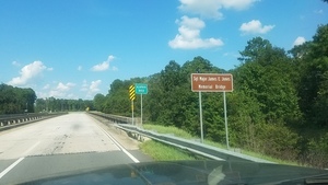
CATEGORIES: Bridge
LAYER: Bridge
GPS: 31.38575, -83.1937
OWNERSHIP: Public
ACCESS: No, PARKING: Free
WATER BODY: Alapaha River
MILE: 127.67
ADDRESS: US 82 east of Alapaha, GA towards Pearson, Berrien County.
DESCRIPTION: Federal highway bridge named for a local hero.
WEBSITE: https://wwals.net/2014/09/25/alapaha-river-access-hwy-82-low-water/
DOWNSTREAM: 0.07 mile from Sgt. Maj. James E Jones Memorial Bridge to Sheboggy Boat Ramp
PHOTO: https://wwals.net/wp-content/themes/pianoblack/img/2018/09/fb56e55caccb12c0ba36b1a11423b9ec.jpg
PHOTOSET: https://wwals.net/2018/09/09/sheboggy-boat-ramp-2018-08-11/
PHOTO SOURCE: John S. Quarterman
PHONE NUMBER: (850) 290-2350
Suggestions: https://forms.gle/DipPgU2TP5atc2Rf9
Sheboggy Boat Ramp @ US 82


CATEGORIES: Landing
LAYER: Brochure
OWNERSHIP: Public
ACCESS: Yes, Ramp: Concrete on graveled access road, PARKING: Free, HANDICAPPED ACCESSIBLE
WATER BODY: Alapaha River
Lowest boatable: 215.3
Highest safe: 218.2
GAUGE: Alapaha
MILE: 127.60
ADDRESS: Left bank, 11004 US Highway 82, Alapaha, GA 31622, Berrien County.
DESCRIPTION: One of the longest downstream paddles, but well worth it to see why the Alapaha is rated A+ for scenery: overhanging oaks, pines, cypress, river birch, ogeechee limes, herons, bass, turtles, almost no invasive species, old railbridge pilings, a mystery church, power lines, and many creeks.
HISTORIC FACTS: Sheboggy is the traditional name for this Alapaha River access point, after the nearby Sheboggy Package Store, which is currently in ruins. At the request of WWALS, in March 2018 Berrien County officially renamed it Sheboggy Boat Ramp. https://wwals.net/?p=43927 Berrien County in June 2017 rebuilt Sheboggy Boat Ramp and improved the access road. https://wwals.net/?p=34422
AKA: Sheboggy Landing
WEBSITE: https://wwals.net/2018/09/23/wwals-cleanup-at-sheboggy-boat-ramp-us-82-alapaha-river-2018-09-09/
DOWNSTREAM: 6.11 miles from Sheboggy Boat Ramp to Rowetown Church Landing
PHOTO: https://wwals.net/wp-content/themes/pianoblack/img//2018/09/915c38119e112b7fb102a9abfc78c947.jpg
PHOTOSET: https://wwals.net/2018/09/23/wwals-cleanup-at-sheboggy-boat-ramp-us-82-alapaha-river-2018-09-09/
PHOTO SOURCE: Gretchen Quarterman
PHONE NUMBER: (850) 290-2350
PHOTO2: https://wwals.net/pictures/2020-09-26–drafts-metal-signs/Sheboggy-Boat-Ramp-ARWT-metal-sign-0001.jpg
PHOTO2 SOURCE: WWALS
Photo2 Phone Number: 850-290-2350
Suggestions: https://forms.gle/DipPgU2TP5atc2Rf9

Sheboggy Boat Ramp River GPS @ US 82

CATEGORIES: Point Of Interest
LAYER: Point of Interest
GPS: 31.38565, -83.19335
OWNERSHIP: Public
ACCESS: Yes, Ramp: Concrete on graveled access road, PARKING: Free, HANDICAPPED ACCESSIBLE
WATER BODY: Alapaha River
Lowest boatable: 215.3
Highest safe: 218.2
GAUGE: Alapaha
MILE: 127.60
ADDRESS: Left bank, 11004 US Highway 82, Alapaha, GA 31622, Berrien County.
DESCRIPTION: One of the longest downstream paddles, but well worth it to see why the Alapaha is rated A+ for scenery: overhanging oaks, pines, cypress, river birch, ogeechee limes, herons, bass, turtles, almost no invasive species, old railbridge pilings, a mystery church, power lines, and many creeks.
HISTORIC FACTS: Sheboggy is the traditional name for this Alapaha River access point, after the nearby Sheboggy Package Store, which is currently in ruins. At the request of WWALS, in March 2018 Berrien County officially renamed it Sheboggy Boat Ramp. https://wwals.net/?p=43927 Berrien County in June 2017 rebuilt Sheboggy Boat Ramp and improved the access road. https://wwals.net/?p=34422
AKA: Sheboggy Landing
WEBSITE: https://wwals.net/2018/09/23/wwals-cleanup-at-sheboggy-boat-ramp-us-82-alapaha-river-2018-09-09/
PHOTO: https://wwals.net/wp-content/themes/pianoblack/img//2018/09/b0219ac762320b1abb929e6494f69459.jpg
PHOTOSET: https://wwals.net/2018/09/09/sheboggy-boat-ramp-2018-08-11/
PHOTO SOURCE: John S. Quarterman
PHONE NUMBER: (229) 242-0102
PHOTO2: https://wwals.net/pictures/2020-09-26–drafts-metal-signs/Sheboggy-Boat-Ramp-ARWT-metal-sign-0001.jpg
PHOTO2 SOURCE: WWALS
Photo2 Phone Number: 850-290-2350
Suggestions: https://forms.gle/DipPgU2TP5atc2Rf9
Sheboggy Package Store ruins
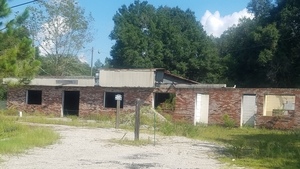
CATEGORIES: Point Of Interest
LAYER: Point of Interest
GPS: 31.38612, -83.1918
OWNERSHIP: Private
ACCESS: `
WATER BODY: Alapaha River
MILE: 127.60
ADDRESS: 11004 US Highway 82, Alapaha, GA 31622, Berrien County.
DESCRIPTION: The remains of the old package store for which Sheboggy Boat Ramp is named.
HISTORIC FACTS: A once-popular bar and package store, now in ruins, that is the namesake of nearby Sheboggy Boat Ramp.
WEBSITE: https://wwals.net/2018/09/09/sheboggy-boat-ramp-2018-08-11/
DOWNSTREAM: 6.11 miles from Sheboggy Package Store ruins to Rowetown Church Landing
PHOTO: https://wwals.net/wp-content/themes/pianoblack/img/2018/09/7094f5f898450898ee0dd4883d3e5c25.jpg
PHOTOSET: https://wwals.net/2018/09/09/sheboggy-boat-ramp-2018-08-11/
PHOTO SOURCE: John S. Quarterman
PHONE NUMBER: (850) 290-2350
Suggestions: https://forms.gle/DipPgU2TP5atc2Rf9
03110202006529 Creek
CATEGORIES: Tributary
LAYER: Point of Interest
OWNERSHIP: Private
WATER BODY: Alapaha River
MILE: 127.46
ADDRESS: Berrien County.
DESCRIPTION: This Tributary is located on river left of the Alapaha River.
UPSTREAM: 0.14 mile from 03110202006529 Creek to Sheboggy Boat Ramp
DOWNSTREAM: 5.97 miles from 03110202006529 Creek to Rowetown Church Landing
Suggestions: https://forms.gle/DipPgU2TP5atc2Rf9
03110202002028 Creek
CATEGORIES: Tributary
LAYER: Point of Interest
OWNERSHIP: Private
WATER BODY: Alapaha River
MILE: 126.72
ADDRESS: Berrien County.
DESCRIPTION: This Tributary is located on river left of the Alapaha River.
UPSTREAM: 0.88 mile from 03110202002028 Creek to Sheboggy Boat Ramp
DOWNSTREAM: 5.23 miles from 03110202002028 Creek to Rowetown Church Landing
Suggestions: https://forms.gle/DipPgU2TP5atc2Rf9
Moore Bluff Church 

CATEGORIES: Church
LAYER: Other
GPS: 31.37452, -83.17406
OWNERSHIP: Private, E.A. Moore, PARCEL 083 29 000
WATER BODY: Alapaha River
MILE: 125.72
ADDRESS: On left bank bluff a few miles downstream of Sheboggy Boat Ramp. Berrien County.
DESCRIPTION: This old church building is quite visible, perched on the left bank of the river. Don’t know its real name, but it’s on a river bluff on Moore property.
UPSTREAM: 1.88 miles from Moore Bluff Church to Sheboggy Boat Ramp
DOWNSTREAM: 4.23 miles from Moore Bluff Church to Rowetown Church Landing
PHOTO: https://wwals.net/wp-content/themes/pianoblack/img//2015/01/355a5ceedf0e911dc9a4e7c95d269b22.jpg
PHOTOSET: https://wwals.net/2015/01/18/alapaha-river-deadfalls-outing-us82-south-wwals-2015-01-17/
PHOTO SOURCE: John S. Quarterman
PHONE NUMBER: (229) 242-0102
Suggestions: https://forms.gle/DipPgU2TP5atc2Rf9
BARR Power Line

CATEGORIES: Power Line
LAYER: Point of Interest
GPS: 31.37175, -83.1719
OWNERSHIP: Private
WATER BODY: Alapaha River
MILE: 125.49
ADDRESS: Just upstream from the Brunswick & Albany RR Bridge, Berrien County.
DESCRIPTION: Power lines often have exotic invasive species on them, such as chamber bitter (Phyllanthus urinaria), which hitchhiked on mowing equipment.
UPSTREAM: 2.11 miles from BARR Power Line to Sheboggy Boat Ramp
DOWNSTREAM: 4.00 miles from BARR Power Line to Rowetown Church Landing
PHOTO: https://wwals.net/wp-content/themes/pianoblack/img/2015/01/7c87136c642c0729ce649c787167f829.jpg
PHOTOSET: https://wwals.net/2015/01/18/alapaha-river-deadfalls-outing-us82-south-wwals-2015-01-17/
PHOTO SOURCE: John S. Quarterman
PHONE NUMBER: (229) 242-0102
Suggestions: https://forms.gle/DipPgU2TP5atc2Rf9
Brunswick Albany RR Bridge Site

CATEGORIES: Railbridgesite
LAYER: Bridge
OWNERSHIP: Private
WATER BODY: Alapaha River
MILE: 125.45
ADDRESS: Just downstream from a power line. Berrien County.
DESCRIPTION: Pilings of a long-defunct railroad.
AKA: Brunswick Albany RR Bridge
WEBSITE: http://www.csa-railroads.com/Brunswick_and_Albany.htm
UPSTREAM: 2.15 miles from Brunswick Albany RR Bridge Site to Sheboggy Boat Ramp
DOWNSTREAM: 3.96 miles from Brunswick Albany RR Bridge Site to Rowetown Church Landing
PHOTO: https://wwals.net/wp-content/themes/pianoblack/img/2015/01/6e51a6ee91972e81e7b7b91cd6d0d703.jpg
PHOTOSET: https://wwals.net/2015/01/18/alapaha-river-deadfalls-outing-us82-south-wwals-2015-01-17/
PHOTO SOURCE: John S. Quarterman
PHONE NUMBER: (229) 242-0102
Suggestions: https://forms.gle/DipPgU2TP5atc2Rf9
begin Gaskins Forest Education Center
CATEGORIES: Point Of Interest
LAYER: Point of Interest
OWNERSHIP: Private
WATER BODY: Alapaha River
MILE: 125.06
ADDRESS: Berrien County.
DESCRIPTION: This Point of Interest is located on river right of the Alapaha River.
UPSTREAM: 2.54 miles from begin Gaskins Forest Education Center to Sheboggy Boat Ramp
DOWNSTREAM: 3.57 miles from begin Gaskins Forest Education Center to Rowetown Church Landing
Suggestions: https://forms.gle/DipPgU2TP5atc2Rf9
03110202006553 Creek
CATEGORIES: Tributary
LAYER: Point of Interest
OWNERSHIP: Private
WATER BODY: Alapaha River
MILE: 124.92
ADDRESS: Berrien County.
DESCRIPTION: This Tributary is located on river right of the Alapaha River.
UPSTREAM: 2.68 miles from 03110202006553 Creek to Sheboggy Boat Ramp
DOWNSTREAM: 3.43 miles from 03110202006553 Creek to Rowetown Church Landing
Suggestions: https://forms.gle/DipPgU2TP5atc2Rf9
Typical Alapaha Deadfall 

CATEGORIES: Deadfall
LAYER: Point of Interest
OWNERSHIP: Public
WATER BODY: Alapaha River
MILE: 124.89
ADDRESS: Berrien County.
DESCRIPTION: Downed trees like this can snag your boat with dragging limbs, or you, or your camera. Always wear your personal flotation device (PFD).
WEBSITE: https://wwals.net/2015/01/18/alapaha-river-deadfalls-outing-us82-south-wwals-2015-01-17/
UPSTREAM: 2.71 miles from Typical Alapaha Deadfall to Sheboggy Boat Ramp
DOWNSTREAM: 3.40 miles from Typical Alapaha Deadfall to Rowetown Church Landing
PHOTO: https://wwals.net/wp-content/themes/pianoblack/img/2015/01/303ce7c220c65609dd252d4be6a34029.jpg
PHOTOSET: https://wwals.net/2015/01/18/alapaha-river-deadfalls-outing-us82-south-wwals-2015-01-17/
PHOTO SOURCE: John S. Quarterman
PHONE NUMBER: (229) 242-0102
Suggestions: https://forms.gle/DipPgU2TP5atc2Rf9
03110202006582 Creek
CATEGORIES: Tributary
LAYER: Point of Interest
OWNERSHIP: Private
WATER BODY: Alapaha River
MILE: 124.59
ADDRESS: Berrien County.
DESCRIPTION: This Tributary is located on river left of the Alapaha River.
UPSTREAM: 3.01 miles from 03110202006582 Creek to Sheboggy Boat Ramp
DOWNSTREAM: 3.10 miles from 03110202006582 Creek to Rowetown Church Landing
Suggestions: https://forms.gle/DipPgU2TP5atc2Rf9
03110202006601 Creek
CATEGORIES: Tributary
LAYER: Point of Interest
OWNERSHIP: Private
WATER BODY: Alapaha River
MILE: 123.11
ADDRESS: Berrien County.
DESCRIPTION: This Tributary is located on river right of the Alapaha River.
UPSTREAM: 4.49 miles from 03110202006601 Creek to Sheboggy Boat Ramp
DOWNSTREAM: 1.62 miles from 03110202006601 Creek to Rowetown Church Landing
Suggestions: https://forms.gle/DipPgU2TP5atc2Rf9
Gaskins Forest Education Center 


CATEGORIES: Point Of Interest
LAYER: Other
OWNERSHIP: Private, GASKINS, MURRAY H SR c/o HEATHER M BRASELL, TRUSTEE, PARCEL 066 1 000
ACCESS: No, Flush Toilet, PARKING: Free, SHELTER, PICNIC AREA, HANDICAPPED ACCESSIBLE
WATER BODY: Alapaha River
ADDRESS: 3359 Moore Sawmill Rd, Alapaha, GA 31622, Berrien County.
DESCRIPTION: This 320-acre private educational facility is available at the discretion of the owners for environmental events. Mission: to promote conservation of natural ecosystems, education focused on forest stewardship, and research related to forest ecology and management.
HISTORIC FACTS: Includes extensive native forest. This area is known as the “”Home Place”” because John Gaskin and his wife built the old farmhouse. In addition to this structure there are also three disused wells.
GRN: Yes
WEBSITE: https://www.facebook.com/GaskinsForestEducationCenter/
OTHER REFERENCE: https://www.exploregeorgia.org/alapaha/outdoors-nature/gardens-arboretums/gaskins-forest-education-center
PHOTO: https://www.wwals.net/pictures/2023-04-22–day-in-the-woods/20220423_114447.jpg
PHOTOSET: https://www.wwals.net/pictures/2023-04-22–day-in-the-woods/
PHOTO SOURCE: John S. Quarterman
PHONE NUMBER: (229) 242-0102
PHOTO2: https://wwals.net/wp-content/themes/pianoblack/img//2015/05/727d34864d302bf0df67c9873459aa14.jpg
Photoset2: http://www.gaskinsforest.com/
PHOTO2 SOURCE: Gaskins Forest Education Center
Photo2 Phone Number: (229) 532-7665 Home; (229) 339-3966 Cell
Suggestions: https://forms.gle/DipPgU2TP5atc2Rf9

begin Gaskins Timber & Wildlife Mgmt
CATEGORIES: Point Of Interest
LAYER: Point of Interest
GPS: 31.348, -83.1662
OWNERSHIP: Private
WATER BODY: Alapaha River
MILE: 122.84
ADDRESS: Berrien County.
DESCRIPTION: This Point of Interest is located on river right of the Alapaha River.
UPSTREAM: 4.76 miles from begin Gaskins Timber & Wildlife Mgmt to Sheboggy Boat Ramp
DOWNSTREAM: 1.35 miles from begin Gaskins Timber & Wildlife Mgmt to Rowetown Church Landing
Suggestions: https://forms.gle/DipPgU2TP5atc2Rf9
Rowetown Church Landing 

CATEGORIES: Landing Private Ask
LAYER: Brochure
GPS: 31.3402, -83.150463
OWNERSHIP: Private, Gaskins Timber & Wildlife LLLP, PARCEL 084 4 002
ACCESS: Ask, Launch: Grassy river bank on private long unpaved woods road back of cemetery. PARKING: Free
WATER BODY: Alapaha River
Lowest boatable: 215.3
Highest safe: 218.2
GAUGE: Alapaha
MILE: 121.49
ADDRESS: 1291 Rowetown Church Road, Alapaha, GA 31622, Berrien County.
DESCRIPTION: Call 229-686-4512 for permission before using. It’s a long (500 feet), smooth, sloping access through the woods, but worth it for itself, and makes a downstream paddle from Sheboggy much more manageable. Long slope below historic cemetery. 7 miles east of Alapaha, GA via Moore Sawmill Road.
HISTORIC FACTS: The nearby Rowetown Church Cemetery dates back to the nineteenth century.
WEBSITE: https://wwals.net/2015/01/18/alapaha-river-deadfalls-outing-us82-south-wwals-2015-01-17/
UPSTREAM: 6.11 miles from Rowetown Church Landing to Sheboggy Boat Ramp
DOWNSTREAM: 12.96 miles from Rowetown Church Landing to Nashville Landing
PHOTO: https://wwals.net/wp-content/themes/pianoblack/img//2015/01/e268cf037394ee58f908d412f493a23e.jpg
PHOTOSET: https://wwals.net/2015/01/18/alapaha-river-deadfalls-outing-us82-south-wwals-2015-01-17/
PHOTO SOURCE: John S. Quarterman
PHONE NUMBER: (850) 290-2350
Suggestions: https://forms.gle/DipPgU2TP5atc2Rf9
Rowetown Church Cemetery 

CATEGORIES: Cemetery
LAYER: Point of Interest
GPS: 31.33906, -83.149789
OWNERSHIP: Private, Rowetown Cemetery, PARCEL 085 5 000
ACCESS: No, PARKING: Free
WATER BODY: Alapaha River
MILE: 121.49
ADDRESS: 1291 Rowetown Church Road, Alapaha, GA 31622, Berrien County.
DESCRIPTION: A historic riverside cemetery. 7 miles east of Alapaha, GA via Moore Sawmill Road.
HISTORIC FACTS: This cemetery dates back to the nineteenth century.
WEBSITE: https://www.findagrave.com/cemetery/2180592
OTHER REFERENCE: https://jeremylr.medium.com/footsteps-of-early-alapaha-catholic-settlers-5d5a50c4f07d
UPSTREAM: 6.11 miles from Rowetown Church Cemetery to Sheboggy Boat Ramp
DOWNSTREAM: 12.96 miles from Rowetown Church Cemetery to Nashville Landing
PHOTO: https://wwals.net/wp-content/themes/pianoblack/img//2015/01/ab8957b5cacfc55c932ac559b27659dd.jpg
PHOTOSET: https://wwals.net/2015/01/18/alapaha-river-deadfalls-outing-us82-south-wwals-2015-01-17/
PHOTO SOURCE: John S. Quarterman
PHONE NUMBER: (850) 290-2350
Suggestions: https://forms.gle/DipPgU2TP5atc2Rf9
Satilla Road Willacoochee River Bridge
CATEGORIES: Bridge
LAYER: Bridge
OWNERSHIP: Public
WATER BODY: Willacoochee River
MILE: 18.63
ADDRESS: Between Cornflower Road and Clover Road. Irwin County.
DESCRIPTION: A bridge over the Willacoochee River.
Suggestions: https://forms.gle/DipPgU2TP5atc2Rf9
Satilla Road Overflow Bridge

CATEGORIES: Bridge
LAYER: Bridge
OWNERSHIP: Public
WATER BODY: Willacoochee River
MILE: 18.63
ADDRESS: Between Cornflower Road and Clover Road. Irwin County.
DESCRIPTION: A bridge over an overflow of the Willacoochee River. Being replaced in 2025.
PHOTOSET: https://www.wwals.net/pictures/2025-07-11–willacoochee-river-overflow-satilla-road-variance/
PHOTO SOURCE: GA-EPD
PHONE NUMBER: (470) 524-0599
Suggestions: https://forms.gle/DipPgU2TP5atc2Rf9
Daffodil Road Bridge
CATEGORIES: Bridge
LAYER: Bridge
OWNERSHIP: Publiic
WATER BODY: Willacoochee River
MILE: 15.47
ADDRESS: 388 Daffodil Road, Ocilla, GA 31774, Irwin County.
DESCRIPTION: Presumably culverts under dirt road.
Suggestions: https://forms.gle/DipPgU2TP5atc2Rf9
Lax Highway Bridge
CATEGORIES: Bridge
LAYER: Bridge
GPS: 31.507162, -83.16479
OWNERSHIP: Public
WATER BODY: Willacoochee River
MILE: 13.72
ADDRESS: Lax Hwy (GA 90), Ocilla, GA 31774, Irwin County.
DESCRIPTION: Two-lane concrete bridge with walkways built in 1998.
WEBSITE: https://maps.app.goo.gl/wz9UBQJjF7eHqPmT9
Suggestions: https://forms.gle/DipPgU2TP5atc2Rf9
Bethlehem Church Road Bridge
CATEGORIES: Bridge
LAYER: Bridge
OWNERSHIP: Public
WATER BODY: Reedy Creek
ADDRESS: 529 Bethlehem Church Road, Ocilla, GA 31774, Irwin County.
DESCRIPTION: Two-lane concrete bridge with walkways built in 1959.
WEBSITE: https://maps.app.goo.gl/JtzSFwcTcQT21VaP6
Suggestions: https://forms.gle/DipPgU2TP5atc2Rf9
Reedy Creek (Willacoochee River)
CATEGORIES: Tributary
LAYER: Other
OWNERSHIP: Private
WATER BODY: Willacoochee River
MILE: 12.11
ADDRESS: About a mile upstream from Gladys Highway (GA 158), between Bethlehem Church Rd and Law Road, Irwin County.
Suggestions: https://forms.gle/DipPgU2TP5atc2Rf9
Gladys Highway Bridge
CATEGORIES: Bridge
LAYER: Bridge
GPS: 31.47207, -83.145691
OWNERSHIP: Public
WATER BODY: Willacoochee River
MILE: 10.85
ADDRESS: Gladys Hwy (GA 158), Ocilla, GA 31774, Berrien, Coffee Counties.
DESCRIPTION: Two-lane concrete bridge with walkways built in 2021.
WEBSITE: https://maps.app.goo.gl/VevchrVGmBAprRYL6
Suggestions: https://forms.gle/DipPgU2TP5atc2Rf9
Coochee Creek Rd. Bridge

CATEGORIES: Bridge
LAYER: Bridge
GPS: 31.395072, -83.12863
OWNERSHIP: Public
WATER BODY: Willacoochee River
MILE: 4.14
ADDRESS: Coochee Creek Road, Alapaha, GA 31622, Berrien, Atkinson Counties.
DESCRIPTION: A very narrow county line county road bridge with wood rails.
AKA: Luke Bridge (road is called St Lukes Church Road in Berrien County).
WEBSITE: https://bridgehunter.com/ga/berrien/luke/
PHOTO: https://bridgehunter.com/photos/19/61/196105-M.jpg
PHOTOSET: https://bridgehunter.com/ga/berrien/luke/
PHOTO SOURCE: Becky Taylor via Bridgehunter.com
PHONE NUMBER: (850) 290-2350
Suggestions: https://forms.gle/DipPgU2TP5atc2Rf9
Braswell Creek
CATEGORIES: Tributary
LAYER: Other
GPS: 31.377407, -83.11144
OWNERSHIP: Private
WATER BODY: Willacoochee River
MILE: 2.52
ADDRESS: About 2 miles upstream from US 82 Willacoochee River Bridge, Atkinson County.
Suggestions: https://forms.gle/DipPgU2TP5atc2Rf9
US 82 Willacoochee River Bridge
CATEGORIES: Bridge
LAYER: Bridge
OWNERSHIP: Public
WATER BODY: Willacoochee River
MILE: 1.03
ADDRESS: Between Alapaha, GA and Willacoochee, GA, about a mile upstream of the Willacoochee Confluence. Berrien, Atkinson Counties.
DESCRIPTION: A pair of two-lane concrete bridges built in 1956.
WEBSITE: https://maps.app.goo.gl/FZYPzTxg5Sx2oSdd7
Suggestions: https://forms.gle/DipPgU2TP5atc2Rf9
Willacoochee River Confluence
CATEGORIES: Tributary
LAYER: Other
GPS: 31.351953, -83.09715
OWNERSHIP: Private, Georgia Department of Transportation, PARCEL 097 1 1000
ACCESS: No
WATER BODY: Alapaha River
MILE: 116.35
ADDRESS: Left bank, south of US 82 between Alapaha, GA and Willacoochee, GA. Berrien, Atkinson Counties.
DESCRIPTION: Willacoochee River flows into the Alapaha River. Very hard to spot.
UPSTREAM: 5.14 miles from Willacoochee River Confluence to Rowetown Church Landing
DOWNSTREAM: 7.82 miles from Willacoochee River Confluence to Nashville Landing
Suggestions: https://forms.gle/DipPgU2TP5atc2Rf9
03110202001961 Creek
CATEGORIES: Tributary
LAYER: Point of Interest
OWNERSHIP: Private
WATER BODY: Alapaha River
MILE: 114.92
ADDRESS: Atkinson County.
DESCRIPTION: This Tributary is located on river left of the Alapaha River.
UPSTREAM: 6.57 miles from 03110202001961 Creek to Rowetown Church Landing
DOWNSTREAM: 6.39 miles from 03110202001961 Creek to Nashville Landing
Suggestions: https://forms.gle/DipPgU2TP5atc2Rf9
03110202006628 Creek
CATEGORIES: Tributary
LAYER: Point of Interest
OWNERSHIP: Private
WATER BODY: Alapaha River
MILE: 113.94
ADDRESS: Atkinson County.
DESCRIPTION: This Tributary is located on river left of the Alapaha River.
UPSTREAM: 7.55 miles from 03110202006628 Creek to Rowetown Church Landing
DOWNSTREAM: 5.41 miles from 03110202006628 Creek to Nashville Landing
Suggestions: https://forms.gle/DipPgU2TP5atc2Rf9
Nashville-Willacoochee Power Line
CATEGORIES: Power Line
LAYER: Point of Interest
OWNERSHIP: Private
WATER BODY: Alapaha River
MILE: 112.10
ADDRESS: Between Berrien County CR 156 and end of Ruby Gideon Street, Willacoochee, GA, Atkinson County. Berrien, Atkinson Counties.
DESCRIPTION: You missed the Willacoochee River Confluence four miles back.
UPSTREAM: 9.39 miles from Nashville-Willacoochee Power Line to Rowetown Church Landing
DOWNSTREAM: 3.57 miles from Nashville-Willacoochee Power Line to Nashville Landing
Suggestions: https://forms.gle/DipPgU2TP5atc2Rf9
03110202006649 Creek
CATEGORIES: Tributary
LAYER: Point of Interest
OWNERSHIP: Private
WATER BODY: Alapaha River
MILE: 111.94
ADDRESS: Atkinson County.
DESCRIPTION: This Tributary is located on river left of the Alapaha River.
UPSTREAM: 9.55 miles from 03110202006649 Creek to Rowetown Church Landing
DOWNSTREAM: 3.41 miles from 03110202006649 Creek to Nashville Landing
Suggestions: https://forms.gle/DipPgU2TP5atc2Rf9
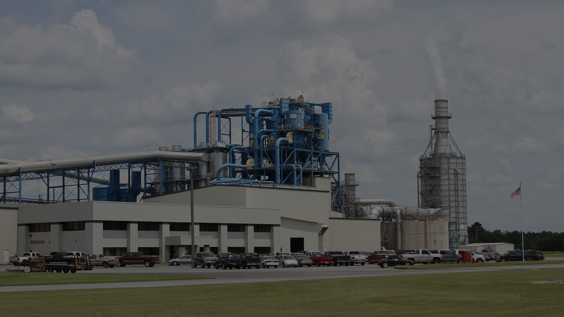
Langboard MDF Outfall
CATEGORIES: Wtp
LAYER: Other
GPS: 31.31919, -83.059535
OWNERSHIP: Private
WATER BODY: Alapaha River
MILE: 110.57
ADDRESS: West across Peterson Street South from 548 Langboard Road, Willacoochee, GA 31650, Atkinson County.
DESCRIPTION: This industrial wood product plant, a particleboard manufacuring facility, discharges into the Alapaha River a “”maximum 0.1 MGD of non-contact cooling water, refiner seal water, water softener backwash, press pit sump, boiler blowdown, reverse osmosis filtrate process water, and stormwater runoff””. NPDES Permit No. GA0037745 and air quality Permit No. 2493-003-0013-V-05-0. “”Langboard MDF is an engineered, wood-based panel. We use 100% Southern Yellow Pine which gives a light-colored MDF that works well in all applications. The chips and shavings are washed, classified, and refined with three high-energy Sunds Defiberator Refiners.”
HISTORIC FACTS: “”Langboard’s Medium Density Fiberboard (MDF) plant began production on September 1, 1998. Langdale Industries, Inc. purchased the plant, originally built in Las Vegas, New Mexico, in 1996. The plant was moved from New Mexico and reassembled in Willacoochee, Georgia. The plant was redesigned to streamline the production process and increase efficiency. The Langboard MDF plant operates 24 hours a day, 7 days a week.””
AKA: Langboard Willacoochee
WEBSITE: http://www.langboard-mdf.com/
OTHER REFERENCE: https://wwals.net/pictures/2018-08-30–permits/langboard-willacoochee/
ADDITIONAL INFO SOURCES: http://www.langboard-mdf.com/about.html
UPSTREAM: 10.92 miles from Langboard MDF Outfall to Rowetown Church Landing
DOWNSTREAM: 2.04 miles from Langboard MDF Outfall to Nashville Landing
PHOTO: http://www.langboard-mdf.com/img/1920×1080/02.jpg
PHOTOSET: http://www.langboard-mdf.com/
PHOTO SOURCE: Langboard MDF
PHONE NUMBER: (912) 534-5959
Suggestions: https://forms.gle/DipPgU2TP5atc2Rf9
Sandpit Lane Creek
CATEGORIES: Tributary
LAYER: Point of Interest
OWNERSHIP: Private
WATER BODY: Alapaha River
MILE: 109.55
ADDRESS: A mile upstream from Willaoochee Landing. Atkinson County.
DESCRIPTION: This Tributary is located on river left of the Alapaha River.
AKA: 03110202001801 Creek
UPSTREAM: 11.94 miles from Sandpit Lane Creek to Rowetown Church Landing
DOWNSTREAM: 1.02 miles from Sandpit Lane Creek to Nashville Landing
Suggestions: https://forms.gle/DipPgU2TP5atc2Rf9
Nashville Landing @ GA 135
*

CATEGORIES: Landing
LAYER: Brochure
OWNERSHIP: Public
ACCESS: Yes, Launch: Sand and gravel state highway abutment down dirt access road, PARKING: Free
WATER BODY: Alapaha River
Lowest boatable: 215.3
Highest safe: 218.2
GAUGE: Alapaha
MILE: 108.53
ADDRESS: 10921 GA 135, Nashville, GA 31639, Berrien County, right bank, west side of the bridge, northeast of Nashville, GA. Berrien County.
DESCRIPTION: Backwoods, no towns, almost no industry: just pines, cypress, river birch, tupelo, fish, birds, and turtles, with a railroad bridge and some creeks: an excellent all-day downstream paddle, although it really will take all day at low water. * For high water go to Willacoochee Landing @ GA 135 in Atkinson County. For low water. Berrien County side of the bridge. GPS at the river: 31.303278, -83.05391.
AKA: GA 135 Berrien
WEBSITE: http://alltrails.com/trail/us/georgia/alapaha-river-ga-135-to-fl-150
UPSTREAM: 12.96 miles from Nashville Landing to Rowetown Church Landing
DOWNSTREAM: 0.02 mile from Nashville Landing to Willacoochee Landing
PHOTOSET: https://wwals.net/2014/12/08/alapaha-river-ga-135-berrien-county-south-willacoochee/
PHOTO SOURCE: Bret Wagenhorst
PHONE NUMBER: (850) 290-2350
PHOTO2: https://wwals.net/pictures/2020-09-26–drafts-metal-signs/Nashville-Landing-ARWT-metal-sign-0001.jpg
Photoset2: https://wwals.net/pictures/2020-09-26–drafts-metal-signs/Nashville-Landing-ARWT-metal-sign-0001.html
PHOTO2 SOURCE: WWALS
Photo2 Phone Number: 850-290-2350
Suggestions: https://forms.gle/DipPgU2TP5atc2Rf9

Nashville Landing River GPS @ GA 135
*
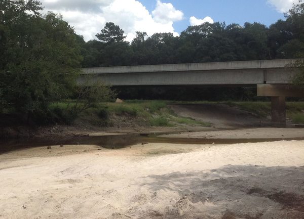
CATEGORIES: Point Of Interest
LAYER: Point of Interest
GPS: 31.303278, -83.05391
OWNERSHIP: Public
ACCESS: Yes, Launch: Sand and gravel state highway abutment down dirt access road, PARKING: Free
WATER BODY: Alapaha River
Lowest boatable: 215.3
Highest safe: 218.2
GAUGE: Alapaha
MILE: 108.53
ADDRESS: 10921 GA 135, Nashville, GA 31639, Berrien County, right bank, west side of the bridge, northeast of Nashville, GA. Berrien County.
DESCRIPTION: Backwoods, no towns, almost no industry: just pines, cypress, river birch, tupelo, fish, birds, and turtles, with a railroad bridge and some creeks: an excellent all-day downstream paddle, although it really will take all day at low water. * For high water go to Willacoochee Landing @ GA 135 in Atkinson County. For low water. Berrien County side of the bridge. GPS at the river: 31.303278, -83.05391.
AKA: GA 135 Berrien
WEBSITE: http://alltrails.com/trail/us/georgia/alapaha-river-ga-135-to-fl-150
PHOTOSET: https://wwals.net/2014/12/08/alapaha-river-ga-135-berrien-county-south-willacoochee/
PHOTO SOURCE: Bret Wagenhorst
PHONE NUMBER: (850) 290-2350
PHOTO2: https://wwals.net/pictures/2020-09-26–drafts-metal-signs/Nashville-Landing-ARWT-metal-sign-0001.jpg
Photoset2: https://wwals.net/pictures/2020-09-26–drafts-metal-signs/Nashville-Landing-ARWT-metal-sign-0001.html
PHOTO2 SOURCE: WWALS
Photo2 Phone Number: 850-290-2350
Suggestions: https://forms.gle/DipPgU2TP5atc2Rf9
Willacoochee Landing @ GA 135
*

CATEGORIES: Landing
LAYER: Brochure
OWNERSHIP: Public
ACCESS: Yes, Launch: Sand and gravel state highway abutment, PARKING: Free
WATER BODY: Alapaha River
Lowest boatable: 215.3
Highest safe: 218.2
GAUGE: Alapaha
MILE: 108.51
ADDRESS: GA 135, left bank, west side of the bridge, Atkinson County side, 2.8 miles south of Willacoochee, GA, Atkinson County.
DESCRIPTION: Very long, but well worth it, for pines, cypress, river birch, tupelo, bass and catfish, herons, and turtles, with a railroad bridge and some creeks: an excellent all-day high-water paddle. * For low water go to Nashville Landing @ GA 135 in Berrien County. For high water. Atkinson County side of the bridge. GPS at the river: 31.3032169, -83.05335.
AKA: GA 135 Atkinson
WEBSITE: https://wwals.net/pictures/2016-02-20–wwals-alapaha/
UPSTREAM: 0.02 mile from Willacoochee Landing to Nashville Landing
DOWNSTREAM: 19.17 miles from Willacoochee Landing to Berrien Beach Boat Ramp
PHOTO: https://wwals.net/pictures/2016-02-20–wwals-alapaha/before-crop.jpg
PHOTOSET: https://wwals.net/pictures/2016-02-20–wwals-alapaha/before-crop.html
PHOTO SOURCE: Gretchen Quarterman
PHONE NUMBER: (850) 290-2350
PHOTO2 SOURCE: WWALS
Photo2 Phone Number: 850-290-2350
Suggestions: https://forms.gle/DipPgU2TP5atc2Rf9

Willacoochee Landing River GPS @ GA 135
*
CATEGORIES: Point Of Interest
LAYER: Point of Interest
OWNERSHIP: Public
ACCESS: Yes, Launch: Sand and gravel state highway abutment, PARKING: Free
WATER BODY: Alapaha River
Lowest boatable: 215.3
Highest safe: 218.2
GAUGE: Alapaha
MILE: 108.51
ADDRESS: GA 135, left bank, west side of the bridge, Atkinson County side, 2.8 miles south of Willacoochee, GA, Atkinson County.
DESCRIPTION: Very long, but well worth it, for pines, cypress, river birch, tupelo, bass and catfish, herons, and turtles, with a railroad bridge and some creeks: an excellent all-day high-water paddle. * For low water go to Nashville Landing @ GA 135 in Berrien County. For high water. Atkinson County side of the bridge. GPS at the river: 31.3032169, -83.05335.
AKA: GA 135 Atkinson
WEBSITE: https://wwals.net/pictures/2016-02-20–wwals-alapaha/
PHOTO: https://wwals.net/pictures/2016-02-20–wwals-alapaha/before-crop.jpg
PHOTOSET: https://wwals.net/pictures/2016-02-20–wwals-alapaha/before-crop.html
PHOTO SOURCE: Gretchen Quarterman
PHONE NUMBER: (850) 290-2350
PHOTO2 SOURCE: WWALS
Photo2 Phone Number: 850-290-2350
Suggestions: https://forms.gle/DipPgU2TP5atc2Rf9
Pvt. George W. Lee Memorial Bridge

CATEGORIES: Bridge
LAYER: Bridge
OWNERSHIP: Public
ACCESS: No, PARKING: Free
WATER BODY: Alapaha River
MILE: 108.50
ADDRESS: 10921 GA 135, Nashville, GA 31639, Berrien, Atkinson Counties.
DESCRIPTION: There is a road sign with the bridge name on the Berrien County side heading east. A two-lane concrete bridge with sidewalks built in 2003.
HISTORIC FACTS: Since it’s named as a memorial, there must be a story.
WEBSITE: http://www.theinfolist.com/php/SummaryGet.php?FindGo=Alapaha%20River
OTHER REFERENCE: https://maps.app.goo.gl/ggANrzd4idzCsmHi9
UPSTREAM: 0.01 mile from Pvt. George W. Lee Memorial Bridge to Willacoochee Landing
DOWNSTREAM: 19.16 miles from Pvt. George W. Lee Memorial Bridge to Berrien Beach Boat Ramp
PHOTO: https://wwals.net/pictures/2016-02-20–wwals-alapaha/before-banner.jpg
PHOTOSET: https://wwals.net/pictures/2016-02-20–wwals-alapaha/before-banner.html
PHOTO SOURCE: Gretchen Quarterman
PHONE NUMBER: (850) 290-2350
Suggestions: https://forms.gle/DipPgU2TP5atc2Rf9
Deep fishing hole

CATEGORIES: Fishing
LAYER: Point of Interest
OWNERSHIP: Public
WATER BODY: Alapaha River
MILE: 107.34
ADDRESS: 1.17 miles downstream from Willacoochee Landing, at hairbend curve, under a tree. Berrien County.
AKA: 03110202006671 Creek
UPSTREAM: 1.17 miles from Deep fishing hole to Willacoochee Landing
DOWNSTREAM: 18 miles from Deep fishing hole to Berrien Beach Boat Ramp
Suggestions: https://forms.gle/DipPgU2TP5atc2Rf9
Aulie Vickers Road Creek
CATEGORIES: Tributary
LAYER: Point of Interest
OWNERSHIP: Private
WATER BODY: Alapaha River
MILE: 107.14
ADDRESS: Just upstream from Georgia and Florida Railway Bridge. Berrien County.
DESCRIPTION: This Tributary is located on river right of the Alapaha River.
AKA: 03110202006671 Creek
UPSTREAM: 1.37 miles from Aulie Vickers Road Creek to Willacoochee Landing
DOWNSTREAM: 17.8 miles from Aulie Vickers Road Creek to Berrien Beach Boat Ramp
Suggestions: https://forms.gle/DipPgU2TP5atc2Rf9
Georgia and Florida Railway Bridge 

CATEGORIES: Railbridge
LAYER: Bridge
GPS: 31.2899, -83.0481
OWNERSHIP: Private
ACCESS: No
WATER BODY: Alapaha River
MILE: 107.13
ADDRESS: Beyond end of Atkinson Co. 208, Atkinson, Berrien Counties.
DESCRIPTION: Railroad bridge between Willacoochee and Nashville, GA. Rail line from Nashville to Willacoochee, formerly owned by the city of Willacoochee, now owned by the Georgia Department of Transportation. http://www.stb.dot.gov/Decisions/readingroom.nsf/8fd5532a0c425c5c8525740f005f36d4/863972f6d4eca32585256fb90056b7f6?OpenDocument&Highlight=0%2CWillacoochee
HISTORIC FACTS: “”The Valdosta-Nashville section was built by the Douglas, Augusta & Gulf Railway and became part of G&F around 1906. G&F later became part of the Southern in 1963 and NS in 1990.[3] In early 2005 changes came to the branch as the Georgia Department of Transportation purchased the line from G&F, including an additional section of exempted track from Nashville to Willacoochee, 16.6 miles (26.7 km), owned by the city of Willacoochee. Under the agreement, G&F would continue to operate the line from Valdosta to Willachoochee. Cater Parrott Railnet now operates this line.[6] “”
WEBSITE: http://railga.com/gafl.html
OTHER REFERENCE: https://en.wikipedia.org/wiki/Georgia_and_Florida_Railway_(2005)#Valdosta-Nashville
UPSTREAM: 1.38 miles from Georgia and Florida Railway Bridge to Willacoochee Landing
DOWNSTREAM: 17.79 miles from Georgia and Florida Railway Bridge to Berrien Beach Boat Ramp
PHOTO: http://farm7.static.flickr.com/6077/6100036578_ed5806244d_z.jpg
PHOTO SOURCE: Lowndes County
PHONE NUMBER: (850) 290-2350
Suggestions: https://forms.gle/DipPgU2TP5atc2Rf9
03110202001802 Creek
CATEGORIES: Tributary
LAYER: Point of Interest
OWNERSHIP: Private
WATER BODY: Alapaha River
MILE: 102.08
ADDRESS: Berrien County.
DESCRIPTION: This Tributary is located on river right of the Alapaha River.
UPSTREAM: 6.43 miles from 03110202001802 Creek to Willacoochee Landing
DOWNSTREAM: 12.74 miles from 03110202001802 Creek to Berrien Beach Boat Ramp
Suggestions: https://forms.gle/DipPgU2TP5atc2Rf9
Chicken CAFO Drain
CATEGORIES: Point Of Interest
LAYER: Point of Interest
OWNERSHIP: Private
WATER BODY: Alapaha River
MILE: 101.54
ADDRESS: About five miles downstream from the Georgia and Florida Railway Bridge. Berrien County.
DESCRIPTION: Right bank, a nondescript outflow that is just down hill from a chicken Concentrated Animal Feeding Operation (CAFO), possibly the only one near the Alapaha River.
UPSTREAM: 6.97 miles from Chicken CAFO Drain to Willacoochee Landing
DOWNSTREAM: 12.2 miles from Chicken CAFO Drain to Berrien Beach Boat Ramp
Suggestions: https://forms.gle/DipPgU2TP5atc2Rf9
Camp Bay
CATEGORIES: Lake
LAYER: Point of Interest
OWNERSHIP: Private
WATER BODY: Camp Bay
ADDRESS: CR 133, Willacoochee, GA 31650, Atkinson County.
GRN: No
Suggestions: https://forms.gle/DipPgU2TP5atc2Rf9
Hog Creek Bay
CATEGORIES: Lake
LAYER: Point of Interest
OWNERSHIP: Private
WATER BODY: Hog Creek Bay
ADDRESS: CR 134, Willacoochee, GA 31650, Atkinson County.
GRN: No
Suggestions: https://forms.gle/DipPgU2TP5atc2Rf9
Meetinghouse Bay
CATEGORIES: Lake
LAYER: Point of Interest
OWNERSHIP: Private
WATER BODY: Meetinghouse Bay
ADDRESS: Springhead Church Road, Willacoochee, GA 31650, Atkinson County.
GRN: No
Suggestions: https://forms.gle/DipPgU2TP5atc2Rf9
Still Bay
CATEGORIES: Lake
LAYER: Point of Interest
OWNERSHIP: Private
WATER BODY: Still Bay
ADDRESS: Springhead Church Road, Willacoochee, GA 31650, Atkinson County.
GRN: No
Suggestions: https://forms.gle/DipPgU2TP5atc2Rf9
Featherbed Bay
CATEGORIES: Lake
LAYER: Point of Interest
OWNERSHIP: Private
WATER BODY: Featherbed Bay
ADDRESS: CR 31, Willacoochee, GA 31650, Atkinson County.
GRN: No
Suggestions: https://forms.gle/DipPgU2TP5atc2Rf9
Riverside Church @ Riverside Road

CATEGORIES: Point Of Interest
LAYER: Other
GPS: 31.2405, -83.04812
OWNERSHIP: Private, David C. Hendley, Jr, PARCEL 110 37 000
ACCESS: No, Launch: riverbank on private road
WATER BODY: Alapaha River
MILE: 100.50
ADDRESS: 1600 Riverside Road, east of GA 135, about 9 miles south of Willacoochee, GA, Berrien County.
DESCRIPTION: Dirt road behind church cemetery. Private river access, not for public use.
HISTORIC FACTS: “”The church was constituted September 27, 1908 and was known to be the Baptist Church of Christ by a group of people meeting at the Gaskins Graveyard established prior to constitution of the church. One acre of land was purchased from Kizzie Brogdon on south side of the Gaskins Graveyard and deeded to the church on July 7, 1909. The first building was erected in 1909 and given the name Riverside Baptist Church. There is no record of the type of building or where the people met prior to its erection. In 1935 and 1936 the second building was built….””
AKA: Gaskins Graveyard
WEBSITE: https://www.findagrave.com/cemetery/2180588/riverside-missionary-baptist-church-cemetery
UPSTREAM: 8.01 miles from Riverside Church to Willacoochee Landing
DOWNSTREAM: 11.16 miles from Riverside Church to Berrien Beach Boat Ramp
PHOTO: https://wwals.net/wp-content/themes/pianoblack/img//2014/12/5a78dd21453ced0e3499d905a0efce56.jpg
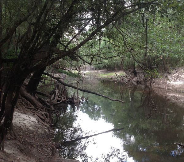
PHOTOSET: https://wwals.net/2014/12/08/alapaha-river-access-riverside-church/
PHOTO SOURCE: Bret Wagenhorst
PHONE NUMBER: (850) 290-2350
Suggestions: https://forms.gle/DipPgU2TP5atc2Rf9
Cozy Lunch Beach
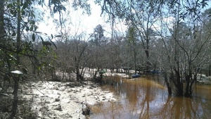
CATEGORIES: Point Of Interest
LAYER: Other
OWNERSHIP: Public
WATER BODY: Alapaha River
MILE: 100.16
ADDRESS: Less than two thousand feet downstream from Riverside Church, near McCranie North Road. Atkinson County.
DESCRIPTION: This Point of Interest is located on river left of the Alapaha River.
WEBSITE: https://wwals.net/2016/02/21/pictures-long-alapaha-outing-ga-135-to-ga-168-2016-02-20/
UPSTREAM: 8.35 miles from Cozy Lunch Beach to Willacoochee Landing
DOWNSTREAM: 10.82 miles from Cozy Lunch Beach to Berrien Beach Boat Ramp
PHOTO: https://wwals.net/wp-content/themes/pianoblack/img//2016/02/52a8cf3f833ab788238eebd14eda56b8.jpg
PHOTOSET: https://wwals.net/2016/02/21/pictures-long-alapaha-outing-ga-135-to-ga-168-2016-02-20/
PHOTO SOURCE: John S. Quarterman
PHONE NUMBER: (229) 242-0102
Suggestions: https://forms.gle/DipPgU2TP5atc2Rf9
03110202001807 Creek
CATEGORIES: Tributary
LAYER: Point of Interest
OWNERSHIP: Private
WATER BODY: Alapaha River
MILE: 98.44
ADDRESS: Berrien County.
DESCRIPTION: This Tributary is located on river right of the Alapaha River.
UPSTREAM: 10.07 miles from 03110202001807 Creek to Willacoochee Landing
DOWNSTREAM: 9.10 miles from 03110202001807 Creek to Berrien Beach Boat Ramp
Suggestions: https://forms.gle/DipPgU2TP5atc2Rf9
Parkers Bluff
CATEGORIES: Point Of Interest
LAYER: Other
OWNERSHIP: Public
WATER BODY: Alapaha River
MILE: 94.44
ADDRESS: Atkinson County.
DESCRIPTION: The left bank is a typical blackwater river bluff.
UPSTREAM: 14.07 miles from Parkers Bluff to Willacoochee Landing
DOWNSTREAM: 5.10 miles from Parkers Bluff to Berrien Beach Boat Ramp
Suggestions: https://forms.gle/DipPgU2TP5atc2Rf9
Reedy Branch 00321438
CATEGORIES: Tributary
LAYER: Point of Interest
OWNERSHIP: Private
WATER BODY: Alapaha River
MILE: 93.72
ADDRESS: Berrien County.
DESCRIPTION: This Tributary is located on river right of the Alapaha River.
UPSTREAM: 14.79 miles from Reedy Branch 00321438 to Willacoochee Landing
DOWNSTREAM: 4.38 miles from Reedy Branch 00321438 to Berrien Beach Boat Ramp
Suggestions: https://forms.gle/DipPgU2TP5atc2Rf9
Cross Creek Road Bluff
CATEGORIES: Point Of Interest
LAYER: Point of Interest
OWNERSHIP: Private
WATER BODY: Alapaha River
MILE: 91.23
ADDRESS: Cross Creek Road. Berrien County.
DESCRIPTION: This Point of Interest is located on river right of the Alapaha River.
UPSTREAM: 17.28 miles from Cross Creek Road Bluff to Willacoochee Landing
DOWNSTREAM: 1.89 miles from Cross Creek Road Bluff to Berrien Beach Boat Ramp
Suggestions: https://forms.gle/DipPgU2TP5atc2Rf9
03110202003668 Creek
CATEGORIES: Tributary
LAYER: Point of Interest
OWNERSHIP: Private
WATER BODY: Alapaha River
MILE: 92.81
ADDRESS: Berrien County.
DESCRIPTION: This Tributary is located on river right of the Alapaha River.
UPSTREAM: 15.7 miles from 03110202003668 Creek to Willacoochee Landing
DOWNSTREAM: 3.47 miles from 03110202003668 Creek to Berrien Beach Boat Ramp
Suggestions: https://forms.gle/DipPgU2TP5atc2Rf9
Lanier EMA marker 24 
CATEGORIES: Emamarker
LAYER: Point of Interest
OWNERSHIP: Public
WATER BODY: Alapaha River
MILE: 92.64
ADDRESS: Left bank. Lanier County.
DESCRIPTION: Signpost with Lanier emergency number, 229-482-5070. Lanier County computes 48.666 miles upstream from Echols County; WWALS estimates 44.96 from Echols County.
UPSTREAM: 15.87 miles from Lanier EMA marker 24 to Willacoochee Landing
DOWNSTREAM: 3.30 miles from Lanier EMA marker 24 to Berrien Beach Boat Ramp
Suggestions: https://forms.gle/DipPgU2TP5atc2Rf9
Berrien-Atkinson-Lanier Tripoint
CATEGORIES: Point Of Interest
LAYER: Point of Interest
GPS: 31.183681, -83.04689
OWNERSHIP: Public
WATER BODY: Alapaha River
MILE: 92.58
ADDRESS: Near Lanier EMA Marker 24. Berrien, Atkinson, Lanier Counties.
DESCRIPTION: Left bank is Atkinson-Lanier County Line; right bank is Berrien County.
UPSTREAM: 15.93 miles from Berrien-Atkinson-Lanier Tripoint to Willacoochee Landing
DOWNSTREAM: 3.24 miles from Berrien-Atkinson-Lanier Tripoint to Berrien Beach Boat Ramp
Suggestions: https://forms.gle/DipPgU2TP5atc2Rf9
03110202001964 Creek
CATEGORIES: Tributary
LAYER: Point of Interest
GPS: 31.17696, -83.048866
OWNERSHIP: Private
WATER BODY: Alapaha River
MILE: 91.54
ADDRESS: Berrien County.
DESCRIPTION: This Tributary is located on river right of the Alapaha River.
UPSTREAM: 16.97 miles from 03110202001964 Creek to Willacoochee Landing
DOWNSTREAM: 2.20 miles from 03110202001964 Creek to Berrien Beach Boat Ramp
Suggestions: https://forms.gle/DipPgU2TP5atc2Rf9
03110202001821 Creek
CATEGORIES: Tributary
LAYER: Point of Interest
OWNERSHIP: Private
WATER BODY: Alapaha River
MILE: 90.81
ADDRESS: Berrien County.
DESCRIPTION: This Tributary is located on river right of the Alapaha River.
UPSTREAM: 17.7 miles from 03110202001821 Creek to Willacoochee Landing
DOWNSTREAM: 1.47 miles from 03110202001821 Creek to Berrien Beach Boat Ramp
Suggestions: https://forms.gle/DipPgU2TP5atc2Rf9
Lanier EMA Marker 23
CATEGORIES: Emamarker
LAYER: Point of Interest
GPS: 31.1701, -83.044367
OWNERSHIP: Public
WATER BODY: Alapaha River
MILE: 90.67
ADDRESS: Right bank. Lanier County.
DESCRIPTION: Signpost with Lanier EMA emergency number, 229-482-5070. Lanier County computes 45.116 miles upstream from Echols County; WWALS estimates 42.99 from Echols County.
UPSTREAM: 17.84 miles from Lanier EMA Marker 23 to Willacoochee Landing
DOWNSTREAM: 1.33 miles from Lanier EMA Marker 23 to Berrien Beach Boat Ramp
Suggestions: https://forms.gle/DipPgU2TP5atc2Rf9
Lake Lewis Boat Ramp


CATEGORIES: Landing Private
LAYER: Other
OWNERSHIP: Private, Gail Milligan (life estate), PARCEL 071 16 001
ACCESS: Yes, Ramp: Concrete boat ramp on paved road, FOOD: Restaurant, WATER, RESTROOMS, PARKING: $5/vehicle, SHELTER, PICNIC AREA
WATER BODY: Ten Mile Creek
ADDRESS: 310 Lake Lewis Road, Nashville, GA (4 miles east of Nashville off of GA 76). 229-686-6431, Berrien County.
DESCRIPTION: Bird rookery in spring. Historic millpond.
HISTORIC FACTS: “”William M. Avera, son of Daniel Avera and Tobitha Cook Avera, constructed an earthen dam from 1880 to 1884 across the lower end of Ten Mile Bay. This impoundment at the southern outfall of the bay created the Avera Mill Pond (now known as Lake Lewis), the mill run forming the Allapacoochee Creek (now known as Ten-mile Creek)…””
AKA: Avera’s Mill Pond, Averys Millpond
WEBSITE: https://raycityhistory.wordpress.com/tag/avera-mill-pond/
PHOTO: https://wwals.net/wp-content/themes/pianoblack/img//2014/08/abab73a322196ed8143e4e2eaba07ba2.jpg
PHOTOSET: https://wwals.net/2014/08/31/lewis-lake-pictures-videos-john-s-quarterman-wwals-2014-05-17/
PHOTO SOURCE: John S. Quarterman
PHONE NUMBER: (229) 242-0102
Suggestions: https://forms.gle/DipPgU2TP5atc2Rf9
Mud Creek
CATEGORIES: Tributary
LAYER: Other
OWNERSHIP: Private
WATER BODY: Alapaha River
MILE: 90.06
ADDRESS: Left bank, about 3000 feet upstream from GA 168. Lanier County.
DESCRIPTION: Drains much of the south and east of Valdosta.
HISTORIC FACTS: Apparently it was always called Mud Creek when it was named on old maps, unlike most other creeks and rivers nearby, which had various different names at different times.
OTHER REFERENCE: https://wwals.net/2018/03/16/ockolocoochee-little-river-1889-01-29/
UPSTREAM: 18.45 miles from Mud Creek to Willacoochee Landing
DOWNSTREAM: 0.72 mile from Mud Creek to Berrien Beach Boat Ramp
Suggestions: https://forms.gle/DipPgU2TP5atc2Rf9
Berrien Beach Boat Ramp @ GA 168

CATEGORIES: Landing
LAYER: Brochure
OWNERSHIP: Public, Langdale Timber Company, PARCEL 114 1 000
ACCESS: Yes, Ramp: Concrete on state highway right of way, PARKING: Free, HANDICAPPED ACCESSIBLE
WATER BODY: Alapaha River
Lowest boatable: 209.6
Highest safe: 218.2
GAUGE: Alapaha
MILE: 89.34
ADDRESS: 12496 GA 168, Nashville, GA 31639, N side of GA 168, right bank, west side of Alapaha River. Berrien County.
DESCRIPTION: Float downstream under the bridge to the sand beaches of Berrien Beach. When there is enough water, take a nice long winter all-day paddle, with sites of two railbridges, many white sand beaches, river birch, cypress, pines, oaks, tupelo, fish, birds, turtles, creeks, and cut-throughs at high water. The boat ramp is public, but the Berrien side of the river is owned by Langdale Timber Company. GPS at the river: 31.1571, -83.0396
HISTORIC FACTS: Ramp rebuilt in September 2020 by Berrien County with assistance of the Georgia Department of Natural Resources (GA-DNR).
AKA: Berrien Beach Landing
UPSTREAM: 19.17 miles from Berrien Beach Boat Ramp to Willacoochee Landing
DOWNSTREAM: 16.77 miles from Berrien Beach Boat Ramp to Lakeland Boat Ramp
PHOTO: https://wwals.net/wp-content/themes/pianoblack/img//2017/02/8536f1f98878228d3b6a43891a0d8089.jpg
PHOTO SOURCE: John S. Quarterman
PHONE NUMBER: (850) 290-2350
Photoset2: https://wwals.net/pictures/2020-09-26–drafts-metal-signs/
PHOTO2 SOURCE: WWALS
Photo2 Phone Number: 850-290-2350
Suggestions: https://forms.gle/DipPgU2TP5atc2Rf9

Berrien Beach Boat Ramp River GPS @ GA 168
CATEGORIES: Point Of Interest
LAYER: Point of Interest
GPS: 31.1571, -83.0396
OWNERSHIP: Public, Langdale Timber Company, PARCEL 114 1 000
ACCESS: Yes, Ramp: Concrete on state highway right of way, PARKING: Free, HANDICAPPED ACCESSIBLE
WATER BODY: Alapaha River
Lowest boatable: 209.6
Highest safe: 218.2
GAUGE: Alapaha
MILE: 89.34
ADDRESS: 12496 GA 168, Nashville, GA 31639, N side of GA 168, right bank, west side of Alapaha River. Berrien County.
DESCRIPTION: Float downstream under the bridge to the sand beaches of Berrien Beach. When there is enough water, take a nice long winter all-day paddle, with sites of two railbridges, many white sand beaches, river birch, cypress, pines, oaks, tupelo, fish, birds, turtles, creeks, and cut-throughs at high water. The boat ramp is public, but the Berrien side of the river is owned by Langdale Timber Company. GPS at the river: 31.1571, -83.0396
HISTORIC FACTS: Ramp rebuilt in September 2020 by Berrien County with assistance of the Georgia Department of Natural Resources (GA-DNR).
AKA: Berrien Beach Landing
PHOTO: https://wwals.net/wp-content/themes/pianoblack/img//2017/02/8536f1f98878228d3b6a43891a0d8089.jpg
PHOTO SOURCE: John S. Quarterman
PHONE NUMBER: (850) 290-2350
Photoset2: https://wwals.net/pictures/2020-09-26–drafts-metal-signs/
PHOTO2 SOURCE: WWALS
Photo2 Phone Number: 850-290-2350
Suggestions: https://forms.gle/DipPgU2TP5atc2Rf9
GA 168 Bridge *

CATEGORIES: Bridge
LAYER: Bridge
GPS: 31.15679, -83.03952
OWNERSHIP: Public
ACCESS: No
WATER BODY: Alapaha River
MILE: 82.32
ADDRESS: GA 168 east of Nashville, GA, Berrien County.
DESCRIPTION: One of the few state highway Alapaha River bridges not named for someone. Connects Nashville and Pearson. A two-lane concrete bridge with sidewalks built in 2006. * https://maps.app.goo.gl/B5Sin57bTAnguWgs6
WEBSITE: https://wwals.net/2014/10/20/berrien-beach-ga-168-alapaha-river/
UPSTREAM: 7.02 miles from GA 168 Bridge to Berrien Beach Boat Ramp
DOWNSTREAM: 9.75 miles from GA 168 Bridge to Lakeland Boat Ramp
PHOTO: https://wwals.net/wp-content/themes/pianoblack/img//2014/10/2f406360933e7f70210e06ecbfe0e98e1.jpg
PHOTOSET: https://wwals.net/2014/10/20/berrien-beach-ga-168-alapaha-river/
PHOTO SOURCE: bret Wagenhorst
PHONE NUMBER: (850) 290-2350
Suggestions: https://forms.gle/DipPgU2TP5atc2Rf9
Berrien Beach Creek
CATEGORIES: Tributary
LAYER: Point of Interest
OWNERSHIP: Private
WATER BODY: Alapaha River
MILE: 89.32
ADDRESS: Enters the Alapaha River left bank alongside GA 168. Lanier County.
DESCRIPTION: Drains woods immediately inland from Berrien Beach south of GA 168, and lands north of GA 168 including east of Ivey Road and north of Durrance Road.
AKA: 03110202006758 Creek
UPSTREAM: 0.02 mile from Berrien Beach Creek to Berrien Beach Boat Ramp
DOWNSTREAM: 16.75 miles from Berrien Beach Creek to Lakeland Boat Ramp
Suggestions: https://forms.gle/DipPgU2TP5atc2Rf9
Berrien Beach

CATEGORIES: Point Of Interest
LAYER: Point of Interest
OWNERSHIP: Private
WATER BODY: Alapaha River
MILE: 89.15
ADDRESS: Downstream and across the river from Berrien Beach Boat Ramp. Lanier County.
DESCRIPTION: These white sands on the left bank in Lanier County are a popular local swimming and party spot. Privately owned, people go there anyway.
HISTORIC FACTS: WWALS did a cleanup at Berrien Beach on September 12, 2020. https://wwals.net/2020/09/13/pictures-berrien-beach-boat-ramp-cleanup-2020-09-12/
WEBSITE: https://wwals.net/2020/09/13/pictures-berrien-beach-boat-ramp-cleanup-2020-09-12/
UPSTREAM: 0.19 mile from Berrien Beach to Berrien Beach Boat Ramp
DOWNSTREAM: 16.58 miles from Berrien Beach to Lakeland Boat Ramp
PHOTO: https://wwals.net/pictures/2020-09-12–berrien-beach-cleanup-pictures/bw-berrien-beach.jpg
PHOTOSET: https://wwals.net/2020/09/13/pictures-berrien-beach-boat-ramp-cleanup-2020-09-12/
PHOTO SOURCE: Bret Wagenhorst
PHONE NUMBER: (850) 290-2350
Suggestions: https://forms.gle/DipPgU2TP5atc2Rf9
Bennett Creek
CATEGORIES: Tributary
LAYER: Point of Interest
OWNERSHIP: Private
WATER BODY: Alapaha River
MILE: 89.02
ADDRESS: Enters the Alapaha River left bank downstream from Berrien Beach. Lanier County.
DESCRIPTION: Drains lands across CR 56 and Murray Road.
AKA: 03110202000607 Creek
UPSTREAM: 0.32 mile from Bennett Creek to Berrien Beach Boat Ramp
DOWNSTREAM: 16.45 miles from Bennett Creek to Lakeland Boat Ramp
Suggestions: https://forms.gle/DipPgU2TP5atc2Rf9
Lanier EMA Marker 22
CATEGORIES: Emamarker
LAYER: Point of Interest
OWNERSHIP: Public
WATER BODY: Alapaha River
MILE: 88.54
ADDRESS: Right bank. Lanier County.
DESCRIPTION: Signpost with Lanier EMA emergency number, 229-482-5070. Lanier County computes 42.926 miles upstream from Echols County; WWALS estimates 40.86 from Echols County.
UPSTREAM: 0.80 mile from Lanier EMA Marker 22 to Berrien Beach Boat Ramp
DOWNSTREAM: 15.97 miles from Lanier EMA Marker 22 to Lakeland Boat Ramp
Suggestions: https://forms.gle/DipPgU2TP5atc2Rf9
Lanier-Berrien County Right Bank LIne
CATEGORIES: Point Of Interest
LAYER: Point of Interest
OWNERSHIP: Public
WATER BODY: Alapaha River
MILE: 88.29
ADDRESS: Right bank. Lanier, Berrien Counties.
DESCRIPTION: Where somebody drew an east-west county line.
UPSTREAM: 1.05 miles from Lanier-Berrien County Right Bank LIne to Berrien Beach Boat Ramp
DOWNSTREAM: 15.72 miles from Lanier-Berrien County Right Bank LIne to Lakeland Boat Ramp
Suggestions: https://forms.gle/DipPgU2TP5atc2Rf9
Lanier EMA Marker 21
CATEGORIES: Emamarker
LAYER: Point of Interest
OWNERSHIP: Public
WATER BODY: Alapaha River
MILE: 87.37
ADDRESS: Left bank. Lanier County.
DESCRIPTION: Signpost with Lanier EMA emergency number, 229-482-5070. Lanier County computes 41.716 miles upstream from Echols County; WWALS estimates 39.69 from Echols County.
UPSTREAM: 1.97 miles from Lanier EMA Marker 21 to Berrien Beach Boat Ramp
DOWNSTREAM: 14.8 miles from Lanier EMA Marker 21 to Lakeland Boat Ramp
Suggestions: https://forms.gle/DipPgU2TP5atc2Rf9
“Ocilla, Pinebloom & Valdosta Railbridge Site”

CATEGORIES: Railbridgesite
LAYER: Bridge
OWNERSHIP: Public
WATER BODY: Alapaha River
MILE: 87.18
ADDRESS: Apparently somewhere between GA 168 and Pafford Circle. Lanier County.
DESCRIPTION: Historic rail bridge; not clear anything remains.
HISTORIC FACTS: “”The Ocilla, Pinebloom & Valdosta Railroad, originally called the Fitzgerald, Pinebloom & Valdosta, was a logging road and occasional common carrier owned by the Gray Lumber Company.””
AKA: Ocilla, Pinebloom & Valdosta Railbridge
WEBSITE: https://raycityhistory.wordpress.com/tag/ocilla-pinebloom-valdosta-railroad/
UPSTREAM: 2.16 miles from “Ocilla, Pinebloom & Valdosta Railbridge Site” to Berrien Beach Boat Ramp
DOWNSTREAM: 14.61 miles from “Ocilla, Pinebloom & Valdosta Railbridge Site” to Lakeland Boat Ramp
PHOTO: https://railga.com/fpv98.jpg
PHOTOSET: https://railga.com/fpv98.html
PHOTO SOURCE: Georgia map in George F. Cram, Standard American Railway System Atlas, 1898
PHONE NUMBER: (850) 290-2350
Suggestions: https://forms.gle/DipPgU2TP5atc2Rf9
03110202000604 Creek
CATEGORIES: Tributary
LAYER: Point of Interest
OWNERSHIP: Private
WATER BODY: Alapaha River
MILE: 86.83
ADDRESS: Lanier County.
DESCRIPTION: This Tributary is located on river left of the Alapaha River.
UPSTREAM: 2.51 miles from 03110202000604 Creek to Berrien Beach Boat Ramp
DOWNSTREAM: 14.26 miles from 03110202000604 Creek to Lakeland Boat Ramp
Suggestions: https://forms.gle/DipPgU2TP5atc2Rf9
03110202006771 Creek
CATEGORIES: Tributary
LAYER: Point of Interest
OWNERSHIP: Private
WATER BODY: Alapaha River
MILE: 86.41
ADDRESS: Lanier County.
DESCRIPTION: This Tributary is located on river left of the Alapaha River.
UPSTREAM: 2.93 miles from 03110202006771 Creek to Berrien Beach Boat Ramp
DOWNSTREAM: 13.84 miles from 03110202006771 Creek to Lakeland Boat Ramp
Suggestions: https://forms.gle/DipPgU2TP5atc2Rf9
Lanier EMA Marker 20
CATEGORIES: Emamarker
LAYER: Point of Interest
GPS: 31.12732908, -83.03813928
OWNERSHIP: Public
WATER BODY: Alapaha River
MILE: 86.04
ADDRESS: Left bank. Lanier County.
DESCRIPTION: Signpost with Lanier EMA emergency number, 229-482-5070. Lanier County computes 40.326 miles upstream from Echols County; WWALS estimates 38.36 from Echols County.
UPSTREAM: 3.30 miles from Lanier EMA Marker 20 to Berrien Beach Boat Ramp
DOWNSTREAM: 13.47 miles from Lanier EMA Marker 20 to Lakeland Boat Ramp
Suggestions: https://forms.gle/DipPgU2TP5atc2Rf9
03110202000603 Creek
CATEGORIES: Tributary
LAYER: Point of Interest
OWNERSHIP: Private
WATER BODY: Alapaha River
MILE: 85.43
ADDRESS: Lanier County.
DESCRIPTION: This Tributary is located on river left of the Alapaha River.
UPSTREAM: 3.91 miles from 03110202000603 Creek to Berrien Beach Boat Ramp
DOWNSTREAM: 12.86 miles from 03110202000603 Creek to Lakeland Boat Ramp
Suggestions: https://forms.gle/DipPgU2TP5atc2Rf9
Lanier EMA Marker 19
CATEGORIES: Emamarker
LAYER: Point of Interest
OWNERSHIP: Public
WATER BODY: Alapaha River
MILE: 84.98
ADDRESS: Left bank. Lanier County.
DESCRIPTION: Signpost with Lanier EMA emergency number, 229-482-5070. Lanier County computes 39.246 miles upstream from Echols County; WWALS estimates 37.3 from Echols County.
UPSTREAM: 4.36 miles from Lanier EMA Marker 19 to Berrien Beach Boat Ramp
DOWNSTREAM: 12.41 miles from Lanier EMA Marker 19 to Lakeland Boat Ramp
Suggestions: https://forms.gle/DipPgU2TP5atc2Rf9
Double Deadfall
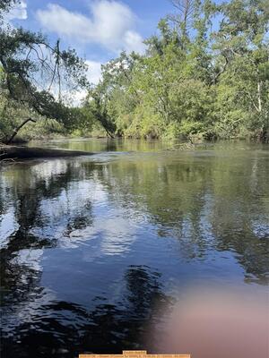
CATEGORIES: Deadfall
LAYER: Point of Interest
OWNERSHIP: Public
WATER BODY: Alapaha River
Lowest boatable: 213.97
Highest safe: 213.97
GAUGE: Alapaha
MILE: 84.60
ADDRESS: A third of a mile downstream from Lanier EMA Marker 19. Lanier County.
DESCRIPTION: Several trees across the river. Discovered by Shawn O’Connor 2026-07-06.
WEBSITE: https://wwals.net/pictures/2026-07-06–berrien-lakeland-alapaha-river
UPSTREAM: 4.74 miles from Double Deadfall to Berrien Beach Boat Ramp
DOWNSTREAM: 12.03 miles from Double Deadfall to Lakeland Boat Ramp
PHOTO: https://www.wwals.net/pictures/2026-07-06–berrien-lakeland-alapaha-river/IMG_6545.jpg
PHOTOSET: https://www.wwals.net/pictures/2026-07-06–berrien-lakeland-alapaha-river/
PHOTO SOURCE: Shawn O’Connor
PHONE NUMBER: (850) 290-2350
Suggestions: https://forms.gle/DipPgU2TP5atc2Rf9
Cross Creek
CATEGORIES: Tributary
LAYER: Other
GPS: 31.123131, -83.05761
OWNERSHIP: Private
WATER BODY: Alapaha River
MILE: 83.69
ADDRESS: Spells Road, Lakeland, GA 31635, Lanier County.
DESCRIPTION: This Tributary is located on river right of the Alapaha River.
UPSTREAM: 5.65 miles from Cross Creek to Berrien Beach Boat Ramp
DOWNSTREAM: 11.12 miles from Cross Creek to Lakeland Boat Ramp
Suggestions: https://forms.gle/DipPgU2TP5atc2Rf9
Cross Creek Deadfall
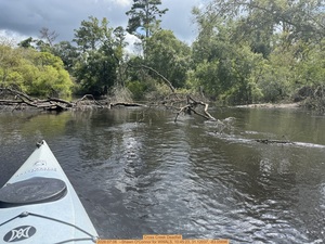
CATEGORIES: Deadfall
LAYER: Point of Interest
GPS: 31.12037, -83.05696
OWNERSHIP: Public
WATER BODY: Alapaha River
Lowest boatable: 213.96
Highest safe: 213.96
GAUGE: Alapaha
MILE: 83.39
ADDRESS: 0.3 miles downstream from Cross Creek. Lanier County.
DESCRIPTION: Tree down across the river, right bank to left. Discovered by Shawn O’Connor 2026-07-06.
WEBSITE: https://wwals.net/pictures/2026-07-06–berrien-lakeland-alapaha-river
UPSTREAM: 5.95 miles from Cross Creek Deadfall to Berrien Beach Boat Ramp
DOWNSTREAM: 10.82 miles from Cross Creek Deadfall to Lakeland Boat Ramp
PHOTO: https://www.wwals.net/pictures/2026-07-06–berrien-lakeland-alapaha-river/IMG_6547.jpg
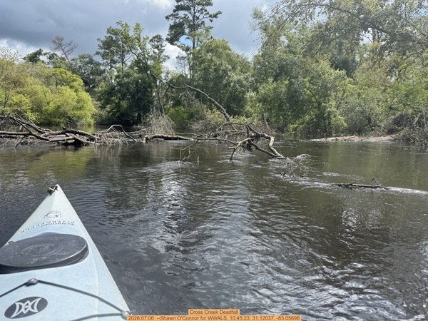
PHOTOSET: https://www.wwals.net/pictures/2026-07-06–berrien-lakeland-alapaha-river/
PHOTO SOURCE: Shawn O’Connor
PHONE NUMBER: (850) 290-2350
Suggestions: https://forms.gle/DipPgU2TP5atc2Rf9
03110202006772 Creek
CATEGORIES: Tributary
LAYER: Point of Interest
OWNERSHIP: Private
WATER BODY: Alapaha River
MILE: 83.01
ADDRESS: Lanier County.
DESCRIPTION: This Tributary is located on river right of the Alapaha River.
UPSTREAM: 6.33 miles from 03110202006772 Creek to Berrien Beach Boat Ramp
DOWNSTREAM: 10.44 miles from 03110202006772 Creek to Lakeland Boat Ramp
Suggestions: https://forms.gle/DipPgU2TP5atc2Rf9
Osceola Deadfall
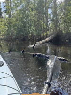
CATEGORIES: Deadfall
LAYER: Point of Interest
GPS: 31.11185, -83.05808
OWNERSHIP: Public
WATER BODY: Alapaha River
Lowest boatable: 213.95
Highest safe: 213.95
GAUGE: Alapaha
MILE: 82.70
ADDRESS: Slightly upstream from Lanier EMA Marker 18, Lanier County.
DESCRIPTION: Big pine across river, left bank to right. Discovered by Shawn O’Connor 2026-07-06.
WEBSITE: https://wwals.net/pictures/2026-07-06–berrien-lakeland-alapaha-river
UPSTREAM: 6.64 miles from Osceola Deadfall to Berrien Beach Boat Ramp
DOWNSTREAM: 10.13 miles from Osceola Deadfall to Lakeland Boat Ramp
PHOTO: https://www.wwals.net/pictures/2026-07-06–berrien-lakeland-alapaha-river/IMG_6549.jpg
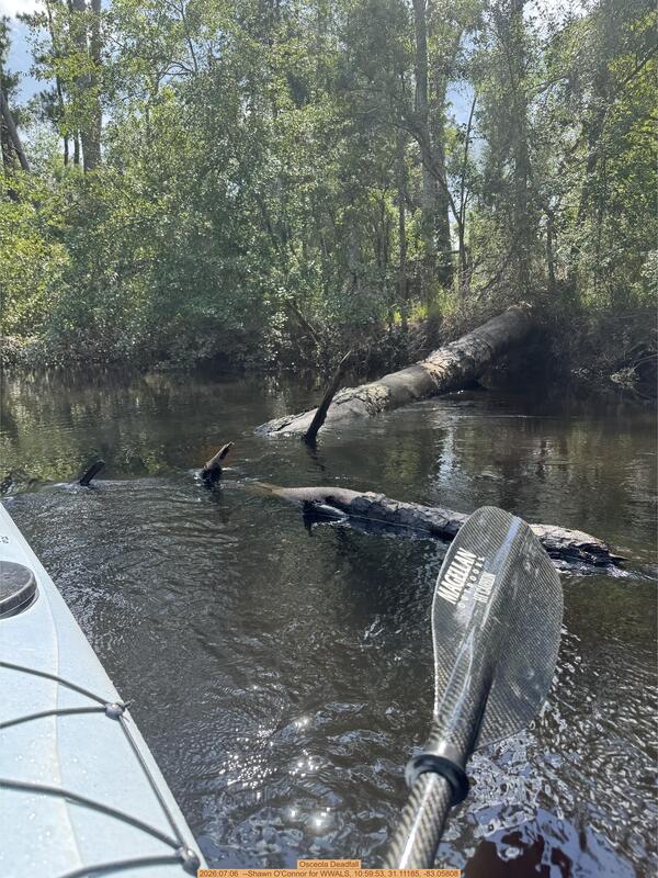
PHOTOSET: https://www.wwals.net/pictures/2026-07-06–berrien-lakeland-alapaha-river/
PHOTO SOURCE: Shawn O’Connor
PHONE NUMBER: (850) 290-2350
Suggestions: https://forms.gle/DipPgU2TP5atc2Rf9
Lanier EMA marker 18
CATEGORIES: Emamarker
LAYER: Point of Interest
OWNERSHIP: Public
WATER BODY: Alapaha River
MILE: 82.56
ADDRESS: Right bank. Lanier County.
DESCRIPTION: Signpost with Lanier EMA emergency number, 229-482-5070. Lanier County computes 36.746 miles upstream from Echols County; WWALS estimates 34.88 from Echols County.
UPSTREAM: 6.78 miles from Lanier EMA marker 18 to Berrien Beach Boat Ramp
DOWNSTREAM: 9.99 miles from Lanier EMA marker 18 to Lakeland Boat Ramp
Suggestions: https://forms.gle/DipPgU2TP5atc2Rf9
03110202006783 Creek
CATEGORIES: Tributary
LAYER: Point of Interest
OWNERSHIP: Private
WATER BODY: Alapaha River
MILE: 82.38
ADDRESS: Lanier County.
DESCRIPTION: This Tributary is located on river left of the Alapaha River.
UPSTREAM: 6.96 miles from 03110202006783 Creek to Berrien Beach Boat Ramp
DOWNSTREAM: 9.81 miles from 03110202006783 Creek to Lakeland Boat Ramp
Suggestions: https://forms.gle/DipPgU2TP5atc2Rf9
Lanier EMA marker 17
CATEGORIES: Emamarker
LAYER: Point of Interest
OWNERSHIP: Public
WATER BODY: Alapaha River
MILE: 81.73
ADDRESS: Left bank. Lanier County.
DESCRIPTION: Signpost with Lanier EMA emergency number, 229-482-5070. Lanier County computes 35.836 miles upstream from Echols County; WWALS estimates 34.05 from Echols County.
UPSTREAM: 7.61 miles from Lanier EMA marker 17 to Berrien Beach Boat Ramp
DOWNSTREAM: 9.16 miles from Lanier EMA marker 17 to Lakeland Boat Ramp
Suggestions: https://forms.gle/DipPgU2TP5atc2Rf9
03110202006787 Creek
CATEGORIES: Tributary
LAYER: Point of Interest
OWNERSHIP: Private
WATER BODY: Alapaha River
MILE: 81.66
ADDRESS: Lanier County.
DESCRIPTION: This Tributary is located on river left of the Alapaha River.
UPSTREAM: 7.68 miles from 03110202006787 Creek to Berrien Beach Boat Ramp
DOWNSTREAM: 9.09 miles from 03110202006787 Creek to Lakeland Boat Ramp
Suggestions: https://forms.gle/DipPgU2TP5atc2Rf9
Marshall Deadfall

CATEGORIES: Deadfall
LAYER: Point of Interest
OWNERSHIP: Public
WATER BODY: Alapaha River
MILE: 81.15
ADDRESS: About 800 feet downstream of a trail off of Plum Drive, Lanier County, GA. 8 1/2 miles upstream from Lakeland Boat Ramp. 8.15 miles downstream from Berrien Beach Boat Ramp. Lanier County.
DESCRIPTION: Dead pine tree completely across the Alapaha River, discovered by Robert Marshall in April 2018.
WEBSITE: https://wwals.net/2018/04/19/deadfall-alapaha-river-between-berrien-beach-and-lakeland-2018-04-15/
UPSTREAM: 8.19 miles from Marshall Deadfall to Berrien Beach Boat Ramp
DOWNSTREAM: 8.58 miles from Marshall Deadfall to Lakeland Boat Ramp
PHOTO: https://wwals.net/wp-content/themes/pianoblack/img//2018/04/7b7b19d5b6fc2915a58688997efb3244.jpg
PHOTOSET: https://wwals.net/2018/04/19/deadfall-alapaha-river-between-berrien-beach-and-lakeland-2018-04-15/
PHOTO SOURCE: Robert Marshall
PHONE NUMBER: (850) 290-2350
Suggestions: https://forms.gle/DipPgU2TP5atc2Rf9
FAS Deadfall
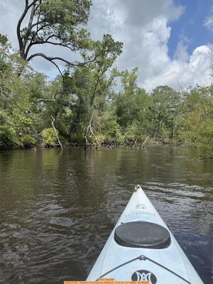
CATEGORIES: Deadfall
LAYER: Point of Interest
GPS: 31.1008, -83.06063
OWNERSHIP: Public
WATER BODY: Alapaha River
Lowest boatable: 213.93
Highest safe: 213.93
GAUGE: Alapaha
MILE: 80.94
ADDRESS: Downstream from Marshall Deadfall, Lanier County.
DESCRIPTION: Dead pine across river. Discovered by Shawn O’Connor 2026-07-06.
WEBSITE: https://wwals.net/pictures/2026-07-06–berrien-lakeland-alapaha-river
UPSTREAM: 8.40 miles from FAS Deadfall to Berrien Beach Boat Ramp
DOWNSTREAM: 8.37 miles from FAS Deadfall to Lakeland Boat Ramp
PHOTO: https://www.wwals.net/pictures/2026-07-06–berrien-lakeland-alapaha-river/IMG_6551.jpg
PHOTOSET: https://www.wwals.net/pictures/2026-07-06–berrien-lakeland-alapaha-river/
PHOTO SOURCE: Shawn O’Connor
PHONE NUMBER: (850) 290-2350
Suggestions: https://forms.gle/DipPgU2TP5atc2Rf9
TD Deadfall
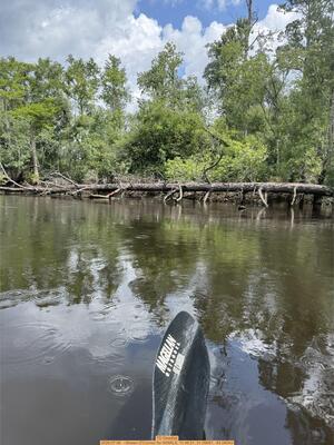
CATEGORIES: Deadfall
LAYER: Point of Interest
GPS: 31.09957, -83.06043
OWNERSHIP: Public
WATER BODY: Alapaha River
Lowest boatable: 213.93
Highest safe: 213.93
GAUGE: Alapaha
MILE: 80.56
ADDRESS: Between Marshall Deadfall and Lanier EMA marker 16, Lanier County.
DESCRIPTION: Dead pine across the river. Discovered by Shawn O’Connor 2026-07-06.
WEBSITE: https://wwals.net/pictures/2026-07-06–berrien-lakeland-alapaha-river
UPSTREAM: 8.78 miles from TD Deadfall to Berrien Beach Boat Ramp
DOWNSTREAM: 7.99 miles from TD Deadfall to Lakeland Boat Ramp
PHOTO: https://www.wwals.net/pictures/2026-07-06–berrien-lakeland-alapaha-river/IMG_6553.jpg
PHOTOSET: https://www.wwals.net/pictures/2026-07-06–berrien-lakeland-alapaha-river/
PHOTO SOURCE: Shawn O’Connor
PHONE NUMBER: (850) 290-2350
Suggestions: https://forms.gle/DipPgU2TP5atc2Rf9
Lanier EMA marker 16
CATEGORIES: Emamarker
LAYER: Point of Interest
OWNERSHIP: Public
WATER BODY: Alapaha River
MILE: 80.09
ADDRESS: Left bank. Lanier County.
DESCRIPTION: Signpost with Lanier EMA emergency number, 229-482-5070. Lanier County computes 34.036 miles upstream from Echols County; WWALS estimates 32.41 from Echols County.
UPSTREAM: 9.25 miles from Lanier EMA marker 16 to Berrien Beach Boat Ramp
DOWNSTREAM: 7.52 miles from Lanier EMA marker 16 to Lakeland Boat Ramp
Suggestions: https://forms.gle/DipPgU2TP5atc2Rf9
03110202000602 Creek
CATEGORIES: Tributary
LAYER: Point of Interest
OWNERSHIP: Private
WATER BODY: Alapaha River
MILE: 79.62
ADDRESS: Lanier County.
DESCRIPTION: This Tributary is located on river left of the Alapaha River.
UPSTREAM: 9.72 miles from 03110202000602 Creek to Berrien Beach Boat Ramp
DOWNSTREAM: 7.05 miles from 03110202000602 Creek to Lakeland Boat Ramp
Suggestions: https://forms.gle/DipPgU2TP5atc2Rf9
Sandy Ben beaches

CATEGORIES: Point Of Interest
LAYER: Point of Interest
OWNERSHIP: Private
WATER BODY: Alapaha River
MILE: 79.27
ADDRESS: Lanier County.
DESCRIPTION: These sandy beaches are a good lunch stop between Berrien Beach Boat Ramp and Lakeland Boat Ramp.
UPSTREAM: 10.07 miles from Sandy Ben beaches to Berrien Beach Boat Ramp
DOWNSTREAM: 6.70 miles from Sandy Ben beaches to Lakeland Boat Ramp
PHOTO: https://wwals.net/wp-content/themes/pianoblack/img//2017/02/1f59f4a6d4ee8f4501e667f91a85a220.jpg
PHOTO SOURCE: Gretchen Quarterman
PHONE NUMBER: (850) 290-2350
Suggestions: https://forms.gle/DipPgU2TP5atc2Rf9
Lanier EMA Marker 15
CATEGORIES: Emamarker
LAYER: Point of Interest
OWNERSHIP: Public
WATER BODY: Alapaha River
MILE: 78.11
ADDRESS: Left bank. Lanier County.
DESCRIPTION: Signpost with Lanier EMA emergency number, 229-482-5070. Lanier County computes 31.9 miles upstream from Echols County; WWALS estimates 30.34 from Echols County.
UPSTREAM: 11.23 miles from Lanier EMA Marker 15 to Berrien Beach Boat Ramp
DOWNSTREAM: 5.54 miles from Lanier EMA Marker 15 to Lakeland Boat Ramp
Suggestions: https://forms.gle/DipPgU2TP5atc2Rf9
03110202001825 Creek
CATEGORIES: Tributary
LAYER: Point of Interest
OWNERSHIP: Private
WATER BODY: Alapaha River
MILE: 77.94
ADDRESS: Lanier County.
DESCRIPTION: This Tributary is located on river right of the Alapaha River.
UPSTREAM: 11.4 miles from 03110202001825 Creek to Berrien Beach Boat Ramp
DOWNSTREAM: 5.37 miles from 03110202001825 Creek to Lakeland Boat Ramp
Suggestions: https://forms.gle/DipPgU2TP5atc2Rf9
Lanier EMA Marker 14
CATEGORIES: Emamarker
LAYER: Point of Interest
OWNERSHIP: Public, SWINDLE PROPERTIES FM LP, PARCEL 029 0004
WATER BODY: Alapaha River
MILE: 76.95
ADDRESS: Left bank. Lanier County.
DESCRIPTION: Signpost with Lanier EMA emergency number, 229-482-5070. Lanier County computes 30.57 miles upstream from Echols County; WWALS estimates 29.27 from Echols County.
UPSTREAM: 12.39 miles from Lanier EMA Marker 14 to Berrien Beach Boat Ramp
DOWNSTREAM: 4.38 miles from Lanier EMA Marker 14 to Lakeland Boat Ramp
Suggestions: https://forms.gle/DipPgU2TP5atc2Rf9
Swindle Deadfall
CATEGORIES: Deadfall
LAYER: Point of Interest
OWNERSHIP: Public
WATER BODY: Alapaha River
MILE: 76.84
ADDRESS: 4.07 miles upstream from Lakeland Boat Ramp and 23.7 miles downstream from Berrien Beach Boat Ramp. West of Richardson Road. Lanier County.
DESCRIPTION: A massive log jam at a cutthrough. May be possible to squeeze through.
HISTORIC FACTS: Reported by Shawn O’Connor, January 10, 2023 https://www.facebook.com/groups/706910156142747/posts/2364898620343884/
UPSTREAM: 12.5 miles from Swindle Deadfall to Berrien Beach Boat Ramp
DOWNSTREAM: 4.27 miles from Swindle Deadfall to Lakeland Boat Ramp
Suggestions: https://forms.gle/DipPgU2TP5atc2Rf9
Ben Neck
CATEGORIES: Point Of Interest
LAYER: Point of Interest
OWNERSHIP: Private
WATER BODY: Alapaha River
MILE: 76.22
ADDRESS: Lanier County.
DESCRIPTION: Can paddle through neck of peninsula at high water; it’s on the right bank.
UPSTREAM: 13.12 miles from Ben Neck to Berrien Beach Boat Ramp
DOWNSTREAM: 3.65 miles from Ben Neck to Lakeland Boat Ramp
Suggestions: https://forms.gle/DipPgU2TP5atc2Rf9
Ben Creek
CATEGORIES: Tributary
LAYER: Other
OWNERSHIP: Private
WATER BODY: Alapaha River
MILE: 73.78
ADDRESS: Old River Road, Lakeland, GA 31635, Lanier County.
DESCRIPTION: This Tributary is located on river left of the Alapaha River.
UPSTREAM: 15.56 miles from Ben Creek to Berrien Beach Boat Ramp
DOWNSTREAM: 1.21 miles from Ben Creek to Lakeland Boat Ramp
Suggestions: https://forms.gle/DipPgU2TP5atc2Rf9
Lanier EMA Marker 13
CATEGORIES: Emamarker
LAYER: Point of Interest
GPS: 31.05966, -83.040517
OWNERSHIP: Public
WATER BODY: Alapaha River
MILE: 73.69
ADDRESS: Left bank. Lanier County.
DESCRIPTION: Signpost with Lanier EMA emergency number, 229-482-5070. Lanier County computes 27.26 miles upstream from Echols County; WWALS estimates 26.01 from Echols County.
UPSTREAM: 15.65 miles from Lanier EMA Marker 13 to Berrien Beach Boat Ramp
DOWNSTREAM: 1.12 miles from Lanier EMA Marker 13 to Lakeland Boat Ramp
Suggestions: https://forms.gle/DipPgU2TP5atc2Rf9
Shaw Creek
CATEGORIES: Tributary
LAYER: Point of Interest
OWNERSHIP: Private
WATER BODY: Alapaha River
MILE: 73.29
ADDRESS: Lanier County.
DESCRIPTION: This Tributary is located on river left of the Alapaha River.
AKA: USGS 03110202000600
UPSTREAM: 16.05 miles from Shaw Creek to Berrien Beach Boat Ramp
DOWNSTREAM: 0.72 mile from Shaw Creek to Lakeland Boat Ramp
Suggestions: https://forms.gle/DipPgU2TP5atc2Rf9
WWRR Deadfall
CATEGORIES: Deadfall
LAYER: Point of Interest
GPS: 31.054, -83.03955
OWNERSHIP: Public, JQJK LLC & JLA FAMILY LLC, PARCEL 029 0005
WATER BODY: Alapaha River
MILE: 73.29
ADDRESS: About 50 feet upstream from the Waycross and Western RR Bridge, at Shaw Creek, Lanier County.
DESCRIPTION: Deadfall from right (west) bank in river. Usually possible to go around it.
HISTORIC FACTS: Reported by Shirley Kokidko and Shawn O’Connor, January 10, 2023, https://www.facebook.com/groups/706910156142747/posts/2364898620343884/
UPSTREAM: 16.05 miles from WWRR Deadfall to Berrien Beach Boat Ramp
DOWNSTREAM: 0.72 mile from WWRR Deadfall to Lakeland Boat Ramp
Suggestions: https://forms.gle/DipPgU2TP5atc2Rf9
Waycross and Western RR Bridge
CATEGORIES: Railbridgesite
LAYER: Bridge
OWNERSHIP: Public
WATER BODY: Alapaha River
MILE: 73.28
ADDRESS: Off Old River Road, south of Shaw Road, north of Lakeland. Lanier County.
DESCRIPTION: Incorporated 1912, closed 1925.
WEBSITE: https://railga.com/waywst.html
UPSTREAM: 16.06 miles from Waycross and Western RR Bridge to Berrien Beach Boat Ramp
DOWNSTREAM: 0.71 mile from Waycross and Western RR Bridge to Lakeland Boat Ramp
Suggestions: https://forms.gle/DipPgU2TP5atc2Rf9
Lanier County Dump

CATEGORIES: Point Of Interest
LAYER: Point of Interest
GPS: 31.05339, -83.069442
OWNERSHIP: Public
WATER BODY: Alapaha River
ADDRESS: 907 N Brantley St, Lakeland, GA 31635, north of Lakeland on GA 135, just north of W. Linda St. and Georgia Forestry Commission. Lanier County.
DESCRIPTION: Where to take trash from river cleanups in Lanier County.
WEBSITE: https://wwals.net/2020/09/13/pictures-berrien-beach-boat-ramp-cleanup-2020-09-12/
PHOTO: https://wwals.net/pictures/2020-09-12–berrien-beach-cleanup-pictures/20200912_120829.jpg
PHOTOSET: https://wwals.net/2020/09/13/pictures-berrien-beach-boat-ramp-cleanup-2020-09-12/
PHOTO SOURCE: John S. Quarterman
PHONE NUMBER: (850) 290-2350
Suggestions: https://forms.gle/DipPgU2TP5atc2Rf9
Edith C. Fulgham Memorial Bridge

CATEGORIES: Bridge
LAYER: Bridge
OWNERSHIP: Public
WATER BODY: Big Creek
MILE: 2.11
ADDRESS: N Brantley St., Lakeland, GA 31635, north of N 6th St, south of E Linda St. Lanier County.
DESCRIPTION: 319.9 foot cast-in-place concrete deck on concrete t-beam bridge built in 1993.
HISTORIC FACTS: Bridge built in 1993. GA HR 671 introduced 2009 with no votes reads in part: “”WHEREAS, Edith C. Fulgham was a retired nutritionist with the Lanier County School System; and WHEREAS, she cared for her own children as well as all of the school children in Lanier County; and WHEREAS, she was beloved by everyone that had the opportunity to spend time with her; and WHEREAS, it is only fitting and proper that a lasting memorial to this fine lady be established in Lanier County. NOW, THEREFORE, BE IT RESOLVED BY THE GENERAL ASSEMBLY OF GEORGIA that the bridge on SR 135 over Big Creek in Lanier County be dedicated as the Edith C. Fulgham Memorial Bridge.””
WEBSITE: https://bridgereports.com/1099094
OTHER REFERENCE: https://maps.app.goo.gl/xK2gdGM1WvFSkGDE9
ADDITIONAL INFO SOURCES: https://legiscan.com/GA/text/HR671/id/401447
PHOTO: https://wwals.net/pictures/2019-10-12–wwals-alapaha-cleanup-lakeland/20191012_121242.jpg
PHOTOSET: https://wwals.net/2019/10/13/pictures-cleanup-alapaha-river-lakeland-and-paffords-landing/
PHOTO SOURCE: John S. Quarterman
PHONE NUMBER: (850) 290-2350
Suggestions: https://forms.gle/DipPgU2TP5atc2Rf9
Mill Creek 00318185
CATEGORIES: Tributary
LAYER: Point of Interest
OWNERSHIP: Public
WATER BODY: Big Creek
MILE: 1.95
ADDRESS: South of N Brantley St., east of N 6th St., west of E Linda St., Lakeland, GA 31635, Lanier County.
DESCRIPTION: Originating at the Banks Lake spillway, this creek flows through Lake Irma in the middle of Lakeland, and on into Big Creek 00311363.
AKA: Mill Creek Lakeland
GRN: Yes
Suggestions: https://forms.gle/DipPgU2TP5atc2Rf9
Lakeland WPCP

CATEGORIES: Wtp
LAYER: Brochure
OWNERSHIP: Public, City of Lakeland, PARCEL 030 0004
WATER BODY: Big Creek
MILE: 1.91
ADDRESS: South Linda Street and Brantley Street @ N Sixth Street, Lakeland, GA 31635, Lanier County.
DESCRIPTION: The Lakeland Water Pollution Control Plant, at the junction of Mill Creek and Big Creek, has no publicly-recorded spills since at least 2015. NPDES Permit No. GA0021296.
GRN: Yes
WEBSITE: https://wwals.net/pictures/2018-08-30–permits/lakeland/
PHOTO: https://wwals.net/pictures/2018-08-30–permits/lakeland/application/Lakeland-Map-0001.jpg
PHOTOSET: https://wwals.net/pictures/2018-08-30–permits/lakeland/
PHOTO SOURCE: GA-EPD via WWALS
PHONE NUMBER: (850) 290-2350
Suggestions: https://forms.gle/DipPgU2TP5atc2Rf9
Outfall of Lakeland WPCP
CATEGORIES: Wtp
LAYER: Other
GPS: 31.04622, -83.06464
OWNERSHIP: Public, City of Lakeland, PARCEL 030 0004
WATER BODY: Big Creek
MILE: 1.71
ADDRESS: Between Linda Street and E. Main Street on Big Creek. Lanier County.
DESCRIPTION: Outfall of the Lakeland Water Pollution Control Plant into Big Creek.
WEBSITE: https://wwals.net/pictures/2018-08-30–permits/lakeland/draft/
PHOTO SOURCE: GA-EPD via WWALS
Suggestions: https://forms.gle/DipPgU2TP5atc2Rf9
Mill Creek GA 135 Bridge
CATEGORIES: Bridge
LAYER: Bridge
OWNERSHIP: Public
WATER BODY: Mill Creek (Lanier)
ADDRESS: N Brantley St., Lakeland, GA 31635, north of N 6th St, south of Fulgham Big Creek Bridge and E Linda St. Lanier County.
DESCRIPTION: Appears to be a box culvert.
WEBSITE: https://maps.app.goo.gl/yGovgsFKhgqYCBe49
Suggestions: https://forms.gle/DipPgU2TP5atc2Rf9
Lake Irma

CATEGORIES: Lake
LAYER: Other
OWNERSHIP: Public, ? PARCEL None
ACCESS: Yes, Launch: Grassy banks, PARKING: Free, PICNIC AREA
WATER BODY: Mill Creek 00318185
ADDRESS: W. North Lakeshore Drive, Lakeland, GA 31635, Lanier County.
DESCRIPTION: Millpond in the middle of Lakeland, GA, on Mill Creek. Historic mill pond
HISTORIC FACTS: “”Tifton Gazette, July 3, 1914, Big Day at Milltown: Milltown, Ga., June 23. — … The boat races will take place on Lake Irma, an artificial body of water right in the center of town, covering about 12 acres. On the bank of this beautiful lake is a skating rink, where a contest in fancy skating will occur.””
WEBSITE: https://wwals.net/maps/alapaha-water-trail/sites/lake-irma/
OTHER REFERENCE: https://raycityhistory.wordpress.com/2015/07/04/4th-of-july-1919-a-big-day-at-milltown/
PHOTOSET: http://commons.wikimedia.org/wiki/File:Lake_Irma, _Lakeland_08.JPG
PHOTO SOURCE: Michael Rivera
PHONE NUMBER: (850) 290-2350
Suggestions: https://forms.gle/DipPgU2TP5atc2Rf9
Robert Simpson Nature Trail 

CATEGORIES: Hiking Trail
LAYER: Hiking Trail
OWNERSHIP: Public, City of Lakeland, PARCEL 030 0001
ACCESS: Yes, PARKING: Free, PICNIC AREA
WATER BODY: Mill Creek 00318185
ADDRESS: 283-299 N Temple St, Lakeland, GA 31635, Lanier County.
DESCRIPTION: Pine, cypress, grape and smilax vines, starting at the Lake Irma dam on Mill Creek in Lakeland, GA.
WEBSITE: https://www.lakelandchamber.org/parks–trails.html
PHOTOSET: https://www.lakelandchamber.org/parks–trails.html
PHOTO SOURCE: Lakeland-Lanier Chamber of Commerce
Photoset2: https://commons.wikimedia.org/wiki/File:Robert_Simpson_Nature_Trail_09.JPG
PHOTO2 SOURCE: Michael Rivera, Creative Commons Attribution-Share Alike 3.0 Unported license.
Suggestions: https://forms.gle/DipPgU2TP5atc2Rf9

GA 122 Big Creek Bridge
CATEGORIES: Bridge
LAYER: Bridge
GPS: 31.04311, -83.06238
OWNERSHIP: Public
WATER BODY: Big Creek
MILE: 1.42
ADDRESS: Between 8th Street and E Pete Jones Street, Lakeland, GA 31635, Lanier County.
DESCRIPTION: 400-foot cast-in-place concrete deck on concrete t-beam bridge built in 1990.
HISTORIC FACTS: Built in 1990.
AKA: GA 37 Big Creek Bridge, GA 31 Big Creek Bridge, GA 1 Big Creek Bridge, or US 221 Big Creek Bridge.
WEBSITE: https://bridgereports.com/1099091
OTHER REFERENCE: https://maps.app.goo.gl/BpZwrjQxofqQcjPa9
Suggestions: https://forms.gle/DipPgU2TP5atc2Rf9
03110202001827 Creek
CATEGORIES: Tributary
LAYER: Point of Interest
OWNERSHIP: Private
WATER BODY: Alapaha River
MILE: 72.71
ADDRESS: Right bank, a tenth of a mile upstream from the GA 122 Bridge. Lanier County.
DESCRIPTION: Hard to spot, on the right bank.
UPSTREAM: 16.63 miles from 03110202001827 Creek to Berrien Beach Boat Ramp
DOWNSTREAM: 0.14 mile from 03110202001827 Creek to Lakeland Boat Ramp
Suggestions: https://forms.gle/DipPgU2TP5atc2Rf9
Capt. Henry Will Jones Bridge

CATEGORIES: Bridge
LAYER: Bridge
OWNERSHIP: Public
ACCESS: No
WATER BODY: Alapaha River
MILE: 72.61
ADDRESS: GA 122, GA 37, US 221, US 129 east of Lakeland, GA, Lanier County.
DESCRIPTION: Busy U.S. and state highway bridge, on whose right of way is Lakeland Boat Ramp. Two-lane concrete bridge with sidewalks built in 1990.
HISTORIC FACTS: “”WHEREAS, Captain Henry Will Jones of Lanier County was killed in action on October 18, 1944, while serving as a commanding officer of a United States Marine Corps company in the South Pacific during World War II; and he was awarded posthumously the Silver Star Medal by the Secretary of the Navy in recognition of his exemplary valor; and… WHEREAS, he enjoyed nature and had a strong attachment to the region in which he had spent his youth exploring the rivers, forests, and wildlife; and he often expressed his dream of returning to the Alapaha River in his letters home to his family; and …””
WEBSITE: https://wwals.net/2017/11/19/capt-henry-will-jones-bridge-alapaha-river-lakeland-lanier-county-ga/
OTHER REFERENCE: https://maps.app.goo.gl/zrzfFkej4K2Yq6BP7
UPSTREAM: 16.73 miles from Capt. Henry Will Jones Bridge to Berrien Beach Boat Ramp
DOWNSTREAM: 0.04 mile from Capt. Henry Will Jones Bridge to Lakeland Boat Ramp
PHOTO: https://i.ytimg.com/vi/DwgriR9ZqKc/hqdefault.jpg
PHOTOSET: https://wwals.net/2013/03/03/alapaha-and-withlacoochee-rivers-ga-122-18-february-2013/
PHOTO SOURCE: John S. Quarterman
PHONE NUMBER: (229) 242-0102
Suggestions: https://forms.gle/DipPgU2TP5atc2Rf9
Lakeland Boat Ramp @ GA 122

CATEGORIES: Landing
LAYER: Brochure
OWNERSHIP: Public, Highway right of way
ACCESS: Yes, Ramp: Concrete down gravelled access road on state highway right of way. PARKING: Free, HANDICAPPED ACCESSIBLE
WATER BODY: Alapaha River
Lowest boatable: 78.1
Highest safe: 85.1
GAUGE: Statenville
MILE: 72.57
ADDRESS: South side of GA 122 and GA 37, right bank, west side of Alapaha River. Lanier County.
DESCRIPTION: Plenty of swimming, fishing, and sand lunch beaches downstream from here. Scout The Rocks before shooting: the difficulty of those rapids varies widely with water level. In the wildwood in the spring you may see resurrection fern or red Ogeechee limes. GPS at the river: 31.04585, -83.04352.
AKA: Lakeland Bridge, GA 122 Lakeland, GA 122 Alapaha River.
WEBSITE: https://www.lakelandchamber.org/parks–trails.html
ADDITIONAL INFO SOURCES: https://www.theswimguide.org/beachmanager/beaches/view?id=10196
UPSTREAM: 16.77 miles from Lakeland Boat Ramp to Berrien Beach Boat Ramp
DOWNSTREAM: 0.20 mile from Lakeland Boat Ramp to Pafford’s Landing
PHOTO: https://wwals.net/pictures/2020-09-12–wq/20200912_121858.jpg
PHOTOSET: https://wwals.net/pictures/2020-09-12–wq/
PHOTO SOURCE: John S. Quarterman
PHONE NUMBER: (850) 290-2350
PHOTO2: https://wwals.net/pictures/2020-09-26–drafts-metal-signs/Lakeland-Boat-Ramp-ARWT-metal-sign-0001.jpg
PHOTO2 SOURCE: WWALS
Suggestions: https://forms.gle/DipPgU2TP5atc2Rf9

Lakeland Boat Ramp River GPS @ GA 122

CATEGORIES: Point Of Interest
LAYER: Point of Interest
GPS: 31.04585, -83.04352
OWNERSHIP: Public, Highway right of way
ACCESS: Yes, Ramp: Concrete down gravelled access road on state highway right of way. PARKING: Free, HANDICAPPED ACCESSIBLE
WATER BODY: Alapaha River
Lowest boatable: 78.1
Highest safe: 85.1
GAUGE: Statenville
MILE: 72.57
ADDRESS: South side of GA 122 and GA 37, right bank, west side of Alapaha River. Lanier County.
DESCRIPTION: Plenty of swimming, fishing, and sand lunch beaches downstream from here. Scout The Rocks before shooting: the difficulty of those rapids varies widely with water level. In the wildwood in the spring you may see resurrection fern or red Ogeechee limes. GPS at the river: 31.04585, -83.04352.
AKA: Lakeland Bridge, GA 122 Lakeland, GA 122 Alapaha River.
WEBSITE: https://www.lakelandchamber.org/parks–trails.html
ADDITIONAL INFO SOURCES: https://www.theswimguide.org/beachmanager/beaches/view?id=10196
PHOTO: https://wwals.net/wp-content/themes/pianoblack/img/2017/02/dfd6aaa6f5302f3e88c24866b2fe2c4a.jpg
PHOTO SOURCE: John S. Quarterman
PHONE NUMBER: (850) 290-2350
PHOTO2: https://wwals.net/pictures/2020-09-26–drafts-metal-signs/Lakeland-Boat-Ramp-ARWT-metal-sign-0001.jpg
PHOTO2 SOURCE: WWALS
Suggestions: https://forms.gle/DipPgU2TP5atc2Rf9
Pafford’s Landing

CATEGORIES: Landing Private
LAYER: Brochure
OWNERSHIP: Private, Lanier Parks, Inc. A GA nonprofit corp. with J. Wendell Goodbee as CEO and CFO and Nell P. Roquemore as Secretary. https://cgov.sos.state.ga.us/Account.aspx/ViewEntityData?entityId=882112, PARCEL 030 0038B
ACCESS: Yes, Launch: sand beach down long dirt road. CAMPING, PARKING: Free
WATER BODY: Alapaha River
Lowest boatable: 78.1
Highest safe: 85.1
GAUGE: Statenville
MILE: 72.37
ADDRESS: South side of GA 122 and GA 37, into the woods, right bank, west side of Alapaha River. Lanier County.
DESCRIPTION: Sand beach in privately-owned park open to the public. Scout The Rocks before shooting: the difficulty of those rapids varies widely with water level. In the wildwood in the spring you may see resurrection fern or red Ogeechee limes. Plenty of swimming, fishing, and sand lunch beaches.
AKA: Blue Hole or Paffords Landing.
WEBSITE: https://wwals.net/2017/08/25/paffords-landing-alapaha-river/
UPSTREAM: 0.20 mile from Pafford’s Landing to Lakeland Boat Ramp
DOWNSTREAM: 1.77 miles from Pafford’s Landing to Burnt Church Landing
PHOTO: https://wwals.net/wp-content/themes/pianoblack/img//2017/08/63af980d816cda40380781be5a81ec91.jpg
PHOTOSET: https://wwals.net/2017/08/25/paffords-landing-alapaha-river/
PHOTO SOURCE: John S. Quarterman
PHONE NUMBER: (850) 290-2350
PHOTO2: https://wwals.net/pictures/2020-09-26–drafts-metal-signs/Paffords-Landing-ARWT-metal-sign-0001.jpg
Photoset2: https://wwals.net/pictures/2020-09-26–drafts-metal-signs/Paffords-Landing-ARWT-metal-sign-0001.html
PHOTO2 SOURCE: WWALS
Suggestions: https://forms.gle/DipPgU2TP5atc2Rf9

Lakeland-Waycross Power Line
CATEGORIES: Power Line
LAYER: Point of Interest
OWNERSHIP: Public
WATER BODY: Alapaha River
MILE: 71.96
ADDRESS: Lanier County.
DESCRIPTION: You’re moving along now.
UPSTREAM: 0.41 mile from Lakeland-Waycross Power Line to Pafford’s Landing
DOWNSTREAM: 1.36 miles from Lakeland-Waycross Power Line to Burnt Church Landing
Suggestions: https://forms.gle/DipPgU2TP5atc2Rf9
Dampier Branch
CATEGORIES: Tributary
LAYER: Other
OWNERSHIP: Private
WATER BODY: Alapaha River
MILE: 71.29
ADDRESS: Lanier County.
DESCRIPTION: Left bank. Comes down across CR 74, CR 23, and US 129.
UPSTREAM: 1.08 miles from Dampier Branch to Pafford’s Landing
DOWNSTREAM: 0.69 mile from Dampier Branch to Burnt Church Landing
Suggestions: https://forms.gle/DipPgU2TP5atc2Rf9
Big Creek 00311363
CATEGORIES: Tributary
LAYER: Other
OWNERSHIP: Private
WATER BODY: Alapaha River
MILE: 71.21
ADDRESS: Right bank, about 200 feet downstream of Dampier Branch and the other side of the river. Lanier County.
DESCRIPTION: Comes down from the Lakeland WPCP.
HISTORIC FACTS: Known as Alapacochee Creek on Portion of Lowndes County Area, 1865, GeorgiaInfo, U.S. Coast Survey Map, Southern Georgia and Part of South Carolina, 1865 http://georgiainfo.galileo.usg.edu/histcountymaps/lowndes1865map.htm and on 1883 and 1885 George Cram Railroad and County Map of Georgia. http://georgiainfo.galileo.usg.edu/histcountymaps/lowndes1883map.htm http://georgiainfo.galileo.usg.edu/histcountymaps/lowndes1885bmap.htm
AKA: Alapacochee Creek
OTHER REFERENCE: https://wwals.net/2018/03/16/ockolocoochee-little-river-1889-01-29/
UPSTREAM: 1.16 miles from Big Creek 00311363 to Pafford’s Landing
DOWNSTREAM: 0.61 mile from Big Creek 00311363 to Burnt Church Landing
Suggestions: https://forms.gle/DipPgU2TP5atc2Rf9
Banks Lake Outdoors 


CATEGORIES: Outfitter
LAYER: Other
OWNERSHIP: Public, U.S. Dept. of Interior, PARCEL 022 0023
ACCESS: No, CANOE, FOOD: Store, WATER, Port-A-Potties, PARKING: Free, SHELTER, PICNIC AREA, FISH BAIT, HANDICAPPED ACCESSIBLE
WATER BODY: Banks Lake
MILE: 1.00
ADDRESS: 307 Georgia 122, Lakeland, GA 31635, Lanier County.
DESCRIPTION: This business is operated by the Lanier County Board of Commissioners. It offers canoe, kayak, bass hunter, and Gheenoe rentals. Your live bait needs are covered with minnows, shiners, crickets, pond worms, and red wrigglers. Rents to the public for use on Banks Lake or elsewhere. Located next to Banks Lake Boat Ramp in Banks Lake National Wildlife Refuge.
GRN: Yes
WEBSITE: https://www.facebook.com/bankslakeoutdoors/
OTHER REFERENCE: http://www.fws.gov/uploadedFiles/BL_concession%281%29.pdf
PHOTO SOURCE: Michael Rivera
PHONE NUMBER: (229) 569-0147
Suggestions: https://forms.gle/DipPgU2TP5atc2Rf9
Banks Lake Boat Ramp

CATEGORIES: Landing
LAYER: Brochure
OWNERSHIP: Public, U.S. Dept. of Interior, PARCEL 022 0023
ACCESS: Yes, Ramp: Concrete boat ramp with nearby boardwalks, CANOE, FOOD: Store, WATER, Port-A-Potties, PARKING: Free, PICNIC AREA, FISH BAIT, HANDICAPPED ACCESSIBLE
WATER BODY: Banks Lake
ADDRESS: 307 Georgia 122, Lakeland, GA 31635, Lanier County.
DESCRIPTION: With boat rental next to a supply store, on a popular fishing lake in the Banks Lake National Wildlife Refuge, a stunning ecological, geological and historical treasure just outside of Lakeland, Georgia. WWALS holds monthly Full Moon Paddles to watch the sun set and the moon rise, often with bats, sometimes with ospreys, here in front of Banks Lake Outdoors,, Banks Lake Outdoors rents boats to the public for use on Banks Lake or elsewhere
HISTORIC FACTS: On Halloween 2020, Mike Lusk, Manager of both Banks Lake and Okefenokee National Wildlife Refuges, paddled with almost thirty people on a WWALS Halloween Full Blue Moon Paddle, one in a monthly series of WWALS paddles at Banks Lake Boat Ramp.
WEBSITE: https://wwals.net/maps/alapaha-water-trail/sites/banks-lake/
OTHER REFERENCE: https://www.exploresouthernhistory.com/bankslake.html
ADDITIONAL INFO SOURCES: https://www.exploregeorgia.org/lakeland/outdoors-nature/bird-watching/banks-lake-national-wildlife-refuge
PHOTO: https://wwals.net/pictures/2020-10-31–banks-lake-halloween-blue-moon/many.jpg
PHOTOSET: https://wwals.net/pictures/2020-10-31–banks-lake-halloween-blue-moon/
PHOTO SOURCE: John S. Quarterman
PHONE NUMBER: (229) 242-0102
Suggestions: https://forms.gle/DipPgU2TP5atc2Rf9
Banks Lake
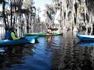
CATEGORIES: Lake
LAYER: Other
OWNERSHIP: Public, U.S. Dept. of Interior, PARCEL 022 0023
ACCESS: Port-A-Potties, PARKING: Free, PICNIC AREA
WATER BODY: Banks Lake
ADDRESS: 307 Georgia Highway 122 west, Lakeland, GA 31635, Lanier County.
DESCRIPTION: A mini-Okefenokee. See Banks Lake Outdoors.
HISTORIC FACTS: “”The earliest settlers marveled at the vast wetland and its swamps of ancient cypress trees. They also recognized the potential of the water as a source of power. Joshua Lee (1782-1855) settled on higher ground overlooking the wetland and in ca. 1830 built a low-level dam across a drainage stream. Water backed up behind the dam and what is now Banks Lake was formed. Lee used the water that poured from his dam as a power source for a grist mill. The water-driven wheel was first used for grinding grain but over time was also adapted to power both a sawmill and a cotton gin.”” https://www.exploresouthernhistory.com/bankslake.html
GRN: No
WEBSITE: https://wwals.net/maps/alapaha-water-trail/sites/banks-lake/
OTHER REFERENCE: https://www.exploresouthernhistory.com/bankslake.html
ADDITIONAL INFO SOURCES: https://www.exploregeorgia.org/lakeland/outdoors-nature/bird-watching/banks-lake-national-wildlife-refuge
PHOTO: https://farm3.staticflickr.com/2880/10879252555_ea7e0103a4_b.jpg
PHOTOSET: https://www.flickr.com/photos/85839940@N03/10879252555/in/photolist-hzn1KV-dZk5Cq
PHOTO SOURCE: John S. Quarterman
PHONE NUMBER: (229) 242-0102
Suggestions: https://forms.gle/DipPgU2TP5atc2Rf9
Banks Lake National Wildlife Refuge

CATEGORIES: Public Land
LAYER: Other
OWNERSHIP: Public, U.S.A. PARCEL Several
ACCESS: Port-A-Potties, PARKING: Free, PICNIC AREA
WATER BODY: Banks Lake
ADDRESS: 307 Georgia Highway 122 west, Lakeland, GA 31635, Lanier County.
DESCRIPTION: Banks Lake National Wildlife Refuge is a stunning ecological, geological and historical treasure just outside of Lakeland, Georgia. See Banks Lake Outdoors.
GRN: Yes
WEBSITE: http://www.fws.gov/refuge/banks_lake/
OTHER REFERENCE: https://www.exploresouthernhistory.com/bankslake.html
ADDITIONAL INFO SOURCES: https://www.exploregeorgia.org/lakeland/outdoors-nature/bird-watching/banks-lake-national-wildlife-refuge
PHOTOSET: https://www.fws.gov/refuge/banks_lake/
PHOTO SOURCE: U.S. Fish & Wildlife Service
PHONE NUMBER: (850) 290-2350
Suggestions: https://forms.gle/DipPgU2TP5atc2Rf9
Banks Lake Nature Trail

CATEGORIES: Hiking Trail
LAYER: Hiking Trail
GPS: 31.034477, -83.09575
OWNERSHIP: Public, U.S. Dept. of Interior, PARCEL 022 0023
ACCESS: Yes, FOOD: Store, WATER, Port-A-Potties, PARKING: Free, SHELTER, PICNIC AREA, FISH BAIT
WATER BODY: Banks Lake
ADDRESS: 307 Georgia Highway 122 west, Lakeland, GA 31635, Lanier County.
DESCRIPTION: At Banks Lake, “”A boardwalk talks visitors from the main entrance area into the lakeside woods and swamps.””
GRN: Yes
WEBSITE: http://www.exploresouthernhistory.com/bankslake.html
OTHER REFERENCE: https://www.exploresouthernhistory.com/bankslake.html
ADDITIONAL INFO SOURCES: https://www.exploregeorgia.org/lakeland/outdoors-nature/bird-watching/banks-lake-national-wildlife-refuge
PHOTO: https://www.exploresouthernhistory.com/sitebuilder/images/IMG_9593-175×118.jpg
PHOTOSET: https://www.exploresouthernhistory.com/bankslake.html
PHOTO SOURCE: Banks Lake NWR
PHONE NUMBER: (229) 569-0147
Suggestions: https://forms.gle/DipPgU2TP5atc2Rf9
Lakeland Solar Energy 

CATEGORIES: Solar
LAYER: Point of Interest
OWNERSHIP: Private, Patten Seed Company, PARCEL 030 0064
WATER BODY: Alapaha River
ADDRESS: 154 E Burnt Church Road, Lakeland, GA 31635, Lanier County.
DESCRIPTION: 2 megawatt solar farm in Lanier County near Burnt Church.
WEBSITE: http://www.l-a-k-e.org/blog/2017/08/lakeland-solar-energy-on-burnt-church-road.html
PHOTOSET: http://www.l-a-k-e.org/blog/2017/08/lakeland-solar-energy-on-burnt-church-road.html
PHOTO SOURCE: John S. Quarterman
PHONE NUMBER: (229) 242-0102
Suggestions: https://forms.gle/DipPgU2TP5atc2Rf9
Burnt Church Landing @ GA 135
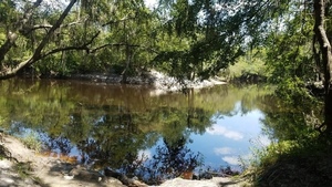
CATEGORIES: Landing
LAYER: Brochure
GPS: 31.024737, -83.04895
OWNERSHIP: Public, Lanier Co. Board of Commissioners, PARCEL 031 0038
ACCESS: Yes, Launch: sand beach below steep riverbank. PARKING: Free
WATER BODY: Alapaha River
Lowest boatable: 78.1
Highest safe: 85.1
GAUGE: Statenville
MILE: 70.60
ADDRESS: 217 Burnt Church Road (GA 135), Lakeland, GA 31635, right bank, west side of river, 3 miles southeast of Lakeland, Lanier County, GA, just north (upstream) of the church. Lanier County.
DESCRIPTION: This Lanier-County-owned landing is the closest public access to The Rocks. The difficulty of those rapids varies widely with water level. In the wildwood in the spring you may see resurrection fern or red Ogeechee limes. Plenty of swimming, fishing, and sand lunch beaches. Public access confirmed by Randy Patten, Berrien County EMA. GPS at the river: 31.024931, -83.048238. The church is Union Primitive Baptist Church, partially burned and rebuilt in the Indian Wars of 1836-1838, since known as Burnt Church.
HISTORIC FACTS: Near historic Burnt Church.
WEBSITE: https://wwals.net/2017/08/22/burnt-church-access-to-alapaha-river-2017-08-18/
ADDITIONAL INFO SOURCES: https://raycityhistory.wordpress.com/2014/02/25/old-union-primitive-baptist-church-also-known-as-burnt-church/
UPSTREAM: 1.77 miles from Burnt Church Landing to Pafford’s Landing
DOWNSTREAM: 12.19 miles from Burnt Church Landing to Hotchkiss Road Landing
PHOTO: https://wwals.net/wp-content/themes/pianoblack/img//2017/08/bd7eed00da0a0ca143b01b5db751f4a9.jpg
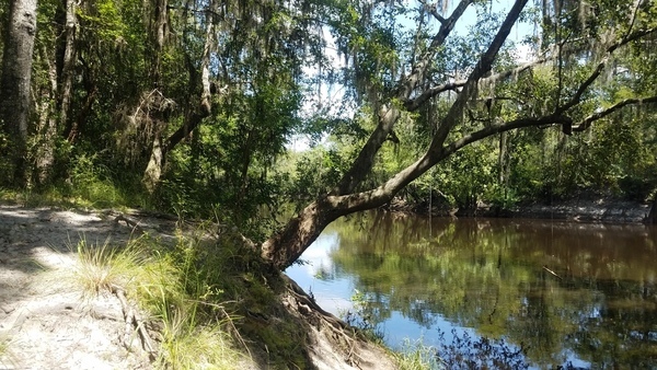
PHOTOSET: https://wwals.net/2017/08/22/burnt-church-access-to-alapaha-river-2017-08-18/
PHOTO SOURCE: John S. Quarterman
PHONE NUMBER: (229) 242-0102
PHOTO2 SOURCE: WWALS
Suggestions: https://forms.gle/DipPgU2TP5atc2Rf9

Burnt Church Landing River GPS @ GA 135
CATEGORIES: Point Of Interest
LAYER: Point of Interest
OWNERSHIP: Public, Lanier Co. Board of Commissioners, PARCEL 031 0038
ACCESS: Yes, Launch: sand beach below steep riverbank. PARKING: Free
WATER BODY: Alapaha River
Lowest boatable: 78.1
Highest safe: 85.1
GAUGE: Statenville
MILE: 70.60
ADDRESS: 217 Burnt Church Road (GA 135), Lakeland, GA 31635, right bank, west side of river, 3 miles southeast of Lakeland, Lanier County, GA, just north (upstream) of the church. Lanier County.
DESCRIPTION: This Lanier-County-owned landing is the closest public access to The Rocks. The difficulty of those rapids varies widely with water level. In the wildwood in the spring you may see resurrection fern or red Ogeechee limes. Plenty of swimming, fishing, and sand lunch beaches. Public access confirmed by Randy Patten, Berrien County EMA. GPS at the river: 31.024931, -83.048238. The church is Union Primitive Baptist Church, partially burned and rebuilt in the Indian Wars of 1836-1838, since known as Burnt Church.
HISTORIC FACTS: Near historic Burnt Church.
WEBSITE: https://wwals.net/2017/08/22/burnt-church-access-to-alapaha-river-2017-08-18/
ADDITIONAL INFO SOURCES: https://raycityhistory.wordpress.com/2014/02/25/old-union-primitive-baptist-church-also-known-as-burnt-church/
PHOTO: https://wwals.net/wp-content/themes/pianoblack/img//2017/08/bd7eed00da0a0ca143b01b5db751f4a9.jpg
PHOTOSET: https://wwals.net/2017/08/22/burnt-church-access-to-alapaha-river-2017-08-18/
PHOTO SOURCE: John S. Quarterman
PHONE NUMBER: (229) 242-0102
PHOTO2 SOURCE: WWALS
Suggestions: https://forms.gle/DipPgU2TP5atc2Rf9
Lanier EMA Marker 12
CATEGORIES: Emamarker
LAYER: Point of Interest
GPS: 31.02487591, -83.04795141
OWNERSHIP: Public
WATER BODY: Alapaha River
MILE: 70.60
ADDRESS: Right bank, just downstream from Burnt Church Landing. Lanier County.
DESCRIPTION: Signpost with Lanier EMA emergency number, 229-482-5070. Lanier County computes 24.01 miles upstream from Echols County; WWALS estimates 22.92 from Echols County.
UPSTREAM: 1.77 miles from Lanier EMA Marker 12 to Pafford’s Landing
DOWNSTREAM: 12.19 miles from Lanier EMA Marker 12 to Hotchkiss Road Landing
Suggestions: https://forms.gle/DipPgU2TP5atc2Rf9
Burnt Church
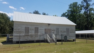
CATEGORIES: Church
LAYER: Point of Interest
GPS: 31.0246, -83.0488
OWNERSHIP: Private
ACCESS: No, PARKING: Free
WATER BODY: Alapaha River
ADDRESS: 217 Burnt Church Road (GA 135), Lakeland, GA 31635, 3 miles southeast of Lakeland, Lanier County, GA. Lanier County.
DESCRIPTION: This is one of the first churches constituted in the area in 1825. It was burned to the ground in 1836 and was since called Burnt Church.
HISTORIC FACTS: First constituted in 1825, “”The church and cemetery were on a trail used by the Creek Indians traveling between the Chattahoochee River and the Okefenokee Swamp. During the Indian Wars, 1836-1838, the church building was partially burned. The fire-damaged timbers were used in the reconstruction [in 1854], and since that time Union Church has also been known as Burnt Church.”” The building was then restored in April, 1998.
AKA: Union Church, Old Union Primitive Baptist Church
GRN: Yes
PHOTO: https://wwals.net/wp-content/themes/pianoblack/img/2017/08/8319da6013fd02aae94745609dd0ff4c.jpg
PHOTOSET: https://wwals.net/2017/08/22/burnt-church-access-to-alapaha-river-2017-08-18/
PHOTO SOURCE: John S. Quarterman
PHONE NUMBER: (229) 242-0102
Suggestions: https://forms.gle/DipPgU2TP5atc2Rf9
Darsey Mill Branch
CATEGORIES: Tributary
LAYER: Other
OWNERSHIP: Private
WATER BODY: Alapaha River
MILE: 69.93
ADDRESS: 2/3 mile downstream from Burnt Church Landing. Off of GA 135 south of Union Church, Lanier County.
DESCRIPTION: Right bank. One of the three outfalls of Banks Lake.
UPSTREAM: 0.67 mile from Darsey Mill Branch to Burnt Church Landing
DOWNSTREAM: 11.52 miles from Darsey Mill Branch to Hotchkiss Road Landing
Suggestions: https://forms.gle/DipPgU2TP5atc2Rf9
Darsey Mill Branch Deadfall
CATEGORIES: Deadfall
LAYER: Point of Interest
OWNERSHIP: Public
WATER BODY: Alapaha River
MILE: 69.92
ADDRESS: Immediately downstream from Darsey Mill Branch and 2/3 mile downstream from Burnt Church Landing. Lanier County.
DESCRIPTION: A deadfall across the river, according to Charles Sparks, 2026-07-15: At least there was when the water was low back in mid April-early May.
UPSTREAM: 0.68 mile from Darsey Mill Branch Deadfall to Burnt Church Landing
DOWNSTREAM: 11.51 miles from Darsey Mill Branch Deadfall to Hotchkiss Road Landing
Suggestions: https://forms.gle/DipPgU2TP5atc2Rf9
Red Bluff undercut bank on left
CATEGORIES: Point Of Interest
LAYER: Point of Interest
OWNERSHIP: Private, RED BLUFF PLANTATION LLC, PARCEL 040 0014
WATER BODY: Alapaha River
MILE: 69.74
ADDRESS: Lanier County.
DESCRIPTION: Just an interesting undercut riverbank bluff on the left.
UPSTREAM: 0.86 mile from Red Bluff undercut bank on left to Burnt Church Landing
DOWNSTREAM: 11.33 miles from Red Bluff undercut bank on left to Hotchkiss Road Landing
Suggestions: https://forms.gle/DipPgU2TP5atc2Rf9
Roquemore North Landing 
CATEGORIES: Landing Private
LAYER: Point of Interest
GPS: 31.0178, -83.03675
OWNERSHIP: Private, BOB’S LANDINGS TREE FARM LLC, PARCEL 041 0005
ACCESS: Launch: riverbank down dirt road.
WATER BODY: Alapaha River
MILE: 68.72
ADDRESS: Right bank. Private entrance off of private road from E. Burnt Church Road. Lanier County.
DESCRIPTION: Private: do not use without permission. Be prepared when you paddle for Hotckiss so you don’t have to call EMA to get rescued here.
UPSTREAM: 1.88 miles from Roquemore North Landing to Burnt Church Landing
DOWNSTREAM: 10.31 miles from Roquemore North Landing to Hotchkiss Road Landing
Suggestions: https://forms.gle/DipPgU2TP5atc2Rf9
Lanier EMA Marker 11
CATEGORIES: Emamarker
LAYER: Point of Interest
OWNERSHIP: Public
WATER BODY: Alapaha River
MILE: 68.72
ADDRESS: Right bank. Lanier County.
DESCRIPTION: Signpost with Lanier EMA emergency number, 229-482-5070. Lanier County computes 21.98 miles upstream from Echols County; WWALS estimates 19.56 from Echols County.
UPSTREAM: 1.88 miles from Lanier EMA Marker 11 to Burnt Church Landing
DOWNSTREAM: 10.31 miles from Lanier EMA Marker 11 to Hotchkiss Road Landing
Suggestions: https://forms.gle/DipPgU2TP5atc2Rf9
Moore Branch
CATEGORIES: Tributary
LAYER: Other
OWNERSHIP: Private
WATER BODY: Alapaha River
MILE: 67.61
ADDRESS: East of Good Hope Road, Naylor, GA 31641, Lanier County.
DESCRIPTION: This Tributary is located on river right of the Alapaha River.
UPSTREAM: 2.99 miles from Moore Branch to Burnt Church Landing
DOWNSTREAM: 9.20 miles from Moore Branch to Hotchkiss Road Landing
Suggestions: https://forms.gle/DipPgU2TP5atc2Rf9
Roquemore South Landing
CATEGORIES: Landing Private
LAYER: Point of Interest
GPS: 31.00955, -83.03075
OWNERSHIP: Private, BOB’S LANDINGS TREE FARM LLC, PARCEL 041 0005
ACCESS: Launch: riverbank down dirt road.
WATER BODY: Alapaha River
MILE: 67.24
ADDRESS: Right bank. Private entrance off of private road from E. Burnt Church Road. Lanier County.
DESCRIPTION: Private: do not use without permission. Be prepared when you paddle for Hotckiss so you don’t have to call EMA to get rescued here.
UPSTREAM: 3.36 miles from Roquemore South Landing to Burnt Church Landing
DOWNSTREAM: 8.83 miles from Roquemore South Landing to Hotchkiss Road Landing
Suggestions: https://forms.gle/DipPgU2TP5atc2Rf9
Lanier EMA Marker 10
CATEGORIES: Emamarker
LAYER: Point of Interest
GPS: 31.00964368, -83.03042728
OWNERSHIP: Public
WATER BODY: Alapaha River
MILE: 67.24
ADDRESS: Right bank. Lanier County.
DESCRIPTION: Signpost with Lanier EMA emergency number, 229-482-5070. Lanier County computes 20.43 miles upstream from Echols County; WWALS estimates 19.56 from Echols County.
UPSTREAM: 3.36 miles from Lanier EMA Marker 10 to Burnt Church Landing
DOWNSTREAM: 8.83 miles from Lanier EMA Marker 10 to Hotchkiss Road Landing
Suggestions: https://forms.gle/DipPgU2TP5atc2Rf9
Sandy lunch spot

CATEGORIES: Point Of Interest
LAYER: Point of Interest
OWNERSHIP: Public
WATER BODY: Alapaha River
MILE: 66.06
ADDRESS: Right bank, a mile and a quarter downstream of Moore Branch. Lanier County.
DESCRIPTION: This sand beach is a good lunch spot between any of Lakeland Boat Ramp, Pafford’s Landing, or Burnt Church Landing and Hotchkiss Road Landing or Naylor Boat Ramp.
UPSTREAM: 4.54 miles from Sandy lunch spot to Burnt Church Landing
DOWNSTREAM: 7.65 miles from Sandy lunch spot to Hotchkiss Road Landing
PHOTO: https://www.wwals.net/pictures/2015-07-11–lakeland-hotchkiss-pictures/IMG_1263.jpg
PHOTOSET: https://www.wwals.net/pictures/2015-07-11–lakeland-hotchkiss-pictures/#LBGQ
PHOTO SOURCE: John S. Quarterman
PHONE NUMBER: (229) 242-0102
Suggestions: https://forms.gle/DipPgU2TP5atc2Rf9
03110202006857 Creek
CATEGORIES: Tributary
LAYER: Point of Interest
OWNERSHIP: Private
WATER BODY: Alapaha River
MILE: 67.06
ADDRESS: Lanier County.
DESCRIPTION: This Tributary is located on river left of the Alapaha River.
UPSTREAM: 3.54 miles from 03110202006857 Creek to Burnt Church Landing
DOWNSTREAM: 8.65 miles from 03110202006857 Creek to Hotchkiss Road Landing
Suggestions: https://forms.gle/DipPgU2TP5atc2Rf9
03110202006862 Creek
CATEGORIES: Tributary
LAYER: Point of Interest
OWNERSHIP: Private
WATER BODY: Alapaha River
MILE: 66.00
ADDRESS: Lanier County.
DESCRIPTION: This Tributary is located on river left of the Alapaha River.
UPSTREAM: 4.60 miles from 03110202006862 Creek to Burnt Church Landing
DOWNSTREAM: 7.59 miles from 03110202006862 Creek to Hotchkiss Road Landing
Suggestions: https://forms.gle/DipPgU2TP5atc2Rf9
03110202006863 Creek
CATEGORIES: Tributary
LAYER: Point of Interest
OWNERSHIP: Private
WATER BODY: Alapaha River
MILE: 65.47
ADDRESS: Lanier County.
DESCRIPTION: This Tributary is located on river right of the Alapaha River.
UPSTREAM: 5.13 miles from 03110202006863 Creek to Burnt Church Landing
DOWNSTREAM: 7.06 miles from 03110202006863 Creek to Hotchkiss Road Landing
Suggestions: https://forms.gle/DipPgU2TP5atc2Rf9
03110202006869 Creek
CATEGORIES: Tributary
LAYER: Point of Interest
OWNERSHIP: Private
WATER BODY: Alapaha River
MILE: 65.35
ADDRESS: Lanier County.
DESCRIPTION: This Tributary is located on river left of the Alapaha River.
UPSTREAM: 5.25 miles from 03110202006869 Creek to Burnt Church Landing
DOWNSTREAM: 6.94 miles from 03110202006869 Creek to Hotchkiss Road Landing
Suggestions: https://forms.gle/DipPgU2TP5atc2Rf9
Lanier EMA Marker 9
CATEGORIES: Emamarker
LAYER: Point of Interest
GPS: 30.996885, -83.02336
OWNERSHIP: Public
WATER BODY: Alapaha River
MILE: 64.82
ADDRESS: Left bank. Lanier County.
DESCRIPTION: Signpost with Lanier EMA emergency number, 229-482-5070. Lanier County computes 17.68 miles upstream from Echols County; WWALS estimates this site from that mileage; WWALS estimates 17.14 from Echols County.
UPSTREAM: 5.78 miles from Lanier EMA Marker 9 to Burnt Church Landing
DOWNSTREAM: 6.41 miles from Lanier EMA Marker 9 to Hotchkiss Road Landing
Suggestions: https://forms.gle/DipPgU2TP5atc2Rf9
03110202006874 Creek
CATEGORIES: Tributary
LAYER: Point of Interest
OWNERSHIP: Private
WATER BODY: Alapaha River
MILE: 64.42
ADDRESS: Lanier County.
DESCRIPTION: This Tributary is located on river left of the Alapaha River.
UPSTREAM: 6.18 miles from 03110202006874 Creek to Burnt Church Landing
DOWNSTREAM: 6.01 miles from 03110202006874 Creek to Hotchkiss Road Landing
Suggestions: https://forms.gle/DipPgU2TP5atc2Rf9
WWALS Watershed Coalition

CATEGORIES: Point Of Interest
LAYER: Other
OWNERSHIP: Private
ADDRESS: PO Box 88, Hahira, GA 31632, Many County.
DESCRIPTION: The Waterkeeper Alliance Affiliate for the Upper Suwannee River watershed, including the Alapaha, Withlacoochee, and Little Rivers.
GRN: No
WEBSITE: https://wwals.net
PHOTOSET: https://wwals.net
PHOTO SOURCE: WWALS Watershed Coalition
PHONE NUMBER: (850) 290-2350
Suggestions: https://forms.gle/DipPgU2TP5atc2Rf9
Lanier EMA Marker 8
CATEGORIES: Emamarker
LAYER: Point of Interest
OWNERSHIP: Public
WATER BODY: Alapaha River
MILE: 64.14
ADDRESS: Right bank. Lanier County.
DESCRIPTION: Signpost with Lanier EMA emergency number, 229-482-5070. Lanier County computes 16.47 miles upstream from Echols County; WWALS estimates this site from that mileage; WWALS estimates 16.46 from Echols County.
UPSTREAM: 6.46 miles from Lanier EMA Marker 8 to Burnt Church Landing
DOWNSTREAM: 5.73 miles from Lanier EMA Marker 8 to Hotchkiss Road Landing
Suggestions: https://forms.gle/DipPgU2TP5atc2Rf9
Triton Island
CATEGORIES: Point Of Interest
LAYER: Point of Interest
OWNERSHIP: Private, TRITON DEVELOPMENT INC, PARCEL 042 0004
WATER BODY: Alapaha River
ADDRESS: Lanier County.
DESCRIPTION: A quarter-acre wooded island in the Alapaha River.
Suggestions: https://forms.gle/DipPgU2TP5atc2Rf9
The Rocks 

CATEGORIES: Shoal
LAYER: Brochure
OWNERSHIP: Public
WHITEWATER CLASS: Class I
WATER BODY: Alapaha River
MILE: 63.49
ADDRESS: Tomlinson Rd, Stockton, GA 31649, Lanier County.
DESCRIPTION: These small shoals between Burnt Church and Hotchkiss Landing are famous locally and appear on Google Maps.
OTHER REFERENCE: https://www.google.com/maps/d/u/0/viewer?mid=1xo8NYUn9oGVnelSxq0W3WR99Jyw&ll=30.988742846187307%2C-83.03135015467362&z=15
UPSTREAM: 7.11 miles from The Rocks to Burnt Church Landing
DOWNSTREAM: 5.08 miles from The Rocks to Hotchkiss Road Landing
PHOTO: https://wwals.net/pictures/2012-03-31–shearer-alapaha/the-rocks.jpg
PHOTOSET: https://wwals.net/pictures/2012-03-31–shearer-alapaha/
PHOTO SOURCE: Diane Shearer
PHONE NUMBER: (850) 290-2350
Suggestions: https://forms.gle/DipPgU2TP5atc2Rf9
03110202001878 Creek
CATEGORIES: Tributary
LAYER: Point of Interest
OWNERSHIP: Private
WATER BODY: Alapaha River
MILE: 63.22
ADDRESS: Lowndes County.
DESCRIPTION: This Tributary is located on river right of the Alapaha River.
UPSTREAM: 7.38 miles from 03110202001878 Creek to Burnt Church Landing
DOWNSTREAM: 4.81 miles from 03110202001878 Creek to Hotchkiss Road Landing
Suggestions: https://forms.gle/DipPgU2TP5atc2Rf9
03110202006868 Creek
CATEGORIES: Tributary
LAYER: Point of Interest
OWNERSHIP: Private
WATER BODY: Alapaha River
MILE: 61.97
ADDRESS: Lowndes County.
DESCRIPTION: This Tributary is located on river right of the Alapaha River.
UPSTREAM: 8.63 miles from 03110202006868 Creek to Burnt Church Landing
DOWNSTREAM: 3.56 miles from 03110202006868 Creek to Hotchkiss Road Landing
Suggestions: https://forms.gle/DipPgU2TP5atc2Rf9
Moody Air Force Base Equipment Rental

CATEGORIES: Outfitter
LAYER: Other
OWNERSHIP: Public
ACCESS: No, CANOE, CAMPING: Camp Rentals Available, WATER, Flush Toilet, PARKING: Free, SHELTER, HANDICAPPED ACCESSIBLE
WATER BODY: Mission Pond
ADDRESS: 4379 George St, Bldg 840, Moody AFB, GA 31699, Lowndes County.
DESCRIPTION: Moody AFB Equipment Rental “”is here to help make your recreation experience an enjoyable one by providing quality equipment and services to meet your needs.”” Services include: Lawn & Garden, Camping Equpiment, Fishing and Boating, RV storage, and sports equipment. Does rent boats and other equipment to the public, but military or veteran ID is required to get on base. “”Our facility is available to active duty members and their dependents 18 years and older with a valid ID card, retirees, reservists, long term contractors and DoD employees. A local address is required when renting equipment.Screen reader support enabled. ”
AKA: Moody Force Support Squadron or Moody FSS.
GRN: Yes
WEBSITE: http://moodyfss.com/equipment-rental/
PHOTO: https://www.flickr.com/photos/187730456@N03/51116063629/sizes/l/
PHOTOSET: http://moodyfss.com/equipment-rental/
PHOTO SOURCE: Moody AFB
PHONE NUMBER: (229) 257-2989
PHOTO2: http://moodyfss.com/wp-content/uploads/2018/08/the-SHOP.jpg
Photoset2: http://moodyfss.com/equipment-rental/
PHOTO2 SOURCE: Moody AFB
Photo2 Phone Number: (229) 257-2989
Suggestions: https://forms.gle/DipPgU2TP5atc2Rf9

Bldg 769 Moody AFB

CATEGORIES: Wtp
LAYER: Other
GPS: 30.96796, -83.2084
OWNERSHIP: Public
WATER BODY: Grand Bay
ADDRESS: Building 769, Vanguard Run, Moody Air Force Base, GA. Lowndes County.
DESCRIPTION: Wastewater lift station for Moody Air Force Base but it includes “”Sanitary, groundwater infiltration, runoff, potable water treatment plant, and vehicle maintenence”” with effects on Mission Lake and Grand Bay in the Alapaha River Basin. NPDES Permit No. GA0020001 has its wastewater plant outfall on Beatty Branch in the Withlacoochee River Basin, but there have also been spills and leaks into the Alapaha River Basin.
HISTORIC FACTS: 2019-08-06: “”No more than 3, 000 gallons spilled into an unnamed tributary that flows to Mission Lake within the boundaries of Moody AFB.”” And from there into Grand Bay, to Grand Bay Creek, the Alapahoochee River, and the Suwannee River. “”The leak originated from a broken pipe departing the lift station. Upon notification, the lift station was immediately turned off, pumping equipment was used to clean up the spill and the area of the broken pipe was then treated with lime to disinfect. Temporary repairs have been made and the station has been placed back in service while materials are on order for a permanent repair with an estimated completion date of Aug. 23, 2019.””
GRN: Yes
WEBSITE: https://wwals.net/2019/08/25/moody-afb-sewage-spill-mission-lake-2019-08-06/
PHOTO: https://wwals.net/pictures/2019-08-06–moody-afb-mission-lake-sewage-spill/Building-769.jpg
PHOTOSET: https://wwals.net/pictures/2019-08-06–moody-afb-mission-lake-sewage-spill/
PHOTO SOURCE: WWALS
PHONE NUMBER: (229) 242-0102
Suggestions: https://forms.gle/DipPgU2TP5atc2Rf9
Knight Creek
CATEGORIES: Tributary
LAYER: Other
GPS: 30.968076, -83.03719
OWNERSHIP: Private
WATER BODY: Alapaha River
MILE: 61.66
ADDRESS: West of CR 124, Stockton, GA 31649, Lanier County.
DESCRIPTION: Right bank. Comes down across US 129.
UPSTREAM: 8.94 miles from Knight Creek to Burnt Church Landing
DOWNSTREAM: 3.25 miles from Knight Creek to Hotchkiss Road Landing
Suggestions: https://forms.gle/DipPgU2TP5atc2Rf9
Dixon Mill Bridge
CATEGORIES: Bridge
LAYER: Bridge
OWNERSHIP: Public
WATER BODY: Dixon Mill Creek
ADDRESS: Good Hope Rd, Naylor, GA 31641, Lanier County.
DESCRIPTION: Public road bridge or culverts.
WEBSITE: https://www.mytopo.com/locations/index.cfm?fid=348095
OTHER REFERENCE: https://maps.app.goo.gl/vqrzUszDcSPvqaSQ7
Suggestions: https://forms.gle/DipPgU2TP5atc2Rf9
Dixon Mill Creek
CATEGORIES: Tributary
LAYER: Other
OWNERSHIP: Private
WATER BODY: Alapaha River
MILE: 60.95
ADDRESS: East of Good Hope Road, Naylor, GA 31641, Lanier County.
DESCRIPTION: Right bank. Evidently there used to be a mill on this creek. Probably it was above the creek bridge over Good Hope Road.
UPSTREAM: 9.65 miles from Dixon Mill Creek to Burnt Church Landing
DOWNSTREAM: 2.54 miles from Dixon Mill Creek to Hotchkiss Road Landing
Suggestions: https://forms.gle/DipPgU2TP5atc2Rf9
Lanier EMA Marker 7
CATEGORIES: Emamarker
LAYER: Point of Interest
OWNERSHIP: Public
WATER BODY: Alapaha River
MILE: 60.35
ADDRESS: Left bank, 0.6 mile downstream from Dixon Mill Creek. Lanier County.
DESCRIPTION: Signpost with Lanier EMA emergency number, 229-482-5070. Lanier County computes 12.74 miles upstream from Echols County; WWALS estimates this site from that mileage; WWALS estimates 12.67 from Echols County.
UPSTREAM: 10.25 miles from Lanier EMA Marker 7 to Burnt Church Landing
DOWNSTREAM: 1.94 miles from Lanier EMA Marker 7 to Hotchkiss Road Landing
Suggestions: https://forms.gle/DipPgU2TP5atc2Rf9
Cherry Creek
CATEGORIES: Tributary
LAYER: Point of Interest
OWNERSHIP: Private
WATER BODY: Alapaha River
MILE: 58.66
ADDRESS: Lanier County.
DESCRIPTION: Left bank. One of two Cherry Creeks in this area; the other flows into the Withlacoochee River.
UPSTREAM: 11.94 miles from Cherry Creek to Burnt Church Landing
DOWNSTREAM: 0.25 mile from Cherry Creek to Hotchkiss Road Landing
Suggestions: https://forms.gle/DipPgU2TP5atc2Rf9
Hotchkiss Landing @ Old State Road 

CATEGORIES: Landing Private Closed
LAYER: Point of Interest
OWNERSHIP: Private, Phillip C. Connell, PARCEL 0259 054A
ACCESS: Closed, Launch: broken concrete at sand beach
WATER BODY: Alapaha River
MILE: 58.41
ADDRESS: At closed end of Old State Road in Lowndes County, right bank, west side of the river. Lowndes County.
DESCRIPTION: Do not get out here. Road closed by Lowndes County Commission 26 February 2013.
HISTORIC FACTS: The Lowndes County Commission closed Old State Road to the public in 2013 at the request of the new landowner.
WEBSITE: http://www.l-a-k-e.org/blog/2013/02/videos-commission-voted-against-the-people-lcc-2013-02-26.html
UPSTREAM: 12.19 miles from Hotchkiss Landing to Burnt Church Landing
DOWNSTREAM: 1.11 miles from Hotchkiss Landing to Naylor Boat Ramp
PHOTO: https://wwals.net/pictures/2020-06-13–naylor-upstream-alapaha-pictures/20200613_110040.jpg
PHOTOSET: https://wwals.net/pictures/2020-06-13–naylor-upstream-alapaha-pictures/
PHOTO SOURCE: John S. Quarterman
PHONE NUMBER: (229) 242-0102
Suggestions: https://forms.gle/DipPgU2TP5atc2Rf9
Hotchkiss Bridge site 

CATEGORIES: Bridgesite
LAYER: Bridge
OWNERSHIP: Public
WATER BODY: Alapaha River
MILE: 58.41
ADDRESS: Hotchkiss Road, Lakeland, GA 31635, Lanier, Lowndes Counties.
DESCRIPTION: Built 1895, only piers remain.
HISTORIC FACTS: Hotchkiss Road used to cross the Alapaha River here from Lanier County, connecting to Old State Road on the Lowndes County side.
WEBSITE: https://www.anyplaceamerica.com/directory/ga/lowndes-county-13185/bridges/hotchkiss-bridge-346269/
UPSTREAM: 12.19 miles from Hotchkiss Bridge site to Burnt Church Landing
DOWNSTREAM: 1.11 miles from Hotchkiss Bridge site to Naylor Boat Ramp
PHOTO: https://wwals.net/pictures/2020-06-13–naylor-upstream-alapaha-pictures/20200613_111148.jpg
PHOTOSET: https://wwals.net/pictures/2020-06-13–naylor-upstream-alapaha-pictures/
PHOTO SOURCE: John S. Quarterman
PHONE NUMBER: (229) 242-0102
Suggestions: https://forms.gle/DipPgU2TP5atc2Rf9
Hotchkiss Road Landing @ Hotchkiss Road

CATEGORIES: Landing
LAYER: Brochure
GPS: 30.93669, -83.0406
OWNERSHIP: Public
ACCESS: Yes, Launch: Sand beach at end of a county dirt road. PARKING: Free
WATER BODY: Alapaha River
Lowest boatable: 78.1
Highest safe: 84.1
GAUGE: Statenville
MILE: 58.41
ADDRESS: At end of Hotchkiss Road, left bank, east side of the river. Lanier County.
DESCRIPTION: An easy one hour paddle to Naylor Boat Ramp, or six hours past multiple rapids, cut-throughs, and creeks: you choose. You’ll see more houses downstream than upstream, but there is plenty of wild river, birds, fish, turtles, and maybe a gator. Avoid hunting season.
HISTORIC FACTS: Near site of former Hotchkiss Road Bridge.
AKA: Stockton Bridge or Hotchkiss Bridge
OTHER REFERENCE: https://wwals.net/pictures/2020-09-26–drafts-metal-signs/Hotchkiss-Road-Landing-ARWT-metal-sign-0001.html
UPSTREAM: 12.19 miles from Hotchkiss Road Landing to Burnt Church Landing
DOWNSTREAM: 1.11 miles from Hotchkiss Road Landing to Naylor Boat Ramp
PHOTO SOURCE: Shirley Kokidko
PHONE NUMBER: (850) 290-2350
PHOTO2 SOURCE: Bobby McKenzie
Suggestions: https://forms.gle/DipPgU2TP5atc2Rf9

Begin Lola Tract VPA Lanier

CATEGORIES: Public Land
LAYER: Other
GPS: 30.93669, -83.0406
OWNERSHIP: Public, ACREE INVESTMENTS LTD A GEORGIA COPRORATION, PARCEL 043 0005A
WATER BODY: Alapaha River
MILE: 58.41
ADDRESS: Left bank, South (downstream) side of Hotchkiss Road, Lanier County.
DESCRIPTION: A Voluntary Public Access (VPA) property owned by Dr. Russell Acree of Adel.
WEBSITE: https://georgiawildlife.com/lola-tract-vpa
UPSTREAM: 12.19 miles from Begin Lola Tract VPA Lanier to Burnt Church Landing
DOWNSTREAM: 1.11 miles from Begin Lola Tract VPA Lanier to Naylor Boat Ramp
PHOTO: https://wwals.net/pictures/2017-08-11–lola-tract-entrance/lola-tract-vpa-map.jpg
PHOTOSET: https://wwals.net/2017/08/11/lola-tract-wma-in-lanier-and-lowndes-counties/
PHOTO SOURCE: ESRI, GA-DNR
PHONE NUMBER: (850) 290-2350
Suggestions: https://forms.gle/DipPgU2TP5atc2Rf9
Begin Lola Tract VPA Lowndes
CATEGORIES: Public Land
LAYER: Other
OWNERSHIP: Public, Acree Investments Ltd, PARCEL 0259 030A
WATER BODY: Alapaha River
MILE: 58.18
ADDRESS: Right bank, downstream from Hotchkiss Road, Lowndes County.
DESCRIPTION: A Voluntary Public Access (VPA) property owned by Dr. Russell Acree of Adel.
WEBSITE: https://georgiawildlife.com/lola-tract-vpa
UPSTREAM: 0.23 mile from Begin Lola Tract VPA Lowndes to Hotchkiss Road Landing
DOWNSTREAM: 0.88 mile from Begin Lola Tract VPA Lowndes to Naylor Boat Ramp
PHOTO: https://wwals.net/pictures/2017-08-11–lola-tract-entrance/lola-tract-vpa-map.jpg
PHOTOSET: https://wwals.net/2017/08/11/lola-tract-wma-in-lanier-and-lowndes-counties/
PHOTO SOURCE: ESRI, GA-DNR
PHONE NUMBER: (850) 290-2350
Suggestions: https://forms.gle/DipPgU2TP5atc2Rf9
Lanier EMA Marker 6
CATEGORIES: Emamarker
LAYER: Point of Interest
OWNERSHIP: Public
WATER BODY: Alapaha River
MILE: 57.79
ADDRESS: Left Bank, halfway between Hotchkiss Road Landing and Naylor Boat Ramp,, Lanier County.
DESCRIPTION: Signpost with Lanier EMA emergency number, 229-482-5070. Lanier County computes 10.06 miles upstream from Echols County; WWALS estimates this site from that mileage; WWALS estimates 10.11 from Echols County.
AKA: Greens Crossing
UPSTREAM: 0.62 mile from Lanier EMA Marker 6 to Hotchkiss Road Landing
DOWNSTREAM: 0.49 mile from Lanier EMA Marker 6 to Naylor Boat Ramp
Suggestions: https://forms.gle/DipPgU2TP5atc2Rf9
Lola Tract VPA entrance
CATEGORIES: Public Land
LAYER: Other
GPS: 30.92807, -83.0296
OWNERSHIP: Public, Acree Investments Ltd, PARCEL 0259 030A
WATER BODY: Alapaha River
ADDRESS: From Stockton: Take Highway 84 west for 1.4 miles. Kiosk is on the right. Property is on both sides of the river. Lowndes, Lanier Counties.
DESCRIPTION: A Voluntary Public Access (VPA) property owned by Dr. Russell Acree of Adel.
WEBSITE: https://georgiawildlife.com/lola-tract-vpa
PHOTO: https://wwals.net/pictures/2017-08-11–lola-tract-entrance/lola-tract-vpa-map.jpg
PHOTOSET: https://wwals.net/2017/08/11/lola-tract-wma-in-lanier-and-lowndes-counties/
PHOTO SOURCE: ESRI, GA-DNR
PHONE NUMBER: (850) 290-2350
PHOTO2: https://wwals.net/wp-content/themes/pianoblack/img//2017/08/6cd7c86085b627cf17b30ecb5fd24948.jpg
Photoset2: https://wwals.net/2017/08/11/lola-tract-wma-in-lanier-and-lowndes-counties/
PHOTO2 SOURCE: Google Streetview
Suggestions: https://forms.gle/DipPgU2TP5atc2Rf9
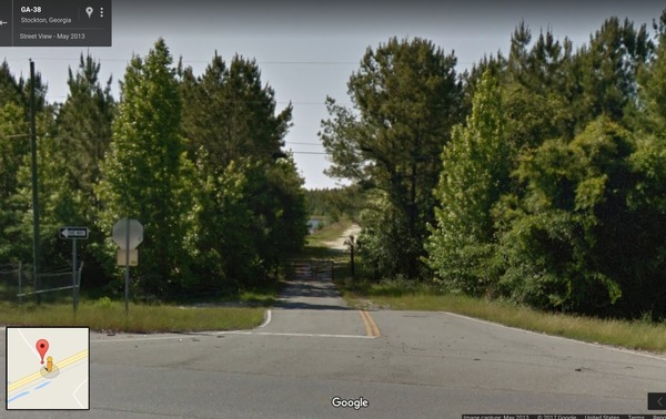
End Lola Tract VPA Lowndes
CATEGORIES: Public Land
LAYER: Other
GPS: 30.9257, -83.039238
OWNERSHIP: Public, ACREE INVESTMENTS LTD A GEORGIA COPRORATION, PARCEL 043 0005A
WATER BODY: Alapaha River
MILE: 57.30
ADDRESS: Right bank, just before Naylor Boat Ramp, 0.14 mile (739 feet) upstream from US 84 bridge. Lanier County.
DESCRIPTION: A Voluntary Public Access (VPA) property owned by Dr. Russell Acree of Adel.
WEBSITE: https://georgiawildlife.com/lola-tract-vpa
UPSTREAM: 1.11 miles from End Lola Tract VPA Lowndes to Hotchkiss Road Landing
DOWNSTREAM: 11.24 miles from End Lola Tract VPA Lowndes to Mayday Landing
PHOTO: https://wwals.net/pictures/2017-08-11–lola-tract-entrance/lola-tract-vpa-map.jpg
PHOTOSET: https://wwals.net/2017/08/11/lola-tract-wma-in-lanier-and-lowndes-counties/
PHOTO SOURCE: ESRI, GA-DNR
PHONE NUMBER: (850) 290-2350
Suggestions: https://forms.gle/DipPgU2TP5atc2Rf9
Naylor Boat Ramp @ US 84

CATEGORIES: Landing
LAYER: Brochure
OWNERSHIP: Public, Lowndes County Board of Commissioners, PARCEL 0259 030B
ACCESS: Yes, Ramp: concrete boat ramp on gravelled access road, with paved parking. PARKING: Free, HANDICAPPED ACCESSIBLE
WATER BODY: Alapaha River
Lowest boatable: 78.1
Highest safe: 83.1
GAUGE: Statenville
MILE: 57.30
ADDRESS: 6955 US 84 E, Naylor, GA 31641, right bank, west of the river, north of US 84. Lowndes County.
DESCRIPTION: A new (2020) boat ramp in a county park with a white sand beach, just upstream from a U.S. highway bridge and a historic railroad bridge, and beyond that multiple rapids, sand beaches, willows, cypress, oaks, river birch, pines, creeks, in a nice summer day paddle. GPS at river: 30.925580, -83.039238
HISTORIC FACTS: Approved by the voters of Lowndes County, Georgia, as a line item on November 2013 Special Local Option Sales Tax (SPLOST), and completed by the county in 2019. In sight of historic Atlantic and Coast Line Railroad bridge (now CSX).
WEBSITE: https://wwals.net/pictures/2020-06-13–naylor-boat-ramp-signs/
OTHER REFERENCE: https://wwals.net/pictures/2020-09-26–drafts-metal-signs/Naylor-Boat-Ramp-ARWT-metal-sign-0001.html
UPSTREAM: 1.11 miles from Naylor Boat Ramp to Hotchkiss Road Landing
DOWNSTREAM: 11.24 miles from Naylor Boat Ramp to Mayday Landing
PHOTO: https://wwals.net/pictures/2020-06-13–naylor-boat-ramp-signs/20200613_094514.jpg
PHOTOSET: https://wwals.net/pictures/2020-06-13–naylor-boat-ramp-signs/20200613_094514.html
PHOTO SOURCE: John S. Quarterman
PHONE NUMBER: (229) 242-0102
PHOTO2 SOURCE: Bobby McKenzie
Suggestions: https://forms.gle/DipPgU2TP5atc2Rf9

Naylor Boat Ramp River GPS @ US 84
CATEGORIES: Point Of Interest
LAYER: Point of Interest
GPS: 30.92558, -83.039238
OWNERSHIP: Public, Lowndes County Board of Commissioners, PARCEL 0259 030B
ACCESS: Yes, Ramp: concrete boat ramp on gravelled access road, with paved parking. PARKING: Free, HANDICAPPED ACCESSIBLE
WATER BODY: Alapaha River
Lowest boatable: 78.1
Highest safe: 83.1
GAUGE: Statenville
MILE: 57.30
ADDRESS: 6955 US 84 E, Naylor, GA 31641, right bank, west of the river, north of US 84. Lowndes County.
DESCRIPTION: A new (2020) boat ramp in a county park with a white sand beach, just upstream from a U.S. highway bridge and a historic railroad bridge, and beyond that multiple rapids, sand beaches, willows, cypress, oaks, river birch, pines, creeks, in a nice summer day paddle. GPS at river: 30.925580, -83.039238
HISTORIC FACTS: Approved by the voters of Lowndes County, Georgia, as a line item on November 2013 Special Local Option Sales Tax (SPLOST), and completed by the county in 2019. In sight of historic Atlantic and Coast Line Railroad bridge (now CSX).
WEBSITE: https://wwals.net/pictures/2020-06-13–naylor-boat-ramp-signs/
OTHER REFERENCE: https://wwals.net/pictures/2020-09-26–drafts-metal-signs/Naylor-Boat-Ramp-ARWT-metal-sign-0001.html
PHOTO: https://wwals.net/pictures/2020-06-13–naylor-boat-ramp-signs/20200613_094514.jpg
PHOTOSET: https://wwals.net/pictures/2020-06-13–naylor-boat-ramp-signs/20200613_094514.html
PHOTO SOURCE: John S. Quarterman
PHONE NUMBER: (229) 242-0102
PHOTO2 SOURCE: Bobby McKenzie
Suggestions: https://forms.gle/DipPgU2TP5atc2Rf9
Naylor Park Beach

CATEGORIES: Landing
LAYER: Other
GPS: 30.92507, -83.03867
OWNERSHIP: Public, Lowndes County Board of Commissioners, PARCEL 0259 030B
ACCESS: Yes, Launch: Sand beach on short dirt road off paved public park access road. PARKING: Free
WATER BODY: Alapaha River
Lowest boatable: 78.1
Highest safe: 83.1
GAUGE: Statenville
MILE: 57.24
ADDRESS: 6955 US 84 E, Naylor, GA 31641, Lowndes County.
DESCRIPTION: A white sand beach on the right bank, below Naylor Boat Ramp and above the US 84 bridge.
WEBSITE: https://wwals.net/2018/05/21/naylor-boat-ramp-2018-05-16/
OTHER REFERENCE: https://wwals.net/pictures/2020-09-26–drafts-metal-signs/Naylor-Boat-Ramp-ARWT-metal-sign-0001.html
PHOTO: https://wwals.net/wp-content/themes/pianoblack/img//2018/05/537a95b3e3e2eb4fc120121279a81537.jpg
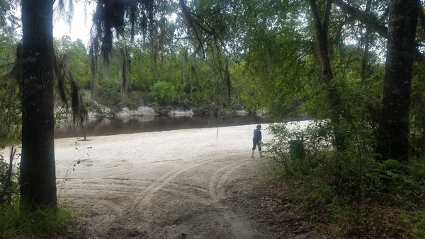
PHOTOSET: https://wwals.net/2018/05/21/naylor-boat-ramp-2018-05-16/
PHOTO SOURCE: John S. Quarterman
PHONE NUMBER: (229) 242-0102
PHOTO2 SOURCE: Bobby McKenzie
Suggestions: https://forms.gle/DipPgU2TP5atc2Rf9

Naylor Park

CATEGORIES: Public Land
LAYER: Other
GPS: 30.9245, -83.0385
OWNERSHIP: Public, Lowndes County Board of Commissioners, PARCEL 0259 030B
ACCESS: Yes, `, PARKING: Free
WATER BODY: Alapaha River
MILE: 57.19
ADDRESS: 6955 US 84 E, Naylor, GA 31641, Lowndes County.
DESCRIPTION: Completed in 2020, Lowndes County built Naylor Park for the concrete Naylor Boat Ramp with penny sales tax SPLOST funds approved by the voters of the county. Operated by Valdosta-Lowndes County Parks & Recreation Authority (VLPRA). Funded as a line item on November 2013 SPLOST ballot. Finished 2019. In sight of historic Atlantic and Coast Line Railroad bridge (now CSX). Park layout schematic: https://wwals.net/2017/08/06/naylor-boat-ramp-and-sheboggy-landing-alapaha-river/
GRN: No
WEBSITE: http://www.l-a-k-e.org/blog/2015/02/video-splost-facility-update-with-boatramp-lcc-2015-02-05.html
PHOTO: https://wwals.net/pictures/2020-06-13–naylor-boat-ramp-signs/20200613_095945.jpg
PHOTOSET: https://wwals.net/pictures/2020-06-13–naylor-boat-ramp-signs/20200613_095945.html
PHOTO SOURCE: John S. Quarterman
PHONE NUMBER: (229) 242-0102
PHOTO2: https://i.ytimg.com/vi/96-Wt72NgFo/hqdefault.jpg
Photoset2: http://www.l-a-k-e.org/blog/2015/02/video-splost-facility-update-with-boatramp-lcc-2015-02-05.html
PHOTO2 SOURCE: Lowndes Area Knowledge Exchange
Suggestions: https://forms.gle/DipPgU2TP5atc2Rf9

End Lola Tract VPA Lanier
CATEGORIES: Public Land
LAYER: Other
GPS: 30.9247, -83.03734
OWNERSHIP: Public, ACREE INVESTMENTS LTD A GEORGIA COPRORATION, PARCEL 043 0005A
WATER BODY: Alapaha River
MILE: 57.16
ADDRESS: Left bank, at north edge of US 84 right of way. Lanier County.
DESCRIPTION: A Voluntary Public Access (VPA) property owned by Dr. Russell Acree of Adel.
WEBSITE: https://georgiawildlife.com/lola-tract-vpa
UPSTREAM: 0.14 mile from End Lola Tract VPA Lanier to Naylor Boat Ramp
DOWNSTREAM: 11.1 miles from End Lola Tract VPA Lanier to Mayday Landing
PHOTO: https://wwals.net/pictures/2017-08-11–lola-tract-entrance/lola-tract-vpa-map.jpg
PHOTOSET: https://wwals.net/2017/08/11/lola-tract-wma-in-lanier-and-lowndes-counties/
PHOTO SOURCE: ESRI, GA-DNR
PHONE NUMBER: (850) 290-2350
Suggestions: https://forms.gle/DipPgU2TP5atc2Rf9
US 84 Bridge

CATEGORIES: Bridge
LAYER: Bridge
OWNERSHIP: Public
ACCESS: No, PARKING: Free
WATER BODY: Alapaha River
MILE: 57.16
ADDRESS: US 84 between Valdosta and Waycross, GA, Lowndes County.
DESCRIPTION: Federal highway bridge between Valdosta and Waycross, Georgia. A pair of two-lane concrete bridges, each with a sidewalk, built in 2003.
AKA: GA 38 Bridge
WEBSITE: https://wwals.net/2014/08/23/alapaha-river-us-84-endpoint-sundays-wwals-outing-24-august-2014/
OTHER REFERENCE: https://maps.app.goo.gl/5rvumi1RsVpYT3vs9
UPSTREAM: 0.14 mile from US 84 Bridge to Naylor Boat Ramp
DOWNSTREAM: 11.1 miles from US 84 Bridge to Mayday Landing
PHOTO: https://wwals.net/wp-content/themes/pianoblack/img//2018/05/f24d1a52723bde0b9d9a4392cbd398f9.jpg
PHOTOSET: https://wwals.net/2018/05/21/naylor-boat-ramp-2018-05-16/
PHOTO SOURCE: John S. Quarterman
PHONE NUMBER: (229) 242-0102
Suggestions: https://forms.gle/DipPgU2TP5atc2Rf9
CSX Bridge
CATEGORIES: Railbridge
LAYER: Bridge
OWNERSHIP: Public
ACCESS: No, PARKING: Free
WATER BODY: Alapaha River
MILE: 57.12
ADDRESS: Just downstream from US 84. US 84, Lowndes County side, south side of road: turn south onto Lake Alapaha Blvd., cross railroad tracks, turn left, continue to river. Lowndes County.
DESCRIPTION: Railroad bridge that now carries CSX Railroad trains.
HISTORIC FACTS: Historic Atlantic and Coast Line Railroad bridge (now CSX). The residents of Troupville, the former Lowndes County seat, literally picked up their buildings and moved four miles east to this railroad to found Valdosta.
WEBSITE: https://wwals.net/2014/08/23/alapaha-river-us-84-endpoint-sundays-wwals-outing-24-august-2014/
UPSTREAM: 0.18 mile from CSX Bridge to Naylor Boat Ramp
DOWNSTREAM: 11.06 miles from CSX Bridge to Mayday Landing
PHOTO: https://wwals.net/wp-content/themes/pianoblack/img//2018/05/f24d1a52723bde0b9d9a4392cbd398f9.jpg
PHOTOSET: https://wwals.net/2018/05/21/naylor-boat-ramp-2018-05-16/
PHOTO SOURCE: John S. Quarterman
PHONE NUMBER: (229) 242-0102
Suggestions: https://forms.gle/DipPgU2TP5atc2Rf9
US 84 No Access

CATEGORIES: Landing Private Closed
LAYER: Point of Interest
GPS: 30.923559, -83.03701
OWNERSHIP: Private
ACCESS: Closed, Launch: Sand beach with steep climb to highway right of way
WATER BODY: Alapaha River
MILE: 57.10
ADDRESS: US 84, Lowndes County side, south side of road: turn south onto Lake Alapaha Blvd., cross railroad tracks, turn left, continue to river. Lowndes County.
DESCRIPTION: Sand beach and steep climb to access road next to railroad. Now private marked no trespassing. Next to historic Atlantic and Coast Line railroad bridge (now CSX).
WEBSITE: https://wwals.net/2014/08/23/alapaha-river-us-84-endpoint-sundays-wwals-outing-24-august-2014/
UPSTREAM: 0.20 mile from US 84 No Access to Naylor Boat Ramp
DOWNSTREAM: 11.04 miles from US 84 No Access to Mayday Landing
PHOTO: https://wwals.net/wp-content/themes/pianoblack/img//2014/08/b23d0103df6b488b38a76e5b8ac9383c.jpg
PHOTOSET: https://wwals.net/2014/08/31/pictures-wwals-alapaha-river-outing-jsq-2014-08-24/
PHOTO SOURCE: John S. Quarterman
PHONE NUMBER: (229) 242-0102
Suggestions: https://forms.gle/DipPgU2TP5atc2Rf9
Grand Bay

CATEGORIES: Lake
LAYER: Brochure
OWNERSHIP: Public, State of Georgia, PARCEL 0182 034
ACCESS: Yes, PARKING: GORP, SHELTER, PICNIC AREA, HANDICAPPED ACCESSIBLE
WATER BODY: Grand Bay
ADDRESS: 4661 Knights Academy Road, Valdosta, GA 31605, Lowndes County.
DESCRIPTION: This Cypress swamp is the second largest natural blackwater wetland in the Coastal Plain of Georgia; the other is the Okefenokee Swamp. “”The Grand Bay Wildlife Management Area (WMA) encompasses 2, 623 acres of state-owned property and 5, 874 acres of land under license from the U.S. Air Force. The WMA consists of approximately 3, 059 acres of upland pine and hardwood forest and 5, 438 acres of cypress/gum wetlands.””, Educational center; historic logging and restoration. One of the following is required: Hunting license, Fishing license, Georgia Lands Pass: http://georgiawildlife.com/licenses-permits-passes “”Hiking trails are closed during firearms deer hunts. Federal lands (Hwy 221 entrance) within the WMA may be closed during training.”
GRN: No
WEBSITE: https://georgiawildlife.com/grand-bay-wma
OTHER REFERENCE: https://wwals.net/maps/alapaha-water-trail/sites/grand-bay/
ADDITIONAL INFO SOURCES: http://georgiawildlife.com/licenses-permits-passes
PHOTO: https://farm4.staticflickr.com/3406/4612966402_08a5a714bf_b.jpg
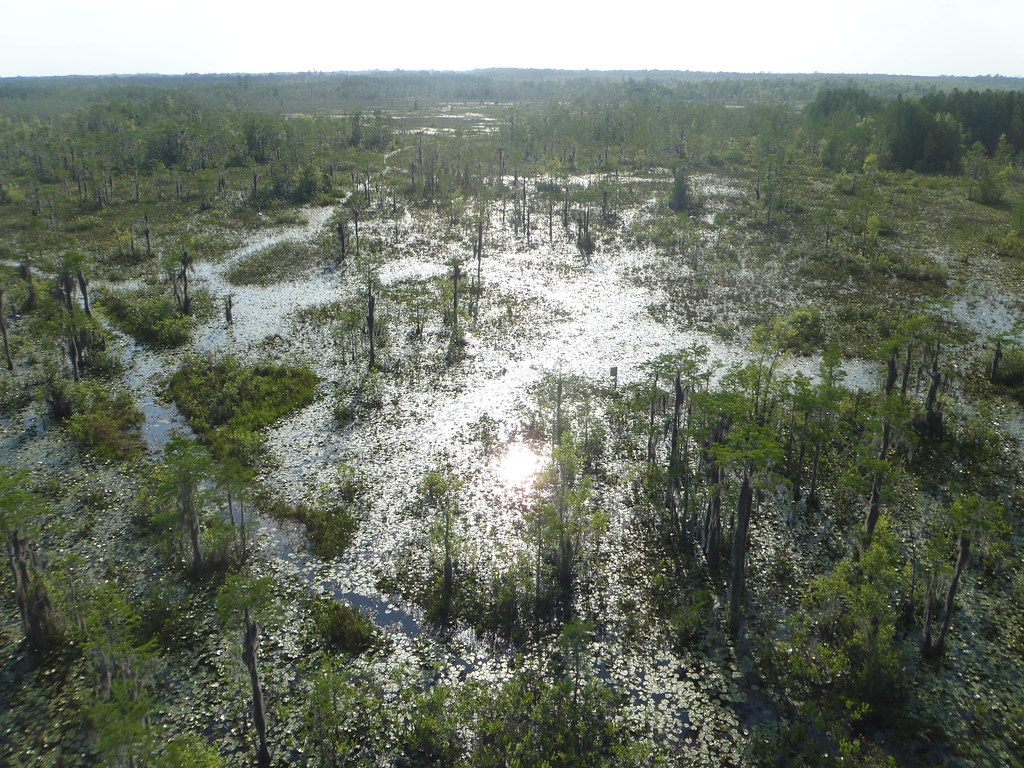
PHOTOSET: https://www.flickr.com/photos/98706376@N00/sets/72157624076194114
PHOTO SOURCE: John S. Quarterman
PHONE NUMBER: (229) 242-0102
Suggestions: https://forms.gle/DipPgU2TP5atc2Rf9
Grand Bay WMA

CATEGORIES: Public Land
LAYER: Other
GPS: 30.92109, -83.205216
OWNERSHIP: Public, U.S.A., State of Georgia, PARCEL Several
ACCESS: PARKING: GORP
WATER BODY: Grand Bay
ADDRESS: 4661 Knights Academy Road, Valdosta, GA 31605, Lowndes, Lanier Counties.
DESCRIPTION: “The Grand Bay Wildlife Management Area (WMA) encompasses 2, 623 acres of state-owned property and 5, 874 acres of land under license from the U.S. Air Force. The WMA consists of approximately 3, 059 acres of upland pine and hardwood forest and 5, 438 acres of cypress/gum wetlands.””, “”Hiking trails are closed during firearms deer hunts. Federal lands (Hwy 221 entrance) within the WMA may be closed during training.”
GRN: No
WEBSITE: https://georgiawildlife.com/grand-bay-wma
OTHER REFERENCE: https://wwals.net/maps/alapaha-water-trail/sites/grand-bay/
ADDITIONAL INFO SOURCES: http://georgiawildlife.com/licenses-permits-passes
PHOTO: https://www.visitvaldosta.org/images/member_photos/grand-bay-4.jpg
PHOTOSET: https://www.visitvaldosta.org/grand-bay-wetlands-education-center
PHOTO SOURCE: Visit Valdosta
PHONE NUMBER: (229) 245-0513
Suggestions: https://forms.gle/DipPgU2TP5atc2Rf9
Grand Bay Wetland Education Center

CATEGORIES: Public Land
LAYER: Other
GPS: 30.9327, -83.1942
OWNERSHIP: Public, U.S.A., State of Georgia, PARCEL Several
ACCESS: WATER, RESTROOMS, PARKING: GORP, SHELTER, PICNIC AREA, HANDICAPPED ACCESSIBLE
WATER BODY: Grand Bay
ADDRESS: 4661 Knights Academy Road, Valdosta, GA 31605, Lowndes, Lanier Counties.
DESCRIPTION: “A partnership between Coastal Plains RESA and the Georgia Department of Natural Resources, the mission of Grand Bay Wetland Education Center (GBWECC) is to teach students about natural processes and relationships between plants and animals.””, “”Hiking trails are closed during firearms deer hunts. Federal lands (Hwy 221 entrance) within the WMA may be closed during training.”
HISTORIC FACTS: Has a cypress log that was about 620 years old when it was cut in 1910.
AKA: Robert Patten Grand Bay Wetland Education Center
WEBSITE: https://sites.google.com/a/cpresa.org/grand-bay-wetland-education-center/home
OTHER REFERENCE: https://wwals.net/maps/alapaha-water-trail/sites/grand-bay/
ADDITIONAL INFO SOURCES: http://georgiawildlife.com/licenses-permits-passes
PHOTOSET: https://sites.google.com/a/cpresa.org/grand-bay-wetland-education-center/home
PHOTO SOURCE: Grand Bay Wetlands Education Center
PHONE NUMBER: (229) 333-0052
Photoset2: https://static.wixstatic.com/media/eb770c_d736b92406fc427384d056540c3fece7~mv2.jpg/v1/fill/w_1000, h_1333, al_c, q_90, usm_0.66_1.00_0.01/eb770c_d736b92406fc427384d056540c3fece7~mv2.jpg
PHOTO2 SOURCE: Brian Childres, Cross Country Corridors, https://www.crosscountrycondors.com/post/grand-bay-valdosta-georgia
Suggestions: https://forms.gle/DipPgU2TP5atc2Rf9
Grand Bay Flatwoods Trail
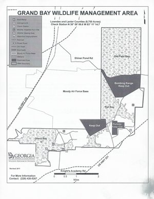
CATEGORIES: Hiking Trail
LAYER: Hiking Trail
GPS: 30.9335, -83.187417
OWNERSHIP: Public
ACCESS: Yes, PARKING: GORP, HANDICAPPED ACCESSIBLE
WATER BODY: Grand Bay
ADDRESS: 4661 Knights Academy Road, Valdosta, GA 31605, Lowndes County.
DESCRIPTION: Three-mile hiking trail through pine flatwoods. “”Hiking trails are closed during firearms deer hunts. Federal lands (Hwy 221 entrance) within the WMA may be closed during training.”
WEBSITE: https://georgiawildlife.com/grand-bay-wma
OTHER REFERENCE: https://wwals.net/maps/alapaha-water-trail/sites/grand-bay/
ADDITIONAL INFO SOURCES: http://georgiawildlife.com/licenses-permits-passes
PHOTO: https://wwals.net/wp-content/themes/pianoblack/img//2015/04/72bf15004475572ca2147eda3299cafc.jpg
PHOTOSET: https://wwals.net/maps/alapaha-water-trail/sites/grand-bay/
PHOTO SOURCE: Grand Bay WMA
PHONE NUMBER: (229) 426-5267
Suggestions: https://forms.gle/DipPgU2TP5atc2Rf9
Grand Bay Boardwalk
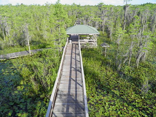
CATEGORIES: Hiking Trail
LAYER: Hiking Trail
OWNERSHIP: Public
ACCESS: Yes, Flush Toilet, PARKING: GORP, HANDICAPPED ACCESSIBLE
WATER BODY: Grand Bay
ADDRESS: 4661 Knights Academy Road, Valdosta, GA 31605, Lowndes County.
DESCRIPTION: This 4-foot-wide boardwalk with handrails goes from pine flatwoods, past fields of pitcher plants, to the center of a huge cypress swamp with the tall Harley Langdale Jr. observation tower. You will probably see ducks, fish, herons, buzzards, lizards, alligators, and maybe snakes. Retrace your steps to return; it’s about a mile round-trip. “”Hiking trails are closed during firearms deer hunts. Federal lands (Hwy 221 entrance) within the WMA may be closed during training.”
HISTORIC FACTS: A small but unique natural area known as Dudley’s Hammock occurs on the area. It is a rare remnant of hardwood hammock community in South Georgia.Reply added
GRN: Yes
WEBSITE: https://georgiawildlife.com/grand-bay-wma
OTHER REFERENCE: https://wwals.net/maps/alapaha-water-trail/sites/grand-bay/
ADDITIONAL INFO SOURCES: http://georgiawildlife.com/licenses-permits-passes
PHOTO: https://farm4.staticflickr.com/3399/4614128174_a2fa222688_o.jpg
PHOTOSET: https://wwals.net/maps/alapaha-water-trail/sites/grand-bay/
PHOTO SOURCE: John S. Quarterman
PHONE NUMBER: (229) 242-0102
Suggestions: https://forms.gle/DipPgU2TP5atc2Rf9
Grand Bay Boat Ramp 1
CATEGORIES: Landing
LAYER: Brochure
GPS: 30.93333, -83.188193
OWNERSHIP: Public
ACCESS: Yes, Launch: Concrete from dirt road, PARKING: GORP, HANDICAPPED ACCESSIBLE
WATER BODY: Grand Bay
ADDRESS: 4655 Knights Academy Road, Valdosta, GA 31605, Lowndes County.
DESCRIPTION: Access to cypress swamp at check station.
AKA: Grand Bay Boatramp 1
GRN: Yes
WEBSITE: https://georgiawildlife.com/grand-bay-wma
OTHER REFERENCE: https://wwals.net/maps/alapaha-water-trail/sites/grand-bay/
ADDITIONAL INFO SOURCES: http://georgiawildlife.com/licenses-permits-passes
PHOTO: https://wwals.net/wp-content/themes/pianoblack/img//2015/04/72bf15004475572ca2147eda3299cafc.jpg
PHOTOSET: https://wwals.net/maps/alapaha-water-trail/sites/grand-bay/
PHOTO SOURCE: Grand Bay WMA
PHONE NUMBER: (229) 426-5267
Suggestions: https://forms.gle/DipPgU2TP5atc2Rf9
Grand Bay Boat Ramp 2
CATEGORIES: Landing
LAYER: Brochure
OWNERSHIP: Public
ACCESS: Yes, Launch: Concrete from dirt road, PARKING: GORP, HANDICAPPED ACCESSIBLE
WATER BODY: Grand Bay
ADDRESS: 4669 Knights Academy Road, Valdosta, GA 31605, Lowndes County.
DESCRIPTION: Access to cypress swamp from hiking trail.
AKA: Grand Bay Boatramp 2
GRN: Yes
WEBSITE: https://georgiawildlife.com/grand-bay-wma
OTHER REFERENCE: https://wwals.net/maps/alapaha-water-trail/sites/grand-bay/
ADDITIONAL INFO SOURCES: http://georgiawildlife.com/licenses-permits-passes
PHOTO: https://wwals.net/wp-content/themes/pianoblack/img//2015/04/72bf15004475572ca2147eda3299cafc.jpg
PHOTOSET: https://wwals.net/maps/alapaha-water-trail/sites/grand-bay/
PHOTO SOURCE: Grand Bay WMA
PHONE NUMBER: (229) 426-5267
Suggestions: https://forms.gle/DipPgU2TP5atc2Rf9
Grand Bay Campsite
CATEGORIES: Camping
LAYER: Other
OWNERSHIP: Public
WATER BODY: Grand Bay Creek
MILE: Nearby
ADDRESS: 5079 Lakeland Hwy, Naylor, GA 31641, Lowndes, Lanier Counties.
DESCRIPTION: Primitive camping in pine flatwoods. Only open on weekends. Contact GA-DNR first: https://georgiawildlife.com/grand-bay-wma The entrance is in Lowndes County owned by Moody Air Force Base, but the actual campsite is in Lanier County on land owned by the U.S. Department of Agriculture. Yet that Dept. Ag. land also contains Bemiss Auxilliary Army Air Field and part of Moody AFB’s bombing range: don’t go those places. Much of the rest of the 5, 438-acre Grand Bay Wildlife Management Area will be open anyway. “”Hiking trails are closed during firearms deer hunts. Federal lands (Hwy 221 entrance) within the WMA may be closed during training.”
GRN: Yes
WEBSITE: https://georgiawildlife.com/grand-bay-wma
OTHER REFERENCE: https://wwals.net/maps/alapaha-water-trail/sites/grand-bay/
ADDITIONAL INFO SOURCES: http://georgiawildlife.com/licenses-permits-passes
PHOTO: https://wwals.net/wp-content/themes/pianoblack/img//2015/04/72bf15004475572ca2147eda3299cafc.jpg
PHOTOSET: https://wwals.net/maps/alapaha-water-trail/sites/grand-bay/
PHOTO SOURCE: Grand Bay WMA
PHONE NUMBER: (229) 426-5267
Suggestions: https://forms.gle/DipPgU2TP5atc2Rf9
Northeast terminus of GA-DOT road work

CATEGORIES: Point Of Interest
LAYER: Point of Interest
GPS: 30.97284, -83.10488
OWNERSHIP: Public
WATER BODY: Grand Bay Creek
MILE: Nearby
ADDRESS: East of Shiner Pond Road aka Spells Road CR 12 in Lanier County, Lanier County.
DESCRIPTION: Road work to add passing lanes.
HISTORIC FACTS: Public Notice 2023-07-18: “”The proposed project will impact the buffer of Open Water (OW) 4, OW 13, and OW 31. The project will add passing lanes at four sites in two interconnected corridors along State Route (SR) 31 in Lanier and Lowndes Counties. The project will impact the state mandated 25-ft buffer within the Suwannee Watershed (HUC 03110202). The disturbance will cover 5, 903 square feet and include discharging of fill and clearing and grubbing to widen SR 31, culvert replacement, and the installation of Best Management Practices (BMPs). https://wwals.net/2023/07/19/road-widening-south-of-grand-bay-lakeland-highway-lightsey-road-to-shiner-pond-road-2023-07-18/
OTHER REFERENCE: https://wwals.net/2023/07/19/road-widening-south-of-grand-bay-lakeland-highway-lightsey-road-to-shiner-pond-road-2023-07-18/
PHOTO: https://www.wwals.net/pictures/2023-07-18–ga-31-grand-bay-creek-encroachment/many.jpg
PHOTOSET: https://www.wwals.net/pictures/2023-07-18–ga-31-grand-bay-creek-encroachment/
PHOTO SOURCE: WWALS
PHONE NUMBER: (850) 290-2350
Suggestions: https://forms.gle/DipPgU2TP5atc2Rf9
GA 31 Grand Bay Creek Bridge

CATEGORIES: Bridge
LAYER: Bridge
OWNERSHIP: Public
WATER BODY: Grand Bay Creek
MILE: 17.80
ADDRESS: East of Byrd Lane on GA 31, US 221, Lakeland Highway, southwest of Lakeland, GA, Lanier County.
DESCRIPTION: A two-lane concrete bridge with sidewalks built in 1991 across a wide creek, named after a Lakeland home economics teacher.
HISTORIC FACTS: “”This Sunday, a well known and loved Lakeland teacher will receive an eternal dedication. Lucille Norton, a native of Lanier County who died at age 86, taught home economics in Lakeland for 58 years. This Sunday [July 9, 2006], the bridge over Grand Bay Pond on U.S. 221 will be named in her honor at a 2 p.m. ceremony in the Lanier County Courthouse.”” Kenna Walsh, Valdosta Daily Times, July 7, 2006 https://www.valdostadailytimes.com/news/local_news/bridge-to-be-named-for-lucille-norton/article_147485a3-5bdb-5919-856e-f4e2c4927bd8.html
AKA: Lucille M. Norton Bridge
OTHER REFERENCE: https://wwals.net/2023/07/19/lucille-m-norton-bridge-across-grand-bay-creek-dedicated-2006-07-09/
PHOTOSET: https://wwals.net/2023/07/19/lucille-m-norton-bridge-across-grand-bay-creek-dedicated-2006-07-09/
PHOTO SOURCE: Google Streetview
PHONE NUMBER: (850) 290-2350
Photoset2: https://wwals.net/2023/07/19/lucille-m-norton-bridge-across-grand-bay-creek-dedicated-2006-07-09/
PHOTO2 SOURCE: Google Streetview
Suggestions: https://forms.gle/DipPgU2TP5atc2Rf9

Southwest terminus of GA-DOT road work
CATEGORIES: Point Of Interest
LAYER: Point of Interest
GPS: 30.90854, -83.18506
OWNERSHIP: Public
WATER BODY: Grand Bay Creek
MILE: Nearby
ADDRESS: East of Lightsey Road aka CCC Road in Lowndes County, Lowndes County.
DESCRIPTION: Road work to add passing lanes.
HISTORIC FACTS: Public Notice 2023-07-18: “”The proposed project will impact the buffer of Open Water (OW) 4, OW 13, and OW 31. The project will add passing lanes at four sites in two interconnected corridors along State Route (SR) 31 in Lanier and Lowndes Counties. The project will impact the state mandated 25-ft buffer within the Suwannee Watershed (HUC 03110202). The disturbance will cover 5, 903 square feet and include discharging of fill and clearing and grubbing to widen SR 31, culvert replacement, and the installation of Best Management Practices (BMPs). https://wwals.net/2023/07/19/road-widening-south-of-grand-bay-lakeland-highway-lightsey-road-to-shiner-pond-road-2023-07-18/
OTHER REFERENCE: https://wwals.net/2023/07/19/road-widening-south-of-grand-bay-lakeland-highway-lightsey-road-to-shiner-pond-road-2023-07-18/
PHOTO: https://www.wwals.net/pictures/2023-07-18–ga-31-grand-bay-creek-encroachment/many.jpg
PHOTOSET: https://www.wwals.net/pictures/2023-07-18–ga-31-grand-bay-creek-encroachment/
PHOTO SOURCE: WWALS
PHONE NUMBER: (850) 290-2350
Suggestions: https://forms.gle/DipPgU2TP5atc2Rf9
Southern Paddling Guide
CATEGORIES: Outfitter
LAYER: Other
OWNERSHIP: Private
ACCESS: No, CANOE
WATER BODY: Cherry Creek
ADDRESS: 3816 Saddlebred Ln, Valdosta, GA 31605, Lowndes County.
DESCRIPTION: “Providing of all the equipment needed for multi-day excursions with comfort and safety as our priority. Come relax and enjoy North Florida’s beautiful Suwannee River. Vacations are for relaxing, not standing in lines at a theme park.””, Dale Dauphinais, southernpaddling@yahoo.com
WEBSITE: https://www.southernpaddling.com/
PHOTOSET: https://www.southernpaddling.com/
PHOTO SOURCE: Southern Paddling Guide
PHONE NUMBER: (229) 630-8179
Suggestions: https://forms.gle/DipPgU2TP5atc2Rf9
River Run Waterfall Shoal

CATEGORIES: Shoal
LAYER: Other
OWNERSHIP: Public, LANGDALE CO, PARCEL 044 0017
WHITEWATER CLASS: Class I
WATER BODY: Alapaha River
MILE: 56.17
ADDRESS: About a mile downstream of US 84, Lowndes, Lanier Counties.
DESCRIPTION: Waterfall can drop 3 to 8 feet. It appears only at low water, when there are also many rapids nearby, dangerous for inexperienced paddlers. Scout before running. About 1.85 feet on Statenville gauge when this picture was taken.
WEBSITE: https://www.facebook.com/photo.php?fbid=4259483103038&set=gm.759245534118630&type=1&theater
UPSTREAM: 1.13 miles from River Run Waterfall Shoal to Naylor Boat Ramp
DOWNSTREAM: 10.11 miles from River Run Waterfall Shoal to Mayday Landing
PHOTO: https://wwals.net/wp-content/themes/pianoblack/img//2015/05/c382958d45b2b0df7414a39c876e3e30.jpg
PHOTO SOURCE: Steven Dansereau
PHONE NUMBER: (850) 290-2350
Suggestions: https://forms.gle/DipPgU2TP5atc2Rf9
Alapaha Plantation Subdivision Water System 

CATEGORIES: Muni Drinking Water
LAYER: Point of Interest
GPS: 30.913141, -83.0447
OWNERSHIP: Public
WATER BODY: Alapaha River
MILE: 56.05
ADDRESS: 6328 Lake Alapaha Blvd, Naylor, GA 31641, Lowndes County.
DESCRIPTION: This long-troubled water system, run by Lowndes County to serve the Lake Alapaha Plantation subdivision next to the Alapaha River, in January 2025 got a Consent Order for the county to move along and fix it.
UPSTREAM: 1.25 miles from Alapaha Plantation Subdivision Water System to Naylor Boat Ramp
DOWNSTREAM: 9.99 miles from Alapaha Plantation Subdivision Water System to Mayday Landing
PHOTO: https://www.wwals.net/pictures/2025-01-06–lake-alapaha-consent-order/9666251722_3d1e7ce9c9_b.jpg
PHOTOSET: https://www.wwals.net/pictures/2025-01-06–lake-alapaha-consent-order/
PHOTO SOURCE: Google Streetview
PHONE NUMBER: (850) 290-2350
Suggestions: https://forms.gle/DipPgU2TP5atc2Rf9
Paddlers Pass Canopy

CATEGORIES: Point Of Interest
LAYER: Point of Interest
GPS: 30.9154281, -83.0352
OWNERSHIP: Public
WATER BODY: Alapaha River
MILE: 55.95
ADDRESS: Around the bend from River Run Waterfall, Lanier, Lowndes Counties.
DESCRIPTION: A shady tree canopy over the river.
WEBSITE: https://wwals.net/pictures/2016-05-07–us84-to-mayday-alapaha-river/#Overhanging
UPSTREAM: 1.35 miles from Paddlers Pass Canopy to Naylor Boat Ramp
DOWNSTREAM: 9.89 miles from Paddlers Pass Canopy to Mayday Landing
PHOTO: https://wwals.net/pictures/2016-05-07–us84-to-mayday-alapaha-river/KIMG4791.jpg
PHOTOSET: https://wwals.net/pictures/2016-05-07–us84-to-mayday-alapaha-river/
PHOTO SOURCE: John S. Quarterman
PHONE NUMBER: (229) 242-0102
Suggestions: https://forms.gle/DipPgU2TP5atc2Rf9
Paddlers Pass Landing

CATEGORIES: Landing Private
LAYER: Point of Interest
OWNERSHIP: Private, LAKE ALAPAHA RIVER TRAILS ROAD OWNERS ASSOCIATION INC, PARCEL 0268 060A
ACCESS: Launch: sand slope
WATER BODY: Alapaha River
MILE: 55.82
ADDRESS: End of Paddlers Pass, Naylor, GA 31641, Lowndes County.
DESCRIPTION: Sand slope to river from dirt road.
WEBSITE: https://wwals.net/pictures/2016-05-07–us84-to-mayday-alapaha-river/#Paddlers-Pass
UPSTREAM: 1.48 miles from Paddlers Pass Landing to Naylor Boat Ramp
DOWNSTREAM: 9.76 miles from Paddlers Pass Landing to Mayday Landing
PHOTO: https://wwals.net/pictures/2016-05-07–us84-to-mayday-alapaha-river/KIMG4796.jpg
PHOTOSET: https://wwals.net/pictures/2016-05-07–us84-to-mayday-alapaha-river/
PHOTO SOURCE: John S. Quarterman
PHONE NUMBER: (229) 242-0102
Suggestions: https://forms.gle/DipPgU2TP5atc2Rf9
Lanier EMA Marker 5
CATEGORIES: Emamarker
LAYER: Point of Interest
GPS: 30.91477642, -83.02718828
OWNERSHIP: Public
WATER BODY: Alapaha River
MILE: 55.44
ADDRESS: Left bank, less than half a mile downstream from Paddlers Pass Landing. Lanier County.
DESCRIPTION: Signpost with Lanier EMA emergency number, 229-482-5070. Lanier County computes 8.05 miles upstream from Echols County; WWALS gets 7.76.
UPSTREAM: 1.86 miles from Lanier EMA Marker 5 to Naylor Boat Ramp
DOWNSTREAM: 9.38 miles from Lanier EMA Marker 5 to Mayday Landing
Suggestions: https://forms.gle/DipPgU2TP5atc2Rf9
Lanier EMA Marker 4
CATEGORIES: Emamarker
LAYER: Point of Interest
GPS: 30.90448331, -83.02017989
OWNERSHIP: Public
WATER BODY: Alapaha River
MILE: 53.88
ADDRESS: Left bank, 200 feet upstream from Foreman Creek, 6.2 river miles upstream from Lanier Milemarker 1. Lanier County.
DESCRIPTION: Signpost with Lanier EMA emergency number, 229-482-5070. Lanier County computes 6.38 miles upstream from Echols County; WWALS gets 6.20.
UPSTREAM: 3.42 miles from Lanier EMA Marker 4 to Naylor Boat Ramp
DOWNSTREAM: 7.82 miles from Lanier EMA Marker 4 to Mayday Landing
Suggestions: https://forms.gle/DipPgU2TP5atc2Rf9
Foreman Creek (03110202000597)
CATEGORIES: Tributary
LAYER: Other
GPS: 30.90392309, -83.02018978
OWNERSHIP: Private, Frances & Luke Kevin Westlake, PARCEL 045 0003
WATER BODY: Alapaha River
MILE: 53.84
ADDRESS: Several miles downstream of US 84. Lanier County.
DESCRIPTION: Comes down across US 84 west of Stockton
UPSTREAM: 3.46 miles from Foreman Creek (03110202000597) to Naylor Boat Ramp
DOWNSTREAM: 7.78 miles from Foreman Creek (03110202000597) to Mayday Landing
Suggestions: https://forms.gle/DipPgU2TP5atc2Rf9
Lake Alapaha
CATEGORIES: Lake
LAYER: Other
OWNERSHIP: Private
WATER BODY: Ray Branch
ADDRESS: 6100 Lake Alapaha Dr, Naylor, GA 31641, Lowndes County.
DESCRIPTION: Man-made lake with a subdivision around it.
Suggestions: https://forms.gle/DipPgU2TP5atc2Rf9
Westlake Ramp

CATEGORIES: Landing Private
LAYER: Point of Interest
GPS: 30.90097, -83.02047
OWNERSHIP: Private, Frances & Luke Kevin Westlake, PARCEL 045 0003
ACCESS: Launch: slope to river at end of slightly improved private road
WATER BODY: Alapaha River
MILE: 53.63
ADDRESS: Lanier County.
DESCRIPTION: Right bank. Slightly improved private road slope to the river. Comes off of private road off of Howard Circle, Stockton, GA.
WEBSITE: https://wwals.net/pictures/2016-05-07–us84-to-mayday-alapaha-river/KIMG4814.html
UPSTREAM: 3.67 miles from Westlake Ramp to Naylor Boat Ramp
DOWNSTREAM: 7.57 miles from Westlake Ramp to Mayday Landing
PHOTO: https://wwals.net/pictures/2016-05-07–us84-to-mayday-alapaha-river/KIMG4814.jpg
PHOTOSET: https://wwals.net/pictures/2016-05-07–us84-to-mayday-alapaha-river/
PHOTO SOURCE: John S. Quarterman
PHONE NUMBER: (229) 242-0102
Suggestions: https://forms.gle/DipPgU2TP5atc2Rf9
Reames Runoff

CATEGORIES: Tributary
LAYER: Point of Interest
GPS: 30.89994, -83.02093
OWNERSHIP: Private, Reames Family LLLP, PARCEL 045 0001
WATER BODY: Alapaha River
MILE: 53.56
ADDRESS: Lanier County.
DESCRIPTION: Left bank. Maybe used for private river access. Comes off of private road off of Howard Circle, Stockton, GA.
WEBSITE: https://wwals.net/pictures/2016-05-07–us84-to-mayday-alapaha-river/KIMG4816.html
UPSTREAM: 3.74 miles from Reames Runoff to Naylor Boat Ramp
DOWNSTREAM: 7.50 miles from Reames Runoff to Mayday Landing
PHOTO: https://wwals.net/pictures/2016-05-07–us84-to-mayday-alapaha-river/KIMG4816.jpg
PHOTOSET: https://wwals.net/pictures/2016-05-07–us84-to-mayday-alapaha-river/KIMG4816.jpg
PHOTO SOURCE: John S. Quarterman
PHONE NUMBER: (229) 242-0102
Suggestions: https://forms.gle/DipPgU2TP5atc2Rf9
Reedy Creek
CATEGORIES: Tributary
LAYER: Other
GPS: 30.89282649, -83.02156478
OWNERSHIP: Public
WATER BODY: Alapaha River
MILE: 53.03
ADDRESS: Lanier County.
DESCRIPTION: Left bank. Comes down from east side of Stockton.
UPSTREAM: 4.27 miles from Reedy Creek to Naylor Boat Ramp
DOWNSTREAM: 6.97 miles from Reedy Creek to Mayday Landing
Suggestions: https://forms.gle/DipPgU2TP5atc2Rf9
Reedy Creek Sandbars

CATEGORIES: Point Of Interest
LAYER: Other
GPS: 30.88913, -83.02319
OWNERSHIP: Public, Reames Family LP, PARCEL 045 0001A
WATER BODY: Alapaha River
MILE: 52.68
ADDRESS: Downstream from Reed Creek. Lanier, Lowndes Counties.
DESCRIPTION: This string of sandbars is a good lunch stop between Naylor Boat Ramp and Mayday.
WEBSITE: https://wwals.net/pictures/2016-05-07–us84-to-mayday-alapaha-river/#Lunch
UPSTREAM: 4.62 miles from Reedy Creek Sandbars to Naylor Boat Ramp
DOWNSTREAM: 6.62 miles from Reedy Creek Sandbars to Mayday Landing
PHOTO: https://wwals.net/pictures/2016-05-07–us84-to-mayday-alapaha-river/KIMG4817.jpg
PHOTOSET: https://wwals.net/pictures/2016-05-07–us84-to-mayday-alapaha-river/
PHOTO SOURCE: John S. Quarterman
PHONE NUMBER: (229) 242-0102
Suggestions: https://forms.gle/DipPgU2TP5atc2Rf9
Lanier EMA Marker 3
CATEGORIES: Emamarker
LAYER: Point of Interest
OWNERSHIP: Public
WATER BODY: Alapaha River
MILE: 51.52
ADDRESS: Left bank. estimated location. Lanier County.
DESCRIPTION: Signpost with Lanier EMA emergency number, 229-482-5070. Lanier County computes 3.78 miles upstream from Echols County; WWALS by that milage estimates this as the location 3.84 miles upstream from Echols County.
UPSTREAM: 5.78 miles from Lanier EMA Marker 3 to Naylor Boat Ramp
DOWNSTREAM: 5.46 miles from Lanier EMA Marker 3 to Mayday Landing
Suggestions: https://forms.gle/DipPgU2TP5atc2Rf9
Hairpin Willows

CATEGORIES: Point Of Interest
LAYER: Other
GPS: 30.87356, -83.0229
OWNERSHIP: Public, Langdale Company, PARCEL 0264 002
WATER BODY: Alapaha River
MILE: 50.99
ADDRESS: Just upstream from Ray Branch. Lanier, Lowndes Counties.
DESCRIPTION: Willow trees lining the river on a hairpin bend.
WEBSITE: https://wwals.net/pictures/2016-05-07–us84-to-mayday-alapaha-river/#Noon
UPSTREAM: 6.31 miles from Hairpin Willows to Naylor Boat Ramp
DOWNSTREAM: 4.93 miles from Hairpin Willows to Mayday Landing
PHOTO: https://wwals.net/pictures/2016-05-07–us84-to-mayday-alapaha-river/KIMG4823.jpg
PHOTOSET: https://wwals.net/pictures/2016-05-07–us84-to-mayday-alapaha-river/
PHOTO SOURCE: John S. Quarterman
PHONE NUMBER: (229) 242-0102
Suggestions: https://forms.gle/DipPgU2TP5atc2Rf9
Hairpin Cutthrough

CATEGORIES: Point Of Interest
LAYER: Point of Interest
OWNERSHIP: Public, Langdale Company, PARCEL 0264 002
WATER BODY: Alapaha River
MILE: 50.82
ADDRESS: Just upstream from Ray Branch. Lanier, Lowndes Counties.
DESCRIPTION: Water through neck of peninsula; at high water, you can paddle through this shortcut.
WEBSITE: https://wwals.net/pictures/2016-05-07–us84-to-mayday-alapaha-river/#Narrows
UPSTREAM: 6.48 miles from Hairpin Cutthrough to Naylor Boat Ramp
DOWNSTREAM: 4.76 miles from Hairpin Cutthrough to Mayday Landing
PHOTO: https://wwals.net/pictures/2016-05-07–us84-to-mayday-alapaha-river/KIMG4826.jpg
PHOTOSET: https://wwals.net/pictures/2016-05-07–us84-to-mayday-alapaha-river/
PHOTO SOURCE: John S. Quarterman
PHONE NUMBER: (229) 242-0102
Suggestions: https://forms.gle/DipPgU2TP5atc2Rf9
Ray Branch
CATEGORIES: Tributary
LAYER: Other
OWNERSHIP: Private
WATER BODY: Alapaha River
MILE: 50.56
ADDRESS: Downstream of man-made Lake Alapaha. Lowndes County.
DESCRIPTION: Right bank, just after Hairpin Cutthrough.
UPSTREAM: 6.74 miles from Ray Branch to Naylor Boat Ramp
DOWNSTREAM: 4.50 miles from Ray Branch to Mayday Landing
Suggestions: https://forms.gle/DipPgU2TP5atc2Rf9
River Bend Deadfall
CATEGORIES: Deadfall
LAYER: Point of Interest
GPS: 30.8714, -83.02335
OWNERSHIP: Public
WATER BODY: Alapaha River
MILE: 50.54
ADDRESS: Slightly downstream from Ray Branch and upstream from River Bend Rapids, Lowndes, Lanier Counties.
DESCRIPTION: “”There is one complete blockage at 6.75 miles [downstream from Naylor Boat Ramp] with a tree across the river [just as you enter the run to the big drop], combined with a swift current, that requires portage around (not easy but doable), [probably won’t be a problem when the river rises up a foot or more].”” —Shirley Kokidko 2024-08-24
WEBSITE: https://www.facebook.com/groups/withlacoochee/posts/8194909717222299/
UPSTREAM: 6.76 miles from River Bend Deadfall to Naylor Boat Ramp
DOWNSTREAM: 4.48 miles from River Bend Deadfall to Mayday Landing
Suggestions: https://forms.gle/DipPgU2TP5atc2Rf9
Whilden Creek 03110202007022
CATEGORIES: Tributary
LAYER: Point of Interest
GPS: 30.86755, -83.023156
OWNERSHIP: Private
WATER BODY: Alapaha River
MILE: 50.23
ADDRESS: Lanier County.
UPSTREAM: 7.07 miles from Whilden Creek 03110202007022 to Naylor Boat Ramp
DOWNSTREAM: 4.17 miles from Whilden Creek 03110202007022 to Mayday Landing
Suggestions: https://forms.gle/DipPgU2TP5atc2Rf9
River Bend Rapids

CATEGORIES: Shoal
LAYER: Other
OWNERSHIP: Public
WHITEWATER CLASS: Class II
WATER BODY: Alapaha River
MILE: 50.49
ADDRESS: Slightly downstream from Ray Branch. Lowndes, Lanier Counties.
DESCRIPTION: Scout before paddling through. Three foot or more waterfall at low water. Even the most experienced paddlers can dunk here, and the rocks are sharp.
AKA: The Drop
WEBSITE: https://wwals.net/2019/01/23/pictures-us-84-to-mayday-alapaha-river-2016-05-07/
UPSTREAM: 6.81 miles from River Bend Rapids to Naylor Boat Ramp
DOWNSTREAM: 4.43 miles from River Bend Rapids to Mayday Landing
PHOTO: https://wwals.net/pictures/2016-05-07–us84-to-mayday-alapaha-river/KVID4839.jpg
PHOTOSET: https://wwals.net/pictures/2016-05-07–us84-to-mayday-alapaha-river/
PHOTO SOURCE: John S. Quarterman
PHONE NUMBER: (229) 242-0102
Suggestions: https://forms.gle/DipPgU2TP5atc2Rf9
Valdosta-Lowndes Development Authority


CATEGORIES: ARWT Sponsor
LAYER: Sponsor
GPS: 30.863199, -83.29056
OWNERSHIP: Public
ACCESS: No
ADDRESS: Valdosta-Lowndes Development Authority, 103 Roosevelt Dr, Valdosta, GA 31602, Lowndes County.
DESCRIPTION: The development authority for the most populous city and county in the Suwannee River Basin. A supporter of the Alapaha River Water Trail.
AKA: VLDA, Valdosta-Lowndes County Industrial Authority, or VLCIA.
WEBSITE: http://www.buildlowndes.com/
PHOTOSET: https://wwals.net/2015/01/21/quality-life-alapaha-river-water-trail/
PHOTO SOURCE: VLDA
PHONE NUMBER: (229) 259-9972
Suggestions: https://forms.gle/DipPgU2TP5atc2Rf9
Lanier EMA Marker 2
CATEGORIES: Emamarker
LAYER: Point of Interest
OWNERSHIP: Public
WATER BODY: Alapaha River
MILE: 49.73
ADDRESS: Left bank. Lanier County.
DESCRIPTION: Signpost with Lanier EMA emergency number, 229-482-5070. Lanier County computes 2.06 miles upstream from Echols County; WWALS by that milage estimates this as the location; WWALS gets 2.05 miles from Echols County.
UPSTREAM: 7.57 miles from Lanier EMA Marker 2 to Naylor Boat Ramp
DOWNSTREAM: 3.67 miles from Lanier EMA Marker 2 to Mayday Landing
Suggestions: https://forms.gle/DipPgU2TP5atc2Rf9
River Straight Rapids

CATEGORIES: Shoal
LAYER: Other
OWNERSHIP: Public
WHITEWATER CLASS: Class I
WATER BODY: Alapaha River
MILE: 49.55
ADDRESS: Between branches of River Bend Road, Stockton, GA 31649, Lowndes, Lanier Counties.
DESCRIPTION: The River Straight Rapids are less than a mile downstream from River Bend Rapids but are nowhere near as challenging. Still, maneuvuring through should be done carefully especially in low water levels.
WEBSITE: https://wwals.net/pictures/2016-05-07–us84-to-mayday-alapaha-river/#River-Straight-Rapids
UPSTREAM: 7.75 miles from River Straight Rapids to Naylor Boat Ramp
DOWNSTREAM: 3.49 miles from River Straight Rapids to Mayday Landing
PHOTO: https://wwals.net/pictures/2016-05-07–us84-to-mayday-alapaha-river/KIMG4842.jpg
PHOTOSET: https://wwals.net/pictures/2016-05-07–us84-to-mayday-alapaha-river/
PHOTO SOURCE: John S. Quarterman
PHONE NUMBER: (229) 242-0102
Suggestions: https://forms.gle/DipPgU2TP5atc2Rf9
Lee Bridge Site
CATEGORIES: Bridgesite
LAYER: Bridge
OWNERSHIP: Public
WATER BODY: Alapaha River
MILE: 49.41
ADDRESS: River Bend Rd, Stockton, GA 31649, Lanier County.
DESCRIPTION: Site of a historic bridge, no longer standing.
AKA: Lee Bridge
WEBSITE: https://www.mytopo.com/locations/index.cfm?fid=346284
UPSTREAM: 7.89 miles from Lee Bridge Site to Naylor Boat Ramp
DOWNSTREAM: 3.35 miles from Lee Bridge Site to Mayday Landing
Suggestions: https://forms.gle/DipPgU2TP5atc2Rf9
Slanted Deadfall

CATEGORIES: Deadfall
LAYER: Point of Interest
OWNERSHIP: Public
WATER BODY: Alapaha River
MILE: 49.18
ADDRESS: Downstream from Lee Bridge. Lanier, Lowndes Counties.
DESCRIPTION: Oak across river at a slant.
WEBSITE: https://wwals.net/pictures/2016-05-07–us84-to-mayday-alapaha-river/#Slanted-Deadfall
UPSTREAM: 8.12 miles from Slanted Deadfall to Naylor Boat Ramp
DOWNSTREAM: 3.12 miles from Slanted Deadfall to Mayday Landing
PHOTO: https://wwals.net/pictures/2016-05-07–us84-to-mayday-alapaha-river/KIMG4849.jpg
PHOTOSET: https://wwals.net/pictures/2016-05-07–us84-to-mayday-alapaha-river/KIMG4849.jpg
PHOTO SOURCE: John S. Quarterman
PHONE NUMBER: (229) 242-0102
Suggestions: https://forms.gle/DipPgU2TP5atc2Rf9
Skirmish at Cow Creek
CATEGORIES: Point Of Interest
LAYER: Other
GPS: 30.8562, -83.001933
OWNERSHIP: Public
ACCESS: No
WATER BODY: Cow Creek
ADDRESS: Wayfare Rd @ US 129, Echols County, GA. Echols County.
DESCRIPTION: Marked by Georgia Historical Commission sign GHM-050-3 in a Georgia Historical Society series. Just south of the Lanier County line, in Echols County.
HISTORIC FACTS: Georgia Historical Commission sign GHM-050-3: “”Near here, on August 27, 1836, Georgia Militia companies commanded by Col Henry Blair, Captain Lindsay and Capt. Levi J. Knight, fought a skirmish with Creek Indians and routed them, kiling two and taking several prisoners.””
GRN: Yes
WEBSITE: https://www.waymarking.com/waymarks/WM9E1P_Skirmish_at_Cow_Creek_GHM_050_3_Echols_County_Georgia
OTHER REFERENCE: https://raycityhistory.wordpress.com/2014/08/27/henry-blairs-account-of-the-skirmish-at-cow-creek/
PHOTO: data:image/gif;base64, R0lGODlhAQABAIAAAP///wAAACH5BAEAAAAALAAAAAABAAEAAAICRAEAOw==
PHOTOSET: https://www.flickr.com/photos/187730456@N03/50144121436/sizes/z/
PHOTO SOURCE: Georgia River Network
PHONE NUMBER: (912) 651-2125
Suggestions: https://forms.gle/DipPgU2TP5atc2Rf9
Echols County right bank
CATEGORIES: Point Of Interest
LAYER: Point of Interest
OWNERSHIP: Public
WATER BODY: Alapaha River
MILE: 48.54
ADDRESS: Right bank, 0.85 miles upstream from Cow Creek. Lanier, Echols Counties.
DESCRIPTION: Echols County starts on the right bank, while Lanier County is still on the left bank.
UPSTREAM: 8.76 miles from Echols County right bank to Naylor Boat Ramp
DOWNSTREAM: 2.48 miles from Echols County right bank to Mayday Landing
Suggestions: https://forms.gle/DipPgU2TP5atc2Rf9
Cow Shoals

CATEGORIES: Shoal
LAYER: Other
OWNERSHIP: Public
WHITEWATER CLASS: Class I
WATER BODY: Alapaha River
MILE: 48.34
ADDRESS: Less than half a mile upstream from Cow Creek. Past end of south branch of River Bend Rd, Stockton, GA 31649, Lanier County, GA, Lanier, Echols Counties.
DESCRIPTION: A mile downstream from River Straight Rapids, Cow Shoals are only noticeable at low water levels.
WEBSITE: https://wwals.net/pictures/2016-05-07–us84-to-mayday-alapaha-river/#Shoals
UPSTREAM: 8.96 miles from Cow Shoals to Naylor Boat Ramp
DOWNSTREAM: 2.28 miles from Cow Shoals to Mayday Landing
PHOTO: https://wwals.net/pictures/2016-05-07–us84-to-mayday-alapaha-river/KIMG4862.jpg
PHOTOSET: https://wwals.net/pictures/2016-05-07–us84-to-mayday-alapaha-river/
PHOTO SOURCE: John S. Quarterman
PHONE NUMBER: (229) 242-0102
Suggestions: https://forms.gle/DipPgU2TP5atc2Rf9
Cow Creek

CATEGORIES: Tributary
LAYER: Other
OWNERSHIP: Public, Langdale H Trust B-1, PARCEL 022 002
ACCESS: No
WATER BODY: Alapaha River
MILE: 47.69
ADDRESS: Left bank, near the end of River Bend Road. Lanier, Echols Counties.
DESCRIPTION: Drains parts of Echols, Lanier, and Clinch Counties. Slightly upstream from the river, Cow Creek is the Lanier-Echols Countyh line. Farther upstream is the site of a famous battle between native Americans and settlers, Skirmish at Cow Creek.
WEBSITE: https://wwals.net/pictures/2016-05-07–us84-to-mayday-alapaha-river/
UPSTREAM: 9.61 miles from Cow Creek to Naylor Boat Ramp
DOWNSTREAM: 1.63 miles from Cow Creek to Mayday Landing
PHOTO: https://wwals.net/pictures/2016-05-07–us84-to-mayday-alapaha-river/KIMG4872.jpg
PHOTOSET: https://wwals.net/pictures/2016-05-07–us84-to-mayday-alapaha-river/
PHOTO SOURCE: John S. Quarterman
PHONE NUMBER: (229) 242-0102
Suggestions: https://forms.gle/DipPgU2TP5atc2Rf9
Echols County both banks
CATEGORIES: Point Of Interest
LAYER: Point of Interest
OWNERSHIP: Public
WATER BODY: Alapaha River
MILE: 47.68
ADDRESS: Both banks are in Echols County below Cow Creek. Lanier, Echols Counties.
DESCRIPTION: Cow Creek appears to be the left bank county line between Lanier and Echols Counties.
UPSTREAM: 9.62 miles from Echols County both banks to Naylor Boat Ramp
DOWNSTREAM: 1.62 miles from Echols County both banks to Mayday Landing
Suggestions: https://forms.gle/DipPgU2TP5atc2Rf9
Lanier EMA Marker 1
CATEGORIES: Emamarker
LAYER: Point of Interest
OWNERSHIP: Public
WATER BODY: Alapaha River
MILE: 47.68
ADDRESS: At Lanier-Echols County line at Cow Creek. Lanier, Echols Counties.
DESCRIPTION: Signpost with Lanier EMA emergency number, 229-482-5070.
UPSTREAM: 9.62 miles from Lanier EMA Marker 1 to Naylor Boat Ramp
DOWNSTREAM: 1.62 miles from Lanier EMA Marker 1 to Mayday Landing
Suggestions: https://forms.gle/DipPgU2TP5atc2Rf9
Cow Creek Deadfall
CATEGORIES: Deadfall
LAYER: Point of Interest
GPS: 30.846, -83.0106
OWNERSHIP: Public
WATER BODY: Alapaha River
MILE: 47.56
ADDRESS: Slightly downstream from Cow Creek. Echols County.
DESCRIPTION: “”Another large tree across the river not too far past Cow Creek [at about 9.5 miles]. It’s laying from bank to bank and easy to paddle under now, it will be bad when the river comes up 2-3 feet.”” —Shirley Kokidko, 2024-08-24
WEBSITE: https://www.facebook.com/groups/withlacoochee/posts/8194909717222299/
UPSTREAM: 9.74 miles from Cow Creek Deadfall to Naylor Boat Ramp
DOWNSTREAM: 1.50 miles from Cow Creek Deadfall to Mayday Landing
Suggestions: https://forms.gle/DipPgU2TP5atc2Rf9
VSU CORE
CATEGORIES: Outfitter
LAYER: Other
OWNERSHIP: Public
ACCESS: No, CANOE, CAMPING: Camp Rentals Available, FOOD: Snack Machine, WATER, Flush Toilet, PARKING: Free, SHELTER, HANDICAPPED ACCESSIBLE
WATER BODY: One Mile Branch
MILE: 1.04
ADDRESS: 1300 Sustella Ave., Valdosta, GA 31698, Lowndes County.
DESCRIPTION: “The Center for Outdoor Recreational Experiences is a place for VSU Students, faculty, and staff to learn about the outdoors, gain leadership skills, make new friends, and go on exciting outdoor adventures!””, University outfitter that also rents to the public.
WEBSITE: https://www.valdosta.edu/student/rec-wellness/campus-recreation/core/
PHOTO: https://wwals.net/pictures/2019-10-26–pictures-wwals-boomerang/20191026_101438.jpg
PHOTOSET: https://wwals.net/pictures/2019-10-26–pictures-wwals-boomerang/
PHOTO SOURCE: WWALS
PHONE NUMBER: (229) 245-2355
PHOTO2: https://wwals.net/pictures/2020-10-24–boomerang-front-videos/vsu-core.jpg
Photoset2: https://wwals.net/pictures/2020-10-24–boomerang-front-videos/
PHOTO2 SOURCE: WWALS
Photo2 Phone Number: 850-290-2350
Suggestions: https://forms.gle/DipPgU2TP5atc2Rf9

Valdosta-Lowndes Co. Chamber

CATEGORIES: ARWT Sponsor
LAYER: Sponsor
OWNERSHIP: Private
ACCESS: No
ADDRESS: Valdosta-Lowndes County Chamber of Commerce, 416 N Ashley St, Valdosta, GA 31601, Lowndes County.
DESCRIPTION: Chamber of Commerce in largest population center in the Suwannee River Basin. An early supporter of the Alapaha River Water Trail.
WEBSITE: https://www.valdostachamber.com/
PHOTO SOURCE: VLCoC
PHONE NUMBER: (229) 247-8100
Suggestions: https://forms.gle/DipPgU2TP5atc2Rf9
Northside Drive Knights Creek Bridge
CATEGORIES: Bridge
LAYER: Bridge
GPS: 30.871959, -83.26315
OWNERSHIP: Public
WATER BODY: Knights Creek
MILE: 5.99
ADDRESS: 1801 Northside Drive, west of Marathon Drive. Lowndes County.
DESCRIPTION: A box culvert.
OTHER REFERENCE: https://maps.app.goo.gl/7go5F73JZLS7tze67
Suggestions: https://forms.gle/DipPgU2TP5atc2Rf9
Marathon Drive Knights Creek Bridge
CATEGORIES: Bridge
LAYER: Bridge
OWNERSHIP: Public
WATER BODY: Knights Creek
MILE: 5.88
ADDRESS: 2584 Marathon Drive, south of Northside Drive. Lowndes County.
DESCRIPTION: A box culvert.
OTHER REFERENCE: https://maps.app.goo.gl/oDkgiv223NN2FECG8
Suggestions: https://forms.gle/DipPgU2TP5atc2Rf9
Knights Creek RFRR Bridge
CATEGORIES: Railbridge
LAYER: Bridge
OWNERSHIP: Public
WATER BODY: Knights Creek
MILE: 5.38
ADDRESS: 2222 Jaycee Shack Road, south of Northside Drive, west of the road. Lowndes County.
DESCRIPTION: Four culverts under the Georgia and Florida Railroad, part of Norfolk Southern Railroad.
OTHER REFERENCE: https://maps.app.goo.gl/MEojF8nrXu6TbEii7
Suggestions: https://forms.gle/DipPgU2TP5atc2Rf9
Jaycee Shack Knights Creek Bridge
CATEGORIES: Bridge
LAYER: Bridge
OWNERSHIP: Public
WATER BODY: Knights Creek
MILE: 5.38
ADDRESS: 2222 Jaycee Shack Road, south of Northside Drive, Lowndes County.
DESCRIPTION: A box culvert.
OTHER REFERENCE: https://maps.app.goo.gl/W33Yutgw8i8hqekt7
Suggestions: https://forms.gle/DipPgU2TP5atc2Rf9
Park Avenue Knights Creek Bridge

CATEGORIES: Bridge
LAYER: Bridge
OWNERSHIP: Public
WATER BODY: Knights Creek
MILE: 4.86
ADDRESS: 1828 E. Park Ave., Valdosta, GA 31602, Lowndes County.
DESCRIPTION: Probably culverts. Has sidewalk and railing on one side.
HISTORIC FACTS: Downstream test site by Valdosta afer its February 2022 sewage spills at E. Park Ave. and US 84 into Knights Creek. https://www.valdostacity.com/2023-knight%E2%80%99s-creek-biological-monitoring-results%C2%A0
OTHER REFERENCE: https://wwals.net/maps/alapaha-river-trail/arwt-map/arwt-points#valdosta-knights-creek-sewer-spill
PHOTOSET: https://www.wwals.net/pictures/2023-02-15–valdosta-e-park-ave-sewer-spill/#EPAB
PHOTO SOURCE: Google Streetview
PHONE NUMBER: (850) 290-2350
Photoset2: https://www.wwals.net/pictures/2023-02-15–valdosta-e-park-ave-sewer-spill/#EPAB
PHOTO2 SOURCE: Google Streetview
Suggestions: https://forms.gle/DipPgU2TP5atc2Rf9
Valdosta Lakeland Highway Lift Station

CATEGORIES: Wtp
LAYER: Other
GPS: 30.86078, -83.255134
OWNERSHIP: Public, VALDOSTA STATE UNIVERSITY FOUNDATION INC, PARCEL 0155B 001
WATER BODY: Knights Creek
MILE: 4.86
ADDRESS: 1850 E. Park Ave., Valdosta, GA 31602, Lowndes County.
DESCRIPTION: Lift Station next to Knights Creek.
PHOTOSET: https://www.wwals.net/pictures/2023-02-15–valdosta-e-park-ave-sewer-spill/#EPark
PHOTO SOURCE: Google Streetview
PHONE NUMBER: (850) 290-2350
Photoset2: https://www.wwals.net/pictures/2023-02-15–valdosta-e-park-ave-sewer-spill/#EPark
PHOTO2 SOURCE: Google Streetview
Suggestions: https://forms.gle/DipPgU2TP5atc2Rf9

Valdosta Knights Creek Sewer Spill

CATEGORIES: Spill
LAYER: Point of Interest
OWNERSHIP: Public
WATER BODY: Knights Creek
MILE: 4.86
ADDRESS: 1800 E. Park Ave., Valdosta, GA 31602, Lowndes County.
DESCRIPTION: Where a sewer issue was reported that turned out to be from a sewer main collapse “”near Hwy 84 and Blanchard Rd.””.
HISTORIC FACTS: “”The City of Valdosta Utilities Department received communication from a local business regarding a possible sewer issue at the 1800 block of E. Park Ave on Wednesday, February 15. … While investigating the issue, city staff located a collapsed 20” Sewer Main near Hwy 84 and Blanchard Rd.”” https://wwals.net/2023/02/17/valdosta-sewer-main-collapse-us-84-effects-to-e-park-ave-along-knights-creek-2023-02-15/
WEBSITE: https://wwals.net/pictures/2023-02-15–valdosta-e-park-ave-sewer-spill
PHOTOSET: https://www.wwals.net/pictures/2023-02-15–valdosta-e-park-ave-sewer-spill/#EPark
PHOTO SOURCE: VALORGIS
PHONE NUMBER: (850) 290-2350
Suggestions: https://forms.gle/DipPgU2TP5atc2Rf9
Ponderosa Drive Lift Station Spill

CATEGORIES: Wtp
LAYER: Other
GPS: 30.8468, -83.2632
OWNERSHIP: Public, CITY OF VALDOSTA, PARCEL 0155C 038
WATER BODY: Knights Creek
MILE: 4.03
ADDRESS: 1001 Ponderosa Drive, Valdosta, GA 31601, Lowndes County.
DESCRIPTION: Lift station just across railroad tracks from Knights Creek.
HISTORIC FACTS: 9, 000-gallon raw sewage spill due to a tree falling on the lift station. Reported 2024-10-04.
WEBSITE: https://wwals.net/pictures/2024-09-27–spills
PHOTOSET: https://www.wwals.net/pictures/2024-09-27–spills/
PHOTO SOURCE: Google Streetview
PHONE NUMBER: (850) 290-2350
Suggestions: https://forms.gle/DipPgU2TP5atc2Rf9
Valdosta 200 Miles Street Spill

CATEGORIES: Spill
LAYER: Point of Interest
OWNERSHIP: Public
WATER BODY: Knights Creek
MILE: 3.80
ADDRESS: 200 Miles Street, Valdosta, GA 31601, Lowndes County.
DESCRIPTION: Tiny 100-gallon sewage spill near Knights Creek Cypress Street Branch in the Alapaha River Basin, “”Did not enter State waters.””
HISTORIC FACTS: 100-gallon sewage spill 2023-12-17 “”Did not enter State waters.””
PHOTO: https://www.wwals.net/pictures/2023-12-17–valdosta-spills/20240123_114953.jpg
PHOTOSET: https://wwals.net/2024/01/28/four-more-valdosta-sewage-spills-2023-12-17/
PHOTO SOURCE: WWALS
PHONE NUMBER: (850) 290-2350
Suggestions: https://forms.gle/DipPgU2TP5atc2Rf9
Valdosta 201 Miles Street Spill

CATEGORIES: Spill
LAYER: Point of Interest
GPS: 30.841253, -83.25392
OWNERSHIP: Public
WATER BODY: Knights Creek
MILE: 3.80
ADDRESS: 201 Miles Street, Valdosta, GA 31601, Lowndes County.
DESCRIPTION: Tiny 100-gallon sewage spill near Knights Creek Cypress Street Branch in the Alapaha River Basin, “”Did not enter State waters.””
HISTORIC FACTS: 100-gallon sewage spill 2023-12-17 “”Did not enter State waters.””
PHOTO: https://www.wwals.net/pictures/2023-12-17–valdosta-spills/20240123_115014.jpg
PHOTOSET: https://wwals.net/2024/01/28/four-more-valdosta-sewage-spills-2023-12-17/
PHOTO SOURCE: WWALS
PHONE NUMBER: (850) 290-2350
Suggestions: https://forms.gle/DipPgU2TP5atc2Rf9
Valdosta sewer main at US 84 E

CATEGORIES: Spill
LAYER: Point of Interest
OWNERSHIP: Public, VALDOSTA CITY OF, PARCEL 0155D 009
WATER BODY: Knights Creek
MILE: 3.47
ADDRESS: 2190 GA 38, Valdosta, GA 31601, Lowndes County.
DESCRIPTION: Site of a sewer main collapsed 20-inch “”Sewer Main near Hwy 84 and Blanchard Rd.””
HISTORIC FACTS: “”The City of Valdosta Utilities Department received communication from a local business regarding a possible sewer issue at the 1800 block of E. Park Ave on Wednesday, February 15. … While investigating the issue, city staff located a collapsed 20” Sewer Main near Hwy 84 and Blanchard Rd.”” https://wwals.net/2023/02/17/valdosta-sewer-main-collapse-us-84-effects-to-e-park-ave-along-knights-creek-2023-02-15/
WEBSITE: https://www.wwals.net/pictures/2023-02-15–valdosta-e-park-ave-sewer-spill
PHOTOSET: https://www.wwals.net/pictures/2023-02-15–valdosta-e-park-ave-sewer-spill/#US84sewer
PHOTO SOURCE: Google Streetview
PHONE NUMBER: (850) 290-2350
Suggestions: https://forms.gle/DipPgU2TP5atc2Rf9
US 84 Knights Creek Bridge

CATEGORIES: Bridge
LAYER: Bridge
OWNERSHIP: Public
WATER BODY: Knights Creek
MILE: 3.43
ADDRESS: 2245 I-75 BUS, Valdosta, GA 31601, Lowndes County.
DESCRIPTION: Probably a box culvert.
OTHER REFERENCE: https://wwals.net/maps/alapaha-river-trail/arwt-map/arwt-points#valdosta-knights-creek-sewer-spill
PHOTOSET: https://www.wwals.net/pictures/2023-02-15–valdosta-e-park-ave-sewer-spill/#US84B
PHOTO SOURCE: Google Streetview
PHONE NUMBER: (850) 290-2350
Suggestions: https://forms.gle/DipPgU2TP5atc2Rf9
CSX RR Knights Creek Bridge

CATEGORIES: Railbridge
LAYER: Bridge
GPS: 30.843816, -83.24296
OWNERSHIP: Private
WATER BODY: Knights Creek
MILE: 3.41
ADDRESS: 2240 GA-38, Valdosta, GA 31601, Lowndes County.
DESCRIPTION: Three culverts.
PHOTOSET: https://www.wwals.net/pictures/2023-02-15–valdosta-e-park-ave-sewer-spill/#CSXRR
PHOTO SOURCE: Google Streetview
PHONE NUMBER: (850) 290-2350
Suggestions: https://forms.gle/DipPgU2TP5atc2Rf9
SolAmerica Hunt Road Solar

CATEGORIES: Solar
LAYER: Point of Interest
OWNERSHIP: Private, Valdosta-Lowndes County Industrial Authority, PARCEL 0186 074
WATER BODY: Knights Creek
MILE: 2.04
ADDRESS: 700 Hunt Road, Valdosta, GA, behind ERCO Worldwide. Lowndes County.
DESCRIPTION: SolAmerica is buying land for a 3 megawatt solar farm that will take up most of the rest of the Perimeter East Business Park.
WEBSITE: http://www.l-a-k-e.org/blog/2017/11/development-authority-sells-land-for-solar-arrays.html
PHOTOSET: http://www.l-a-k-e.org/blog/2017/11/development-authority-sells-land-for-solar-arrays.html
PHOTO SOURCE: SolAmerica
PHONE NUMBER: (850) 290-2350
Suggestions: https://forms.gle/DipPgU2TP5atc2Rf9
Norfolk Southern Railyard Knights Creek Bridge
CATEGORIES: Railbridge
LAYER: Bridge
GPS: 30.83014, -83.236504
OWNERSHIP: Private
WATER BODY: Knights Creek
MILE: 2.34
ADDRESS: West of Inner Perimeter Road. Lowndes County.
DESCRIPTION: Appears to be a box culvert.
Suggestions: https://forms.gle/DipPgU2TP5atc2Rf9
Howell Road Knights Creek Bridge
CATEGORIES: Bridge
LAYER: Point of Interest
OWNERSHIP: Public
WATER BODY: Knights Creek
MILE: 1.90
ADDRESS: 1512 Howell Road, Valdosta, GA 31601, between Old Statenville Road and Inner Perimeter. Lowndes County.
DESCRIPTION: Apparently a box culvert. A Valdosta sewer main runs parallel to the south (downstream).
OTHER REFERENCE: https://maps.app.goo.gl/ZsyG12UAWurKXwBUA
Suggestions: https://forms.gle/DipPgU2TP5atc2Rf9
Inner Perimeter Knights Creek Bridge

CATEGORIES: Bridge
LAYER: Bridge
GPS: 30.82087, -83.229504
OWNERSHIP: Public
WATER BODY: Knights Creek
MILE: 1.56
ADDRESS: Between Howell Road and Ontario Way, on Inner Perimeter Road. Lowndes County.
DESCRIPTION: Two highway bridges, each with two lanes.
HISTORIC FACTS: Downstream test site by Valdosta after its February 2022 sewage spills at E. Park Ave. and US 84 into Knights Creek. https://www.valdostacity.com/2023-knight%E2%80%99s-creek-biological-monitoring-results%C2%A0
AKA: US 41 Knights Creek Bridge or GA 37 Knights Creek Bridge or GA 7 Knights Creek Bridge
OTHER REFERENCE: https://wwals.net/maps/alapaha-river-trail/arwt-map/arwt-points#valdosta-knights-creek-sewer-spill
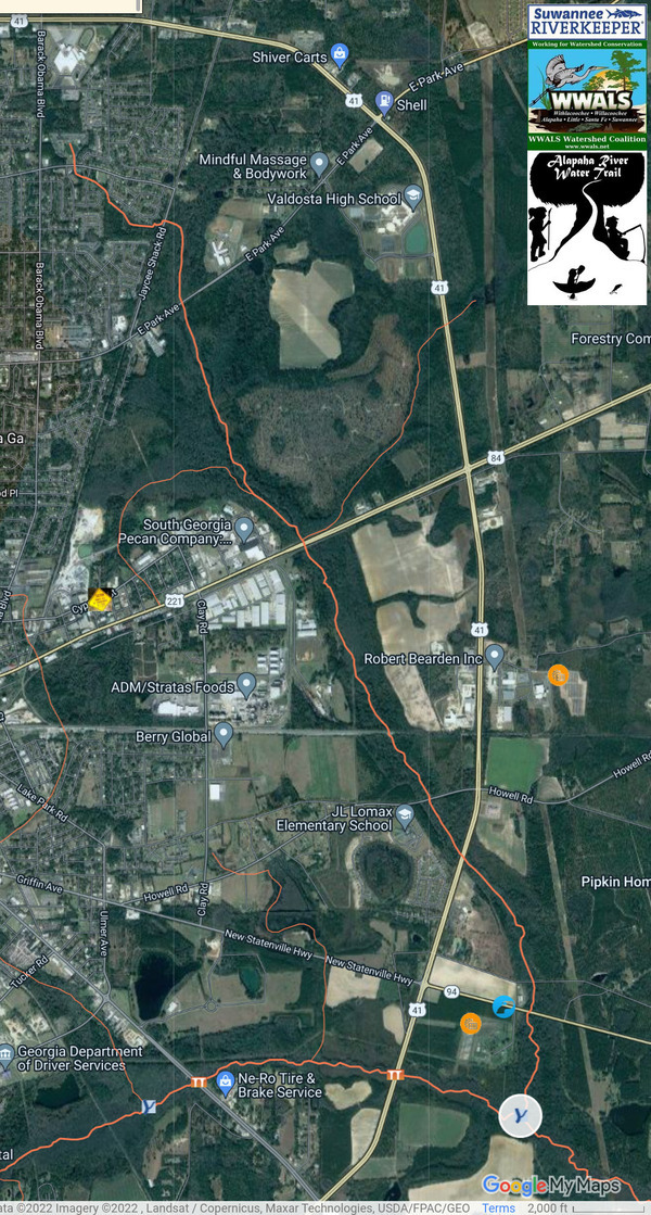
PHOTOSET: https://www.wwals.net/pictures/2022-08-08–trash-family-dollar-inner-perimeter-valdosta/#Maps
PHOTO SOURCE: WWALS
PHONE NUMBER: (850) 290-2350
Suggestions: https://forms.gle/DipPgU2TP5atc2Rf9
Historic Statenville Road Knights Creek Bridge

CATEGORIES: Bridgehistoric
LAYER: Bridge
GPS: 30.811702, -83.22329
OWNERSHIP: Private, MCLEOD-ALLISON FAMILY FARMS LLC, PARCEL 0187 002A
WATER BODY: Knights Creek
MILE: 0.78
ADDRESS: On private land east of Inner Perimeter Road. Lowndes County.
DESCRIPTION: Appears to be an old wood bridge.
AKA: Old Statenville Road Knights Creek Bridge
Suggestions: https://forms.gle/DipPgU2TP5atc2Rf9
New Statenville Highway Knights Creek Bridge
CATEGORIES: Bridge
LAYER: Bridge
OWNERSHIP: Public
WATER BODY: Knights Creek
MILE: 0.62
ADDRESS: 1657 GA 94, east of Inner Perimeter Road. Lowndes County.
DESCRIPTION: A box culvert.
AKA: GA 94 Kinghts Creek Bridge.
OTHER REFERENCE: https://maps.app.goo.gl/T6ZKeYjxoBCRn7Dp8
Suggestions: https://forms.gle/DipPgU2TP5atc2Rf9
Howells Rapids

CATEGORIES: Shoal
LAYER: Point of Interest
OWNERSHIP: Public
WHITEWATER CLASS: Class I
WATER BODY: Alapaha River
MILE: 46.27
ADDRESS: Just upstream from site of Howells Ferry and current Howell Road Bridge, Echols County.
DESCRIPTION: These low-water shoals, two miles downstream from Cow Shoals, make the last rapids before Mayday Landing.
WEBSITE: https://wwals.net/pictures/2016-05-07–us84-to-mayday-alapaha-river/#And-more-rapids
UPSTREAM: 11.03 miles from Howells Rapids to Naylor Boat Ramp
DOWNSTREAM: 0.21 mile from Howells Rapids to Mayday Landing
PHOTO: https://wwals.net/pictures/2016-05-07–us84-to-mayday-alapaha-river/KIMG4891.jpg
PHOTOSET: https://wwals.net/pictures/2016-05-07–us84-to-mayday-alapaha-river/
PHOTO SOURCE: John S. Quarterman
PHONE NUMBER: (229) 242-0102
Suggestions: https://forms.gle/DipPgU2TP5atc2Rf9
Howells Ferry and Bridge site
CATEGORIES: Bridgesite
LAYER: Bridge
GPS: 30.828749, -83.01864
OWNERSHIP: Public
WATER BODY: Alapaha River
MILE: 46.12
ADDRESS: North (upstream) of Howell Road, Echols County.
DESCRIPTION: Site of a historical ferry and apparently later bridge.
WEBSITE: https://en.wikipedia.org/wiki/Alapaha_River
UPSTREAM: 11.18 miles from Howells Ferry and Bridge site to Naylor Boat Ramp
DOWNSTREAM: 0.06 mile from Howells Ferry and Bridge site to Mayday Landing
Suggestions: https://forms.gle/DipPgU2TP5atc2Rf9
Howell Road Bridge
CATEGORIES: Bridge
LAYER: Bridge
OWNERSHIP: Public
ACCESS: No
WATER BODY: Alapaha River
MILE: 46.08
ADDRESS: Howell Road, due east of Valdosta, GA. Echols County.
DESCRIPTION: Two-lane concrete county road bridge built in 1955 between Valdosta and Fruitland.
WEBSITE: https://wwals.net/pictures/2016-05-07–us84-to-mayday-alapaha-river/#Bridges
OTHER REFERENCE: https://maps.app.goo.gl/31bDuzmjLgcZicZ2A
UPSTREAM: 11.22 miles from Howell Road Bridge to Naylor Boat Ramp
DOWNSTREAM: 0.02 mile from Howell Road Bridge to Mayday Landing
PHOTO SOURCE: Valdosta Daily Times
PHONE NUMBER: (850) 290-2350
Suggestions: https://forms.gle/DipPgU2TP5atc2Rf9
Mayday Gauge
CATEGORIES: River Gauge
LAYER: River Gauge
OWNERSHIP: Public
ACCESS: No
WATER BODY: Alapaha River
MILE: 46.08
ADDRESS: Howell Road, due east of Valdosta, GA. Echols County.
DESCRIPTION: USGS 02317000, Historic gauge withold data only; not currently active.
WEBSITE: https://waterdata.usgs.gov/nwis/inventory/?site_no=02317000
UPSTREAM: 11.22 miles from Mayday Gauge to Naylor Boat Ramp
DOWNSTREAM: 0.02 mile from Mayday Gauge to Mayday Landing
Suggestions: https://forms.gle/DipPgU2TP5atc2Rf9
Mayday Landing @ Howell Road

CATEGORIES: Landing
LAYER: Brochure
GPS: 30.82827, -83.017179
OWNERSHIP: Public, LANGDALE H TRUST B-1, PARCEL 022 002
ACCESS: Yes, Launch: Sand beach down very sandy dirt access road.
WATER BODY: Alapaha River
Lowest boatable: 78.1
Highest safe: 86.1
GAUGE: Statenville
MILE: 46.06
ADDRESS: 749 Howell Road, Stockton, GA 31649. left bank, east side of the Alapaha River, south of Howell Road, north of the railroad bridge. Echols County.
DESCRIPTION: Skitter down the sand slope for an uneventful but very pleasant paddle, with many creeks, pines, cypress, tupelo, river birch, fish, birds, and turtles, plus houses. Avoid hunting season. The land is privately owned, but access is controled by the Echols County Commission. GPS at the river: 30.827842, -83.0183.
HISTORIC FACTS: In 1985 a Superior Court judge ruled that the County Commission, not the Sheriff, controls access to Mayday Landing, and he could not close it, no matter how rowdy its regulars. https://apnews.com/article/4e637c059d965c4fa99326ede4a0ef49
WEBSITE: https://wwals.net/maps/alapaha-water-trail/sites/mayday/
UPSTREAM: 11.24 miles from Mayday Landing to Naylor Boat Ramp
DOWNSTREAM: 14.55 miles from Mayday Landing to Statenville Boat Ramp
PHOTO: https://wwals.net/pictures/2016-05-07–us84-to-mayday-alapaha-river/KIMG4896.jpg
PHOTOSET: https://wwals.net/pictures/2016-05-07–us84-to-mayday-alapaha-river/KIMG4896.html
PHOTO SOURCE: John S. Quarterman
PHONE NUMBER: (229) 242-0102
PHOTO2: https://wwals.net/pictures/2020-09-26–drafts-metal-signs/Mayday-Landing-ARWT-metal-sign-0001.jpg
Photoset2: https://wwals.net/pictures/2020-09-26–drafts-metal-signs/Mayday-Landing-ARWT-metal-sign-0001.html
PHOTO2 SOURCE: WWALS
Suggestions: https://forms.gle/DipPgU2TP5atc2Rf9

Mayday Landing River GPS
CATEGORIES: Point Of Interest
LAYER: Point of Interest
GPS: 30.827842, -83.0183
OWNERSHIP: Public
ACCESS: Yes, Launch: Sand beach down very sandy dirt access road.
WATER BODY: Alapaha River
Lowest boatable: 78.1
Highest safe: 86.1
GAUGE: Statenville
MILE: 46.06
ADDRESS: 749 Howell Road, Stockton, GA 31649. left bank, east side of the Alapaha River, south of Howell Road, north of the railroad bridge. Echols County.
DESCRIPTION: Skitter down the sand slope for an uneventful but very pleasant paddle, with many creeks, pines, cypress, tupelo, river birch, fish, birds, and turtles, plus houses. Avoid hunting season. The land is privately owned, but access is controled by the Echols County Commission. GPS at the river: 30.827842, -83.0183.
HISTORIC FACTS: In 1985 a Superior Court judge ruled that the County Commission, not the Sheriff, controls access to Mayday Landing, and he could not close it, no matter how rowdy its regulars. https://apnews.com/article/4e637c059d965c4fa99326ede4a0ef49
WEBSITE: https://wwals.net/maps/alapaha-water-trail/sites/mayday/
PHOTO: https://wwals.net/pictures/2016-05-07–us84-to-mayday-alapaha-river/KIMG4896.jpg
PHOTOSET: https://wwals.net/pictures/2016-05-07–us84-to-mayday-alapaha-river/KIMG4896.html
PHOTO SOURCE: John S. Quarterman
PHONE NUMBER: (229) 242-0102
PHOTO2: https://wwals.net/pictures/2020-09-26–drafts-metal-signs/Mayday-Landing-ARWT-metal-sign-0001.jpg
Photoset2: https://wwals.net/pictures/2020-09-26–drafts-metal-signs/Mayday-Landing-ARWT-metal-sign-0001.html
PHOTO2 SOURCE: WWALS
Suggestions: https://forms.gle/DipPgU2TP5atc2Rf9
Norfolk Southern Railroad Bridge
CATEGORIES: Railbridge
LAYER: Bridge
OWNERSHIP: Public
ACCESS: No
WATER BODY: Alapaha River
MILE: 45.99
ADDRESS: Just south of Howell Road, due east of Valdosta, Echols County.
DESCRIPTION: Railroad bridge just downstream from Mayday Landing. The railroad did massive work on this bridge in late 2020 and early 2021, using a floating barge. Now Norfolk Southern, originally Atlantic, Valdosta & Western Railway and Georgia Southern & Florida Railroad. Goes from Valdosta to Fargo and Jacksonville.
WEBSITE: http://www.railga.com/gsf.html
UPSTREAM: 0.07 mile from Norfolk Southern Railroad Bridge to Mayday Landing
DOWNSTREAM: 14.48 miles from Norfolk Southern Railroad Bridge to Statenville Boat Ramp
PHOTO SOURCE: Valdosta Daily Times
PHONE NUMBER: (850) 290-2350
Suggestions: https://forms.gle/DipPgU2TP5atc2Rf9
Valdosta-Lowndes Tourism Authority

CATEGORIES: ARWT Sponsor
LAYER: Sponsor
OWNERSHIP: Public
ACCESS: No
ADDRESS: Valdosta-Lowndes County Conference Center and Tourism Authority, 1 Meeting Pl, Valdosta, GA 31601, Lowndes County.
DESCRIPTION: The tourism authority for the most populous city and county in the Suwannee River Basin.
WEBSITE: https://www.visitvaldosta.org/
PHOTOSET: http://www.l-a-k-e.org/blog/2014/10/wwals-on-tourism-authority-agenda-vlcccta-2014-10-28.html
PHOTO SOURCE: VLCCCTA
PHONE NUMBER: (229) 245-0513
Suggestions: https://forms.gle/DipPgU2TP5atc2Rf9
Valdosta MCWTP
CATEGORIES: Wtp
LAYER: Brochure
OWNERSHIP: Public, City of Valdosta, PARCEL 0188 001
ACCESS: No
WATER BODY: Knights Creek
MILE: 0.59
ADDRESS: 1638 New Statenville Hwy, Valdosta, GA 31606, Lowndes County.
DESCRIPTION: Valdosta’s Mud Creek Wastewater Treatment Plant, one of two (the other is on the Withlacoochee River). Fortunately, it has not spilled in years. NPDES Permit No. GA0020222.
AKA: MCWTP or Mud Creek Wastewater Treatment Plant.
GRN: Yes
WEBSITE: https://www.valdostacity.com/utilities/wastewater-treatment-plants/mud-creek
PHOTO: http://www.valdostacity.com/Modules/ShowImage.aspx?imageid=990
PHOTOSET: http://www.valdostacity.com/Index.aspx?page=270&recordid=1871
PHOTO SOURCE: City of Valdosta
PHONE NUMBER: (229) 259-3548
Suggestions: https://forms.gle/DipPgU2TP5atc2Rf9
Valdosta Solar Array

CATEGORIES: Solar
LAYER: Point of Interest
OWNERSHIP: Public, City of Valdosta, PARCEL 0188 001
ACCESS: No
WATER BODY: Knights Creek
MILE: 0.58
ADDRESS: 1638 New Statenville HwyValdosta, GA 31606, Lowndes County.
DESCRIPTION: 1.25 megawatt solar array
WEBSITE: http://www.valdostacity.com/Index.aspx?page=134
PHOTO: https://farm6.staticflickr.com/5169/5724944716_e59f43e41e_o.jpg
PHOTOSET: http://www.l-a-k-e.org/blog/2011/05/putting-power-on-the-grid-at-wiregrass-solar-commissioning.html
PHOTO SOURCE: Lowndes Area Knowledge Exchange
PHONE NUMBER: (850) 290-2350
Suggestions: https://forms.gle/DipPgU2TP5atc2Rf9
I-75 Mud Swamp Creek Bridge
CATEGORIES: Bridge
LAYER: Bridge
GPS: 30.79484, -83.30405
OWNERSHIP: Public
WATER BODY: Mud Swamp Creek
MILE: 13.69
ADDRESS: About I-75 mile 14, north of Old Clyattville Road exit.
DESCRIPTION: 120.1-foot 4-span concrete tee-beam bridge with 136.8-foot concrete cast-in-place deck, built in 1961, rebuilt in 1995, over Mud Swamp Creek.
WEBSITE: https://bridgereports.com/1099471
Suggestions: https://forms.gle/DipPgU2TP5atc2Rf9
Old Clyattville Road Mud Swamp Creek Bridge
CATEGORIES: Bridge
LAYER: Bridge
GPS: 30.79456, -83.28527
OWNERSHIP: Public
WATER BODY: Mud Swamp Creek
MILE: 12.46
ADDRESS: Between AIrport Road and M.E. Thompson Drive. Lowndes County.
DESCRIPTION: 120.1-foot 3-span concrete tee beam bridge with 91.2-foot concrete cast-in-place deck, built in 1998, over Mud Swamp Creek.
WEBSITE: https://bridgereports.com/1099545
Suggestions: https://forms.gle/DipPgU2TP5atc2Rf9
Perma-Fix Hazardous Waste Site

CATEGORIES: Point Of Interest
LAYER: Point of Interest
OWNERSHIP: Private, CHEMICAL CONSERVATION OF C/O PERMAFIX, PARCEL 0126A 010
WATER BODY: Mud Swamp Creek
MILE: 12.13
ADDRESS: 1612 James P Rodgers Cir, Valdosta, GA 31601, Lowndes County.
DESCRIPTION: Former hazardous waste processing site, now GA-EPD hazardous waste site with continual monitoring.
HISTORIC FACTS: “”On August 14, 2013, an explosion occurred at the Permafix of South Georgia facility in Valdosta, Georgia. The explosion occurred when an employee was off-loading a 55-gallon container of acetone type waste into a fuel blending pot. The explosion resulted in a two-alarm fire which engulfed half of the facility and led to the evacuation of residents and businesses in a one mile radius.”” https://response.epa.gov/site/site_profile.aspx?site_id=8781
WEBSITE: https://response.epa.gov/site/site_profile.aspx?site_id=8781
PHOTO: https://www.wwals.net/pictures/2022-09-08–perma-fix-permit/perma-fix-explosion.jpg
PHOTOSET: https://www.wwals.net/pictures/2022-09-08–perma-fix-permit/
PHOTO SOURCE: City of Valdosta
PHONE NUMBER: (850) 290-2350
Suggestions: https://forms.gle/DipPgU2TP5atc2Rf9
GA 31 Mud Swamp Creek Bridge
CATEGORIES: Bridge
LAYER: Bridge
GPS: 30.79587, -83.27263
OWNERSHIP: Public
WATER BODY: Mud Swamp Creek
MILE: 11.66
ADDRESS: Just north of Airport Road on Madison Highway. Lowndes County.
DESCRIPTION: 160.1-foot 4-span concrete tee-beam bridge with 85.0-foot concrete cast-in-place deck, built in 1974, rebuilt in 1989, over Mud Swamp Creek.
AKA: Madison Highway Mud Swamp Creek Bridge
WEBSITE: https://bridgereports.com/1099456
Suggestions: https://forms.gle/DipPgU2TP5atc2Rf9
Bus. US 41 Mud Swamp Creek Bridge
CATEGORIES: Bridge
LAYER: Bridge
GPS: 30.80431, -83.25224
OWNERSHIP: Public
WATER BODY: Mud Swamp Creek
MILE: 10.24
ADDRESS: Three miles south of Downtown Valdosta on S. Patterson Street. Lowndes County.
DESCRIPTION: 160.1-foot 4-span concrete tee-beam bridge with 49.9-foot cast-in-place concrete deck, built in 1969, over Mud Swamp Creek.
AKA: GA 7 Mud Swamp Creek Bridge or South Patterson Street Mud Swamp Creek Bridge
WEBSITE: https://bridgereports.com/1099443
Suggestions: https://forms.gle/DipPgU2TP5atc2Rf9
US 41 Northbound Mud Swamp Creek Bridge
CATEGORIES: Bridge
LAYER: Bridge
OWNERSHIP: Public
WATER BODY: Mud Swamp Creek
MILE: 9.14
ADDRESS: Half mile south of US 94 on US 41 (Inner Perimeter Road) northbound. Lowndes County.
DESCRIPTION: 160.1-foot 4-span concrete tee-beam bridge with 41.3-foot concrete cast-in-place deck, built in 1987, over Mud Swamp Creek.
AKA: Inner Perimeter Mud Swamp Creek Bridge or Inner Perimeter Road Mud Creek Bridge
WEBSITE: https://bridgereports.com/1099539
Suggestions: https://forms.gle/DipPgU2TP5atc2Rf9
US 41 Southbound Mud Swamp Creek Bridge
CATEGORIES: Bridge
LAYER: Bridge
GPS: 30.80485, -83.23534
OWNERSHIP: Public
WATER BODY: Mud Swamp Creek
MILE: 9.14
ADDRESS: Half mile south of US 94 on US 41 (Inner Perimeter Road) southbound. Lowndes County.
DESCRIPTION: 160.1-foot 4-span concrete tee-beam bridge with 41.3-foot concrete cast-in-place deck, built in 1987, over Mud Swamp Creek.
AKA: Inner Perimeter Mud Swamp Creek Bridge or Inner Perimeter Road Mud Creek Bridge
WEBSITE: https://bridgereports.com/1099540
Suggestions: https://forms.gle/DipPgU2TP5atc2Rf9
Outfall of MCWTP
CATEGORIES: Wtp
LAYER: Other
OWNERSHIP: Public, CALIFF STEPHEN FELTON & ETAL, PARCEL 0164 025
WATER BODY: Mud Swamp Creek
MILE: 8.56
ADDRESS: 1638 New Stantenville Highway, Valdosta, Georgia 31603. South through the woods from Valdosta’s Mud Creek Wastewater Treatment Plant, downstream from US 41, upstream from the Knights Creek Confluence and Johnson Road. Lowndes County.
DESCRIPTION: Up to 3.22 million gallons per day (MGD) of treated effluent from Valdosta’s Mud Creek Wastewater Treatment Plant into Mud Creek.
Suggestions: https://forms.gle/DipPgU2TP5atc2Rf9
Valdosta-Lake Park Power Line at Mud Swamp
CATEGORIES: Point Of Interest
LAYER: Point of Interest
OWNERSHIP: Private
WATER BODY: Mud Swamp Creek
MILE: 7.74
ADDRESS: Upstream from Johnson Road, accessible from New Statenville Highway or Hickory Grove Road. Lowndes County.
DESCRIPTION: A power line.
Suggestions: https://forms.gle/DipPgU2TP5atc2Rf9
Johnson Road Mud Swamp Creek Bridge
CATEGORIES: Bridge
LAYER: Bridge
GPS: 30.79603, -83.20889
OWNERSHIP: Public
WATER BODY: Mud Swamp Creek
MILE: 7.16
ADDRESS: 4.8 miles southeast of Valdosta. Lowndes County.
DESCRIPTION: 180.1-foot 9-span concrete slab bridge with 26.9-foot concrete precast panel deck, built in 1993, over Mud Swamp Creek.
WEBSITE: https://bridgereports.com/1099517
Suggestions: https://forms.gle/DipPgU2TP5atc2Rf9
Vann Road Mud Swamp Creek Bridge
CATEGORIES: Bridge
LAYER: Bridge
GPS: 30.7779, -83.18002
OWNERSHIP: Public
WATER BODY: Mud Swamp Creek
MILE: 4.43
ADDRESS: 6.5 miles southeast of Valdosta, off of Hickory Grove Road North, before US 94. Lowndes County.
DESCRIPTION: 140.1-foot 7-span concrfete slab bridge with 26.9-foot concrete precast panel deck, built in 2005, over Mud Swamp Creek.
WEBSITE: https://bridgereports.com/1099559
Suggestions: https://forms.gle/DipPgU2TP5atc2Rf9
Hickory Church Road Mud Swamp Creek Bridge
CATEGORIES: Bridge
LAYER: Bridge
GPS: 30.74088, -83.14108
OWNERSHIP: Public
WATER BODY: Mud Swamp Creek
MILE: 0.56
ADDRESS: 4.4 miles northeast of Lake Park, GA. Lowndes County.
DESCRIPTION: 264.1-foot 13-span prestressed concrete channel beam bridge with 25.9-foot concrete pre-cast panel deck, built in 1972, over Mud Swamp Creek.
WEBSITE: https://bridgereports.com/1099520
Suggestions: https://forms.gle/DipPgU2TP5atc2Rf9
Connell Branch
CATEGORIES: Tributary
LAYER: Other
OWNERSHIP: Private
WATER BODY: Alapaha River
MILE: 44.42
ADDRESS: Valentine Road, Lake Park, GA 31636, Echols County.
DESCRIPTION: Right bank. Comes down across Howell road and by extensive borrow pits.
UPSTREAM: 1.64 miles from Connell Branch to Mayday Landing
DOWNSTREAM: 12.91 miles from Connell Branch to Statenville Boat Ramp
Suggestions: https://forms.gle/DipPgU2TP5atc2Rf9
Odd Stump Sculpture at sandu beach point

CATEGORIES: Point Of Interest
LAYER: Point of Interest
OWNERSHIP: Public
WATER BODY: Alapaha River
ADDRESS: Below Connell Branch, Echols County.
DESCRIPTION: Right bank. Can’t tell whether it grew that way or it was constructed.
PHOTOSET: https://www.wwals.net/pictures/2024-05-11–mayday-statenville-alapaha-river-pictures/
PHOTO SOURCE: John S. Quarterman
PHONE NUMBER: (229) 242-0102
Suggestions: https://forms.gle/DipPgU2TP5atc2Rf9
Resurrection fern over beach

CATEGORIES: Point Of Interest
LAYER: Point of Interest
OWNERSHIP: Public
WATER BODY: Alapaha River
ADDRESS: Between Connell Branch and Howell Branch, Echols County.
DESCRIPTION: Right bank: an oak with a mat of resurrection fern over a sandy beach on a point.
PHOTOSET: https://www.wwals.net/pictures/2024-05-11–mayday-statenville-alapaha-river-pictures/
PHOTO SOURCE: John S. Quarterman
PHONE NUMBER: (229) 242-0102
Suggestions: https://forms.gle/DipPgU2TP5atc2Rf9
Foaming creek or slough

CATEGORIES: Point Of Interest
LAYER: Point of Interest
OWNERSHIP: Public
WATER BODY: Alapaha River
ADDRESS: Between Connell Branch and Howell Branch, Echols County.
DESCRIPTION: Left bank: looks like a creek.
PHOTOSET: https://www.wwals.net/pictures/2024-05-11–mayday-statenville-alapaha-river-pictures/
PHOTO SOURCE: John S. Quarterman
PHONE NUMBER: (229) 242-0102
Suggestions: https://forms.gle/DipPgU2TP5atc2Rf9
Howell Branch
CATEGORIES: Tributary
LAYER: Other
GPS: 30.804351, -83.02695
OWNERSHIP: Private
WATER BODY: Alapaha River
MILE: 43.28
ADDRESS: Valentine Road, Lake Park, GA 31636, Echols County.
DESCRIPTION: Right bank. Comes all the way across GA 135 and Howell Road, past the same borrow pits as Connell Branch.
UPSTREAM: 2.78 miles from Howell Branch to Mayday Landing
DOWNSTREAM: 11.77 miles from Howell Branch to Statenville Boat Ramp
Suggestions: https://forms.gle/DipPgU2TP5atc2Rf9
Langdale Private Park at Howell-Rentz Oxbow
CATEGORIES: Point Of Interest
LAYER: Point of Interest
OWNERSHIP: Private
WATER BODY: Alapaha River
ADDRESS: Between Howell Branch and Rentz Branch, Echols County.
DESCRIPTION: Left bank, off of Carroll Road. Private: no unauthorized use.
Suggestions: https://forms.gle/DipPgU2TP5atc2Rf9
Howell-Rentz Oxbow Cutoff

CATEGORIES: Point Of Interest
LAYER: Point of Interest
OWNERSHIP: Public
WATER BODY: Alapaha River
MILE: 42.81
ADDRESS: Valentine Road, Lake Park, GA 31636, Echols County.
DESCRIPTION: Bend to the right to take the cutoff, while the oxbow goes to the left.
UPSTREAM: 3.25 miles from Howell-Rentz Oxbow Cutoff to Mayday Landing
DOWNSTREAM: 11.3 miles from Howell-Rentz Oxbow Cutoff to Statenville Boat Ramp
PHOTO: https://www.wwals.net/pictures/gretchen/2019-03-23–wwals-alapaha-mayday/IMG_2004.jpg
PHOTOSET: https://www.wwals.net/pictures/gretchen/2019-03-23–wwals-alapaha-mayday
PHOTO SOURCE: Gretchen Quarterman
PHONE NUMBER: (850) 290-2350
Suggestions: https://forms.gle/DipPgU2TP5atc2Rf9
Rentz Branch
CATEGORIES: Tributary
LAYER: Other
OWNERSHIP: Private
WATER BODY: Alapaha River
MILE: 42.20
ADDRESS: Valentine Road, Lake Park, GA 31636, Echols County.
DESCRIPTION: Right bank. Comes down across GA 135.
UPSTREAM: 3.86 miles from Rentz Branch to Mayday Landing
DOWNSTREAM: 10.69 miles from Rentz Branch to Statenville Boat Ramp
Suggestions: https://forms.gle/DipPgU2TP5atc2Rf9
Wide sandy creek or private low-water landing

CATEGORIES: Point Of Interest
LAYER: Point of Interest
OWNERSHIP: Private
WATER BODY: Alapaha River
ADDRESS: Below Rentz Branch, Echols County.
DESCRIPTION: Left bank, under some oaks, off of Carroll Road.
PHOTOSET: https://www.wwals.net/pictures/2024-05-11–mayday-statenville-alapaha-river-pictures/
PHOTO SOURCE: John S. Quarterman
PHONE NUMBER: (229) 242-0102
Suggestions: https://forms.gle/DipPgU2TP5atc2Rf9
03110202007067 Creek
CATEGORIES: Tributary
LAYER: Point of Interest
OWNERSHIP: Private
WATER BODY: Alapaha River
MILE: 39.28
ADDRESS: Echols County.
DESCRIPTION: This Tributary is located on river right of the Alapaha River.
UPSTREAM: 6.78 miles from 03110202007067 Creek to Mayday Landing
DOWNSTREAM: 7.77 miles from 03110202007067 Creek to Statenville Boat Ramp
Suggestions: https://forms.gle/DipPgU2TP5atc2Rf9
Big Branch 00311302
CATEGORIES: Tributary
LAYER: Other
OWNERSHIP: Private
WATER BODY: Alapaha River
MILE: 38.00
ADDRESS: North of Statenville, Echols County.
DESCRIPTION: Left bank. More creative names would have avoided having to use numbers to distinguish creeks.
UPSTREAM: 8.06 miles from Big Branch 00311302 to Mayday Landing
DOWNSTREAM: 6.49 miles from Big Branch 00311302 to Statenville Boat Ramp
Suggestions: https://forms.gle/DipPgU2TP5atc2Rf9
Martin Branch
CATEGORIES: Tributary
LAYER: Point of Interest
OWNERSHIP: Private
WATER BODY: Alapaha River
MILE: 37.82
ADDRESS: Echols County.
DESCRIPTION: This Tributary is located on river right of the Alapaha River.
UPSTREAM: 8.24 miles from Martin Branch to Mayday Landing
DOWNSTREAM: 6.31 miles from Martin Branch to Statenville Boat Ramp
Suggestions: https://forms.gle/DipPgU2TP5atc2Rf9
03110202007099 Creek
CATEGORIES: Tributary
LAYER: Point of Interest
OWNERSHIP: Private
WATER BODY: Alapaha River
MILE: 36.51
ADDRESS: Echols County.
DESCRIPTION: This Tributary is located on river right of the Alapaha River.
UPSTREAM: 9.55 miles from 03110202007099 Creek to Mayday Landing
DOWNSTREAM: 5.00 miles from 03110202007099 Creek to Statenville Boat Ramp
Suggestions: https://forms.gle/DipPgU2TP5atc2Rf9
Cranford Branch
CATEGORIES: Tributary
LAYER: Point of Interest
OWNERSHIP: Private
WATER BODY: Alapaha River
MILE: 35.98
ADDRESS: Echols County.
DESCRIPTION: This Tributary is located on river right of the Alapaha River.
UPSTREAM: 10.08 miles from Cranford Branch to Mayday Landing
DOWNSTREAM: 4.47 miles from Cranford Branch to Statenville Boat Ramp
Suggestions: https://forms.gle/DipPgU2TP5atc2Rf9
03110202001891 Creek
CATEGORIES: Tributary
LAYER: Point of Interest
OWNERSHIP: Private
WATER BODY: Alapaha River
MILE: 33.28
ADDRESS: Echols County.
DESCRIPTION: This Tributary is located on river right of the Alapaha River.
UPSTREAM: 12.78 miles from 03110202001891 Creek to Mayday Landing
DOWNSTREAM: 1.77 miles from 03110202001891 Creek to Statenville Boat Ramp
Suggestions: https://forms.gle/DipPgU2TP5atc2Rf9
03110202000585 Creek
CATEGORIES: Tributary
LAYER: Point of Interest
OWNERSHIP: Private
WATER BODY: Alapaha River
MILE: 32.46
ADDRESS: Echols County.
DESCRIPTION: This Tributary is located on river left of the Alapaha River.
UPSTREAM: 13.6 miles from 03110202000585 Creek to Mayday Landing
DOWNSTREAM: 0.95 mile from 03110202000585 Creek to Statenville Boat Ramp
Suggestions: https://forms.gle/DipPgU2TP5atc2Rf9
Troublesome Creek
CATEGORIES: Tributary
LAYER: Point of Interest
OWNERSHIP: Private
WATER BODY: Alapaha River
MILE: 31.70
ADDRESS: Echols County.
DESCRIPTION: On the left bank, the last creek before Statenville Boat Ramp.
UPSTREAM: 14.36 miles from Troublesome Creek to Mayday Landing
DOWNSTREAM: 0.19 mile from Troublesome Creek to Statenville Boat Ramp
Suggestions: https://forms.gle/DipPgU2TP5atc2Rf9
400 Mildred Street Spill

CATEGORIES: Spill
LAYER: Point of Interest
OWNERSHIP: Public, City of Valdosta
WATER BODY: Dukes Bay Canal
ADDRESS: 400 Mildred Street, Valdosta, GA 31601, Lowndes County.
DESCRIPTION: 25, 150 gallons of raw sewage spilled due to rain, 2021-01-02, A notorious location for Valdosta sewage spills for many years.
WEBSITE: https://wwals.net/pictures/2021-01-02–valdosta-mildred-street-dukes-bay-canal-spill
PHOTOSET: https://wwals.net/pictures/2021-01-02–valdosta-mildred-street-dukes-bay-canal-spill/
PHOTO SOURCE: Google Streetview
PHONE NUMBER: (850) 290-2350
Suggestions: https://forms.gle/DipPgU2TP5atc2Rf9
200 MLK Drive Spill *
CATEGORIES: Spill
LAYER: Point of Interest
OWNERSHIP: Lowndes, PARCEL GA
ACCESS: Dukes Bay Canal, TYPE OF LAUNCH, DOCK: “Sewage spill, “”200 Block of MLK Dr. = 320 gallons”” 2021-07-07 during Tropical Storm Elsa. CANOE: Public
MILE: 2.01
ADDRESS: “”200 MLK Drive”
DESCRIPTION: GA 31601, * https://wwals.net/pictures/2021-07-08–sewage-spills-valdosta-starke
WEBSITE: Valdosta
OTHER REFERENCE: Apparently across the street from the Martin Luther King Jr. Memorial.
Suggestions: https://forms.gle/DipPgU2TP5atc2Rf9
Jackson Drive Sewage Spill
CATEGORIES: Spill
LAYER: Point of Interest
GPS: 30.81102673, -83.27182962
OWNERSHIP: Public
WATER BODY: Dukes Bay Canal
MILE: 1.12
ADDRESS: 110 Jackson Drive, Valdosta, GA 31601, near the Lowndes County Sheriff Department and associated detention facilities. Lowndes County.
DESCRIPTION: Site of a 1, 800-gallon raw sewage spill due to debris. “”Did Not Enter State Waters”” in the catchment of Dukes Bay Canal: “”Obstruction from trash from local corrections facility””. Erroneously reported as on Jackson Street, in downtown Valdosta, where there is no detention facility, In the catchment of Browns Canal.
HISTORIC FACTS: WWALS filed a Georgia Open Records Act (GORA) request February 17, 2025, to get the report Valdosta Utilities sent to GA-EPD, with the latlong of the spill.
Suggestions: https://forms.gle/DipPgU2TP5atc2Rf9
Gil Harbin Dukes Bay Canal Bridge
CATEGORIES: Bridge
LAYER: Bridge
OWNERSHIP: Public
WATER BODY: Dukes Bay Canal
MILE: 0.57
ADDRESS: Just west of South Patterson Street on Gil Harbin Industrial Blvd., Valdosta, GA 31601, Lowndes County.
DESCRIPTION: Appears to be a single big box culvert.
Suggestions: https://forms.gle/DipPgU2TP5atc2Rf9
819 Bunche Drive spill

CATEGORIES: Spill
LAYER: Point of Interest
OWNERSHIP: Public
WATER BODY: Dukes Bay Canal East
MILE: 1.11
ADDRESS: 819 Bunche Drive, Valdosta, GA 31601, Lowndes County.
DESCRIPTION: Near Dukes Bay Canal East.
HISTORIC FACTS: Sewage spill, “”there was an unknown obstruction in the line and likely the cause of the spill. City staff were able to remove the block after several hours. An estimated 8400 gallons of wastewater were released into two stormwater catch basins and released into Duke’s Bay.””
PHOTO: https://www.wwals.net/pictures/2023-08-28–valdosta-obstruction-sewer-spill-dukes-bay-canal/many.jpg
PHOTOSET: https://www.wwals.net/pictures/2023-08-28–valdosta-obstruction-sewer-spill-dukes-bay-canal/
PHOTO SOURCE: WWALS
PHONE NUMBER: (850) 290-2350
Suggestions: https://forms.gle/DipPgU2TP5atc2Rf9
Dukes Bay Canal
CATEGORIES: Tributary
LAYER: Other
OWNERSHIP: Public, Valdosta-Lowndes County Industrial Authority, PARCEL 0161D 001
ACCESS: No
WATER BODY: Mud Swamp Creek
ADDRESS: West of Old U.S. 41 South at Lester Road, Lowndes County.
DESCRIPTION: Confluence of Dukes Bay Canal with Mud Swamp Creek, both coming out of Valdosta. Dukes Bay Canal is notorious for wastewater overflows, including one in February 2015
WEBSITE: https://wwals.net/2015/03/22/videos-valdosta-wastewater-meeting-with-slides-2015-03-17/
PHOTO: https://wwals.net/wp-content/themes/pianoblack/img//2015/03/d247f009be7c1f763ee0d11c0b5e4765.jpg
PHOTO SOURCE: City of Valdosta
PHONE NUMBER: (850) 290-2350
Suggestions: https://forms.gle/DipPgU2TP5atc2Rf9
Knights Creek

CATEGORIES: Tributary
LAYER: Other
OWNERSHIP: Private, Charles Douglas Brown and Rodney Wayne Brown, PARCEL 0188 108A
ACCESS: No
WATER BODY: Mud Swamp Creek
ADDRESS: 3309 Hickory Grove Road, Lowndes County.
DESCRIPTION: Confluence of Knights Creek from east Valdosta with Mud Swamp Creek from south Valdosta. Knights Creek has one of Valdosta’s two wastewater treatment plants. Knights Creek is notorious for wastewater overflows, including two of the three reported by Valdosta in February 2015.
WEBSITE: https://wwals.net/2015/03/22/videos-valdosta-wastewater-meeting-with-slides-2015-03-17/
PHOTO: https://wwals.net/wp-content/themes/pianoblack/img//2015/03/445ed0164035afdc13d867249757fcdb.jpg
PHOTO SOURCE: City of Valdosta
PHONE NUMBER: (850) 290-2350
Suggestions: https://forms.gle/DipPgU2TP5atc2Rf9
GA 94 Grand Bay Creek Bridge
CATEGORIES: Bridge
LAYER: Bridge
OWNERSHIP: Public
WATER BODY: Grand Bay Creek
MILE: 2.93
ADDRESS: Ten miles SE of Valdosta on GA 94, Lowndes, Echols Counties.
DESCRIPTION: Last bridge over Grand Bay Creek before it joins with Mud Swamp Creek to form the Alapahoochee River. Grand Bay Creek is the county line here between Lowndes and Echols.
Suggestions: https://forms.gle/DipPgU2TP5atc2Rf9
Wild Adventures

CATEGORIES: Logo Contest Sponsor
LAYER: Sponsor
OWNERSHIP: Private
ACCESS: No
WATER BODY: Clyatt Mill Creek
ADDRESS: 3766 Old Clyattville Rd, Valdosta, GA 31601, Lowndes County.
DESCRIPTION: A well-known theme park with wild animals including a giraffe, rides, and frequent concerts of local and national musical acts.
WEBSITE: http://www.wildadventures.com/
PHOTO: http://www.wildadventures.com/Portals/0/SM%20frame%202015%20SPs%20monkey%20takeover.jpg
PHOTOSET: http://www.wildadventures.com/
PHOTO SOURCE: Wild Adventures
PHONE NUMBER: (229) 219-7080
Suggestions: https://forms.gle/DipPgU2TP5atc2Rf9
Statenville Boat Ramp @ GA 94

CATEGORIES: Landing
LAYER: Brochure
GPS: 30.704437, -83.03468
OWNERSHIP: Public, TIMBERLANDS HOLDING COMPANY ATLANTIC INC, PARCEL 028 001
ACCESS: Yes, Ramp: Concrete ramp on paved access road, with paved parking lot. PARKING: Free, HANDICAPPED ACCESSIBLE
WATER BODY: Alapaha River
Lowest boatable: 78.1
Highest safe: 86.1
GAUGE: Statenville
MILE: 31.51
ADDRESS: 206 GA 94 West, Statenville, GA 31648, right bank, west of river, north of highway bridge. Echols County.
DESCRIPTION: The only GA-DNR boat ramp on the Alapaha River. After rains, you can see countless gushing streams, many of them waterfalls. Any time, there are black rocks and a fallen island. Watch for the Halberdleaf Rosemallow blooming in June. Across the GA-FL line there are very nice rapids. Paddle up the Alapahoochee River to see Turket Falls! Last Alapaha River access in Georgia. GPS at the river: 30.70426, -83.03275
WEBSITE: https://georgiaoutdoormap.com/
UPSTREAM: 14.55 miles from Statenville Boat Ramp to Mayday Landing
DOWNSTREAM: 10.36 miles from Statenville Boat Ramp to Sasser Landing
PHOTO: https://www.wwals.net/pictures/2019-07-06–statenville-sasser-pictures/20190706_093220.jpg
PHOTOSET: https://www.wwals.net/pictures/2019-07-06–statenville-sasser-pictures/
PHOTO SOURCE: John S. Quarterman
PHONE NUMBER: (229) 242-0102
PHOTO2 SOURCE: WWALS
Suggestions: https://forms.gle/DipPgU2TP5atc2Rf9

Statenville Boat Ramp River GPS
CATEGORIES: Point Of Interest
LAYER: Point of Interest
GPS: 30.70426, -83.03275
OWNERSHIP: Public
ACCESS: Yes, Ramp: Concrete ramp on paved access road, with paved parking lot. PARKING: Free, HANDICAPPED ACCESSIBLE
WATER BODY: Alapaha River
Lowest boatable: 78.1
Highest safe: 86.1
GAUGE: Statenville
MILE: 31.51
ADDRESS: 206 GA 94 West, Statenville, GA 31648, right bank, west of river, north of highway bridge. Echols County.
DESCRIPTION: The only GA-DNR boat ramp on the Alapaha River. After rains, you can see countless gushing streams, many of them waterfalls. Any time, there are black rocks and a fallen island. Watch for the Halberdleaf Rosemallow blooming in June. Across the GA-FL line there are very nice rapids. Paddle up the Alapahoochee River to see Turket Falls! Last Alapaha River access in Georgia. GPS at the river: 30.70426, -83.03275
WEBSITE: https://georgiaoutdoormap.com/
PHOTO: https://www.wwals.net/pictures/2019-07-06–statenville-sasser-pictures/20190706_093220.jpg
PHOTOSET: https://www.wwals.net/pictures/2019-07-06–statenville-sasser-pictures/
PHOTO SOURCE: John S. Quarterman
PHONE NUMBER: (229) 242-0102
PHOTO2 SOURCE: WWALS
Suggestions: https://forms.gle/DipPgU2TP5atc2Rf9
Statenville Gauge
CATEGORIES: River Gauge
LAYER: River Gauge
GPS: 30.7039, -83.032666
OWNERSHIP: Public
ACCESS: No
WATER BODY: Alapaha River
Lowest boatable: 78.1
Highest safe: 86.1
GAUGE: Statenville
MILE: 31.49
ADDRESS: At GA 94 near Statenville, GA, Echols County.
DESCRIPTION: USGS 02317500
WEBSITE: https://wwals.net/2014/11/03/alapaha-river-water-levels/#Statenville
UPSTREAM: 0.02 mile from Statenville Gauge to Statenville Boat Ramp
DOWNSTREAM: 10.34 miles from Statenville Gauge to Sasser Landing
PHOTO: https://waterwatch.usgs.gov/wwapps/ftc.php?site_no=02317500
PHOTOSET: https://wwals.net/2014/12/01/alapaha-river-rainy-season/
PHOTO SOURCE: John S. Quarterman
PHONE NUMBER: (229) 242-0102
Suggestions: https://forms.gle/DipPgU2TP5atc2Rf9
GA 94 Bridge

CATEGORIES: Bridge
LAYER: Bridge
GPS: 30.7039, -83.032666
OWNERSHIP: Public
ACCESS: No
WATER BODY: Alapaha River
MILE: 31.49
ADDRESS: At GA 94 near Statenville, GA, Echols County.
DESCRIPTION: Two-lane concrete state highway bridge with sidewalks built in 1989 between Valdosta and Statenville. Home of Statenville Boat Ramp and the Statenville USGS gauge.
WEBSITE: https://wwals.net/2015/01/30/pictures-upstream-alapaha-river-statenville-boat-ramp-2014-01-18/
OTHER REFERENCE: https://maps.app.goo.gl/qw1ivkrPECAkMtG89
UPSTREAM: 0.02 mile from GA 94 Bridge to Statenville Boat Ramp
DOWNSTREAM: 10.34 miles from GA 94 Bridge to Sasser Landing
PHOTO: https://wwals.net/wp-content/themes/pianoblack/img//2015/01/62c171ced53e2a0c47a02615d811e6fd.jpg
PHOTOSET: https://wwals.net/2015/01/30/pictures-upstream-alapaha-river-statenville-boat-ramp-2014-01-18/
PHOTO SOURCE: John S. Quarterman
PHONE NUMBER: (229) 242-0102
Suggestions: https://forms.gle/DipPgU2TP5atc2Rf9
Corbett Waterfall 

CATEGORIES: Waterfall
LAYER: Point of Interest
OWNERSHIP: Private
WATER BODY: Alapaha River
MILE: 30.74
ADDRESS: Echols County.
DESCRIPTION: This Waterfall is located on river left of the Alapaha River.
UPSTREAM: 0.77 mile from Corbett Waterfall to Statenville Boat Ramp
DOWNSTREAM: 9.59 miles from Corbett Waterfall to Sasser Landing
PHOTO: https://www.wwals.net/pictures/2019-07-06–statenville-sasser-pictures/20190706_103817.jpg
PHOTOSET: https://wwals.net/pictures/2019-07-06–statenville-sasser-pictures/#Waterfalls
PHOTO SOURCE: John S. Quarterman
PHONE NUMBER: (229) 242-0102
Suggestions: https://forms.gle/DipPgU2TP5atc2Rf9
BST North Waterfall

CATEGORIES: Waterfall
LAYER: Point of Interest
OWNERSHIP: Private
WATER BODY: Alapaha River
MILE: 30.40
ADDRESS: Echols County.
DESCRIPTION: This Waterfall is located on river left of the Alapaha River.
GRN: No
UPSTREAM: 1.11 miles from BST North Waterfall to Statenville Boat Ramp
DOWNSTREAM: 9.25 miles from BST North Waterfall to Sasser Landing
PHOTO: https://wwals.net/pictures/2019-07-06–statenville-sasser-pictures/20190706_104712.jpg
PHOTOSET: https://wwals.net/pictures/2019-07-06–statenville-sasser-pictures/#BST-Family-Properties
PHOTO SOURCE: John S. Quarterman
PHONE NUMBER: (229) 242-0102
Suggestions: https://forms.gle/DipPgU2TP5atc2Rf9
Rayonier Echols Branch (03110202001892)
CATEGORIES: Tributary
LAYER: Point of Interest
GPS: 30.694538, -83.04513
OWNERSHIP: Private
WATER BODY: Alapaha River
MILE: 30.14
ADDRESS: Echols County.
DESCRIPTION: This Tributary is located on river right of the Alapaha River.
GRN: No
UPSTREAM: 1.37 miles from Rayonier Echols Branch (03110202001892) to Statenville Boat Ramp
DOWNSTREAM: 8.99 miles from Rayonier Echols Branch (03110202001892) to Sasser Landing
Suggestions: https://forms.gle/DipPgU2TP5atc2Rf9
Rayonier-BST tiny rapids

CATEGORIES: Shoal
LAYER: Other
OWNERSHIP: Public
WHITEWATER CLASS: Class I
WATER BODY: Alapaha River
MILE: 30.06
ADDRESS: Echols County.
GRN: No
UPSTREAM: 1.45 miles from Rayonier-BST tiny rapids to Statenville Boat Ramp
DOWNSTREAM: 8.91 miles from Rayonier-BST tiny rapids to Sasser Landing
PHOTO: https://wwals.net/pictures/2019-07-06–statenville-sasser-pictures/20190706_105411.jpg
PHOTOSET: https://wwals.net/pictures/2019-07-06–statenville-sasser-pictures/#Rayonier-Rapids
PHOTO SOURCE: John S. Quarterman
PHONE NUMBER: (229) 242-0102
Suggestions: https://forms.gle/DipPgU2TP5atc2Rf9
BST South High Waterfall

CATEGORIES: Waterfall
LAYER: Point of Interest
OWNERSHIP: Private
WATER BODY: Alapaha River
MILE: 29.70
ADDRESS: Echols County.
GRN: No
UPSTREAM: 1.81 miles from BST South High Waterfall to Statenville Boat Ramp
DOWNSTREAM: 8.55 miles from BST South High Waterfall to Sasser Landing
PHOTO: https://wwals.net/pictures/2019-07-06–statenville-sasser-pictures/20190706_110203.jpg
PHOTOSET: https://wwals.net/pictures/2019-07-06–statenville-sasser-pictures/#BST-South-Waterfall
PHOTO SOURCE: John S. Quarterman
PHONE NUMBER: (229) 242-0102
Suggestions: https://forms.gle/DipPgU2TP5atc2Rf9
Prine Waterfall

CATEGORIES: Waterfall
LAYER: Point of Interest
OWNERSHIP: Private
WATER BODY: Alapaha River
MILE: 29.44
ADDRESS: Echols County.
DESCRIPTION: This Waterfall is located on river left of the Alapaha River.
UPSTREAM: 2.07 miles from Prine Waterfall to Statenville Boat Ramp
DOWNSTREAM: 8.29 miles from Prine Waterfall to Sasser Landing
PHOTO: https://wwals.net/pictures/2019-07-06–statenville-sasser-pictures/20190706_111146.jpg
PHOTOSET: https://wwals.net/pictures/2019-07-06–statenville-sasser-pictures/#Prine-waterfall
PHOTO SOURCE: John S. Quarterman
PHONE NUMBER: (229) 242-0102
Suggestions: https://forms.gle/DipPgU2TP5atc2Rf9
Rayonier Echols Runoff

CATEGORIES: Tributary
LAYER: Point of Interest
OWNERSHIP: Private
WATER BODY: Alapaha River
MILE: 29.12
ADDRESS: Echols County.
DESCRIPTION: Water gushing from the right bank.
UPSTREAM: 2.39 miles from Rayonier Echols Runoff to Statenville Boat Ramp
DOWNSTREAM: 7.97 miles from Rayonier Echols Runoff to Sasser Landing
PHOTO: https://www.wwals.net/pictures/2019-07-06–statenville-sasser-pictures/20190706_111931.jpg
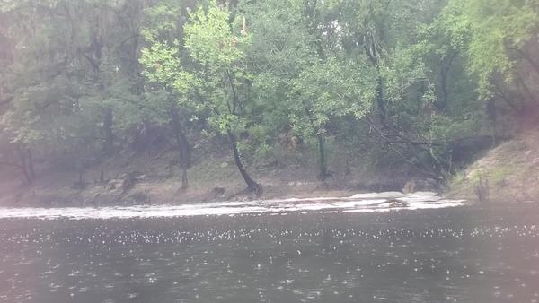
PHOTOSET: https://www.wwals.net/pictures/2019-07-06–statenville-sasser-pictures/
PHOTO SOURCE: John S. Quarterman
PHONE NUMBER: (229) 242-0102
Suggestions: https://forms.gle/DipPgU2TP5atc2Rf9
Langdale Echols private landing

CATEGORIES: Landing Private
LAYER: Other
GPS: 30.68327, -83.05352
OWNERSHIP: Private
ACCESS: Launch: slope at the end of a private dirt road
WATER BODY: Alapaha River
MILE: 28.92
ADDRESS: Echols County.
DESCRIPTION: A private dirt road comes down the right bank into the river.
UPSTREAM: 2.59 miles from Langdale Echols private landing to Statenville Boat Ramp
DOWNSTREAM: 7.77 miles from Langdale Echols private landing to Sasser Landing
PHOTO: https://www.wwals.net/pictures/2019-07-06–statenville-sasser-pictures/20190706_112816.jpg
PHOTOSET: https://www.wwals.net/pictures/2019-07-06–statenville-sasser-pictures/
PHOTO SOURCE: John S. Quarterman
PHONE NUMBER: (229) 242-0102
Suggestions: https://forms.gle/DipPgU2TP5atc2Rf9
Langdale Echols Runoff

CATEGORIES: Tributary
LAYER: Point of Interest
OWNERSHIP: Private
WATER BODY: Alapaha River
MILE: 27.84
ADDRESS: Echols County.
DESCRIPTION: This Tributary is located on river right of the Alapaha River.
UPSTREAM: 3.67 miles from Langdale Echols Runoff to Statenville Boat Ramp
DOWNSTREAM: 6.69 miles from Langdale Echols Runoff to Sasser Landing
PHOTO: https://wwals.net/pictures/2019-07-06–statenville-sasser-pictures/20190706_115408.jpg
PHOTOSET: https://wwals.net/pictures/2019-07-06–statenville-sasser-pictures/#Langdale-Runoff
PHOTO SOURCE: John S. Quarterman
PHONE NUMBER: (229) 242-0102
Suggestions: https://forms.gle/DipPgU2TP5atc2Rf9
Knights Branch
CATEGORIES: Tributary
LAYER: Point of Interest
OWNERSHIP: Private
WATER BODY: Alapaha River
MILE: 28.31
ADDRESS: About 2 miles downstream of Statenville, Echols County.
DESCRIPTION: This Tributary is located on river left of the Alapaha River.
UPSTREAM: 3.20 miles from Knights Branch to Statenville Boat Ramp
DOWNSTREAM: 7.16 miles from Knights Branch to Sasser Landing
Suggestions: https://forms.gle/DipPgU2TP5atc2Rf9
ECS Farm North Creek 03110202000580
CATEGORIES: Tributary
LAYER: Point of Interest
OWNERSHIP: Private
WATER BODY: Alapaha River
MILE: 27.57
ADDRESS: Echols County.
DESCRIPTION: This Tributary is located on river left of the Alapaha River.
GRN: No
UPSTREAM: 3.94 miles from ECS Farm North Creek 03110202000580 to Statenville Boat Ramp
DOWNSTREAM: 6.42 miles from ECS Farm North Creek 03110202000580 to Sasser Landing
Suggestions: https://forms.gle/DipPgU2TP5atc2Rf9
Pine Bluff Baptist Church private landing

CATEGORIES: Landing Private
LAYER: Other
OWNERSHIP: Private
ACCESS: Launch: slope at the end of a private sand road
WATER BODY: Alapaha River
MILE: 27.57
ADDRESS: Echols County.
DESCRIPTION: A sand road ramp comes down the right bank into the river.
UPSTREAM: 3.94 miles from Pine Bluff Baptist Church private landing to Statenville Boat Ramp
DOWNSTREAM: 6.42 miles from Pine Bluff Baptist Church private landing to Sasser Landing
PHOTO: https://www.wwals.net/pictures/2019-07-06–statenville-sasser-pictures/20190706_120055.jpg
PHOTOSET: https://www.wwals.net/pictures/2019-07-06–statenville-sasser-pictures/
PHOTO SOURCE: John S. Quarterman
PHONE NUMBER: (229) 242-0102
Suggestions: https://forms.gle/DipPgU2TP5atc2Rf9
ECS Farm South Creek 03110202007163
CATEGORIES: Tributary
LAYER: Point of Interest
OWNERSHIP: Private
WATER BODY: Alapaha River
MILE: 27.24
ADDRESS: Echols County.
DESCRIPTION: This Tributary is located on river left of the Alapaha River.
GRN: No
UPSTREAM: 4.27 miles from ECS Farm South Creek 03110202007163 to Statenville Boat Ramp
DOWNSTREAM: 6.09 miles from ECS Farm South Creek 03110202007163 to Sasser Landing
Suggestions: https://forms.gle/DipPgU2TP5atc2Rf9
ECS South Waterfall

CATEGORIES: Waterfall
LAYER: Point of Interest
OWNERSHIP: Private
WATER BODY: Alapaha River
MILE: 27.08
ADDRESS: Echols County.
DESCRIPTION: This Waterfall is located on river left of the Alapaha River.
UPSTREAM: 4.43 miles from ECS South Waterfall to Statenville Boat Ramp
DOWNSTREAM: 5.93 miles from ECS South Waterfall to Sasser Landing
PHOTO: https://wwals.net/pictures/2019-07-06–statenville-sasser-pictures/20190706_121009.jpg
PHOTOSET: https://wwals.net/pictures/2019-07-06–statenville-sasser-pictures/#ECS-South-Waterfall
PHOTO SOURCE: John S. Quarterman
PHONE NUMBER: (229) 242-0102
Suggestions: https://forms.gle/DipPgU2TP5atc2Rf9
Staten Rocks

CATEGORIES: Shoal
LAYER: Other
OWNERSHIP: Public
WHITEWATER CLASS: Class I
WATER BODY: Alapaha River
MILE: 26.95
ADDRESS: Echols County.
DESCRIPTION: Noticeable rapids at low water, usually with deadfalls collected against them.
UPSTREAM: 4.56 miles from Staten Rocks to Statenville Boat Ramp
DOWNSTREAM: 5.80 miles from Staten Rocks to Sasser Landing
PHOTO: https://wwals.net/pictures/2019-07-06–statenville-sasser-pictures/20190706_124436.jpg
PHOTOSET: https://wwals.net/pictures/2019-07-06–statenville-sasser-pictures/
PHOTO SOURCE: John S. Quarterman
PHONE NUMBER: (229) 242-0102
Suggestions: https://forms.gle/DipPgU2TP5atc2Rf9
Staten Echols Branch

CATEGORIES: Tributary
LAYER: Point of Interest
OWNERSHIP: Private
WATER BODY: Alapaha River
MILE: 26.89
ADDRESS: Echols County.
DESCRIPTION: This Tributary is located on river left of the Alapaha River.
UPSTREAM: 4.62 miles from Staten Echols Branch to Statenville Boat Ramp
DOWNSTREAM: 5.74 miles from Staten Echols Branch to Sasser Landing
PHOTO: https://wwals.net/pictures/2019-07-06–statenville-sasser-pictures/20190706_124650.jpg
PHOTOSET: https://wwals.net/pictures/2019-07-06–statenville-sasser-pictures/#Staten-Branch
PHOTO SOURCE: John S. Quarterman
PHONE NUMBER: (229) 242-0102
Suggestions: https://forms.gle/DipPgU2TP5atc2Rf9
Volleyball net

CATEGORIES: Point Of Interest
LAYER: Point of Interest
GPS: 30.65707, -83.0498
OWNERSHIP: Private
WATER BODY: Alapaha River
MILE: 26.63
ADDRESS: Echols County.
DESCRIPTION: This net is quite a sight, stretching all the way across the river. Apparently it belongs to the church land on the right bank.
UPSTREAM: 4.88 miles from Volleyball net to Statenville Boat Ramp
DOWNSTREAM: 5.48 miles from Volleyball net to Sasser Landing
PHOTO: https://wwals.net/pictures/2019-07-06–statenville-sasser-pictures/20190706_125328.jpg
PHOTOSET: https://wwals.net/pictures/2019-07-06–statenville-sasser-pictures/
PHOTO SOURCE: John S. Quarterman
PHONE NUMBER: (229) 242-0102
Suggestions: https://forms.gle/DipPgU2TP5atc2Rf9
Bowfin private Boat Ramp 

CATEGORIES: Landing Private
LAYER: Other
GPS: 30.657, -83.0501
OWNERSHIP: Private
ACCESS: Ramp: Concrete
WATER BODY: Alapaha River
MILE: 26.62
ADDRESS: Echols County.
DESCRIPTION: A concrete boat ramp with curb on the right bank, just past the volleyball net.
UPSTREAM: 4.89 miles from Bowfin private Boat Ramp to Statenville Boat Ramp
DOWNSTREAM: 5.47 miles from Bowfin private Boat Ramp to Sasser Landing
PHOTO: https://www.wwals.net/pictures/2019-07-06–statenville-sasser-pictures/20190706_125355.jpg
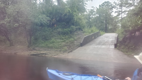
PHOTOSET: https://www.wwals.net/pictures/2019-07-06–statenville-sasser-pictures/
PHOTO SOURCE: John S. Quarterman
PHONE NUMBER: (229) 242-0102
Suggestions: https://forms.gle/DipPgU2TP5atc2Rf9
Bronson Echols Creek 03110202001895

CATEGORIES: Tributary
LAYER: Point of Interest
OWNERSHIP: Private
WATER BODY: Alapaha River
MILE: 26.32
ADDRESS: Echols County.
DESCRIPTION: This Tributary is located on river right of the Alapaha River.
GRN: No
UPSTREAM: 5.19 miles from Bronson Echols Creek 03110202001895 to Statenville Boat Ramp
DOWNSTREAM: 5.17 miles from Bronson Echols Creek 03110202001895 to Sasser Landing
PHOTO: https://wwals.net/pictures/2019-07-06–statenville-sasser-pictures/20190706_130015.jpg
PHOTOSET: https://wwals.net/pictures/2019-07-06–statenville-sasser-pictures/#Bronson-Runoff
PHOTO SOURCE: John S. Quarterman
PHONE NUMBER: (229) 242-0102
Suggestions: https://forms.gle/DipPgU2TP5atc2Rf9
Bronson Echols Branch 03110202007174

CATEGORIES: Tributary
LAYER: Point of Interest
OWNERSHIP: Private
WATER BODY: Alapaha River
MILE: 25.78
ADDRESS: Echols County.
DESCRIPTION: This Tributary is located on river right of the Alapaha River.
GRN: No
UPSTREAM: 5.73 miles from Bronson Echols Branch 03110202007174 to Statenville Boat Ramp
DOWNSTREAM: 4.63 miles from Bronson Echols Branch 03110202007174 to Sasser Landing
PHOTO: https://wwals.net/pictures/2019-07-06–statenville-sasser-pictures/20190706_131401.jpg
PHOTO SOURCE: John S. Quarterman
PHONE NUMBER: (229) 242-0102
Suggestions: https://forms.gle/DipPgU2TP5atc2Rf9
Strickland Echols Branch
CATEGORIES: Tributary
LAYER: Point of Interest
GPS: 30.64546, -83.051984
OWNERSHIP: Private
WATER BODY: Alapaha River
MILE: 25.74
ADDRESS: Echols County.
DESCRIPTION: This Tributary is located on river left of the Alapaha River.
UPSTREAM: 5.77 miles from Strickland Echols Branch to Statenville Boat Ramp
DOWNSTREAM: 4.59 miles from Strickland Echols Branch to Sasser Landing
Suggestions: https://forms.gle/DipPgU2TP5atc2Rf9
Strickland Echols Runoff

CATEGORIES: Tributary
LAYER: Point of Interest
OWNERSHIP: Private
WATER BODY: Alapaha River
MILE: 25.41
ADDRESS: Echols County.
DESCRIPTION: This Tributary is located on river left of the Alapaha River.
UPSTREAM: 6.10 miles from Strickland Echols Runoff to Statenville Boat Ramp
DOWNSTREAM: 4.26 miles from Strickland Echols Runoff to Sasser Landing
PHOTO: https://wwals.net/pictures/2019-07-06–statenville-sasser-pictures/20190706_132107.jpg
PHOTOSET: https://wwals.net/pictures/2019-07-06–statenville-sasser-pictures/#Strickland-Runoff
PHOTO SOURCE: John S. Quarterman
PHONE NUMBER: (229) 242-0102
Suggestions: https://forms.gle/DipPgU2TP5atc2Rf9
Valdosta-Jasper Power Line

CATEGORIES: Power Line
LAYER: Point of Interest
GPS: 30.64026, -83.05012
OWNERSHIP: Private
WATER BODY: Alapaha River
MILE: 25.34
ADDRESS: Echols County.
DESCRIPTION: A good landmark for paddling progress, indicating it’s only a little more than two miles to the GA-FL line.
UPSTREAM: 6.17 miles from Valdosta-Jasper Power Line to Statenville Boat Ramp
DOWNSTREAM: 4.19 miles from Valdosta-Jasper Power Line to Sasser Landing
PHOTO: https://wwals.net/pictures/2019-07-06–statenville-sasser-pictures/20190706_132259.jpg
PHOTOSET: https://wwals.net/pictures/2019-07-06–statenville-sasser-pictures/#Power-line-to-Jasper
PHOTO SOURCE: John S. Quarterman
PHONE NUMBER: (229) 242-0102
Suggestions: https://forms.gle/DipPgU2TP5atc2Rf9
Fallen Island

CATEGORIES: Point Of Interest
LAYER: Point of Interest
GPS: 30.63872, -83.05086
OWNERSHIP: Private
WATER BODY: Alapaha River
MILE: 25.20
ADDRESS: Echols County.
DESCRIPTION: Part of the right bank of the river split off and fell down, making a picturesque lost world island.
UPSTREAM: 6.31 miles from Fallen Island to Statenville Boat Ramp
DOWNSTREAM: 4.05 miles from Fallen Island to Sasser Landing
PHOTO: https://wwals.net/pictures/2019-07-06–statenville-sasser-pictures/20190706_132534.jpg
PHOTOSET: https://wwals.net/pictures/2019-07-06–statenville-sasser-pictures/#Fallen-island
PHOTO SOURCE: John S. Quarterman
PHONE NUMBER: (229) 242-0102
Suggestions: https://forms.gle/DipPgU2TP5atc2Rf9
Strickland Waterfall 03110202007212

CATEGORIES: Waterfall
LAYER: Point of Interest
OWNERSHIP: Private
WATER BODY: Alapaha River
MILE: 24.66
ADDRESS: Echols County.
DESCRIPTION: This Waterfall is located on river left of the Alapaha River.
GRN: No
UPSTREAM: 6.85 miles from Strickland Waterfall 03110202007212 to Statenville Boat Ramp
DOWNSTREAM: 3.51 miles from Strickland Waterfall 03110202007212 to Sasser Landing
PHOTO: https://wwals.net/pictures/2019-07-06–statenville-sasser-pictures/20190706_133848.jpg
PHOTO SOURCE: John S. Quarterman
PHONE NUMBER: (229) 242-0102
Suggestions: https://forms.gle/DipPgU2TP5atc2Rf9
Rogers Echols Runoff

CATEGORIES: Tributary
LAYER: Point of Interest
OWNERSHIP: Private
WATER BODY: Alapaha River
MILE: 24.53
ADDRESS: Echols County.
DESCRIPTION: This Tributary is located on river right of the Alapaha River.
UPSTREAM: 6.98 miles from Rogers Echols Runoff to Statenville Boat Ramp
DOWNSTREAM: 3.38 miles from Rogers Echols Runoff to Sasser Landing
PHOTO: https://wwals.net/pictures/2019-07-06–statenville-sasser-pictures/20190706_134213.jpg
PHOTOSET: https://wwals.net/pictures/2019-07-06–statenville-sasser-pictures/#Rogers-Runoff
PHOTO SOURCE: John S. Quarterman
PHONE NUMBER: (229) 242-0102
Suggestions: https://forms.gle/DipPgU2TP5atc2Rf9
Rogers Echols Trickle

CATEGORIES: Tributary
LAYER: Point of Interest
OWNERSHIP: Private
WATER BODY: Alapaha River
MILE: 24.36
ADDRESS: Echols County.
DESCRIPTION: This Tributary is located on river right of the Alapaha River.
UPSTREAM: 7.15 miles from Rogers Echols Trickle to Statenville Boat Ramp
DOWNSTREAM: 3.21 miles from Rogers Echols Trickle to Sasser Landing
PHOTO: https://wwals.net/pictures/2019-07-06–statenville-sasser-pictures/20190706_134606.jpg
PHOTOSET: https://wwals.net/pictures/2019-07-06–statenville-sasser-pictures/#Rogers-Trickle
PHOTO SOURCE: John S. Quarterman
PHONE NUMBER: (229) 242-0102
Suggestions: https://forms.gle/DipPgU2TP5atc2Rf9
Rogers Bluff

CATEGORIES: Point Of Interest
LAYER: Point of Interest
OWNERSHIP: Private
WATER BODY: Alapaha River
MILE: 24.23
ADDRESS: Echols County.
DESCRIPTION: This Point of Interest is located on river right of the Alapaha River.
UPSTREAM: 7.28 miles from Rogers Bluff to Statenville Boat Ramp
DOWNSTREAM: 3.08 miles from Rogers Bluff to Sasser Landing
PHOTO: https://wwals.net/pictures/2019-07-06–statenville-sasser-pictures/20190706_134831.jpg
PHOTOSET: https://wwals.net/pictures/2019-07-06–statenville-sasser-pictures/#Allen-Entrance
PHOTO SOURCE: John S. Quarterman
PHONE NUMBER: (229) 242-0102
Suggestions: https://forms.gle/DipPgU2TP5atc2Rf9
Allen Echols Waterfall

CATEGORIES: Waterfall
LAYER: Point of Interest
OWNERSHIP: Private
WATER BODY: Alapaha River
MILE: 24.16
ADDRESS: Echols County.
DESCRIPTION: This Waterfall is located on river left of the Alapaha River.
GRN: No
UPSTREAM: 7.35 miles from Allen Echols Waterfall to Statenville Boat Ramp
DOWNSTREAM: 3.01 miles from Allen Echols Waterfall to Sasser Landing
PHOTO: https://wwals.net/pictures/2019-07-06–statenville-sasser-pictures/20190706_135039.jpg
PHOTOSET: https://wwals.net/pictures/2019-07-06–statenville-sasser-pictures/#Allen-Waterfall
PHOTO SOURCE: John S. Quarterman
PHONE NUMBER: (229) 242-0102
Suggestions: https://forms.gle/DipPgU2TP5atc2Rf9
Bolesta Trickle

CATEGORIES: Tributary
LAYER: Point of Interest
OWNERSHIP: Private
WATER BODY: Alapaha River
MILE: 23.93
ADDRESS: Echols County.
DESCRIPTION: This Tributary is located on river left of the Alapaha River.
UPSTREAM: 7.58 miles from Bolesta Trickle to Statenville Boat Ramp
DOWNSTREAM: 2.78 miles from Bolesta Trickle to Sasser Landing
PHOTO: https://wwals.net/pictures/2019-07-06–statenville-sasser-pictures/20190706_135534.jpg
PHOTOSET: https://wwals.net/pictures/2019-07-06–statenville-sasser-pictures/#Bolesta-Trickle
PHOTO SOURCE: John S. Quarterman
PHONE NUMBER: (229) 242-0102
Suggestions: https://forms.gle/DipPgU2TP5atc2Rf9
Rogers Black Rocks

CATEGORIES: Shoal
LAYER: Other
OWNERSHIP: Public
WHITEWATER CLASS: Class I
WATER BODY: Alapaha River
MILE: 23.89
ADDRESS: Echols County.
DESCRIPTION: Amusing tiny rapids located on the right bank.
UPSTREAM: 7.62 miles from Rogers Black Rocks to Statenville Boat Ramp
DOWNSTREAM: 2.74 miles from Rogers Black Rocks to Sasser Landing
PHOTO: https://wwals.net/pictures/2019-07-06–statenville-sasser-pictures/20190706_135735.jpg
PHOTOSET: https://wwals.net/pictures/2019-07-06–statenville-sasser-pictures/#Black-rocks
PHOTO SOURCE: John S. Quarterman
PHONE NUMBER: (229) 242-0102
Suggestions: https://forms.gle/DipPgU2TP5atc2Rf9
Horseshoe Bend

CATEGORIES: Point Of Interest
LAYER: Point of Interest
OWNERSHIP: Public
WATER BODY: Alapaha River
MILE: 23.43
ADDRESS: Echols County.
DESCRIPTION: Last river bend before the GA-FL line.
UPSTREAM: 8.08 miles from Horseshoe Bend to Statenville Boat Ramp
DOWNSTREAM: 2.28 miles from Horseshoe Bend to Sasser Landing
PHOTO: https://wwals.net/pictures/2019-07-06–statenville-sasser-pictures/20190706_140618.jpg
PHOTOSET: https://wwals.net/pictures/2019-07-06–statenville-sasser-pictures/#Horseshoe-Bend
PHOTO SOURCE: John S. Quarterman
PHONE NUMBER: (229) 242-0102
Suggestions: https://forms.gle/DipPgU2TP5atc2Rf9
GA-FL Line Alapaha River

CATEGORIES: Point Of Interest
LAYER: Other
OWNERSHIP: Public
WATER BODY: Alapaha River
MILE: 23.29
ADDRESS: East of Swilley Road, Lake Park, GA 31636, Echols, Hamilton County, Echols, Hamilton Counties.
DESCRIPTION: Now entering Florida. It’s palm trees all the way from here.
UPSTREAM: 8.22 miles from GA-FL Line Alapaha River to Statenville Boat Ramp
DOWNSTREAM: 2.14 miles from GA-FL Line Alapaha River to Sasser Landing
PHOTO: https://wwals.net/pictures/2019-07-06–statenville-sasser-pictures/20190706_141751.jpg
PHOTOSET: https://wwals.net/pictures/2019-07-06–statenville-sasser-pictures/#Welcome-to-Florida-Rapids
PHOTO SOURCE: John S. Quarterman
PHONE NUMBER: (229) 242-0102
Suggestions: https://forms.gle/DipPgU2TP5atc2Rf9
Upper Alapaha Conservation Area

CATEGORIES: Public Land
LAYER: Other
GPS: 30.617827, -83.05725
OWNERSHIP: Public
WATER BODY: Alapaha River
MILE: 23.14
ADDRESS: Starts about 500 feet downstream of state line, Hamilton County.
GRN: No
UPSTREAM: 8.37 miles from Upper Alapaha Conservation Area to Statenville Boat Ramp
DOWNSTREAM: 1.99 miles from Upper Alapaha Conservation Area to Sasser Landing
PHOTO: https://wwals.net/pictures/2019-07-06–statenville-sasser-pictures/20190706_141843.jpg
PHOTO SOURCE: John S. Quarterman
PHONE NUMBER: (229) 242-0102
Suggestions: https://forms.gle/DipPgU2TP5atc2Rf9
Jennings Defeat

CATEGORIES: Shoal
LAYER: Other
OWNERSHIP: Public
WHITEWATER CLASS: Class II+
WATER BODY: Alapaha River
MILE: 22.37
ADDRESS: Less than a mile downstream from the GA-FL line. Hamilton County.
DESCRIPTION: Fast, narrow, twisty, and historic rapids. On one outing, only three boats chose to risk it, out of two dozen, and only after scouting by land. Where George Jennings capsized in the 1830s and walked to Miccotown at the Alapahoochee Confluence. He later founded Jennings, Florida.
GRN: Yes
WEBSITE: https://wwals.net/2020/12/02/sulaks-defeat-at-jennings-defeat-2020-08-26/
UPSTREAM: 9.14 miles from Jennings Defeat to Statenville Boat Ramp
DOWNSTREAM: 1.22 miles from Jennings Defeat to Sasser Landing
PHOTO: https://wwals.net/pictures/2019-07-06–statenville-sasser-pictures/20190706_144039.jpg
PHOTOSET: https://wwals.net/pictures/2019-07-06–statenville-sasser-pictures/#Alapaha-Real-Rapids
PHOTO SOURCE: John S. Quarterman
PHONE NUMBER: (229) 242-0102
PHOTO2: https://wwals.net/pictures/2019-07-06–statenville-sasser-pictures/rapidsshot0008.jpg
Photoset2: https://wwals.net/pictures/2019-07-06–statenville-sasser-pictures/#Coles-run-the-Rapids
PHOTO2 SOURCE: John S. Quarterman
Photo2 Phone Number: 229-242-0102
Suggestions: https://forms.gle/DipPgU2TP5atc2Rf9

Lake Park-Jasper Power Line

CATEGORIES: Power Line
LAYER: Point of Interest
OWNERSHIP: Public
WATER BODY: Alapaha River
MILE: 21.93
ADDRESS: Two thirds of a mile upstream from the Alapahoochee River Confluence. Hamilton County.
GRN: No
UPSTREAM: 9.58 miles from Lake Park-Jasper Power Line to Statenville Boat Ramp
DOWNSTREAM: 0.78 mile from Lake Park-Jasper Power Line to Sasser Landing
PHOTO: https://wwals.net/pictures/2019-07-06–statenville-sasser-pictures/20190706_151703.jpg
PHOTOSET: https://wwals.net/pictures/2019-07-06–statenville-sasser-pictures/#Last-powerline
PHOTO SOURCE: John S. Quarterman
PHONE NUMBER: (229) 242-0102
Suggestions: https://forms.gle/DipPgU2TP5atc2Rf9
Mud Swamp Creek and Grand Bay Creek
CATEGORIES: Tributary
LAYER: Other
OWNERSHIP: Private, Langdale Company on west, Corbett family north and east
ACCESS: No
WATER BODY: Alapahoochee River
MILE: 14.34
ADDRESS: South of Hickory Grove Road on border of Lowndes and Echols Counties, GA, Lowndes, Echols Counties.
DESCRIPTION: The 22-mile Mud Swamp Creek out of Valdosta and the 31-mile Grand Bay Creek down from Grand Bay join to form the 23-mile Alapahoochee River, which runs through Echols County, Georgia and Hamilton County, Florida into the Alapaha River.
GRN: Yes
DOWNSTREAM: 3.52 miles from Mud Swamp Creek and Grand Bay Creek to GA 376 Alapahoochee Landing
Suggestions: https://forms.gle/DipPgU2TP5atc2Rf9
GA 376 Bridge

CATEGORIES: Bridge
LAYER: Bridge
OWNERSHIP: Public
ACCESS: No
WATER BODY: Alapahoochee River
MILE: 10.82
ADDRESS: Between Lake Park and Statenville, Echols County.
DESCRIPTION: State highway bridge, 420 feet, concrete slabs, 28 spans, being rebuilt in 2024. https://maps.app.goo.gl/v4PUanLDZynAyv2V6, Former location of Troublesome Ford. https://en.wikipedia.org/wiki/Alapaha_River
HISTORIC FACTS: Built 1956, reconstructed 1969. Being replaced in 2021. https://wwals.net/pictures/2021-05-10–alapahoochee-ga-376-bridge/
WEBSITE: https://bridgereports.com/1094962
OTHER REFERENCE: https://wwals.net/2019/11/13/trash-at-ga-135-alapahoochee-river-echols-county-ga-2019-11-08/
ADDITIONAL INFO SOURCES: https://paddling.com/paddle/trips/alapahoochee-river-in-georgia
DOWNSTREAM: 3.54 miles from GA 376 Bridge to Culpepper Alapahoochee Landing
PHOTO SOURCE: Lanier County News
PHONE NUMBER: (850) 290-2350
Photoset2: https://wwals.net/pictures/2019-11-08–alapachoochee-elizabeth-reynolds/
PHOTO2 SOURCE: Elizabeth Reynolds
Suggestions: https://forms.gle/DipPgU2TP5atc2Rf9

GA 376 Alapahoochee Landing
CATEGORIES: Landing
LAYER: Brochure
GPS: 30.70355, -83.12253
OWNERSHIP: Public
ACCESS: Yes, Launch: riverbank between power line and state highway bridge down dirt access road. PARKING: Free
WATER BODY: Alapahoochee River
MILE: 10.82
ADDRESS: Right bank, south side of highway, between J. Frank Culpepper Road and Sardis Church Road, between Lake Park and Statenville, GA. Echols County.
DESCRIPTION: The most upstream public access to the Alapahoochee River.
WEBSITE: https://wwals.net/2019/11/13/trash-at-ga-135-alapahoochee-river-echols-county-ga-2019-11-08/
OTHER REFERENCE: https://bridgereports.com/1094962
ADDITIONAL INFO SOURCES: https://paddling.com/paddle/trips/alapahoochee-river-in-georgia
DOWNSTREAM: 3.54 miles from GA 376 Alapahoochee Landing to Culpepper Alapahoochee Landing
PHOTOSET: https://wwals.net/pictures/2019-11-08–alapachoochee-elizabeth-reynolds/
PHOTO SOURCE: Elizabeth Reynolds
PHONE NUMBER: (850) 290-2350
Suggestions: https://forms.gle/DipPgU2TP5atc2Rf9
GA 376 Alapahoochee Landing River GPS
CATEGORIES: Point Of Interest
LAYER: Point of Interest
GPS: 30.70365, -83.12143
OWNERSHIP: Public
ACCESS: Yes, Launch: riverbank between power line and state highway bridge down dirt access road. PARKING: Free
WATER BODY: Alapahoochee River
MILE: 10.82
ADDRESS: Right bank, downstream of the bridge, upstream of the power line, between J. Frank Culpepper Road and Sardis Church Road, between Lake Park and Statenville, GA. Echols County.
DESCRIPTION: The most upstream public access to the Alapahoochee River.
WEBSITE: https://wwals.net/2019/11/13/trash-at-ga-135-alapahoochee-river-echols-county-ga-2019-11-08/
OTHER REFERENCE: https://bridgereports.com/1094962
ADDITIONAL INFO SOURCES: https://paddling.com/paddle/trips/alapahoochee-river-in-georgia
PHOTOSET: https://wwals.net/pictures/2019-11-08–alapachoochee-elizabeth-reynolds/
PHOTO SOURCE: Elizabeth Reynolds
PHONE NUMBER: (850) 290-2350
Suggestions: https://forms.gle/DipPgU2TP5atc2Rf9
Solamerica Tycor Farms Solar

CATEGORIES: Solar
LAYER: Point of Interest
GPS: 30.69185, -83.1681
OWNERSHIP: Private, Tycor Farms LLC, PARCEL 0222 002
WATER BODY: Enoch Creek
ADDRESS: 6530 GA HWY 376, Lake Park, GA 31636, Lowndes County.
DESCRIPTION: Solar farm on previously cultivated land.
PHOTO: http://www.l-a-k-e.org/govt/zboa/2019-08-06–zboa-packet/VAR-2019-09-context.jpg
PHOTOSET: http://www.l-a-k-e.org/govt/zboa/2019-08-06–zboa-packet/
PHOTO SOURCE: Gretchen Quarterman
PHONE NUMBER: (850) 290-2350
Suggestions: https://forms.gle/DipPgU2TP5atc2Rf9
Camping World

CATEGORIES: Logo Contest Sponsor
LAYER: Sponsor
OWNERSHIP: Private
ACCESS: No
ADDRESS: Camping World of Valdosta, 5244 Jewell Futch Rd, Lake Park, GA 31636, Lowndes County.
DESCRIPTION: RV sales and camping equipment
WEBSITE: http://www.campingworldofvaldosta.com/
PHOTO: http://images.rvs.com/dealers/settings/01092014camping_world_of_valdosta.png
PHOTOSET: http://www.campingworldofvaldosta.com/
PHOTO SOURCE: Camping World
PHONE NUMBER: (888) 239-4005
Suggestions: https://forms.gle/DipPgU2TP5atc2Rf9
J. Frank Culpepper Road Bridge
CATEGORIES: Bridge
LAYER: Bridge
OWNERSHIP: Public
ACCESS: No
WATER BODY: Alapahoochee River
MILE: 7.28
ADDRESS: Between Statenville and Belleville, Echols County.
DESCRIPTION: County road bridge, 222.1 feet, concrete T beam, 4 spans, built 1961.
WEBSITE: https://bridgereports.com/1094981
OTHER REFERENCE: https://paddling.com/paddle/trips/alapahoochee-river-in-georgia
UPSTREAM: 3.54 miles from J. Frank Culpepper Road Bridge to GA 376 Alapahoochee Landing
DOWNSTREAM: 4.54 miles from J. Frank Culpepper Road Bridge to GA 135 Alapahoochee Landing
PHOTO: https://www.google.com/maps/@30.673308, -83.105043, 3a, 75y, 173.81h, 63.78t/data=!3m4!1e1!3m2!1sfZIBZ7Kf2jxqYncNColnIQ!2e0
PHOTOSET: https://www.google.com/maps/@30.673308, -83.105043, 3a, 75y, 173.81h, 63.78t/data=!3m4!1e1!3m2!1sfZIBZ7Kf2jxqYncNColnIQ!2e0
PHOTO SOURCE: google maps
PHONE NUMBER: (850) 290-2350
Suggestions: https://forms.gle/DipPgU2TP5atc2Rf9
Culpepper Alapahoochee Landing
CATEGORIES: Landing
LAYER: Brochure
OWNERSHIP: Public
ACCESS: Yes, Launch: riverbank under power line on county road right of way down dirt access road. PARKING: Free
WATER BODY: Alapahoochee River
MILE: 7.28
ADDRESS: Left bank, north side of J. Frank Culpepper Road, between Bethel Church Road and Son Clayton Road, between Statenville and Belleville, Echols County.
DESCRIPTION: Middle public access to Alapahoochee River.
WEBSITE: https://bridgereports.com/1094981
OTHER REFERENCE: https://paddling.com/paddle/trips/alapahoochee-river-in-georgia
ADDITIONAL INFO SOURCES: https://paddling.com/paddle/trips/alapahoochee-river-in-georgia
UPSTREAM: 3.54 miles from Culpepper Alapahoochee Landing to GA 376 Alapahoochee Landing
DOWNSTREAM: 4.54 miles from Culpepper Alapahoochee Landing to GA 135 Alapahoochee Landing
PHOTO: https://www.google.com/maps/@30.673308, -83.105043, 3a, 75y, 173.81h, 63.78t/data=!3m4!1e1!3m2!1sfZIBZ7Kf2jxqYncNColnIQ!2e0
PHOTOSET: https://www.google.com/maps/@30.673308, -83.105043, 3a, 75y, 173.81h, 63.78t/data=!3m4!1e1!3m2!1sfZIBZ7Kf2jxqYncNColnIQ!2e0
PHOTO SOURCE: google maps
PHONE NUMBER: (850) 290-2350
Suggestions: https://forms.gle/DipPgU2TP5atc2Rf9
Culpepper Alapahoochee Landing River GPS
CATEGORIES: Point Of Interest
LAYER: Point of Interest
OWNERSHIP: Public
ACCESS: Yes, Launch: riverbank under power line on county road right of way down dirt access road. PARKING: Free
WATER BODY: Alapahoochee River
MILE: 7.28
ADDRESS: Left bank, upstream and under the bridge, between Bethel Church Road and Son Clayton Road, between Statenville and Belleville, Echols County.
DESCRIPTION: Middle public access to Alapahoochee River.
WEBSITE: https://bridgereports.com/1094981
OTHER REFERENCE: https://paddling.com/paddle/trips/alapahoochee-river-in-georgia
ADDITIONAL INFO SOURCES: https://paddling.com/paddle/trips/alapahoochee-river-in-georgia
PHOTO: https://www.google.com/maps/@30.673308, -83.105043, 3a, 75y, 173.81h, 63.78t/data=!3m4!1e1!3m2!1sfZIBZ7Kf2jxqYncNColnIQ!2e0
PHOTOSET: https://www.google.com/maps/@30.673308, -83.105043, 3a, 75y, 173.81h, 63.78t/data=!3m4!1e1!3m2!1sfZIBZ7Kf2jxqYncNColnIQ!2e0
PHOTO SOURCE: google maps
PHONE NUMBER: (850) 290-2350
Suggestions: https://forms.gle/DipPgU2TP5atc2Rf9
GA 135 Alapahoochee Bridge

CATEGORIES: Bridge
LAYER: Bridge
OWNERSHIP: Public
ACCESS: No
WATER BODY: Alapahoochee River
MILE: 2.74
ADDRESS: Between Jennings and Statenville, Echols County.
DESCRIPTION: State highway bridge, 350.1 feet, concrete cast-in-place deck on sringer bridge, 4 spans, built in 2006. https://maps.app.goo.gl/iULgcEDVxp9ahCwR7
WEBSITE: https://bridgereports.com/1094988
OTHER REFERENCE: https://wwals.net/2014/09/03/alapahoochee/
UPSTREAM: 4.54 miles from GA 135 Alapahoochee Bridge to Culpepper Alapahoochee Landing
PHOTO: https://www.wwals.net/pictures/2022-07-09–alapahoochee-adventure-pictures/ga135bridge.jpg
PHOTOSET: https://www.wwals.net/pictures/2022-07-09–alapahoochee-adventure-pictures/
PHOTO SOURCE: John S. Quarterman
PHONE NUMBER: (229) 242-0102
PHOTO2: https://wwals.net/wp-content/themes/pianoblack/img//2014/09/2e6144203474d6a743bb1a31290766c8.jpg
Photoset2: https://wwals.net/2014/09/03/alapahoochee/
PHOTO2 SOURCE: April Huntley
Suggestions: https://forms.gle/DipPgU2TP5atc2Rf9

GA 135 Alapahoochee Landing

CATEGORIES: Landing
LAYER: Brochure
GPS: 30.62845, -83.0893
OWNERSHIP: Public
ACCESS: Yes, Launch: riverbank down dirt access road. PARKING: Free
WHITEWATER CLASS: Class II
WATER BODY: Alapahoochee River
Lowest boatable: 77.5
Highest safe: 86.1
GAUGE: Statenville
MILE: 2.74
ADDRESS: North side of road, left bank, 3/4 mile upstream of the GA-FL line and west of Pear Tree Lane, between Jennings and Statenville, Echols County.
DESCRIPTION: State highway bridge, 350.1 feet, concrete cast-in-place deck on sringer bridge, 4 spans.
WEBSITE: https://wwals.net/2014/09/03/alapahoochee/
OTHER REFERENCE: https://bridgereports.com/1094988
ADDITIONAL INFO SOURCES: https://paddling.com/paddle/trips/alapahoochee-river-in-georgia
UPSTREAM: 4.54 miles from GA 135 Alapahoochee Landing to Culpepper Alapahoochee Landing
DOWNSTREAM: 2.83 miles from GA 135 Alapahoochee Landing to Sasser Landing
PHOTO: https://www.wwals.net/pictures/2021-06-05–alapahoochee-pictures/20210605_092841.jpg
PHOTOSET: https://www.wwals.net/pictures/2021-06-05–alapahoochee-pictures/
PHOTO SOURCE: John S. Quarterman
PHONE NUMBER: (229) 242-0102
PHOTO2: https://wwals.net/wp-content/themes/pianoblack/img//2014/09/a1bf459e253cc43d7bb02c16b5303b78.jpg
Photoset2: https://wwals.net/2014/09/03/alapahoochee/
PHOTO2 SOURCE: April Huntley
Suggestions: https://forms.gle/DipPgU2TP5atc2Rf9

GA 135 Alapahoochee Landing River GPS

CATEGORIES: Point Of Interest
LAYER: Point of Interest
GPS: 30.62879, -83.08814
OWNERSHIP: Public
ACCESS: Yes, Launch: riverbank down dirt access road. PARKING: Free
WHITEWATER CLASS: Class II
WATER BODY: Alapahoochee River
Lowest boatable: 77.5
Highest safe: 86.1
GAUGE: Statenville
MILE: 2.74
ADDRESS: Left bank, upstream and under the bridge, just north of the GA-FL line and west of Pear Tree Lane, between Jennings and Statenville, Echols County.
DESCRIPTION: State highway bridge, 350.1 feet, concrete cast-in-place deck on sringer bridge, 4 spans.
WEBSITE: https://wwals.net/2014/09/03/alapahoochee/
OTHER REFERENCE: https://bridgereports.com/1094988
ADDITIONAL INFO SOURCES: https://paddling.com/paddle/trips/alapahoochee-river-in-georgia
PHOTO: https://www.wwals.net/pictures/2021-06-05–alapahoochee-pictures/20210605_092755.jpg
PHOTOSET: https://www.wwals.net/pictures/2021-06-05–alapahoochee-pictures/
PHOTO SOURCE: John S. Quarterman
PHONE NUMBER: (229) 242-0102
PHOTO2: https://www.wwals.net/pictures/2022-07-09–alapahoochee-adventure-pictures/20220709_094643.jpg
Photoset2: https://www.wwals.net/pictures/2022-07-09–alapahoochee-adventure-pictures/
PHOTO2 SOURCE: John S. Quarterman
Photo2 Phone Number: 229-242-0102
Suggestions: https://forms.gle/DipPgU2TP5atc2Rf9

Old GA 135 Bridge

CATEGORIES: Bridgesite
LAYER: Bridge
OWNERSHIP: Public
WATER BODY: Alapahoochee River
GAUGE: Statenville
MILE: 2.71
ADDRESS: About 100 feet downstream from the current GA 135 bridge. Echols County.
DESCRIPTION: Concrete abutments on each bank.
UPSTREAM: 0.03 mile from Old GA 135 Bridge to GA 135 Alapahoochee Landing
PHOTO: https://www.wwals.net/pictures/2022-07-09–alapahoochee-adventure-pictures/GSAJ2116.jpg
PHOTOSET: https://www.wwals.net/pictures/2022-07-09–alapahoochee-adventure-pictures/
PHOTO SOURCE: John S. Quarterman
PHONE NUMBER: (229) 242-0102
Suggestions: https://forms.gle/DipPgU2TP5atc2Rf9
GA 135 Deadfall

CATEGORIES: Deadfall
LAYER: Point of Interest
OWNERSHIP: Public
WATER BODY: Alapahoochee River
GAUGE: Statenville
MILE: 2.69
ADDRESS: About 260 feet downstream from the GA 135 bridge. Echols County.
DESCRIPTION: Stay to the left and you can paddle around.
UPSTREAM: 0.05 mile from GA 135 Deadfall to GA 135 Alapahoochee Landing
PHOTO: https://www.wwals.net/pictures/2022-07-09–alapahoochee-adventure-pictures/20220709_100352.jpg
PHOTOSET: https://www.wwals.net/pictures/2022-07-09–alapahoochee-adventure-pictures/
PHOTO SOURCE: John S. Quarterman
PHONE NUMBER: (229) 242-0102
PHOTO2: https://www.wwals.net/pictures/2022-07-09–alapahoochee-adventure-pictures/GSAJ2124.jpg
Photoset2: https://www.wwals.net/pictures/2022-07-09–alapahoochee-adventure-pictures/
PHOTO2 SOURCE: John S. Quarterman
Photo2 Phone Number: 229-242-0102
Suggestions: https://forms.gle/DipPgU2TP5atc2Rf9

GA 135 Deadfall2

CATEGORIES: Deadfall
LAYER: Point of Interest
OWNERSHIP: Public
WATER BODY: Alapahoochee River
GAUGE: Statenville
MILE: 2.61
ADDRESS: About 500 feet downstream from the GA 135 bridge. Echols County.
DESCRIPTION: Paddle under to the left.
UPSTREAM: 0.13 mile from GA 135 Deadfall2 to GA 135 Alapahoochee Landing
PHOTO: https://www.wwals.net/pictures/2022-07-09–alapahoochee-adventure-pictures/20220709_100611.jpg
PHOTOSET: https://www.wwals.net/pictures/2022-07-09–alapahoochee-adventure-pictures/
PHOTO SOURCE: John S. Quarterman
PHONE NUMBER: (229) 242-0102
PHOTO2: https://www.wwals.net/pictures/2022-07-09–alapahoochee-adventure-pictures/GSAJ2139.jpg
Photoset2: https://www.wwals.net/pictures/2022-07-09–alapahoochee-adventure-pictures/
PHOTO2 SOURCE: John S. Quarterman
Photo2 Phone Number: 229-242-0102
Suggestions: https://forms.gle/DipPgU2TP5atc2Rf9

Rogers Deadfall

CATEGORIES: Deadfall
LAYER: Point of Interest
OWNERSHIP: Public
WATER BODY: Alapahoochee River
GAUGE: Statenville
MILE: 2.36
ADDRESS: A third of a mile downstream from the GA 135 bridge. Echols County.
DESCRIPTION: Paddle under to the left.
UPSTREAM: 0.38 mile from Rogers Deadfall to GA 135 Alapahoochee Landing
PHOTO: https://www.wwals.net/pictures/2022-07-09–alapahoochee-adventure-pictures/20220709_101610.jpg
PHOTOSET: https://www.wwals.net/pictures/2022-07-09–alapahoochee-adventure-pictures/
PHOTO SOURCE: John S. Quarterman
PHONE NUMBER: (229) 242-0102
PHOTO2: https://www.wwals.net/pictures/2022-07-09–alapahoochee-adventure-pictures/GSAJ2211.jpg
Photoset2: https://www.wwals.net/pictures/2022-07-09–alapahoochee-adventure-pictures/
PHOTO2 SOURCE: John S. Quarterman
Photo2 Phone Number: 229-242-0102
Suggestions: https://forms.gle/DipPgU2TP5atc2Rf9

Lone cypress

CATEGORIES: Point Of Interest
LAYER: Point of Interest
OWNERSHIP: Public
WATER BODY: Alapahoochee River
GAUGE: Statenville
MILE: 2.32
ADDRESS: Right bank, more than a third of a mile downstream from GA 135, less than a third of a mile upstream from the GA-FL line. Echols County.
DESCRIPTION: A striking large cypress tree.
UPSTREAM: 0.42 mile from Lone cypress to GA 135 Alapahoochee Landing
PHOTO: https://www.wwals.net/pictures/2022-07-09–alapahoochee-adventure-pictures/20220709_102425.jpg
PHOTOSET: https://www.wwals.net/pictures/2022-07-09–alapahoochee-adventure-pictures/
PHOTO SOURCE: John S. Quarterman
PHONE NUMBER: (229) 242-0102
PHOTO2: https://www.wwals.net/pictures/2022-07-09–alapahoochee-adventure-pictures/GSAJ2246.jpg
Photoset2: https://www.wwals.net/pictures/2022-07-09–alapahoochee-adventure-pictures/
PHOTO2 SOURCE: John S. Quarterman
Photo2 Phone Number: 229-242-0102
Suggestions: https://forms.gle/DipPgU2TP5atc2Rf9

Last Georgia Deadfall

CATEGORIES: Deadfall
LAYER: Point of Interest
OWNERSHIP: Public
WATER BODY: Alapahoochee River
GAUGE: Statenville
MILE: 2.17
ADDRESS: Half a mile downstream from GA 135 and 840 feet upstream from the GA-FL line. Echols County.
DESCRIPTION: Squeeze under to the left or portage to the right.
UPSTREAM: 0.57 mile from Last Georgia Deadfall to GA 135 Alapahoochee Landing
PHOTO: https://www.wwals.net/pictures/2022-07-09–alapahoochee-adventure-pictures/20220709_102717.jpg
PHOTOSET: https://www.wwals.net/pictures/2022-07-09–alapahoochee-adventure-pictures/
PHOTO SOURCE: John S. Quarterman
PHONE NUMBER: (229) 242-0102
PHOTO2: https://www.wwals.net/pictures/2022-07-09–alapahoochee-adventure-pictures/GSAJ2268.jpg
Photoset2: https://www.wwals.net/pictures/2022-07-09–alapahoochee-adventure-pictures/
PHOTO2 SOURCE: John S. Quarterman
Photo2 Phone Number: 229-242-0102
Suggestions: https://forms.gle/DipPgU2TP5atc2Rf9

GA-FL Line Alapahoochee River

CATEGORIES: Point Of Interest
LAYER: Other
OWNERSHIP: Public
WATER BODY: Alapahoochee River
GAUGE: Statenville
MILE: 2.01
ADDRESS: Halfway between the GA 135 Bridge and Beaty Bridge on Swilley Road. Echols, Hamilton Counties.
DESCRIPTION: Has some seeps on the right bank.
UPSTREAM: 0.73 mile from GA-FL Line Alapahoochee River to GA 135 Alapahoochee Landing
PHOTO: https://www.wwals.net/pictures/2022-07-09–alapahoochee-adventure-pictures/GSAJ2354.jpg
PHOTOSET: https://www.wwals.net/pictures/2022-07-09–alapahoochee-adventure-pictures/
PHOTO SOURCE: John S. Quarterman
PHONE NUMBER: (229) 242-0102
PHOTO2: https://www.wwals.net/pictures/2022-07-09–alapahoochee-adventure-pictures/20220709_104405.jpg
Photoset2: https://www.wwals.net/pictures/2022-07-09–alapahoochee-adventure-pictures/
PHOTO2 SOURCE: John S. Quarterman
Photo2 Phone Number: 229-242-0102
Suggestions: https://forms.gle/DipPgU2TP5atc2Rf9

First Florida Deadfall

CATEGORIES: Deadfall
LAYER: Point of Interest
OWNERSHIP: Public
WATER BODY: Alapahoochee River
GAUGE: Statenville
MILE: 1.67
ADDRESS: A third of a mile downstream from the GA-FL line and 1 and 2/3 miles upstream from the Alapaha River. Hamilton County.
DESCRIPTION: Duck under to the left.
UPSTREAM: 1.07 miles from First Florida Deadfall to GA 135 Alapahoochee Landing
PHOTO: https://www.wwals.net/pictures/2022-07-09–alapahoochee-adventure-pictures/20220709_105319.jpg
PHOTOSET: https://www.wwals.net/pictures/2022-07-09–alapahoochee-adventure-pictures/
PHOTO SOURCE: John S. Quarterman
PHONE NUMBER: (229) 242-0102
PHOTO2: https://www.wwals.net/pictures/2022-07-09–alapahoochee-adventure-pictures/GSAJ2427.jpg
Photoset2: https://www.wwals.net/pictures/2022-07-09–alapahoochee-adventure-pictures/
PHOTO2 SOURCE: John S. Quarterman
Photo2 Phone Number: 229-242-0102
Suggestions: https://forms.gle/DipPgU2TP5atc2Rf9

Beaty Deadfall

CATEGORIES: Deadfall
LAYER: Point of Interest
OWNERSHIP: Public
WATER BODY: Alapahoochee River
GAUGE: Statenville
MILE: 1.36
ADDRESS: Upstream within sight of Beaty Bridge. Hamilton County.
DESCRIPTION: Duck under to the right.
UPSTREAM: 1.38 miles from Beaty Deadfall to GA 135 Alapahoochee Landing
PHOTO: https://www.wwals.net/pictures/2022-07-09–alapahoochee-adventure-pictures/20220709_113032.jpg
PHOTOSET: https://www.wwals.net/pictures/2022-07-09–alapahoochee-adventure-pictures/
PHOTO SOURCE: John S. Quarterman
PHONE NUMBER: (229) 242-0102
PHOTO2: https://www.wwals.net/pictures/2022-07-09–alapahoochee-adventure-pictures/GSAK2514.jpg
Photoset2: https://www.wwals.net/pictures/2022-07-09–alapahoochee-adventure-pictures/
PHOTO2 SOURCE: John S. Quarterman
Photo2 Phone Number: 229-242-0102
Suggestions: https://forms.gle/DipPgU2TP5atc2Rf9

Historic Beaty Bridge

CATEGORIES: Bridgehistoric
LAYER: Bridge
OWNERSHIP: Public, SHAFFNER WILLIAM BRADLEY, PARCEL 3868-005, 3686-030
ACCESS: No
WATER BODY: Alapahoochee River
MILE: 1.36
ADDRESS: From Jennings, FL, take Hamilton Road aka CR 141 northeast, turn right on NW 9th Drive, continue to Alapahoochee River, Hamilton County.
DESCRIPTION: Second oldest iron bridge of Florida. Built 1911; Condemned 1970. Ken Sulak notes it is named: “”after George Washington Beatty, a wealthy Georgia cotton planter. It was built on his land, originally in old Irwin County, GA, by the Roanoke Bridge Co. for $2, 200. It is the oldest Pony Truss iron bridge still standing in Florida (only 2 survive). It was condemned and abandoned in 1970. Preceding the bridge in the mid to late 1800s, John Knight operated a ferry nearby, connecting Miccotown with Bellville to the west, and the Roebuck Bridge over the Alapaha to the east.””
AKA: Swilley Road Bridge or Beatty Bridge or Beaty Bridge
WEBSITE: https://bridgehunter.com/fl/hamilton/beaty/
OTHER REFERENCE: https://historicbridges.org/bridges/browser/?bridgebrowser=florida/beatybridge/
UPSTREAM: 1.38 miles from Historic Beaty Bridge to GA 135 Alapahoochee Landing
PHOTO: https://wwals.net/wp-content/themes/pianoblack/img//2015/01/9e8e29a10b8697bf506026436d18e3d3.jpg
PHOTOSET: https://wwals.net/2015/01/04/old-bridge-alapahoochee-river/
PHOTO SOURCE: Chris Mericle
PHONE NUMBER: (850) 290-2350
PHOTO2: https://www.wwals.net/pictures/2021-06-05–alapahoochee-pictures/20210605_111918.jpg
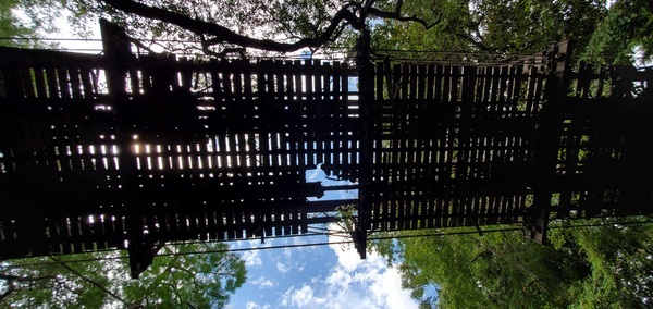
Photoset2: https://www.wwals.net/pictures/2021-06-05–alapahoochee-pictures/
PHOTO2 SOURCE: John S. Quarterman
Photo2 Phone Number: 229-242-0102
Suggestions: https://forms.gle/DipPgU2TP5atc2Rf9

Concrete and steel below Beaty Bridge

CATEGORIES: Point Of Interest
LAYER: Point of Interest
OWNERSHIP: Public
WATER BODY: Alapahoochee River
GAUGE: Statenville
MILE: 1.33
ADDRESS: Left bank, 150 feet downstream from Beaty Bridge. Hamilton County.
DESCRIPTION: Steel sticking up out of concrete. Old road bridge pier or something else?
UPSTREAM: 1.41 miles from Concrete and steel below Beaty Bridge to GA 135 Alapahoochee Landing
PHOTO: https://www.wwals.net/pictures/2021-06-05–alapahoochee-pictures/20210605_112005.jpg
PHOTOSET: https://www.wwals.net/pictures/2021-06-05–alapahoochee-pictures/
PHOTO SOURCE: John S. Quarterman
PHONE NUMBER: (229) 242-0102
Suggestions: https://forms.gle/DipPgU2TP5atc2Rf9
Kren Deadfall
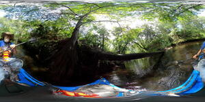
CATEGORIES: Deadfall
LAYER: Point of Interest
OWNERSHIP: Public
WATER BODY: Alapahoochee River
GAUGE: Statenville
MILE: 1.21
ADDRESS: About 800 feet downstream from Beaty Bridge. Hamilton County.
UPSTREAM: 1.53 miles from Kren Deadfall to GA 135 Alapahoochee Landing
PHOTO: https://www.wwals.net/pictures/2022-07-09–alapahoochee-adventure-pictures/GSAK2582.jpg
PHOTOSET: https://www.wwals.net/pictures/2022-07-09–alapahoochee-adventure-pictures/
PHOTO SOURCE: John S. Quarterman
PHONE NUMBER: (229) 242-0102
Suggestions: https://forms.gle/DipPgU2TP5atc2Rf9
Shelf Oak

CATEGORIES: Point Of Interest
LAYER: Point of Interest
OWNERSHIP: Public
WATER BODY: Alapahoochee River
GAUGE: Statenville
MILE: 1.14
ADDRESS: Left bank, on a shelf, about a quarter mile downstream from Beaty Bridge. Hamilton County.
DESCRIPTION: A photogenic oak on a rock shelf jutting from the left bank.
UPSTREAM: 1.60 miles from Shelf Oak to GA 135 Alapahoochee Landing
PHOTO: https://www.wwals.net/pictures/2022-07-09–alapahoochee-adventure-pictures/20220709_114541.jpg
PHOTOSET: https://www.wwals.net/pictures/2022-07-09–alapahoochee-adventure-pictures/
PHOTO SOURCE: John S. Quarterman
PHONE NUMBER: (229) 242-0102
Suggestions: https://forms.gle/DipPgU2TP5atc2Rf9
Limestone balconies with seeps

CATEGORIES: Point Of Interest
LAYER: Point of Interest
OWNERSHIP: Public
WATER BODY: Alapahoochee River
GAUGE: Statenville
MILE: 1.12
ADDRESS: Right bank, a quarter mile downstream from Beaty Bridge. Hamilton County.
DESCRIPTION: Limestone balconies jutting out from the right bank, with seeps dripping from them.
UPSTREAM: 1.62 miles from Limestone balconies with seeps to GA 135 Alapahoochee Landing
PHOTO: https://www.wwals.net/pictures/2022-07-09–alapahoochee-adventure-pictures/20220709_114659.jpg
PHOTOSET: https://www.wwals.net/pictures/2022-07-09–alapahoochee-adventure-pictures/
PHOTO SOURCE: John S. Quarterman
PHONE NUMBER: (229) 242-0102
PHOTO2: https://www.wwals.net/pictures/2022-07-09–alapahoochee-adventure-pictures/20220709_114824.jpg
Photoset2: https://www.wwals.net/pictures/2022-07-09–alapahoochee-adventure-pictures/
PHOTO2 SOURCE: John S. Quarterman
Photo2 Phone Number: 229-242-0102
Suggestions: https://forms.gle/DipPgU2TP5atc2Rf9

Power Line Deadfalls

CATEGORIES: Deadfall
LAYER: Point of Interest
OWNERSHIP: Public
WATER BODY: Alapahoochee River
GAUGE: Statenville
MILE: 1.08
ADDRESS: A third of a mile downstream from Beaty Bridge, and just upstream from Lake Park-Alapahoochee-Jasper Power Line. Hamilton County.
DESCRIPTION: Several small deadfalls requiring weaving among them.
UPSTREAM: 1.66 miles from Power Line Deadfalls to GA 135 Alapahoochee Landing
PHOTO: https://www.wwals.net/pictures/2022-07-09–alapahoochee-adventure-pictures/20220709_114829.jpg
PHOTOSET: https://www.wwals.net/pictures/2022-07-09–alapahoochee-adventure-pictures/
PHOTO SOURCE: John S. Quarterman
PHONE NUMBER: (229) 242-0102
PHOTO2: https://www.wwals.net/pictures/2022-07-09–alapahoochee-adventure-pictures/GSAK2630.jpg
Photoset2: https://www.wwals.net/pictures/2022-07-09–alapahoochee-adventure-pictures/
PHOTO2 SOURCE: John S. Quarterman
Photo2 Phone Number: 229-242-0102
Suggestions: https://forms.gle/DipPgU2TP5atc2Rf9

Lake Park-Alapahoochee-Jasper Power Line

CATEGORIES: Power Line
LAYER: Point of Interest
GPS: 30.611481, -83.07608
OWNERSHIP: Public
WATER BODY: Alapahoochee River
GAUGE: Statenville
MILE: 0.88
ADDRESS: Half a mile downstream from Beaty Bridge on Swilley Road. Hamilton County.
DESCRIPTION: The Alapahoochee River runs along the power line right of way for four or five hundred feet, with shoals and rapids.
GRN: No
WEBSITE: https://www.americanwhitewater.org/content/River/view/river-detail/3178/main
UPSTREAM: 1.86 miles from Lake Park-Alapahoochee-Jasper Power Line to GA 135 Alapahoochee Landing
PHOTO: https://www.wwals.net/pictures/2022-07-09–alapahoochee-adventure-pictures/GSAK2711.jpg
PHOTOSET: https://www.wwals.net/pictures/2022-07-09–alapahoochee-adventure-pictures/
PHOTO SOURCE: John S. Quarterman
PHONE NUMBER: (229) 242-0102
PHOTO2: https://www.wwals.net/pictures/2022-07-09–alapahoochee-adventure-pictures/20220709_120714.jpg
Photoset2: https://www.wwals.net/pictures/2022-07-09–alapahoochee-adventure-pictures/
PHOTO2 SOURCE: John S. Quarterman
Photo2 Phone Number: 229-242-0102
Suggestions: https://forms.gle/DipPgU2TP5atc2Rf9

Devil Shoal

CATEGORIES: Shoal
LAYER: Brochure
OWNERSHIP: Public
WHITEWATER CLASS: Class II
WATER BODY: Alapahoochee River
GAUGE: Statenville
MILE: 0.86
ADDRESS: Half a mile downstream from the Beaty Bridge, under the power line. Hamilton County.
DESCRIPTION: “”At low/runnable flows, there are two distinct ledges. At higher flows, they will run together into a wave train.””
AKA: Alapahoochee power line rapids, Devil’s Waterfall, or Electric Line Rapids.
GRN: No
WEBSITE: https://www.americanwhitewater.org/content/River/view/river-detail/3178/main
UPSTREAM: 1.88 miles from Devil Shoal to GA 135 Alapahoochee Landing
PHOTO: https://www.wwals.net/pictures/2022-07-09–alapahoochee-adventure-pictures/GSAK2719.jpg
PHOTOSET: https://www.wwals.net/pictures/2022-07-09–alapahoochee-adventure-pictures/
PHOTO SOURCE: John S. Quarterman
PHONE NUMBER: (229) 242-0102
PHOTO2: https://www.wwals.net/pictures/2022-07-09–alapahoochee-adventure-pictures/GSAK2751.jpg
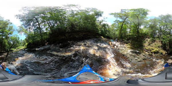
Photoset2: https://www.wwals.net/pictures/2022-07-09–alapahoochee-adventure-pictures/
PHOTO2 SOURCE: John S. Quarterman
Photo2 Phone Number: 229-242-0102
Suggestions: https://forms.gle/DipPgU2TP5atc2Rf9

Turket Creek Waterfall
CATEGORIES: Waterfall
LAYER: Other
OWNERSHIP: Public
WATER BODY: Alapahoochee River
MILE: 0.26
ADDRESS: A quarter mile paddle upstream from Sasser Landing, on the right (west) bank of the Alapahoochee River. Hamilton County.
DESCRIPTION: This waterfall where Turket Creek enters the Alapahoochee River can be three or seven feet high, depending on river water levels. Always good for a picture, sometimes good for a shower.
AKA: Turket Falls
GRN: No
WEBSITE: https://wwals.net/maps/alapaha-water-trail/sites/turket-creek-waterfall/
UPSTREAM: 2.48 miles from Turket Creek Waterfall to GA 135 Alapahoochee Landing
PHOTO: https://www.wwals.net/pictures/2021-06-05–alapahoochee-pictures/20210605_125026.jpg
PHOTOSET: https://www.wwals.net/pictures/2021-06-05–alapahoochee-pictures/
PHOTO SOURCE: John S. Quarterman
PHONE NUMBER: (229) 242-0102
PHOTO2 SOURCE: John S. Quarterman
Photo2 Phone Number: 229-242-0102
Suggestions: https://forms.gle/DipPgU2TP5atc2Rf9

Alapahoochee River Confluence

CATEGORIES: Tributary
LAYER: Other
GPS: 30.602, -83.074
OWNERSHIP: Public
ACCESS: No
WATER BODY: Alapaha River
MILE: 21.24
ADDRESS: Right bank, east of Jennings, FL; accessible slightly upstream from Sasser Landing. Hamilton County.
DESCRIPTION: The 23-mile Alapahoochee River flows into the Alapaha River. See Alapahoochee Launch
HISTORIC FACTS: On old maps known as Irwin’s Creek or, earlier, Irwin’s River, apparently including Grand Bay Creek. Map of Georgia and Alabama by H.S. Tanner, 1823. http://georgiainfo.galileo.usg.edu/histcountymaps/irwin1823map.htm Lowndes County, 1839, GeorgiaInfo, GeorgiaInfo, “Map of Georgia & Alabama exhibiting the post offices, post roads, canals, rail roads & c. By David H. Burr. (Late topographer to the Post Office.) Geographer to the House of Representatives of the U.S.†From his The American Atlas (London, J. Arrowsmith, 1839) . http://georgiainfo.galileo.usg.edu/histcountymaps/lowndes1839map.htm Lowndes County, 1855, GeorgiaInfo. http://georgiainfo.galileo.usg.edu/histcountymaps/lowndes1855map.htm Lowndes County, 1864, GeorgiaInfo. http://georgiainfo.galileo.usg.edu/histcountymaps/lowndes1864map.htm
WEBSITE: http://southgakayakfishing.blogspot.com/2011/09/alapahoochee-convergence-at-alapaha.html
OTHER REFERENCE: https://wwals.net/2018/03/16/ockolocoochee-little-river-1889-01-29/
UPSTREAM: 10.27 miles from Alapahoochee River Confluence to Statenville Boat Ramp
DOWNSTREAM: 0.09 mile from Alapahoochee River Confluence to Sasser Landing
PHOTO: https://wwals.net/pictures/2019-07-06–statenville-sasser-pictures/ar2shot0008.jpg
PHOTOSET: https://wwals.net/pictures/2019-07-06–statenville-sasser-pictures/#Alapahoochee-River
PHOTO SOURCE: John S. Quarterman
PHONE NUMBER: (229) 242-0102
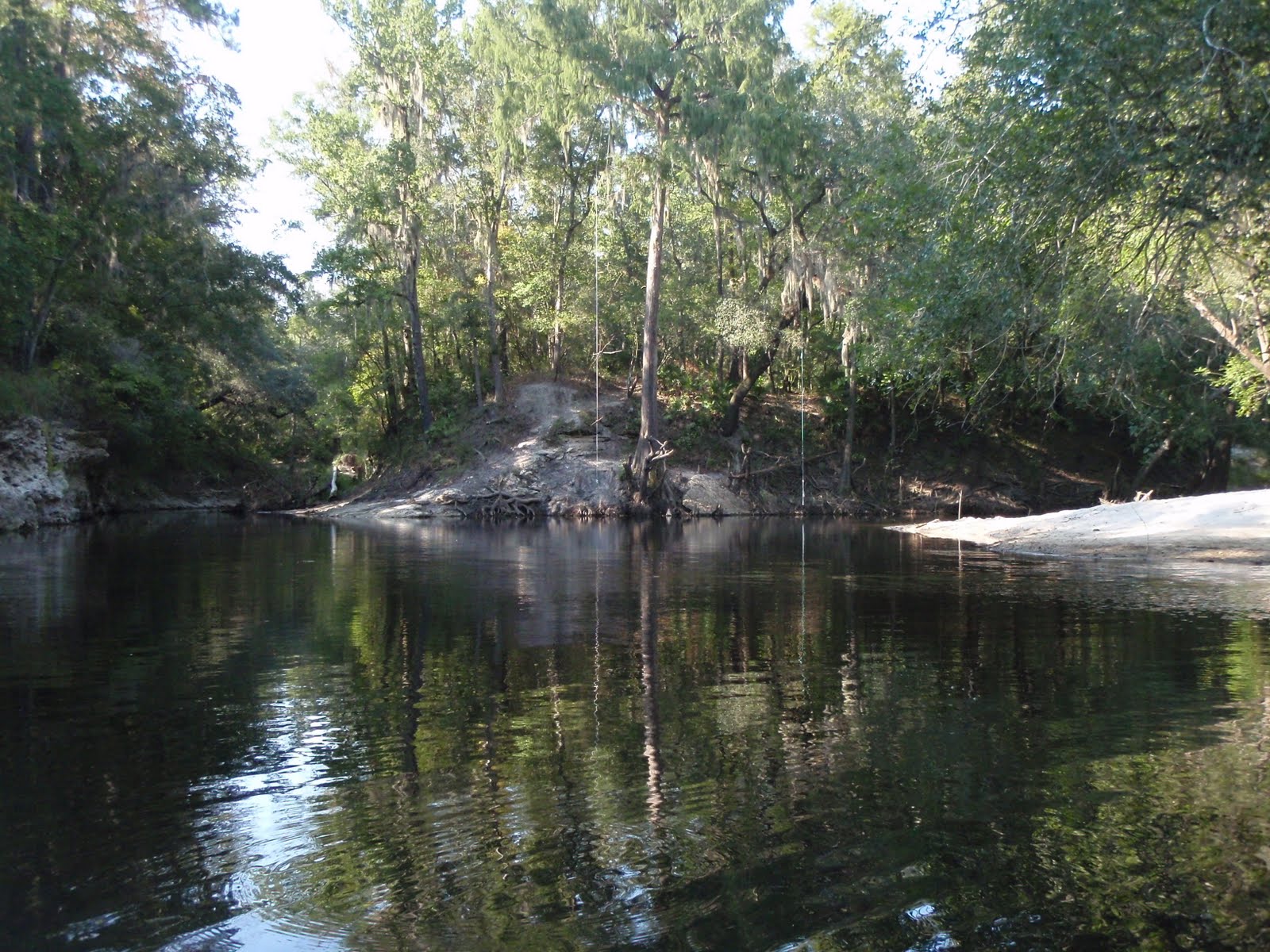
Photoset2: http://southgakayakfishing.blogspot.com/2011/09/alapahoochee-convergence-at-alapaha.html
PHOTO2 SOURCE: South Georgia Kayak Fishing
Suggestions: https://forms.gle/DipPgU2TP5atc2Rf9

Sasser Landing @ NW 72 Court

CATEGORIES: Landing
LAYER: Brochure
OWNERSHIP: Public, Suwannee River Water Management District, PARCEL 3624-010
ACCESS: Yes, Ramp: Concrete ramp on dirt road. PARKING: Free, HANDICAPPED ACCESSIBLE
WATER BODY: Alapaha River
Lowest boatable: 65
Highest safe: 76
GAUGE: Jennings
MILE: 21.15
ADDRESS: Left bank, east of river, north of CR 150. From Jennings, Hamilton County, FL, travel east on CR 150; cross the Alapaha River; turn left onto NW 72 Court and follow to river. Hamilton County.
DESCRIPTION: This well-built ramp is excellent for paddle a tenth of a mile to the Alapahoochee River and then a quarter mile to the picturesque Turket Creek Waterfall. Or the Alapaha River Sink is less than three miles downstream, just before the Dead River Confluence. Do not paddle down the Dead River! Walk a quarter mile through the woods and see the Dead River Sink, where in the dry season the Alapaha River goes underground for more than 18 miles until it comes back up in the Alapaha River Rise on the Suwannee River. Just south of confluence with Alapahoochee River. GPS at River: 30.60071, -83.07326
HISTORIC FACTS: Current ramp built in 2010, but the landing is much older than that.
AKA: Alapahoochee Launch (SRWMD) or Sasser Boat Ramp or Sasser Ramp
WEBSITE: https://wwals.net/maps/alapaha-water-trail/sites/alapahoochee-launch/
ADDITIONAL INFO SOURCES: http://www.mysuwanneeriver.org/launches/index.html
UPSTREAM: 10.36 miles from Sasser Landing to Statenville Boat Ramp
DOWNSTREAM: 3.60 miles from Sasser Landing to Jennings Bluff Launch
PHOTOSET: https://wwals.net/?attachment_id=6521
PHOTO SOURCE: Deanna Mericle
PHONE NUMBER: (850) 290-2350
PHOTO2: https://wwals.net/pictures/2019-07-06–statenville-sasser-pictures/20190706_154101.jpg
Photoset2: https://wwals.net/pictures/2019-07-06–statenville-sasser-pictures/#Sasser-Boat-Ramp
PHOTO2 SOURCE: John S. Quarterman
Photo2 Phone Number: 229-242-0102
Suggestions: https://forms.gle/DipPgU2TP5atc2Rf9

Sasser Landing River GPS @ NW 72 Court
CATEGORIES: Point Of Interest
LAYER: Point of Interest
GPS: 30.60071, -83.07326
OWNERSHIP: Public, Suwannee River Water Management District, PARCEL 3624-010
ACCESS: Yes, Ramp: Concrete ramp on dirt road. PARKING: Free, HANDICAPPED ACCESSIBLE
WATER BODY: Alapaha River
Lowest boatable: 65
Highest safe: 76
GAUGE: Jennings
MILE: 21.15
ADDRESS: Left bank, east of river, north of CR 150. From Jennings, Hamilton County, FL, travel east on CR 150; cross the Alapaha River; turn left onto NW 72 Court and follow to river. Hamilton County.
DESCRIPTION: This well-built ramp is excellent for paddle a tenth of a mile to the Alapahoochee River and then a quarter mile to the picturesque Turket Creek Waterfall. Or the Alapaha River Sink is less than three miles downstream, just before the Dead River Confluence. Do not paddle down the Dead River! Walk a quarter mile through the woods and see the Dead River Sink, where in the dry season the Alapaha River goes underground for more than 18 miles until it comes back up in the Alapaha River Rise on the Suwannee River. Just south of confluence with Alapahoochee River. GPS at River: 30.60071, -83.07326
HISTORIC FACTS: Current ramp built in 2010, but the landing is much older than that.
AKA: Alapahoochee Launch (SRWMD) or Sasser Boat Ramp or Sasser Ramp
WEBSITE: https://wwals.net/maps/alapaha-water-trail/sites/alapahoochee-launch/
ADDITIONAL INFO SOURCES: http://www.mysuwanneeriver.org/launches/index.html
PHOTOSET: https://wwals.net/?attachment_id=6521
PHOTO SOURCE: Deanna Mericle
PHONE NUMBER: (850) 290-2350
PHOTO2: https://wwals.net/pictures/2019-07-06–statenville-sasser-pictures/20190706_154101.jpg
Photoset2: https://wwals.net/pictures/2019-07-06–statenville-sasser-pictures/#Sasser-Boat-Ramp
PHOTO2 SOURCE: John S. Quarterman
Photo2 Phone Number: 229-242-0102
Suggestions: https://forms.gle/DipPgU2TP5atc2Rf9
Sasser Shoals

CATEGORIES: Shoal
LAYER: Point of Interest
GPS: 30.6007, -83.0734
OWNERSHIP: Public
WATER BODY: Alapaha River
MILE: 21.14
ADDRESS: Just downstream from Sasser Landing. Hamilton County.
DESCRIPTION: Small shoals between Sasser Landing and the CR 150 Bridge.
WEBSITE: https://wwals.net/2022/10/31/pictures-alapaha-dead-rivers-sink-2022-10-02/
UPSTREAM: 0.01 mile from Sasser Shoals to Sasser Landing
DOWNSTREAM: 3.59 miles from Sasser Shoals to Jennings Bluff Launch
PHOTO: https://www.wwals.net/pictures/2022-10-02–alapaha-dead-river-pictures/20221002_103908.jpg
PHOTOSET: https://www.wwals.net/pictures/2022-10-02–alapaha-dead-river-pictures/
PHOTO SOURCE: John S. Quarterman
PHONE NUMBER: (229) 242-0102
PHOTO2: https://wwals.net/pictures/2019-07-06–statenville-sasser-pictures/20190706_154255.jpg
Photoset2: https://wwals.net/pictures/2019-07-06–statenville-sasser-pictures/#CR-150-Bridge
PHOTO2 SOURCE: John S. Quarterman
Photo2 Phone Number: 229-242-0102
Suggestions: https://forms.gle/DipPgU2TP5atc2Rf9

Alapahoochee Tract

CATEGORIES: Public Land
LAYER: Other
GPS: 30.60071, -83.039308
OWNERSHIP: Public, SRWMD, PARCEL 3864-020
ACCESS: Yes, Ramp: Concrete, CAMPING: Primitive, PARKING: Free
WATER BODY: Alapaha River
MILE: 18.18
ADDRESS: From Jennings, Hamilton County, FL, travel east on CR 150; cross the Alapaha River; turn left onto NW 72 Court and follow to river. Hamilton County.
DESCRIPTION: 1075 Acre Tract of Public land along the east and west banks of the Alapaha from CR 150 north to the FL/GA State Line
WEBSITE: https://www.mysuwanneeriver.com/index.aspx?nid=235
PHOTO: https://www.mysuwanneeriver.com/images/pages/N235/image006.jpg
PHOTOSET: https://www.mysuwanneeriver.com/index.aspx?nid=235
PHOTO SOURCE: SRWMD
PHONE NUMBER: (850) 290-2350
Suggestions: https://forms.gle/DipPgU2TP5atc2Rf9
Alapahoochee Trail
CATEGORIES: Hiking Trail
LAYER: Hiking Trail
GPS: 30.60071, -83.039308
OWNERSHIP: Public
WATER BODY: Alapaha River
MILE: 18.18
ADDRESS: From Jennings, Hamilton County, FL, travel east on CR 150; cross the Alapaha River; turn left onto NW 72 Court and follow to river. Hamilton County.
DESCRIPTION: 1075 Acre Tract of Public land along the east and west banks of the Alapaha from CR 150 north to the FL/GA State Line
UPSTREAM: 2.97 miles from Alapahoochee Trail to Sasser Landing
DOWNSTREAM: 0.63 mile from Alapahoochee Trail to Jennings Bluff Launch
Suggestions: https://forms.gle/DipPgU2TP5atc2Rf9
FL 150 Bridge

CATEGORIES: Bridge
LAYER: Bridge
GPS: 30.59849, -83.0733
OWNERSHIP: Public
ACCESS: No
WATER BODY: Alapaha River
MILE: 20.99
ADDRESS: 1.6 mi southeast of Jennings, Hamilton County.
DESCRIPTION: State highway and county road two-lane bridge. prestressed concrete stringer bride, 359.9 feet long, built unknown date. https://maps.app.goo.gl/w1K5E2CZ3iycc3kD8, “”Bank protection is being eroded. River control devices and/or embankment have major damage. Trees and rush restrict the channel.”
AKA: CR 150 Bridge.
WEBSITE: https://wwals.net/maps/alapaha-water-trail/sites/alapahoochee-launch/
OTHER REFERENCE: http://bridgereports.com/1081868
UPSTREAM: 0.16 mile from FL 150 Bridge to Sasser Landing
DOWNSTREAM: 3.44 miles from FL 150 Bridge to Jennings Bluff Launch
PHOTOSET: https://wwals.net/pictures/2021-05-07–bobby-mckenzie-lower-alapaha/
PHOTO SOURCE: Bobby McKenzie
PHONE NUMBER: (850) 290-2350
PHOTO2: https://waterdata.usgs.gov/nwisweb/local/state/fl/text/Jennings8172007.jpg
Photoset2: https://waterdata.usgs.gov/usa/nwis/uv?02317620
PHOTO2 SOURCE: USGS
Suggestions: https://forms.gle/DipPgU2TP5atc2Rf9

Jennings Gauge
CATEGORIES: River Gauge
LAYER: River Gauge
GPS: 30.59837, -83.0733
OWNERSHIP: Public
ACCESS: No
WATER BODY: Alapaha River
Lowest boatable: 65
Highest safe: 76
GAUGE: Jennings
MILE: 20.98
ADDRESS: Near left bank on downstream side of bridge on State Highway 150, 150 ft upstream from Southern Railroad bridge,, Hamilton County.
DESCRIPTION: USGS 02317620, 1, 400 ft downstream from Apalahoochee River, 1.5 mi south of Florida-Georgia State line, 1.6 mi southeast of Jennings, and 20.1 mi upstream from mouth.
WEBSITE: https://wwals.net/2014/11/03/alapaha-river-water-levels/#Jennings
UPSTREAM: 0.17 mile from Jennings Gauge to Sasser Landing
DOWNSTREAM: 3.43 miles from Jennings Gauge to Jennings Bluff Launch
PHOTO: https://waterwatch.usgs.gov/wwapps/ftc.php?site_no=02317620
PHOTOSET: https://waterdata.usgs.gov/nwis/uv?02317620
PHOTO SOURCE: USGS
PHONE NUMBER: (850) 290-2350
Suggestions: https://forms.gle/DipPgU2TP5atc2Rf9
Southern Railroad Bridge

CATEGORIES: Railbridge
LAYER: Bridge
OWNERSHIP: Public
ACCESS: No
WATER BODY: Alapaha River
MILE: 20.96
ADDRESS: 1.6 mi southeast of Jennings, FL, Hamilton County.
DESCRIPTION: Railroad bridge. Norfolk Southern Railway, formerly Georgia Southern and Florida Railway https://en.wikipedia.org/wiki/Alapaha_River
WEBSITE: https://wwals.net/maps/alapaha-water-trail/sites/alapahoochee-launch/
UPSTREAM: 0.19 mile from Southern Railroad Bridge to Sasser Landing
DOWNSTREAM: 3.41 miles from Southern Railroad Bridge to Jennings Bluff Launch
PHOTOSET: https://wwals.net/pictures/2021-05-07–bobby-mckenzie-lower-alapaha/
PHOTO SOURCE: Bobby McKenzie
PHONE NUMBER: (850) 290-2350
PHOTO2: https://waterdata.usgs.gov/nwisweb/local/state/fl/text/Jennings4152009.jpg
Photoset2: https://waterdata.usgs.gov/usa/nwis/uv?02317620
PHOTO2 SOURCE: USGS
Suggestions: https://forms.gle/DipPgU2TP5atc2Rf9
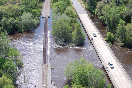
Sasser’s Landing African-American Cemetery
CATEGORIES: Cemetery
LAYER: Other
GPS: 30.596758, -83.077
OWNERSHIP: Private, BETHEL CHURCH (SASSER LANDING), PARCEL 3629-000
WATER BODY: Alapaha River
MILE: 20.89
ADDRESS: NW 14th Terrace, Hamilton County, Florida, 32053. The Sasser’s Landing (African-American) Cemetery will be first on approach. Hamilton County.
DESCRIPTION: “”The Sasser’s Landing white and African-American cemeteries are separated by a chain link fence at approximately 2/10 mile.””
HISTORIC FACTS: “”Sasser’s Landing (African-American) Cemetery was first surveyed by Winnie Smith Hodges and recorded in her book Cemeteries of Hamilton County in 1991. Sasser’s Landing African-American Cemetery was re-surveyed and photographed by Lesleigh Laite Butts and Marie Cantlin on July 15, 2008.””
WEBSITE: http://usgenwebsites.org/flgenweb/FLHamilton/cemetery/sassers_afriamer_cem-1.html
UPSTREAM: 0.26 mile from Sasser’s Landing African-American Cemetery to Sasser Landing
DOWNSTREAM: 3.34 miles from Sasser’s Landing African-American Cemetery to Jennings Bluff Launch
Suggestions: https://forms.gle/DipPgU2TP5atc2Rf9
Sasser’s Landing Cemetery
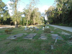
CATEGORIES: Cemetery
LAYER: Other
OWNERSHIP: Private, BETHEL CHURCH (SASSER LANDING), PARCEL 3629-000
WATER BODY: Alapaha River
MILE: 20.90
ADDRESS: NW 14th Terrace, Hamilton County, Florida, 32053, left side of road. Hamilton County.
DESCRIPTION: Old settler cemetery near Sasser Landing. The Sasser’s Landing white cemetery follows the African-American cemetery and a chain link fence at approximately 2/10 mile.
HISTORIC FACTS: Many people in early local histories are buried here.
WEBSITE: https://www.findagrave.com/cemetery/2313855/sasser’s-landing-cemetery/map
UPSTREAM: 0.25 mile from Sasser’s Landing Cemetery to Sasser Landing
DOWNSTREAM: 3.35 miles from Sasser’s Landing Cemetery to Jennings Bluff Launch
PHOTOSET: https://www.findagrave.com/cemetery/2313855/sasser’s-landing-cemetery/map
PHOTO SOURCE: Buddy Wiegand
Suggestions: https://forms.gle/DipPgU2TP5atc2Rf9
Jennings Bridge Site

CATEGORIES: Bridgesite
LAYER: Bridge
OWNERSHIP: Public
WATER BODY: Alapaha River
MILE: 20.35
ADDRESS: End of NW 14th Terrace, 0.8 miles downstream from Sasser Landing, 0.64 miles downstream from CR 150 bridge. Hamilton County.
DESCRIPTION: Defunct road bridge, a steel through-truss bridge, apparently built around 1902-1903.
HISTORIC FACTS: This is the site of the ‘Jennings_Bridge’, a steel through-truss bridge, apparently built around 1902-1903. If there are cutoff Lally columns, then the Jennings Bridge was probably indeed built around 1902-1903. But if the supports are old limerock concrete or brick, then it would have been built before 1898.
AKA: NW 14th Terrace Bridge or Old Jennings Bridge
WEBSITE: https://en.wikipedia.org/wiki/Alapaha_River
OTHER REFERENCE: https://www.floridamemory.com/items/show/139281#nav-buy
UPSTREAM: 0.80 mile from Jennings Bridge Site to Sasser Landing
DOWNSTREAM: 2.80 miles from Jennings Bridge Site to Jennings Bluff Launch
PHOTO: https://www.wwals.net/pictures/2022-01-05–jennings-bridge-sulak/n029695.jpg
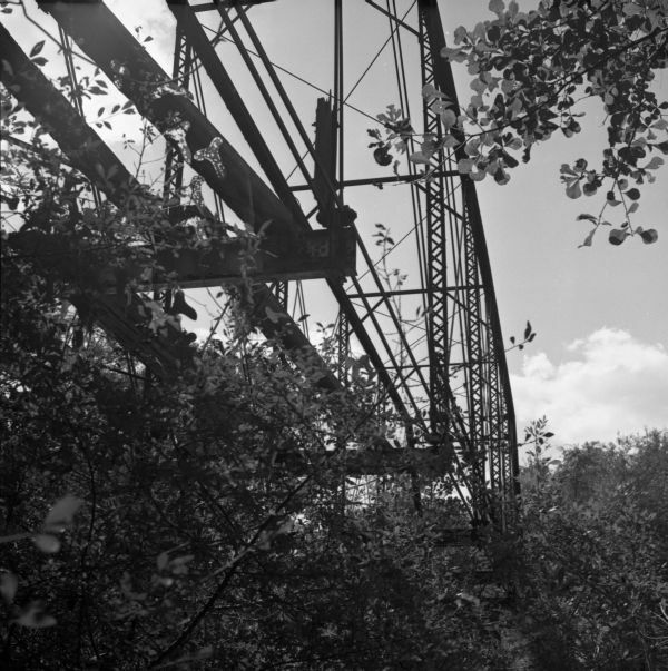
PHOTOSET: https://www.wwals.net/pictures/2022-01-05–jennings-bridge-sulak/
PHOTO SOURCE: Florida Memory
PHONE NUMBER: (850) 290-2350
Suggestions: https://forms.gle/DipPgU2TP5atc2Rf9
Old Sasser Landing

CATEGORIES: Point Of Interest
LAYER: Point of Interest
OWNERSHIP: Public
WATER BODY: Alapaha River
MILE: 20.26
ADDRESS: Near end of NW 14th Terrace, Jennings, FL, across the river from NW 79th Drive. Hamilton County.
DESCRIPTION: Possible original location of Sasser Landing.
HISTORIC FACTS: Possibly where Sasser Landing was to start with.
WEBSITE: https://www.wwals.net/pictures/2022-01-05–jennings-bridge-sulak/
UPSTREAM: 0.89 mile from Old Sasser Landing to Sasser Landing
DOWNSTREAM: 2.71 miles from Old Sasser Landing to Jennings Bluff Launch
PHOTO: https://www.wwals.net/pictures/2022-01-05–jennings-bridge-sulak/SASSER-JENNINGS-MAP.jpg
PHOTOSET: https://www.wwals.net/pictures/2022-01-05–jennings-bridge-sulak/
PHOTO SOURCE: Ken Sulak
PHONE NUMBER: (850) 290-2350
Suggestions: https://forms.gle/DipPgU2TP5atc2Rf9
Sasser Swallet 

CATEGORIES: Sinkhole
LAYER: Other
OWNERSHIP: Public
WATER BODY: Alapaha River
MILE: 20.20
ADDRESS: Right bank, near end of NW 14th Terrace, Jennings, FL, across the river from NW 79th Drive. Hamilton County.
DESCRIPTION: A small swallet on the right bank.
WEBSITE: https://wwals.net/2016/11/12/pictures-alapaha-and-dead-river-sinks-2016-11-06
UPSTREAM: 0.95 mile from Sasser Swallet to Sasser Landing
DOWNSTREAM: 2.65 miles from Sasser Swallet to Jennings Bluff Launch
PHOTO: https://www.wwals.net/pictures/2022-10-02–alapaha-dead-river-pictures/20221002_105838.jpg
PHOTOSET: https://www.wwals.net/pictures/2022-10-02–alapaha-dead-river-pictures/#Small-swallet
PHOTO SOURCE: John S. Quarterman
PHONE NUMBER: (229) 242-0102
Suggestions: https://forms.gle/DipPgU2TP5atc2Rf9
1836 Sasser Ferry 
CATEGORIES: Ferry
LAYER: Bridge
GPS: 30.591312, -83.06509
OWNERSHIP: Public
WATER BODY: Alapaha River
MILE: 20.20
ADDRESS: Near end of NW 14th Terrace, Jennings, FL, across the river from NW 79th Drive. Hamilton County.
DESCRIPTION: Slot cut in the riverbank at likely site of old ferry.
HISTORIC FACTS: Possible location of ferry from 1836.
WEBSITE: https://www.wwals.net/pictures/2022-01-05–jennings-bridge-sulak/
UPSTREAM: 0.95 mile from 1836 Sasser Ferry to Sasser Landing
DOWNSTREAM: 2.65 miles from 1836 Sasser Ferry to Jennings Bluff Launch
PHOTO: https://www.wwals.net/pictures/2022-01-05–jennings-bridge-sulak/SASSER-JENNINGS-MAP.jpg
PHOTOSET: https://www.wwals.net/pictures/2022-01-05–jennings-bridge-sulak/
PHOTO SOURCE: Ken Sulak
PHONE NUMBER: (850) 290-2350
Suggestions: https://forms.gle/DipPgU2TP5atc2Rf9
Sasser-Jennings Lunch Beach

CATEGORIES: Point Of Interest
LAYER: Point of Interest
OWNERSHIP: Public
WATER BODY: Alapaha River
MILE: 19.15
ADDRESS: Two miles downstream from Sasser Landing, right (west) bank. Near the corner of NW 17th Way and NW 79th Drive. Hamilton County.
DESCRIPTION: A nice lunch beach at the right water levels.
WEBSITE: https://www.wwals.net/pictures/2022-10-02–alapaha-dead-river-pictures/#Lunch-beach
UPSTREAM: 2.00 miles from Sasser-Jennings Lunch Beach to Sasser Landing
DOWNSTREAM: 1.60 miles from Sasser-Jennings Lunch Beach to Jennings Bluff Launch
PHOTO: https://www.wwals.net/pictures/2022-10-02–alapaha-dead-river-pictures/20221002_112400.jpg
PHOTOSET: https://www.wwals.net/pictures/2022-10-02–alapaha-dead-river-pictures/#Lunch-beach
PHOTO SOURCE: John S. Quarterman
PHONE NUMBER: (229) 242-0102
PHOTO2: https://www.wwals.net/pictures/2022-10-02–alapaha-dead-river-pictures/20221002_114649.jpg
Photoset2: https://www.wwals.net/pictures/2022-10-02–alapaha-dead-river-pictures/#Lunch-beach
PHOTO2 SOURCE: John S. Quarterman
Photo2 Phone Number: 229-242-0102
Suggestions: https://forms.gle/DipPgU2TP5atc2Rf9

Alapaha River Sink

CATEGORIES: Sinkhole
LAYER: Other
GPS: 30.5854, -83.052728
OWNERSHIP: Public, Suwannee River Water Management District, PARCEL 3140-010
ACCESS: No
WATER BODY: Alapaha River
MILE: 18.67
ADDRESS: Approx. 1/4 mile upstream of the dead river confluence, on the right (west) bank. Hamilton County.
DESCRIPTION: A siphon on the right (west) bank that takes almost the entire river at low water levels, with much of the rest going into the Dead River Sink. At higher levels, this sinkhole in the Alapaha River may be invisible to paddlers.
AKA: The Devil’s Den or the Devil’s Suckhole
GRN: Yes
WEBSITE: https://wwals.net/2016/11/12/pictures-alapaha-and-dead-river-sinks-2016-11-06
UPSTREAM: 2.48 miles from Alapaha River Sink to Sasser Landing
DOWNSTREAM: 1.12 miles from Alapaha River Sink to Jennings Bluff Launch
PHOTO: https://www.wwals.net/pictures/2016-11-06–alapaha-sink/20161106_111552.jpg
PHOTOSET: https://www.wwals.net/pictures/2016-11-06–alapaha-sink/#ARS2
PHOTO SOURCE: John S. Quarterman
PHONE NUMBER: (229) 242-0102
PHOTO2: https://wwals.net/wp-content/themes/pianoblack/img//2014/11/733b80ca3e57a7ee110b61cee53d517f.jpg
Photoset2: https://wwals.net/2014/11/13/alapaha-river-sink/
PHOTO2 SOURCE: Chris Mericle
Suggestions: https://forms.gle/DipPgU2TP5atc2Rf9
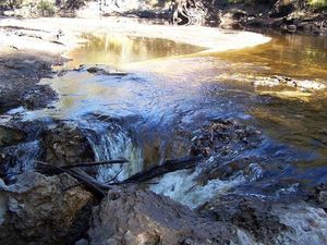
Dead River Confluence

CATEGORIES: Tributary
LAYER: Other
OWNERSHIP: Public, Suwannee River Water Management District, PARCEL 3142-010
WATER BODY: Alapaha River
MILE: 18.53
ADDRESS: From US 41, turn east onto NW 25 Ln, turn into Jennings Bluff Tract, park at Jennings Bluff Launch, walk to the confluence of the Dead River, Hamilton County.
DESCRIPTION: The Alapaha River flows backwards into the Dead River on river right unless the water is quite high. At low water, you can walk over 60-million-year-old fossilized oysters. At the other end of the Dead River is the Dead River Sink. Where Alph, the sacred river, ran / Through caverns measureless to man / Down to a sunless sea. —Samuel Taylor Coleridge 1797
GRN: Yes
WEBSITE: https://wwals.net/2016/11/12/pictures-alapaha-and-dead-river-sinks-2016-11-06
UPSTREAM: 2.62 miles from Dead River Confluence to Sasser Landing
DOWNSTREAM: 0.98 mile from Dead River Confluence to Jennings Bluff Launch
PHOTO: https://www.wwals.net/pictures/2016-11-06–alapaha-sink/20161106_115153.jpg
PHOTOSET: https://www.wwals.net/pictures/2016-11-06–alapaha-sink/#LB
PHOTO SOURCE: John S. Quarterman
PHONE NUMBER: (229) 242-0102
PHOTO2: https://www.wwals.net/pictures/2022-10-02–alapaha-dead-river-pictures/20221002_120606.jpg
Photoset2: https://www.wwals.net/pictures/2022-10-02–alapaha-dead-river-pictures/#DRC
PHOTO2 SOURCE: John S. Quarterman
Photo2 Phone Number: 229-242-0102
Suggestions: https://forms.gle/DipPgU2TP5atc2Rf9

Dead River Sink Kiosk

CATEGORIES: Point Of Interest
LAYER: Point of Interest
OWNERSHIP: Public, Suwannee River Water Management District, PARCEL 3225-002
WATER BODY: Dead River
MILE: 0.51
ADDRESS: From US 41, turn east onto NW 25 Ln, turn into Jennings Bluff Tract, take the first left, proceed to Dead River Kiosk. Hamilton County.
DESCRIPTION: Informative signs about the Dead River and its Sink, placed by the Suwannee River Water Management District.
WEBSITE: https://www.wwals.net/pictures/2022-10-02–alapaha-dead-river-pictures/#DRk
PHOTO: https://www.wwals.net/pictures/2022-10-02–alapaha-dead-river-pictures/20221002_130317.jpg
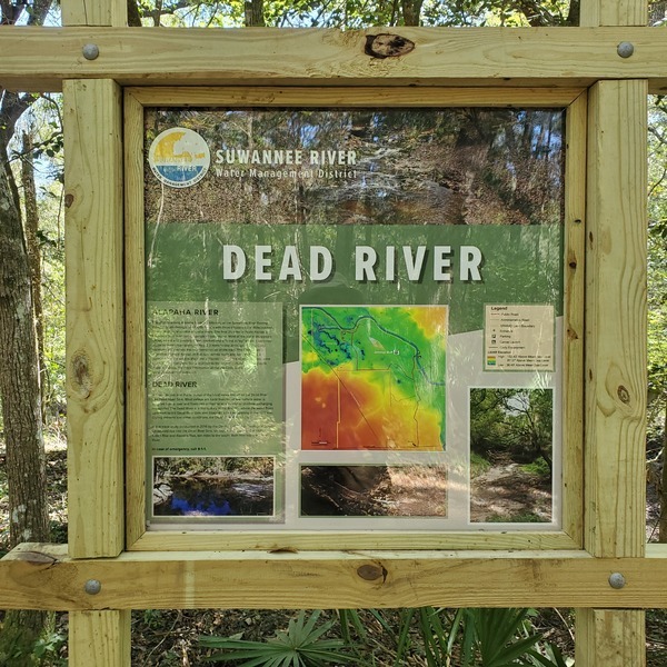
PHOTOSET: https://www.wwals.net/pictures/2022-10-02–alapaha-dead-river-pictures/#DRk
PHOTO SOURCE: John S. Quarterman
PHONE NUMBER: (229) 242-0102
Suggestions: https://forms.gle/DipPgU2TP5atc2Rf9
Dead River Sink

CATEGORIES: Sinkhole
LAYER: Brochure
OWNERSHIP: Public, Suwannee River Water Management District, PARCEL 3225-002
ACCESS: PARKING: Free, PICNIC AREA
WATER BODY: Dead River
MILE: 0.51
ADDRESS: From US 41, turn east onto NW 25 Ln, turn into Jennings Bluff Tract, park at Jennings Bluff Launch, walk to Dead River, follow inland half a mile. Hamilton County.
DESCRIPTION: When water levels are low, most of the Alapaha River water rushes into the sinks in the Alapaha River and into the Dead River Sink, leaving the Alapaha River dry downstream from Jennings Bluff, for the seventeen river miles to the Suwannee River. The Dead River Sink is the end of the Dead River, which is a distributary that takes water from the Alapaha River. Water is always going into the Dead River Sink, down into the Floridan Aquifer, or perhaps one of the aquifers above it. The water comes back up about three days later in the Alapaha River Rise, a spring connected to the Suwannee River just upstream from the Alapaha River Confluence. With walls and towers were girdled round: / And there were gardens bright with sinuous rills —Samuel Taylor Coleridge 1797
HISTORIC FACTS: SRWMD and FDEP dye test of 2016-06-22 found dye coming back up about six days later in Alapaha River Rise and Holton Creek Rise on the Suwannee River. https://wwals.net/?p=20807 Part of the Jennings Bluff State Geological Site, declared 2023-03-17. https://wwals.net/?p=61477
GRN: Yes
WEBSITE: https://wwals.net/2016/11/12/pictures-alapaha-and-dead-river-sinks-2016-11-06
PHOTO: https://www.wwals.net/pictures/2016-11-06–alapaha-sink/32e084bd88c99b4268ddbd92bf2afe9f-1.jpg
PHOTOSET: https://www.wwals.net/pictures/2016-11-06–alapaha-sink/#GQ
PHOTO SOURCE: Gretchen Quarterman
PHONE NUMBER: (850) 290-2350
PHOTO2: https://wwals.net/wp-content/themes/pianoblack/img//2014/09/d08a68fc4f60110fe05edf80b1f0e294.jpg
Photoset2: https://wwals.net/2014/09/17/alapaha-sink/
PHOTO2 SOURCE: Chris Mericle
Photo2 Phone Number: 229-242-0102
Suggestions: https://forms.gle/DipPgU2TP5atc2Rf9

Jennings Bluff Launch @ NW 82 Court


CATEGORIES: Landing
LAYER: Brochure
GPS: 30.56716, -83.0391
OWNERSHIP: Public, Suwannee River Water Management District, PARCEL 3221-000
ACCESS: Yes, Stairs: wooden steps down from unpaved parking area. PARKING: Free
WATER BODY: Alapaha River
Lowest boatable: 65
Highest safe: 76
GAUGE: Jennings
MILE: 17.55
ADDRESS: From Jennings, Hamilton County, FL, travel south on US 41 to NW 25 Lane; turn left; travel east to NW 82 Court and the entrance into the SRWMD Jennings Bluff tract; turn left and follow road to canoe launch. Hamilton County.
DESCRIPTION: During the dry season, these steep steps on river right (west bank) are the last stop before seventeen miles of dry sandy riverbottom. In the rainy season, this is the first stop before a very fast paddle to the Suwannee River. GPS at river: 30.579864, -83.039308
HISTORIC FACTS: Steps rebuilt 2020; hard to distinguish from the old ones at a distance.
AKA: Jennings Bluff Landing
GRN: Yes
WEBSITE: https://www.mysuwanneeriver.com/178/Avoca-Jennings-Bluff
ADDITIONAL INFO SOURCES: https://qpublic6.qpublic.net/cgi-bin/mapserv56?map=/qpub1/maps/fl/hamilton/parcel4.map&mode=map&layers=parcels+roads+aerials+copyright+counties+cities&layer=qparcel_print&parcel=3221-000&mapsize=685%20626&mapext=2429313.3247259%20572749.40545509%202429677.5729287%20573082.28045509 Hamilton County Property Appraiser
UPSTREAM: 3.60 miles from Jennings Bluff Launch to Sasser Landing
DOWNSTREAM: 6.05 miles from Jennings Bluff Launch to US 41 Alapaha River Landing
PHOTOSET: https://wwals.net/pictures/2021-05-11–nondiscrimination-policy/
PHOTO SOURCE: Bobby McKenzie
PHONE NUMBER: (850) 290-2350
Suggestions: https://forms.gle/DipPgU2TP5atc2Rf9
Jennings Bluff Launch River GPS
CATEGORIES: Point Of Interest
LAYER: Point of Interest
OWNERSHIP: Public
ACCESS: Yes, Stairs: wooden steps down from unpaved parking area. PARKING: Free
WATER BODY: Alapaha River
Lowest boatable: 65
Highest safe: 76
GAUGE: Jennings
MILE: 17.55
ADDRESS: From Jennings, Hamilton County, FL, travel south on US 41 to NW 25 Lane; turn left; travel east to NW 82 Court and the entrance into the SRWMD Jennings Bluff tract; turn left and follow road to canoe launch. Hamilton County.
DESCRIPTION: During the dry season, these steep steps on river right (west bank) are the last stop before seventeen miles of dry sandy riverbottom. In the rainy season, this is the first stop before a very fast paddle to the Suwannee River. GPS at river: 30.579864, -83.039308
HISTORIC FACTS: Steps rebuilt 2020; hard to distinguish from the old ones at a distance.
AKA: Jennings Bluff Landing
GRN: No
WEBSITE: https://www.mysuwanneeriver.com/178/Avoca-Jennings-Bluff
ADDITIONAL INFO SOURCES: https://qpublic6.qpublic.net/cgi-bin/mapserv56?map=/qpub1/maps/fl/hamilton/parcel4.map&mode=map&layers=parcels+roads+aerials+copyright+counties+cities&layer=qparcel_print&parcel=3221-000&mapsize=685%20626&mapext=2429313.3247259%20572749.40545509%202429677.5729287%20573082.28045509 Hamilton County Property Appraiser
PHOTOSET: https://wwals.net/pictures/2021-05-11–nondiscrimination-policy/
PHOTO SOURCE: Bobby McKenzie
PHONE NUMBER: (850) 290-2350
Suggestions: https://forms.gle/DipPgU2TP5atc2Rf9
McCook Abandoned Trestle site
CATEGORIES: Railbridgesite
LAYER: Bridge
OWNERSHIP: Public, Suwannee River Water Management District, PARCEL 3221-000
WATER BODY: Alapaha River
GAUGE: White Springs
MILE: 17.19
ADDRESS: A third of a mile downstream from Jennings Bluff Launch; probably walkable at low water. Possibly visible from a side trail on the way to Jennings Bluff Launch. Hamilton County.
DESCRIPTION: A “”spur of the GS&F RR crossed a timber trestle… to a log yard.”” —Ken Sulak, 2022-11-26 He says Edwin McCook reports that some pilings are visible in the river below 51.0 on the White Springs gauge. The right (south) bank is owned by SRWMD; the left bank is privately owned.
OTHER REFERENCE: https://myfiles.dot.ga.gov/Environmental/CulturalResources/Appendix%20G_GSF_Final%20100318.pdf
UPSTREAM: 0.36 mile from McCook Abandoned Trestle site to Jennings Bluff Launch
DOWNSTREAM: 5.69 miles from McCook Abandoned Trestle site to US 41 Alapaha River Landing
Suggestions: https://forms.gle/DipPgU2TP5atc2Rf9
Jennings Bluff Tract

CATEGORIES: Public Land
LAYER: Other
GPS: 30.5674, -83.0389
OWNERSHIP: Public, SRWMD, PARCEL 3221-000
ACCESS: Stairs: wooden steps, CAMPING: Primitive, PARKING: Free
WATER BODY: Alapaha River
MILE: 16.40
ADDRESS: From Jennings, Hamilton County, FL, travel south on US 41 to NW 25 Lane; turn left; travel east to NW 82 Court and the entrance into the SRWMD Jennings Bluff tract. Hamilton County.
DESCRIPTION: 500 Acre Tract of Public Land along the west bank of the Alapaha River between mile 16 and 18.5
HISTORIC FACTS: Declared Jennings Bluff State Geological Site 2023-03-17. https://wwals.net/?p=61477
AKA: Jennings Bluff State Geological Site
WEBSITE: https://www.mysuwanneeriver.com/index.aspx?NID=178
UPSTREAM: 1.15 miles from Jennings Bluff Tract to Jennings Bluff Launch
DOWNSTREAM: 4.90 miles from Jennings Bluff Tract to US 41 Alapaha River Landing
PHOTO: https://www.wwals.net/pictures/2016-11-06–alapaha-sink/20161106_094958.jpg
PHOTOSET: https://www.wwals.net/pictures/2016-11-06–alapaha-sink/#JBT
PHOTO SOURCE: John S. Quarterman
PHONE NUMBER: (229) 242-0102
PHOTO2: https://www.mysuwanneeriver.com/images/pages/N178/avoca_jenningsbluff%20map.jpg
Photoset2: https://www.mysuwanneeriver.com/index.aspx?NID=178
PHOTO2 SOURCE: SRWMD
Suggestions: https://forms.gle/DipPgU2TP5atc2Rf9

Jennings Bluff Trail
CATEGORIES: Hiking Trail
LAYER: Hiking Trail
OWNERSHIP: Public
WATER BODY: Alapaha River
MILE: 16.40
ADDRESS: From Jennings, Hamilton County, FL, travel south on US 41 to NW 25 Lane; turn left; travel east to NW 82 Court and the entrance into the SRWMD Jennings Bluff tract. Hamilton County.
DESCRIPTION: 500 Acre Tract of Public Land along the west bank of the Alapaha River between mile 16 and 18.5
UPSTREAM: 1.15 miles from Jennings Bluff Trail to Jennings Bluff Launch
DOWNSTREAM: 4.90 miles from Jennings Bluff Trail to US 41 Alapaha River Landing
PHOTO: https://www.mysuwanneeriver.com/images/pages/N178/avoca_jenningsbluff%20map.jpg
PHOTOSET: https://www.mysuwanneeriver.com/index.aspx?NID=178
PHOTO SOURCE: SRWMD
PHONE NUMBER: (850) 290-2350
Suggestions: https://forms.gle/DipPgU2TP5atc2Rf9
Jennings Bluff Spring

CATEGORIES: Spring
LAYER: Other
GPS: 30.56845, -83.035483
OWNERSHIP: Public
ACCESS: No
WATER BODY: Alapaha River
MILE: 16.37
ADDRESS: Right bank, below Jennings Bluff Cemetery, Hamilton Co., FL, Hamilton County.
DESCRIPTION: Spring at the end of a several hundred foot run at the NW end of the Bluff
GRN: Yes
WEBSITE: https://wwals.net/?attachment_id=4380
UPSTREAM: 1.18 miles from Jennings Bluff Spring to Jennings Bluff Launch
DOWNSTREAM: 4.87 miles from Jennings Bluff Spring to US 41 Alapaha River Landing
PHOTO: https://wwals.net/wp-content/themes/pianoblack/img//2014/11/72acded3acd45e4c8b6ed680854b8ab1.jpg
PHOTOSET: https://wwals.net/?attachment_id=4380
PHOTO SOURCE: Chris Mericle
PHONE NUMBER: (850) 290-2350
Suggestions: https://forms.gle/DipPgU2TP5atc2Rf9
Jennings Bluff African-American Cemetery

CATEGORIES: Cemetery
LAYER: Other
OWNERSHIP: Public
WATER BODY: Alapaha River
MILE: 16.33
ADDRESS: End of NW 25th Lane, Jennings, FL 32053, on the left. Hamilton County.
DESCRIPTION: Small African-American cemetery near the Alapaha River. See also Jennings Bluff Cemetery on the other side of the road.
WEBSITE: http://usgenwebsites.org/flgenweb/FLHamilton/cemetery/jenningsbluff_afriamer_cem.html
UPSTREAM: 1.22 miles from Jennings Bluff African-American Cemetery to Jennings Bluff Launch
DOWNSTREAM: 4.83 miles from Jennings Bluff African-American Cemetery to US 41 Alapaha River Landing
PHOTO: https://wwals.net/pictures/2018-01-27–hike-dead-river-sink/20180127_153633.jpg
PHOTOSET: https://wwals.net/pictures/2018-01-27–hike-dead-river-sink/
PHOTO SOURCE: John S. Quarterman
PHONE NUMBER: (229) 242-0102
Suggestions: https://forms.gle/DipPgU2TP5atc2Rf9
Jennings Bluff Cemetery
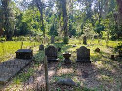
CATEGORIES: Cemetery
LAYER: Other
GPS: 30.56693, -83.035297
OWNERSHIP: Public
WATER BODY: Alapaha River
MILE: 16.30
ADDRESS: End of NW 25th Lane, Jennings, FL 32053, on the right. Hamilton County.
DESCRIPTION: Rather large nineteenth century settler cemetery near the banks of the Alapaha River.
GRN: No
WEBSITE: https://www.findagrave.com/cemetery/2230132/jennings-bluff-cemetery
UPSTREAM: 1.25 miles from Jennings Bluff Cemetery to Jennings Bluff Launch
DOWNSTREAM: 4.80 miles from Jennings Bluff Cemetery to US 41 Alapaha River Landing
PHOTOSET: https://www.findagrave.com/cemetery/2230132/jennings-bluff-cemetery/photo
PHOTO SOURCE: Melissa Gayle
Suggestions: https://forms.gle/DipPgU2TP5atc2Rf9
Alligator Creek
CATEGORIES: Tributary
LAYER: Other
GPS: 30.558886, -83.02036
OWNERSHIP: Private
WATER BODY: Alapaha River
MILE: 15.23
ADDRESS: South of NW 86th Blvd, Jasper, FL, Hamilton County.
UPSTREAM: 2.32 miles from Alligator Creek to Jennings Bluff Launch
DOWNSTREAM: 3.73 miles from Alligator Creek to US 41 Alapaha River Landing
Suggestions: https://forms.gle/DipPgU2TP5atc2Rf9
US 41 Alapaha River Bridge

CATEGORIES: Bridge
LAYER: Bridge
OWNERSHIP: Public
ACCESS: No
WATER BODY: Alapaha River
MILE: 11.50
ADDRESS: Between Jennings and Jasper, FL, Hamilton County.
DESCRIPTION: Two-lane concrete Federal highway bridge with sidewalks built in 1988.
HISTORIC FACTS: Current bridge built 1988 to replace “”Lost Pratt through truss bridge””. https://bridgehunter.com/fl/hamilton/alapaha-river/
WEBSITE: https://wwals.net/pictures/2021-05-07–bobby-mckenzie-lower-alapaha/
OTHER REFERENCE: https://maps.app.goo.gl/jStBLHr1Dw2kKW8e9
UPSTREAM: 6.05 miles from US 41 Alapaha River Bridge to Jennings Bluff Launch
PHOTOSET: https://wwals.net/pictures/2021-05-07–bobby-mckenzie-lower-alapaha/
PHOTO SOURCE: Bobby McKenzie
PHONE NUMBER: (850) 290-2350
Photoset2: https://en.wikipedia.org/wiki/File:US_41_Alapaha_River_bridge_west02.jpg
PHOTO2 SOURCE: Ebyabe Creative Commons Attribution ShareAlike 2.5 https://en.wikipedia.org/wiki/File:US_41_Alapaha_River_bridge_west02.jpg
Suggestions: https://forms.gle/DipPgU2TP5atc2Rf9

Davenport’s Ferry

CATEGORIES: Ferry
LAYER: Bridge
GPS: 30.5287, -83.0384
OWNERSHIP: Private
WATER BODY: Alapaha River
MILE: 11.50
ADDRESS: Where the current US 41 bridge is, between Jennins and Jasper, FL. Hamilton County.
DESCRIPTION: A ferry back in the early 1800s, with scant information available on it.
HISTORIC FACTS: “”Back in the early 1800s, it was the site of Davenport’s Ferry. I have scant information on Davenport or his ferry. It was never licensed that I can determine, but was subsequently taken over by Henry Peeples Nunn in the 1870s, and became known as Nunn’s Ferry. Nunn is buried in the Jennings Bluff Cemetery…. The only way I know that there was a Davenport’s Ferry is that it is mentioned in the Florida Acts in which a license was issued to Mr. Nunn “at the site of old Davenport Ferry””.”” —Ken Sulak
AKA: Nunn’s Ferry
UPSTREAM: 6.05 miles from Davenport’s Ferry to Jennings Bluff Launch
PHOTO: https://www.wwals.net/pictures/2021-12-08–history-last-stretch-alapaha-river/us-41-bridge.jpg
PHOTOSET: https://www.wwals.net/pictures/2021-12-08–history-last-stretch-alapaha-river/
PHOTO SOURCE: WWALS
PHONE NUMBER: (850) 290-2350
Suggestions: https://forms.gle/DipPgU2TP5atc2Rf9
Nunn-Gill Toll Bridge Site
CATEGORIES: Bridgesite
LAYER: Bridge
GPS: 30.5286, -83.0381
OWNERSHIP: Private
WATER BODY: Alapaha River
MILE: 11.50
ADDRESS: Where the current US 41 bridge is, between Jennins and Jasper, FL. Hamilton County.
DESCRIPTION: A steel truss toll bridge, built to replace Davenport’s Ferry.
HISTORIC FACTS: “”In 1885, Nunn and Jeremiah Gill obtained a state license to construct a toll bridge to replace the ferry crossing. It was a steel truss bridge of a very early design, an arched bowstring bridge. Only two such bridges were built in Florida, the other over the Withlacoochee near Lee (close to Suwannee River State Park). It probably had two spans to cross the long distance from shore to shore. Being built before the invention of steel Lally columns, the two spans probably rested upon brick and/or concrete piers. This may be the earliest steel truss bridge built in Florida, or at least one of the first few. Supposedly, there are remnants of the piers in the riverbank, but I have not found them. This was a light-duty wood plank deck bridge with only a single brace over top to connect the two sides.”” —Ken Sulak
AKA: Old Nunn Toll Bridge or Old Nunn-Gill Toll Bridge
UPSTREAM: 6.05 miles from Nunn-Gill Toll Bridge Site to Jennings Bluff Launch
PHOTO: https://www.wwals.net/pictures/2021-12-08–history-last-stretch-alapaha-river/us-41-bridge.jpg
PHOTOSET: https://www.wwals.net/pictures/2021-12-08–history-last-stretch-alapaha-river/
PHOTO SOURCE: WWALS
PHONE NUMBER: (850) 290-2350
Suggestions: https://forms.gle/DipPgU2TP5atc2Rf9
US 41 Alapaha River Landing

CATEGORIES: Landing
LAYER: Brochure
OWNERSHIP: Public
ACCESS: Yes, Launch: riverbank down good access road on federal highway right of way, PARKING: Free
WATER BODY: Alapaha River
Lowest boatable: 65
Highest safe: 76
GAUGE: Jennings
MILE: 11.50
ADDRESS: South side of the road, under the power line, between Jennings and Jasper, FL. Hamilton County.
DESCRIPTION: Gravel road down to riverbank from federal highway. Check water level first, since the river is dry most of the year. This landing is not actually part of the Alapaha River Water Trail.
HISTORIC FACTS: “”Jennings Gauge that day read 74′. The water was moving fairly quick. Average spreed without paddling was 3.5 mph. No dead falls or blockage. Good paddling for more experienced paddlers at this level.”” —Bobby McKenzie 2021-05-07
WEBSITE: https://wwals.net/pictures/2021-05-07–bobby-mckenzie-lower-alapaha/
UPSTREAM: 6.05 miles from US 41 Alapaha River Landing to Jennings Bluff Launch
DOWNSTREAM: 11.53 miles from US 41 Alapaha River Landing to Gibson Park Ramp
PHOTOSET: https://wwals.net/pictures/2021-05-07–bobby-mckenzie-lower-alapaha/
PHOTO SOURCE: Bobby McKenzie
PHONE NUMBER: (850) 290-2350
Suggestions: https://forms.gle/DipPgU2TP5atc2Rf9
US 41 Alapaha River Landing River GPS

CATEGORIES: Point Of Interest
LAYER: Point of Interest
GPS: 30.5287, -83.0391
OWNERSHIP: Public
ACCESS: Yes, Launch: riverbank down good access road on federal highway right of way, PARKING: Free
WATER BODY: Alapaha River
Lowest boatable: 65
Highest safe: 76
GAUGE: Jennings
MILE: 11.50
ADDRESS: Right bank, west side, downstream (south) of the bridge, under the power line. Hamilton County.
DESCRIPTION: Gravel road down to riverbank from federal highway. Check water level first, since the river is dry most of the year. This landing is not actually part of the Alapaha River Water Trail.
HISTORIC FACTS: “”Jennings Gauge that day read 74′. The water was moving fairly quick. Average spreed without paddling was 3.5 mph. No dead falls or blockage. Good paddling for more experienced paddlers at this level.”” —Bobby McKenzie 2021-05-07
WEBSITE: https://wwals.net/pictures/2021-05-07–bobby-mckenzie-lower-alapaha/
PHOTOSET: https://wwals.net/pictures/2021-05-07–bobby-mckenzie-lower-alapaha/
PHOTO SOURCE: Bobby McKenzie
PHONE NUMBER: (850) 290-2350
Suggestions: https://forms.gle/DipPgU2TP5atc2Rf9
Hamilton Co. TDC

CATEGORIES: ARWT Sponsor
LAYER: Sponsor
OWNERSHIP: Public
ACCESS: No
WATER BODY: Alapaha River
ADDRESS: Hamllton County Tourist Development Council, 1153 US Hwy 41 NW Suite 2, Jasper. FL 32052, Hamilton County.
DESCRIPTION: Tourist Development Council for Hamilton County, Florida.
WEBSITE: https://hamiltoncountyfl.com/tourist-development-council/
PHOTOSET: https://wwals.net/2014/11/28/tdc-letter-support-alapaha-river-water-trail-hamilton-county-fl/
PHOTO SOURCE: Hamilton Co. TDC
PHONE NUMBER: (386) 792-6829
Suggestions: https://forms.gle/DipPgU2TP5atc2Rf9
Hamilton Co. Commission
CATEGORIES: ARWT Sponsor
LAYER: Sponsor
OWNERSHIP: Public
ACCESS: No
WATER BODY: Alapaha River
ADDRESS: Hamilton County Board of Commissioners, 207 NE First Street Jasper, FL 32052, Hamilton County.
DESCRIPTION: County commission
WEBSITE: https://hamiltoncountyfl.com/board-of-county-commissioners/
PHOTOSET: https://hamiltoncountyfl.com/board-of-county-commissioners/
PHOTO SOURCE: Hamilton Co. BOCC
PHONE NUMBER: (386) 792-6639
Suggestions: https://forms.gle/DipPgU2TP5atc2Rf9
Jasper Hardware

CATEGORIES: Logo Contest Sponsor
LAYER: Sponsor
OWNERSHIP: Private
ACCESS: No
WATER BODY: Alapaha River
ADDRESS: 208 Central Ave NW, Jasper, FL 32052, Hamilton County.
DESCRIPTION: Hardware and sporting goods store
WEBSITE: https://www.facebook.com/pages/Jasper-Hardware-Supply-Company-Inc/333393348754?sk=info&tab=overview
PHOTO SOURCE: Jasper Hardware
PHONE NUMBER: (386) 792-1052
Suggestions: https://forms.gle/DipPgU2TP5atc2Rf9
Jasper-Greenville Power Line

CATEGORIES: Power Line
LAYER: Point of Interest
OWNERSHIP: Private, WSK Family LLC (west bank); SRWMD (east bank), PARCEL 2899-000 (west bank), 2896-000 (east bank)
WATER BODY: Alapaha River
MILE: 9.40
ADDRESS: Less than a mile south of FL 6 exit on I-75, and less than a mile upstream from the I-75 bridge across the Alapaha River. Hamilton County.
DESCRIPTION: Right (west) bank owned and posted by WSK Family, LLC; left (east) bank owned by SRWMD.
WEBSITE: https://www.wwals.net/pictures/2022-02-05–last-stretch-alapaha-pictures/
UPSTREAM: 2.10 miles from Jasper-Greenville Power Line to US 41 Alapaha River Landing
PHOTO: https://www.wwals.net/pictures/2022-02-05–last-stretch-alapaha-pictures/20220205_105630.jpg
PHOTOSET: https://www.wwals.net/pictures/2022-02-05–last-stretch-alapaha-pictures/
PHOTO SOURCE: WWALS
PHONE NUMBER: (850) 290-2350
PHOTO2: https://www.wwals.net/pictures/2022-02-05–last-stretch-alapaha-pictures/20220205_105609.jpg
Photoset2: https://www.wwals.net/pictures/2022-02-05–last-stretch-alapaha-pictures/
PHOTO2 SOURCE: WWALS
Suggestions: https://forms.gle/DipPgU2TP5atc2Rf9

Source of Little Alapaha River

CATEGORIES: Spring
LAYER: Point of Interest
GPS: 30.613122, -82.92267
OWNERSHIP: Private, JTO VALDOSTA LLC, 654 NORTH STATE STREET, JACKSON, MS 39202, PARCEL 050 002A
WATER BODY: Little Alapaha River
MILE: 10.90
ADDRESS: 6.14 miles east of US 129, 0.86 miles east of Barnes Road, just north of the GA-FL line, on private land. Echols County.
DESCRIPTION: Maybe a spring; more likely just overflow from the various bays and swamps north of it.
WEBSITE: https://www.google.com/maps/place/30%C2%B036’47.2%22N+82%C2%B055’21.6%22W/@30.6122077, -82.9240275, 293m/data=!3m1!1e3!4m14!1m7!3m6!1s0x0:0xa40a6d039732e922!2zMzDCsDMzJzExLjAiTiA4MsKwNTknNDAuMCJX!3b1!8m2!3d30.553056!4d-82.994444!3m5!1s0x0:0x150d35a17449652a!7e2!8m2!3d30.6131216!4d-82.92267!5m1!1e4
PHOTO: https://www.wwals.net/pictures/2022-02-07–little-alapaha-river/source.jpg
PHOTOSET: https://www.wwals.net/pictures/2022-02-07–little-alapaha-river/
PHOTO SOURCE: Echols County Tax Assessors
PHONE NUMBER: (850) 290-2350
Suggestions: https://forms.gle/DipPgU2TP5atc2Rf9
CR 51 Little Alapaha River Bridge

CATEGORIES: Bridge
LAYER: Bridge
OWNERSHIP: Public
WATER BODY: Little Alapaha River
MILE: 8.24
ADDRESS: Five miles north of CR 6. Hamilton County.
DESCRIPTION: 100.1-foot 4-span concrete tee-beam bridge built in 1963. “”Bank protection is in need of minor repairs. River control devices and embankment protection have a little minor damage. Banks and/or channel have minor amounts of drift.”” —bridgereports.com
WEBSITE: http://bridgereports.com/1081865
PHOTO: https://www.wwals.net/pictures/2022-02-07–little-alapaha-river/cr-51.jpg
PHOTOSET: https://www.wwals.net/pictures/2022-02-07–little-alapaha-river/
PHOTO SOURCE: Google Streetview
PHONE NUMBER: (850) 290-2350
Suggestions: https://forms.gle/DipPgU2TP5atc2Rf9
NW 25th Drive Little Alapaha River Bridge

CATEGORIES: Bridge
LAYER: Bridge
OWNERSHIP: Public
WATER BODY: Little Alapaha River
MILE: 5.27
ADDRESS: 0.7 miles east of US 129. Hamilton County.
DESCRIPTION: 67.3-foot 5-span wood stringer bridge built in 1989.
WEBSITE: http://bridgereports.com/1081902
PHOTO: https://www.wwals.net/pictures/2022-02-07–little-alapaha-river/nw-25th-dr.jpg
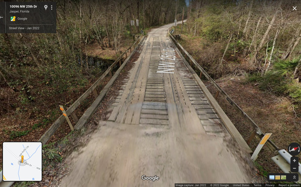
PHOTOSET: https://www.wwals.net/pictures/2022-02-07–little-alapaha-river/
PHOTO SOURCE: Google Streetview
PHONE NUMBER: (850) 290-2350
Suggestions: https://forms.gle/DipPgU2TP5atc2Rf9
US 129 Little Alapaha River Bridge

CATEGORIES: Bridge
LAYER: Bridge
GPS: 30.565472, -82.98725
OWNERSHIP: Public
WATER BODY: Little Alapaha River
MILE: 4.95
ADDRESS: 3.4 miles north of Jasper. Hamilton County.
DESCRIPTION: 160.1-foot 4-span prestressed concrete stringer bridge built in 1967. “”Bank protection is in need of minor repairs. River control devices and embankment protection have a little minor damage. Banks and/or channel have minor amounts of drift. [7] … Bridge foundations determined to be stable for assessed or calculated scour condition.”” —bridgereports.com
AKA: FL 100 Little Alapaha River Bridge
WEBSITE: http://bridgereports.com/1081852
PHOTO: https://www.wwals.net/pictures/2022-02-07–little-alapaha-river/us-129.jpg
PHOTOSET: https://www.wwals.net/pictures/2022-02-07–little-alapaha-river/
PHOTO SOURCE: Google Streetview
PHONE NUMBER: (850) 290-2350
Suggestions: https://forms.gle/DipPgU2TP5atc2Rf9
CR 148 LIttle Alapaha River Bridge

CATEGORIES: Bridge
LAYER: Bridge
OWNERSHIP: Public
WATER BODY: Little Alapaha River
MILE: 3.82
ADDRESS: Between NW 86th Blvd. and NW 97th Ave., 1.1 miles west of US 129. Hamilton County.
DESCRIPTION: 75.1-foot concrete slab 5-span bridge across the Little Alapaha River.
WEBSITE: https://bridgereports.com/1081901
OTHER REFERENCE: https://maps.app.goo.gl/6vJacRNzyhy5MLku8
PHOTO: https://www.wwals.net/pictures/2022-02-07–little-alapaha-river/nw-cr-148.jpg
PHOTOSET: https://www.wwals.net/pictures/2022-02-07–little-alapaha-river/
PHOTO SOURCE: Google Streetview
PHONE NUMBER: (850) 290-2350
Suggestions: https://forms.gle/DipPgU2TP5atc2Rf9
Little Alapaha River Swallet

CATEGORIES: Sinkhole
LAYER: Brochure
OWNERSHIP: Private, BURNAM MARILYN B, PARCEL 3360-050
WATER BODY: Little Alapaha River
MILE: 0.57
ADDRESS: About 1.2 miles east of the US 41 Alapaha River Bridge (1.38 miles via US 41) and 0.28 miles north of US 41, on private property. Hamilton County.
DESCRIPTION: “”The Little Alapaha River, for example, enters the Floridan aquifer approximately 1.2 mi. east of the Alapaha through a large, complex swallet….”” —SEGS
WEBSITE: https://segs.org/wp-content/uploads/2010/01/SEGS-Guidebook-63-Alapaha-River-Area.pdf
PHOTO: https://www.wwals.net/pictures/2022-02-07–little-alapaha-river/swallet.jpg
PHOTOSET: https://www.wwals.net/pictures/2022-02-07–little-alapaha-river/
PHOTO SOURCE: Hamilton County Property Appraiser
PHONE NUMBER: (850) 290-2350
Photoset2: https://www.wwals.net/pictures/2022-02-07–little-alapaha-river/
PHOTO2 SOURCE: SEGS
Suggestions: https://forms.gle/DipPgU2TP5atc2Rf9

US 41 Little Alapaha River Bridge

CATEGORIES: Bridge
LAYER: Bridge
GPS: 30.52389, -83.0155
OWNERSHIP: Public
WATER BODY: Little Alapaha River
MILE: 0.56
ADDRESS: Between NW 86th Blvd. and SW 90th Blvd., about 1.2 miles east of the US 41 Alapaha River Bridge.
DESCRIPTION: 86.9-foot concrete slab cast-in-place bridge across the Little Alapaha River, where it seldom flows. “”Deck geometry appraisal: Basically intolerable requiring high priority of corrrective action [3]; Water adequacy appraisal: Equal to present desirable criteria [8]; Roadway alignment appraisal: Equal to present desirable crieria [8]; Channel protection: Bank protection is in need of minor repairs. River control devices and embankment protection have a little minor damage. Banks and/or channel have minor amounts of drift. [7; ]Scour condition: Bridge is scour critical; bridge foundations determined to be unstable. [3]”” —bridgereports.com
HISTORIC FACTS: “”Bridge is possibly eligible for the National Register of Historic Places.”” —bridgereports.com
AKA: FL 6 Little Alapaha River Bridge
WEBSITE: http://bridgereports.com/1081851
OTHER REFERENCE: https://www.google.com/maps/place/30%C2%B031’26.0%22N+83%C2%B000’55.8%22W/@30.5233036, -83.0142426, 688m/data=!3m1!1e3!4m5!3m4!1s0x0:0xc06cad04878a639d!8m2!3d30.52389!4d-83.0155
PHOTO: https://www.wwals.net/pictures/2022-02-07–little-alapaha-river/fl6.jpg
PHOTOSET: https://www.wwals.net/pictures/small/2022-02-07–little-alapaha-river/
PHOTO SOURCE: Google Streetview
PHONE NUMBER: (850) 290-2350
PHOTO2: https://www.wwals.net/pictures/2022-02-07–little-alapaha-river/fl6n.jpg
Photoset2: https://www.wwals.net/pictures/2022-02-07–little-alapaha-river/
PHOTO2 SOURCE: Google Streetview
Suggestions: https://forms.gle/DipPgU2TP5atc2Rf9

Little Alapaha River

CATEGORIES: Tributary
LAYER: Brochure
OWNERSHIP: Public, SRWMD, PARCEL 2897-000
ACCESS: No
WATER BODY: Alapaha River
MILE: 8.56
ADDRESS: Left bank, between US 41 and I-75. Hamilton County.
DESCRIPTION: Much of the year most likely the Little Alapaha River goes underground. Sometimes the Alapaha River flows backwards into the Little Alapaha River as a distributary.
WEBSITE: https://segs.org/wp-content/uploads/2010/01/SEGS-Guidebook-63-Alapaha-River-Area.pdf
UPSTREAM: 2.94 miles from Little Alapaha River to US 41 Alapaha River Landing
PHOTO: https://www.wwals.net/pictures/2022-02-05–last-stretch-alapaha-pictures/20220205_110748.jpg
PHOTOSET: https://www.wwals.net/pictures/2022-02-05–last-stretch-alapaha-pictures/
PHOTO SOURCE: John S. Quarterman
PHONE NUMBER: (229) 242-0102
PHOTO2: https://www.wwals.net/pictures/2022-02-05–last-stretch-alapaha-pictures/little-alapaha-river.jpg
Photoset2: https://www.wwals.net/pictures/2022-02-05–last-stretch-alapaha-pictures/
PHOTO2 SOURCE: WWALS
Suggestions: https://forms.gle/DipPgU2TP5atc2Rf9
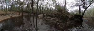
I-75 Alapaha River Bridge

CATEGORIES: Bridge
LAYER: Bridge
OWNERSHIP: Public
ACCESS: No
WATER BODY: Alapaha River
MILE: 8.24
ADDRESS: Between Jennings and Jasper, FL, Hamilton County.
DESCRIPTION: A pair of Interstate highway bridges, each 259.9 feet long pre-stressed concrete on stringers, built in 1994. https://maps.app.goo.gl/hNYvdgcnjPxAGE7E6, “”Bank protection is in need of minor repairs. River control devices and embankment protection have a little minor damage. Banks and/or channel have minor amounts of drift.”
WEBSITE: http://bridgereports.com/1081887
OTHER REFERENCE: http://bridgereports.com/1081882
UPSTREAM: 3.26 miles from I-75 Alapaha River Bridge to US 41 Alapaha River Landing
PHOTOSET: https://wwals.net/pictures/2021-05-07–bobby-mckenzie-lower-alapaha/
PHOTO SOURCE: Bobby McKenzie
PHONE NUMBER: (850) 290-2350
Suggestions: https://forms.gle/DipPgU2TP5atc2Rf9
Tyree Tract

CATEGORIES: Public Land
LAYER: Other
GPS: 30.47223, -83.0897
OWNERSHIP: Public, SRWMD, PARCEL 3581-000
ACCESS: PARKING: Free
WATER BODY: Alapaha River
MILE: 3.63
ADDRESS: From I-75 exit SR6 west to CR751 south to sw 57th St turn left, go to W 65th turn left, dead ends at entrance. Hamilton County.
DESCRIPTION: 213 Acre Tract of Public Land along the West bank of the Alapaha River between mile 3.5 and 4.5.
GRN: No
WEBSITE: https://www.mysuwanneeriver.com/index.aspx?nid=236
UPSTREAM: 7.87 miles from Tyree Tract to US 41 Alapaha River Landing
PHOTO: https://www.mysuwanneeriver.com/images/pages/N236/image005.jpg
PHOTOSET: https://www.mysuwanneeriver.com/index.aspx?nid=236
PHOTO SOURCE: SRWMD
PHONE NUMBER: (850) 290-2350
Suggestions: https://forms.gle/DipPgU2TP5atc2Rf9
Tyree Trail
CATEGORIES: Hiking Trail
LAYER: Hiking Trail
GPS: 30.47223, -83.0897
OWNERSHIP: Public
WATER BODY: Alapaha River
MILE: 3.63
ADDRESS: From I-75 exit SR6 west to CR751 south to sw 57th St turn left, go to W 65th turn left, dead ends at entrance. Hamilton County.
DESCRIPTION: 213 Acre Tract of Public Land along the West bank of the Alapaha River between mile 3.5 and 4.5.
WEBSITE: https://www.mysuwanneeriver.com/index.aspx?nid=236
UPSTREAM: 7.87 miles from Tyree Trail to US 41 Alapaha River Landing
PHOTO: https://www.mysuwanneeriver.com/images/pages/N236/image005.jpg
PHOTOSET: https://www.mysuwanneeriver.com/index.aspx?nid=236
PHOTO SOURCE: SRWMD
PHONE NUMBER: (850) 290-2350
Suggestions: https://forms.gle/DipPgU2TP5atc2Rf9
CR 387 Bridge Site
CATEGORIES: Bridgesite
LAYER: Bridge
GPS: 30.45334, -83.089351
OWNERSHIP: Public
WATER BODY: Alapaha River
MILE: 2.03
ADDRESS: From SW CR 751, east on CR 249, first left onto unnamed road. Hamilton County.
DESCRIPTION: Across the river from the NE tip of the Lower Alapaha Conservation Area.
HISTORIC FACTS: “”[O]ld CR 387 bridge crossed the river two miles upstream of Nobles Ferry. It was a single-lane, single-span steel truss bridge, built after 1911…. In 1910-1911, the Florida Railway surveyed, grubbed and graded a rail line that would have run from Quitman, GA to Live Oak, FL…. It was to cross the Alapaha right where the CR 387 bridge later stood…. But with the cleared grade in place to serve as a highway, and concrete/brick abutments in place on the river banks, a highway bridge was built at the site. It remained in place until 1981 or maybe 1985, then was replaced a bit further downstream by the existing CR 751 … bridge. “” —Ken Sulak
AKA: Lower Alapaha Bridge or Old CR 387 Bridge
OTHER REFERENCE: https://en.wikipedia.org/wiki/Alapaha_River
UPSTREAM: 9.47 miles from CR 387 Bridge Site to US 41 Alapaha River Landing
Suggestions: https://forms.gle/DipPgU2TP5atc2Rf9
Osteen Campsite
CATEGORIES: Camping
LAYER: Other
GPS: 30.44702, -83.094161
OWNERSHIP: Public
ACCESS: CAMPING: Primitive
WATER BODY: Alapaha River
MILE: 1.40
ADDRESS: From I-75 exit SR6 west to CR751 south, entrance just before you cross the Alapaha River on both sides of CR 751, Hamilton County.
DESCRIPTION: Campsite on the bank of the Alapaha River accessible by boat or hiking trail; first ask SRWMD for permit: 386-362-1001 or recreation@srwmd.org.
WEBSITE: https://www.mysuwanneeriver.com/index.aspx?nid=236a
UPSTREAM: 10.1 miles from Osteen Campsite to US 41 Alapaha River Landing
PHOTO: https://www.mysuwanneeriver.com/images/pages/N236/image005.jpg
PHOTOSET: https://www.mysuwanneeriver.com/index.aspx?nid=236
PHOTO SOURCE: SRWMD
PHONE NUMBER: (850) 290-2350
Suggestions: https://forms.gle/DipPgU2TP5atc2Rf9
Osteen Tract
CATEGORIES: Public Land
LAYER: Other
OWNERSHIP: Public, SRWMD, PARCEL 3622-000
ACCESS: CAMPING: Primitive, PARKING: Free
WATER BODY: Alapaha River
MILE: 1.18
ADDRESS: From I-75 exit SR6 west to CR751 south, entrance just before you cross the Alapaha River on both sides of CR 751, Hamilton County.
DESCRIPTION: 203 Acre Tract of Public Land along the west bank of the Alapaha River between mile .5 and 2
GRN: No
WEBSITE: https://www.mysuwanneeriver.com/index.aspx?nid=236
UPSTREAM: 10.32 miles from Osteen Tract to US 41 Alapaha River Landing
PHOTO: https://www.mysuwanneeriver.com/images/pages/N236/image005.jpg
PHOTOSET: https://www.mysuwanneeriver.com/index.aspx?nid=236
PHOTO SOURCE: SRWMD
PHONE NUMBER: (850) 290-2350
Suggestions: https://forms.gle/DipPgU2TP5atc2Rf9
Osteen Trail
CATEGORIES: Hiking Trail
LAYER: Hiking Trail
OWNERSHIP: Public
WATER BODY: Alapaha River
MILE: 1.18
ADDRESS: From I-75 exit SR6 west to CR751 south, entrance just before you cross the Alapaha River on both sides of CR 751, Hamilton County.
DESCRIPTION: 203 Acre Tract of Public Land along the west bank of the Alapaha River between mile .5 and 2
WEBSITE: https://www.mysuwanneeriver.com/index.aspx?nid=236
UPSTREAM: 10.32 miles from Osteen Trail to US 41 Alapaha River Landing
PHOTO: https://www.mysuwanneeriver.com/images/pages/N236/image005.jpg
PHOTOSET: https://www.mysuwanneeriver.com/index.aspx?nid=236
PHOTO SOURCE: SRWMD
PHONE NUMBER: (850) 290-2350
Suggestions: https://forms.gle/DipPgU2TP5atc2Rf9
SW Co. Rd. 751 Bridge

CATEGORIES: Bridge
LAYER: Bridge
OWNERSHIP: Public
ACCESS: No
WATER BODY: Alapaha River
MILE: 1.20
ADDRESS: Between Jennings and Live Oak, FL, Hamilton County.
DESCRIPTION: A county road bridge, and the last bridge on the Alapaha River. A 536.1 foot prestressed concrete stringer bridge built in 1986 on a major collector rural road. https://maps.app.goo.gl/hPLWrxJNn2fLR2Ai7, “”Bank protection is being eroded. River control devices and/or embankment have major damage. Trees and [b]rush restrict the channel.”
HISTORIC FACTS: Built to replace the Old CR 387 Bridge, according to Ken Sulak. https://wwals.net/2021/12/15/history-of-alapaha-river-bridges-us-41-to-nobles-ferry-ken-sulak-2021-12-08/#old-cr-387-bridge
AKA: SW CR 751 Bridge
WEBSITE: http://bridgereports.com/1081903
OTHER REFERENCE: https://wwals.net/2021/12/15/history-of-alapaha-river-bridges-us-41-to-nobles-ferry-ken-sulak-2021-12-08/#old-cr-387-bridge
UPSTREAM: 10.3 miles from SW Co. Rd. 751 Bridge to US 41 Alapaha River Landing
PHOTOSET: https://wwals.net/pictures/2021-05-07–bobby-mckenzie-lower-alapaha/
PHOTO SOURCE: Bobby McKenzie
PHONE NUMBER: (850) 290-2350
Suggestions: https://forms.gle/DipPgU2TP5atc2Rf9
Nobles Ferry

CATEGORIES: Ferry
LAYER: Bridge
GPS: 30.43673, -83.0964
OWNERSHIP: Public
WATER BODY: Alapaha River, Suwannee River
MILE: 0.00
ADDRESS: The ferry used to land on the east or west banks of the Alapaha River, crossing the Suwannee River. “”The approach road to the ferry landing winds down the south (east) bank and is still evident. Atop the bank is a large oak with a ring scar where the ferry cable was moored. The ferry crossed the Suwannee, landing on either side of the mouth of the Alapaha (east actually landing up into the Alapaha). There were roads down from both sides.”” —Ken Sulak
DESCRIPTION: A ferry across the Suwannee River, operating 1842-1860, and again 1880-1912.
HISTORIC FACTS: “”In 1842, Soloman Zipperer and John Martin Zipperer Jr. got a license to operate a ferry across the Suwannee River at what is now called Nobles Ferry (Gibson Park). The Zipperers were immigrants from Germany (perhaps Austria) and obtained several land patents in the Nobles Ferry area along the river. Soloman died in 1864, I am guessing in the Civil War because in 1860 his sister Elizabeth ( ˜Hester’) Zipperer and William J. J. Duncan obtained a license to build a toll bridge to replace the ferry. Eventually, the toll bridge collapsed and was replaced in 1880 by a new ferry at the same site, operated I think by William P. Nobles, a resident of Live Oak. “” —Ken Sulak
PHOTO: https://www.wwals.net/pictures/2022-02-05–last-stretch-alapaha-pictures/20220205_135907.jpg
PHOTOSET: https://www.wwals.net/pictures/2022-02-05–last-stretch-alapaha-pictures/
PHOTO SOURCE: John S. Quarterman
PHONE NUMBER: (850) 290-2350
Suggestions: https://forms.gle/DipPgU2TP5atc2Rf9
Nobles Ferry Bridge Site

CATEGORIES: Bridgesite
LAYER: Bridge
GPS: 30.4365, -83.0969
OWNERSHIP: Public
WATER BODY: Alapaha River, Suwannee River
MILE: 0.00
ADDRESS: From the west (right) bank of the Alapaha River across the Suwannee River. Hamilton County.
DESCRIPTION: “”Much of the collapsed old Nobles Ferry Bridge remains on the north (west) river bank and down into the river, including the fallen Lally columns, and lots of pieces of concrete piers and the banktop abutment.”” —Ken Sulak
HISTORIC FACTS: “”[I]n 1860 … Elizabeth ( ˜Hester’) Zipperer and William J. J. Duncan obtained a license to build a toll bridge to replace the ferry. Eventually, the toll bridge collapsed and was replaced in 1880 by a new ferry at the same site, operated I think by William P. Nobles, a resident of Live Oak. “” —Ken Sulak
AKA: Old Nobles Ferry Bridge
PHOTO: https://www.wwals.net/pictures/2022-02-05–last-stretch-alapaha-pictures/20220205_135845.jpg
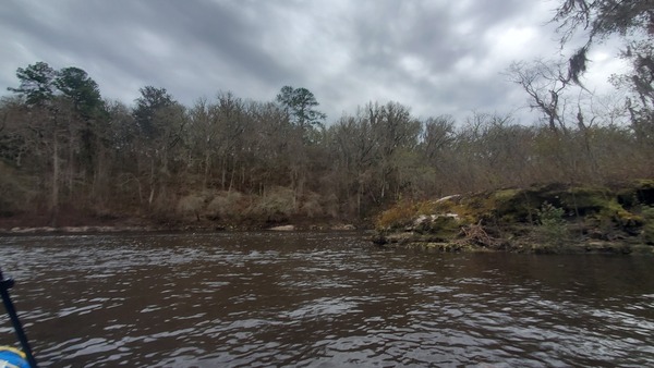
PHOTOSET: https://www.wwals.net/pictures/2022-02-05–last-stretch-alapaha-pictures/
PHOTO SOURCE: John S. Quarterman
PHONE NUMBER: (850) 290-2350
Suggestions: https://forms.gle/DipPgU2TP5atc2Rf9
American Canoe Adventures @ Bridge Street
CATEGORIES: Outfitter
LAYER: Brochure
OWNERSHIP: Private
ACCESS: Yes
WATER BODY: Suwannee River
GAUGE: White Springs
MILE: 169.02
ADDRESS: 10610 Bridge St. White Springs, FL 32096, Hamilton County.
DESCRIPTION: “”You will be transported to your trip from our shop. On the way you will be provided with a river map, an explanation of your trip, and current river conditions. Approximated paddling times will vary with your paddling proficiency, weather conditions, and water level, but average 2 to 3 miles an hour.””
GRN: Yes
WEBSITE: https://aca1.com/
ADDITIONAL INFO SOURCES: http://www.suwanneeoutpost.com/waterlevels.html
PHOTO: https://img1.wsimg.com/isteam/ip/07862e21-56db-4b42-9004-85367c386fae/bdf2871e47ee28d0dbab0cf8cf414bde.jpeg/:/cr=t:19.88%25, l:4.82%25, w:90.36%25, h:60.24%25/rs=w:600, h:300, cg:true, m
PHOTOSET: https://aca1.com/
PHOTO SOURCE: American Canoe Adventures
PHONE NUMBER: (386) 397-1309
Suggestions: https://forms.gle/DipPgU2TP5atc2Rf9
Suwannee Canoe Outpost @ 95th Drive
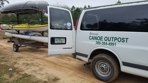
CATEGORIES: Outfitter
LAYER: Brochure
GPS: 30.4058, -82.948765
OWNERSHIP: Private
ACCESS: Yes, Ramp: Concrete, CANOE, CAMPING: “Yes, Outposts, Outpost toilet, PARKING: Free, SHELTER, PICNIC AREA, HANDICAPPED ACCESSIBLE
WATER BODY: Suwannee River
GAUGE: Suwannee Springs
MILE: 148.50
ADDRESS: 2461 95th Dr, Live Oak, FL 32060, Suwannee County.
DESCRIPTION: On the left bank: “”The Suwannee Canoe Outpost is the original premier canoe outfitter on the Suwannee River! We have been at our current location in the Spirit of the Suwannee Music Park since 1993. We are fortunate to be located at a boat ramp, so we can maximize customer satisfaction while minimizing shuttle times! We offer canoe rental and shuttle service on three of the most exciting and remote rivers in Florida, the Suwannee, North Withlacoochee, and Alapaha Rivers!
HISTORIC FACTS: The oldest outfitter in the Suwannee River Basin.
GRN: Yes
WEBSITE: http://shop.suwanneeoutpost.com/
PHOTO: https://wwals.net/pictures/2018-02-18–ga-37-withlacoochee/20180218_084006.jpg
PHOTOSET: https://wwals.net/pictures/2018-02-18–ga-37-withlacoochee/
PHOTO SOURCE: John S. Quarterman
PHONE NUMBER: (386) 364-4991
PHOTO2: https://www.wwals.net/pictures/2020-10-16–suwannee-fl-6-sl/20201016_151342.jpg
Photoset2: https://www.wwals.net/pictures/2020-10-16–suwannee-fl-6-sl/
PHOTO2 SOURCE: John S. Quarterman
Photo2 Phone Number: 229-242-0102
Suggestions: https://forms.gle/DipPgU2TP5atc2Rf9

Alapaha River Rise

CATEGORIES: Spring
LAYER: Brochure
OWNERSHIP: Private, Edmund G. Herder Jr, PARCEL 3619-070
ACCESS: No
WATER BODY: Suwannee River
GAUGE: Ellaville
MILE: 135.69
ADDRESS: Right bank. Upstream on the Suwannee River from Gibson Park Ramp past CR 249. Hamilton County.
DESCRIPTION: The Alapaha River comes out of this spring next to the Suwannee River, after traveling 19 miles underground from the Dead River Sink during much of the dry season.
HISTORIC FACTS: SRWMD and FDEP dye test of 2016-06-22 found dye coming back up about six days later in Alapaha River Rise and Holton Creek Rise on the Suwannee River. https://wwals.net/?p=20807
WEBSITE: https://wwals.net/maps/alapaha-water-trail/map-alapaha-river-trail/underground/#Rise
DOWNSTREAM: 0.29 mile from Alapaha River Rise to Gibson Park Ramp
PHOTO: https://wwals.net/wp-content/themes/pianoblack/img//2015/08/9465ab1041b3f75e2b2d275ca8dc58f91.jpg
PHOTO SOURCE: John S. Quarterman
PHONE NUMBER: (229) 242-0102
Suggestions: https://forms.gle/DipPgU2TP5atc2Rf9
Alapaha Rise Gauge
CATEGORIES: River Gauge
LAYER: River Gauge
OWNERSHIP: Private
ACCESS: No
WATER BODY: Suwannee River
GAUGE: Alapaha River Rise
MILE: 135.73
ADDRESS: 15 ft north of southwest 68th Street, 1, 000 ft north of the Suwannee River and 10 mi southwest of Jasper. Hamilton County.
DESCRIPTION: USGS 02315626 historic
WEBSITE: https://wwals.net/2014/11/03/alapaha-river-water-levels/#Rise
DOWNSTREAM: 0.33 mile from Alapaha Rise Gauge to Gibson Park Ramp
PHOTO: https://wwals.net/wp-content/themes/pianoblack/img//2014/11/e14b339c024df3469f215831872cced1.jpg
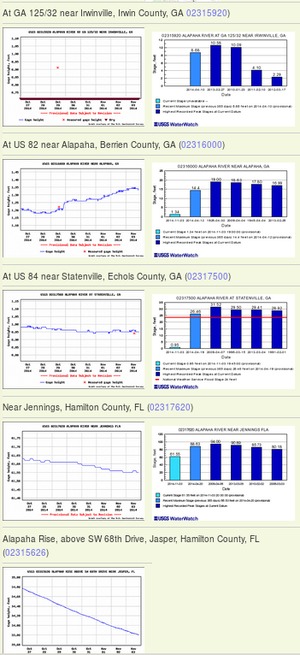
PHOTOSET: https://wwals.net/2014/11/03/alapaha-river-water-levels/
PHOTO SOURCE: John S. Quarterman
PHONE NUMBER: (229) 242-0102
Suggestions: https://forms.gle/DipPgU2TP5atc2Rf9
Gibson Park Ramp @ SW CR 751

CATEGORIES: Landing
LAYER: Brochure
OWNERSHIP: Public, Hamilton County, PARCEL 3620-000
ACCESS: Yes, Ramp: Concrete, PARKING: Free, PICNIC AREA, HANDICAPPED ACCESSIBLE
WATER BODY: Suwannee River
GAUGE: Ellaville
MILE: 135.40
ADDRESS: 6844 SW CR 751, Jasper, FL 32052. Right bank, west side of the river. From Jasper, Hamilton County, FL, travel southwest on Right bank. SW CR 249 to SW CR 751; turn left and boat ramp is on the right in Gibson Park. Hamilton County.
DESCRIPTION: The last stop on the Alapaha River Water Trail is on the Suwannee River: Gibson Park Ramp, in a county park of Hamilton County, Florida. Much of the year those last 17.95 river miles are dry down from Jennings Bluff Launch. But in the rainy season (winter) sometimes the Alapaha is high and fast and it’s a quick paddle to the Suwannee and a very short upstream to Gibson Park Ramp.
AKA: Hutch Gibson Park Public Boat Ramp or Nobles Ferry.
WEBSITE: https://hamiltoncountyfl.com/parks-recreation/
DOWNSTREAM: 5.00 miles from Gibson Park Ramp to Suwannee River Campsites Ramp
PHOTOSET: https://www.wwals.net/pictures/2021-05-11–nondiscrimination-policy/
PHOTO SOURCE: Bobby McKenzie
PHONE NUMBER: (850) 290-2350
Suggestions: https://forms.gle/DipPgU2TP5atc2Rf9
Alapaha River Confluence

CATEGORIES: Tributary
LAYER: Brochure
GPS: 30.43672, -83.09655
OWNERSHIP: Public
ACCESS: No
WATER BODY: Suwannee River
GAUGE: Ellaville
MILE: 135.37
ADDRESS: Put in at Gibson Park and float downstream on the Suwannee River, Hamilton County.
DESCRIPTION: Confluence of the Alapaha River with the Suwannee River. There is water here year-round, but upstream not far may be dry much of the year. End of the Alapaha River.
WEBSITE: http://www.hamiltoncountyflorida.com/cd_parksrec.aspx
UPSTREAM: 0.03 mile from Alapaha River Confluence to Gibson Park Ramp
DOWNSTREAM: 4.97 miles from Alapaha River Confluence to Suwannee River Campsites Ramp
PHOTO: https://wwals.net/wp-content/themes/pianoblack/img//2015/08/e06605733a8679809c29c7945c923d6f1.jpg
PHOTO SOURCE: John S. Quarterman
PHONE NUMBER: (229) 242-0102
Suggestions: https://forms.gle/DipPgU2TP5atc2Rf9
Suwannee River Campsites Ramp @ SW 46th Ave.

CATEGORIES: Landing
LAYER: Brochure
GPS: 30.414, -83.159167
OWNERSHIP: Public, SRWMD? PARCEL 5555-555
ACCESS: Yes, Ramp: Concrete, PARKING: Free
WATER BODY: Suwannee River
GAUGE: Ellaville
MILE: 130.40
ADDRESS: Right bank. 10650 SW 46th Ave., Jasper, FL 32052, Hamilton County.
DESCRIPTION: From US 90, turn right onto NE Myrrh Street; cross the Withlacoochee River (road becomes CR 141); turn right on SW 74 Street; turn right on SW 44 Lane; travel south to SW 77 Street; turn left and follow to boat ramp. Government Owned for General Public Use.
HISTORIC FACTS: River put-in for many protests in 2015, 2016, and 2017 against the Sabal Trail fracked methane pipeline crossing slightly downstream. https://wwals.net/?p=28959
AKA: CR 141 Ramp (SRWMD) or Suwannee Campsites Ramp or Florida Trail Suwannee River Boat Launch Trailhead or Big Oak Boat Ramp.
UPSTREAM: 5.00 miles from Suwannee River Campsites Ramp to Gibson Park Ramp
DOWNSTREAM: 2.70 miles from Suwannee River Campsites Ramp to Suwannee River State Park Ramp
PHOTO: https://wwals.net/wp-content/themes/pianoblack/img//2021/12/20170423_125547-1.jpg
PHOTOSET: https://wwals.net/2017/04/23/suwannee-river-campsites/
PHOTO SOURCE: John S. Quarterman
PHONE NUMBER: (229) 242-0102
Suggestions: https://forms.gle/DipPgU2TP5atc2Rf9
Suwannee River State Park Ramp @ 201st Path
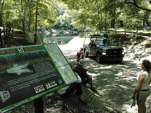
CATEGORIES: Landing
LAYER: Brochure
GPS: 30.3877, -83.1688
OWNERSHIP: Public, SRWMD
ACCESS: Yes, Launch: Concrete, CAMPING, WATER, RESTROOMS, PARKING: $5.00/vehicle, SHELTER, PICNIC AREA
WATER BODY: Suwannee River
GAUGE: Ellaville
MILE: 127.70
ADDRESS: Left bank, 3631 201st Path, Live Oak, FL 32060, Suwannee County.
DESCRIPTION: Slightly upstream from the Withlacoochee River Confluence with the Suwannee River.
WEBSITE: https://www.floridastateparks.org/park/Suwannee-River
UPSTREAM: 2.70 miles from Suwannee River State Park Ramp to Suwannee River Campsites Ramp
PHOTO: https://wwals.net/wp-content/themes/pianoblack/img//2015/08/69d2ffd7fa67b505d9a5ee0658c5e8f31.jpg
PHOTO SOURCE: John S. Quarterman
PHONE NUMBER: (229) 242-0102
Suggestions: https://forms.gle/DipPgU2TP5atc2Rf9
Hometown Handyman
CATEGORIES: Logo Contest Sponsor
LAYER: Sponsor
OWNERSHIP: Private
ACCESS: No
WATER BODY: Withlacoochee River
MILE: 3.82
ADDRESS: 7712 SW 32nd Lane, Jasper, FL 32052, Hamilton County.
DESCRIPTION: Carpentry and more.
WEBSITE: https://www.manta.com/c/mb4cq68/hometown-handyman-llc
PHOTO SOURCE: Chris Mericle
PHONE NUMBER: (386) 938-5943
Suggestions: https://forms.gle/DipPgU2TP5atc2Rf9
NWXpeditions
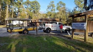
CATEGORIES: Outfitter
LAYER: Other
GPS: 30.967687, -83.5024
OWNERSHIP: Private
ACCESS: No, CANOE, CAMPING: Primitive Campsites, FOOD, WATER, PARKING: Free, SHELTER
WATER BODY: Bay Branch
ADDRESS: 13086 Adel Hwy, Barney, GA 31625, USA, Brooks County.
DESCRIPTION: “No Worries Expeditions will take u canoeing and camping on the rivers of S Georgia and N Florida. We custom design the canoe trip of your dreams.””, Has a variety of dive gear as well as boats.
GRN: Yes
WEBSITE: https://www.facebook.com/NWXExpeditions/
PHOTOSET: https://wwals.net/pictures/2020-02-09–banks-lake-full-moon/
PHOTO SOURCE: John S. Quarterman
PHONE NUMBER: (229) 289-5573
Suggestions: https://forms.gle/DipPgU2TP5atc2Rf9