Tag Archives: Alapaha River

Entering the Floridan Aquifer Recharge zone –Kristofer Graham

Written as a newspaper letter to the editor and posted here with permission. -jsq

Dear Residents

Did you know Lanier County doesn’t have zoning laws. Which that mean they can development on wetlands and on our Floridan Aquifer Recharge zone and build resident houses, subdivided, commercial building etc., cut timber on wetlands, on our watersheds and a Natural Gas Company want to put a pipeline through on these precious lands they can. It will destroy the land environment like our Floridan Aquifer Recharge zone (aka our drinking water) and our wetlands and our watersheds. Because it not protected like it should.

Lanier County Groundwater Recharge Areas Well it time to protect it before it all destroy and gone. It is up to our local government to protect these precious lands and preserve it in the original state. Yes it’s time for our local government to do there job to protect it. So it can be there forever.

I notices they got those lands zone as Ag and V5 zone. Which those zone doesn’t protect it and in fact it can destroy those lands Eco system because they spray pesticide for there farm crops near the Floridan Aquifer Recharge zone and wetlands, our watersheds. It will Continue reading

Ichetucknee Alliance thinks it got the pipeline to move

According to their facebook page today, a conservation group in Florida convinced Sabal Trail to steer clear of their springs. Or did they? The “written assurances” they they got from Spectra’s Andrea Grover say “preferred” and “currently”. In any case, some of Ichetucknee Alliance’s positions are just as valid in WWALS’ watersheds.

Here’s an excerpt from their position, Ichetucknee Alliance Pipeline Position Paper, 21 August 2013, Continue reading

Entering Floridan Aquifer Recharge Zone

Maybe we need signs like that around here to remind people that what goes into the ground comes out in our drinking water. For example, San Antonio has its Edwards Aquifer Protection Program. Maybe our local governments need to have Floridan Aquifer Protection Programs. Georgia state law seems to indicate they should.

GA Secretary of State has GA Code §391-3-16-.02 Criteria For Protection of Groundwater Recharge Areas. (more legible copy on GA EPD website),

Georgia's Groundwater Recharge Areas (1) Background. Variable levels of recharge area protection can be based upon the State’s hydrogeology (e.g., areas such as the Dougherty Plain where a major aquifer crops out would receive a relatively high degree of protection whereas other areas, such as the shale hills of northwest Georgia, would receive a lower degree of protection). Recharge area protection within the significant recharge areas would be further refined, based upon the local susceptibility or vulnerability to human induced pollution (e.g., high, medium, or low). The significant recharge areas have already been identified and mapped (about 22-23% of the State). Pollution susceptibility mapping is ongoing. Existing statutes are adequate for protecting the remaining recharge areas (about 77-78% of the State).

[…]

(2)(f)3. In the Coastal Plain, the significant recharge areas are Continue reading

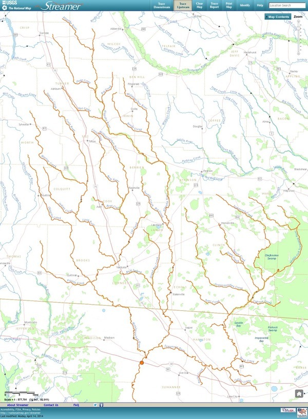
Streamer on the Suwannee, Alapaha, and Withlacoochee Rivers: ten or more rivers and many creeks, lakes, swamps, and ponds

Update 3 March 2016: Suwannee River, ten rivers, and current location of USGS streamer.

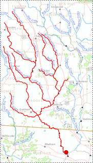
The USGS Streamer interactive map shows all (well, most) tributaries of our two biggest WWALS rivers. Visitors sometimes refer to our “four rivers” since we only originally named four in our WWALS mission: Withlacoochee, Willacoochee, Alapaha, and Little. Yet we added the upper Suwannee, and there always were more than that: from one to ten rivers, depending on how you count them.

600x817 WWALS Rivers, in WWALS Rivers, by John S. Quarterman, for WWALS.net, 25 July 2015

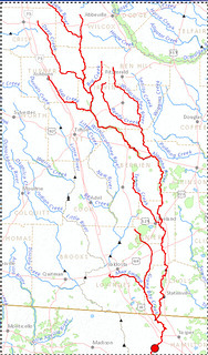
The Withlacoochee River tributary map here shows the New River south of Tifton joining the Withlacoochee between Nashville and Adel.

Withlacoochee River Alapaha River

The New River is rather important, since it forms half of the boundary between Cook and Berrien Counties (the Withlacoochee River forms the other half): Continue reading

Arsenic, Outings, and Flooding: WWALS Watershed Coalition @ VLCIA 2013-04-16

Water issues strongly affect economic development, so I talked about the new WWALS Watershed Coalition at the 16 April 2013 Board Meeting of the Valdosta-Lowndes County Industrial Authority.

The VDT declined to speak, so I did. After apologizing for no okra today, I commended the Authority for talking about the missing agenda items and for mentioning due diligence and flood control.

Mostly I talked about the new WWALS Watershed Coalition, www.wwals.net, incorporated in June 2012, which is about watershed issues such as flooding, water quality, and invasive species related to the Withlacoochee, Willacoochee, Alapaha, and Little River System. I mentioned arsenic in some local well water, which the Department of Health has finally said should be tested, three years after Janet McMahan discovered it was a problem. I invited VLCIA board and staff to two upcoming WWALS events:

WWALS board meetings are every second Wednesday of the month, usually at the IHOP in Adel because it’s centrally located. WWALS is communicating with Valdosta and various organizations about flooding and other watershed-wide issues, which in my opinion have to do with things like too much clearcutting without consideration for where the water goes, too much development without consideration for what the impervious surface would do, (to my surprise, the Executive Director and several board members nodded along with that) so it was good to hear them mention flood containment.

Here’s the video:


Arsenic, Outings, and Flooding: WWALS Watershed Coalition
Regular Meeting, Valdosta-Lowndes County Industrial Authority (VLCIA),
Norman Bennett, Tom Call, Roy Copeland, Chairman, Mary Gooding, Jerry Jennett, Andrea Schruijer, Executive Director, J. Stephen Gupton, Attorney, Tom Davis, CPA, Allan Ricketts, Project Manager,S. Meghan Duke, Public Relations & Marketing Manager, Lu Williams, Operations Manager,
Video by John S. Quarterman for Lowndes Area Knowledge Exchange (LAKE), Valdosta, Lowndes County, Georgia, 16 April 2013.

-jsq

Reservoirs for control of stormwater –Tim Carroll

Valdosta City Council Tim Carroll spoke about the need for watershed-wide planning to reduce flooding and provide water for agriculture with distributed flood containment reservoirs. He referred to the materials he sent in advance as well as to some additional data about water quality measurements upstream and downstream of selected points. And he sent an update the next day.

Tim Carroll noted that one thing that was clear from the Valdosta City Manager Larry Hanson’s 2010 presentation to the Suwannee-Satilla Water Council about the 2009 flood was that the drainage basin study proposed by that Council (which completed its report and disbanded) still needs to be completed. For that purpose, Hanson had just sent a letter to the Army Corps of Engineers requesting assistance. Apparently they have partial answer, and they’re also talking the state.

Carroll said that with the renewed attention to flooding problems Continue reading

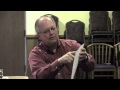
Tim Carroll of Valdosta at WWALS board meeting tonight

Valdosta City Council member Tim Carroll will speak tonight at the monthly WWALS Watershed Coalition board meeting at 7:30 PM at the IHOP in Adel (exit 39 from I-75, 1200 W 4th St, Adel, GA, 229-896-2662); the public is invited. In advance he sent the appended letter from the City of Valdosta to the Army Corps of Engineers requesting assistance related to flooding and droughts.

March 11, 2013

William Bailey
Chief of Planning Division
US Army Corps of Engineers – Savannah District Office
100 W. Oglethorpe Avenue
Savannah, Georgia 31401

Dear Mr. Bailey,

Over the last several years, the City of Valdosta and neighboring communities have been severely impacted by the increase of flood events that have occurred throughout our region and particularly the drainage basin we are located in. The city recognizes the various levels of responsibility throughout government agencies for flood management and flood control and is interested in furthering the discussions to understand the changes that are occurring and to ensure the protection of our communities from future flood events.

In February 2009, the city began updating its 1996 Master Stormwater Management Plan. In April, just two months later, our county along with 46 counties in south Georgia, experienced historic flooding and were declared disaster areas. The Federal Emergency Management Agency (FEMA) reported

Continue reading

Alapaha and Withlacoochee Rivers @ GA 122 18 February 2013

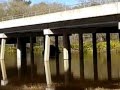
video playlist Movies on 18 February 2013 after the first rains of the Alapaha River on GA 122 at Lakeland in Lanier County and the Withlacoochee River at GA 122 and Hambrick Road in Lowndes County and some points in between.

Withlacoochee in the woods with sunlight Withlacoochee River overflow Withlacoochee River broad

Withlacoochee River broad

Here’s a video playlist.

Continue reading

WWALS outing called because of weather, but….

Gretchen posted:

The “official” event is off because of the weather. However, if you want to see the location, gather at Gary Rampley’s, past Mullins Lane at 6974 Old State Road and park in his yard and then walk to the River (less than .2 miles) at 1:00. Meet others who like a cold, rainy outing.

Or, at 2:00pm meet at Let’s Eat Cafe (Exit 18 from I75—across from Austin’s Steak House at the Shell Station) to discuss strategies for keeping access to the Alapaha River in Lowndes County.

Our local hosts still want to meet up with interested folks and for those not up to braving the weather, we will be indoors at Let’s Eat (an excellent local place to meet and eat).

WWALS asks that Old State Road be kept open to the Alapaha River in Lowndes County

Letter from WWALS to Lowndes County Commission, signed Friday, mailed Saturday; the hearing is 5:30 PM today 12 February 2013, 327 North Ashley Street 2nd floor, Valdosta, GA.

Signed letter from WWALS to Lowndes County Commission

Lowndes County Board of Commissioners
327 North Ashley Street
Valdosta, GA 31601

WWALS Watershed Coalition
www.wwals.net

Dear Lowndes County Commissioners,
Continue reading