Tag Archives: Barney

Stone Bridge, Little River, by Dan Phillips 2016-08-01

Here’s a piece of south Georgia history, Stone Bridge, on the Little River, between Adel in Cook County and Barney in Brooks County, on the Withlacoochee and Little River Water Trail (WLRWT).

On a summer day, Stone Bridge

Dan Phillips wrote about this picture he took: Continue reading

Pictures of all the BLRPR paddlers 2018-04-28

You’ve seen who won the eleven awards. Now here are the rest of the paddlers in the 6th Annual BIG Little River Paddle Race, from more counties, states, and watersheds than ever before. Also more Solo Female Kayaks than Solo Male Kayaks, and several whole families of paddlers.

[Finish]
Finish

Statistics: 2018 BIG Little River Paddle Race

43 Boats 
37 kayaks
6 canoes

49 Paddlers
29 male
20 female Continue reading

GA DNR responds about Sabal Trail at Okapilco Creek 2017-09-21

Not the answer I was looking for, but GA-EPD is still by far the most responsive agency regarding Sabal Trail.

West to sinkhole, Coffee Road, near Okapilco Creek

Lisa Myler of GA-DNR called back Friday about 7PM saying Tom Fowler had been to the Okapilco Creek Sabal Trail sinkhole site I reported.

I called her back Monday, and after DNR’s web server came back up she forwarded Tom Fowler’s report today: Continue reading

Sinkhole, Sabal Trail, Okapilco Creek, Brooks County, GA 2017-09-19

Update 2017-09-21: Yes, I reported it to GA-EPD, et al. (PDF), and here are facebook photos of most of the images below.

How close to exposed is Sabal Trail’s pipe? This sinkhole is at least a foot deep, maybe two or more, and Sabal Trail only buried their pipe three feet deep, despite requests by Brooks, Colquitt, and Lowndes Counties to bury it deeper.

At sinkhole, Sinkhole

N of sinkhole, Sinkhole

Is that fill material exposed Continue reading

Old Coffee Road, Georgia

The Google map of locations on Old Coffee Road was used by many of the early settlers of south central Georgia, including in the watersheds of the Willacoochee, Alapaha, Withlacoochee, and Little Rivers and Okapilco Creek. It crossed all those and other waterways by ford or private ferry: there were no bridges back then.

Old Coffee Road map, WWALS.net
Follow this link for the interactive google map.

The Georgia Historical Commission erected markers at half a dozen locations in the 1950s and 1960, reading: Continue reading

Brooks County Comprehensive Plan Workshop

More about that in a previous post.

 -jsq, John S. Quarterman, Suwannee RIVERKEEPER®

You can join this fun and work by becoming a WWALS member today!

Workshop, Greater Brooks 2030 Comprehensive Plan, 2017-02-07

First on the list of Areas Requiring Special Attention in Brooks County, Georgia:

  • Areas of significant natural or cultural resources, particularly where they are likely to be intruded upon or otherwise impacted by development; such as wetlands, groundwater recharge areas and river corridors.

/pictures/2007-01-01--brooks-compplan/[Map D-4 Water Resource Protection Districts]
Map D-4 Water Resource Protection Districts

According to Ariel Godwin of the Southern Georgia Regional Commission,

The next workshop for the Brooks County Comprehensive Plan will be:

Thursday, February 7th, 2017
9:30 a.m
Brooks County Commission Offices
610 South Highland Street, Quitman

In this workshop we will work on the Land Use Maps and Character Areas.

We are inviting you to participate to ensure Continue reading

Sabal Trail erosion and waterlogged, Brooks County, GA 2017-01-23

End of pipe in water, CR 146, towards Tallokas Road 30.9873162, -83.6535762 Is that pipe supposed to be wallowing in water? Is that end supposed to be in the water? What about the obvious erosion? Remember Sabal Trail is only burying its 36-inch pipe 36-inches deep most places. Erosion could expose it and make it even more likely to corrode.

WWALS video playlist and more pictures below. Continue reading

Okapilco Creek flooding @ GA 122 2017-01-23

Narrow Bridge 30.9955325, -83.6041529 Half a mile wide: Okapilco Creek one week ago on GA 122 between Barney and Pavo, Georgia.

Usually you have to peer down into the woods to see if you can see any water in the creek. After the recent storms, you could see water beside the highway half a mile before you got to the creek bridge.

WWALS video: Continue reading

Condolences to the survivors of the recent storms

As our community begins the long path of recovery, WWALS Watershed Coalition extends deepest sympathy and condolences to those who have lost family, friends, possessions, and a sense of security in the recent storms and tornadoes.

The first two tornado fatalities were in Brooks County west of Barney, with seven more in Cook County and two in Berrien County, plus four in Dougherty County. Only rubble left at Rock Hill Road 31.0092858, -83.5478993 
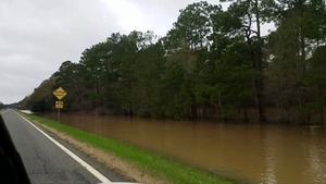
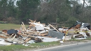
Lowndes County got off light this time, with nobody injured, 
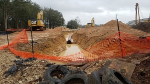
although there is extensive property damage in all these counties and others.

Cook County Probate Court (Judge Chase Daughtrey) has set up a fund to which you can donate directly. That Court has also supplied contacts for other methods of donation: a bank account, and dropoff locations for school supplies. That page announces a memorial service tonight: Continue reading