Monthly Archives: February 2016

Sewage into Two Mile Branch towards the Withlacoochee River 2016-02-15

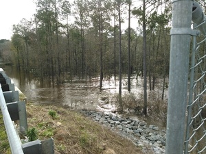
I wonder what this “debris” was? And the rags? Anyway, Valdosta has fixed another sanitary sewage spill. Probably if you stay out of the water around 2500 Bemiss Road (south of Northside Drive) you’ll be OK. But you may also want to know where Two Mile Branch goes downstream, and as usual Valdosta didn’t tell us.

HUC boundaries aerial As we recall from Valdosta’s last episode of multiple wastewater spills earlier this month, 
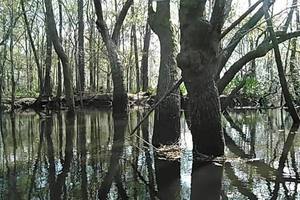
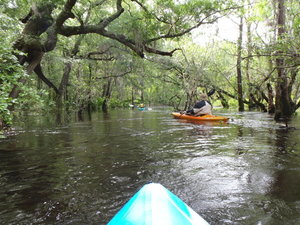
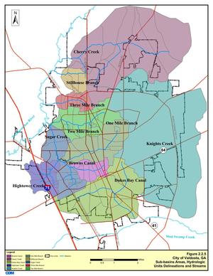
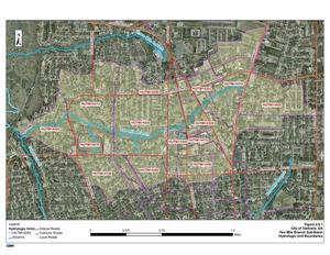
Two Mile Branch runs into Sugar Creek which goes into the Withlacoochee River, and eventually into the Suwannee River and the Gulf of Mexico. Don’t be surprised if you see a Florida Department of Health advisory like the one earlier this month. Continue reading

Hutchinson Mill Creek at Withlacoochee River, GA 122

Deadfalls on this creek, backing up flood waters onto Skipper Bridge Road forcing a bridge to close in 2009, Movie: Hutchinson Mill Creek (2.0M) 31.0155182, -83.3020477 were one reason for the formation of WWALS. Here are some pictures and a very brief movie.

In a typical day for a Waterkeeper®, starting slow after a road trip to Atlanta the previous day with several Riverkeepers and other environmental organizations, I was preparing for the movie in Live Oak Friday evening when I got a message from Noelani Mathews wanting an interview about the pipeline movie. As I threw a kayak in the truck, the Yellow Dog hopped in, and Continue reading

Online movie: At What Cost? Pipelines, Pollution and Eminent Domain in the Rural South

If you missed it in Live Oak last night, or in one of the previous premieres along the Georgia coast, you can see the movie online: At What Cost? Pipelines, Pollution and Eminent Domain in the Rural South, by Mark Albertin. And yes, he’s happy for it to be shown elsewhere; just ask.

Thanks to Push Back the Pipeline for getting this movie made about Kinder Morgan’s proposed petroleum products pipeline from South Carolina across the Georgia coast to Jacksonville, Florida. Special thanks to Eileen, Lori, and Debra and the Woman’s Club of Live Oak for the movie showing last night, and to SpectraBusters, Our Santa Fe River, and Gulf Restoration Network for helping promote it. Don’t forget the hike to the Suwannee River Sabal Trail crossing 8:15 AM Thursday 28 February 2016 with Suwannee and Hamilton County Commissioners.

Most of the issues are the same for the invading Sabal Trail fracked methane pipeline which Continue reading

A 3-foot pipeline through the windows to our aquifer is a very bad idea –Debra Johnson on FirstCoastNews, 2016-02-11

“This is an outstanding waterway of America,” said WWALS member Debra Johnson. “It is the legendary Suwannee River.” And the Sabal Trail fracked methane pipeline drilling under it is a very bad idea. (Events: facebook or meetup)

Kenneth Amaro and Debra Johnson Kenneth Amaro, FCN, 11 February 2016, Suwannee residents face setback but vow to fight proposed natural gas pipeline,

They have already made their opposition known to the U.S. Army Corps of Engineers, which is Continue reading

Conversations with Noah Valenstein, E.D., SRWMD in Columbia County 2016-02-04

It’s not for shipping water to Jacksonville, it’s not much changed from last year, no money is allocated for it yet, and people should get involved in the process, said Noah Valenstein, the new Executive Director of the Suwannee River Water Management District (SRWMD), in answer to questions from Jim Tatum and Merillee Malwitz-Jipson of Our Santa Fe River (OSFR) and me about the Falling Creek Aquifer Recharge Project at the Columbia County Commission meeting last Thursday, 4 February 2016. Plus Sabal Trail, Amtrak and that chicken farm.

Movie: Noah Valenstein, E.D., SRWMD (6.9M)

Valenstein answered Jim during the Commission meeting. See also Jim’s report for OSFR. I stayed afterwards and had a longer discussion with Valenstein. Some notes from memory: Continue reading

Pictures: Withlacoochee River, GA 122 to Franklinville Road 2013-04-20

One of the remotest segments of the Withlacoochee River, yet with easy access, and when the water was high enough. Unter den acer Also one of the least-attended WWALS outings, because we hadn’t really gotten the hang of announcing outings yet. But that just made it more intimate for the three of us who went. I got especially intimate with the river, choosing to swim twice. I always choose to swim when the water comes up to meet me…. Eventually I learned not to lean towards the side you’re tipping towards.

The closest USGS gauge is Continue reading

Yet more Valdosta wastewater spills

Maybe soon this February baker’s dozen of wastewater spills will be a thing of the past, but for now it’s deja vu similar to but worse than last February.

300x388 Figure 2.2.5. Sub-basins Areas, in Section 2 Methodology, by City of Valdosta, for WWALS.net, 14 January 2011 It looks like Valdosta has updated, as repeatedly asked, its schedule for wastewater project completion, with the force main project now aimed at July 2016 and relocation of the Withlacoochee WasteWater Treatment Plant (WWTP) for August 2017. See also Valdosta PR 22 January 2016, Withlacoochee Aerial Sewer Mains Replacement Project.

Those schedule changes are mentioned in the most recent Valdosta News. It does not, however, say which watersheds the various spills affect. I have added * for Alapaha River watershed and ** for Withlacoochee River watershed. It’s not that hard, and Valdosta has a water management plan that spells this all out, with maps. One Mile Branch** and Two Mile Branch** flow into Sugar Creek**, which goes into the Withlacoochee River**. Knights Creek* goes into Mud Creek* which goes into the Alapahoochee* River and then the Alapaha River*, eventually joining the Suwannee River in Florida, as does the Withlacoochee. Valdosta Utilities and Public Relations know all that. But why should every citizen, Continue reading

Skipper Bridge, 17.66 feet, flood level 15 feet

The water level continued up from yesterday, when it was Downstream 31.0116939, -83.2915878 17.66 feet on the USGS guage at Skipper Bridge in Lowndes County, Georgia at 9:46 AM when I took these pictures. Flood stage is 15 feet. It was so high you could have floated over the chain link fence the county put in when it replaced the bridge, thus preventing normal use of this bridge as a Withlacoochee River access point on the Withlacoochee and Little River Water Trail.

-jsq

You can join this fun and work by becoming a WWALS member today!

Downstream panorama 30.9016667, 83.2930556

Continue reading