Monthly Archives: November 2017

Hagan Bridge to Franklinville, Withlacoochee River, 2018-02-11

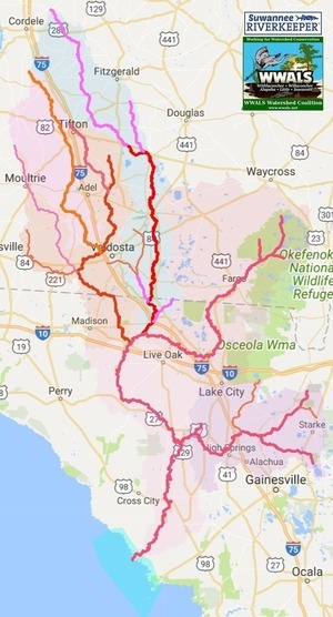
Join WWALS for a leisurely Sunday 5.7 mile paddle on the Withlacoochee from Hagan Bridge Landing to Franklinville Road Landing, through a very rural region of Lowndes County, Georgia, on the Withlacoochee and Little River Water Trail (WLRWT).

When: 10 AM, Sunday, February 11, 2018.

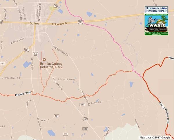
Put In: Hagan Bridge Landing, MILE 84.4, 5110 GA Hwy 122 E, Hahira, GA 31632, Lowndes County. 5 miles east of Hahira, GA. Between Hahira and Lakeland. Also known as GA 122 Withlacoochee Access.

GPS: 31.013966, -83.299306

Take Out: Franklinville Road Landing, MILE 78.71, 6560 Franklinville Road, Hahira, GA 31632. Lowndes County. Between Hahira and Moody AFB on dirt Franklinville Road off of Skipper Bridge Road. Do come in from Skipper Bridge Road: Tyler Bridge on Franklinville Road is closed, so you can’t get to the landing there from Cat Creek Road. On the way out we will view the Franklinville Monument, marking the original county seat of Lowndes County.

Bring: the usual personal flotation device, boat paddles, food, drinking water, warm clothes, and first aid kit. Also trash pickers and trash bags: every WWALS outing is also a cleanup.

Free: This outing is Free! And we recommend you support the work of WWALS by becoming a WWALS member today!

Event: facebook, meetup

Three paddlers, Withlacoochee River, 2014-04-20
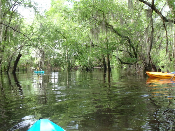
Photo: Gretchen Quarterman, 2013-04-20.

Continue reading

Sabal Trail no gas for a week?

Has Sabal Trail been shut down for a week? Its FERC-required online reports seem to say so, while Gulfstream and FGT numbers jumped up that same day. Read to the end for something even more interesting.

2017-11-13, Operationally Available Capacity

While Cap stays about the same 789 million dekatherms per day (MDTH/day), Nom drops from around 186 on November 13th to zero or less on November 14th, and stays zero for a week; still zero this morning.

2017-11-14, Operationally Available Capacity

What’s Nom? Apparently Continue reading

Nine Riverkeepers say FERC’s Sabal Trail SEIS unacceptable; request pipeline shutdown

FOR IMMEDIATE RELEASE

Hahira, Georgia, November 21, 2017 — Factually incorrect, failing to account for LNG export or solar power, and irresponsible for not finding or creating a method for attributing environmental effects to greenhouse gases, as the DC Circuit Court had instructed the Federal Energy Regulatory Commission (FERC) to do: that’s what nine Riverkeepers called FERC’s Supplementary Environmental Impact Statement (SEIS) yesterday; see their letter to FERC. The nine include all the Riverkeepers in the path of Sabal Trail and all parts of the Southeast Market Pipelines Project (SMPP) plus others in all three states invaded by those pipelines, Florida, Georgia, Alabama, plus Oklahoma, where the SMPP instigator, Florida Power & Light (FPL), owns a fracking field, The nine, who support fishable, swimmable, drinkable water, pointed out that all of FPL’s original excuses for Sabal Trail have been proven incorrect, and asked FERC to shut it down.

Green is Sabal Trail; Transco and FSC in black, SMPP
Sabal Trail in green, Transco and FSC in black, in Sierra Club interactive map of gas pipelines.

The Riverkeepers weren’t buying FERC’s ignorance: Continue reading

Twin Rivers State Forest

The center of the very extensive Twin Rivers State Forest, near the confluence of the Withlacoochee and Suwannee Rivers at Ellaville.

Great Florida Birding Trail, Entrance

The Florida Wildlife Commission says about Twin Rivers Wildlife Management Area:

Twin Rivers consists of more than 9,000 acres in 14 noncontiguous tracts in Madison, Hamilton, and Suwannee counties. Most of the land is in Continue reading

Eight Riverkeepers oppose FERC’s inaccurate and inadequate Sabal Trail SEIS and request pipeline shutdown 2017-11-20

Filed today as FERC Accession number 20171120-5130, “Opposition to the incorrect and inadequate FERC Sabal Trail SEIS and request for pipeline shut down by Suwannee Riverkeeper (WWALS) and Apalachicola, Ogeechee, Grand, Choctawhatchee, Chattahoochee, Indian, and Flint Riverkeepers.” (Or see WWALS PDF.)

Shut it down, From: The undersigned Waterkeepers

Date: November 20, 2017

To: Kimberly D. Bose, Secretary
Federal Energy Regulatory Commission
888 First Street NE, Room 1A
Washington, DC 20426

Re: We oppose the incorrect and inadequate FERC Sabal Trail SEIS
FERC Docket Numbers CP14-554-002, CP15-16-003, and CP15-17-002

On September 27, 2017, the Federal Energy Regulatory Commission (FERC) published a draft Supplementary Environmental Impact Statement (SEIS).[1] That SEIS was in response to the August 27, 2017 DC Circuit Court decision[2] regarding FERC’s previous approval of Certificates of Convenience and Necessity for the three parts of the Southeast Markets Pipeline Project (SMPP), which are the Transcontinental Gas Pipe Line Company, LLC’s (Transco) Hillabee Expansion Project in Docket No. CP15-16-000; Sabal Trail Transmission, LLC’s (Sabal Trail) Sabal Trail Project in Docket No. CP15-17-000; and Florida Southeast Connection, LLC’s (FSC) Florida Southeast Connection Project in Docket No. CP14-554-000. The judges ordered:

“The orders under review are vacated and remanded to FERC for the preparation of an environmental impact statement that is consistent with this opinion.“

The draft SEIS issued by FERC is clearly not consistent with the court’s opinion for the following reasons:

  1. The SEIS is factually incorrect in stating that: Continue reading

Capt. Henry Will Jones Bridge, Alapaha River, Lakeland, Lanier County, GA

Nobody seems to know the bridge just east of Lakeland has a name: Captain Henry Will Jones Bridge. Just below it is Lakeland Boat Ramp on the Alapaha River Water Trail (ARWT). We’ll be going by there in a few months on the Alapaha Quest.

Scott Thompson, Pieces of Our Past, November 30, 2015, CAPTAIN HENRY WILL JONES,

Captain Henry Will Jones

Henry Will Jones was born about 1917 in what became Lanier County just as our country was entering World War I. After Continue reading

Senators from Rhode Island and Colorado show how FERC can use social cost of carbon

Senators from two states far away just did what none of the senators from Alabama, Georgia, or Florida have done: called out FERC on its failure to do what the judges ordered about the social cost of carbon for the fracked methane pipelines Sabal Trail, Transco, and Florida Southeast Connection.

Sheldon Whitehouse Michael Bennet

FERC Accession Number 20171114-0043, “Comments of Senator Sheldon Whitehouse et al re the Southeast Market Pipelines Project under CP14-554 et al.” FERC’s generated PDF is not very legible, so the text below is from Sheldon Whitehouse, Press Releases, 8 November 2017, WHITEHOUSE, BENNET CALL ON FERC TO USE SOCIAL COST OF CARBON IN REVIEW OF PIPELINES, which also has linked to it a legible PDF. Continue reading

Pilgrim’s Pride to pay $1.43 million Suwannee River pollution to settle lawsuit by Environment Florida and Sierra Club 2017-11-14

Despite what we heard at the BMAP meeting Tuesday, it turns out Best Management Practices (BMP) are not all that can be done to fix fertilizer nitrate runoff in the Suwannee Rier Basin. “More than $1 million of the Pilgrim’s penalty would fund a program to help nearby farmers reduce their pollution as well.” The Florida Department of Agriculture & Consumer Services (FDACS) could also ask the legislature for further such funding, in addition to recommending BMPs. Congratulations, Environment Florida and Sierra Club, for doing what the state of Florida has not!

Pilgrims Pride, US 90,
Photo: Dominic Gheesling for WWALS on Southwings flight 22 October 2016, Pilgrims Pride, US 90, 30.3648380, -83.1636130

Another chicken breeder is setting up in the Suwannee River Basin, near Quitman in Brooks County Georgia, next to Okapilco Creek, which flows into the Withlacoochee River and then the Suwannee River. We’ll be watching.

Drains south, Piscola Creek

  • Video by Environment Florida, starring Merrillee Malwitz-Jipson (Sierra Club), Jeniffer Rubiello (Environment Florida), and Heather Govern (attorney, National Environmental Law Center), and Whitey Markle (Suwannee-St Johns Group, Sierra Club Florida). Continue reading

Suwannee River Basin Maps

Update 2019-02-13: And a version with Landings. See also Water Trails, with more detailed maps and access points.

Nobody seems to have done this, so we did: a map of the Suwannee River Basin, with the major watersheds and the Estuary shaded, and all the major rivers, plus many of the creeks. Bonus: springs! Narrow, Suwannee River Basin Click on this link for an interactive google map of the Suwannee River Basin.

The river traces come from USGS and Chris Graham. The watershed boundaries are from USGS. The springs are from the Florida Springs Institute, plus four Georgia springs collected by WWALS.

The eight-digit hydrologic unit codes (HUC8) for the Suwannee River Basin are: Continue reading