Update 2020-03-09: Nestlé pulled from the agenda.
Update 2020-03-09:
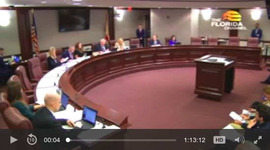
Citizens about Nestle at SRWMD 2019-12-10.
9 AM, Tuesday, March 10, 2020, at SRWMD HQ in Live Oak, Florida is the Nestlé decision day.
Facebook event.
![[Map: Active and Proposed Withdrawal Points]](https://www.wwals.net/pictures/2020-03-10--srwmd-nestle/2020-03-10--srwmd-board-packet-0077.jpg)
Map: Active and Proposed Withdrawal Points
PDF
-
Consideration of Agenda Item No. 20 – BCS Page 61 – Authorization to Deny Water Use Permit Renewal Application 2-041-218202-3, Seven Springs Water Company Project, Gilchrist County
(Public comment on this item will be allowed at this time)
That agenda item says Seven Springs, but it’s for Nestlé Waters North America (NWNA).
Tired of
cleaning up plastic bottles from our springs and rivers?
Want to end
a Swiss company profiting by depleting our waters while paying almost nothing?
Want to remind SRWMD they have statutory authority to revoke this permit?
Come on down to 9225 CR 49. Live Oak, FL 32060.
That’s east going out of town on US 90,
turn right at the Suwannee River Water Management District (SRWMD) sign.
You don’t even have to wait for Tuesday.
You can go ahead and file your own comment against.
Feel free to recommend they revisit the Nestlé permit for Madison Blue Spring, as well, especially now that we know there are
waves of fecal bacteria contamination coming down the Withlacoochee and Suwannee Rivers.
SRWMD staff recommend denial of this Ginnie Springs renewal water withdrawal permit.
But staff recommended denial that back in 1995, when this permit was originally decided, and the SRWMD board approved it anyway.
[Actually,]
In a memo obtained by the St. Petersburg Times dated Nov. 15, 2002, “the water management district staff recommended reducing the amount of water Nestlé could draw under the permit it would obtain from 1.47-million gallons a day to 400,000 a day.” The spring’s flow had been reduced from 55-million gallons day to just 34 million gallons a day. The St. Petersburg Times reported: “ The current drought has reduced the flow of Madison Blue Springs to record lows,’ Jon Dinges, director of resource management, wrote to the water management district’s governing board. “The drought has become severe since the permit was issued, thus requiring a reduction of the (average daily withdrawal) to ensure resource protection.”
But in January 2003 when it came before the regulators — all appointed by Jeb Bush — they refused to follow water staff recommendations after Nestlé threatened to reduce the size of the plant it would build in Madison if their water allotment was reduced from the Bruic allotment.
Enterprise Florida, the governor’s politically appointed business development agency supported Nestlé’s argument at the meeting….
So come make your voice heard, or send a comment in advance.
Details start on Continue reading →

![[1 Plant]](https://www.wwals.net/pictures/2020-04-27--quiz4/1-plant.jpg)
![[Brown water with foam]](https://www.wwals.net/pictures/2020-04-28--suwannee-running-springs-ugly/94640759_3396438840380621_4931391628616138752_o.jpg)
![[Plant, Bird, Spring, Flower]](https://www.wwals.net/pictures/2020-04-27--quiz4/square.jpg)
![[Florida]](https://www.wwals.net/pictures/2020-04-09--fl-boat-ramps-status/florida.jpg)
![[Tifton to the Gulf]](https://www.wwals.net/pictures/2020-03-03--cleaner-wq/map-suwannee-gulf.jpg)
![[Nestle denial pulled from agenda]](https://www.wwals.net/pictures/2020-03-10--srwmd-agenda-no-nestle/2020-03-09--srwmd-notice-no-nestle-agenda-0001.jpg)
![[No to Nestle!]](https://www.wwals.net/pictures/2019-12-10--srwmd-videos/notonestle.jpg)

![[Map: Active and Proposed Withdrawal Points]](https://www.wwals.net/pictures/2020-03-10--srwmd-nestle/2020-03-10--srwmd-board-packet-0077.jpg)
![[Announce]](https://www.wwals.net/pictures/2020-02-14--wkfl-preemption-resolution/20200207_143311.jpg)
