GA-EPD told USACE the mining application is incomplete, asked for comments to be reopened, and cited Suwannee Riverkeeper and Georgia River Network:
“Understanding that groundwater hydrologic effects associated with the Twin Pines project have been a central concern expressed by federal resource/regulatory agencies, NGOs (e.g. the Suwannee Riverkeeper and Georgia River Network), and the public at large, we respectfully submit that the 404/401 permit application as submitted thus far is not complete since it lacks full information and findings regarding hydrogeologic factors on site and post-project effects to hydrogeology/groundwater.
We feel that it is inappropriate and premature to close the project comment window when such notable elements of the environmental documentation for this project have not yet been made available. documentation which we at GaEPD judge to be important to our review of this project.”
![[the 404/401 permit application as submitted thus far is not complete]](https://www.wwals.net/pictures/2019-09-12--epa-ga-epd-usace-tpm/SAS-2018-00554-Charlton-0917-SP-HAR-0005.jpg)
the 404/401 permit application as submitted thus far is not complete
This was revealed by USACE in a Public Notice of September 17, 2019.
So far, this is the only update posted by the Corps since it closed comments on September 12, 2019.
It also includes comments by U.S. EPA, also saying the application is incomplete, and also cited by GA-EPD.
EPA cites cumulative effects and notes numerous lacking documents and studies.
EPA concludes:
“Due to the potential for the proposed Twin Pines Minerals mine to
adversely affect the hydrology of the Okefenokee NWR, the EPA
believes that there is the potential for this project as proposed to
cause adverse effects to water quality and the life stages of
aquatic life or other wildlife dependent on aquatic systems. The EPA
finds that this project, as proposed, may result in substantial and
unacceptable impacts to aquatic resources of national importance, as
covered in Part IV. paragraph 3(a) of the August 1992 Memorandum of
Agreement between the EPA and the Department of the Army regarding
CWA Section 404(q).”
Apparently USACE is at least listening to the public and the public and NGOs such as Suwannee Riverkeeper.
You can still
send in comments.
The Corps won’t say they will read them, but they explicitly won’t say they won’t read them, so keep sending them in, and publish them on social media, as op-eds, etc. Continue reading →

![[4.32 mgd, 1.44 mgd from each of three wells]](https://www.wwals.net/pictures/2019-07-24--tpm-ga-epd-water-withdrawal/424772086-7-24-19-Final-Application-for-Industrial-Groundwater-Withdrawal-Permit-0003.jpg)
![[Alapaha River Water Trail Map]](https://www.l-a-k-e.org/govt/zboa/2019-08-06--zboa-packet/arwt-map.jpg)
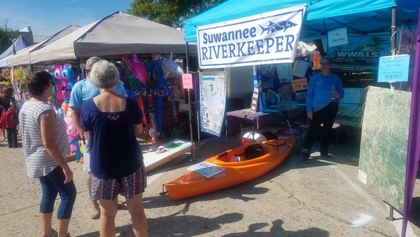

![[Froggy Toss]](https://www.wwals.net/pictures/2018-09-15--soga-pride/20180915_132415.jpg)
![[Gretchen at the booth]](https://www.wwals.net/pictures/2018-09-15--soga-pride/20180915_132408.jpg)
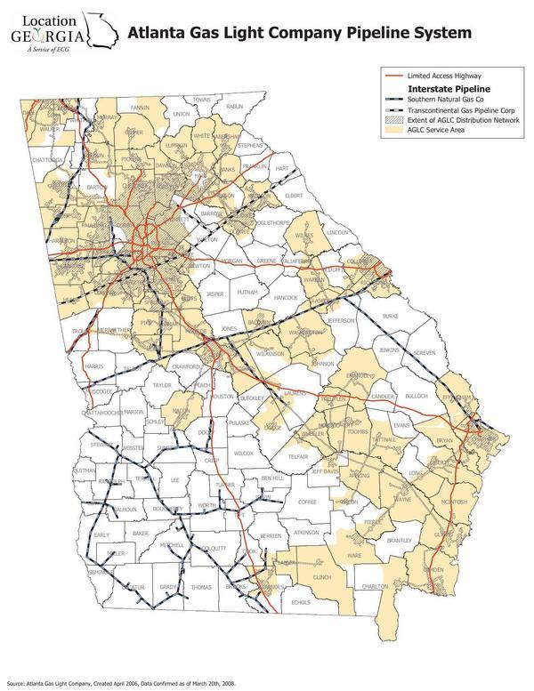
![[Commissioner Jason Shaw]](https://www.wwals.net/pictures/2019-09-17--agl-ga-psc/2019-09-17-13:56:10--shaw.jpg)