Tag Archives: river

Sabal Trail between SRSP and I-10 in Suwannee County, FL 2016-10-16

Signs and pipe, 30.3918 -83.152922 
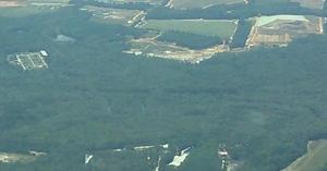
Does Sabal Trail think black bears can’t walk the short distance from 24th Street, Stagecoach Road, and US 90 to 199th Place? What about those fox squirrels and indigo snakes? 
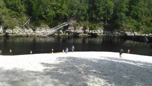
Gopher tortoises are also more places than people might think.

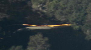
And what about that sinkhole only about 200 feet from the pipeline at Pilgrim’s Pride on US 90? These two pictures were taken from the same place, looking in opposite directions:

w. to Sabal Trail, less than 200 feet from sinkhole, 30.3721680, -83.1550210 e. to huge sinkhole just s. of US 90 e. of Pilgrims Pride, 30.3720440, -83.1548290

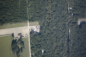
Here are the pictures, from north to south. I actually started on Continue reading

Suwannee River Beach @ Spirit of Suwannee Music Park 2016-10-16

Stairs 30.4059372, -82.9478073 Very dry, and this was a week ago Sunday, with a bit more than 23 feet on the Nobles Ferry USGS gage. Surprisingly, the water’s not much lower now according to that gage.

Somebody asked us at Suwannee River Roots Revival: why is the Suwannee River so low? He was from the Atlantic coast of Florida, where they just had hurricanes, and didn’t realize: none of that rain fell upstream inland in Florida and Georgia up to the Okefenokee Swamp.

-jsq

You can join this fun and work by becoming a WWALS member today!

Continue reading

US 129 HDD Santa Fe River Sabal Trail 2016-10-22

South to North HDD, 29.9122530, -82.8515280 Sabal Trail plans to start drilling here in the next few days. I count three houses within the blast radius just in this picture at the Santa Fe River just east of US 129 in Suwannee and Gilchrist Counties, Florida. See also Jim Tatum’s pictures of this Santa Fe River Sabal Trail HDD location from this flight. Continue reading

From the air: US 84 HDD Withlacoochee River Sabal Trail 2016-10-22

Update 2016-10-24: Questions filed with FERC in Docket CP15-17 as Accession Number 20161024-5049 and emailed to USACE and GA-EPD (PDF).

Extreme closeup yellow in Withlacoochee River, 30.7952780, -83.4524840 What is that yellow thing in the river, Sabal Trail? Is that a sinkhole you’ve marked at the Lowndes County HDD site? And does blue pipe mean thinner for rural areas like your executive from Houston told us in WWALS v Sabal Trail & FDEP?

FERC gave you permission to Continue reading

Withlacoochee Wastewater Treatment Plant old and new 2016-10-22

Old and New WWTP and landfill, 30.8212690, -83.3581890 Uphill and farther from the river: the new Withlacoochee Wastewater Treatment plant (top left of center) seen next to the old one, the Pecan Row Landfill, and the Withlacoochee River. Come ask your questions for the entire Suwannee River basin about wastewater and flood prevention this Thursday, October 27th 2016, at the Valdosta City Hall Annex. The $60 million in fixes so far and those still in progress are a big improvement for everybody downstream to the Gulf on the Withlacoochee, Alapaha, and Suwannee Rivers, and upstream on the Withlacoochee and Little River Water Trail. Continue reading

Sabal Trail planting exotic invasive grasses

Landowners can ask for something else.

Right now in Mitchell and Colquitt County, Georgia, Troy Construction is heading south, covering up the pipe they planted with seed, which according to Sabal Trail’s documents is bermuda grass and bahia grass, both of which are exotic invasive species in Georgia. According to Sabal Trail’s documents, “Alternative seed mixes specifically requested by the landowner or required by agencies may be used.”

Now I’m told by at least one Georgia agency that both those grasses can be killed off with Roundup if they spread. But is that really what we want in and near our waterways and wetlands? And why should neighboring landowners have to fight exotic invasive species brought in by an invading pipeline?

So if you’re a landowner or Continue reading

Sabal Trail requests variance to Colquitt County, GA creek 2016-10-17

Monday Sabal Trail asked FERC to add a contractor yard in Colquitt County, and to change routing under a small stream. No rush: Sabal Trail wants approval by tomorrow, Thursday, October 20th 2016. Presumably because they’re racing hell-for-leather to meet their May 2017 in-service drop-dead date, after which (according to FPL’s RFP) they could forfeit a $200 million bond or lose the contract.

Here, courtesy of Lowndes Area Knowledge Exchange (LAKE), are Sabal Trail’s October 17th 2016 maps of that stream, plus Sabal Trail’s April 2016 maps of where it wants to cross the stream it flows into, Hog Creek and that stream’s downstream Okapilco Creek.

We’ve already seen where Sabal Trail is drilling under the Withlacoochee River between Valdosta and Quitman, Georgia and under the Suwannee River in Suwannee River State Park. Plus there’s an encampment of water protectors in Suwannee County.

Contractor Yard CY3-6

Continue reading

Okefenokee Suwannee River Outing @ Fargo, GA 2016-12-10

Update 2017-02-05 Pictures.

Okefenokee West Entrance Trails You can join WWALS for a fall Saturday paddle on the Suwannee River in the Okefenokee swamp. Bring a boat, PFD, and paddle, or you can rent those at the park.

When: 10AM Saturday December 10th 2016

Where: Georgia’s Stephen C. Foster State Park near Fargo, GA

What: Paddle from Billy’s Lake down through the River Narrows to the Suwannee River Sill.

Distance: About 7 miles in about 4 hours Continue reading

Suwannee-Satilla and GA coastal river water councils in Dublin, GA 2016-11-17

Next month, once again the upper Suwannee that drains into the Gulf gets pulled into a meeting with coastal Georgia Water Planning Councils. This is the meeting that got delayed by hurricane.

GA DNR, Bulletin, 18 October 2016,

Joint Regional Water Planning Council Meeting NEW DATE: November 17, 2016

Georgia Department of Natural Resources sent this bulletin at 10/18/2016 09:18 AM EDT

NOTICE:

JOINT REGIONAL WATER PLANNING COUNCIL MEETING

Announcement Date: October 18, 2016

TO ALL INTERESTED PERSONS AND PARTIES:

A Joint Council Meeting will be held for the Altamaha, Coastal Georgia, Middle Ocmulgee, Savannah-Upper Ogeechee, Suwannee-Satilla and Upper Oconee Regional Water Planning Councils at the following date, time, and location:

Continue reading