Tag Archives: signs

Animals opposing titanium mine near Okefenokee Swamp 2019-08-13-14

Update 2019-08-11: What to bring: pictures and signs (not costumes).

Come early to see the animals assembling on the sidewalk before the miners’ public meetings Tuesday and Wednesday in Folkston and St. George, Georgia. Think of it as Early Okefenokee Halloween!

Alligator

You can bring an animal costume picture and help oppose the mine, also by distributing information outside and asking questions inside. There will be reporters from near and far.

Locals especially please come to the Charlton County Commission meeting Thursday, but no demonstration there, please, just listen and speak. Continue reading

Spooks of the Bridge, Water Trail Signs, and Porta-Potties: #PaddleGA2019 Day 2 2019-06-16

Spooks! Daredevil dry-land kayaker! Bridge climber! Gnarly jerky and the golf cart! Also the Withlacoochee River at Spook Bridge, Knight’s Ferry Boat Ramp, Nankin Boat Ramp, each with road and kiosk signs for the Withlacoochee and Little River Water Trail, plus briefly Port-A-Potties at all those places and halfway back up towards Troupville Boat Ramp, and a gopher tortoise, all during Day 2 of #PaddleGA2019.

[Joe Cook and Harold Harbert]
Joe Cook and Harold Harbert

There were boats. Continue reading

Paddle Georgia on Scott James Radio 8AM 2019-06-14

All about Paddle Georgia #PaddleGA2019, PaddleGA2019 (back on the original route, starting at Troupville!) on the radio 8:00 AM tomorrow, Friday, June 14, 2019, Suwannee Riverkeeper John S. Quarterman with Scott James on his Talk 92.1 drive-time radio show, out of Valdosta, Georgia.

We’ll be working out the final details for Scott James broadcasting from the Suwannee Riverkeeper Aircraft Carrier Saturday morning, as Paddle Georgia’s 300 paddlers set out downstream from Troupville Boat Ramp, just west of Valdosta.

Also Saturday morning, 8AM to 10AM, Helen Tapp and WWALS will be set up at the Little River Confluence, with water trail and other information. That’s on land Helen and her cousins are trying to get funded to turn into a park.

Scott James Talk 92.1 drive-time radio show
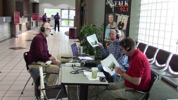
Photo: John S. Quarterman, Scott James radio 2019-02-22.

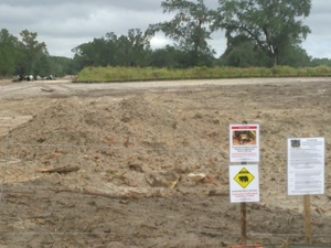
Friday WWALS will be planting signs at Troupville Boat Ramp for the Withlacoochee and Little River Water Trail (WLRWT), and at Knights Ferry, Nankin, and State Line.

Tickets are still available for the Journey’s End Feast, Friday, June 21st, in Dowling Park, Florida, on the Suwannee River. That Feast is catered by WWALS by The Salty Snapper of Valdosta, Georgia.

The Salty Snapper will also be the venue for the Second Annual Suwannee Riverkeeper Songwriting Contest, Saturday August 24.

When: Approximately 8:00 AM, Friday, June 14, 2019

Where: You can listen on the air, or through the radio show’s own website, or through several online listening services.

Event: facebook.

 -jsq, John S. Quarterman, Suwannee RIVERKEEPER®

You can join this fun and work by becoming a WWALS member today!

Slab curing at Naylor Boat Ramp 2019-05-21

The concrete was curing Tuesday, May 21, 2019, that was poured after May 8, following the bed built by April 30.

[With representative human]
With representative human

Many people want to know: when will Lowndes County slide this slab down into the river? I am not Lowndes County Project Manager Chad McLeod, but my guess is Continue reading

Naylor Boat Ramp Park is not Lola VPA or WMA 2019-05-19

If you’re down at the beach on the Alapaha River, just upstream from US 84, in the new Lowndes County Naylor Boat Ramp Park, and a game warden should happen to say you need a WMA pass, please tell him you’re in a public park owned by Lowndes County, and if there’s any doubt about that, please consult the Lowndes County Tax Assessors online map, or call Lowndes County, or call me.

[Beach]
Beach, Lowndes County Tax Commission Map, Parcel 0259 030B.

There seems to be some confusion, possibly because the Georgia Department of Natural Resources (DNR) map for the Lola Tract WMA does not show Continue reading

Naylor Boat Ramp framed 2019-05-08

Frame and concrete wire.

[Frame]
Frame

Lowndes County Project Manager Chad McLeod says they will probably pour the concrete Saturday. Then 10 to 14 days to set before pushing into the Alapaha River for Naylor Boat Ramp. Continue reading

Naylor Boat Ramp poured 2019-04-30

Update 2019-05-08: Now with framing and concrete wire.

Update 2019-05-06: OK, as April Huntley pointed out after went out there over the weekend, the concrete is not poured yet: what’s out there is the bed on which to put the concrete. I called Lowndes County Project Manager Chad McLeod, who said that’s right. Today the forms for the concrete are in place. Probably Wednesday they will pour the concrete. Then it has to set for 10-14 days. After that, they will pick a day with an appropriate river level (they need a couple of feet of water in the river), and they will slide the segments down the ramp into the river. So probably somewhere between 18 and 25 May 2019 the concrete ramp should be in the river.

Some of the concrete was still setting on the new Naylor Boat Ramp on the Alapaha River just upstream from US 84.

[From the top]
From the top

Lowndes County Commissioner Joyce Evans asked Gretchen Quarterman at the Monday Planning Commission meeting whether she had been to the new Naylor Boat Ramp. Continue reading

Alapaha River Beauty should not be hidden 2018-04-07

Randy Patten used to say he’d never seen an alligator on the Alapaha River in Lanier County, but he just saw a log with eyes and a tail.

On Patrol, Stills

He also changed his mind about something else:

I have been against the publication and the making public of our river for people kayaking it, due to the fact that we couldn’t get people out of the river if they got in trouble.

Well, after a couple of years of planning with the assistance of the county commissioners, and volunteer firefighters, and everybody that would assist, we now have signs, 24 actually, up and down the river, from Atkinson County to Echols County. So every few miles you’ll see a sign with a phone number. And later on, when I get close to one I’ll go live again and show you what they look like.

But it makes it a lot nicer to know that if we have people looking at its beauty, which should never be kept a secret, but if something does happen, we have the ability to come get you. Continue reading

Crowdsourcing pictures of Sabal Trail path

Update 2016-11-29: Added to this google map: WWALS aerials of Gilchrist County, and Sabal Trail alignment maps localized by LAKE for Mitchell, Colquitt, Brooks, and Lowndes Counties, Georgia, and Hamilton, Suwannee, and Gilchrist Counties, Florida to just north of Bell, FL.

Update 2016-11-04: Now with Sabal Trail route digitized through Gilchrist, Alachua, and part of Levy Counties, plus part of the Citrus County line.

Signs, silt fences, backhoes in wetlands: you can log pictures on a map of anything going on at a Sabal Trail construction site from your mobile phone, tablet, or laptop. Already posted your pictures on the web? Link them into the map. Here’s how.

You’ve seen many pictures posted by WWALS, taken on the ground and in the air, and linked into a google map (which also has Sabal Trail’s alignment maps linked in).

Here’s another google map, to which more people can add pictures.

If you want to add pictures to this new crowdsourcing google map, you need to: Continue reading