
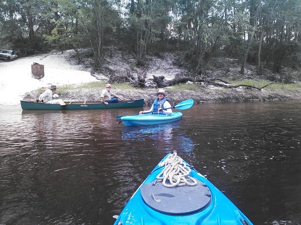
Overcast and a small chance of drizzle won’t stop us:
yes, we’re paddling
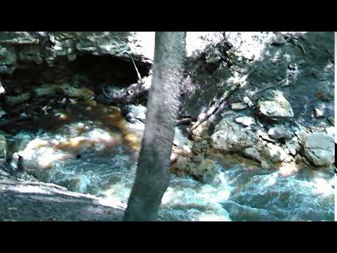
from Hagan Bridge to Franklinville on the Withlacoochee River,
10 AM Sunday, February 11, 2018.
Follow
the link for details.
More:
For more outings and events as they are posted, see the WWALS calendar.
-jsq, John S. Quarterman, Suwannee RIVERKEEPER® You can join this fun and work by becoming a WWALS member today!
Pictures by Gretchen Quarterman for WWALS, between Hagan Bridge and Franklinville, Withlacoochee River 2013-04-20.
Category Archives: Blueway
It’s a Go for this weekend’s outings 2018-02-10-11
Update 2018-02-10: And it’s a go for Hagan Bridge on the Withlacoochee Sunday morning!
Definitely for today’s Five Holes Cleanup at the Suwannee River, and probably for tomorrow’s Hagan Bridge Withlacoochee River paddle (stay tuned for final word on that one).
5 Holes Clean Up at the Suwannee River
Outings Chair Phil Hubbard says:
“We are a GO for the clean up at 5 Holes for this afternoon at 3 PM.”
Five Holes is also known as
Seven Sisters Spring; see also Pictures by Alan Cressler from 2008.

Pictures by John S. Quarterman for WWALS at Five Holes, Suwannee River,
2015-08-15.
Withlacoochee River Paddle from Hagan Bridge to Franklinville Road
Phil says: “Like wise, as of the 8 AM forecast we should be a GO for the paddle outing tomorrow with a 25% chance that of now appears to be decreasing during the midday and increasing after sunset. However we shall revisit this one again this afternoon before making a final decision.”
More good news: Continue reading
Rain and this weekend’s outings 2018-02-10-11
Update 2018-02-10: And it’s a go for Hagan Bridge on the Withlacoochee River Sunday morning!
Update 2018-02-10: It’s a Go for Five Holes, and probably for Hagan Bridge.
Even the rain likes the weekend. Multiple weather forecasts show chances of rain ranging from 40% to 100% this weekend. Rain is not the best time to be clambering up and down steep slopes at Five Holes, and a thunderstorm is not a good time to be paddling the Withlacoochee River from Hagan Bridge. But we don’t want to call it early, because then both days would for sure be sunny.
-
So, Outings Chair Phil Hubbard says he will make a decision
on the
5 Holes Clean Up by 10 AM Saturday.
By the way, Five Holes is also known as
Seven Sisters Spring; see also Pictures by Alan Cressler from 2008.

Pictures by John S. Quarterman for WWALS at Five Holes, Suwannee River, 2015-08-15. - Phil will make a decision on the Withlacoochee River Paddle from Hagan Bridge to Franklinville Road by Saturday afternoon by 4 PM. The good news: Continue reading

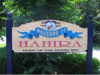
Hahira: against GA state fee diversions and for WLRWT 2018-01-30
Tonight, a resolution supporting the Withlacoochee and Little River Water Trail, and a resolution for Georgia HR 158 against state fee diversions, (the one already passed by three counties and two cities in the Suwannee River Basin), on the agenda at the Hahira City Council Work Session (and Thursday at the Regular Session). Both will be introduced by Suwannee Riverkeeper John S. Quarterman.
When: 6:00 PM, Tuesday, January 30, 2018
Where: Hahira Courthouse, 301 W Main Street, Hahira, GA 31632
What: Work Session, Hahira City Council
Hotchkiss Road Landing, Old State Road, and Naylor Boat Ramp
Common question: isn’t Hotchkiss closed?
Answer: the old
Hotchkiss Landing
in Lowndes County is closed, private, and
don’t go there!
 But
Hotchkiss Road Landing
in Lanier County is open as always, do go there to get to the Alapaha River.
But
Hotchkiss Road Landing
in Lanier County is open as always, do go there to get to the Alapaha River.
 And there’s a new park at US 84, with a Naylor Boat Ramp being built
by Lowndes County, as urged by WWALS.
And there’s a new park at US 84, with a Naylor Boat Ramp being built
by Lowndes County, as urged by WWALS.
Bret Wagenhorst, Dave Hetzel, Gretchen Quarterman, at Hotchkiss Road (open, do go there
), in Alapaha River Outing, by John S. Quarterman, for WWALS.net, 24 August 2014.
Previously there was some discussion of using a different name for Hotchkiss Road Landing in the Alapaha River Water Trail, but then nobody would know what we were referring to, since that’s what it’s always been called, down at the end of Hotchkiss Road off of US 84.
For those relatively new to WWALS, WWALS was heavily involved in Continue reading
Gornto Road, Valdosta, access to Withlacoochee River 2018-01-24
It could use some markers to keep people on it and off private property, and maybe some loaner kayak wheels, but there is public access to the Withlacoochee River off of Gornto Road in Valdosta.
Tea-colored water, 16:22:37,, Withlacoochee River 30.8623900, -83.3224600
And a very nice blackwater river it is. Continue reading
Atkinson County passes Alapaha River Water Trail resolution 2018-01-18
It probably didn’t hurt that Lace Futch was Mayor of Willacoochee before he became Chairman of Atkinson County. During a brief discussion, I pointed out that the resolution includes this clause, to fix the last landing name before we update and reprint the Alapaha River Water Trail brochures:
Section 3: The public access to the Alapaha River at GA 135 south of the city of Willacoochee is hereby named Willacoochee Landing;
The Commissioners passed it unanimously.
WWALS board member Shirley Kokidko, who lives in Atkinson County and who had asked for this resolution to be on the agenda, thanked the Commissioners afterwards, and invited them to come on the Hike to the Dead River Sink, noon Saturday, January 27, 2018, explaining that this first outing on the Alapaha Quest was originally scheduled to start at Sheboggy Landing at US 82 and to end up at Willacoochee Landing, but was rescheduled due to low water. Shirley is near the center of each of the pictures below, each taken at Willacoochee Landing on different WWALS outings.
See also the resolution in support of the Alapaha River Water Trail (ARWT) passed by Lanier County 2018-01-08.
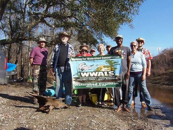
Photo: Gretchen Quarterman for WWALS
at Willacoochee Landing 2016-02-20.
Text of the resolution
Continue readingAdel passes Withlacoochee and Little River Water Trail resolution 2018-01-16
Update 2020-10-01: Signed and executed copy.
Thanks, City of Adel, for passing this resolution last Tuesday! The next BIG Little River Paddle Race at Reed Bingham State Park will be April 28, 2018, pending final approval by GA DNR. Meanwhile, come paddle with WWALS from Hagan Bridge (GA 122) to Franklinville on the Withlacoochee River, February 11, 2018.
![[Under the cypress]](/pictures/2017-04-29--blrpr-hubbard/PWHX8661.jpg)
Photo: Phil Hubbard, Under Reed Bingham State Park cypress at the 2017 BIG Little River Paddle Race.
Text of the resolution (see also PDF)
Continue reading
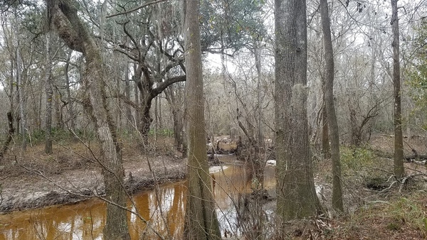
Hike to Dead River Sink, Alapaha Quest 2017-01-27 2018-01-27
Update 2018-11-21: Pictures.
Rescheduled due to low water, this time moved and mutated into a hike to the Dead River Sink, starting in the middle of the Alapaha Quest.
Practicing Geologist and WWALS member Dennis James Price will once again lead us through this impressive geological phenomenon. It is an eye opener that will perfectly illustrate the karst topography that is typical for quite a bit of the area where many of our rivers flow. When you see the exposed limestone along the river banks you see the porous rock. However when you see a hole that is capable of swallowing the entire Alapaha for most of the year…. it’s impressive.
When: High noon, Saturday, January 27, 2018
Put In: Meet at Jennings Bluff Launch. From Jennings, Hamilton County, FL, travel south on US 41 to NW 25 Lane; turn left; travel east to NW 82 Court and the entrance into the Suwannee River Water Management District’s Jennings Bluff tract; turn left and follow road to canoe launch.
GPS: 30.567172, -83.039189 (for the entrance to Jennings Bluff Tract)
Take Out: Same.
Bring: Cold weather gear, hiking shoes, and clothes resistant to thorny bushes. No boat needed. Also trash pickers and trash bags: every WWALS outing is also a cleanup.
Join: This outing is Free to WWALS members. Non-members: $10/person. We recommend you support the work of WWALS by becoming a WWALS member today!
Picture by John S. Quarterman for WWALS,
Into the Dead River Sink, June 14, 2015.
Shuttle: None.
Once you get to Suwannee River Water management District (SRWMD)’s Jennings Bluff Tract, Continue reading
Douglas, GA: SGRC Regional Plan Update 2018-01-18
Received January 8, 2018. I think this is the last workshop, so if you haven’t been to one….
Good Afternoon Everyone,
This email is a quick reminder to attend the 4th Regional Plan Update Workshop in the City of Douglas, Georgia, on:
January 18th, 2018 10:00 a.m. to 12:30p
City of Douglas City Hall,
224 East Bryan Street, Douglas, GA 31533,
912-389-3401

Photo: Mjrmtg on Wikimedia, CC BY-SA 3.0.This fourth workshop will cover the following topics: Continue reading
