Tag Archives: Hamilton County

GWC Dirty Dozen and Sabal Trail pipeline drilling mud leak on WALB 2016-11-16

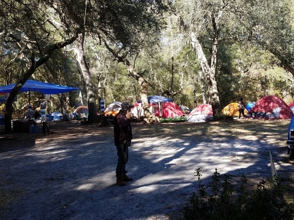
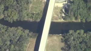
People and news media turned out from Florida and Georgia at the Withlacoochee River US 84 bridge in cross-state-line solidarity about the Sabal Trail pipeline and its recent drilling mud leak. They heard the Georgia Water Coalition announce that Sabal Trail is, for the third year running, on the Dirty Dozen 2016.

Ashlyn Becton, WALB, 16 November 2016, Environmentalist raise awareness about Sabal Trail Pipeline,

Folks from North Florida and South Georgia held a protest at the Withlacoochee River Wednesday and listened to a news conference announcing the Georgia Water Coalition’s Dirty Dozen.

The report highlights the worst offenses and greatest threats to Georgia’s bodies of water.

And the Sabal Trail fracked methane pipeline is on the GWC Dirty Dozen 2016, as Chattahoochee, Flint, Withlacoochee Rivers and Floridan Aquifer: Gas pipeline company, federal agency run roughshod over state, local residents property rights, with this What Must Be Done: Continue reading

Mozell Spells, Horn Bridge, GA-FL line, Withlacoochee River 2016-10-22

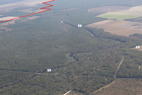
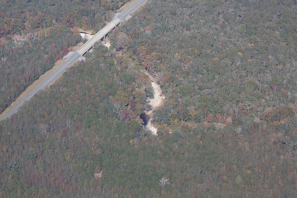
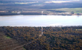
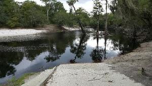
Movie: Horn Bridge, Mozell Spells, Withlacoochee River, GA-FL line (227K) Pictures and a movie clip from the air (thanks, Southwings!) of Mozell Spells, aka Madison Highway Boat Ramp, State Line Ramp (GA DNR) or GA 31 Ramp (SRWMD) or CR 145 Bridge Launch (FDEP).

This is one of two dozen public landings on the Withlacoochee and Little River Water Trail (WLRWT). It’s at the Georgia-Florida state line, and in the big picture (scroll down) you can see Continue reading

Sabal Trail maps digitized

Update 2019-03-19: The google map now includes Florida Southeast Connection (FSC) and FPL’s Martin County to Riviera Beach (MR-RV) pipeline to the sea, which FPL in 2018 got FPSC and FERC to roll into FSC. See also Stop FERC Shirking LNG Oversight.
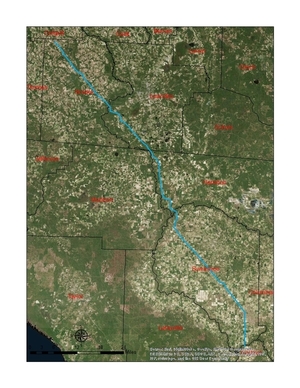
South Georgia and north Florida Update 2016-12-13: The google map now includes the Sabal Trail path digitized for all of Georgia and to the end of the line in Florida south of Orlando.

Update 2016-11-29: In the google map, extended the Sabal Trail alignment maps localized by LAKE for Mitchell, Colquitt, Brooks, and Lowndes Counties, Georgia, and Hamilton, Suwannee, and Gilchrist Counties, Florida to just north of Bell, FL, plus on the crowdsourcing map, WWALS aerials of Gilchrist County.

Update 2016-11-03: Added to the google map digitized path and maps for Gilchrist, Alachua, and part of Levy Counties, FL.

Update 2016-10-31: Added to the google map: Aerials: Suwannee, Ocholockonee, Withlacoochee, Santa Fe Rivers, Okapilco Creek, Sabal Trail Moultrie CY3-6 @ WWALS Southwings 2016-10-22.

Update 2016-10-30: The google map now has all Sabal Trail’s alignment maps from 7 April 2016 linked in for (part of Gilchrist 2016-11-29), Suwannee and Hamilton Counties, FL and Lowndes, Brooks, Colquitt, and Mitchell Counties, GA. Aerial pictures from the WWALS Southwings flight of October 22nd 2016 are also linked in, starting with US 84 HDD Withlacoochee River and US 129 HDD Santa Fe River.

Update 2016-09-14: All 527 alignment maps Sabal Trail filed with FERC in April 2016, in small, big, huge, and PDF formats, courtesy of Lowndes Area Knowledge Exchange (LAKE).

Update 2016-09-23: Added Depressions within 1 mile of Sabal Trail in Hamilton, Madison, and Suwannee Counties, Florida. The pipeline path doesn’t go through Madison County, but it comes closer than a mile, and not even two miles from Madison Blue Spring.

These maps show the path Sabal Trail is gouging its fracked methane pipeline through south Georgia and north Florida, with comparisons to some geological features, including Okapilco Creek, Withlacoochee River, Suwannee River, Suwannacoochee Spring, Falmouth Spring, the Cathedral Cave System, and numerous karstic features, some of them sinkholes.
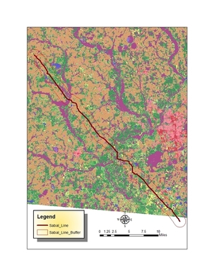
Brooks and Lowndes Counties, GA This digitizaiton is thanks to Continue reading

Sabal Trail, Bell Bros, WWALS, Solar in APN 2016-09-12

The Bell brothers, Flint Riverkeeper, and John S. Quarterman of WWALS all against Sabal Trail in an Atlanta publication. Come on down to the Suwannee River Tuesday near Jasper, FL or to the Withlacoochee River between Quitman and Valdosta, GA 9AM Saturday Sep. 17th to see for yourself what we’re protecting and to say your piece on video.

Gloria Tatum, Atlanta Progressive News, 12 September 2016, Proposed SabaL Gas Pipeline runs through aquifer, wetlands, sinkhole territory, Continue reading

Roline Redoux is on for Monday on the Suwannee River 2016-09-05

“We’re on for Monday morning! River excellent condition,” Roline Launch says expedition leader Phil Hubbard, reporting from the Suwannee River just now. “Maybe 2 feet higher. Flow is perfect,” he added.

Earlier he said helpfully, “I’m stopping at Hardee’s in Jasper to grab a biscuit around 9:15 if anyone needs help finding the launch site.”

About an essential outing ingredient, Gretchen Quarterman says: “I just baked bon-bons!”

For outing details, see the original post, Redoux Suwannee River Roline to Cypress Creek.

-jsq

You can join this fun and work by becoming a WWALS member today!

Continue reading

Delay Roline Redoux as Suwannee River rises after Hurricane Hermine 2016-09-05

Update 2016-09-04: “We’re on for Monday morning! River excellent condition,” says expedition leader Phil Hubbard.

With water still coming downstream from Hurricane Hermine and storms following, USGS WSPF1 at White Springs expedition leader Phil Hubbard says:

I’m thinking looking at the weather forecast, the only safe call we can make today is to delay till Monday pend river level. The rain probability is actually higher on Sunday but looks good for Monday.

So we’re rescheduling Redoux Roline for 10 AM Monday morning September 5th 2016, still at Roline.

At lest now now we know the Suwannee River won’t be too low!

Hoping to see you there. Details are still in the first blog post.

-jsq

You can join this fun and work by becoming a WWALS member today!

Continue reading

Tropical Storm Hermine and Roline Redoux 2016-09-03

It looks like Hermine will have moved along east by Saturday, or at least by Sunday, which is the fallback date for the WWALS paddle outing this weekend from Redoux Suwannee River Roline to Cypress Creek. We won’t be able to tell for a day or so what the situation will be, but so far we’re still planning on Saturday morning. Expedition leader Phil Hubbard will make a determination before then.

-jsq

You can join this fun and work by becoming a WWALS member today!

Redoux Suwannee River Roline to Cypress Creek, 2016-09-03

Update 2016-09-04: “We’re on for Monday morning! River excellent condition,” says expedition leader Phil Hubbard.

Update 2016-09-02: Delayed until 10AM Monday 5th September due to aftereffects of Hurricane Hermine.

Update 2016-09-01: Watching Tropical Storm Hermine.

More people want to go after the pictures and reports from a few weeks ago, so WWALS has scheduled a redo from Roline to Cypress Creek on the iconic Suwannee River in north Florida. Also with a slightly later start this time; more convenient for far-away folks.

When: 10AM Saturday September 3rd 2016

Put in: Roline Launch, 30°33’51.0″N 82°43’30.6″W or 30.564185, -82.725167

Duration: 7.5 miles, about 4 hours.

Events: facebook, meetup.

Directions: Continue reading

State line to Sullivan Launch, Withlacoochee River 2016-10-09

Sunday morning on the tea-colored Withlacoochee River in north Florida in fall: come join us!

Shuttle When: 10AM Sunday October 9th 2016

Put in: Madison Highway on the Georgia side, also known as GA 31 Ramp (SRWMD) or State Line Ramp (GA DNR) or CR 145 Bridge Launch (FDEP). 30.635933, -83.311103

Directions: Continue reading

New hydrology report exposes Sabal Trail pipeline risk to Floridan Aquifer

FOR IMMEDIATE RELEASE

Jasper, Florida, July 1st 2016 — Another independent professional geologist reveals more omissions and discrepancies in pipeline company reports and faults in federal oversight of the Sabal Trail pipeline: Figure 7: Locations of the caves and springs mentioned in this study groundflow actually goes the other way, drilling under a river will change water flow in the Floridan Aquifer, and there is very high risk of sinkhole collapse. An indigenous Floridian commissioned this scientific report to protect his mother, the living earth. This geological report provides compelling additional reasons for the U.S. Army Corps of Engineers (USACE) to open a new process to evaluate this and other new information.

Bobby C. Billie, one of the Clan Leaders and Spiritual Leader, Council of the Original Miccosukee Simanolee Nation Aboriginal Peoples, asked professional geologist and hydrologist Peter Schreuder, P.G. to conduct investigations at the proposed Sabal Trail crossing under the Suwannee River from Hamilton County and under U.S. 90 in close proximity to the Falmouth Cave System in Suwannee County.

This Schreuder report concludes about the Floridan Aquifer System (FAS): Continue reading