Tag Archives: Southwings

Drone aerials of titanium mine site near Okefenokee Swamp 2019-11-23

Yesterday someone sent me drone pictures of the titanium mine site near the Okefenokee Swamp. They were taken from above GA 94, looking northwest.

You can still can comment against the proposed mine to the U.S. Army Corps of Engineers.

[Closeup 2019-11-23]
Closeup 2019-11-23

For comparison, here is an aerial Wayne Morgan took for WWALS on October 5, 2019, on a Southwings flight Continue reading

Okefenokee flyaround –Wayne Morgan 2019-10-05

The cause of this flight was the titanium mine Twin Pines Minerals wants to put near the southeast corner of the Okefenokee Swamp. We documented they have heavy equipment on that site now:


      031Equipment Twin Pines Minerals mine site T Model Road
031Equipment Twin Pines Minerals mine site T Model Road

The Georgia Water Coalition Dirty Dozen, used one of these aerial pictures taken by Wayne Morgan for WWALS on a Southwings flight for Suwannee Riverkeeper, pilot Allen Nodorft, October 5, 2019.

The mine site is less than three miles from the Okefenokee National Wildlife Refuge, and about the same distance from the Cherokee of Georgia Tribal Grounds:


      029Cherokee of Georgia Tribal Grounds
029Cherokee of Georgia Tribal Grounds

For more about why that mine is a bad idea, see the Waterkeepers Florida resolulution against the mine.

For how bad it can get, see Continue reading

Okefenokee Swamp on GWC Dirty Dozen because Titanium Mine 2019-11-14

Announced yesterday to press across Georgia and beyond, the titanium mine near Georgia and Florida’s Okefenokee Swamp proposed by Twin Pines Minerals of Alabama made the Georgia Water Coalition Dirty Dozen (see also PDF).

You can still file a comment with the Army Corps and GA-EPD asking them to reject the mine or at least require an Environmental Impact Statement. Convenience for miners is no excuse to risk the fishing, boating, and birding in the swamp and hunting and forestry nearby.
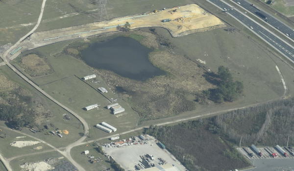
[Closeup]
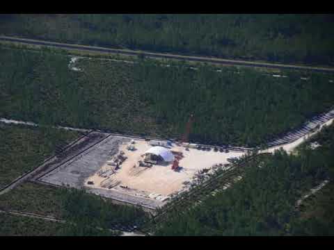
Closeup of TPM equipment on mine site from GA 94 westbound.
Photo: John S. Quarterman for WWALS, November 14, 2019

2019’s
Worst Offenses Against
GEORGIA’S WATER
OKEFENOKEE SWAMP, ST. MARYS AND SUWANNEE RIVERS

Proposed 2,400-Acre Titanium Mine Threatens Signature Landscape of Georgia

INTRODUCTION:

Twenty years ago when chemical giant DuPont proposed mining titanium dioxide ore near the Okefenokee Swamp, opposition to the plan was so strong— Continue reading

Heavy equipment on TPM titanium mining site near Okefenokee Swamp 2019-10-05

Update 2019-10-10: Looking west from the Cherokee of Georgia Tribal Grounds along GA 94 past sawmill to equipment on mine site, with Okefenokee Swamp beyond. And a Bill of Rights for Nature.

[Tribal Grounds west along GA 94 to TPM equipment, 12:38:38, 30.5257540, -82.0411100]
Tribal Grounds west along GA 94 to TPM equipment, 12:38:38.
Photo: John S. Quarterman for WWALS, on Southwings flight, pilot Allen Nodorft, 2019-10-05.

This time it’s true: there is heavy equipment on site Twin Pines Minerals proposes for titanium mining near the Okefenokee Swamp, as of yesterday. It looks like dredging equipment similar to what we saw a few minutes earlier at the Chemours North Maxville Mine in Baker County, Florida. People more familiar with mining equipment, what do you think?

[Closeup: equipment]
Photo: John S. Quarterman for WWALS, on Southwings flight, pilot Allen Nodorft, Closeup: equipment, 12:41 PM, Saturday, October 5, 2019.

For context, this picture is looking east along GA 94 towards St. George: Continue reading

Sabal Trail gas into Gulfstream, 2018-01-1-6

It’s a shell game: much of Sabal Trail’s early January burst to maximum capacity went back out through the Gulfstream pipeline in Osceola County, which sent it to a Duke Energy Florida peaker plant in Intercession City and to Florida Gas Transmission (FGT). Presumably some of Sabal Trail’s peak went directly to FPL, but some of it apparently went through Gulfstream to get there. Yet apparently none of it was needed, since in the coldest week of the winter so far, Sabal Trail went back down to almost zero.

100% above ave: IN Sabal Trail Osceola, out Duke Intercession City and FGT Hardee, Charts

Using data from the various pipeline’s own FERC-required daily information postings, Gulfstream shows “SABAL TRAIL – OSCEOLA IN MP 60.25” suddenly bumping up Continue reading

Aerials: Woods Ferry Tract to Suwannee Springs 2016-11-23

These aerial photographs by Beth Gammie cover the route of the Saturady 20 May 2017 WWALS Outing down the Suwannee River from Woods Ferry Tract Launch to Suwannee Springs. She took them for WWALS 23 November 2016, on a Southwings flight piloted by Roy Zimmer. They’re all looking from Hamilton County south (or west) across the Suwannee River into Suwannee County.

Woods Ferry Tract Launch

Woods Ferry Tract Launch

I have pulled out a few detail shots, of Woods Ferry Tract Launch and of Suwannee Springs.

Suwannee Springs bathhouse

Continue reading

Hunters Creek Pipeline, Sabal Trail, Osceola County, FL 2017-02-07

The south end of Sabal Trail connects its Hunters Creek Pipeline, running through many wetlands and past many subdivisions and malls through Davenport and Kissimmee to connect to Florida Gas Transmission (FGT) just west of Florida’s Turnpike. This is all about six miles south and east of Disney World.

NW past Central Florida Pipeline Corp. to Reunion Compressor Station, 6781 Osceola Polk Line Rd, Davenport, FL 33896,
NW past Central Florida Pipeline Corp. to Reunion Compressor Station, 6781 Osceola Polk Line Rd, Davenport, FL 33896, 28.2610489, -81.5572004

Here are aerials taken Continue reading

Gum Springs 3,000 feet from Sabal Trail and lower flow @ WWALS 2017-02-07

Interesting questions about Gum Springs, seen in this picture only 3,000 feet across Marion Oaks Golf Course from Sabal Trail:

Detail, SW corner Marion Oaks, FL,
Picture: Jim Tatum for WWALS on Southwings flight 2017-02-07.

Follow this link for the interactive google map, or it’s also embedded below. Continue reading

Aerials: Sabal Trail hydrostatic test pond at I-75 @ WWALS 2017-02-07

Good questions by Janet Barrow. Who has answers?

Janet Barrow
March 13, 2017 at 4:55 pm

Look at the first photo — “Sabal Trail north from I-75 to the Withlacoochee (south) River.” This shows the hydrostatic discharge point for Spread 5 (at least the site they reported that they will use) and the withdrawal point for Spread 6. Coordinates are: 28°52’47.99″N, 82°5’39.69″W

Thanks to Mark Skogman’s long lens on the Southwings flight for WWALS, we can zoom in on that spot.

Hydrostatic test pond at I-75

Janet Barrow
March 13, 2017 at 5:07 pm

Continue reading

Aerials: I-75 to Withlacoochee (south) River 2017-02-07

Update again 2017-03-13:

Sabal Trail north from I-75 to the Withlacoochee (south) River.

Tommys Tire Shop, 418 FL-44, Wildwood, FL 34785,
Photo: Mark Skogman for WWALS on Southwings flight 2017-02-07

The Villages is about six miles northeast of where Sabal Trail crosses I-75 just north of FL-44.

Closeup, Withlacoochee (South) River crossing,
Photo: Jim Tatum for WWALS on Southwings flight 2017-02-07

Many more pictures below, and a Google Map showing the locations.

 -jsq, John S. Quarterman, Suwannee RIVERKEEPER®

You can join this fun and work by becoming a WWALS member today!

Pictures

Continue reading