Tag Archives: Alapaha River

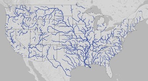
Map of American Rivers by Nelson Minar

Here’s a map of all rivers in the U.S. by Nelson Minar. Lower 48 U.S. It actually covers the lower 48 states and is pretty impressive at that scale. Plus you can zoom in.

Gulf and south Atlantic

Here you can see rivers running to the Gulf start all the way up Continue reading

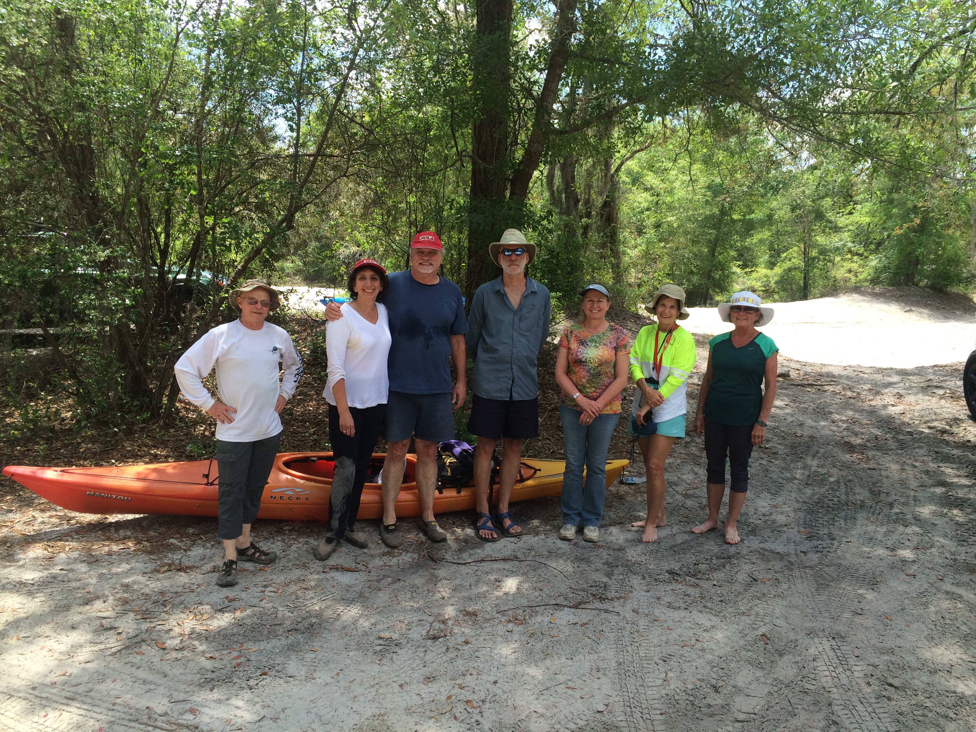
A wonderful Paddle on the Alapaha 2016-04-23

HWY 84 to Mayday.

What a great day for a paddle! The current was moving us along nicely, about 12 miles in just under 4 hours. It is a very beautiful stretch of river, very wild, many birds could be heard in the forest canopy.

cjm

This was the Hotchkiss Road to Mayday Outing.

More from Chris’s details in the Outings spreadsheet:

Hotchkiss road was washed out, put in at Naylor park property. Cut about .5 mile off of the trip.

Water level 85 on the Statenville gage. Was in the banks and moving quick. Would not recommend paddling at levels much higher than this.

Features: canopy over much of the river.

Flora: Tupelo, birch, oaks, pine, wild azalea. No invasive species seen.

Fauna: wood ducks, great egrets, kingfisher, heard- barred owls, hooded warblers, and many other birds.

Assessment: Very nice paddle. Very beautiful stretch of river

And a bit more from Chris:

Water level was high, much higher would not be recommended. Looking at the water level in comparison with the Safe Water Level criteria, Item 3 stood out. It became very apparent why it is important that you should be able to paddle against the current for a short distance. One of our paddlers needed a rescue and the only way to reach her was to paddle upstream.

-jsq

You can join this fun and work by becoming a WWALS member today!
Earth Day 2016, at VSU, on the Alapaha River, and worldwide

Noon to 3PM today, WWALS will be on the VSU front lawn with VSU Front Lawn Students Against Violating the Environment (S.A.V.E.), celebrating Earth Day, recommending along with Waterkeeper Alliance: Keep it in the Ground, especially fracking for pipelines including Sabal Trail, and congratulating Lowndes County on progress on the new Naylor Boatramp and Valdosta on finally almost just about pretty soon finishing its fixes to stop spilling sewage into our rivers.

Tomorrow at 8AM, come paddle with WWALS from Hotchkiss Road in Lanier County to Mayday in Echols County, past the new park and boat ramp Lowndes County is building just north of US 84. Next month at Reed Bingham State Park between Adel and Moultrie, GA, it’s the BIG Little River Paddle Race, registration 8-9AM Saturday May 21, 2016. And in June come paddle on the Withlacoochee River from Florida Campsites Ramp to Suwannee River State Park, Saturday June 4, 2016. Before then we hope to invite everybody downstream from Valdosta’s sewage spills to attend the end-of-May signing ceremony for the new Valdosta force main and uphill Withlacoochee Wastewater Treatment Plant!

If you fall in on one of these outings, you could win Continue reading

No new sewer spills from Valdosta or Lowndes County 2016-04-14

Nothing new since April 4th is good news today from Utilities at both local governments, since the Valdosta spills into both the Withlacoochee and Alapaha watersheds of April 2nd and 3rd, and the Lowndes County spill into the Withlacoochee River of Aprll 4th. So Suwannee River people at the moment only have those spills, arriving downstream about now, to look forward to for the moment.

Valdosta is sometimes a little slow posting a report, and Lowndes County never posted one on its website last time, so I called both of them just now. Tuesday I asked Lowndes County to post such reports on its website and send them through their agenda alert system. It’s possible they may start doing that.

-jsq

You can join this fun and work by becoming a WWALS member today!
Details on Valdosta overflows last weekend 2016-04-04

Force main and the new WWTP on line by May!

More extensive overflows than usual last weekend, and now more extensive information about them, in the update Tim Carroll promised, on the City of Valdosta website as City System Impacted by Severe Storms and Regional Watershed. It even starts with schedule details, which say they’re ahead of the schedule I previously posted. This report’s table of overflows has start and stop times and amounts, with the Creeks affected.

It still doesn’t say which river basin they go into. Knights Creek flows into Mud Creek, which goes into the Alapahoochee, Alapaha, and Suwannee Rivers. All the others end up in the Withlacoochee and the Suwannee Rivers. And there are still some unanswered questions. But getting the force main and the new WWTP on line by May is a very good development.

The City of Valdosta is ahead of schedule and plans to bring online nearly $60 million in wastewater system improvements next month. The $35 million Force Main project and the $23 million new Withlacoochee Wastewater Treatment Plant (WWTP) are both ahead of schedule, and bringing them both online cannot come a day too soon for the city. 

“We are pleased to be in the final stages of construction on both projects. Testing is underway now with full startup expected in late May,” according to Director of Utilities Henry Hicks. “We are also pleased that these projects and other awarded sewer collection system improvement projects underway will resolve all the areas of the city impacted by reoccurring overflows that often follow heavy rains and regional flooding.”

Continue reading

What Valdosta is doing about its wastewater problem

Update 2016-04-05: Actually, force main and new WWTP on line by May.

Frances Adams asked:

I just want to know when will this be fixed, I can’t even drink my water for it having ecoli in it. Someone needs to do something now!!!

The two biggest pieces are scheduled to be finished this summer and next summer: the force main project in July 2016, and the new Withlacoochee Wastewater Treatment Plant relocated uphill by August 2017. Valdosta is spending upwards of $300 million to fix the problem.

As I point out every time I post about new spills, there are still open questions and, as your Waterkeeper® Affiliate for the upper Suwannee River and the Withlacoochee and Alapaha Rivers, WWALS Watershed Coalition will keep after Valdosta until we get the answers. See also the slides and videos from the meeting Valdosta held for us a year ago about this.

Here’s what Valdosta’s Sewer System Improvements web page says today: Continue reading

More Valdosta wastewater spills over the weekend; stay tuned 2016-04-04

Update 2016-04-05: Here are the details, and force main and new WWTP on line by May.

Valdosta spilled more wastewater over the weekend, according to Valdosta City Council Tim Carroll, who called just now. The Withlacoochee River is out of its banks, actually up on the property containing the Withlacoochee Wastewater Treatment Plant (WWTP), but “according to the experts” not going to threaten the plant. “But lines are underwater”.

Water is not even close to the new WWTP currently under construction, according to Carroll. And the new force main project should deal with much of the manhole overflow problem on the west side of Valdosta in the Withlacoochee basin, for example into Sugar Creek.

On the east and southeast, in the Alapaha basin, Continue reading

Three more Valdosta wastewater overflows 2016-03-28

Who thought it was a good idea for stormwater to go into Valdosta’s sanitary sewer system? 700 Cypress Street, Valdosta, GA Whoever it was, the current Valdosta Utilities, Engineering, and especially Stormwater Director have to deal with it, frequently. Maybe some of the upwards of $300 million Valdosta is spending on force main, new Withlacoochee Wastewater Treatment Plant, etc., will help with this problem. But none of that will stop rain from falling on Valdosta, and little of it is directed at the Alapaha River watershed in Valdosta, where one of this week’s three spills went.

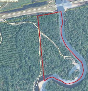
Come see for yourself where Sugar Creek flows into the Withlacoochee River, this Sunday morning, April 3rd, on the extra WWALS Outing from Langdale Park to the Little River Boat Ramp. And come paddle with us on the Alapaha River Saturday morning April 23rd, from Hotchkiss Road in Lanier County to Mayday in Echols County, upstream from where Knights Creek flows into Mud Swamp Creek, which joins Grand Bay Creek to form the Alapahoochee River, which joins the Alapaha River in Florida. And of course both the Withlacoochee and the Alapaha join the Suwannee River. Valdosta says there’s no significant vestige of its wastewater that far downstream. It would be good to have some independent water quality monitoring to be sure.

I notice Section 5 Mud Swamp Creek Basin of Valdosta’s Master Stormwater Management Plan says: Continue reading

WWALS Watersheds google map

Update 2020-01-25: Superseded by WWALS Suwannee River Basin Map and All Landings in the Suwannee River Basin, now that Suwannee Riverkeeper territory includes the entire Basin plus Estuary, since Waterkeeper Alliance agreed to add the Ichetucknee and Santa Fe Rivers on September 26, 2019.

Update 2017-10-30: River flowlines.
Update 2017-10-08: Better colors plus a Suwannee River Basin map.
Update 2017-04-13: Since December 2016 WWALS Watersheds have included the Lower Suwannee River HUC 03110205 and the Suwannee River Estuary, approved by Waterkeeper Alliance the same time as the license for Suwannee RIVERKEEPER®.

Small, WWALS Watersheds Map Legend

Click on this link for an interactive google map of WWALS watersheds.

The images you see here are static screenshots of that google map. Follow the link above for the actual google map.

The watershed outlines are from Continue reading

Pictures: Long Alapaha Outing, GA 135 to GA 168 2016-02-20

You never know on our blackwater rivers in south Georgia and north Florida. The danger! The thrill of the rapids!

After WWALS banner by Gretchen Quarterman OK, it was actually more like paddling on a lake with a current. The hardest part was when the wind picked up against us a few times. Sometimes we heard what sounded like rapids, but it was just flotsam lodged against oak trees.

But that’s the point: you really never know until you’re on the water, and on a trip like this with no good takeout until the end of the 18.25 miles, being prepared it much better than not.

The current did make for Continue reading