Tag Archives: Alapaha River

Expert paddlers get ready for Long Alapaha River Paddle, GA 135 to GA 168 (Berrien Beach) 2016-02-20

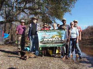
Update 2016-02-21: Actually it took 6 hours. Here are some pictures.

The water is high and fast, so expert paddlers only, arrive by 8AM at GA 135 (Atkinson County side), and be ready so we can shuttle quickly and get on the Alapaha River as soon as possible. 2015-02-19 to 2016-02-19 It’s a long way and we need to be off the river before dark. Berrien County Sheriff, game warden, and emergency response have all been advised of this trip, but expert paddlers only, please. As always, bring personal flotation devices, warm layers of clothes, drinking water, food, and a change of dry clothes. There is no good place to take out before the end point, so be prepared to paddle all day.

The USGS Gauge at Alapaha, GA shows 9.41 feet this morning, which is a good level. The Statenville gauge shows 17.32, which while well below flood level is also well above our usual recommended high of 9 feet. That Statenville gauge is quite a few river miles (56 miles) below our takeout point at GA 168, so the main bulk of rainfall in the river has apparently already moved downstream. But the water is very high and very fast. You will come up on any deadfalls or overhanging limbs quite quickly. Expert paddlers only. There are many other outings and events coming up that are much better suited for other paddlers.

2015-02-19 to 2016-02-19

Continuing our exploration of the entire Alapaha River Water Trail, Tall from Willacoochee we’re into the longer stretches, including this one.

Events: facebook, meetup.

When: 8AM Saturday 20 February 2016

Put In: GA 135, MILE 106.5, Atkinson County side, 2.8 miles south of Willacoochee, GA, Atkinson County.

Take Out: GA 168 (Berrien Beach), MILE 88.24, N side of GA 168, west side of Alapaha River; float downstream under the bridge to the sand beaches, Berrien County

Duration: 18.25 miles. This paddle could take as long as 9-10 hrs.

Shuttle: Probably more than 30 minutes due to distance.

End time: Around 6PM. Yes, really all day.

Responsible party: Chris Mericle

This outing is Free! But we encourage you to join WWALS today to support our fun outings and important work: https://wwals.net/donations/. Continue reading

Yet more Valdosta wastewater spills

Maybe soon this February baker’s dozen of wastewater spills will be a thing of the past, but for now it’s deja vu similar to but worse than last February.

300x388 Figure 2.2.5. Sub-basins Areas, in Section 2 Methodology, by City of Valdosta, for WWALS.net, 14 January 2011 It looks like Valdosta has updated, as repeatedly asked, its schedule for wastewater project completion, with the force main project now aimed at July 2016 and relocation of the Withlacoochee WasteWater Treatment Plant (WWTP) for August 2017. See also Valdosta PR 22 January 2016, Withlacoochee Aerial Sewer Mains Replacement Project.

Those schedule changes are mentioned in the most recent Valdosta News. It does not, however, say which watersheds the various spills affect. I have added * for Alapaha River watershed and ** for Withlacoochee River watershed. It’s not that hard, and Valdosta has a water management plan that spells this all out, with maps. One Mile Branch** and Two Mile Branch** flow into Sugar Creek**, which goes into the Withlacoochee River**. Knights Creek* goes into Mud Creek* which goes into the Alapahoochee* River and then the Alapaha River*, eventually joining the Suwannee River in Florida, as does the Withlacoochee. Valdosta Utilities and Public Relations know all that. But why should every citizen, Continue reading

Water Resources of the upper Suwannee River Watershed

Even the trend of sinking groundwater levels hasn’t changed a lot in the Georgia parts of WWALS’ watersheds of the Withlacoochee, Alapaha, and upper Suwannee Rivers. Figure 1: Georgia Watersheds Thanks to Tom Potter for the pointer, and we’re inviting someone to talk about this subject at the Withlacoochee and Little River Water Trail Workshop at VSU February 27th, 2016.

WATER RESOURCES OF THE UPPER SUWANNEE RIVER WATERSHED, by Mary M. Davis1 and David W. Hicks2,

1 Ecologist, Continue reading

Stranded campers rescued from Alapaha River above GA 135 2016-01-16

This is why WWALS recommends filing a float plan, or in this case, a hiking and camping plan. Boaters

WALB News Team, 17 January 2016, Campers rescued from rising floodwater, warning issued,

BERRIEN CO., GA (WALB) – The Berrien County Sheriff is sending a warning to residents to stay off the Alapaha River.

“Its not a good time to be camping out on the river,” said Sheriff Anthony Heath.

Image About 11 a.m. on Sunday, four Berrien County campers had to be rescued after they were surrounded by rising floodwaters. A father, his daughter, son, and son’s girlfriend hiked downstream and set up camp at the Alapaha River bridge near state Route 135, south of Willacoochee.

The VDT says they camped on Saturday, and were found the next day. Terry Richards, Valdosta Daily Times, 19 January 2016, page 8A, Stranded campers réscued, Continue reading

Video: WWALS outings on Chris Beckham drive-time radio WVGA 105.9 FM 7:30 AM 2016-01-15

Here’s WWALS video of the radio interview this morning on WVGA 105.9 FM. It’s an invitation to tomorrow morning’s events, both at 10AM:

Chris also got me to say a few words about why WWALS formed in the first place, and why you should all join WWALS; it has to do with the 700-year flood in 2009.

Plus some plugs for Valdosta’s wastewater fixes and their recent LiDAR flight.

The one thing I realized on the way out I forgot to mention, the one item that caused me to schedule this interview, was the workshop at VSU February 27th about the Withlacoochee and Little River Water Trail, featuring the visual beauty of all WWALS’ rivers in an art exhibit and silent auction, the geology on display by Dennis Price, and the remains of past people and cultures still visible along the river by Tom Baird.

Looking forward to seeing you tomorrow morning on the Little River, or other WWALS members look forward to seeing you tomorrow morning on the Suwannee River. If not tomorrow, there’s plenty more to do on our beautiful south Georgia and north Florida blackwater rivers!

Here’s the video:

Continue reading

WWALS outings on Chris Beckham drive-time radio WVGA 105.9 FM 7:30 AM 2016-01-15

Everybody listens to the radio in the car on the way to work, and Friday morning 8:30 AM I’ll be talking about paddling this Saturday morning 10AM on the Little River from GA 122 between Hahira and Barney to Lawson Millpond Road; it’s a nice brief 2.5 hour paddle along the Brooks-Lowndes County river border: you can do it!

When: 7:30AM Friday January 15th 2016

Where: 105.9 FM WVGA, Valdosta, Lowndes County, Georgia

What: John S. Quarterman, president of WWALS Watershed Coalition, Inc., on Chris Beckham drive-time radio show

How: Continue reading

Alapaha River @ US 84 & CSX RR 2016-01-09

Chris Graham reported on facebook from the Alapaha River:

CSX Railroad bridge Here what the Alapaha River look like this afternoon near HWY 84 and CSX RR Track. Which it is high but it is going down tho.

The Alapaha was about 11.25 feet on the Statenville gauge at that time. Actually it kept going up. Today it’s at 13 feet.

We’ve been to that CSX railroad bridge before, Continue reading

Hotchkiss Road to Mayday, Alapaha River 2016-04-23

See the beautiful blackwater Alapaha River while it’s high, in the middle of the Alapaha River Water Trail, from Hotchkiss Road in Lanier County to Mayday in Echols County.

Events: facebook or meetup.

When: 8AM Saturday 23 April 2016

Put in: Hotchkiss Road in Lanier County, 30.93669, -83.0406

Take out: Mayday in Echols County, 30.82827, -83.017179

Distance: 12.7 miles

Duration: about 6 hours

Directions: Continue reading