Tag Archives: Okapilco Creek

Ockolocoochee, Little River 1889-01-29

Update 2023-12-28: Revised version..

Who knows the Ockolocoochee River? No, not the Ochlockonee River; that’s a bit to the west. You do know the Ockolocoochee River as the Little River, of the Withlacoochee, of the Suwannee. Here is news from 1889 that also includes the boat that didn’t survive from Troupville to Ellaville, which was apparently not a paddlewheel steamer.


Irwin County, 1885a, GeorgiaInfo, Rand McNally Map of Georgia, 1885

Atlanta Constitution, January 29, 1889, Pg 12., quoted in Ray City History Blog, 18 October 2010, More About Troupville, GA and the Withlacoochee River,

THE WITHLACOOCHEE RIVER.

VALDOSTA, Ga., January 19. -[Special.]- Away up near the northern limit of the great wiregrass section there is a big cypress swamp. They call them bays there. From this bay emerges Continue reading

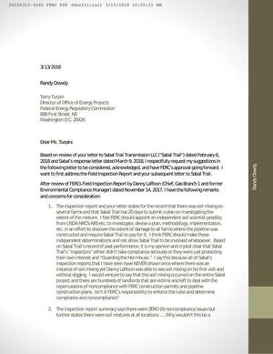
Randy Dowdy calls for independent investigation of Sabal Trail soil mixing 2018-03-06

Dear pipeline companies: if you gouge through a rock-star farmer’s world-record-holding soybean fields, you may find he gets national coverage.

Bryan Mitchell, March 6, 2018 08:16 AM, AgWeb powered by Farm Journal, Pipeline Nightmare: Randy Dowdy Calls For Independent Investigation,

Randy Dowdy’s soil death is no mystery, insists the Georgia producer, and now a federal inspection report appears to back his claims of soil damage on record-breaking farmland due to pipeline construction. A letter (Feb. 6) from the Federal Regulatory Commission (FERC) to the Sabal Trail Pipeline Project describes “topsoil and subsoil mixing” on Dowdy’s farming operation, yet significantly does not address issues of noncompliance.

GA-BR-029.000 Dowdy south field, Little Creek, MP 217, 1657-PL-DG-70197-219,, Dowdy parcel 053 00161 Brooks County, GA
GA-BR-029.000 Dowdy south field, Little Creek, MP 217, 1657-PL-DG-70197-219, 30.9439700, -83.6154600

Dowdy signed Continue reading

Sabal Trail alleged plan for soil mixing 2018-03-09

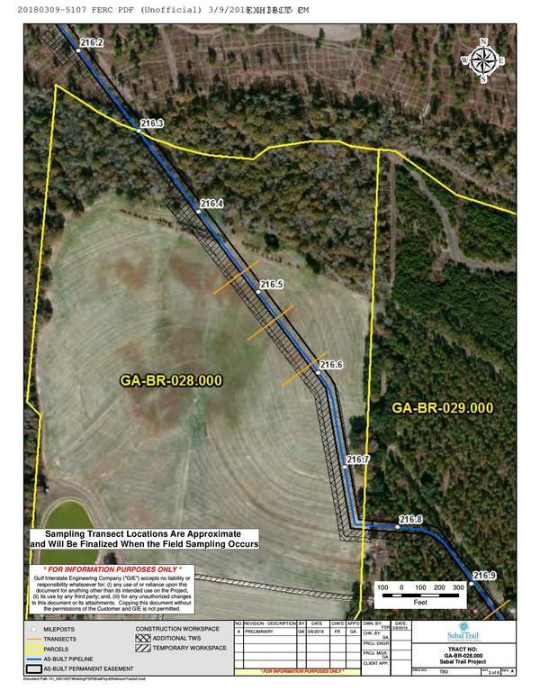
Yesterday Sabal Trail filed with FERC a sketchy plan to investigate the subsoil and topsoil mixing it caused on four farmers’ lands in two Georgia counties. The tail wagging the dog, Sabal Trail demanded FERC rubberstamp this plan within one week.

GA-BR-028.000 Dowdy north field, Little Creek, MP 216.4, 1657-PL-DG-70197-218
GA-BR-028.000 Dowdy north field, Little Creek, MP 216.4, 1657-PL-DG-70197-218, 30.9503000, -83.6217700

Needless to say FERC didn’t supply the GPS coordinates, nor the county parcel numbers, nor the related Sabal Trail alignment maps: WWALS did that, to figure out things are in what Sabal Trail filed.

The details are on the WWALS website, also including maps by WWALS.

 -jsq, John S. Quarterman, Suwannee RIVERKEEPER®

You can join this fun and work by becoming a WWALS member today!

FERC requires Sabal Trail report mixing of Randy Dowdy’s subsoil and topsoil

Bad news doubled for the little pipeline that cried wolf: FERC did not file any certificates today for Sabal Trail, and Brooks County farmer Randy Dowdy is vindicated with a letter from FERC demanding a plan from Sabal Trailwithin 20 days” (emphasis in the original) for “for investigating the actual extent of the topsoil and subsoil mixing on the Dowdy and Robinson properties and the reported mixing on the Jones property.”

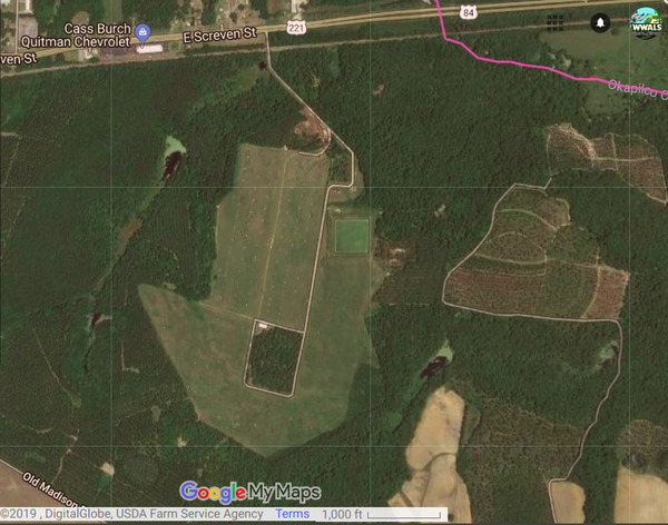
Sabal Trail through Randy Dowdy fields and Little Creek, Google Map
Map: Google, of Sabal Trail pipeline through Randy Dowdy’s soybean fields, next to Little Creek, which runs into Okapilco Creek, into the Withlacoochee River, into the Suwannee, to the Gulf.

That letter refers to an inspection report of November 14, 2017, also filed by FERC today, that documents that “topsoil and subsoil mixing has occurred in agricultural areas during construction of Sabal Trail Transmission, LLC’s (Sabal Trail) Sabal Trail Pipeline Project.”

FERC has thus validated Continue reading

Suwannee River Basin Maps

Update 2019-02-13: And a version with Landings. See also Water Trails, with more detailed maps and access points.

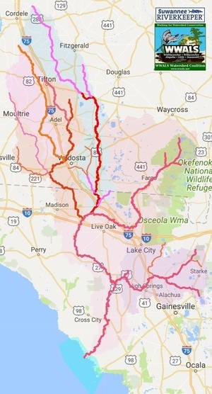
Nobody seems to have done this, so we did: a map of the Suwannee River Basin, with the major watersheds and the Estuary shaded, and all the major rivers, plus many of the creeks. Bonus: springs! Narrow, Suwannee River Basin Click on this link for an interactive google map of the Suwannee River Basin.

The river traces come from USGS and Chris Graham. The watershed boundaries are from USGS. The springs are from the Florida Springs Institute, plus four Georgia springs collected by WWALS.

The eight-digit hydrologic unit codes (HUC8) for the Suwannee River Basin are: Continue reading

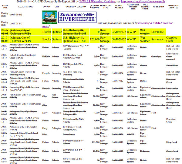
Quitman, GA, WPCP spill 2017-09-11

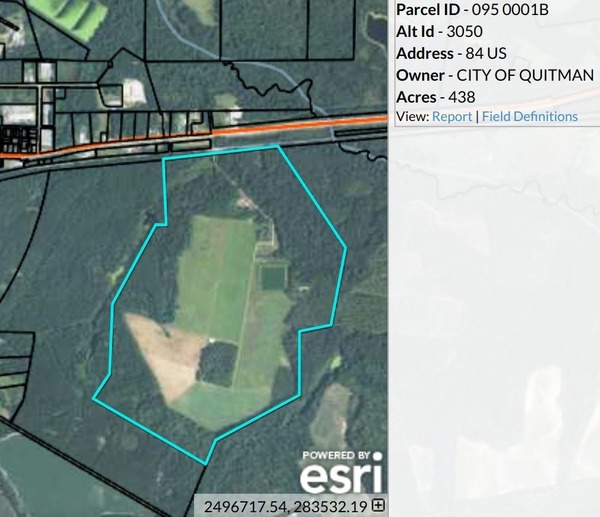
Quitman, Georgia also spilled sewage during Tropical Storm Irma, next to Okapilco Creek, which runs into the Withlacoochee River, then the Suwannee River.

Quitman WPCP, South of US 84

According to John Thursby with Quitman Utilities, the lift station at Quitman’s main wastewater treatment plant lost power, and Continue reading

GA DNR responds about Sabal Trail at Okapilco Creek 2017-09-21

Not the answer I was looking for, but GA-EPD is still by far the most responsive agency regarding Sabal Trail.

West to sinkhole, Coffee Road, near Okapilco Creek

Lisa Myler of GA-DNR called back Friday about 7PM saying Tom Fowler had been to the Okapilco Creek Sabal Trail sinkhole site I reported.

I called her back Monday, and after DNR’s web server came back up she forwarded Tom Fowler’s report today: Continue reading

Sinkhole, Sabal Trail, Okapilco Creek, Brooks County, GA 2017-09-19

Update 2017-09-21: Yes, I reported it to GA-EPD, et al. (PDF), and here are facebook photos of most of the images below.

How close to exposed is Sabal Trail’s pipe? This sinkhole is at least a foot deep, maybe two or more, and Sabal Trail only buried their pipe three feet deep, despite requests by Brooks, Colquitt, and Lowndes Counties to bury it deeper.

At sinkhole, Sinkhole

N of sinkhole, Sinkhole

Is that fill material exposed Continue reading

The Three Stooges Greatest Sabal Fails at Dunnellon

To see Sabal Fail in inaction at Dunnellon, jump to The Dunnellon odorant leaks, where the pipeline stooges wrapped it in towels, sprayed a deodorant, and waited until morning. Really, according to the incident report from Marion County Fire Rescue. It doesn’t get better in this summary: none of the state or federal permitting or safety agencies did anything, leaving Marion County to deal with the situation unassisted.

The Three Stooges: A Plumbing We Will Go

If you want to know some background, see also Continue reading

Old Coffee Road, Georgia

The Google map of locations on Old Coffee Road was used by many of the early settlers of south central Georgia, including in the watersheds of the Willacoochee, Alapaha, Withlacoochee, and Little Rivers and Okapilco Creek. It crossed all those and other waterways by ford or private ferry: there were no bridges back then.

Old Coffee Road map, WWALS.net
Follow this link for the interactive google map.

The Georgia Historical Commission erected markers at half a dozen locations in the 1950s and 1960, reading: Continue reading