Thirty people paddled on Halloween at Banks Lake. The Blue Moon declined to show. The bats mostly wouldn’t fly, but we could hear them in their trees. Everybody had a good time anyway.
The Mad Manatee, Mike Lusk, Okefenokee National Wildlife Refuge Manager, and more importantly, Banks Lake National Wildlife Refuge Manager, met the Mad Hatter, a coven of witches, Beetlejuice?, a Wolf, two Power Rangers, a pirate, a fortune teller, and, scariest of all, a covey of Valdosta State University professors! They liked it so much, they threaten to hold a faculty meeting on Banks Lake.
![[The Mad Manatee meets Pirate, witches, wolf, Mad Hatter, and more]](https://www.wwals.net/pictures/2020-10-31--banks-lake-halloween-blue-moon/many.jpg)
The Mad Manatee meets Pirate, witches, wolf, Mad Hatter, and more
Special thanks to Shelby Miller for organizing this paddle. Continue reading
![[ARWT front and back, WLRWT mapside]](https://www.wwals.net/pictures/2019-10-17--wt-brochure-proofs/many.jpg)
![[Satellite Map]](https://www.wwals.net/pictures/2019-04-21--wwals-suw-basin-landings/basin-ga-sat.jpg)
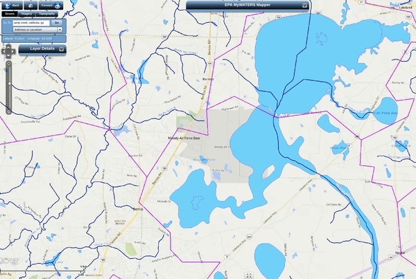
![[Building 769 and Mission Lake]](https://www.wwals.net/pictures/2019-08-06--moody-afb-mission-lake-sewage-spill/Building-769.jpg)
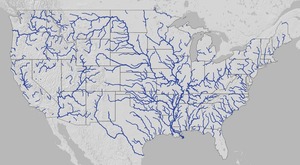
![[U.S.]](https://www.wwals.net/pictures/2019-05-06--pfas-us-map-ewg/usmap.jpg)
![[Page 01]](https://www.wwals.net/pictures/2019-05-06--pfas-us-map-ewg/1524589484-0001.jpg)
![[Southeast U.S.]](https://www.wwals.net/pictures/2019-05-06--pfas-us-map-ewg/ussemap.jpg)
![[Moody Air Force Base]](https://www.wwals.net/pictures/2019-05-06--pfas-us-map-ewg/vadmap.jpg)
![[Georgia landings in Suwannee River Basin]](https://www.wwals.net/pictures/2019-03-03--wwals-suw-basin-landings-ga/all-ga-landings-suw-river-basin.jpg)