Update 2016-03-05: Poster, flyer, registration form, and a way to pay online!
7AM Saturday May 21st at Reed Bingham State Park, it’s the annual fundraiser for WWALS and Friends of Reed Bingham, back again by popular demand (facebook event, meetup event):
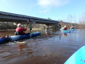
A fun event for good causes. This four mile downstream paddle on flatwater takes you on a winding course through pretty south Georgia forest, under towering cypress trees, past live oaks, coppices of ogeechee tupelo, and majestic pines. The tannin stained blackwaters reflect the beautiful scenery and are typical of the coastal plain. Paddle it to win or just to enjoy. Cash prize to the paddler who finishes first. Medals to top finishers in several categories: male and female solo canoe, male and female solo kayak; male 2 person canoe, female 2 person canoe, mixed 2 person canoe, male tandem kayak, female tandem kayak, mixed tandem kayak. Entrance fee includes a free lunch at the end of the race. Fastest paddlers will complete in under an hour; slow paddlers in 1.5-2 hours. Bring your own boat or rent one from Reed Bingham State Park (advance reservations recommended).
There will be a registration fee, well worth it for the fun, community, and to support your friendly local watershed organization; details to come. Here are last year’s winners.
Meanwhile, these other events coming up sooner are free, Continue reading