
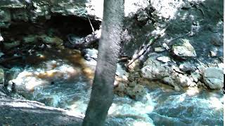
 See three sinks, a waterfall, and a distributary in these videos from the
WWALS Outing to Turket Creek Waterfall, the Alapahoochee River,
the Alapaha River Sink, and the Dead River Sink, June 14, 2015.
A WWALS video playlist
follows the links to each video below. Continue reading
See three sinks, a waterfall, and a distributary in these videos from the
WWALS Outing to Turket Creek Waterfall, the Alapahoochee River,
the Alapaha River Sink, and the Dead River Sink, June 14, 2015.
A WWALS video playlist
follows the links to each video below. Continue reading
Tag Archives: Creek
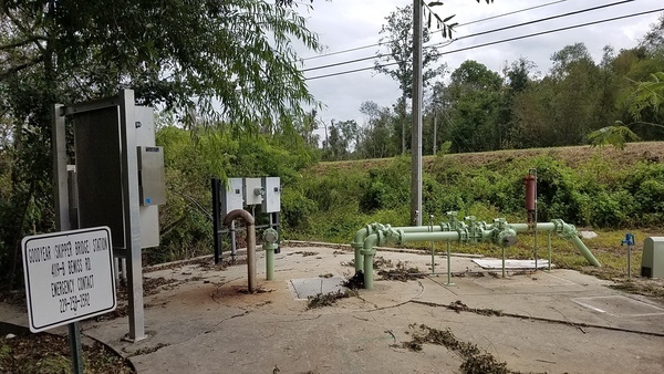
Valdosta report of spill at Cherry Creek Lift Station 2017-09-12
City Council Tim Carroll forwarded me the appended press release yesterday. I assumed it would be on Valdosta’s News page, but it is not.
Also, despite assurances back in January that Continue reading
Cherry Creek & Stillhouse Branch, Lift Station, Sinks, Withlacoochee River
Why should anyone downstream care about an obscure creek north of Valdosta? Because it runs past sinkholes that leak into the Floridan Aquifer, into the Withlacoochee River, then into the Suwannee River, then into the Gulf of Mexico, going by all seven of the downstream Florida counties that passed resolutions asking the state of Florida to do something about Valdosta wastewater, not to mention neighborhoods and wetlands closer to the recent Cherry Creek Lift Station sewage leak, which was at least smaller than previous spills.
Cherry Creek, Withlacoochee River, Suwannee River, Gulf of Mexico
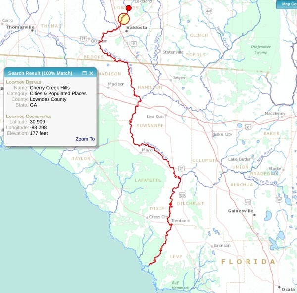
The orange red-circled disk shows Continue reading
Cherry Creek and Grand Bay Creek
Does Cherry Creek come from Grand Bay? This question came up about Valdosta’s Cherry Creek Lift Station Spill. No, but you weren’t alone if you didn’t know that.
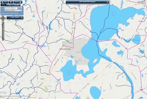
Cherry Creek (lower left) and Grand Bay Creek (right)
Cherry Creek runs into the Withlacoochee River, and comes from very near Grand Bay, but not Continue reading
Cherry Creek Lift Station Spill, Bemiss Road, Valdosta, GA
Valdosta had one spill at a lift station that lost power during Tropical Storm Irma, said David Frost, Interim Utilities Director, City of Valdosta, when I called him just now. I asked him if there were any others, and he said there was just that one.

He said it was a small spill. I asked how small. He said Continue reading
Bradford County, FL Comprehensive Plan 2012-04-19
Apparently you can mine almost anywhere in Bradford County, Florida, according to the Bradford County Comprehensive Plan:
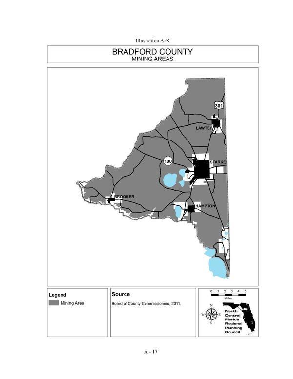
Illustration A-X Bradford County MINING AREAS
That map is about as bad as the one in Continue reading
One Mile Branch Cleanup, Valdosta, GA 2017-11-11
Update 2017-10-29: Meet at VSU CORE.
A first for WWALS: an urban cleanup! One Mile Branch runs right through the heart of the biggest city in the Suwannee River Basin (Valdosta) and through the biggest educational institution in the Basin (Valdosta State University). It has some trash, and you can help WWALS come get it!
When: 10AM, Saturday, November 11, 2017
Where: One Mile Branch, through the heart of Valdosta and VSU.
Meet:
VSU CORE, 1300 Sustella Ave., Valdosta, GA
31698
(This is a WWALS event; we’re just meeting in CORE’s parking lot.)
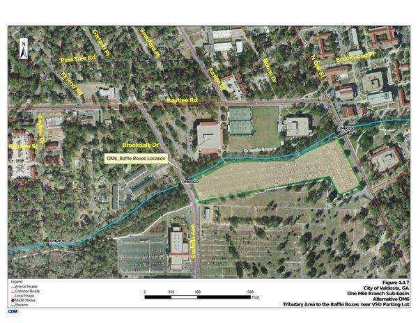
Map: Brookdale Drive and VSU parking lot
Hosts: Scotti Jay and Dan Phillips
Contact: Continue reading
Proposed HPSII phosphate mine in Union and Bradford Counties, Florida
Update 2017-08-31: More maps and other information in the Phosphate Mining page.
The proposed HPSII phosphate mine on the New River in Bradford and Union Counties, Florida, features in Dave Wilson’s talk from April. HPSII would be upstream from the Santa Fe River, and thus upstream from the Suwannee River.
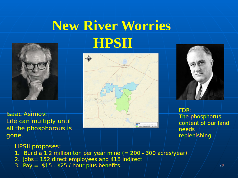
WWALS Watershed Coalition opposes the HPSII phosphate mine. We see no benefit in Union and Bradford Counties suffering effects such as those outlined in Dave Wilson’s slides, and looking like Hamilton County in these aerials: Continue reading
PotashCorp Field Trip Summary –David Wilson 2017-04-13
The moonscape that seems to go on forever while flying over Hamilton County, Florida in a small plane is the PCS phosphate mine, as seen in some WWALS aerials in these slides that David Wilson presented at a Santa Fe River Springs Protection Forum April 13, 2017 at Otter Springs, Florida. Dave is Treasurer of the Board of Florida Springs Institute, and a WWALS member. His slides are published on the WWALS website with his permission.

According to the slides, perhaps JEA is responsible for the low water levels at White Sulfur Springs, formerly a famous resort, now bone dry: Continue reading
WWALS adds evidence, again asks FERC to stay Sabal Trail, revoke its permit, plus do a SEIS 2017-06-05
FOR IMMEDIATE RELEASE
June 5, 2017, Hahira, GA — Citing the sea change of solar power overtaking natural gas in new U.S. electricity last year, and generational damage to the fields of farmers such as Randy Dowdy, WWALS Watershed Coalition today filed more evidence and reasons to stop the Sabal Trail fracked methane pipeline from going into service and to revoke its permit. WWALS filed the same Monday that Sabal Trail Friday asked FERC to authorize turning on the gas. Plus WWALS explicitly requested FERC do a Supplemental Environmental Impact Statement (SEIS) to take into account LNG export from Sabal Trail, copious environmental permit violations, and especially new scientific evidence about the Floridan Aquifer.
Suwannee Riverkeeper John S. Quarterman said: “Such irreparable harm outweighs a few billion dollars spent in error by a few companies.”

And that’s without even getting into risks to education, such as
Sabal Trail only a mile from Clyattville Elementary School.
WWALS filed the document today with the Federal Energy Regulatory Commission (FERC). The WWALS cover letter is included below in this message, and the FERC filing is available online.
WWALS wrote in Attachment 1:
“Solar power has actually more than doubled every two years since 2013. Yet FERC only counts utility-scale solar power. Adding rooftop and community solar panels, already a sea change has occurred.
Continue reading