Tag Archives: Echols County

Deny or EIS, titanium mining near Okefenokee Swamp –Suwannee Riverkeeper for WWALS 2019-09-12

Sent just now as PDF. You can still send in your comments today.

[Who wants to boat, fish, bird, or hunt next to a strip mine?]
Who wants to boat, fish, bird, or hunt next to a strip mine? PDF


September 12, 2019

To: Col. Daniel Hibner, Commander, U.S. Army Corps of Engineers, Savannah District
       Attention: Ms. Holly Ross,  holly.a.ross@usace.army.mil
       1104 North Westover Boulevard, Suite 9, Albany, Georgia  31707

Cc: Stephen Wiedl, Wetlands Unit, stephen.wiedl@dnr.ga.gov
       Georgia Department of Natural Resources, Environmental Protection Division,
       Water Protection Branch, 7 Martin Luther King, Jr. Drive, Atlanta, GA 30334

Re: Applicant: Twin Pines Minerals, LLC, Application Number: SAS-2018-00554

Dear Colonel Hibner,

Suwannee Riverkeeper for WWALS Watershed Coalition (WWALS) asks USACE:

  • to reject the subject Application from Twin Pines Minerals (TPM), given the inappropriate location which would over the years move ever closer to the Okefenokee Swamp, which is the headwaters of the Suwannee and St. Mary’s Rivers, combined with the numerous omissions from the Application regarding the wide hydrogeologic, water quality, ecologic, and economic ramifications of the proposed mining, and the numerous other mines relevant to the proposal.

If USACE continues to process the Application, WWALS requests USACE:

  • to require a complete hydrogeological assessment and report, a full Environmental Impact Statement (EIS), and an economic analysis, with all three covering all the relevant features, mines, and applications in south Georgia and north Florida, including at least those outlined in this letter.
  • to accept comments until at least ninety days after all these documents are submitted to USACE and distributed to the public, preferably on USACE’s website, without requiring site visits to Albany to get them.
  • to hold public hearings in Georgia and Florida for further independent input and review after sufficient time (months or years) for independent third-party review.

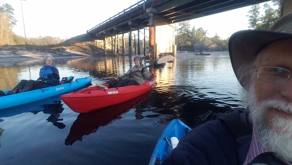
The proposed Charlton County, Georgia, TPM mine site is hydraulically upgradient from the Okefenokee Swamp and within close proximity to the boundary of the Okefenokee National Wildlife Refuge (ONWR), with its 600,000 visits per year for boating, birding, and fishing, with more than $60 million annual economic effects including hundreds of jobs supported directly or indirectly, plus hunt clubs surrounding the Swamp. The Swamp provides ecosystem services of great economic values, including storm protection, water quality provisioning, support for nursery and habitat for commercial fishing species; and carbon storage, plus those hunt clubs depend on the Swamp. Any pollution of the Swamp or change in surface or groundwater levels could adversely affect not only ONWR and nearby areas, but also the Okefenokee Swamp Park (OSP) near Waycross, in Ware County, GA, and Stephen C. Foster State Park (SCFSP) in Charlton County, via Fargo in Clinch County. Visitors come from Jacksonville, Florida, Brunswick and Valdosta, Georgia, and from much farther away to visit the Okefenokee Swamp. The Swamp is a treasure to the entire nation and the world.

The stigma of a strip mine next to the swamp could cause people to turn away, taking their dollars with them. Who wants to boat, fish, bird, or hunt next to a strip mine?

Continue reading

Waterfalls, rapids, and a lawn chair: Statenville to Sasser Landing 2019-07-06

Nineteen paddlers in fifteen boats braved the early morning deluge, which quit just in time to start paddling the Alapaha River from Statenville Boat Ramp to Sasser Landing, past many waterfalls, quite a few shoals, one real rapid, and an incoming river too fast to paddle up. Even a couple of unexpected boat ramps, one of them concrete.

[Ronnie, Shirley, Fountain, 13:50:02, 30.6253002, -83.0480667]
Ronnie, Shirley, Fountain, 13:50:02, 30.6253002, -83.0480667

Around every corner, a waterfall. Continue reading

Water Trails and River Camps @ Paddle Georgia 2019-06-17

Last night at Paddle Georgia, #PaddleGA2019, Gwyneth Moody explained Georgia Water Trails, Edwin McCook explained the Suwannee River Wilderness Trail and its River Camps, and Katie Conrad explained the Suwannee Headwaters Project, which is about arranging camping betweent the Okefenokee Swamp and White Springs, in Georgia and Florida. Here are videos of what Edwin and Katie said.

[Georgia Water Trails --Gwyneth Moody]
Georgia Water Trails –Gwyneth Moody

Yes, Edwin left copies of the SRWT Pamphlets, which we will have at the Suwannee Riverkeeper table at Camp Suwannee tomorrow, Thursday, and Friday.

See also the WCTV report of that same day, River Camp between the Little and Withlacoochee Rivers? 2019-06-17.

Pictures: US 84 to Mayday, Alapaha River 2016-05-07

Update 2023-04-19: Videos: US 84 to Mayday, Alapaha River 2016-05-07

Waterfalls on the Alapaha River?

[Movie: Waterfall (786K), 30.87078, -83.02267]
Movie: Waterfall (786K), 30.8707800, -83.0226700

Two weeks after the WWALS outing from US 84 to Mayday, some of us who didn’t make that one paddled the same stretch. The earlier crew had smooth sailing. We had rapids and waterfalls, because the Alapaha River was feet lower on the Statenville USGS Gauge. Continue reading

Valdosta water quality testing data 2018-09-12

Here is most of a year’s river water quality testing data from the city of Valdosta, on a Water Reporter map:

Valdosta stations, Map

Click on any of the colored diamonds for graphs. Scroll right to see more graphs. Click on any graph to see every datapoint. Clearly fecal coliform (FCOLI) and E. coli (ECOLI) have significant spikes way beyond the Georgia state limit of 200 cfu/100 ml.

However, as we already saw on the spill followup data map, often, even usually, FCOLI and ECOLI are just as bad or worse upstream Continue reading

Ockolocoochee, Little River 1889-01-29

Update 2023-12-28: Revised version..

Who knows the Ockolocoochee River? No, not the Ochlockonee River; that’s a bit to the west. You do know the Ockolocoochee River as the Little River, of the Withlacoochee, of the Suwannee. Here is news from 1889 that also includes the boat that didn’t survive from Troupville to Ellaville, which was apparently not a paddlewheel steamer.


Irwin County, 1885a, GeorgiaInfo, Rand McNally Map of Georgia, 1885

Atlanta Constitution, January 29, 1889, Pg 12., quoted in Ray City History Blog, 18 October 2010, More About Troupville, GA and the Withlacoochee River,

THE WITHLACOOCHEE RIVER.

VALDOSTA, Ga., January 19. -[Special.]- Away up near the northern limit of the great wiregrass section there is a big cypress swamp. They call them bays there. From this bay emerges Continue reading

Fundraising for Water Trail signs

Update 2019-11-08: Donate through GA Gives, including if you wish for Brochures.

Update 2019-04-26: Price of metal signs at the water at boat ramps and landings. Just the signs, Westbound

Update 2018-04-27: Pictures of Lakeland Boat Ramp signs in the ground.

Update 2018-03-15: People want to know how much the signs cost:

  • Road Signs
    • $150 one road sign
    • $300 pair of road signs for a landing or boat ramp
  • Signs at the water near a boat ramp or landing: if you donate for a specific location, your logo can go on the signs there, and on the water trail brochures and web pages

Any amount of donation helps put up the road signs that let people know the Alapaha River Water Trail (ARWT) exists and directs them to the landings, as well as the kiosks that inform people about what to expect nearby, so we get more people paddling the Alapaha River who will take care of the river.

The pair of metal signs at the water also work for the Withlacoochee and Little River Water Trail (WLRWT). Here is an example pair of metal signs at the water for Troupville Boat Ramp:

[Side by Side]
Side by Side

The Alapaha River Water Trail (ARWT) is a reality. We are ordering have bought the road signs from the Georgia Department of Transportation (GDOT) which has planted them on roads leading to landings, and we need to pay for them. We have a small amount of money from Continue reading

Pictures: Fargo to Roline, Suwannee River 2017-03-18

Cold and foggy to warm and bright, a fine spring morning on the Suwannee River from Florida to Georgia. Plus Canadians!

Here are pictures by John S. Quarterman and Gretchen Quarterman and a Google map.

Pictures by John S. Quarterman

Ninety-nine pictures are on the WWALS website.

Here we go
Under the US 441 bridge.

Continue reading

WWALS Outings, Rivers, and Pipeline on Chris Beckham drive-time radio WVGA 105.9 FM 8:00 7:30 AM 2016-09-02

8AM Friday morning WWALS will be on Chris Beckham’s drive-time radio show. WWALS president John S. Quarterman will be talking about Saturday morning’s Suwannee River paddle outing and other outings upcoming on the Alapaha and Withlacoochee Rivers, along with other developments on the Alapaha River Water Trail and the Withlacoochee and Little River Water Trail, along with many other things WWALS does. Plus what you can do about the FERC rubberstamp of the Sabal Trail fracked methane pipeline drilling under the Withlacoochee and Suwannee Rivers.

When: 8:00 7:30AM Friday September 2nd 2016

Where: Continue reading

A wonderful Paddle on the Alapaha 2016-04-23

HWY 84 to Mayday.

What a great day for a paddle! The current was moving us along nicely, about 12 miles in just under 4 hours. It is a very beautiful stretch of river, very wild, many birds could be heard in the forest canopy.

cjm

This was the Hotchkiss Road to Mayday Outing.

More from Chris’s details in the Outings spreadsheet:

Hotchkiss road was washed out, put in at Naylor park property. Cut about .5 mile off of the trip.

Water level 85 on the Statenville gage. Was in the banks and moving quick. Would not recommend paddling at levels much higher than this.

Features: canopy over much of the river.

Flora: Tupelo, birch, oaks, pine, wild azalea. No invasive species seen.

Fauna: wood ducks, great egrets, kingfisher, heard- barred owls, hooded warblers, and many other birds.

Assessment: Very nice paddle. Very beautiful stretch of river

And a bit more from Chris:

Water level was high, much higher would not be recommended. Looking at the water level in comparison with the Safe Water Level criteria, Item 3 stood out. It became very apparent why it is important that you should be able to paddle against the current for a short distance. One of our paddlers needed a rescue and the only way to reach her was to paddle upstream.

-jsq

You can join this fun and work by becoming a WWALS member today!