Tag Archives: karst

Other aquifer models don’t work for karst Floridan Aquifer –Geology Prof. Can Denizman to Suwannee River Partnership 2017-03-03

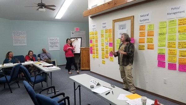
Someone said there’s an actual scientist in the room, so let’s hear from him. So WWALS Science Committee member Geology Professor Can Denizman said a few words about modeling karst limestone aquifers such as the Floridan Aquifer. This was at the March 3, 2017 meeting of the new Environmental Advisory Work Group of the Suwannee River Partnership.

Geology Prof. Can Denizman, VSU, WWALS Science Committee

Here’s video followed by a transcript: Continue reading

Delineation of Spring Protection Areas

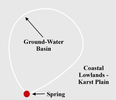
These figures tell the story of springsheds in a coastal lowland karst plain such as much of the Suwannee River Basin. Maybe you already know all this, but if you don’t, these pictures may help make sense of Springsheds and Water Withdrawal Permits in the Suwannee River Basin.

Fig. 11_1: Groundwater Basin

A spring is fed from a ground-water basin.

Fig. 11_1: Groundwater Basin

Fig. 12_1: Springshed Protection Area

Continue reading

Pictures, McIntyre and Arnold Springs, Nankin to Madison Hwy, Withlacoochee River 2016-07-09

Update 2024-02-29: Now with better picture format.

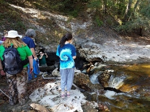
We found McIntyre Spring, and Arnold Springs, too, on the WWALS Withlacoochee River Outing from Nankin Boat Ramp to Madison Highway Boat Ramp, July 9th 2016. Swimming, snorkeling, karst, shoals, an abandoned railroad trestle, more shoals, State Line Shoals, old road bridge posts, dragonflies, and Halberdleaf rosemallow (Hibiscus laevis All.), unfortunately plus Chamber bitter.

[McIntyre Spring and State Line Shoals 2016-07-09]
McIntyre Spring and State Line Shoals 2016-07-09

Update 2017-05-13: On 2016-07-09, the US 84 Quitman gage showed about 1.75 feet (85.26 NAVD), and the Pinetta gage showed about 6.57 (53.08 NAVD). That’s a foot lower than June 22, 2013, when we thought that was already as low as you’d want to paddle.

Here are a few videos, some pictures, and a google map showing where the pictures were taken.

 -jsq, John S. Quarterman, Suwannee RIVERKEEPER®

You can help with clean, swimmable, fishable, drinkable, water in the 10,000-square-mile Suwannee River Basin in Florida and Georgia by becoming a WWALS member today!
https://wwals.net/donations/

Videos

Here is a playlist of WWALS videos:
https://www.youtube.com/playlist?list=PLKwQ5xfKf-Qyed6eWPp4xcYNjZI-NMW-j Continue reading

Solar power versus Sabal Trail –Suwannee Riverkeeper in VDT 2017-01-08

Op-ed, Valdosta Daily Times, today, January 8th 2017:

John S. Quarterman, Suwannee Riverkeeper Sabal Trail and the Florida Department of Environmental Protection assured us there would be no problems drilling a 36-inch natural gas pipeline through the fragile karst limestone under the Suwannee River in Florida, yet already Sabal Trail’s pilot hole under the Withlacoochee River in Georgia caused a frac-out of drilling mud into the river and a sinkhole.

The U.S. Army Corps of Engineers should halt construction and do a Supplemental Environmental Impact Statement.

When I happened to fly over the Withlacoochee River frac-out, I also saw Continue reading

Stop Sabal Trail fracked gas pipeline; invest in solar –John S. Quarterman in Citrus County Chronicle 2016-12-25

Here’s a Christmas present for pipeline opponents and solar power proponents.

John S. Quarterman John S. Quarterman, Citrus County Chronicle, other voices, 25 December 2016, Stop gas pipeline; invest in solar,

Sabal Trail and FDEP assured us there would be no problems drilling a 36-inch natural gas pipeline through the fragile karst limestone under the Suwannee River and the Withlacoochee (south) River in Florida, yet already Sabal Trail’s pilot hole under the Withlacoochee (north) River in Georgia caused a frac-out of drilling mud into the river and a sinkhole. The U.S. Army Corps of Engineers should halt construction and do a Supplemental Environmental Impact Statement.

When I happened to fly over the Withlacoochee (north) River frac-out, I also saw Continue reading

WWALS: “It did happen”, Sabal Trail: “inadvertent”, WUSF, Tallahassee

Do you think Sabal Trail’s excuse that it was “inadvertent” is enough? Come on down to the US 84 bridge 9:30 this morning, hear more, and have your say.

Turbidity curtains with human for scale (Chris Mericle) Nick Evans, WUSF, 14 November 2016, Drilling Mud Leak In South Georgia Raises New Sabal Trail Pipeline Concerns,

Water activists are raising the alarm over a South Georgia drilling leak in the Withlacoochee River. Sabal Trail is drilling beneath the river to build a more than 500-mile natural gas pipeline stretching from Alabama to Florida.

WWALS Watershed Coalition works to protect Continue reading

Pictures: Alapaha and Dead River Sinks 2016-11-06

the Alapaha River sink, 30.5855189, -83.0528064 A very scenic hike to some of the most unusual geological features in all of Florida: the Alapaha River Sink and the Dead River Sink. We walked over beds of 50-million-year-old fossilized oysters, above all our drinking water in the Floridan Aquifer. See many pictures and a few videos of the sights, and a google map of the sites.

Practicing Geologist Dennis Price led us by the scenic route on this hike, explaining the karst geology on display, which underlies all of north Florida and south Georgia, containing our drinking water in the Floridan Aquifer. Dennis and hike organizer Chris Mericle recommend making this very unusual area a state park.

The Alapaha River goes underground here unless it has a lot of water, which usually this time of year and right now it does not.

[Don't fall into the Devil's Den, 30.5855189, -83.0528064]
Don’t fall into the Devil’s Den, 30.5855189, -83.0528064

Update 2022-11-17: The Jennings Gauge read 61.70′ NAVD88.

Until recently nobody knew for sure Continue reading

From the air: US 84 HDD Withlacoochee River Sabal Trail 2016-10-22

Update 2016-10-24: Questions filed with FERC in Docket CP15-17 as Accession Number 20161024-5049 and emailed to USACE and GA-EPD (PDF).

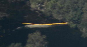
Extreme closeup yellow in Withlacoochee River, 30.7952780, -83.4524840 What is that yellow thing in the river, Sabal Trail? Is that a sinkhole you’ve marked at the Lowndes County HDD site? And does blue pipe mean thinner for rural areas like your executive from Houston told us in WWALS v Sabal Trail & FDEP?

FERC gave you permission to Continue reading

Sabal Trail maps digitized

Update 2016-08-22: Map format updated and other updates moved to the bottom.

These maps show the path Sabal Trail is gouging its fracked methane pipeline through south Georgia and north Florida.

[Sabal Trail maps digitized, 2016-09-17, Thanks to VSU, Prof. Can Denizman]
Sabal Trail maps digitized, 2016-09-17, Thanks to VSU, Prof. Can Denizman

They include comparisons to some geological features, including Okapilco Creek, Withlacoochee River, Suwannee River, Suwannacoochee Spring, Falmouth Spring, the Cathedral Cave System, and numerous karstic features, some of them sinkholes.

This digitization is thanks to Continue reading

Same owners, DAPL and Sabal Trail

Update 2016-09-23: Not quite: Energy Transfer backed out of buying Williams Co..

DAPL and Sabal Trail: now part of the same pipeline companies.

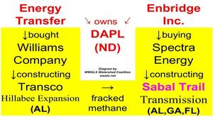
DAPL owners Energy Transfer, Enbridge, own Williams and Spectra of Sabal Trail The pipeline companies behind the Sabal Trail fracked methane boondoogle through Alabama, Georgia, and Florida are now owned by the companies behind the Dakota Access Pipeline (DAPL) that wants to pump oil through North Dakota where the Standing Rock Sioux have attracted an encampment of thousands of people who have successfully and nonviolently stopped pipeline construction at least for the moment. WWALS was one of 93 Waterkeeper organizations worldwide that co-signed a letter from Waterkeeper Alliance in support of the Standing Rock Sioux. Opponents of these pipelines, including native Americans in Florida and Georgia as well as North Dakota, are no longer just fighting the same industry: they’re fighting the same companies.

The pipeline companies behind DAPL are Continue reading