Tag Archives: Little River

Cook County Landing (GA 76) to Folsom Bridge (GA 122), Little River 20162017-01-14

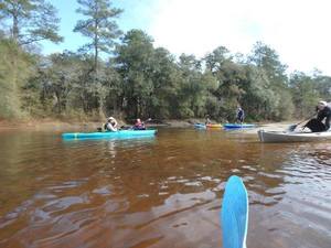
Not a great boat ramp but public access it is. In January the water should be up like a year ago at this three-hour tour of the idyllic Little River between Brooks County and Cook and Lowndes Counties, Georgia. There should be no need to drag boats, like there was in July.

When: 10 AM Saturday January 14th 2017

Put In: Cook County Landing (GA 76) between Adel, Cook County and Barney, Brooks County, Georgia

GPS Coordinates: Continue reading

What is Sabal Trail sending into the WIthlacoochee River between Quitman and Valdosta, GA? WWALS PR 2016-11-09

Update 2016-11-14: GWC Dirty Dozen Press Conference at US 84 Bridge with tour of Sabal Trail HDD 2016-11-16

Update 2016-11-13:Sabal Trail still leaking drilling mud into the Withlacoochee River at US 84 in GA 2016-11-12

Update 2016-11-11: Sabal Trail leaked drilling mud up into the Withlacoochee River.

FOR IMMEDIATE RELEASE

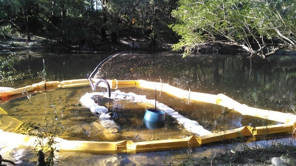
Hahira, GA, November 9th 2016 — Sabal Trail appears to have contradicted itself in its recent responses to WWALS, perhaps admitting it may be dumping drilling mud into the Withlacoochee River, which would explain the picture below of a black pipe coming from Sabal Trail’s Brooks County HDD site into the river. WWALS had to wait two weeks just to get those non-answers, so WWALS now asks for a written response by email tomorrow. In addition, at least two Sabal Trail yards (a contractor yard in Moultrie, GA and a pipe yard near Lake City, FL) appear never to have been approved by FERC.

Dumping
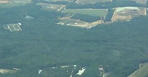
About 2000 feet upstream (north) of the US 84 bridge. Many more pictures here.

“FERC granted permission in less than a week for Continue reading

CY3-6 full less than a day after FERC approval: Sabal Trail Moultrie contractor yard 2016-10-22

Less than a day after FERC rubberstamped (or did it?) Sabal Trail’s request for a new contractor yard on the east side of Moultrie, Georgia, WWALS saw that yard already full of materials. Did Sabal Trail really move everything in that fast, or were those things already there, like the notorious Lake City, Florida pipe yard that never has gotten any formal FERC approval that we’ve seen?

Here’s what we saw from the Southwings flight for WWALS on Saturday October 22nd 2016:

CY3-6 area of Sabal Trail overview map

Compare with the overview map Sabal Trail filed with its request to FERC of Monday October 17th 2016: Continue reading

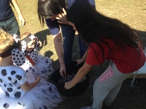
WWALS and children at Trunk or Treat at Reed Bingham State Park 2016-10-29

Girl Scouts helping Girl Scouts were a big part of our success today! Boy Scouts wanted to know if we had Eagle Scout projects: yes, we do! Thank you to our new friends.

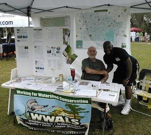
People wanted to know about outings, advocacy, pipeline, and since Reed Bingham is on the Little River, I gave out all the pamphlets for the Withlacoochee and Little River Water Trail I had printed. An excellent time was had by WWALS and all at the Reed Bingham Trunk or Treat Fall Festival.

Gretchen

You can join this fun and work by becoming a WWALS member today!

Continue reading

WWALS at Reed Bingham Fall Festival 2016-10-29

The wizard is in

Update 2016-10-30: Pictures and scouts.

WWALS will have a bean bag game at Reed Bingham State Park this Saturday. You may not be too old to win some candy! Come join us on the banks of the Little River, between Adel and Moultrie, Georgia.

When: 1-5PM Saturday October 29th 2016

Where: Reed Bingham State Park, 542 Reed Bingham Rd, Adel, GA 31620

Handshake Facebook: event

Moultrie Observer, 26 October 2016, Reed Bingham to host Fall Festival, Halloween events,

All participants should give out individually wrapped candies or promotional items appropriate to families. Friends of Reed Bingham will give a prize for the best decorated “Trunk”

For more information or Continue reading

Withlacoochee Wastewater Treatment Plant old and new 2016-10-22

Old and New WWTP and landfill, 30.8212690, -83.3581890 Uphill and farther from the river: the new Withlacoochee Wastewater Treatment plant (top left of center) seen next to the old one, the Pecan Row Landfill, and the Withlacoochee River. Come ask your questions for the entire Suwannee River basin about wastewater and flood prevention this Thursday, October 27th 2016, at the Valdosta City Hall Annex. The $60 million in fixes so far and those still in progress are a big improvement for everybody downstream to the Gulf on the Withlacoochee, Alapaha, and Suwannee Rivers, and upstream on the Withlacoochee and Little River Water Trail. Continue reading

Valdosta wastewater and flood prevention public meeting by WWALS 2016-10-27

New WWTP, 30.8327808, -83.3283234 Update 2016-10-23: Seen from the air.

Update 2016-10-19: PDF flyer.

Come hear about the $60 million in wastewater fixes Valdosta just finished, what remains to be done, and what they’re doing about flood prevention for the entire Suwannee River Basin in Georgia and Florida. You can ask questions in this first of a new WWALS Quarterly Speaker Series, and the people organizing this work will be there to answer:

  • Henry Hicks, Utilities Director, about wastewater
  • Emily Davenport, Assistant Director of Engineering, about flooding, and
  • Tim Carroll, Valdosta City Council, about solar power for utilities.

When: 6PM Thursday October 27th

Where: Valdosta City Hall Annex
Multipurpose Room
300 N Lee St.
Valdosta, GA 31601 Continue reading

Sabal Trail maps digitized

Update 2019-03-19: The google map now includes Florida Southeast Connection (FSC) and FPL’s Martin County to Riviera Beach (MR-RV) pipeline to the sea, which FPL in 2018 got FPSC and FERC to roll into FSC. See also Stop FERC Shirking LNG Oversight.
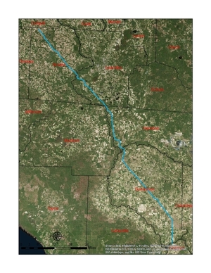
South Georgia and north Florida Update 2016-12-13: The google map now includes the Sabal Trail path digitized for all of Georgia and to the end of the line in Florida south of Orlando.

Update 2016-11-29: In the google map, extended the Sabal Trail alignment maps localized by LAKE for Mitchell, Colquitt, Brooks, and Lowndes Counties, Georgia, and Hamilton, Suwannee, and Gilchrist Counties, Florida to just north of Bell, FL, plus on the crowdsourcing map, WWALS aerials of Gilchrist County.

Update 2016-11-03: Added to the google map digitized path and maps for Gilchrist, Alachua, and part of Levy Counties, FL.

Update 2016-10-31: Added to the google map: Aerials: Suwannee, Ocholockonee, Withlacoochee, Santa Fe Rivers, Okapilco Creek, Sabal Trail Moultrie CY3-6 @ WWALS Southwings 2016-10-22.

Update 2016-10-30: The google map now has all Sabal Trail’s alignment maps from 7 April 2016 linked in for (part of Gilchrist 2016-11-29), Suwannee and Hamilton Counties, FL and Lowndes, Brooks, Colquitt, and Mitchell Counties, GA. Aerial pictures from the WWALS Southwings flight of October 22nd 2016 are also linked in, starting with US 84 HDD Withlacoochee River and US 129 HDD Santa Fe River.

Update 2016-09-14: All 527 alignment maps Sabal Trail filed with FERC in April 2016, in small, big, huge, and PDF formats, courtesy of Lowndes Area Knowledge Exchange (LAKE).

Update 2016-09-23: Added Depressions within 1 mile of Sabal Trail in Hamilton, Madison, and Suwannee Counties, Florida. The pipeline path doesn’t go through Madison County, but it comes closer than a mile, and not even two miles from Madison Blue Spring.

These maps show the path Sabal Trail is gouging its fracked methane pipeline through south Georgia and north Florida, with comparisons to some geological features, including Okapilco Creek, Withlacoochee River, Suwannee River, Suwannacoochee Spring, Falmouth Spring, the Cathedral Cave System, and numerous karstic features, some of them sinkholes.
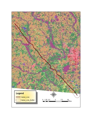
Brooks and Lowndes Counties, GA This digitizaiton is thanks to Continue reading

WWALS Outings, Rivers, and Pipeline on Chris Beckham drive-time radio WVGA 105.9 FM 8:00 7:30 AM 2016-09-02

8AM Friday morning WWALS will be on Chris Beckham’s drive-time radio show. WWALS president John S. Quarterman will be talking about Saturday morning’s Suwannee River paddle outing and other outings upcoming on the Alapaha and Withlacoochee Rivers, along with other developments on the Alapaha River Water Trail and the Withlacoochee and Little River Water Trail, along with many other things WWALS does. Plus what you can do about the FERC rubberstamp of the Sabal Trail fracked methane pipeline drilling under the Withlacoochee and Suwannee Rivers.

When: 8:00 7:30AM Friday September 2nd 2016

Where: Continue reading

Anhinga Trek on the Georgia Southern Rivers Birding Trail

Sites in WWALS watersheds include Paradise Public Fishing Area (PFA) at the headwaters of our Withlacoochee River, Reed Bingham State Park on our Little River, Grand Bay Wildlife Management Area (WMA) upstream from our Alapaha River, and Stephen C. Foster State Park at the headwaters of our Suwannee River in the Okefenokee Swamp, all on the Anhinga Trek of the Southern Rivers Birding Trail.

You can buy a license for any of these parks or WMAs from the state, and you can also see anhingas and other fascinating wildlife on our water trails.

Or come along on upcoming WWALS outings: Continue reading